Waen

Settlement in Caernarfonshire

Wales

Waen

St Deiniol's Church, Llanddeiniolen
St Deiniol's Church, Llanddeiniolen Credit: Chris Andrews

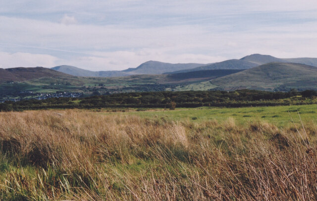
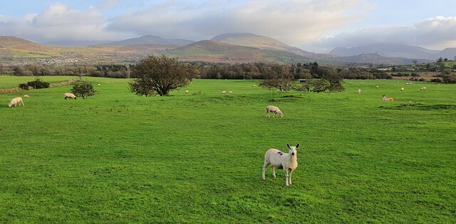
Waen is a small village located in the county of Caernarfonshire, Wales. Situated in the picturesque countryside, it lies approximately 5 miles northeast of the town of Caernarfon. The village is nestled in a valley between the Snowdonia National Park and the Menai Strait, offering stunning views of the surrounding natural beauty.

With a population of around 500 residents, Waen is a close-knit and friendly community. The village consists of a mix of traditional Welsh stone cottages and newer houses, creating a charming and picturesque atmosphere.

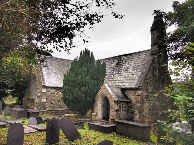
Waen is known for its rich history, dating back to the medieval times. The nearby Dolbadarn Castle, a 13th-century fortress, is a popular tourist attraction and a testament to the area's heritage. The village also boasts a historic church, St. Beuno's, which adds to its cultural significance.

The village is well-served by local amenities, including a community center, a primary school, and a village hall. Residents can enjoy the tranquility of rural living while still having access to essential facilities.

The surrounding area offers a wide range of outdoor activities for nature enthusiasts. The nearby Snowdonia National Park provides ample opportunities for hiking, mountain biking, and exploring the breathtaking landscape. The Menai Strait offers opportunities for water sports such as sailing and kayaking.

Overall, Waen is a peaceful and idyllic village, perfect for those seeking a close community and a connection to nature. Its rich history and stunning surroundings make it an attractive place to live or visit.

If you have any feedback on the listing, please let us know in the comments section below.
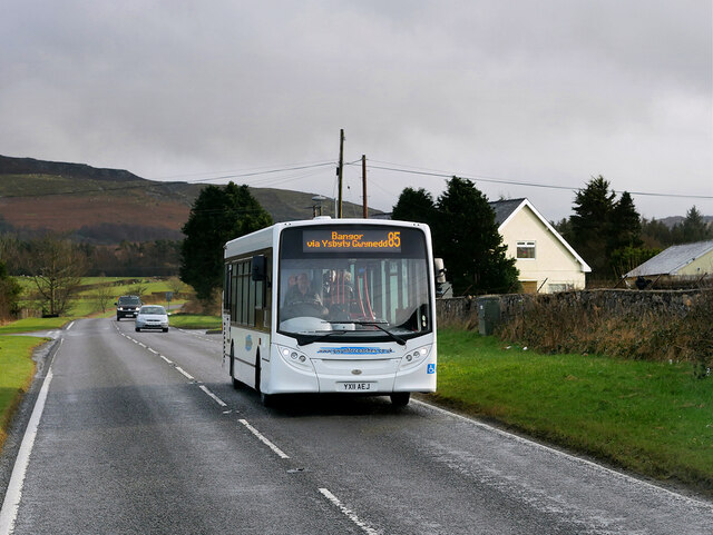
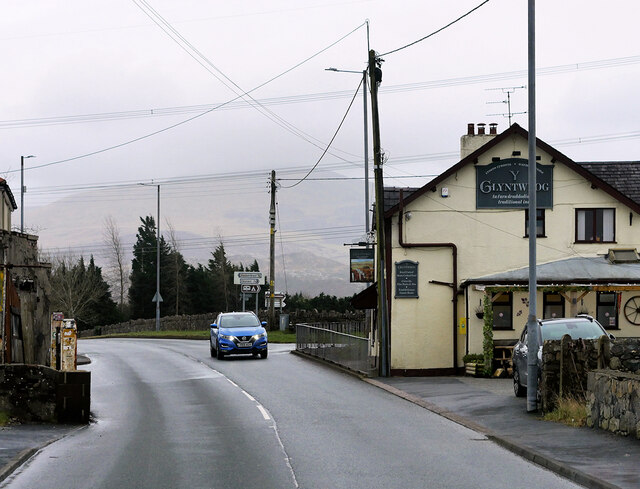
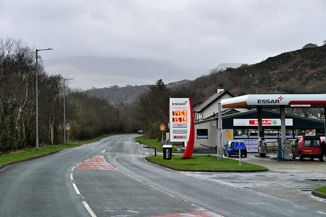
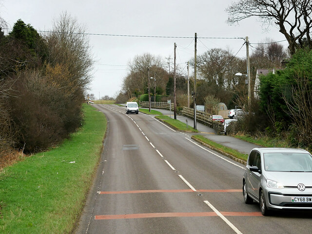
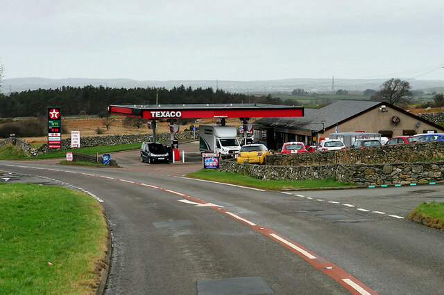
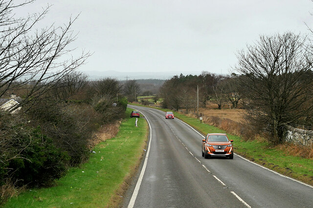
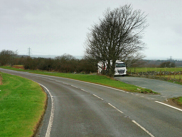
Waen Images

Images are sourced within 2km of 53.158376/-4.164169 or Grid Reference SH5564. Thanks to Geograph Open Source API. All images are credited.

St Deiniol's Church, Llanddeiniolen
Trackway Near Waun
Trackway Near Waun
A Neglected Stile
A Neglected Stile
Wetland at Llanddeiniolen The Carneddau form the background.
Wetland at Llanddeiniolen
The Carneddau form the background.
Llanddeiniolen, Gwynedd Sheep grazing on pasture land to the east of Llanddeiniolen and to the south of Snowdonia, which can be seen in the distance.
Llanddeiniolen, Gwynedd
Sheep grazing on pasture land to the east of Llanddeiniolen and to the south of Snowdonia, which can be seen in the distance.
Connector pylon at the Stabla ESS
Field of sheep at Tyddin Hendre A field of sheep at Tyddin Hendre farm near Penisa'r Waun.
Field of sheep at Tyddin Hendre
A field of sheep at Tyddin Hendre farm near Penisa'r Waun.
Service Bus on the A4244 Gwynfor Coaches Alexander Dennis Enviro 200 Dart, YX11 AEJ on route number 85 towards Bangor. (A4244, Ynys lago bus stop).
Service Bus on the A4244
Gwynfor Coaches Alexander Dennis Enviro 200 Dart, YX11 AEJ on route number 85 towards Bangor. (A4244, Ynys lago bus stop).
Y Glyntywrog, Llanberis Road The A4086 runs for almost 18 miles between Caernarfon and Capel Curig. It is a popular tourist route as it passes through some of the most memorable and famous parts of Snowdonia including the Llanberis Pass.
Y Glyntywrog, Llanberis Road
The A4086 runs for almost 18 miles between Caernarfon and Capel Curig. It is a popular tourist route as it passes through some of the most memorable and famous parts of Snowdonia including the Llanberis Pass.
London Garage, Maes Gerddi The A4086 runs for almost 18 miles between Caernarfon and Capel Curig. It is a popular tourist route as it passes through some of the most memorable and famous parts of Snowdonia including the Llanberis Pass.
London Garage, Maes Gerddi
The A4086 runs for almost 18 miles between Caernarfon and Capel Curig. It is a popular tourist route as it passes through some of the most memorable and famous parts of Snowdonia including the Llanberis Pass.
A4244 near Bryn Derw The A4244 is a relatively short (6½ miles) rural A-road in north Caernarfonshire. It connects the A5/A55 (near the Llys-y-gwynt junction) with the A4086 at Brynrefail, just outside Llanberis.
A4244 near Bryn Derw
The A4244 is a relatively short (6½ miles) rural A-road in north Caernarfonshire. It connects the A5/A55 (near the Llys-y-gwynt junction) with the A4086 at Brynrefail, just outside Llanberis.
Beran Service Station The A4244 is a relatively short (6½ miles) rural A-road in north Caernarfonshire. It connects the A5/A55 (near the Llys-y-gwynt junction) with the A4086 at Brynrefail, just outside Llanberis.
Beran Service Station
The A4244 is a relatively short (6½ miles) rural A-road in north Caernarfonshire. It connects the A5/A55 (near the Llys-y-gwynt junction) with the A4086 at Brynrefail, just outside Llanberis.
A4244 northbound The A4244 is a relatively short (6½ miles) rural A-road in north Caernarfonshire. It connects the A5/A55 (near the Llys-y-gwynt junction) with the A4086 at Brynrefail, just outside Llanberis.
A4244 northbound
The A4244 is a relatively short (6½ miles) rural A-road in north Caernarfonshire. It connects the A5/A55 (near the Llys-y-gwynt junction) with the A4086 at Brynrefail, just outside Llanberis.
Layby on the A4244 The A4244 is a relatively short (6½ miles) rural A-road in north Caernarfonshire. It connects the A5/A55 (near the Llys-y-gwynt junction) with the A4086 at Brynrefail, just outside Llanberis.
Layby on the A4244
The A4244 is a relatively short (6½ miles) rural A-road in north Caernarfonshire. It connects the A5/A55 (near the Llys-y-gwynt junction) with the A4086 at Brynrefail, just outside Llanberis.
The Gors Bach Inn at Llanddeiniolen The appearance, signage and road layout have changed since 2005 and 2008. See: <a title="https://www.geograph.org.uk/photo/39549" href="https://www.geograph.org.uk/photo/39549">Link</a> and <a title="https://www.geograph.org.uk/photo/808514" href="https://www.geograph.org.uk/photo/808514">Link</a>
The Gors Bach Inn at Llanddeiniolen
The appearance, signage and road layout have changed since 2005 and 2008. See: Link and Link
Benchmark at Tan-dinas, Llanddeiniolen This benchmark is located on the SE face of Tan-dinas in Llanddeiniolen & it is shown in the current Ordnance Survey database at a height of 108.4235m above the Newlyn datum.
Benchmark at Tan-dinas, Llanddeiniolen
This benchmark is located on the SE face of Tan-dinas in Llanddeiniolen & it is shown in the current Ordnance Survey database at a height of 108.4235m above the Newlyn datum.
Benchmark on St. Deiniolen's Church, Llanddeiniolen This benchmark is located on the SE face of St. Deniniolen's church (Eglwys Llanddeiniolen) in Llanddeniolen & it is shown in the current Ordnance Survey database at a height of 126.1903m above the Newlyn datum.
Benchmark on St. Deiniolen's Church, Llanddeiniolen
This benchmark is located on the SE face of St. Deniniolen's church (Eglwys Llanddeiniolen) in Llanddeniolen & it is shown in the current Ordnance Survey database at a height of 126.1903m above the Newlyn datum.
Benchmark at Ynys Farm, Llanddeiniolen This benchmark is located on the SW face of an outbuilding at Ynys farm in Llanddeiniolen. The mark does not appear in the current Ordnance Survey database but is shown on an 1970 map of the area at a height of 117.24m above the Newlyn datum.
Benchmark at Ynys Farm, Llanddeiniolen
This benchmark is located on the SW face of an outbuilding at Ynys farm in Llanddeiniolen. The mark does not appear in the current Ordnance Survey database but is shown on an 1970 map of the area at a height of 117.24m above the Newlyn datum.
Show me another place!

Waen is located at Grid Ref: SH5564 (Lat: 53.158376, Lng: -4.164169)

Unitary Authority: Gwynedd

Police Authority: North Wales

Also known as: Waun

What 3 Words

///prowling.shining.dreamers. Near Llanrug, Gwynedd

Related Wikis

Penisa'r Waun

Penisa'r-waun is a small village which is located 4 miles to the east of Caernarfon and a mile to the northeast of Llanrug on the A4547 in Gwynedd, north...

Afon Rhythallt

The River Rhythallt (Welsh: Afon Rhythallt) is a river in Gwynedd, North Wales whose source is Llyn Padarn. It flows in a northwesterly direction past...

Pontrhythallt railway station

Pontrhythallt was a railway station in the village of Pont Rhythallt, Gwynedd, Wales. This station opened in 1869 and closed for regular passenger services...
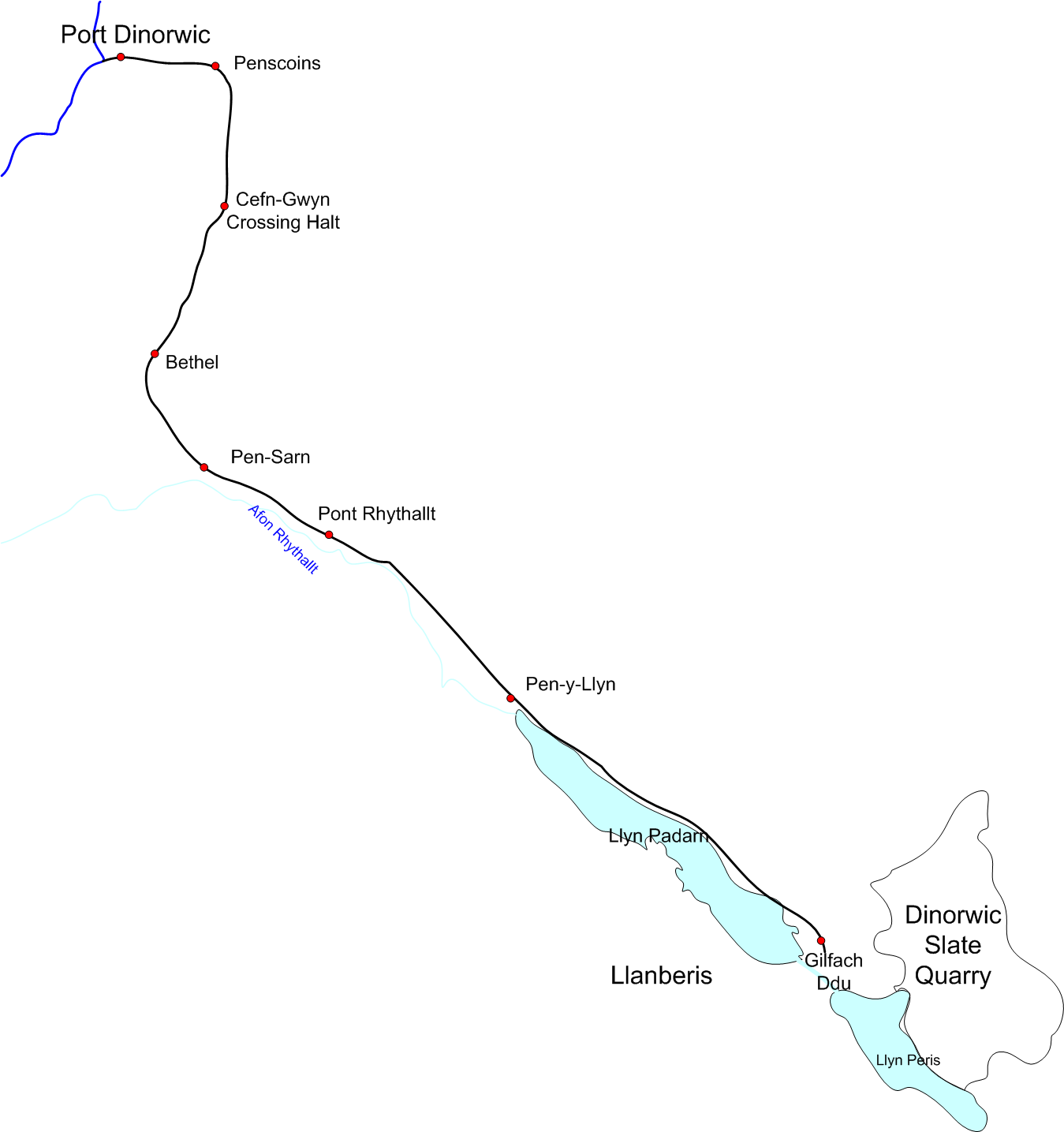
Padarn Railway

The Padarn Railway was a narrow-gauge railway in North Wales, built to the unusual gauge of 4 ft (1,219 mm). It carried slate seven miles (11 km) from...

Nearby Amenities

Located within 500m of 53.158376,-4.164169
Power: tower
Lat/Long: 53.1595117/-4.1671299
Power: tower
Lat/Long: 53.157759/-4.167212
Power: tower
Lat/Long: 53.1623326/-4.16332
Power: tower
Lat/Long: 53.1549969/-4.1673926
Pen-ucha'r-waen
Place: hamlet
Lat/Long: 53.1565119/-4.1666363
Waen
Place: hamlet
Lat/Long: 53.158667/-4.160081
Barrier: kissing_gate
Foot: yes
Lat/Long: 53.1587203/-4.1680413
Post Box
Drive Through: no
Operator: Royal Mail
Lat/Long: 53.1565855/-4.1666286
Noexit: yes
Lat/Long: 53.1563264/-4.1654217
Direction: 105
Generator Method: photovoltaic
Generator Output Electricity: yes
Generator Solar Modules: 16
Generator Source: solar
Generator Type: solar_photovoltaic_panel
Location: roof
Power: generator
Lat/Long: 53.1589408/-4.1606252
The data included in this document is from www.openstreetmap.org. The data is made available under ODbL.

Have you been to Waen?

Leave your review of Waen below (or comments, questions and feedback).