Boxgrove

Settlement in Sussex Chichester

England

Boxgrove

Road near Oakham Farm
Road near Oakham Farm Credit: P Gaskell

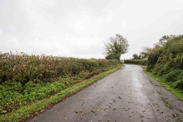
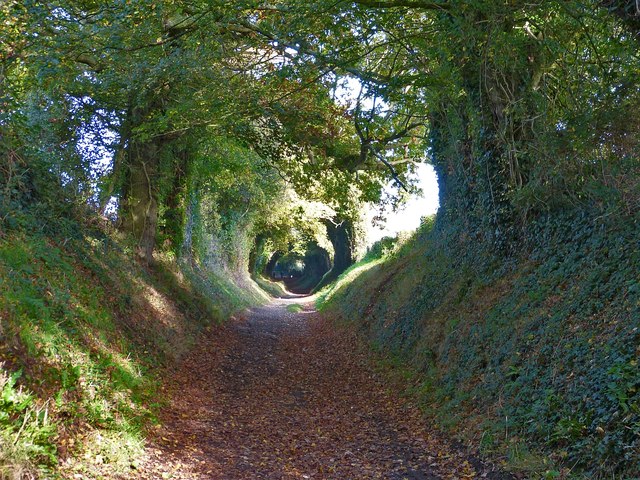
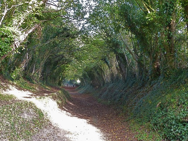
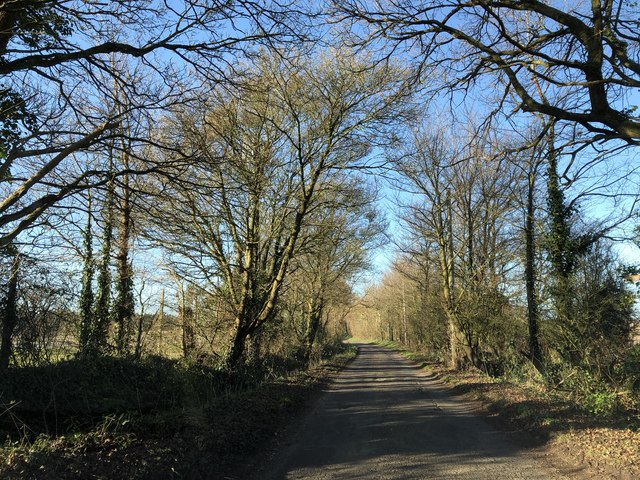
Boxgrove is a small village located in the Chichester district of West Sussex, England. It lies approximately five miles northwest of Chichester and is nestled within the South Downs National Park. The village is known for its picturesque countryside, ancient history, and archaeological significance.

The area around Boxgrove has been inhabited since prehistoric times, with evidence of human occupation dating back over 500,000 years. The internationally renowned Boxgrove Quarry, located just outside the village, has yielded numerous finds, including the remains of the Boxgrove Man, a Homo heidelbergensis who lived around 500,000 years ago. These discoveries have provided key insights into early human evolution.

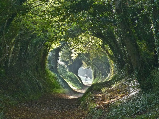
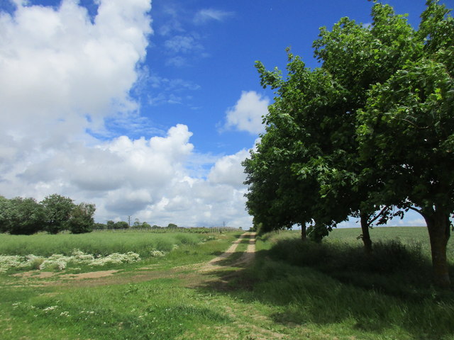
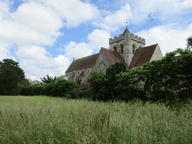
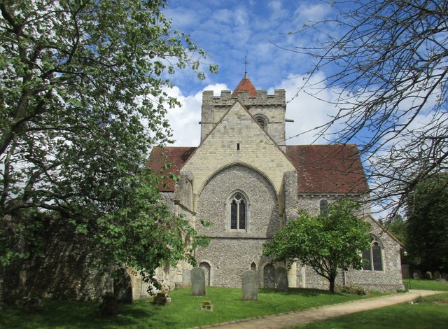
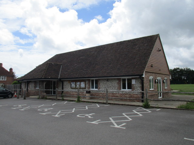
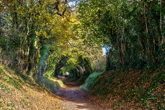
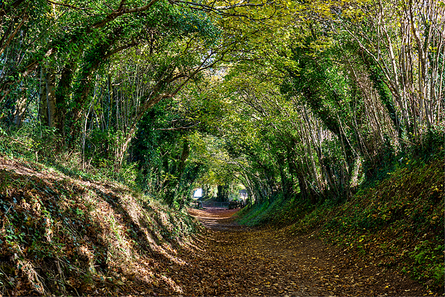
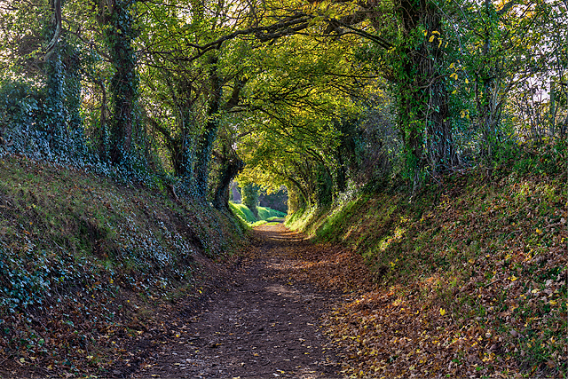
Today, Boxgrove is a charming village with a population of around 500 residents. It boasts a quaint village green, a beautiful 13th-century church, and a local pub that serves as a hub for social gatherings. The surrounding countryside offers stunning walks and breathtaking views, making it a popular destination for outdoor enthusiasts.

Despite its small size, Boxgrove is well-connected to neighboring towns and cities, with good transport links to Chichester and London. It is also within easy reach of the nearby Goodwood Estate, famous for its motorsport events and horse racing.

Boxgrove's rich history, natural beauty, and tranquil atmosphere make it an attractive place to live or visit, offering a glimpse into the past and a chance to immerse oneself in the beauty of the Sussex countryside.

If you have any feedback on the listing, please let us know in the comments section below.

Boxgrove Images

Images are sourced within 2km of 50.85923/-0.712663 or Grid Reference SU9007. Thanks to Geograph Open Source API. All images are credited.

Road near Oakham Farm
Esso filling station on A27 in Tangmere
Mill Lane, Halnaker view northeastwards Mill Lane to the northeast of the village of Halnaker follows the route of the old Roman Road, Stane Street at this point. With its tunnel-like overarching canopy of  trees it is a particularly attractive walk, especially with the Autumn colours beginning to show. Its beauty is well known, as there were numerous photographers about trying to take a particularly good photo of the scene.
Mill Lane is so called because after a while it diverges from Stane Street, heading north to Halnaker Windmill atop nearby Halnaker Hill.
See also <a href="https://www.geograph.org.uk/photo/4727988">SU9108 : Mill Lane section of Stane Street in Autumn</a> and <a href="https://www.geograph.org.uk/photo/4727996">SU9108 : Mill Lane, Halnaker view southwestwards</a>
Mill Lane, Halnaker view northeastwards
Mill Lane to the northeast of the village of Halnaker follows the route of the old Roman Road, Stane Street at this point. With its tunnel-like overarching canopy of trees it is a particularly attractive walk, especially with the Autumn colours beginning to show. Its beauty is well known, as there were numerous photographers about trying to take a particularly good photo of the scene. Mill Lane is so called because after a while it diverges from Stane Street, heading north to Halnaker Windmill atop nearby Halnaker Hill. See also SU9108 : Mill Lane section of Stane Street in Autumn and SU9108 : Mill Lane, Halnaker view southwestwards
Mill Lane section of Stane Street in Autumn A view a little further along Mill Lane than <a href="https://www.geograph.org.uk/photo/4727983">SU9108 : Mill Lane, Halnaker view northeastwards</a> (q.v. for more information). Ahead can be seen a gate which crosses the track with the public footpath being diverted to the south of the track but immediately parallel with it. The group of people seen in front of the gate are all photographers, hoping to get a really good photo of this very attractive lane in its Autumn foliage.
See also <a href="https://www.geograph.org.uk/photo/4727996">SU9108 : Mill Lane, Halnaker view southwestwards</a> looking in the opposite direction, from that gate.
Mill Lane section of Stane Street in Autumn
A view a little further along Mill Lane than SU9108 : Mill Lane, Halnaker view northeastwards (q.v. for more information). Ahead can be seen a gate which crosses the track with the public footpath being diverted to the south of the track but immediately parallel with it. The group of people seen in front of the gate are all photographers, hoping to get a really good photo of this very attractive lane in its Autumn foliage. See also SU9108 : Mill Lane, Halnaker view southwestwards looking in the opposite direction, from that gate.
Mill Lane, Halnaker view southwestwards This view southwestwards along Mill Lane to the northeast of Halnaker, particularly shows the tunnel-like effect created by the trees overarching the track. I was far from alone in taking photos of this scene, as it seems to be a well-known spot with photographers trying to catch a fine example of Autumnal colours. The photo was taken from the gate seen in the distance in <a href="https://www.geograph.org.uk/photo/4727988">SU9108 : Mill Lane section of Stane Street in Autumn</a>. At this point the public footpath leaves the main track and runs parallel with it on a bank immediately to the south. A little further to the northeast the footpath forks, with one footpath continuing roughly straight northeastwards along the old Stane Street route, while a second path heads northwards to <a href="https://www.geograph.org.uk/photo/4728332">SU9209 : Halnaker Windmill</a> atop Halnaker Hill.
See also <a href="https://www.geograph.org.uk/photo/4727983">SU9108 : Mill Lane, Halnaker view northeastwards</a>
Mill Lane, Halnaker view southwestwards
This view southwestwards along Mill Lane to the northeast of Halnaker, particularly shows the tunnel-like effect created by the trees overarching the track. I was far from alone in taking photos of this scene, as it seems to be a well-known spot with photographers trying to catch a fine example of Autumnal colours. The photo was taken from the gate seen in the distance in SU9108 : Mill Lane section of Stane Street in Autumn. At this point the public footpath leaves the main track and runs parallel with it on a bank immediately to the south. A little further to the northeast the footpath forks, with one footpath continuing roughly straight northeastwards along the old Stane Street route, while a second path heads northwards to SU9209 : Halnaker Windmill atop Halnaker Hill. See also SU9108 : Mill Lane, Halnaker view northeastwards
Footpath to Boxgrove Common
Boxgrove Priory church from the north west Most of the nave has disappeared.
Boxgrove Priory church from the north west
Most of the nave has disappeared.
Gateway into the Goodwood estate
Boxgrove Priory, west end Most of the nave was demolished in the sixteenth century.
Boxgrove Priory, west end
Most of the nave was demolished in the sixteenth century.
Boxgrove Priory, remains of the Guest House Dates from about 1300.
Boxgrove Priory, remains of the Guest House
Dates from about 1300.
The meeting of paths Just north-east of Boxgrove.
The meeting of paths
Just north-east of Boxgrove.
Meadow at Boxgrove Just east of the church.
Meadow at Boxgrove
Just east of the church.
Boxgrove Village Hall
Mill Lane, Halnaker (1) The famous 'tunnel of trees' on the footpath to Halnaker Windmill. The view northeast.

<a href="https://www.geograph.org.uk/photo/5603895">SU9108 : Mill Lane, Halnaker (2)</a>
Mill Lane, Halnaker (1)
The famous 'tunnel of trees' on the footpath to Halnaker Windmill. The view northeast. SU9108 : Mill Lane, Halnaker (2)
Mill Lane, Halnaker (2) The famous 'tunnel of trees' a short distance further along the footpath to Halnaker Windmill. The view northeast.

<a href="https://www.geograph.org.uk/photo/5603897">SU9108 : Mill Lane, Halnaker (3)</a>
Mill Lane, Halnaker (2)
The famous 'tunnel of trees' a short distance further along the footpath to Halnaker Windmill. The view northeast. SU9108 : Mill Lane, Halnaker (3)
Mill Lane, Halnaker (3) The famous 'tunnel of trees' on the footpath to Halnaker Windmill. The view southwest.
Mill Lane, Halnaker (3)
The famous 'tunnel of trees' on the footpath to Halnaker Windmill. The view southwest.
East Hampnett Lane Heading westwards on the lane close to the Sewerage Works.
East Hampnett Lane
Heading westwards on the lane close to the Sewerage Works.
Boxgrove Priory Ruins The ruins of Boxgrove Priory, Boxgrove, West Sussex.
<span class="nowrap"><a title="https://www.english-heritage.org.uk/visit/places/boxgrove-priory/" rel="nofollow ugc noopener" href="https://www.english-heritage.org.uk/visit/places/boxgrove-priory/">Link</a><img style="margin-left:2px;" alt="External link" title="External link - shift click to open in new window" src="https://s1.geograph.org.uk/img/external.png" width="10" height="10"/></span>
<span class="nowrap"><a title="https://en.wikipedia.org/wiki/Boxgrove_Priory" rel="nofollow ugc noopener" href="https://en.wikipedia.org/wiki/Boxgrove_Priory">Link</a><img style="margin-left:2px;" alt="External link" title="External link - shift click to open in new window" src="https://s1.geograph.org.uk/img/external.png" width="10" height="10"/></span>
Boxgrove Priory Ruins
The ruins of Boxgrove Priory, Boxgrove, West Sussex. LinkExternal link LinkExternal link
Show me another place!

Boxgrove is located at Grid Ref: SU9007 (Lat: 50.85923, Lng: -0.712663)

Administrative County: West Sussex

District: Chichester

Police Authority: Sussex

What 3 Words

///outsmart.reader.cornering. Near Boxgrove, West Sussex

Nearby Locations

Boxgrove

Related Wikis

Boxgrove

Boxgrove is a village, ecclesiastical parish and civil parish in the Chichester District of the English county of West Sussex, about 3.5 miles (5.6 km...
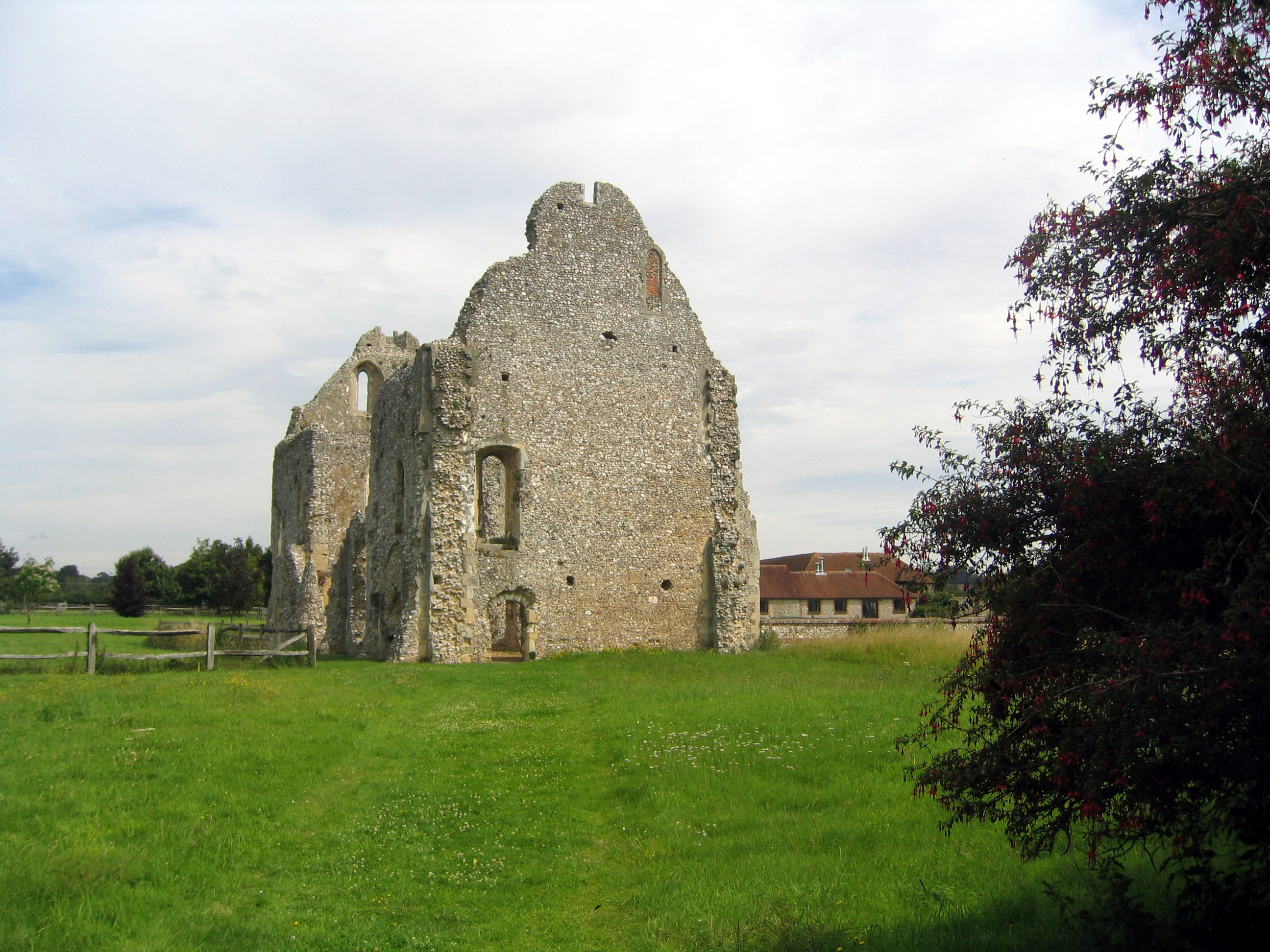
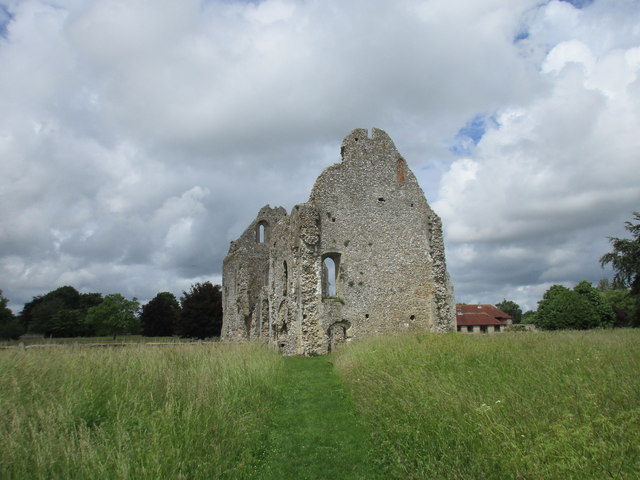
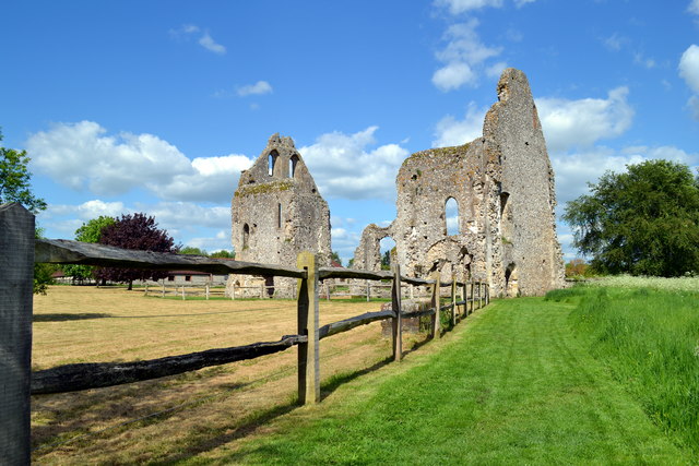
Boxgrove Priory

Boxgrove Priory is a ruined priory in the village of Boxgrove in Sussex, England. It was founded in the 12th century. == History == === Origins === The Priory...

Halnaker

Halnaker is a hamlet in the Chichester district of West Sussex, England. It lies on the A285 road 3.5 miles (5.6 km) northeast of Chichester, where it...

Tangmere

Tangmere is a village, civil parish, and electoral ward in the Chichester District of West Sussex, England. Located three miles (5 km) north east of Chichester...

St Andrew's Church, Tangmere

St Andrew's Church is a Church of England church, located in Tangmere, West Sussex. It lies within the Diocese of Chichester. == Overview == The Saxon...

Tangmere Military Aviation Museum

The Tangmere Military Aviation Museum is a museum located on the former site of RAF Tangmere, West Sussex. The museum was opened in June 1982. Many aerospace...

RAF Tangmere

Royal Air Force Tangmere or more simply RAF Tangmere is a former Royal Air Force station located in Tangmere, England, famous for its role in the Battle...

Crockerhill, West Sussex

Crockerhill is a hamlet on the A27 road between Tangmere and Fontwell in West Sussex, England. It has one public house, The Winterton Arms.. At the 2011...

Nearby Amenities

Located within 500m of 50.85923,-0.712663
Boxgrove
Is In: West Sussex, England, UK
Place: village
Source: npe
Lat/Long: 50.8603445/-0.712802
Crossing
Crossing: unmarked
Crossing Markings: no
Lat/Long: 50.8549861/-0.7121262
Bus Stop
Village Shop
Bus: yes
Naptan AtcoCode: 4400MO0008
Naptan Bearing: N
Naptan BusStopType: CUS
Naptan CommonName: Shops
Naptan Indicator: o/s stores
Naptan Landmark: Boxgrove Village Stores
Naptan NaptanCode: wsxdgpgm
Naptan Street: The Street
Naptan Verified: no
Public Transport: platform
Source: naptan_import
Lat/Long: 50.8587462/-0.7127269
Bus Stop
Priory Close
Bus: yes
Naptan AtcoCode: 4400MO0009
Naptan Bearing: S
Naptan CommonName: Priory Close
Naptan Indicator: adj Priory Close
Naptan Landmark: Priory Close
Naptan NaptanCode: wsxdgpgp
Naptan Street: The Street
Naptan Verified: no
Public Transport: platform
Source: naptan_import
Lat/Long: 50.8575507/-0.712774
Bus Stop
Priory Close
Bus: yes
Naptan AtcoCode: 4400MO0010
Naptan Bearing: N
Naptan CommonName: Priory Close
Naptan Indicator: adj Priors Acre
Naptan Landmark: Priors Acre
Naptan NaptanCode: wsxdgpgt
Naptan Street: The Street
Naptan Verified: no
Public Transport: platform
Source: naptan_import
Lat/Long: 50.8566456/-0.7130689
Bus Stop
Primary School
Bus: yes
Naptan AtcoCode: 4400MO0011
Naptan Bearing: S
Naptan CommonName: Primary School
Naptan Indicator: opp school
Naptan Landmark: Boxgrove CofE Primary
Naptan NaptanCode: wsxdgpgw
Naptan Street: The Street
Naptan Verified: no
Public Transport: platform
Source: naptan_import
Lat/Long: 50.8608055/-0.7127128
Bus Stop
Primary School
Bus: yes
Naptan AtcoCode: 4400MO0012
Naptan Bearing: N
Naptan CommonName: Primary School
Naptan Indicator: adj school
Naptan Landmark: Boxgrove CofE Primary School
Naptan NaptanCode: wsxdgpja
Naptan Street: The Street
Naptan Verified: no
Public Transport: platform
Source: naptan_import
Lat/Long: 50.8610943/-0.7128043
Power: pole
Lat/Long: 50.8630151/-0.7107159
Power: pole
Lat/Long: 50.8632859/-0.7120891
Power: pole
Lat/Long: 50.8633503/-0.7136019
Power: pole
Lat/Long: 50.8633943/-0.712116
Power: pole
Lat/Long: 50.8632927/-0.7150771
Power: pole
Lat/Long: 50.8630929/-0.7106139
Power: pole
Lat/Long: 50.8621855/-0.715281
Power: pole
Lat/Long: 50.862751/-0.7136663
Power: pole
Lat/Long: 50.8627205/-0.7092245
Power: pole
Lat/Long: 50.8624056/-0.7077225
Power: pole
Lat/Long: 50.8616607/-0.7168635
Power: pole
Lat/Long: 50.8611392/-0.718387
Power: pole
Lat/Long: 50.8628017/-0.7091602
Post Box
Collection Plate: CP1
Collection Times: Mo-Fr 17:00; Sa 11:00
Operator: Royal Mail
Operator Wikidata: Q638098
Post Box Type: pillar
Ref: PO18 11
Royal Cypher: EIIR
Royal Cypher Wikidata: Q33102113
Lat/Long: 50.8586833/-0.7127362
Bicycle Parking
Bicycle Parking: stands
Capacity: 10
Lat/Long: 50.86105/-0.7130879
Maxheight: 2
Lat/Long: 50.8611926/-0.712831
Defibrillator
Emergency: defibrillator
Indoor: no
Lat/Long: 50.8611746/-0.7131232
Crossing
Crossing: unmarked
Crossing Markings: no
Lat/Long: 50.8549702/-0.7119831
Charging Station
Access: yes
Capacity: 1
Operator: Chargemaster
Operator Wikidata: Q39057719
Lat/Long: 50.8611385/-0.7131152
Crossing
Lat/Long: 50.8605931/-0.7129379
Turning Loop
Lat/Long: 50.8613485/-0.7104906
The Brufords
Addr City: Chichester
Addr Housenumber: 66
Addr Postcode: PO18 0EE
Addr Street: The Street
Addr Suburb: Boxgrove
Fhrs Authority: Chichester
Fhrs Id: 19
Fhrs Local Authority Id: 00/00005/FOOD
Tourism: guest_house
Lat/Long: 50.8598103/-0.7130545
Boxgrove Village Stores
Addr City: Chichester
Addr Postcode: PO18 0DX
Addr Street: The Street
Addr Suburb: Boxgrove
Fhrs Authority: Chichester
Fhrs Id: 1171919
Fhrs Local Authority Id: 19/00156/FOOD
Shop: convenience
Lat/Long: 50.8586404/-0.712789
The data included in this document is from www.openstreetmap.org. The data is made available under ODbL.

Have you been to Boxgrove?

Leave your review of Boxgrove below (or comments, questions and feedback).