An t-Olach àrd

Settlement in Inverness-shire

Scotland

An t-Olach àrd

Rather featureless moorland Flattish and largely featureless moorland to the north of Beinn nan Capull.
Rather featureless moorland Credit: Richard Dorrell

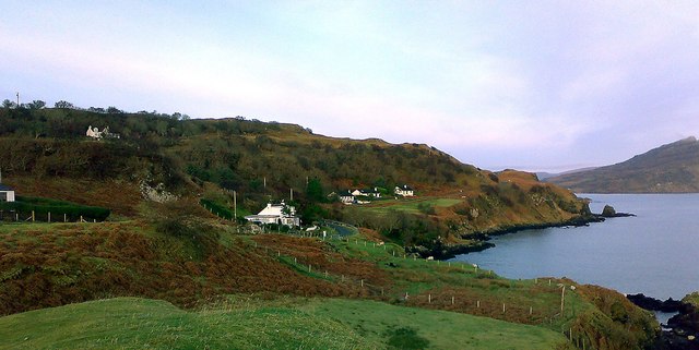
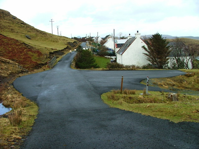
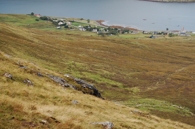
An t-Olach àrd, also known as The High Place, is a small village located in the Inverness-shire region of Scotland. Situated amidst the stunning Scottish Highlands, this picturesque settlement offers a tranquil retreat for nature enthusiasts and history buffs alike.

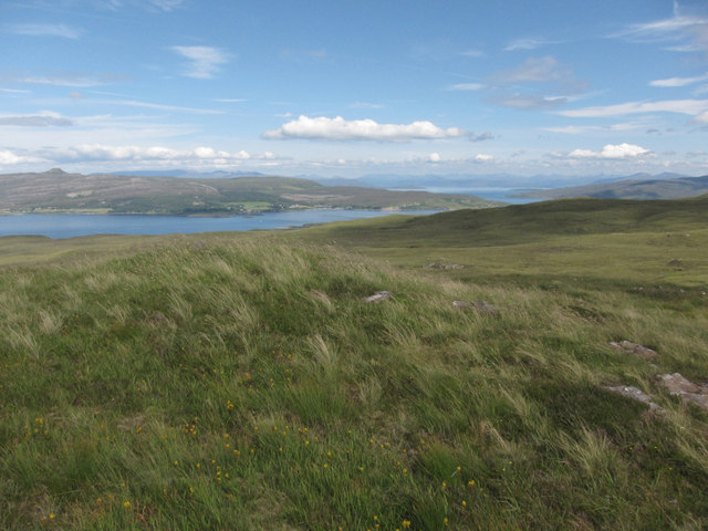
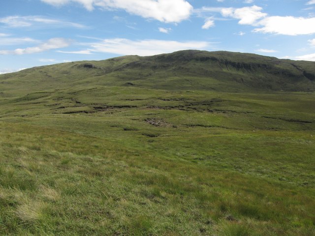
The village is nestled in a valley surrounded by rolling hills, providing visitors with breathtaking views of the rugged landscape. Its remote location allows for a peaceful and idyllic atmosphere, making it an ideal destination for those seeking a break from the hustle and bustle of city life.

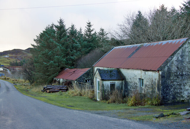
An t-Olach àrd is known for its rich history, dating back centuries. The area was once inhabited by ancient clans, and remnants of their settlements can still be found in the form of stone circles and burial sites. Visitors can explore these historical sites, gaining insight into the village's past.

For outdoor enthusiasts, the village offers a plethora of activities such as hiking, cycling, and fishing. The surrounding hills provide numerous trails, allowing visitors to immerse themselves in the stunning natural beauty of the Scottish Highlands. Fishing enthusiasts can enjoy angling in the nearby lochs and rivers, which are renowned for their abundance of salmon and trout.

Despite its small size, An t-Olach àrd has a close-knit community that takes pride in preserving its cultural heritage. The village hosts several annual events and festivals that celebrate traditional Scottish music, dance, and cuisine. Visitors can experience the warmth and hospitality of the locals, who are always eager to share their knowledge and stories about the village's history.

Overall, An t-Olach àrd is a hidden gem in the Inverness-shire region, offering visitors a unique blend of natural beauty, historical significance, and Scottish charm. It provides a perfect escape for those seeking a peaceful retreat in the heart of the Scottish Highlands.

If you have any feedback on the listing, please let us know in the comments section below.

An t-Olach àrd Images

Images are sourced within 2km of 57.346251/-6.1404388 or Grid Reference NG5136. Thanks to Geograph Open Source API. All images are credited.

Rather featureless moorland Flattish and largely featureless moorland to the north of Beinn nan Capull.
Rather featureless moorland
Flattish and largely featureless moorland to the north of Beinn nan Capull.
Lumpy moorland  It doesn't matter much which way you face here - all you see in every direction is flattish moorland, which quickly becomes boggy in wet weather.
Lumpy moorland
It doesn't matter much which way you face here - all you see in every direction is flattish moorland, which quickly becomes boggy in wet weather.
Remarkable erratic This rather odd rock feature stands alone amid many acres of otherwise featureless and fairly flat moorland. It measures about four metres by three, and stands about two metres high. I think it is a glacial erratic, rather than exposed bedrock, as there is no such exposed bedrock for some distance around. Slightly closer view, from the other side: <a href="https://www.geograph.org.uk/photo/4089013">NG4935 : Odd rock</a>.
Remarkable erratic
This rather odd rock feature stands alone amid many acres of otherwise featureless and fairly flat moorland. It measures about four metres by three, and stands about two metres high. I think it is a glacial erratic, rather than exposed bedrock, as there is no such exposed bedrock for some distance around. Slightly closer view, from the other side: NG4935 : Odd rock.
Odd rock This unusual feature stands all alone amid acres of otherwise largely featureless moorland. 
Another view: <a href="https://www.geograph.org.uk/photo/4089009">NG4935 : Remarkable erratic</a>.
Odd rock
This unusual feature stands all alone amid acres of otherwise largely featureless moorland. Another view: NG4935 : Remarkable erratic.
Moorland north of Beinn nan Capull Looking down the east facing slope of the hill with the island of Raasay beyond.
Moorland north of Beinn nan Capull
Looking down the east facing slope of the hill with the island of Raasay beyond.
Trig point on Beinn nan Capull The trig is a few metres below the true summit. See <a href="https://www.geograph.org.uk/photo/4089026">NG4935 : Summit of Beinn nan Capull</a>.
Trig point on Beinn nan Capull
The trig is a few metres below the true summit. See NG4935 : Summit of Beinn nan Capull.
Summit of Beinn nan Capull This grassy mound is at the true summit of the hill, though there is a trig point a short distance to the north. This view is east. The water is the Narrows of Raasay, with the island of Raasay beyond.
Summit of Beinn nan Capull
This grassy mound is at the true summit of the hill, though there is a trig point a short distance to the north. This view is east. The water is the Narrows of Raasay, with the island of Raasay beyond.
Towards Meall Odhar Beag Looking south west from close to the summit of Beinn nan Capull over a boggy bealach between the hills.
Towards Meall Odhar Beag
Looking south west from close to the summit of Beinn nan Capull over a boggy bealach between the hills.
Boggy going Flat areas of moorland between hills usually results in boggy ground, and here is no exception. Craggy outcrops on Ben Lee lie beyond.
Boggy going
Flat areas of moorland between hills usually results in boggy ground, and here is no exception. Craggy outcrops on Ben Lee lie beyond.
Glen Varragill moorland Not much variety in this square. Uniformly rough and wet.
Glen Varragill moorland
Not much variety in this square. Uniformly rough and wet.
Mamofa Looking west from the slopes of Capull to the forests by the Varragill River.
Mamofa
Looking west from the slopes of Capull to the forests by the Varragill River.
Beinn nan Capull trig point A little to the north of the true summit, but a great vantage point.
In the distance are the peaks of Pein a'Chleibh, Hartaval, the Storr, Bealach Cumhang and Ben Tianavaig.
Beinn nan Capull trig point
A little to the north of the true summit, but a great vantage point. In the distance are the peaks of Pein a'Chleibh, Hartaval, the Storr, Bealach Cumhang and Ben Tianavaig.
Old and new houses in Ollach The ruin of a Braes croft house in the foreground, and a modern red roofed house further back.
Old and new houses in Ollach
The ruin of a Braes croft house in the foreground, and a modern red roofed house further back.
Barn and house in Achnahanaid The modern large house operates as Bed and Breakfast accommodation.
Barn and house in Achnahanaid
The modern large house operates as Bed and Breakfast accommodation.
Old house and barn Standing at the roadside in Achnahanaid, the large building was almost certainly once a dwelling, though unusually, has no chimneys - which would normally be in the both gable ends.
Old house and barn
Standing at the roadside in Achnahanaid, the large building was almost certainly once a dwelling, though unusually, has no chimneys - which would normally be in the both gable ends.
Braes road in Achnahanaid Looking south east. 
Braes is a district made up of a number of small townships. Ahead are Lower and Upper Ollach.
Braes road in Achnahanaid
Looking south east. Braes is a district made up of a number of small townships. Ahead are Lower and Upper Ollach.
Braesburn Hall, revised Building work is currently underway which will convert the original Braesburn Hall into a domestic dwelling. The new-build will have two en-suite bedrooms, one on the ground floor and one in the roof. The original doorway is to be filled-in, and one arched window becomes rectangular. A new extension on the southern side of the building will provide a sun-lounge. 
Former images of the hall: 
<a href="https://www.geograph.org.uk/photo/677700">NG5136 : Braesburn Hall</a>
<a href="https://www.geograph.org.uk/photo/1454752">NG5136 : Building work at the church hall</a>
Braesburn Hall, revised
Building work is currently underway which will convert the original Braesburn Hall into a domestic dwelling. The new-build will have two en-suite bedrooms, one on the ground floor and one in the roof. The original doorway is to be filled-in, and one arched window becomes rectangular. A new extension on the southern side of the building will provide a sun-lounge. Former images of the hall: NG5136 : Braesburn Hall NG5136 : Building work at the church hall
Braesburn Hall, revised Building work is currently underway which will convert the original Braesburn Hall into a domestic dwelling. The new-build will have two en-suite bedrooms, one on the ground floor and one in the roof, with roof-lights. The original doorway is to be filled-in, and one arched window becomes rectangular. A new extension on the southern side of the building will provide a sun-lounge.
Former images of the hall:
<a href="https://www.geograph.org.uk/photo/677700">NG5136 : Braesburn Hall</a>
<a href="https://www.geograph.org.uk/photo/1454752">NG5136 : Building work at the church hall</a>
Braesburn Hall, revised
Building work is currently underway which will convert the original Braesburn Hall into a domestic dwelling. The new-build will have two en-suite bedrooms, one on the ground floor and one in the roof, with roof-lights. The original doorway is to be filled-in, and one arched window becomes rectangular. A new extension on the southern side of the building will provide a sun-lounge. Former images of the hall: NG5136 : Braesburn Hall NG5136 : Building work at the church hall
Show me another place!

An t-Olach àrd is located at Grid Ref: NG5136 (Lat: 57.346251, Lng: -6.1404388)

Unitary Authority: Highland

Police Authority: Highlands and Islands

Also known as: Upper Ollach

What 3 Words

///investors.venue.expensive. Near Portree, Highland

Related Wikis

Ollach

Ollach (in Scottish Gaelic, An t-Olach) is a remote settlement, made up of Lower Ollach and Upper Ollach, lying on B883 road, south of Portree, Isle of...

Gedintailor

Gedintailor (Scottish Gaelic: Gead an t-Sailleir) is a crofting village, lying on the shores of the Narrows of Raasay on the east coast of the island of...

Peinachorran

Peinchorran (Scottish Gaelic: Peighinn a' Chorrain; Peinachorrain on Ordnance Survey maps) is a remote settlement, lying at the end of the B883 road, on...

Camastianavaig

Camustianavaig (also English spelling: Camustinivaig) is a crofting township on the island of Skye in Scotland. It is located on the shores of the Sound...

Isle of Raasay distillery

Isle of Raasay distillery is a Scotch whisky distillery on the Inner Hebridean Isle of Raasay in Northwest Scotland. The distillery is owned by R&B Distillers...

Sconser

Sconser (Scottish Gaelic: Sgonnsair) is a small crofting township on the island of Skye, in Scotland, situated on the south shore of Loch Sligachan. The...

Inverarish

Inverarish (Scottish Gaelic: Inbhir Àrais) is a village that is the main settlement of the Isle of Raasay, in the civil parish of Portree, in the council...

Ben Tianavaig

Ben Tianavaig is a hill located on the Isle of Skye, near Portree . It is very prominent from Portree dominating the view from the harbour. It is a Marilyn...

Nearby Amenities

Located within 500m of 57.346251,-6.1404388
Waterway: waterfall
Lat/Long: 57.3486939/-6.1355974
Waterway: waterfall
Lat/Long: 57.3485022/-6.1370393
Cnoc Donn
Natural: peak
Peak: hill
Lat/Long: 57.3476583/-6.1350911
Coir Beag
Place: locality
Lat/Long: 57.345213/-6.1429239
The data included in this document is from www.openstreetmap.org. The data is made available under ODbL.

Have you been to An t-Olach àrd?

Leave your review of An t-Olach àrd below (or comments, questions and feedback).