An t-Ollach

Settlement in Inverness-shire

Scotland

An t-Ollach

Rather featureless moorland Flattish and largely featureless moorland to the north of Beinn nan Capull.
Rather featureless moorland Credit: Richard Dorrell

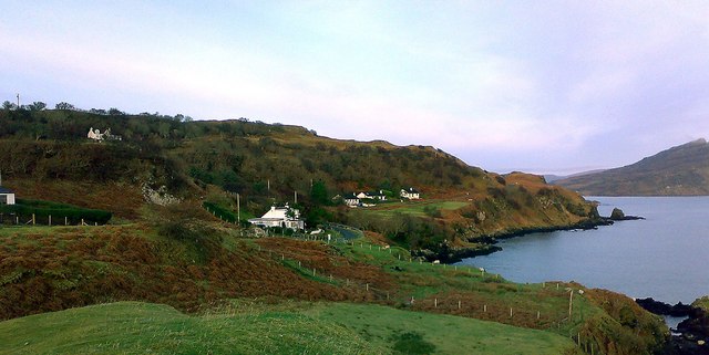
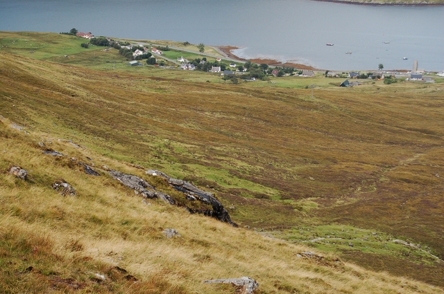
An t-Ollach is a small village located in the Inverness-shire region of Scotland. Situated on the west coast of the Scottish Highlands, it is nestled between the picturesque Loch Duich and the majestic Five Sisters of Kintail mountain range. The village is part of the Glen Shiel area, renowned for its stunning natural beauty and outdoor recreational opportunities.

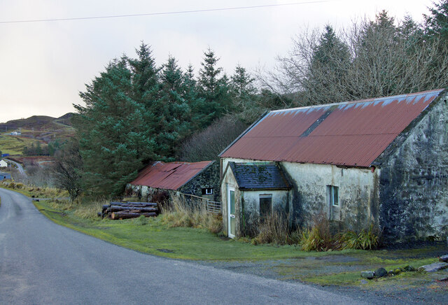
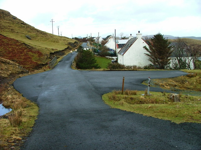
With a population of just over 100 residents, An t-Ollach offers a tranquil and peaceful setting for both locals and visitors alike. The village is primarily residential, with a scattering of traditional stone houses and cottages. Its remote location and unspoiled surroundings make it a popular destination for those seeking a getaway from the hustle and bustle of city life.

Nature enthusiasts will be delighted by the abundance of outdoor activities available in and around An t-Ollach. The nearby Glen Shiel offers numerous hiking trails, ranging from gentle strolls to challenging climbs, providing breathtaking views of the surrounding mountains and valleys. The village is also a popular base for fishing, with several nearby lochs and rivers teeming with salmon and trout.

While An t-Ollach does not boast a wide range of amenities, visitors can find a few local amenities, such as a small convenience store and a charming tea room. For a wider range of services, the town of Kyle of Lochalsh is just a short drive away.

In summary, An t-Ollach is a peaceful village nestled amidst the stunning Scottish Highlands, offering a tranquil escape and a wealth of outdoor activities for nature enthusiasts.

If you have any feedback on the listing, please let us know in the comments section below.

An t-Ollach Images

Images are sourced within 2km of 57.35128/-6.1313404 or Grid Reference NG5136. Thanks to Geograph Open Source API. All images are credited.

Rather featureless moorland Flattish and largely featureless moorland to the north of Beinn nan Capull.
Rather featureless moorland
Flattish and largely featureless moorland to the north of Beinn nan Capull.
Lumpy moorland  It doesn't matter much which way you face here - all you see in every direction is flattish moorland, which quickly becomes boggy in wet weather.
Lumpy moorland
It doesn't matter much which way you face here - all you see in every direction is flattish moorland, which quickly becomes boggy in wet weather.
Remarkable erratic This rather odd rock feature stands alone amid many acres of otherwise featureless and fairly flat moorland. It measures about four metres by three, and stands about two metres high. I think it is a glacial erratic, rather than exposed bedrock, as there is no such exposed bedrock for some distance around. Slightly closer view, from the other side: <a href="https://www.geograph.org.uk/photo/4089013">NG4935 : Odd rock</a>.
Remarkable erratic
This rather odd rock feature stands alone amid many acres of otherwise featureless and fairly flat moorland. It measures about four metres by three, and stands about two metres high. I think it is a glacial erratic, rather than exposed bedrock, as there is no such exposed bedrock for some distance around. Slightly closer view, from the other side: NG4935 : Odd rock.
Odd rock This unusual feature stands all alone amid acres of otherwise largely featureless moorland. 
Another view: <a href="https://www.geograph.org.uk/photo/4089009">NG4935 : Remarkable erratic</a>.
Odd rock
This unusual feature stands all alone amid acres of otherwise largely featureless moorland. Another view: NG4935 : Remarkable erratic.
Moorland north of Beinn nan Capull Looking down the east facing slope of the hill with the island of Raasay beyond.
Moorland north of Beinn nan Capull
Looking down the east facing slope of the hill with the island of Raasay beyond.
Trig point on Beinn nan Capull The trig is a few metres below the true summit. See <a href="https://www.geograph.org.uk/photo/4089026">NG4935 : Summit of Beinn nan Capull</a>.
Trig point on Beinn nan Capull
The trig is a few metres below the true summit. See NG4935 : Summit of Beinn nan Capull.
Beinn nan Capull trig point A little to the north of the true summit, but a great vantage point.
In the distance are the peaks of Pein a'Chleibh, Hartaval, the Storr, Bealach Cumhang and Ben Tianavaig.
Beinn nan Capull trig point
A little to the north of the true summit, but a great vantage point. In the distance are the peaks of Pein a'Chleibh, Hartaval, the Storr, Bealach Cumhang and Ben Tianavaig.
Shoreline rocks, An Aird
Shore at the Braes Looking north from above the beach towards Ben Tianavaig.
Camas a' Mhòr-bheòil extends to the right (east).
Sheep are grazing the steep slopes.
Shore at the Braes
Looking north from above the beach towards Ben Tianavaig. Camas a' Mhòr-bheòil extends to the right (east). Sheep are grazing the steep slopes.
Marker buoy on McMillan's Rock McMillan's Rock is a small low-water rock situate near the narrow channel between Raasay and An Aird on Skye. It can only be seen at extreme low tides, and is marked by this buoy.
Marker buoy on McMillan's Rock
McMillan's Rock is a small low-water rock situate near the narrow channel between Raasay and An Aird on Skye. It can only be seen at extreme low tides, and is marked by this buoy.
Old and new houses in Ollach The ruin of a Braes croft house in the foreground, and a modern red roofed house further back.
Old and new houses in Ollach
The ruin of a Braes croft house in the foreground, and a modern red roofed house further back.
Barn and house in Achnahanaid The modern large house operates as Bed and Breakfast accommodation.
Barn and house in Achnahanaid
The modern large house operates as Bed and Breakfast accommodation.
Old house and barn Standing at the roadside in Achnahanaid, the large building was almost certainly once a dwelling, though unusually, has no chimneys - which would normally be in the both gable ends.
Old house and barn
Standing at the roadside in Achnahanaid, the large building was almost certainly once a dwelling, though unusually, has no chimneys - which would normally be in the both gable ends.
Braes road in Achnahanaid Looking south east. 
Braes is a district made up of a number of small townships. Ahead are Lower and Upper Ollach.
Braes road in Achnahanaid
Looking south east. Braes is a district made up of a number of small townships. Ahead are Lower and Upper Ollach.
Braesburn Hall, revised Building work is currently underway which will convert the original Braesburn Hall into a domestic dwelling. The new-build will have two en-suite bedrooms, one on the ground floor and one in the roof. The original doorway is to be filled-in, and one arched window becomes rectangular. A new extension on the southern side of the building will provide a sun-lounge. 
Former images of the hall: 
<a href="https://www.geograph.org.uk/photo/677700">NG5136 : Braesburn Hall</a>
<a href="https://www.geograph.org.uk/photo/1454752">NG5136 : Building work at the church hall</a>
Braesburn Hall, revised
Building work is currently underway which will convert the original Braesburn Hall into a domestic dwelling. The new-build will have two en-suite bedrooms, one on the ground floor and one in the roof. The original doorway is to be filled-in, and one arched window becomes rectangular. A new extension on the southern side of the building will provide a sun-lounge. Former images of the hall: NG5136 : Braesburn Hall NG5136 : Building work at the church hall
Braesburn Hall, revised Building work is currently underway which will convert the original Braesburn Hall into a domestic dwelling. The new-build will have two en-suite bedrooms, one on the ground floor and one in the roof, with roof-lights. The original doorway is to be filled-in, and one arched window becomes rectangular. A new extension on the southern side of the building will provide a sun-lounge.
Former images of the hall:
<a href="https://www.geograph.org.uk/photo/677700">NG5136 : Braesburn Hall</a>
<a href="https://www.geograph.org.uk/photo/1454752">NG5136 : Building work at the church hall</a>
Braesburn Hall, revised
Building work is currently underway which will convert the original Braesburn Hall into a domestic dwelling. The new-build will have two en-suite bedrooms, one on the ground floor and one in the roof, with roof-lights. The original doorway is to be filled-in, and one arched window becomes rectangular. A new extension on the southern side of the building will provide a sun-lounge. Former images of the hall: NG5136 : Braesburn Hall NG5136 : Building work at the church hall
Path to the beach This little un-signposted path leads to one of Skye's most attractive beaches.
Don't tell everyone!
Path to the beach
This little un-signposted path leads to one of Skye's most attractive beaches. Don't tell everyone!
The Braes road, and Balmeanach Bay Looking south-east from Gedintailor. 
The Braes is a district, made up of a number of small townships.
The narrow, single-track road is the only road access, and eventually comes to a dead-end.
The Braes road, and Balmeanach Bay
Looking south-east from Gedintailor. The Braes is a district, made up of a number of small townships. The narrow, single-track road is the only road access, and eventually comes to a dead-end.
Show me another place!

An t-Ollach is located at Grid Ref: NG5136 (Lat: 57.35128, Lng: -6.1313404)

Unitary Authority: Highland

Police Authority: Highlands and Islands

Also known as: Ollach

What 3 Words

///sped.trunk.confident. Near Portree, Highland

Related Wikis

Ollach

Ollach (in Scottish Gaelic, An t-Olach) is a remote settlement, made up of Lower Ollach and Upper Ollach, lying on B883 road, south of Portree, Isle of...

Gedintailor

Gedintailor (Scottish Gaelic: Gead an t-Sailleir) is a crofting village, lying on the shores of the Narrows of Raasay on the east coast of the island of...

Camastianavaig

Camustianavaig (also English spelling: Camustinivaig) is a crofting township on the island of Skye in Scotland. It is located on the shores of the Sound...

Peinachorran

Peinchorran (Scottish Gaelic: Peighinn a' Chorrain; Peinachorrain on Ordnance Survey maps) is a remote settlement, lying at the end of the B883 road, on...

Isle of Raasay distillery

Isle of Raasay distillery is a Scotch whisky distillery on the Inner Hebridean Isle of Raasay in Northwest Scotland. The distillery is owned by R&B Distillers...

Inverarish

Inverarish (Scottish Gaelic: Inbhir Àrais) is a village that is the main settlement of the Isle of Raasay, in the civil parish of Portree, in the council...

Ben Tianavaig

Ben Tianavaig is a hill located on the Isle of Skye, near Portree . It is very prominent from Portree dominating the view from the harbour. It is a Marilyn...

Sconser

Sconser (Scottish Gaelic: Sgonnsair) is a small crofting township on the island of Skye, in Scotland, situated on the south shore of Loch Sligachan. The...

Nearby Amenities

Located within 500m of 57.35128,-6.1313404
Natural: arch
Source: PGS
Lat/Long: 57.3548348/-6.1274573
Passing Place
Lat/Long: 57.3502542/-6.1293882
Passing Place
Lat/Long: 57.3488749/-6.1275182
Passing Place
Lat/Long: 57.3485299/-6.1261384
Telephone
Booth: KX100
Covered: booth
Source: survey
Lat/Long: 57.3523019/-6.132812
Power: pole
Lat/Long: 57.3475936/-6.1275816
Power: pole
Lat/Long: 57.349307/-6.1304355
Power: pole
Lat/Long: 57.3503677/-6.1321843
Power: pole
Lat/Long: 57.3513083/-6.1328602
Power: pole
Lat/Long: 57.3524094/-6.1336756
Power: pole
Lat/Long: 57.3542167/-6.1349523
Power: pole
Lat/Long: 57.3545379/-6.135757
Power: pole
Lat/Long: 57.3547484/-6.1356457
Rubha Buidhe
Natural: cape
Lat/Long: 57.3546532/-6.126737
Power: pole
Lat/Long: 57.3543074/-6.1348592
Power: pole
Lat/Long: 57.3535818/-6.1343206
Power: pole
Lat/Long: 57.3529136/-6.1338504
Power: pole
Lat/Long: 57.3513918/-6.1327296
Power: pole
Lat/Long: 57.3504565/-6.1320571
Power: pole
Lat/Long: 57.348867/-6.1294384
Power: pole
Lat/Long: 57.3483738/-6.1286029
Power: pole
Lat/Long: 57.3477117/-6.1275228
Ollach
Name Gd: An t-Òlach
Place: hamlet
Lat/Long: 57.3518757/-6.1319056
Dùn ?V
Castle Type: dun
Historic: castle
Ruins: yes
Lat/Long: 57.3548441/-6.1281677
Eilean Tioram
Natural: rock
Lat/Long: 57.3517121/-6.1238418
Waterway: waterfall
Lat/Long: 57.3486939/-6.1355974
Waterway: waterfall
Lat/Long: 57.3485022/-6.1370393
Cnoc Donn
Natural: peak
Peak: hill
Lat/Long: 57.3476583/-6.1350911
Man Made: mast
Tower Type: communication
Lat/Long: 57.3524037/-6.1328491
Man Made: mast
Tower Type: communication
Lat/Long: 57.3524221/-6.1328882
Community Centre
Braes Community Hall
Addr City: Braes
Addr Country: GB
Addr Postcode: IV51 9LJ
Addr Street: B883
Community Centre: village_hall
Nohousenumber: yes
Lat/Long: 57.3523067/-6.132423
Recycling
Recycling Glass: yes
Recycling Type: container
Lat/Long: 57.3521063/-6.1322983
Barrier: cattle_grid
Lat/Long: 57.3516838/-6.1320917
Barrier: cattle_grid
Lat/Long: 57.3488461/-6.1265878
The data included in this document is from www.openstreetmap.org. The data is made available under ODbL.

Have you been to An t-Ollach?

Leave your review of An t-Ollach below (or comments, questions and feedback).