Bower Ashton

Settlement in Somerset

England

Bower Ashton

South Bristol Crematorium
South Bristol Crematorium Credit: Adrian and Janet Quantock

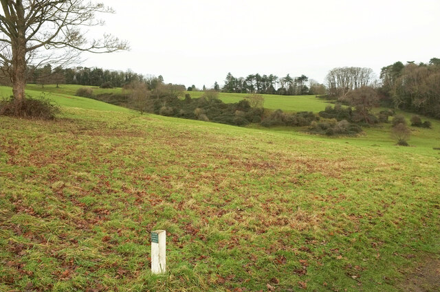
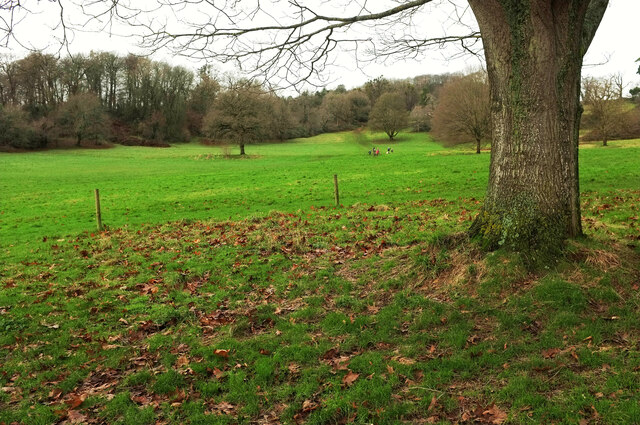
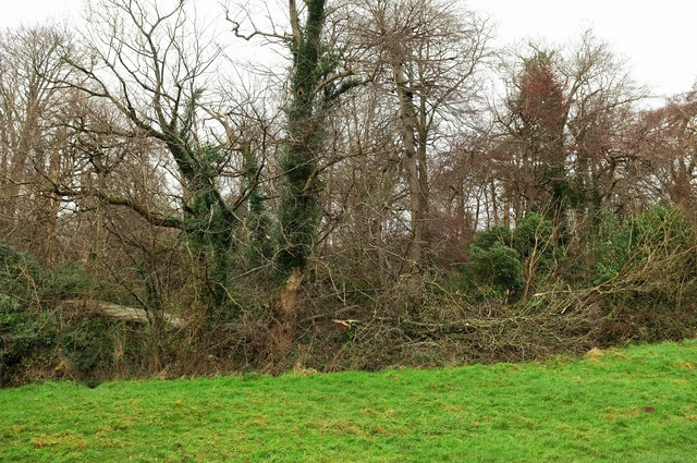
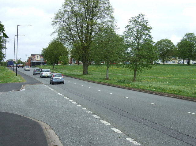
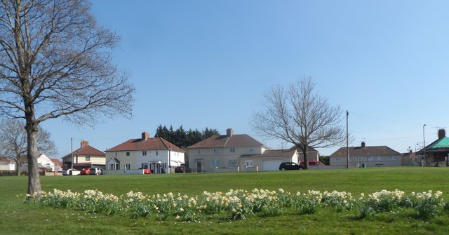
Bower Ashton is a small village located in the county of Somerset, England. It is situated on the western outskirts of the city of Bristol and is part of the civil parish of Long Ashton. Bower Ashton is nestled within a picturesque rural landscape, surrounded by rolling hills and lush green fields.

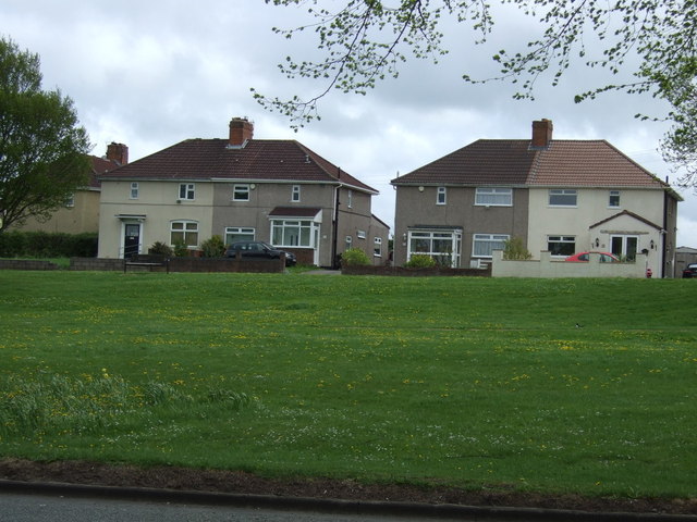
The village is known for its tranquil and idyllic setting, making it a popular destination for those seeking a peaceful retreat from the bustling city life. Bower Ashton boasts a close-knit community, with a small population of residents who enjoy the quiet and friendly atmosphere.

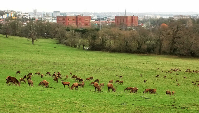
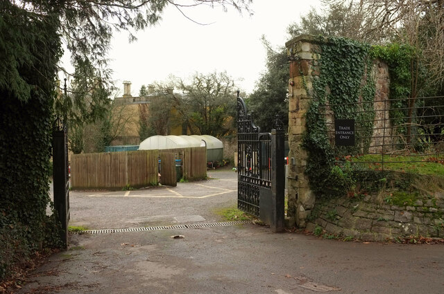
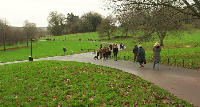
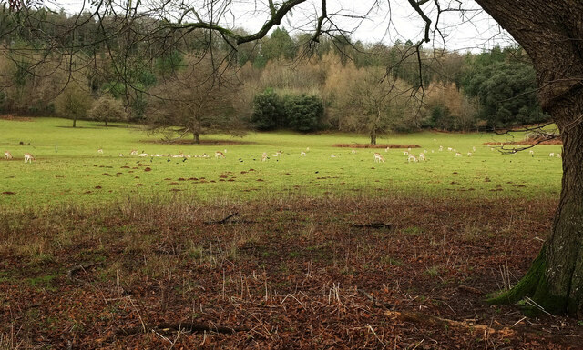
One of the notable landmarks in Bower Ashton is Ashton Court Estate, a large country estate that spans over 850 acres of land. The estate features a historic mansion house, beautiful gardens, and a deer park, providing ample opportunities for outdoor activities such as walking, cycling, and picnicking.

Bower Ashton is also home to the renowned University of the West of England (UWE), which has a campus located within the village. The university's School of Art and Design is based here, attracting aspiring artists and designers from around the world.

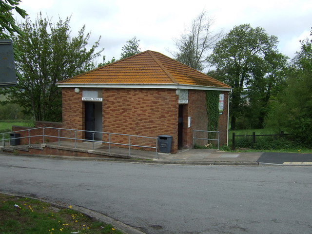
In terms of amenities, Bower Ashton offers limited facilities within the village itself. However, neighboring areas provide a wider range of services, including shops, supermarkets, and recreational facilities. The village is well-connected to Bristol and other surrounding towns via road and public transport, making it easily accessible for residents and visitors alike.

Overall, Bower Ashton offers a peaceful and scenic environment, along with its close proximity to Bristol, making it a desirable place to live or visit.

If you have any feedback on the listing, please let us know in the comments section below.
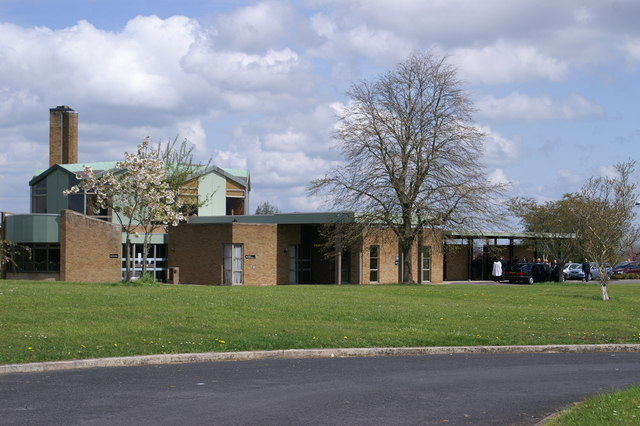
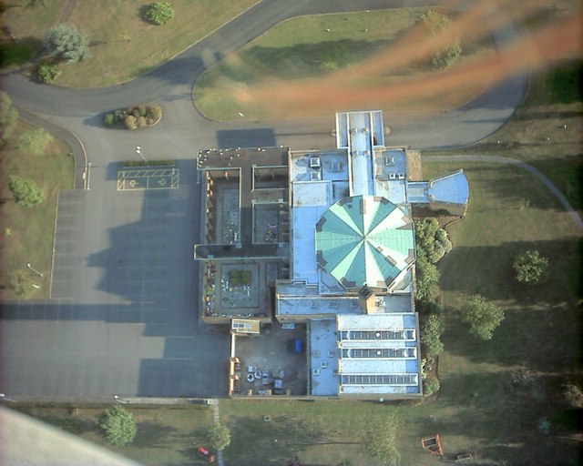
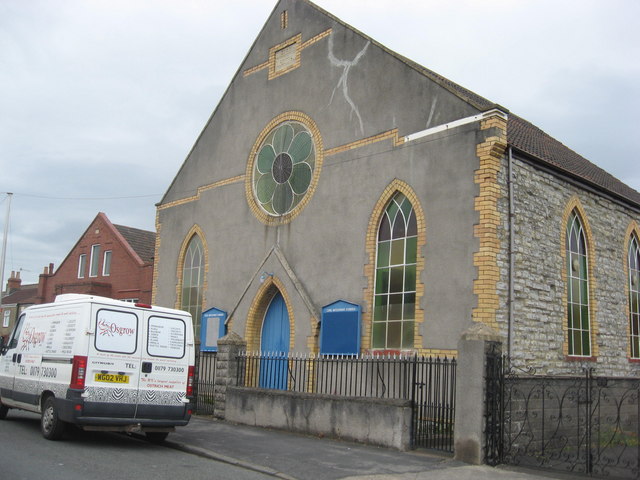
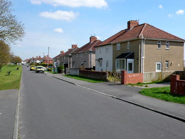
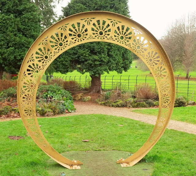
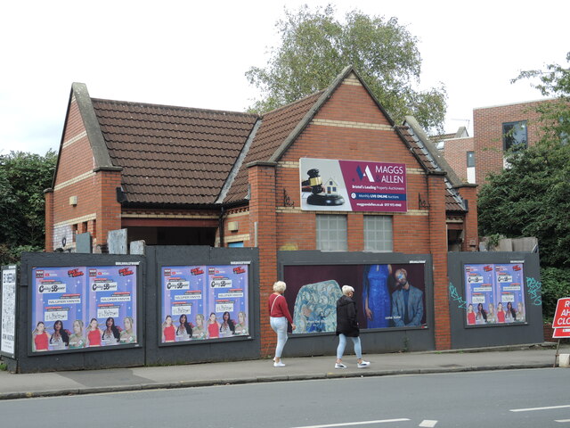
Bower Ashton Images

Images are sourced within 2km of 51.441393/-2.6297328 or Grid Reference ST5671. Thanks to Geograph Open Source API. All images are credited.

South Bristol Crematorium
South Bristol Crematorium A view from above.
South Bristol Crematorium
A view from above.
Zion Methodist Church, Bishopsworth Road
Brunel Rd Bedminster Down Brunel Rd runs parallel to the A38 as it runs south west out of Bristol. This is the view north east close to the junction with Winford Grove.
Brunel Rd Bedminster Down
Brunel Rd runs parallel to the A38 as it runs south west out of Bristol. This is the view north east close to the junction with Winford Grove.
Zlatíčko, Ashton Court Zlatíčko (Slovak for "sweetheart" and Czech for "honey", which are more or less the same thing) is a sculpture by Cjay Roughgarden, to be found southwest of the building. It is made of powder-coated laser cut steel. Something of a family photo - my niece can be seen in the distance wearing a white jumper.
Zlatíčko, Ashton Court
Zlatíčko (Slovak for "sweetheart" and Czech for "honey", which are more or less the same thing) is a sculpture by Cjay Roughgarden, to be found southwest of the building. It is made of powder-coated laser cut steel. Something of a family photo - my niece can be seen in the distance wearing a white jumper.
Toilet under the hammer? The disused public conveniences on Cannon Street have been closed for a good few years but recent activity has brought hoardings. The big advert on the block appears to infer the site is up for auction. Who would buy it - and then demolish it for new housing?
Toilet under the hammer?
The disused public conveniences on Cannon Street have been closed for a good few years but recent activity has brought hoardings. The big advert on the block appears to infer the site is up for auction. Who would buy it - and then demolish it for new housing?
Red deer, Ashton Court An identical view to taken over 14 years ago, but on a gloomy Boxing Day instead of a sunny day in late spring - when I wasn't that far away, staying in Lacock and getting attacked by a ram. Still, at least it wasn't a red deer.  The park is Grade II* listed <span class="nowrap"><a title="https://historicengland.org.uk/listing/the-list/list-entry/1000560?section=official-list-entry" rel="nofollow ugc noopener" href="https://historicengland.org.uk/listing/the-list/list-entry/1000560?section=official-list-entry">Link</a><img style="margin-left:2px;" alt="External link" title="External link - shift click to open in new window" src="https://s1.geograph.org.uk/img/external.png" width="10" height="10"/></span> . The Community Forest Path passes by.
Red deer, Ashton Court
An identical view to taken over 14 years ago, but on a gloomy Boxing Day instead of a sunny day in late spring - when I wasn't that far away, staying in Lacock and getting attacked by a ram. Still, at least it wasn't a red deer. The park is Grade II* listed LinkExternal link . The Community Forest Path passes by.
Hillside, Ashton Court Estate Looking left from <a href="https://www.geograph.org.uk/photo/7680861">ST5672 : Red deer, Ashton Court</a>, with strategically placed trees and woods; that on the right is Rownham Plantation. The Community Forest Path passes by.  The park is Grade II* listed <span class="nowrap"><a title="https://historicengland.org.uk/listing/the-list/list-entry/1000560?section=official-list-entry" rel="nofollow ugc noopener" href="https://historicengland.org.uk/listing/the-list/list-entry/1000560?section=official-list-entry">Link</a><img style="margin-left:2px;" alt="External link" title="External link - shift click to open in new window" src="https://s1.geograph.org.uk/img/external.png" width="10" height="10"/></span> .
Hillside, Ashton Court Estate
Looking left from ST5672 : Red deer, Ashton Court, with strategically placed trees and woods; that on the right is Rownham Plantation. The Community Forest Path passes by. The park is Grade II* listed LinkExternal link .
Trade entrance, Ashton Court With bin store and polytunnel.
Trade entrance, Ashton Court
With bin store and polytunnel.
Boxing Day at Ashton Court Plenty of visitors out for a post-feast walk.  The park is Grade II* listed <span class="nowrap"><a title="https://historicengland.org.uk/listing/the-list/list-entry/1000560?section=official-list-entry" rel="nofollow ugc noopener" href="https://historicengland.org.uk/listing/the-list/list-entry/1000560?section=official-list-entry">Link</a><img style="margin-left:2px;" alt="External link" title="External link - shift click to open in new window" src="https://s1.geograph.org.uk/img/external.png" width="10" height="10"/></span> .
Boxing Day at Ashton Court
Plenty of visitors out for a post-feast walk. The park is Grade II* listed LinkExternal link .
The Goram, Ashton Court Estate "The Goram is the name of this lawn which is marked out by a three‑sided square of chestnut trees and pre‑dates the carefully designed 18th century landscape" <span class="nowrap"><a title="https://www.bristol.gov.uk/files/documents/4811-ashton-court-woodland-walks" rel="nofollow ugc noopener" href="https://www.bristol.gov.uk/files/documents/4811-ashton-court-woodland-walks">Link</a><img style="margin-left:2px;" alt="External link" title="External link - shift click to open in new window" src="https://s1.geograph.org.uk/img/external.png" width="10" height="10"/></span> . On the left is Ashton Court Plantation. The park is Grade II* listed <span class="nowrap"><a title="https://historicengland.org.uk/listing/the-list/list-entry/1000560?section=official-list-entry" rel="nofollow ugc noopener" href="https://historicengland.org.uk/listing/the-list/list-entry/1000560?section=official-list-entry">Link</a><img style="margin-left:2px;" alt="External link" title="External link - shift click to open in new window" src="https://s1.geograph.org.uk/img/external.png" width="10" height="10"/></span> .
The Goram, Ashton Court Estate
"The Goram is the name of this lawn which is marked out by a three‑sided square of chestnut trees and pre‑dates the carefully designed 18th century landscape" LinkExternal link . On the left is Ashton Court Plantation. The park is Grade II* listed LinkExternal link .
Fallen tree, Ashton Court Plantation Seen from the Deer Trail.
Fallen tree, Ashton Court Plantation
Seen from the Deer Trail.
Fallow deer, Ashton Court Estate I think that's Keepers Wood in the background. The park is Grade II* listed <span class="nowrap"><a title="https://historicengland.org.uk/listing/the-list/list-entry/1000560?section=official-list-entry" rel="nofollow ugc noopener" href="https://historicengland.org.uk/listing/the-list/list-entry/1000560?section=official-list-entry">Link</a><img style="margin-left:2px;" alt="External link" title="External link - shift click to open in new window" src="https://s1.geograph.org.uk/img/external.png" width="10" height="10"/></span> .
Fallow deer, Ashton Court Estate
I think that's Keepers Wood in the background. The park is Grade II* listed LinkExternal link .
Ordnance Survey Cut Mark This OS cut mark can be found on north angle of the Zion Methodist Chapel. It marks a point 68.184m above mean sea level.
Ordnance Survey Cut Mark
This OS cut mark can be found on north angle of the Zion Methodist Chapel. It marks a point 68.184m above mean sea level.
Houses on Brunel Road
Public toilets, Bedminster Down
Bridgwater Road (A38), Bedminster Down Heading north east towards Bristol.
Bridgwater Road (A38), Bedminster Down
Heading north east towards Bristol.
Housing - Bedminster Down
Show me another place!

Bower Ashton is located at Grid Ref: ST5671 (Lat: 51.441393, Lng: -2.6297328)

Unitary Authority: Bristol

Police Authority: Avon and Somerset

What 3 Words

///hope.copy.regard. Near Long Ashton, Somerset

Nearby Locations

Ashton Park Bower Ashton

Related Wikis

Bower Ashton

Bower Ashton is a village in south west Bristol on the western boundary with North Somerset, lying within the Southville ward, approximately two miles...
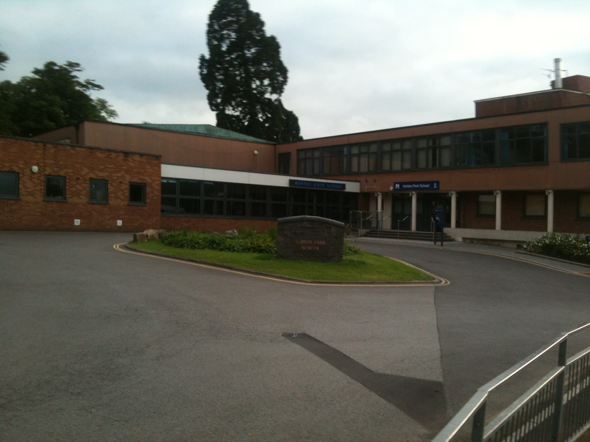
Ashton Park School

Ashton Park School is a coeducational secondary school and sixth form located in the Bower Ashton area of Bristol, England. == History == The school opened...

The Breeze (Frome & West Wiltshire)

Greatest Hits Radio Somerset (West Somerset) is an Independent Local Radio station serving Warminster, Westbury / Trowbridge in West Wiltshire / Frome...

Ashton Gate railway station

Ashton Gate railway station was a railway station serving the Ashton Gate area of Bristol, England, which included Ashton Gate football ground, the home...

Bristol International Exhibition

The Bristol International Exhibition was held on Ashton Meadows in the Bower Ashton area of Bristol, England in 1914. The exhibition which had been planned...

Bristol City Stadium

The Bristol City Stadium (tentative name) was a proposed football stadium, announced in November 2007, which would be built on land at Ashton Vale, Bristol...

Clifton Bridge railway station

Clifton Bridge railway station is a former railway station in the Bower Ashton district of Bristol, England, near the River Avon. It was opened in 1867...

Ashton Gate (stadium)

Ashton Gate is a multi-use stadium in Ashton Gate, Bristol, England, and is the home of Bristol City football club and the Bristol Bears rugby union team...

Nearby Amenities

Located within 500m of 51.441393,-2.6297328
Motorway Junction
Lat/Long: 51.4420023/-2.6236144
Motorway Junction
Lat/Long: 51.4391905/-2.6310591
Give Way
Direction: forward
Lat/Long: 51.4410988/-2.6243841
Motorway Junction
Lat/Long: 51.4400014/-2.6291499
Ashton Junction
Historic Railway: junction
Railway: site
Lat/Long: 51.4407832/-2.625147
Barrier: lift_gate
Lat/Long: 51.4404585/-2.6262977
Bus Stop
Winterstoke Road
Bench: yes
Bin: yes
Bus: yes
Mapillary: 521047182261949
Naptan AtcoCode: 0100053343
Naptan Bearing: W
Naptan CommonName: Winterstoke Road
Naptan Crossing: Ashton Gate Underpass
Naptan NaptanCode: bstatat
Naptan PlusbusZoneRef: BRSTLTM
Naptan Street: Ashton Road
Naptan Verified: no
Public Transport: platform
Shelter: yes
Source: naptan_import
Survey Date: 2021-03-27
Lat/Long: 51.440612/-2.6254079
Bus Stop
Ashton Park School
Bus: school
Naptan AtcoCode: 0100053344
Naptan Bearing: NW
Naptan CommonName: Ashton Park School
Naptan Landmark: Ashton Park School
Naptan NaptanCode: bstamwp
Naptan Street: Blackmoors Lane
Public Transport: platform
Source: naptan_import
Lat/Long: 51.4402495/-2.6301576
Bus Stop
Clanage Road
Bench: yes
Bin: yes
Lit: yes
Mapillary: 1005112880025928
Naptan AtcoCode: 0100053345
Naptan Bearing: N
Naptan CommonName: Clanage Road
Naptan Crossing: Kennel Lodge Road
Naptan NaptanCode: bstapdm
Naptan PlusbusZoneRef: BRSTLTM
Naptan Street: Clanage Road
Naptan Verified: no
Passenger Information Display: yes
Public Transport: platform
Shelter: yes
Source: naptan_import
Survey Date: 2021-03-27
Tactile Paving: yes
Lat/Long: 51.4436145/-2.6284054
Bus Stop
Clanage Road
Bench: yes
Bin: no
Lit: yes
Mapillary: 495224148343769
Naptan AtcoCode: 0100053346
Naptan Bearing: S
Naptan CommonName: Clanage Road
Naptan Crossing: Kennel Lodge Road
Naptan NaptanCode: bstapgd
Naptan PlusbusZoneRef: BRSTLTM
Naptan Street: Clanage Road
Naptan Verified: no
Passenger Information Display: yes
Public Transport: platform
Shelter: yes
Source: naptan_import
Survey Date: 2021-03-27
Tactile Paving: yes
Lat/Long: 51.44379/-2.6281717
Bus Stop
Blackmoors Lane
Bench: yes
Bin: yes
Lit: yes
Naptan AtcoCode: 0100BRA16947
Naptan Bearing: NW
Naptan CommonName: Blackmoors Lane
Naptan Crossing: Blackmore Lane
Naptan NaptanCode: bstpapt
Naptan PlusbusZoneRef: BRSTLTM
Naptan Street: Clanage Road
Shelter: yes
Source: naptan_import
Tactile Paving: yes
Lat/Long: 51.4413235/-2.6265731
Bus Stop
Bower Ashton Campus
Naptan AtcoCode: 0100BRA46654
Naptan Bearing: E
Naptan CommonName: Bower Ashton Campus
Naptan Landmark: Uwe Bower Ashton Campus
Naptan NaptanCode: bstpdwd
Naptan Street: Kennel Lodge Road
Naptan Verified: no
Source: naptan_import
Lat/Long: 51.4432396/-2.6317462
Crossing
Crossing: traffic_signals
Crossing Ref: toucan
Lat/Long: 51.4396874/-2.6239612
Traffic Signals
Lat/Long: 51.4393988/-2.623688
Crossing
Crossing: traffic_signals
Crossing Markings: dots
Crossing Ref: toucan
Tactile Paving: yes
Traffic Signals Sound: no
Lat/Long: 51.4398649/-2.6237879
Traffic Signals
Traffic Signals: level_crossing
Traffic Signals Direction: backward
Lat/Long: 51.4394202/-2.624235
Traffic Signals
Lat/Long: 51.4394494/-2.6235518
Railway: level_crossing
Lat/Long: 51.4394657/-2.624097
Crossing
Button Operated: yes
Crossing: traffic_signals
Crossing Markings: dots
Crossing Ref: toucan
Tactile Paving: yes
Traffic Signals Sound: no
Lat/Long: 51.4398726/-2.6236057
Crossing
Crossing: unmarked
Crossing Island: yes
Tactile Paving: yes
Lat/Long: 51.4415972/-2.6273785
Give Way
Direction: forward
Lat/Long: 51.4412653/-2.6273238
Crossing
Crossing: traffic_signals
Lat/Long: 51.4394911/-2.6239413
Crossing
Button Operated: yes
Crossing: traffic_signals
Crossing Ref: pelican
Tactile Paving: yes
Traffic Signals Sound: yes
Lat/Long: 51.4406948/-2.6252229
Motorway Junction
Lat/Long: 51.4430321/-2.6230348
Barrier: cycle_barrier
Lat/Long: 51.4412462/-2.6256079
Give Way
Lat/Long: 51.4391881/-2.6312627
Barrier: bollard
Lat/Long: 51.4425897/-2.6255074
Traffic Signals
Crossing: traffic_signals
Crossing Ref: toucan
Lat/Long: 51.4431986/-2.6285507
Barrier: bollard
Lat/Long: 51.4432859/-2.628411
Crossing
Crossing: unmarked
Crossing Island: no
Tactile Paving: yes
Lat/Long: 51.4430999/-2.6288852
Barrier: kissing_gate
Lat/Long: 51.4443434/-2.6334592
Barrier: block
Bicycle: yes
Foot: yes
Lat/Long: 51.4408706/-2.6227525
Barrier: block
Bicycle: yes
Foot: yes
Lat/Long: 51.4408988/-2.6228182
Barrier: block
Bicycle: yes
Foot: yes
Lat/Long: 51.440908/-2.6227228
Barrier: block
Bicycle: yes
Foot: yes
Lat/Long: 51.440914/-2.6226713
Barrier: archway
Lat/Long: 51.4391692/-2.6347366
All Star Action Days
Leisure: sports_centre
Lat/Long: 51.4453725/-2.6265918
Entrance: main
Lat/Long: 51.4432968/-2.6314932
Barrier: bollard
Bollard: fixed
Lat/Long: 51.4423811/-2.627128
Post Box
Operator: Royal Mail
Operator Wikidata: Q638098
Post Box Type: pillar
Ref: BS3 59D
Royal Cypher: EIIR
Royal Cypher Wikidata: Q33102113
Lat/Long: 51.4396271/-2.6234768
Crossing
Crossing: traffic_signals
Crossing Ref: toucan
Mapillary: 544670776520532
Survey Date: 2021-03-20
Tactile Paving: yes
Traffic Signals Sound: no
Lat/Long: 51.4397942/-2.6238602
Post Box
Collection Times: Mo-Fr 17:15, Sa 10:30
Post Box Type: wall
Ref: BS3 67
Royal Cypher: GR
Royal Cypher Wikidata: Q33102273
Lat/Long: 51.442368/-2.6295572
Crossing
Lat/Long: 51.4390612/-2.635346
Crossing
Button Operated: yes
Crossing: traffic_signals
Crossing Markings: dots
Crossing Ref: toucan
Tactile Paving: yes
Traffic Signals Sound: no
Lat/Long: 51.4399534/-2.6236746
Motorway Junction
Lat/Long: 51.4406851/-2.6254067
Grit Bin
Lat/Long: 51.4426521/-2.6243762
Bus Stop
Ashton Gate
Bench: yes
Bin: yes
Bus: yes
Departures Board: realtime
Lit: yes
Mapillary: 456289529006789
Naptan AtcoCode: 010000050
Naptan NaptanCode: bstpjgp
Network: Bristol
Operator: metrobus/ First Bus Bristol
Passenger Information Display: yes
Public Transport: platform
Shelter: yes
Survey Date: 2018-09-15
Wheelchair: yes
Lat/Long: 51.4432987/-2.6243591
Grit Bin
Lat/Long: 51.4433141/-2.6238735
Crossing
Crossing: unmarked
Crossing Island: yes
Tactile Paving: yes
Lat/Long: 51.442925/-2.6284834
Crossing
Crossing: unmarked
Crossing Island: yes
Tactile Paving: yes
Lat/Long: 51.4429089/-2.628561
Grit Bin
Lat/Long: 51.443669/-2.6305631
Man Made: surveillance
Surveillance Type: camera
Lat/Long: 51.4440744/-2.6312806
Grit Bin
Lat/Long: 51.4440593/-2.6327772
Information: guidepost
Tourism: information
Lat/Long: 51.4443276/-2.6335323
Barrier: lift_gate
Lat/Long: 51.4394774/-2.624064
Barrier: lift_gate
Lat/Long: 51.4394463/-2.6241534
Crossing
Crossing: traffic_signals
Crossing Ref: toucan
Lat/Long: 51.4395135/-2.6239513
Traffic Signals
Traffic Signals: crossing
Lat/Long: 51.4399562/-2.6237516
Power: substation
Lat/Long: 51.4421644/-2.6243712
Grit Bin
Lat/Long: 51.4422527/-2.6246475
Barrier: cycle_barrier
Lat/Long: 51.4393504/-2.6241558
Bicycle Parking
Bicycle Parking: stands
Capacity: 6
Covered: no
Lat/Long: 51.4430345/-2.6247092
Waste Basket
Lat/Long: 51.4430563/-2.6246971
Bicycle Parking
Bicycle Parking: stands
Capacity: 6
Mapillary: 456289529006789
Survey Date: 2018-09-15
Lat/Long: 51.4433505/-2.6243229
Waste Basket
Lat/Long: 51.4433221/-2.6243444
Barrier: cycle_barrier
Lat/Long: 51.4414371/-2.6251651
Bus Stop
Ashton Gate
Bench: yes
Bin: yes
Bus: yes
Departures Board: realtime
Lit: yes
Naptan AtcoCode: 010000049
Naptan NaptanCode: bstpjgt
Network: Bristol
Note: Please note the Airport Flyer (A1) only drops off at this stop and does NOT collect passengers.
Operator: metrobus/ First Bus Bristol
Public Transport: platform
Shelter: yes
Wheelchair: yes
Lat/Long: 51.4430772/-2.6246823
Bristol City & County
Traffic Sign: city_limit
Lat/Long: 51.4396821/-2.630127
Crossing
Crossing: uncontrolled
Crossing Ref: zebra
Lat/Long: 51.4396807/-2.6254795
Crossing
Crossing: uncontrolled
Crossing Ref: zebra
Lat/Long: 51.4396043/-2.6250366
Crossing
Crossing: uncontrolled
Crossing Ref: zebra
Lat/Long: 51.4395605/-2.6248176
Waste Basket
Lat/Long: 51.441369/-2.6266031
Waste Basket
Lat/Long: 51.4404697/-2.6291187
Man Made: street_cabinet
Street Cabinet: cable_tv
Lat/Long: 51.4408822/-2.6283439
Waste Basket
Lat/Long: 51.4404481/-2.6289514
Noexit: yes
Lat/Long: 51.439033/-2.6356418
Crossing
Crossing: unmarked
Crossing Island: yes
Tactile Paving: yes
Lat/Long: 51.4416277/-2.6271478
Barrier: kerb
Kerb: lowered
Tactile Paving: yes
Lat/Long: 51.4429295/-2.6284619
Barrier: kerb
Kerb: lowered
Tactile Paving: yes
Lat/Long: 51.4429031/-2.6285887
Barrier: kerb
Kerb: lowered
Tactile Paving: yes
Lat/Long: 51.4415985/-2.6274135
Barrier: kerb
Kerb: lowered
Tactile Paving: yes
Lat/Long: 51.4416458/-2.627111
Barrier: kerb
Kerb: lowered
Tactile Paving: yes
Lat/Long: 51.4415959/-2.6273427
Barrier: kerb
Kerb: lowered
Tactile Paving: yes
Lat/Long: 51.4416103/-2.6271832
Crossing
Crossing: unmarked
Crossing Island: no
Tactile Paving: no
Lat/Long: 51.440882/-2.6285993
Barrier: kerb
Kerb: raised
Tactile Paving: no
Lat/Long: 51.4409257/-2.6284784
Barrier: kerb
Kerb: raised
Tactile Paving: no
Lat/Long: 51.4408341/-2.628732
Barrier: kerb
Kerb: lowered
Tactile Paving: no
Lat/Long: 51.4409166/-2.6282886
Entrance: main
Lat/Long: 51.4402279/-2.6235778
Entrance: service
Lat/Long: 51.440583/-2.6231298
Crossing
Crossing: unmarked
Crossing Island: no
Crossing Markings: no
Tactile Paving: yes
Lat/Long: 51.440781/-2.6228039
Crossing
Crossing: unmarked
Crossing Island: no
Crossing Markings: no
Tactile Paving: yes
Lat/Long: 51.4408439/-2.6229612
Bower Ashton
Place: neighbourhood
Wikidata: Q15204021
Lat/Long: 51.4415821/-2.6288378
Barrier: kerb
Kerb: lowered
Tactile Paving: yes
Lat/Long: 51.4404023/-2.6298669
Entrance: yes
Lat/Long: 51.4414742/-2.6313851
Entrance: yes
Lat/Long: 51.4405063/-2.6304002
Entrance: yes
Lat/Long: 51.4415555/-2.6314682
Entrance: yes
Lat/Long: 51.4411015/-2.6315168
Entrance: yes
Lat/Long: 51.4413399/-2.6309298
Entrance: yes
Lat/Long: 51.4412571/-2.6315029
Barrier: kerb
Kerb: lowered
Tactile Paving: yes
Lat/Long: 51.4404286/-2.629965
Entrance: yes
Lat/Long: 51.440807/-2.6307514
Crossing
Crossing: unmarked
Crossing Island: no
Tactile Paving: yes
Lat/Long: 51.4404153/-2.6299156
Entrance: yes
Lat/Long: 51.4417149/-2.6308572
Barrier: kerb
Kerb: raised
Tactile Paving: no
Lat/Long: 51.4421825/-2.6290637
Entrance: yes
Lat/Long: 51.4413319/-2.6309914
Entrance: yes
Lat/Long: 51.4403197/-2.6302379
Entrance: yes
Lat/Long: 51.4415169/-2.6310086
Entrance: yes
Lat/Long: 51.4416347/-2.6309918
Entrance: yes
Lat/Long: 51.4404297/-2.6305169
Entrance: yes
Lat/Long: 51.440812/-2.6311423
Barrier: kerb
Kerb: lowered
Tactile Paving: yes
Lat/Long: 51.4408699/-2.6229442
Barrier: kerb
Kerb: lowered
Tactile Paving: yes
Lat/Long: 51.4408164/-2.6229792
Barrier: kerb
Kerb: lowered
Tactile Paving: yes
Lat/Long: 51.4408007/-2.6227799
Barrier: kerb
Kerb: lowered
Tactile Paving: yes
Lat/Long: 51.4407618/-2.6228273
Fire Hydrant
Emergency: fire_hydrant
Fire Hydrant Diameter: 75
Fire Hydrant Position: lane
Fire Hydrant Type: underground
Water Source: main
Lat/Long: 51.4422768/-2.63038
B.A.R.A. Noticeboard
Board Type: notice
Information: board
Operator: Bower Ashton Residents Association
Tourism: information
Lat/Long: 51.4423637/-2.6294701
Fire Hydrant
Emergency: fire_hydrant
Fire Hydrant Diameter: 75
Fire Hydrant Position: lane
Fire Hydrant Type: underground
Water Source: main
Lat/Long: 51.4429571/-2.6287591
Barrier: bollard
Lat/Long: 51.4436292/-2.6305841
Crossing
Crossing: marked
Crossing Island: no
Tactile Paving: no
Lat/Long: 51.4430701/-2.6325016
Crossing
Crossing: marked
Crossing Island: no
Tactile Paving: no
Lat/Long: 51.4431371/-2.6328448
Crossing
Crossing: unmarked
Crossing Island: no
Tactile Paving: yes
Lat/Long: 51.4443395/-2.6325753
Crossing
Crossing: unmarked
Crossing Island: no
Tactile Paving: yes
Lat/Long: 51.4443163/-2.6331224
Barrier: kerb
Kerb: lowered
Tactile Paving: yes
Lat/Long: 51.4443144/-2.6331631
Barrier: kerb
Kerb: lowered
Tactile Paving: yes
Lat/Long: 51.4443185/-2.6330756
Barrier: kerb
Kerb: lowered
Tactile Paving: yes
Lat/Long: 51.4443389/-2.6326334
Barrier: kerb
Kerb: lowered
Tactile Paving: yes
Lat/Long: 51.4443401/-2.6325184
Fire Hydrant
Emergency: fire_hydrant
Fire Hydrant Diameter: 100
Fire Hydrant Position: sidewalk
Fire Hydrant Type: underground
Water Source: main
Lat/Long: 51.4443348/-2.6323082
Crossing
Crossing: unmarked
Crossing Island: no
Tactile Paving: yes
Lat/Long: 51.4430319/-2.6321298
Crossing
Crossing: unmarked
Crossing Island: no
Tactile Paving: yes
Lat/Long: 51.4431232/-2.6326091
Barrier: kerb
Kerb: lowered
Tactile Paving: yes
Lat/Long: 51.4432138/-2.6325636
Barrier: kerb
Kerb: lowered
Tactile Paving: yes
Lat/Long: 51.4432691/-2.6327997
Barrier: kerb
Kerb: lowered
Tactile Paving: yes
Lat/Long: 51.4430096/-2.6320126
Barrier: kerb
Kerb: lowered
Tactile Paving: yes
Lat/Long: 51.4431156/-2.6325692
Barrier: kerb
Kerb: lowered
Tactile Paving: yes
Lat/Long: 51.4431312/-2.6326514
Barrier: kerb
Kerb: lowered
Tactile Paving: yes
Lat/Long: 51.4430381/-2.6321622
Barrier: kerb
Kerb: lowered
Tactile Paving: yes
Lat/Long: 51.4431691/-2.6328503
Fire Hydrant
Emergency: fire_hydrant
Fire Hydrant Diameter: 100
Fire Hydrant Position: lane
Fire Hydrant Type: underground
Water Source: main
Lat/Long: 51.4421104/-2.6288351
Bench
Backrest: yes
Lat/Long: 51.4433526/-2.6317629
Waste Basket
Lat/Long: 51.4432736/-2.6316199
Barrier: kerb
Kerb: lowered
Tactile Paving: yes
Lat/Long: 51.4429828/-2.6287902
Barrier: kerb
Kerb: raised
Tactile Paving: no
Lat/Long: 51.4438524/-2.6306657
Barrier: kerb
Kerb: raised
Tactile Paving: no
Lat/Long: 51.4437299/-2.6302783
Bench
Backrest: no
Lat/Long: 51.4433034/-2.6317379
Brand: National Grid
Brand Wikidata: Q1465461
Operator: National Grid Electricity Distribution Plc
Operator Old: Western Power Distribution
Operator Wikidata: Q7988183
Owner: National Grid Electricity Distribution (South West) Plc
Owner Wikidata: Q114397866
Power: substation
Substation: minor_distribution
Lat/Long: 51.4433244/-2.6313446
Waste Basket
Lat/Long: 51.4433162/-2.6317798
Bench
Backrest: yes
Lat/Long: 51.443331/-2.6317751
Dry Riser Inlet
Emergency: dry_riser_inlet
Lat/Long: 51.4433243/-2.6316491
Crossing
Crossing: unmarked
Crossing Island: no
Tactile Paving: yes
Lat/Long: 51.4429591/-2.6287457
Crossing
Crossing: unmarked
Crossing Island: no
Tactile Paving: no
Lat/Long: 51.4437718/-2.6304107
Bench
Backrest: no
Lat/Long: 51.443294/-2.6317094
Fire Hydrant
Emergency: fire_hydrant
Fire Hydrant Diameter: 150
Fire Hydrant Position: sidewalk
Fire Hydrant Type: underground
Water Source: main
Lat/Long: 51.4431643/-2.6285055
Fire Hydrant
Emergency: fire_hydrant
Fire Hydrant Diameter: 75
Fire Hydrant Position: sidewalk
Fire Hydrant Type: underground
Water Source: main
Lat/Long: 51.4433265/-2.631873
Barrier: kerb
Kerb: lowered
Tactile Paving: yes
Lat/Long: 51.4429395/-2.628709
Barrier: kerb
Kerb: lowered
Tactile Paving: yes
Lat/Long: 51.4431207/-2.6288593
Barrier: kerb
Kerb: lowered
Tactile Paving: yes
Lat/Long: 51.4430804/-2.6289094
Fire Hydrant
Emergency: fire_hydrant
Fire Hydrant Diameter: 75
Fire Hydrant Position: sidewalk
Fire Hydrant Type: underground
Water Source: main
Lat/Long: 51.4433448/-2.6237176
Bicycle Parking
Capacity: 2
Lat/Long: 51.4434608/-2.6237647
Grit Bin
Lat/Long: 51.4429106/-2.6238391
Dry Riser Inlet
Emergency: dry_riser_inlet
Lat/Long: 51.4428605/-2.6242254
Entrance: yes
Lat/Long: 51.4428255/-2.624225
Dry Riser Inlet
Emergency: dry_riser_inlet
Lat/Long: 51.4422243/-2.6246626
Entrance: yes
Lat/Long: 51.4433745/-2.6238174
Dry Riser Inlet
Emergency: dry_riser_inlet
Lat/Long: 51.4433702/-2.6238206
Entrance: yes
Lat/Long: 51.4426856/-2.6243304
Dry Riser Inlet
Emergency: dry_riser_inlet
Lat/Long: 51.4433951/-2.6234566
Dry Riser Inlet
Emergency: dry_riser_inlet
Lat/Long: 51.4431838/-2.6236854
Dry Riser Inlet
Emergency: dry_riser_inlet
Lat/Long: 51.4429605/-2.6237936
Dry Riser Inlet
Emergency: dry_riser_inlet
Lat/Long: 51.442774/-2.6239346
Dry Riser Inlet
Emergency: dry_riser_inlet
Lat/Long: 51.4426646/-2.6243731
Dry Riser Inlet
Emergency: dry_riser_inlet
Lat/Long: 51.4425882/-2.6241256
Dry Riser Inlet
Emergency: dry_riser_inlet
Lat/Long: 51.4423498/-2.6242535
Bench
Backrest: yes
Lat/Long: 51.4425551/-2.6245172
Bench
Backrest: yes
Lat/Long: 51.4425726/-2.6245765
Bench
Backrest: yes
Lat/Long: 51.442586/-2.6246227
Bench
Backrest: yes
Lat/Long: 51.4425693/-2.6246911
Bench
Backrest: yes
Lat/Long: 51.4425146/-2.6246022
Bench
Backrest: yes
Lat/Long: 51.4424841/-2.6247279
Bench
Backrest: yes
Lat/Long: 51.4424335/-2.6246817
Bicycle Parking
Capacity: 2
Lat/Long: 51.4421596/-2.6247043
Fire Hydrant
Emergency: fire_hydrant
Fire Hydrant Diameter: 75
Fire Hydrant Position: sidewalk
Fire Hydrant Type: underground
Water Source: main
Lat/Long: 51.4422074/-2.6245601
Barrier: bollard
Lat/Long: 51.4421995/-2.6245972
Entrance: yes
Lat/Long: 51.4422194/-2.6246663
Entrance: yes
Lat/Long: 51.4423545/-2.6242574
Entrance: yes
Lat/Long: 51.4425679/-2.6241274
Entrance: yes
Lat/Long: 51.4433912/-2.6234735
Entrance: yes
Lat/Long: 51.4423044/-2.6240652
Entrance: yes
Lat/Long: 51.4431852/-2.6236606
Entrance: yes
Lat/Long: 51.4429673/-2.6237884
Entrance: yes
Lat/Long: 51.4427806/-2.6239296
Entrance: yes
Lat/Long: 51.4433319/-2.6232882
Fire Hydrant
Emergency: fire_hydrant
Fire Hydrant Diameter: 75
Fire Hydrant Position: sidewalk
Fire Hydrant Type: underground
Water Source: main
Lat/Long: 51.4408522/-2.6238852
Fire Hydrant
Emergency: fire_hydrant
Fire Hydrant Diameter: 3 inch
Fire Hydrant Position: sidewalk
Fire Hydrant Type: underground
Water Source: main
Lat/Long: 51.4411984/-2.6278512
Fire Hydrant
Emergency: fire_hydrant
Fire Hydrant Diameter: 75
Fire Hydrant Position: sidewalk
Fire Hydrant Type: underground
Water Source: main
Lat/Long: 51.4412951/-2.6294495
Fire Hydrant
Emergency: fire_hydrant
Fire Hydrant Diameter: 3 inch
Fire Hydrant Position: sidewalk
Fire Hydrant Type: underground
Water Source: main
Lat/Long: 51.440682/-2.6226807
Give Way
Lat/Long: 51.4414496/-2.6274593
Give Way
Lat/Long: 51.4415817/-2.6270876
Give Way
Lat/Long: 51.4411039/-2.6273303
Street Lamp
Lat/Long: 51.4413174/-2.6296923
Street Lamp
Lat/Long: 51.4411352/-2.6290666
Cycleway: asl
Lat/Long: 51.4394353/-2.6237254
Cycleway: asl
Lat/Long: 51.4394905/-2.6235892
Traffic Signals
Traffic Signals: signal
Lat/Long: 51.4398981/-2.6238199
Traffic Signals
Traffic Signals: signal
Lat/Long: 51.4395028/-2.6239852
Traffic Signals
Traffic Signals: crossing
Lat/Long: 51.4406975/-2.6251716
The data included in this document is from www.openstreetmap.org. The data is made available under ODbL.

Have you been to Bower Ashton?

Leave your review of Bower Ashton below (or comments, questions and feedback).