Bucklebury, Upper

Settlement in Berkshire

England

Bucklebury, Upper

Roundfield, Upper Bucklebury One of two cul-de-sacs sharing the same name.
Roundfield, Upper Bucklebury Credit: Oscar

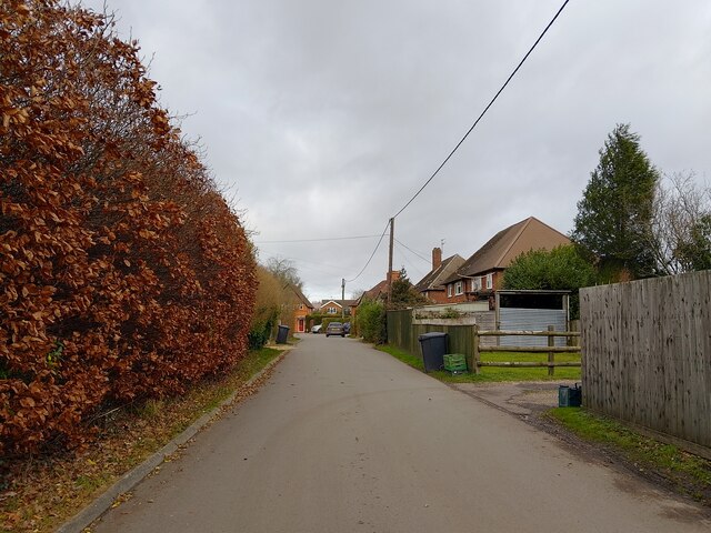
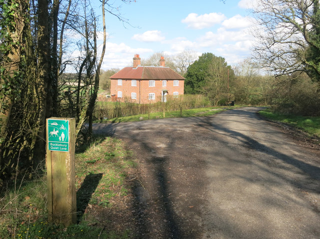
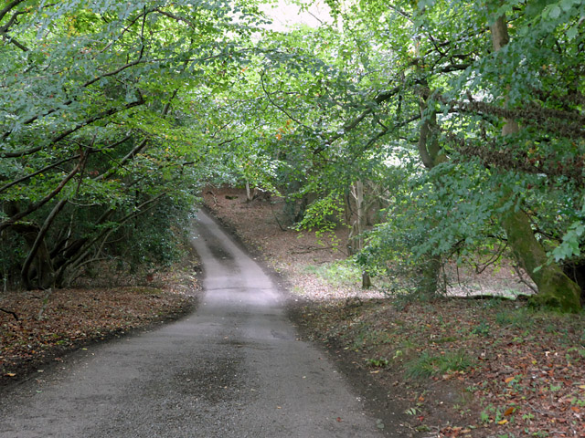
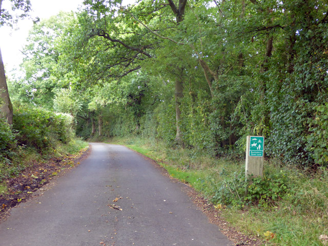
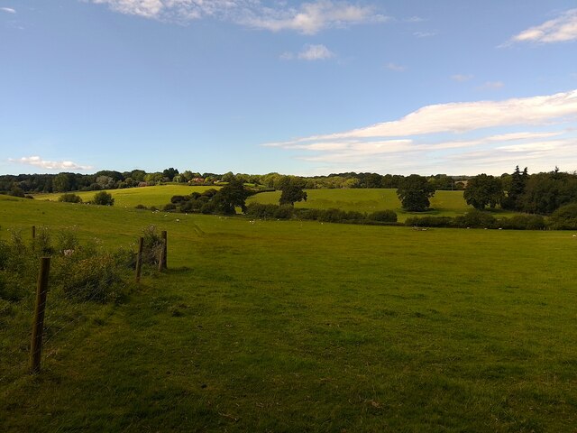
Bucklebury is a quaint village nestled in the Upper region of Berkshire, England. It is located approximately 10 miles east of Newbury and 50 miles west of London, making it a desirable location for commuters. The village sits on the banks of the River Pang and is surrounded by picturesque countryside, offering residents and visitors a peaceful and idyllic setting.

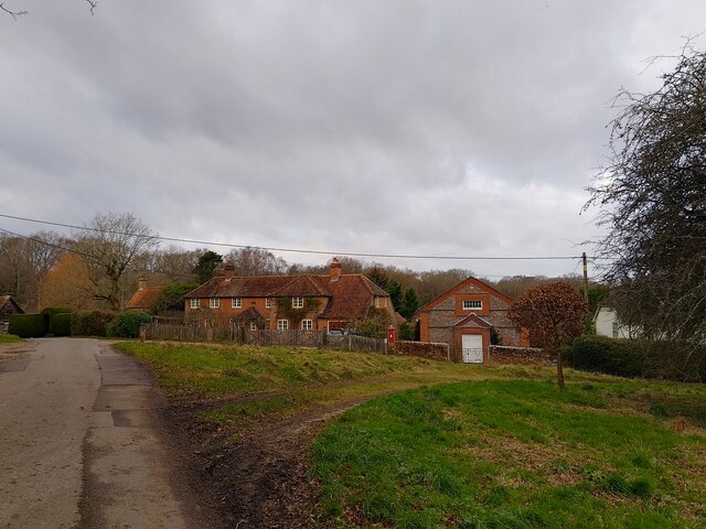
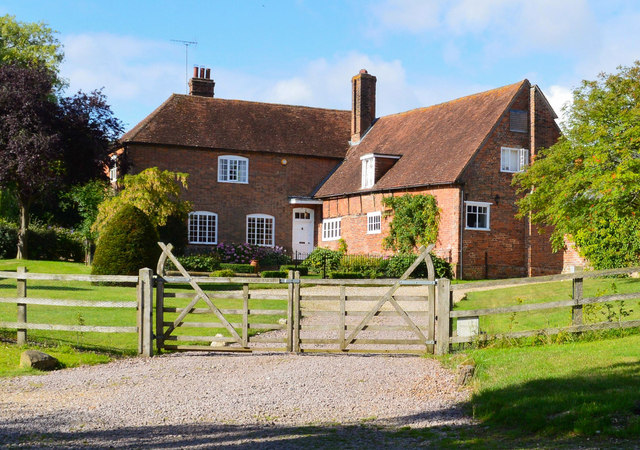
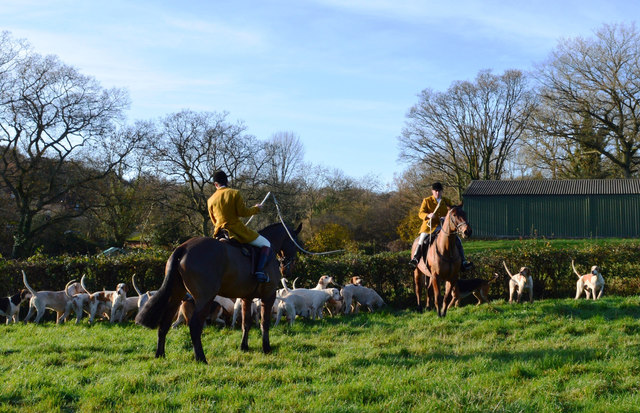
Bucklebury is renowned for its rich history, with evidence of human settlement dating back to the Roman era. The village is home to several historic landmarks, including St. Mary the Virgin Church, which dates back to the 12th century and is known for its stunning architecture and beautiful stained glass windows.

In terms of amenities, Bucklebury offers a range of essential services, including a primary school, village hall, post office, and local shops. The village also boasts a variety of recreational facilities, such as sports fields, playgrounds, and walking trails, providing ample opportunities for outdoor activities and leisurely strolls.

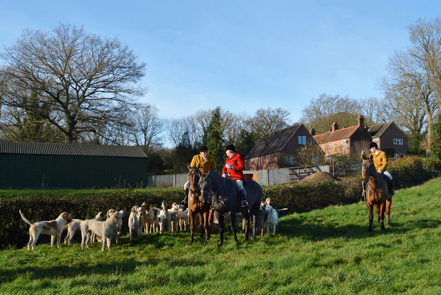
The community in Bucklebury is close-knit and friendly, with a strong sense of local pride. The village hosts regular events and festivals throughout the year, bringing residents together and fostering a sense of community spirit.

With its charming rural setting, historical significance, and convenient location, Bucklebury is a highly sought-after place to live or visit in Upper Berkshire. Its tranquil atmosphere and beautiful surroundings make it an ideal destination for those seeking a peaceful and scenic retreat.

If you have any feedback on the listing, please let us know in the comments section below.

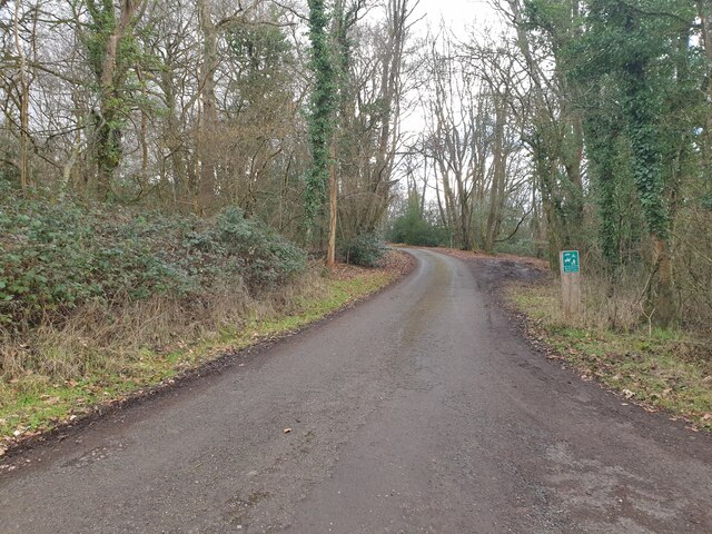
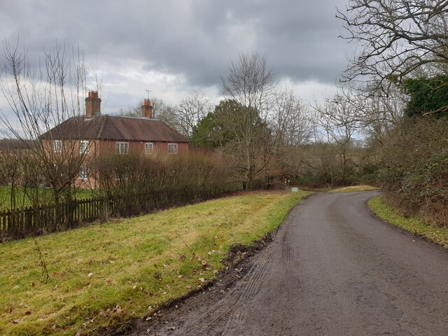
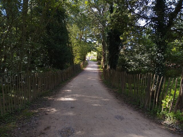
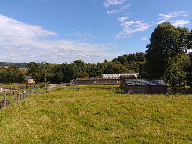
Bucklebury, Upper Images

Images are sourced within 2km of 51.414294/-1.2245187 or Grid Reference SU5468. Thanks to Geograph Open Source API. All images are credited.

Roundfield, Upper Bucklebury One of two cul-de-sacs sharing the same name.
Roundfield, Upper Bucklebury
One of two cul-de-sacs sharing the same name.
Turners Green, Upper Bucklebury Apple Tree Cottage to the left, a small church to the centre and Turners Green House to the right.
Turners Green, Upper Bucklebury
Apple Tree Cottage to the left, a small church to the centre and Turners Green House to the right.
Hillhouse Farmhouse, Bucklebury, Berkshire Circa 1600 with some C19 refacing and large C19 wing to south. Brick, timber framed with brick nogging, some later brick refacing. Old tile roof, hipped over projecting wing to left with stack off-centre to left, stack to right and C20 dormer with casements. L-plan: 3 framed bays of one storey and attic with large C19 two storey wing projecting to left. East front: brick faced bay to right, 2-light C19 casement in centre bay and 5-light C19 casement in left-hand bay. Projecting wing, right-hand return wall: one first floor 3-light segemental headed casement and 2 ground floor 3-light segmental headed casements to left. 5-panelled door to right with rectangular overlight under segmental head and C20 porch. Interior: frame includes one pair of cruck blades.

(Source:Historic England)
Hillhouse Farmhouse, Bucklebury, Berkshire
Circa 1600 with some C19 refacing and large C19 wing to south. Brick, timber framed with brick nogging, some later brick refacing. Old tile roof, hipped over projecting wing to left with stack off-centre to left, stack to right and C20 dormer with casements. L-plan: 3 framed bays of one storey and attic with large C19 two storey wing projecting to left. East front: brick faced bay to right, 2-light C19 casement in centre bay and 5-light C19 casement in left-hand bay. Projecting wing, right-hand return wall: one first floor 3-light segemental headed casement and 2 ground floor 3-light segmental headed casements to left. 5-panelled door to right with rectangular overlight under segmental head and C20 porch. Interior: frame includes one pair of cruck blades. (Source:Historic England)
Before the hunt, Bucklebury, Berkshire
Excited hounds, Bucklebury, Berkshire
All Quiet down Holly Lane Well, there's nothing like a good rant, and these absurd Quiet Lane bollards are always a good excuse.
There's a much higher than normal number of them infesting the roads around here. 
It's not just that they're unsightly, it's that you know they've shut two and a half schools and a hospital to pay for them....
End of Rant.
Holly Farm House in the background. You could be really noisy in a house like that, if only it wasn't a quiet lane....
All Quiet down Holly Lane
Well, there's nothing like a good rant, and these absurd Quiet Lane bollards are always a good excuse. There's a much higher than normal number of them infesting the roads around here. It's not just that they're unsightly, it's that you know they've shut two and a half schools and a hospital to pay for them.... End of Rant. Holly Farm House in the background. You could be really noisy in a house like that, if only it wasn't a quiet lane....
Towards Hillhouse Farm A short public footpath runs across this valley from here to the farm opposite.
Towards Hillhouse Farm
A short public footpath runs across this valley from here to the farm opposite.
Holly Lane This is signed as a 'Quiet Lane'.
Holly Lane
This is signed as a 'Quiet Lane'.
Tylers Lane, Bucklebury Signed as a 'Bucklebury Quiet Lane'.
Tylers Lane, Bucklebury
Signed as a 'Bucklebury Quiet Lane'.
Holly Lane A view up Holly Lane from near to Holly Farm House.
Holly Lane
A view up Holly Lane from near to Holly Farm House.
Holly Farm House Holly Farm House on Holly Lane.
Holly Farm House
Holly Farm House on Holly Lane.
Bucklebury Farm footpath A public footpath crossing Bucklebury Farm. This is also the main path towards Bucklebury Farm Park for visitors.
Bucklebury Farm footpath
A public footpath crossing Bucklebury Farm. This is also the main path towards Bucklebury Farm Park for visitors.
Bucklebury Farm chickens Beside the public footpath.
Bucklebury Farm chickens
Beside the public footpath.
Bucklebury Farm footpath A public footpath crossing Bucklebury Farm. The route of the path is a little confusing across the attraction itself.

If approaching from the north, you cross the car park after crossing the field near Pease Hill, follow the pedestrian entrance to the park, then walk through the "exit" gate to the right (west) of the admissions building. You then climb or open and close three metal gates to fields, and walk on the left (east) side of the fence in this field until you reach two stiles. Cross these and then follow the fenceline until you reach a gate and exit to the restricted byway.

If approaching from the south, you go through the metal gate from the restricted byway, follow the fenceline to a pair of stiles, cross both and follow the fenceline down to a series of three gates. Open and close or climb over these three through fields until you reach the exit gate. Go through the gate and follow the pedestrian walk to the car park and continue to the metal gate crossing a field beside the entrance driveway.

Shoutout to the kind gentleman who helped me with the route on my walk!
Bucklebury Farm footpath
A public footpath crossing Bucklebury Farm. The route of the path is a little confusing across the attraction itself. If approaching from the north, you cross the car park after crossing the field near Pease Hill, follow the pedestrian entrance to the park, then walk through the "exit" gate to the right (west) of the admissions building. You then climb or open and close three metal gates to fields, and walk on the left (east) side of the fence in this field until you reach two stiles. Cross these and then follow the fenceline until you reach a gate and exit to the restricted byway. If approaching from the south, you go through the metal gate from the restricted byway, follow the fenceline to a pair of stiles, cross both and follow the fenceline down to a series of three gates. Open and close or climb over these three through fields until you reach the exit gate. Go through the gate and follow the pedestrian walk to the car park and continue to the metal gate crossing a field beside the entrance driveway. Shoutout to the kind gentleman who helped me with the route on my walk!
Bucklebury Farm and footpath A public footpath crossing Bucklebury Farm. The route of the path is a little confusing across the attraction itself.

If approaching from the north, you cross the car park after crossing the field near Pease Hill, follow the pedestrian entrance to the park, then walk through the "exit" gate to the right (west) of the admissions building. You then climb or open and close three metal gates to fields, and walk on the left (east) side of the fence in this field until you reach two stiles. Cross these and then follow the fenceline until you reach a gate and exit to the restricted byway.

If approaching from the south, you go through the metal gate from the restricted byway, follow the fenceline to a pair of stiles, cross both and follow the fenceline down to a series of three gates. Open and close or climb over these three through fields until you reach the exit gate. Go through the gate and follow the pedestrian walk to the car park and continue to the metal gate crossing a field beside the entrance driveway.

Shoutout to the kind gentleman who helped me with the route on my walk!
Bucklebury Farm and footpath
A public footpath crossing Bucklebury Farm. The route of the path is a little confusing across the attraction itself. If approaching from the north, you cross the car park after crossing the field near Pease Hill, follow the pedestrian entrance to the park, then walk through the "exit" gate to the right (west) of the admissions building. You then climb or open and close three metal gates to fields, and walk on the left (east) side of the fence in this field until you reach two stiles. Cross these and then follow the fenceline until you reach a gate and exit to the restricted byway. If approaching from the south, you go through the metal gate from the restricted byway, follow the fenceline to a pair of stiles, cross both and follow the fenceline down to a series of three gates. Open and close or climb over these three through fields until you reach the exit gate. Go through the gate and follow the pedestrian walk to the car park and continue to the metal gate crossing a field beside the entrance driveway. Shoutout to the kind gentleman who helped me with the route on my walk!
Bucklebury Farm footpath A public footpath crossing Bucklebury Farm. The route of the path is a little confusing across the attraction itself.

If approaching from the north, you cross the car park after crossing the field near Pease Hill, follow the pedestrian entrance to the park, then walk through the "exit" gate to the right (west) of the admissions building. You then climb or open and close three metal gates to fields, and walk on the left (east) side of the fence in this field until you reach two stiles. Cross these and then follow the fenceline until you reach a gate and exit to the restricted byway.

If approaching from the south, you go through the metal gate from the restricted byway, follow the fenceline to a pair of stiles, cross both and follow the fenceline down to a series of three gates. Open and close or climb over these three through fields until you reach the exit gate. Go through the gate and follow the pedestrian walk to the car park and continue to the metal gate crossing a field beside the entrance driveway.

Shoutout to the kind gentleman who helped me with the route on my walk!
Bucklebury Farm footpath
A public footpath crossing Bucklebury Farm. The route of the path is a little confusing across the attraction itself. If approaching from the north, you cross the car park after crossing the field near Pease Hill, follow the pedestrian entrance to the park, then walk through the "exit" gate to the right (west) of the admissions building. You then climb or open and close three metal gates to fields, and walk on the left (east) side of the fence in this field until you reach two stiles. Cross these and then follow the fenceline until you reach a gate and exit to the restricted byway. If approaching from the south, you go through the metal gate from the restricted byway, follow the fenceline to a pair of stiles, cross both and follow the fenceline down to a series of three gates. Open and close or climb over these three through fields until you reach the exit gate. Go through the gate and follow the pedestrian walk to the car park and continue to the metal gate crossing a field beside the entrance driveway. Shoutout to the kind gentleman who helped me with the route on my walk!
Bucklebury landscape A field of sheep near to Redhill Copse.
Bucklebury landscape
A field of sheep near to Redhill Copse.
Bucklebury footpath A public footpath crossing a field near to Redhill Copse.
Bucklebury footpath
A public footpath crossing a field near to Redhill Copse.
Show me another place!

Bucklebury, Upper is located at Grid Ref: SU5468 (Lat: 51.414294, Lng: -1.2245187)

Unitary Authority: West Berkshire

Police Authority: Thames Valley

What 3 Words

///apes.rewriting.relegate. Near Thatcham, Berkshire

Related Wikis

Colthrop

Colthrop is a suburb of the town of Thatcham in the English county of Berkshire, England. == Geography == Colthrop is part of the civil parish of Thatcham...

Briff Lane Meadows

Briff Lane Meadows is a 8.9-hectare (22-acre) biological Site of Special Scientific Interest north of Thatcham in Berkshire.These meadows have unimproved...

Midgham

Midgham is a village and civil parish occupying slopes and the flood plain on the north side of the River Kennet, which in summer months draws much of...

Bucklebury Common

Bucklebury Common is an elevated common consisting of woodland with a few relatively small clearings in the English county of Berkshire, within the civil...

Bucklebury Manor

Bucklebury Manor is a Grade II listed manor house in the civil parish of Bucklebury in the English county of Berkshire. Since 2012, it has been the home...

Old Bluecoat School, Thatcham

Old Bluecoat School, or the St Thomas’ Chapel is a Grade I listed building in the town of Thatcham in the English county of Berkshire. It is located on...

Kennet School

Kennet School is an academy secondary school in Thatcham, Berkshire, England. In 2011, Kennet was the highest achieving state school in West Berkshire...

Bucklebury Farm Park

Bucklebury Farm Park is an animal park located in Bucklebury in Berkshire, England. The Farm Park consists of mostly Animals, Play equipment, Deer and...

Nearby Amenities

Located within 500m of 51.414294,-1.2245187
Upper Bucklebury
Place: village
Wikidata: Q37873842
Lat/Long: 51.4146583/-1.2234581
Defibrillator
Emergency: defibrillator
Indoor: no
Opening Hours: 24/7
Lat/Long: 51.4142786/-1.2251089
Bicycle Parking
Lat/Long: 51.4134316/-1.2179337
Turning Loop
Lat/Long: 51.4146127/-1.2297024
Post Box
Operator: Royal Mail
Post Box Type: pillar
Ref: RG7 348
Royal Cypher: GVIR
Royal Cypher Wikidata: Q33102169
Lat/Long: 51.4145273/-1.2249461
Waste Basket
Lat/Long: 51.414429/-1.2246665
Bench
Backrest: yes
Lat/Long: 51.4144922/-1.2247328
The data included in this document is from www.openstreetmap.org. The data is made available under ODbL.

Have you been to Bucklebury, Upper?

Leave your review of Bucklebury, Upper below (or comments, questions and feedback).