Upend

Settlement in Cambridgeshire East Cambridgeshire

England

Upend

Property NE of Upend: aerial 2022
Property NE of Upend: aerial 2022 Credit: Simon Tomson

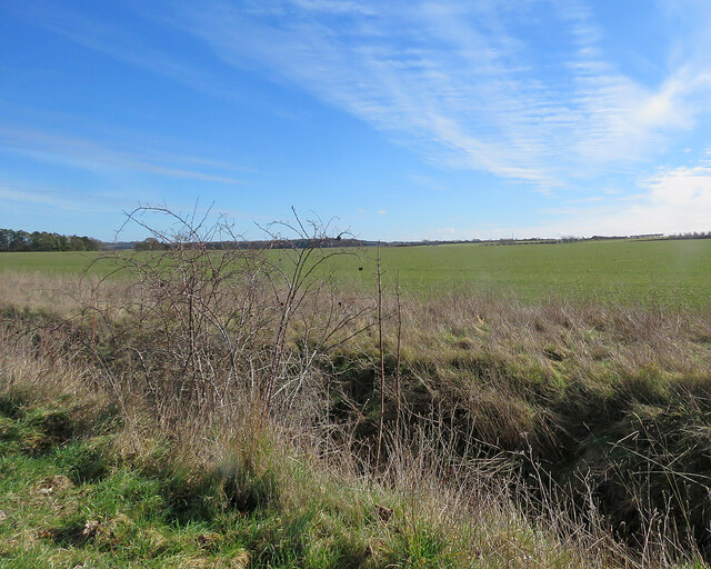
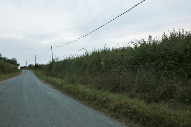
Upend is a small village located in the county of Cambridgeshire, England. Situated approximately 7 miles southwest of the city of Cambridge, it falls within the administrative district of South Cambridgeshire. The village is surrounded by the picturesque countryside that characterizes the region, offering a tranquil and idyllic setting.

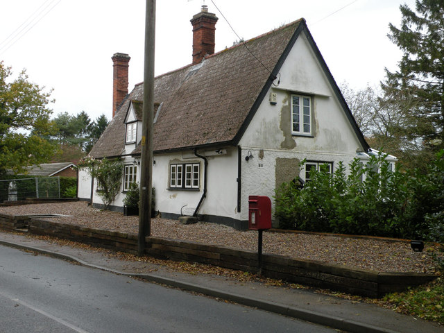
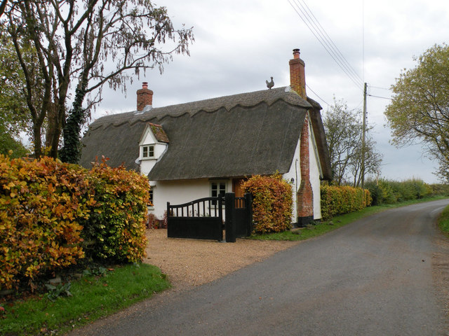
With a population of around 500 residents, Upend maintains a close-knit community atmosphere. The village is primarily residential, with a scattering of traditional cottages and modern houses. The architecture reflects the area's rich history, with some buildings dating back several centuries. A charming church, St. Mary's, stands as a prominent feature, adding to the village's charm and heritage.

Despite its small size, Upend boasts a few amenities that cater to the community's needs. These include a local pub, The Red Lion, which serves as a meeting place for villagers and visitors alike. Additionally, a village hall provides a space for social gatherings, events, and local activities.

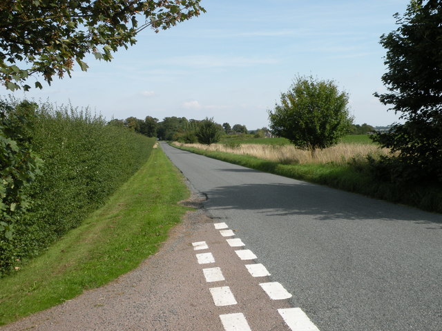
The village's proximity to Cambridge allows residents to benefit from the city's amenities and employment opportunities while enjoying the tranquility of rural life. Upend is well-connected to nearby towns and cities through a network of roads, making it easily accessible.

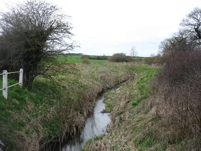
Surrounded by beautiful countryside, Upend offers residents and visitors ample opportunities for outdoor activities. The village is situated near picturesque walking and cycling routes, allowing individuals to explore the stunning landscapes and enjoy the peaceful surroundings.

Overall, Upend, Cambridgeshire, is a charming and historic village that offers a peaceful countryside lifestyle within easy reach of nearby towns and cities.

If you have any feedback on the listing, please let us know in the comments section below.
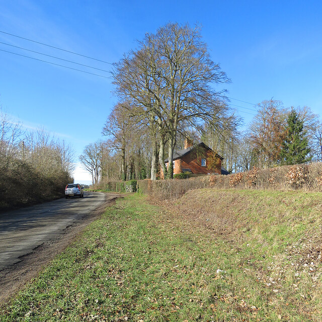
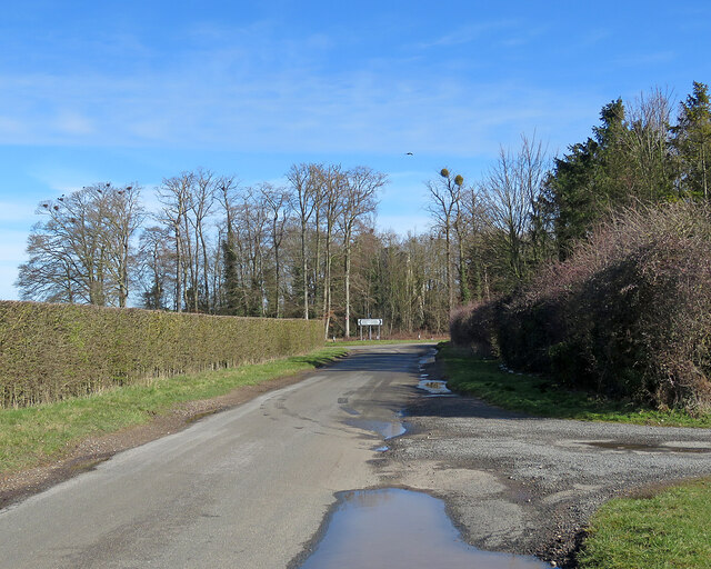
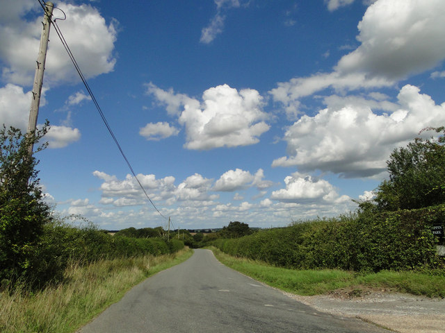
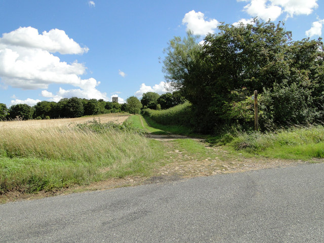
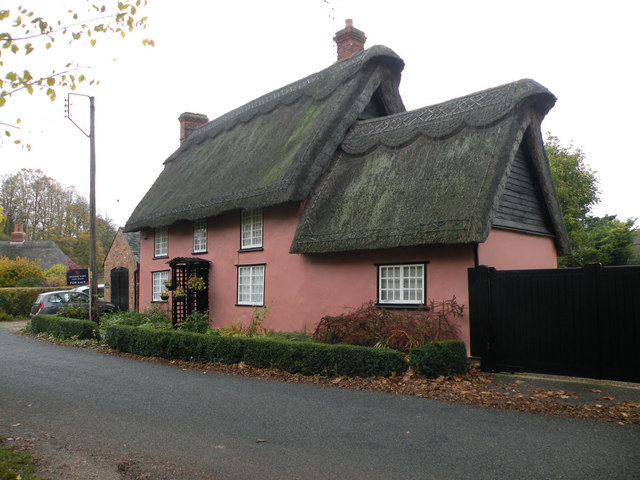
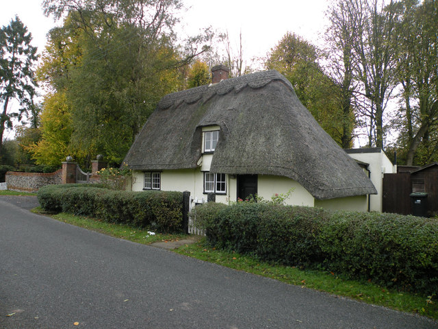
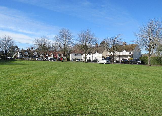
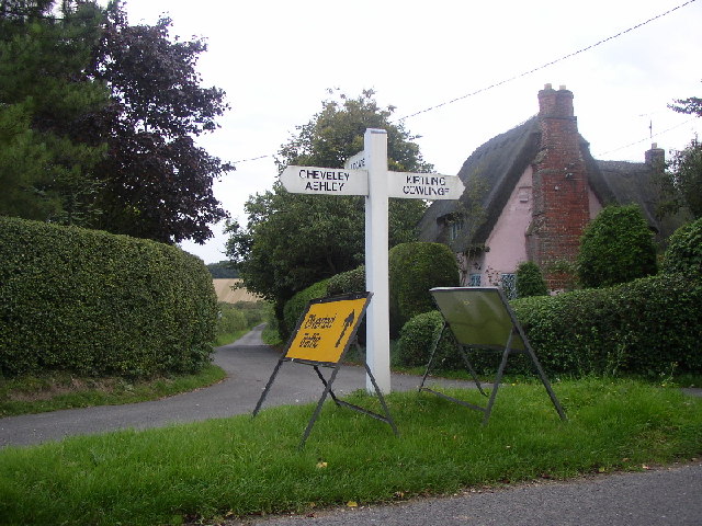
Upend Images

Images are sourced within 2km of 52.198912/0.486822 or Grid Reference TL7058. Thanks to Geograph Open Source API. All images are credited.

Property NE of Upend: aerial 2022
Big fields on the edge of Cambridgeshire Looking east-southeast from the roadside opposite the farm on Upend Road. Suffolk is not far away.
Big fields on the edge of Cambridgeshire
Looking east-southeast from the roadside opposite the farm on Upend Road. Suffolk is not far away.
The Belt, Lidgate
The Belt, Lidgate
Silverley: the ruins of All Saints' Church Silverley was once big enough to have an impressive church, but is now no more than a farm and a few cottages. The settlement shifted northwards, to Ashley, and the church was abandoned in the sixteenth century. Only the ruined tower remains, in a copse. "Eminently picturesque in its decay. The interior especially fine, with the winding of the spiral stair ripped open" (Nikolaus Pevsner).
Silverley: the ruins of All Saints' Church
Silverley was once big enough to have an impressive church, but is now no more than a farm and a few cottages. The settlement shifted northwards, to Ashley, and the church was abandoned in the sixteenth century. Only the ruined tower remains, in a copse. "Eminently picturesque in its decay. The interior especially fine, with the winding of the spiral stair ripped open" (Nikolaus Pevsner).
Silverley: cottage and copse Now no more than a farm, a few cottages and a road junction, Silverley was once big enough to have an impressive church, whose ruined tower survives among the trees on the crest of the hill: <a href="https://www.geograph.org.uk/photo/7429779">TL7060 : Silverley: the ruins of All Saints' Church</a>.
Silverley: cottage and copse
Now no more than a farm, a few cottages and a road junction, Silverley was once big enough to have an impressive church, whose ruined tower survives among the trees on the crest of the hill: TL7060 : Silverley: the ruins of All Saints' Church.
Nearing Silverley This is the road from Cheveley and Broad Green. There's a hint of <a href="https://www.geograph.org.uk/photo/7429779">TL7060 : Silverley: the ruins of All Saints' Church</a> among the trees just to the right of the signpost.
Nearing Silverley
This is the road from Cheveley and Broad Green. There's a hint of TL7060 : Silverley: the ruins of All Saints' Church among the trees just to the right of the signpost.
Approaching Cowlinge Corner under blue skies
Footpath to Lidgate church, seen on the horizon
A flinty field near Lidgate Looking north-west from the corner of the B1063 and the lane to Upend.
A flinty field near Lidgate
Looking north-west from the corner of the B1063 and the lane to Upend.
Towards Lidgate church A view from the corner of the B1063 and the lane to Upend. The bridge crosses a tributary of the Kennett.
Towards Lidgate church
A view from the corner of the B1063 and the lane to Upend. The bridge crosses a tributary of the Kennett.
The upper River Kennett The River Kennett (not to be confused with the River Kennet in Wiltshire) rises a short distance south-west of here, and flows north to join the River Lark and finally the River Great Ouse.
The upper River Kennett
The River Kennett (not to be confused with the River Kennet in Wiltshire) rises a short distance south-west of here, and flows north to join the River Lark and finally the River Great Ouse.
Road from Woodditton to Ashley
Cottage on The Street, Lidgate The postbox is CB8 53
Cottage on The Street, Lidgate
The postbox is CB8 53
Well Cottage, Upend Cottage possibly C17. Timber framed and plastered - described on the listed building register with corrugated iron roof but now thatched. Grade II listed.
Well Cottage, Upend
Cottage possibly C17. Timber framed and plastered - described on the listed building register with corrugated iron roof but now thatched. Grade II listed.
Oak Gate, Upend Late C17 or early C18. Timber framed and plastered. Grade II listed.
Oak Gate, Upend
Late C17 or early C18. Timber framed and plastered. Grade II listed.
Gate Cottage, Upend C17. Timber framed and plastered with hipped thatched roof. Grade II listed.
Gate Cottage, Upend
C17. Timber framed and plastered with hipped thatched roof. Grade II listed.
Broad Green: across the green A small settlement near Cheveley, on the eastern edge of Cambridgeshire.
Broad Green: across the green
A small settlement near Cheveley, on the eastern edge of Cambridgeshire.
Upend Looking down the road to Lidgate. Main street (such as it is) runs left to right
Upend
Looking down the road to Lidgate. Main street (such as it is) runs left to right
Show me another place!

Upend is located at Grid Ref: TL7058 (Lat: 52.198912, Lng: 0.486822)

Administrative County: Cambridgeshire

District: East Cambridgeshire

Police Authority: Cambridgeshire

What 3 Words

///respond.heightens.pyramid. Near Newmarket, Suffolk

Nearby Locations

Upend

Related Wikis

Upend

Upend is a hamlet in the east of Cambridgeshire. It is five miles (8.0 km) south-east of Newmarket and lies in the same parish as Kirtling. Until the...
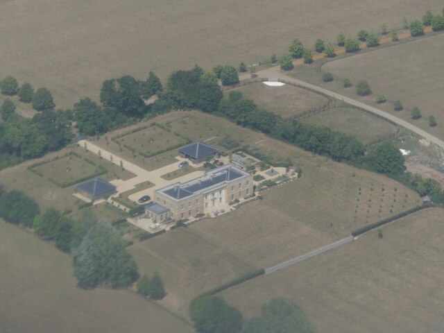
Kirtling Tower

Kirtling Tower was a medieval castle and Tudor country house in Kirtling, Cambridgeshire, England, of which the gatehouse still remains. == History... ==
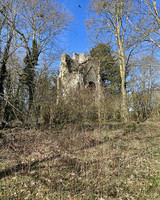
Lidgate Castle

Lidgate Castle is a medieval motte and bailey castle in the village of Lidgate, Suffolk, England, built to an unusual quadrangular design. == Details... ==

Kirtling

Kirtling, together with Kirtling Green and Kirtling Towers, is a scattered settlement in the south-eastern edge of the English county of Cambridgeshire...

Nearby Amenities

Located within 500m of 52.198912,0.486822
Upend
Is In: Cambridgeshire, England, UK
Place: village
Source Name: dictaphone
Wikidata: Q7898235
Lat/Long: 52.1974537/0.4874094
Bus Stop
Oak Gates
Naptan AtcoCode: 0500EKIRT002
Naptan Bearing: N
Naptan BusStopType: CUS
Naptan CommonName: Oak Gates
Naptan Indicator: opp
Naptan Landmark: Oak Gates
Naptan NaptanCode: cmbdgwjw
Naptan ShortCommonName: Oak Gates
Naptan Street: main street
Naptan Verified: no
Source: naptan_import
Lat/Long: 52.1978743/0.4874606
Bus Stop
Oak Gates
Naptan AtcoCode: 0500EKIRT008
Naptan Bearing: S
Naptan BusStopType: CUS
Naptan CommonName: Oak Gates
Naptan Indicator: near
Naptan Landmark: Oak Gates
Naptan NaptanCode: cmbdgwmt
Naptan ShortCommonName: Oak Gates
Naptan Street: Main Street
Naptan Verified: no
Source: naptan_import
Lat/Long: 52.1978583/0.4876176
Power: pole
Lat/Long: 52.1992371/0.4860779
Power: pole
Lat/Long: 52.2004602/0.4809175
Power: pole
Lat/Long: 52.199492/0.4848695
Power: pole
Lat/Long: 52.1993308/0.4807083
Power: pole
Lat/Long: 52.2002054/0.4819218
Power: transformer
Lat/Long: 52.19903/0.4872017
Power: pole
Lat/Long: 52.1982096/0.4801034
Power: pole
Lat/Long: 52.2012526/0.4815812
Power: pole
Lat/Long: 52.1999498/0.4829196
Power: pole
Lat/Long: 52.1996941/0.483853
Power: pole
Lat/Long: 52.2021427/0.4823724
Post Box
Collection Times: Mo-Fr 16:30; Sa 10:15
Operator: Royal Mail
Post Box Type: wall
Ref: CB8 67
Royal Cypher: VR
Royal Cypher Wikidata: Q33102356
Source: survey
Lat/Long: 52.1974186/0.4872918
Telephone
Defibrillator
Booth: K6
Covered: booth
Defibrillator Location: inside red phone box in Upend
Emergency: defibrillator
Listed Status: Grade II
Man Made: telephone_box
Lat/Long: 52.1983861/0.4876029
The data included in this document is from www.openstreetmap.org. The data is made available under ODbL.

Have you been to Upend?

Leave your review of Upend below (or comments, questions and feedback).