Aireworth

Settlement in Yorkshire

England

Aireworth

Benchmark on NW corner of #10 Hanover Street Ordnance Survey cut mark benchmark levelled at 105.455m above Newlyn Datum in 1962
Benchmark on NW corner of #10 Hanover Street Credit: Roger Templeman

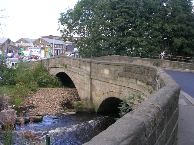
Aireworth is a small town located in the county of Yorkshire, England. Situated along the banks of the River Aire, it is nestled in the picturesque Aire Valley, surrounded by rolling hills and green landscapes. The town is part of the larger metropolitan district of Bradford.

Aireworth has a rich history, dating back to Roman times when it was a strategic settlement along the Roman road connecting York to Manchester. Over the centuries, it has grown into a thriving community with a population of around 10,000 residents.

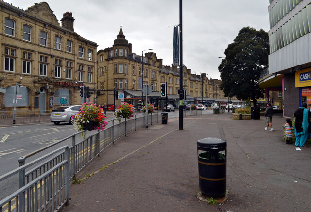
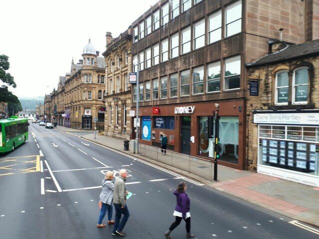
The town is known for its close-knit community and friendly atmosphere. It offers a range of amenities to cater to the needs of its residents, including schools, healthcare facilities, and recreational spaces. Additionally, Aireworth boasts a variety of shops, restaurants, and cafes, making it a vibrant hub for local commerce.

Nature enthusiasts will appreciate the town's proximity to the Yorkshire Dales National Park, just a short drive away. This allows residents and visitors to enjoy outdoor activities such as hiking, cycling, and picnicking amidst stunning natural scenery.

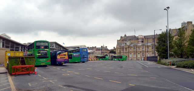
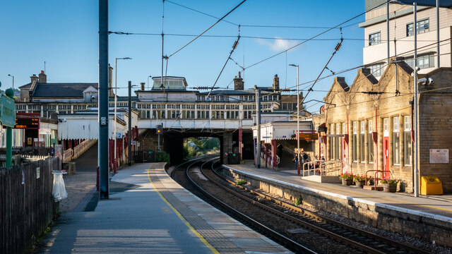
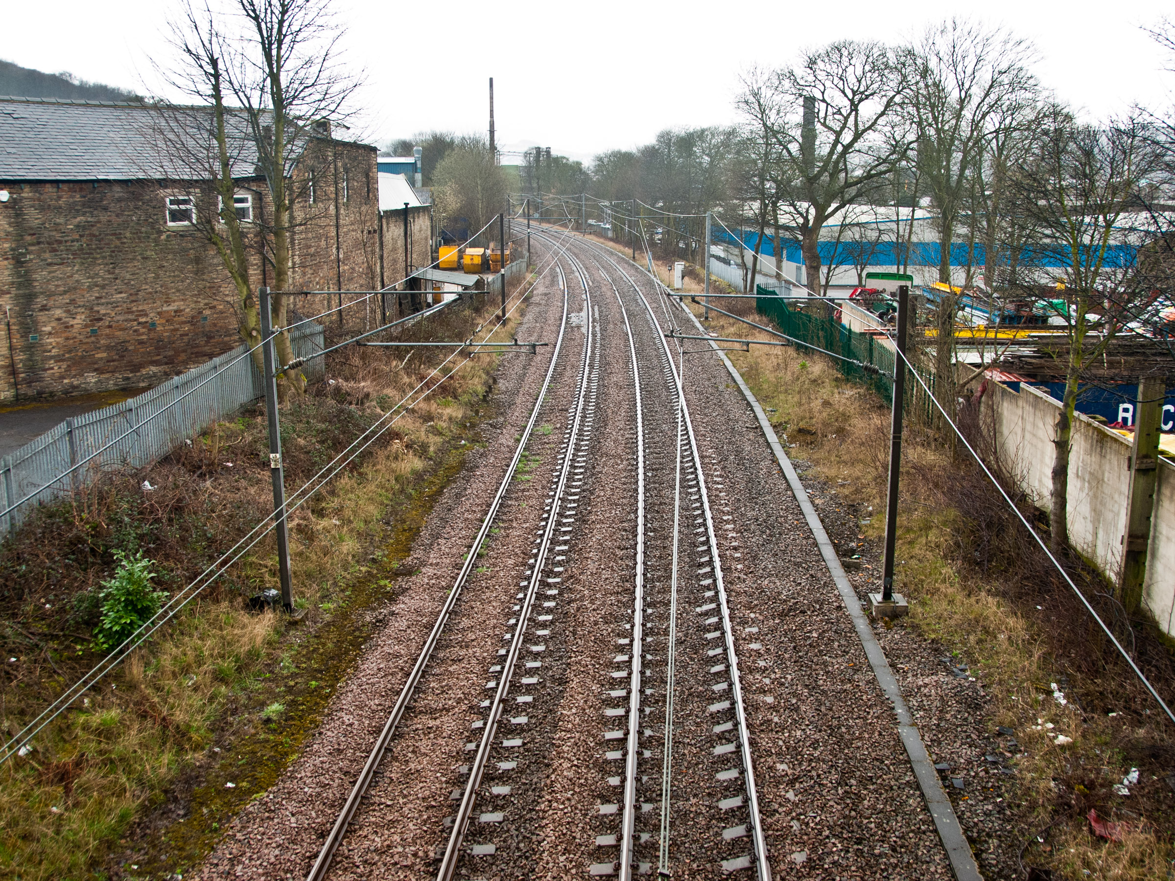
Transportation in Aireworth is well-connected, with regular bus services linking the town to nearby cities and towns. The nearby train station provides convenient access to larger cities like Leeds and Bradford.

Overall, Aireworth offers a peaceful and idyllic lifestyle, combining the tranquility of its rural surroundings with easy access to urban amenities.

If you have any feedback on the listing, please let us know in the comments section below.

Aireworth Images

Images are sourced within 2km of 53.872626/-1.892134 or Grid Reference SE0741. Thanks to Geograph Open Source API. All images are credited.

Benchmark on NW corner of #10 Hanover Street Ordnance Survey cut mark benchmark levelled at 105.455m above Newlyn Datum in 1962
Benchmark on NW corner of #10 Hanover Street
Ordnance Survey cut mark benchmark levelled at 105.455m above Newlyn Datum in 1962
CoCo desert shop, 14 Hanover Street at Carr Street junction There is an Ordnance Survey benchmark <a href="https://www.geograph.org.uk/photo/7688145">SE0641 : Benchmark on NW corner of #10 Hanover Street</a> on the near corner, right hand face, of the shop
CoCo desert shop, 14 Hanover Street at Carr Street junction
There is an Ordnance Survey benchmark SE0641 : Benchmark on NW corner of #10 Hanover Street on the near corner, right hand face, of the shop
Cavendish Mobiles. 90 Cavendish Street at Lawkholme Lane junction Ordnance Survey documents indicate that a benchmark was levelled at 106.174m above Newlyn Datum on the NE corner of the shop in 1962
Cavendish Mobiles. 90 Cavendish Street at Lawkholme Lane junction
Ordnance Survey documents indicate that a benchmark was levelled at 106.174m above Newlyn Datum on the NE corner of the shop in 1962
Industrial building on SE side of Lawkholme Lane Ordnance Survey documents describe a benchmark levelled at 102.846m above Newlyn Datum in 1962 on a public lavatory which was present at the wall at the left hand edge of the image
Industrial building on SE side of Lawkholme Lane
Ordnance Survey documents describe a benchmark levelled at 102.846m above Newlyn Datum in 1962 on a public lavatory which was present at the wall at the left hand edge of the image
Benchmark on stone at base of wall on west side of Skipton Road Ordnance Survey cut mark benchmark levelled at 111.286m above Newlyn Datum verified 1962
Benchmark on stone at base of wall on west side of Skipton Road
Ordnance Survey cut mark benchmark levelled at 111.286m above Newlyn Datum verified 1962
Looking north along Skipton Road as it passes #206 There is an Ordnance Survey benchmark <a href="https://www.geograph.org.uk/photo/7689482">SE0641 : Benchmark on stone at base of wall on west side of Skipton Road</a> on a stone at the base of the nearest pier in the wall on the left hand side of the road
Looking north along Skipton Road as it passes #206
There is an Ordnance Survey benchmark SE0641 : Benchmark on stone at base of wall on west side of Skipton Road on a stone at the base of the nearest pier in the wall on the left hand side of the road
Benchmark on Madinah Mosque, Spencer Street Ordnance Survey cut mark benchmark levelled at 120.472m above Newlyn Datum verified 1962
Benchmark on Madinah Mosque, Spencer Street
Ordnance Survey cut mark benchmark levelled at 120.472m above Newlyn Datum verified 1962
Madinah Mosque on north side of Spencer Street There is an Ordnance Survey benchmark <a href="https://www.geograph.org.uk/photo/7689565">SE0541 : Benchmark on Madinah Mosque, Spencer Street</a> on the front of the mosque on its wall right of the white door
Madinah Mosque on north side of Spencer Street
There is an Ordnance Survey benchmark SE0541 : Benchmark on Madinah Mosque, Spencer Street on the front of the mosque on its wall right of the white door
Bus station, Keighley
Cavendish Street (A6035), Keighley
Trains at Keighley Station Ex LNWR 'Coal Tank' No.1054 departs from Keighley with a retro train whilst USATC S160 2-8-0 No. 5820 awaits departure with a second train for Haworth and Oxenhope at the Keighley and Worth Valley Railway Gala Day.  The S160 locomotives were built during WW2 in the USA and shipped to Europe for use by American Forces after D-Day.  Many of them worked in Great Britain before going to the continent, and several are now preserved in this country and also in mainland Europe.  They are a companion locomotive to the British 'WD' 2-8-0 produced for British Forces at the same time.
Trains at Keighley Station
Ex LNWR 'Coal Tank' No.1054 departs from Keighley with a retro train whilst USATC S160 2-8-0 No. 5820 awaits departure with a second train for Haworth and Oxenhope at the Keighley and Worth Valley Railway Gala Day. The S160 locomotives were built during WW2 in the USA and shipped to Europe for use by American Forces after D-Day. Many of them worked in Great Britain before going to the continent, and several are now preserved in this country and also in mainland Europe. They are a companion locomotive to the British 'WD' 2-8-0 produced for British Forces at the same time.
Virgin Money, Keighley I think this is the first actual branch of the bank that I have seen, it's normally thought of as a purely online provider.
Virgin Money, Keighley
I think this is the first actual branch of the bank that I have seen, it's normally thought of as a purely online provider.
Keighley Station looking west
East Riddlesden Hall and grounds [1] The south front of the hall.
Built on the site of an earlier building, the hall was erected in the 1640s and added to in 1692. Constructed of ashlar under stone slate roofs, the hall has two two-storey porches with wheel (or Yorkshire rose) windows. Many original internal features and fittings remain. Listed, grade I, with details at:  
<span class="nowrap"><a title="https://historicengland.org.uk/listing/the-list/list-entry/1283478" rel="nofollow ugc noopener" href="https://historicengland.org.uk/listing/the-list/list-entry/1283478">Link</a><img style="margin-left:2px;" alt="External link" title="External link - shift click to open in new window" src="https://s1.geograph.org.uk/img/external.png" width="10" height="10"/></span>
East Riddlesden Hall is sited on the banks of the River Aire, in Riddlesden, about 1¼ miles northeast of Keighley. Once the centre of a thriving agricultural estate, the grounds of the hall include a tithe barn. Saved from demolition by two local men in 1934, the house and grounds are now in the care of the National Trust.
East Riddlesden Hall and grounds [1]
The south front of the hall. Built on the site of an earlier building, the hall was erected in the 1640s and added to in 1692. Constructed of ashlar under stone slate roofs, the hall has two two-storey porches with wheel (or Yorkshire rose) windows. Many original internal features and fittings remain. Listed, grade I, with details at: LinkExternal link East Riddlesden Hall is sited on the banks of the River Aire, in Riddlesden, about 1¼ miles northeast of Keighley. Once the centre of a thriving agricultural estate, the grounds of the hall include a tithe barn. Saved from demolition by two local men in 1934, the house and grounds are now in the care of the National Trust.
East Riddlesden Hall and grounds [2] The entrance porch in the south front.
Built on the site of an earlier building, the hall was erected in the 1640s and added to in 1692. Constructed of ashlar under stone slate roofs, the hall has two two-storey porches with wheel (or Yorkshire rose) windows. Many original internal features and fittings remain. Listed, grade I, with details at:  
<span class="nowrap"><a title="https://historicengland.org.uk/listing/the-list/list-entry/1283478" rel="nofollow ugc noopener" href="https://historicengland.org.uk/listing/the-list/list-entry/1283478">Link</a><img style="margin-left:2px;" alt="External link" title="External link - shift click to open in new window" src="https://s1.geograph.org.uk/img/external.png" width="10" height="10"/></span>
East Riddlesden Hall is sited on the banks of the River Aire, in Riddlesden, about 1¼ miles northeast of Keighley. Once the centre of a thriving agricultural estate, the grounds of the hall include a tithe barn. Saved from demolition by two local men in 1934, the house and grounds are now in the care of the National Trust.
East Riddlesden Hall and grounds [2]
The entrance porch in the south front. Built on the site of an earlier building, the hall was erected in the 1640s and added to in 1692. Constructed of ashlar under stone slate roofs, the hall has two two-storey porches with wheel (or Yorkshire rose) windows. Many original internal features and fittings remain. Listed, grade I, with details at: LinkExternal link East Riddlesden Hall is sited on the banks of the River Aire, in Riddlesden, about 1¼ miles northeast of Keighley. Once the centre of a thriving agricultural estate, the grounds of the hall include a tithe barn. Saved from demolition by two local men in 1934, the house and grounds are now in the care of the National Trust.
East Riddlesden Hall and grounds [3] The north front of the hall.
Built on the site of an earlier building, the hall was erected in the 1640s and added to in 1692. Constructed of ashlar under stone slate roofs, the hall has two two-storey porches with wheel (or Yorkshire rose) windows. Many original internal features and fittings remain. Listed, grade I, with details at:  
<span class="nowrap"><a title="https://historicengland.org.uk/listing/the-list/list-entry/1283478" rel="nofollow ugc noopener" href="https://historicengland.org.uk/listing/the-list/list-entry/1283478">Link</a><img style="margin-left:2px;" alt="External link" title="External link - shift click to open in new window" src="https://s1.geograph.org.uk/img/external.png" width="10" height="10"/></span>
East Riddlesden Hall is sited on the banks of the River Aire, in Riddlesden, about 1¼ miles northeast of Keighley. Once the centre of a thriving agricultural estate, the grounds of the hall include a tithe barn. Saved from demolition by two local men in 1934, the house and grounds are now in the care of the National Trust.
East Riddlesden Hall and grounds [3]
The north front of the hall. Built on the site of an earlier building, the hall was erected in the 1640s and added to in 1692. Constructed of ashlar under stone slate roofs, the hall has two two-storey porches with wheel (or Yorkshire rose) windows. Many original internal features and fittings remain. Listed, grade I, with details at: LinkExternal link East Riddlesden Hall is sited on the banks of the River Aire, in Riddlesden, about 1¼ miles northeast of Keighley. Once the centre of a thriving agricultural estate, the grounds of the hall include a tithe barn. Saved from demolition by two local men in 1934, the house and grounds are now in the care of the National Trust.
East Riddlesden Hall and grounds [4] The south front of the hall.
Built on the site of an earlier building, the hall was erected in the 1640s and added to in 1692. Constructed of ashlar under stone slate roofs, the hall has two two-storey porches with wheel (or Yorkshire rose) windows. Many original internal features and fittings remain. Listed, grade I, with details at:  
<span class="nowrap"><a title="https://historicengland.org.uk/listing/the-list/list-entry/1283478" rel="nofollow ugc noopener" href="https://historicengland.org.uk/listing/the-list/list-entry/1283478">Link</a><img style="margin-left:2px;" alt="External link" title="External link - shift click to open in new window" src="https://s1.geograph.org.uk/img/external.png" width="10" height="10"/></span>
East Riddlesden Hall is sited on the banks of the River Aire, in Riddlesden, about 1¼ miles northeast of Keighley. Once the centre of a thriving agricultural estate, the grounds of the hall include a tithe barn. Saved from demolition by two local men in 1934, the house and grounds are now in the care of the National Trust.
East Riddlesden Hall and grounds [4]
The south front of the hall. Built on the site of an earlier building, the hall was erected in the 1640s and added to in 1692. Constructed of ashlar under stone slate roofs, the hall has two two-storey porches with wheel (or Yorkshire rose) windows. Many original internal features and fittings remain. Listed, grade I, with details at: LinkExternal link East Riddlesden Hall is sited on the banks of the River Aire, in Riddlesden, about 1¼ miles northeast of Keighley. Once the centre of a thriving agricultural estate, the grounds of the hall include a tithe barn. Saved from demolition by two local men in 1934, the house and grounds are now in the care of the National Trust.
East Riddlesden Hall and grounds [5] One of the rooms of the hall.
Built on the site of an earlier building, the hall was erected in the 1640s and added to in 1692. Constructed of ashlar under stone slate roofs, the hall has two two-storey porches with wheel (or Yorkshire rose) windows. Many original internal features and fittings remain. Listed, grade I, with details at:  
<span class="nowrap"><a title="https://historicengland.org.uk/listing/the-list/list-entry/1283478" rel="nofollow ugc noopener" href="https://historicengland.org.uk/listing/the-list/list-entry/1283478">Link</a><img style="margin-left:2px;" alt="External link" title="External link - shift click to open in new window" src="https://s1.geograph.org.uk/img/external.png" width="10" height="10"/></span>
East Riddlesden Hall is sited on the banks of the River Aire, in Riddlesden, about 1¼ miles northeast of Keighley. Once the centre of a thriving agricultural estate, the grounds of the hall include a tithe barn. Saved from demolition by two local men in 1934, the house and grounds are now in the care of the National Trust.
East Riddlesden Hall and grounds [5]
One of the rooms of the hall. Built on the site of an earlier building, the hall was erected in the 1640s and added to in 1692. Constructed of ashlar under stone slate roofs, the hall has two two-storey porches with wheel (or Yorkshire rose) windows. Many original internal features and fittings remain. Listed, grade I, with details at: LinkExternal link East Riddlesden Hall is sited on the banks of the River Aire, in Riddlesden, about 1¼ miles northeast of Keighley. Once the centre of a thriving agricultural estate, the grounds of the hall include a tithe barn. Saved from demolition by two local men in 1934, the house and grounds are now in the care of the National Trust.
Show me another place!

Aireworth is located at Grid Ref: SE0741 (Lat: 53.872626, Lng: -1.892134)

Division: West Riding

Unitary Authority: Bradford

Police Authority: West Yorkshire

What 3 Words

///moth.stews.living. Near Keighley, West Yorkshire

Related Wikis

Route One Rovers F.C.

Route One Rovers Football Club is a football club based in Bradford, England. They are currently members of the North West Counties League Division One...

Dalton Mills

Dalton Mills is a 19th century Grade II* Victorian former textile mill located in Keighley, West Yorkshire, England. It was roughly 45,681 sq ft (4,243...

River Worth

The River Worth is a river in West Yorkshire, England. It flows from minor tributaries on the moors above Watersheddles Reservoir down the Worth Valley...

Thwaites railway station

Thwaites railway station was a railway station located just east of Keighley, West Riding of Yorkshire, on the Midland Railway line through the Aire Valley...

Nearby Amenities

Located within 500m of 53.872626,-1.892134
Marley Activities and Coaching Centre
Created By: Potlatch 0.10f
Leisure: sports_centre
Lat/Long: 53.8719133/-1.8856121
Traffic Signals
Traffic Signals: signal
Lat/Long: 53.8733946/-1.8968554
Crossing
Crossing: traffic_signals
Crossing Ref: toucan
Kerb: lowered
Tactile Paving: yes
Lat/Long: 53.873345/-1.897066
Crossing
Crossing: toucan
Crossing Ref: puffin
Kerb: lowered
Tactile Paving: yes
Lat/Long: 53.8738947/-1.8971989
Traffic Signals
Traffic Signals: signal
Lat/Long: 53.8737878/-1.8970652
Post Box
Operator: Royal Mail
Post Box Type: pillar
Ref: BD21 49
Royal Cypher: GVIR
Royal Cypher Wikidata: Q33102169
Lat/Long: 53.8750058/-1.8913426
Post Box
Note: franked mail only
Operator: Royal Mail
Post Box Type: meter
Royal Cypher: EIIR
Royal Cypher Wikidata: Q33102113
Lat/Long: 53.8750618/-1.8919496
Bus Stop
Bradford Road Cornwall Road
Local Ref: 45020019
Naptan AtcoCode: 450020019
Naptan Bearing: SW
Naptan CommonName: Bradford Road Cornwall Road
Naptan Crossing: Cornwall Road
Naptan Indicator: Stop 45020019
Naptan Landmark: The Bridge PH
Naptan PlusbusZoneRef: LEEDS
Naptan ShortCommonName: Cornwall Road
Naptan Street: Bradford Road
Naptan Verified: no
Source: naptan_import
Lat/Long: 53.8754076/-1.8901365
Bus Stop
Bradford Road Aireworth Road
Local Ref: 45020020
Naptan AtcoCode: 450020020
Naptan Bearing: NE
Naptan CommonName: Bradford Road Aireworth Road
Naptan Crossing: Aireworth Road
Naptan Indicator: Stop 45020020
Naptan PlusbusZoneRef: LEEDS
Naptan ShortCommonName: Aireworth Road
Naptan Street: Bradford Road
Naptan Verified: no
Source: naptan_import
Lat/Long: 53.8751908/-1.8911974
Bus Stop
Bradford Road Wardman Street
Local Ref: 45020021
Naptan AtcoCode: 450020021
Naptan Bearing: NE
Naptan CommonName: Bradford Road Wardman Street
Naptan Crossing: Wardman Street
Naptan Indicator: Stop 45020021
Naptan Landmark: Retail Park
Naptan PlusbusZoneRef: LEEDS
Naptan ShortCommonName: Wardman Street
Naptan Street: Bradford Road
Naptan Verified: no
Source: naptan_import
Lat/Long: 53.8745748/-1.8936521
Bus Stop
Bradford Road Sussex Street
Local Ref: 45020022
Naptan AtcoCode: 450020022
Naptan Bearing: SE
Naptan CommonName: Bradford Road Sussex Street
Naptan Crossing: Sussex Street
Naptan Indicator: Stop 45020022
Naptan PlusbusZoneRef: LEEDS
Naptan ShortCommonName: Sussex Street
Naptan Street: Bradford Road
Naptan Verified: no
Source: naptan_import
Lat/Long: 53.8740991/-1.8943834
Bus Stop
Wenning Street Valley Road
Local Ref: 45022560
Naptan AtcoCode: 450022560
Naptan Bearing: S
Naptan CommonName: Wenning Street Valley Road
Naptan Crossing: Valley Road
Naptan Indicator: Stop 45022560
Naptan Landmark: Strong Cross School
Naptan PlusbusZoneRef: LEEDS
Naptan ShortCommonName: Valley Road
Naptan Street: Wenning Street
Naptan Verified: no
Source: naptan_import
Lat/Long: 53.8700668/-1.8881886
Bus Stop
Dalton Lane Thwaites Lane
Local Ref: 45022561
Naptan AtcoCode: 450022561
Naptan Bearing: W
Naptan CommonName: Dalton Lane Thwaites Lane
Naptan Crossing: Thwaites Lane
Naptan Indicator: Stop 45022561
Naptan Landmark: Jersey House
Naptan PlusbusZoneRef: LEEDS
Naptan ShortCommonName: Thwaites Lane
Naptan Street: Dalton Lane
Naptan Verified: no
Source: naptan_import
Lat/Long: 53.8694473/-1.8888594
Bus Stop
Dalton Lane Keighley
Local Ref: 45022562
Naptan AtcoCode: 450022562
Naptan Bearing: E
Naptan CommonName: Dalton Lane Keighley
Naptan Crossing: Fruit Street
Naptan Indicator: Stop 45022562
Naptan PlusbusZoneRef: LEEDS
Naptan ShortCommonName: Fruit Street
Naptan Street: Dalton Lane
Naptan Verified: no
Source: naptan_import
Lat/Long: 53.86998/-1.891565
Bus Stop
Dalton Lane Keighley
Local Ref: 45022563
Naptan AtcoCode: 450022563
Naptan Bearing: W
Naptan CommonName: Dalton Lane Keighley
Naptan Crossing: Fruit Street
Naptan Indicator: Stop 45022563
Naptan PlusbusZoneRef: LEEDS
Naptan ShortCommonName: Fruit Street
Naptan Street: Dalton Lane
Naptan Verified: no
Source: naptan_import
Lat/Long: 53.8697739/-1.8922043
Bus Stop
Dalton Lane Dalton Mills
Bus: yes
Local Ref: 45022564
Naptan AtcoCode: 450022564
Naptan Bearing: E
Naptan CommonName: Dalton Lane Dalton Mills
Naptan Indicator: Stop 45022564
Naptan Landmark: Dalton Mills
Naptan PlusbusZoneRef: LEEDS
Naptan ShortCommonName: Dalton Mills
Naptan Street: Dalton Lane
Naptan Verified: no
Public Transport: platform
Source: naptan_import
Lat/Long: 53.8694434/-1.8945928
Bus Stop
Dalton Lane Dalton Mills
Bus: yes
Local Ref: 45022565
Naptan AtcoCode: 450022565
Naptan Bearing: W
Naptan CommonName: Dalton Lane Dalton Mills
Naptan Crossing: Worthbridge Road
Naptan Indicator: Stop 45022565
Naptan Landmark: Mills
Naptan PlusbusZoneRef: LEEDS
Naptan ShortCommonName: Dalton Mills
Naptan Street: Dalton Lane
Naptan Verified: no
Public Transport: platform
Source: naptan_import
Lat/Long: 53.8692641/-1.8950191
Bus Stop
Bradford Road Elia Street
Local Ref: 45023141
Naptan AtcoCode: 450023141
Naptan Bearing: NE
Naptan CommonName: Bradford Road Elia Street
Naptan Crossing: Elia Street
Naptan Indicator: Stop 45023141
Naptan PlusbusZoneRef: LEEDS
Naptan ShortCommonName: Elia Street
Naptan Street: Bradford Road
Naptan Verified: no
Source: naptan_import
Lat/Long: 53.8714062/-1.8984205
Bus Stop
Bradford Road Elia Street
Local Ref: 45023142
Naptan AtcoCode: 450023142
Naptan Bearing: SE
Naptan CommonName: Bradford Road Elia Street
Naptan Crossing: Elia Street
Naptan Indicator: Stop 45023142
Naptan Landmark: The Leisure Centre
Naptan PlusbusZoneRef: LEEDS
Naptan ShortCommonName: Elia Street
Naptan Street: Bradford Road
Naptan Verified: no
Source: naptan_import
Lat/Long: 53.8715586/-1.8980551
Bus Stop
Wenning Street Airedale Street
Local Ref: 45023143
Naptan AtcoCode: 450023143
Naptan Bearing: N
Naptan CommonName: Wenning Street Airedale Street
Naptan Crossing: Airedale Street
Naptan Indicator: Stop 45023143
Naptan Landmark: Nursery School
Naptan PlusbusZoneRef: LEEDS
Naptan ShortCommonName: Airedale Street
Naptan Street: Wenning Street
Naptan Verified: no
Source: naptan_import
Lat/Long: 53.8704175/-1.8883701
Bus Stop
Aireworth Road Aireworth Grove
Local Ref: 45024307
Naptan AtcoCode: 450024307
Naptan Bearing: N
Naptan CommonName: Aireworth Road Aireworth Grove
Naptan Crossing: Aireworth Grove
Naptan Indicator: Stop 45024307
Naptan Landmark: Garden Centre
Naptan PlusbusZoneRef: LEEDS
Naptan ShortCommonName: Aireworth Grove
Naptan Street: Aireworth Road
Naptan Verified: no
Source: naptan_import
Lat/Long: 53.8733131/-1.889929
Bus Stop
Aireworth Road Aireworth Grove
Local Ref: 45025511
Naptan AtcoCode: 450025511
Naptan Bearing: S
Naptan CommonName: Aireworth Road Aireworth Grove
Naptan Crossing: Aireworth Grove
Naptan Indicator: Stop 45025511
Naptan Landmark: Aireworth Bridge
Naptan PlusbusZoneRef: LEEDS
Naptan ShortCommonName: Aireworth Grove
Naptan Street: Aireworth Road
Naptan Verified: no
Source: naptan_import
Lat/Long: 53.8733579/-1.8897616
Bus Stop
Dalton Lane Thwaites Lane
Local Ref: 45025536
Naptan AtcoCode: 450025536
Naptan Bearing: E
Naptan CommonName: Dalton Lane Thwaites Lane
Naptan Crossing: Thwaites Lane
Naptan Indicator: Stop 45025536
Naptan Landmark: Jersey House
Naptan PlusbusZoneRef: LEEDS
Naptan ShortCommonName: Thwaites Lane
Naptan Street: Dalton Lane
Naptan Verified: no
Source: naptan_import
Lat/Long: 53.8695551/-1.8888895
Bus Stop
Aireworth Road Back Colenso Road
Local Ref: 45025564
Naptan AtcoCode: 450025564
Naptan Bearing: N
Naptan CommonName: Aireworth Road Back Colenso Road
Naptan Crossing: Back Colenso Road
Naptan Indicator: Stop 45025564
Naptan PlusbusZoneRef: LEEDS
Naptan ShortCommonName: Back Colenso Road
Naptan Street: Aireworth Road
Naptan Verified: no
Source: naptan_import
Lat/Long: 53.8745902/-1.8907166
Traffic Signals
Crossing: traffic_signals
Crossing Ref: puffin
Kerb: flush
Tactile Paving: yes
Lat/Long: 53.8708995/-1.8989049
Post Box
Operator: Royal Mail
Post Box Type: wall
Ref: BD21 75
Royal Cypher: GR
Royal Cypher Wikidata: Q33102273
Lat/Long: 53.8709786/-1.8989453
Traffic Signals
Traffic Signals
Emergency: traffic_signals
Traffic Signals: emergency
Traffic Signals Direction: forward
Lat/Long: 53.8741921/-1.8987599
Crossing
Crossing: traffic_signals
Crossing Ref: toucan
Kerb: flush
Tactile Paving: yes
Lat/Long: 53.8731844/-1.8969438
Traffic Signals
Traffic Signals: signal
Lat/Long: 53.8733399/-1.8962926
Traffic Signals
Traffic Signals: signal
Lat/Long: 53.8736882/-1.8960525
Crossing
Crossing: toucan
Crossing Ref: puffin
Kerb: flush
Tactile Paving: yes
Lat/Long: 53.8737918/-1.8973735
Recycling
Recycling Batteries: no
Recycling Books: no
Recycling Cans: no
Recycling Cardboard: no
Recycling Cartons: no
Recycling Clothes: yes
Recycling Electrical Appliances: no
Recycling Glass: no
Recycling Glass Bottles: no
Recycling Green Waste: no
Recycling Magazines: no
Recycling Newspaper: no
Recycling Paper: no
Recycling Paper Packaging: no
Recycling Plastic: no
Recycling Plastic Bottles: no
Recycling Plastic Packaging: no
Recycling Scrap Metal: no
Recycling Small Appliances: no
Recycling Waste: no
Recycling Wood: no
Recycling Type: container
Source: survey
Lat/Long: 53.8687881/-1.8919323
Crossing
Crossing: uncontrolled
Kerb: lowered
Tactile Paving: yes
Lat/Long: 53.8740829/-1.8966914
Crossing
Crossing: traffic_signals
Crossing Ref: toucan
Kerb: lowered
Tactile Paving: yes
Lat/Long: 53.8736389/-1.8958331
Crossing
Crossing: traffic_signals
Crossing Ref: toucan
Kerb: lowered
Tactile Paving: yes
Lat/Long: 53.8737629/-1.8957727
Crossing
Crossing: uncontrolled
Kerb: lowered
Tactile Paving: yes
Lat/Long: 53.8740894/-1.8965922
Home Bargains
Addr City: Keighley
Addr Housename: Unit 6 Alston Retail Park
Addr Postcode: BD21 4AG
Addr Street: Alston Road
Brand: Home Bargains
Brand Wikidata: Q5888229
Brand Wikipedia: en:Home Bargains
Contact Website: https://storelocator.homebargains.co.uk/store/A343/Alston+Retail+Park,+Alston+Road,+Keighley
Fhrs Id: 801467
Old Name: Netto
Shop: variety_store
Source Addr: FHRS Open Data
Lat/Long: 53.874104/-1.8953036
Restaurant
Mother Hubbard's fish & chips
Addr City: Keighley
Addr Postcode: BD21 4AH
Addr Street: Bradford Road
Alt Name: Dawat Lounge
Cuisine: indian
Fhrs Id: 845388
Old Name: The Bridge, The Stockbridge Arms
Source: Local Knowledge
Source Addr Postcode: code-point_open
Wheelchair: no
Wheelchair Description: completely refurbished, wheelchair status may have changed
Lat/Long: 53.8756695/-1.8902114
Power: tower
Lat/Long: 53.8765976/-1.8910246
Crossing
Crossing: uncontrolled
Kerb: lowered
Tactile Paving: no
Lat/Long: 53.8710593/-1.8876476
Crossing
Crossing: traffic_signals
Crossing Ref: toucan
Kerb: lowered
Tactile Paving: yes
Traffic Signals: pedestrian_crossing
Lat/Long: 53.8752882/-1.8906543
Traffic Signals
Traffic Signals: signal
Lat/Long: 53.8731782/-1.8961932
Crossing
Crossing: traffic_signals
Crossing Ref: toucan
Kerb: lowered
Tactile Paving: yes
Lat/Long: 53.8731993/-1.8962273
Crossing
Crossing: traffic_signals
Crossing Ref: toucan
Kerb: lowered
Tactile Paving: yes
Lat/Long: 53.8732643/-1.8959828
Crossing
Crossing: uncontrolled
Kerb: lowered
Tactile Paving: no
Lat/Long: 53.8713406/-1.8896184
Crossing
Crossing: uncontrolled
Kerb: lowered
Tactile Paving: no
Lat/Long: 53.8712229/-1.8895505
Crossing
Crossing: uncontrolled
Kerb: lowered
Tactile Paving: no
Lat/Long: 53.8711483/-1.887499
Fast Food
Sands Sandwiches
Addr City: Keighley
Addr Housenumber: 58
Addr Postcode: BD21 4JR
Addr Street: Dalton Lane
Cuisine: sandwich
Fhrs Id: 326767
Lat/Long: 53.8694774/-1.8932587
Barrier: bollard
Bicycle: yes
Foot: yes
Lat/Long: 53.8716391/-1.8910502
Parking
Parking: surface
Lat/Long: 53.8721621/-1.8948509
Parking
Parking: surface
Lat/Long: 53.8706215/-1.8967076
Wishbone Brewery
Addr City: Keighley
Addr Housename: 2A Worth Bridge Industrial Estate
Addr Postcode: BD21 4LG
Addr Street: Chesham Street
Craft: brewery
Operator: Wishbone Brewery Limited
Real Ale: yes
Taproom: occasional
Website: https://www.wishbonebrewery.co.uk/
Lat/Long: 53.8700023/-1.8953459
Traffic Signals
Traffic Signals: crossing
Lat/Long: 53.8733132/-1.8960045
Traffic Signals
Traffic Signals: signal
Lat/Long: 53.8733216/-1.8970797
Traffic Signals
Traffic Signals: crossing
Lat/Long: 53.8732125/-1.8968914
Traffic Signals
Traffic Signals: crossing
Lat/Long: 53.8737797/-1.8973494
Traffic Signals
Traffic Signals: signal
Lat/Long: 53.8739101/-1.8972826
Traffic Signals
Traffic Signals: signal
Lat/Long: 53.8736556/-1.895782
Traffic Signals
Traffic Signals: crossing
Lat/Long: 53.8737716/-1.8958331
Restaurant
Toby Carvery
Brand: Toby Carvery
Brand Wikidata: Q7811777
Cuisine: british
Internet Access: wlan
Internet Access Fee: no
Operator: Mitchells & Butlers
Lat/Long: 53.8726131/-1.8965261
The data included in this document is from www.openstreetmap.org. The data is made available under ODbL.

Have you been to Aireworth?

Leave your review of Aireworth below (or comments, questions and feedback).