Airedale

Settlement in Yorkshire

England

Airedale

Multi fuel Power stations Ferrybridge The two new power stations at Ferrybridge and the three remaining cooling towers from the demolished "C" station.
Multi fuel Power stations Ferrybridge Credit: derek dye

Airedale is a region located in West Yorkshire, England. It is situated in the Aire Valley, which is named after the River Aire that flows through the area. The region encompasses several towns and villages, including Keighley, Bingley, Shipley, and Skipton.

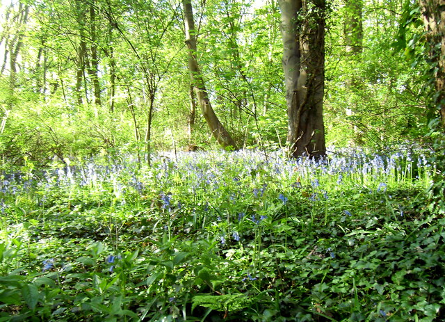
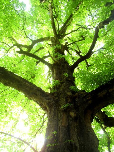
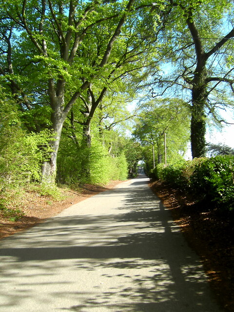
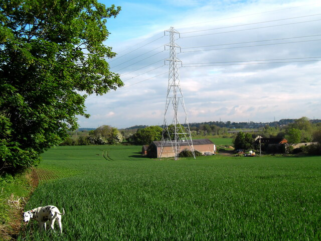
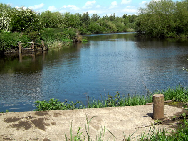
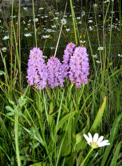
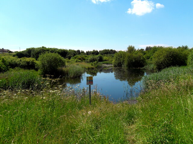
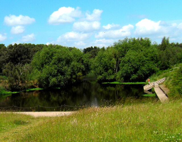
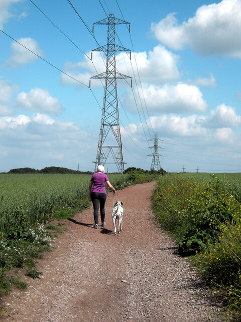
Airedale is known for its picturesque countryside and stunning landscapes. The area is surrounded by rolling hills, moorland, and the beautiful Yorkshire Dales National Park, making it a popular destination for outdoor enthusiasts and nature lovers. The River Aire adds to the charm of the region, with its tranquil waters and riverside walks.

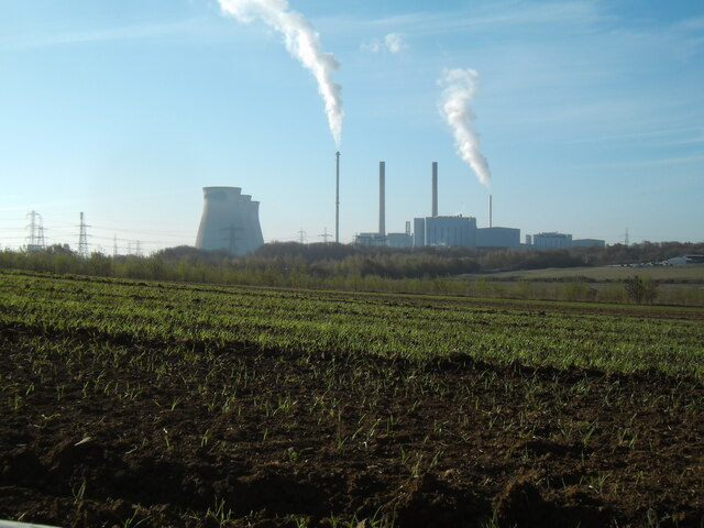
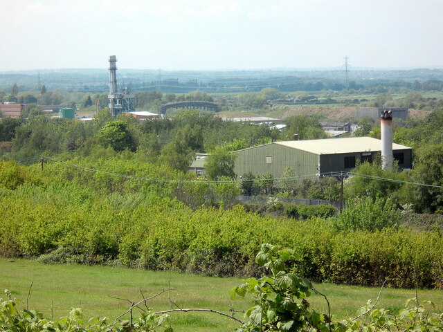
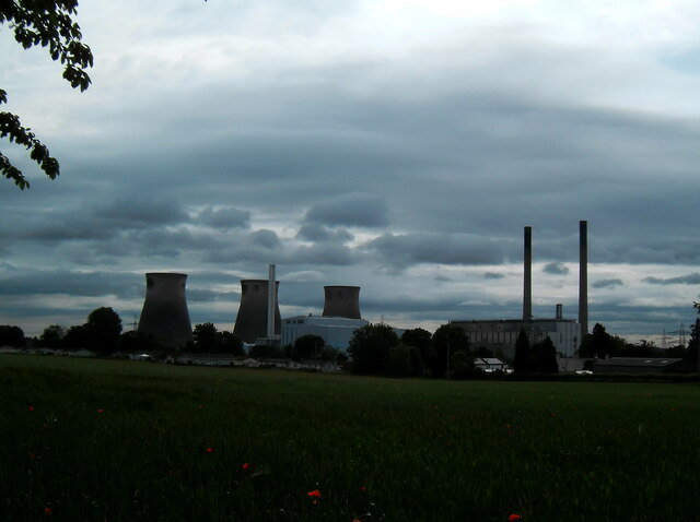
The region has a rich industrial history, particularly in the textile industry. Airedale was once a prominent center for woolen mills and textile manufacturing, playing a significant role in the Industrial Revolution. Today, remnants of this industrial past can still be seen in the form of historic mills and buildings that have been repurposed for modern use.

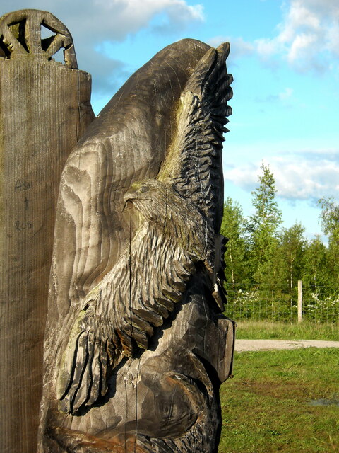
Airedale is also known for its strong sense of community and cultural heritage. The region hosts various events and festivals throughout the year, celebrating local traditions, music, and arts. Additionally, there are numerous historical sites and landmarks to explore, including medieval castles, churches, and museums.

With its combination of natural beauty, historical significance, and vibrant community, Airedale offers a diverse range of attractions, making it an appealing destination for both residents and visitors alike.

If you have any feedback on the listing, please let us know in the comments section below.
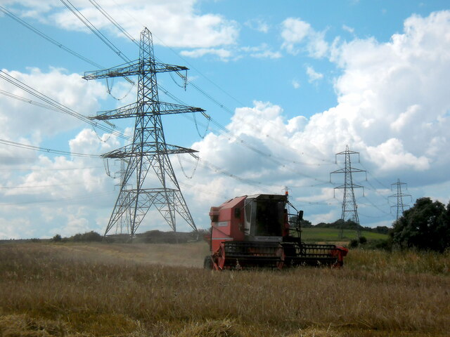
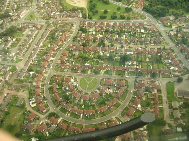
Airedale Images

Images are sourced within 2km of 53.723934/-1.313877 or Grid Reference SE4525. Thanks to Geograph Open Source API. All images are credited.

Multi fuel Power stations Ferrybridge The two new power stations at Ferrybridge and the three remaining cooling towers from the demolished "C" station.
Multi fuel Power stations Ferrybridge
The two new power stations at Ferrybridge and the three remaining cooling towers from the demolished "C" station.
Fryston wood bluebells
The green canopy Light filtering through the leaves and branches of an old horse chestnut tree in Fryston woods.
The green canopy
Light filtering through the leaves and branches of an old horse chestnut tree in Fryston woods.
Fryston Lane
Fryston Lane
Fryston Hall Farm
Fryston Hall Farm
RSPB Wood carving way marker. Fairburn Ings
Site of demolished Wheldale Colliery and demolished Hickson and Welsh chemical works, Castleford Methane from the old colliery working is now used to generate electricity.
Site of demolished Wheldale Colliery and demolished Hickson and Welsh chemical works, Castleford
Methane from the old colliery working is now used to generate electricity.
Course of disused railway line The old railway line that once led over the Iron Bridge towards Allerton Bywater.
Course of disused railway line
The old railway line that once led over the Iron Bridge towards Allerton Bywater.
Ex Wheldale Colliery Stathe and barge loading basin Where the coal was loaded on tom puddings to be transported down the Aire and Calder Navigation for export from Goole.
Ex Wheldale Colliery Stathe and barge loading basin
Where the coal was loaded on tom puddings to be transported down the Aire and Calder Navigation for export from Goole.
Night falls on the power industry
Beetle mania
Beetle mania
Poppy power
Poppy power
Woodland wild flowers
Fryston village fishing pond
Re generated canal basin Aire and Calder navigation Ex Fryston Colliery barge loading staithe / basin given a new lease of life.
Re generated canal basin Aire and Calder navigation
Ex Fryston Colliery barge loading staithe / basin given a new lease of life.
Pylonsand fields  on Wheldale Lane Castleford
Pylonsand fields on Wheldale Lane Castleford
Sunrise over Fryston woods Viewed from my bedroom window.
Sunrise over Fryston woods
Viewed from my bedroom window.
Combining at Holmfield Lane
Show me another place!

Airedale is located at Grid Ref: SE4525 (Lat: 53.723934, Lng: -1.313877)

Division: West Riding

Unitary Authority: Wakefield

Police Authority: West Yorkshire

What 3 Words

///bucked.offers.comic. Near Ferrybridge, West Yorkshire

Nearby Locations

Airedale

Related Wikis

Ferry Fryston

Ferry Fryston is a suburb of the town of Castleford in West Yorkshire, England. It is situated in the metropolitan borough of the City of Wakefield. The...

Airedale Academy

Airedale Academy High School (formerly known as Airedale High School) is a secondary school and sixth form on Crewe Road in a suburb of Castleford in West...

Airedale, Castleford

Airedale is a suburb in the town of Castleford, West Yorkshire, England. It consists mainly of Local Authority Housing. It borders with Ferry Fryston...

Airedale and Ferry Fryston

Airedale and Ferry Fryston is an electoral ward of the City of Wakefield district used for elections to Wakefield Metropolitan District Council. ��2�...

Nearby Amenities

Located within 500m of 53.723934,-1.313877
Bus Stop
Fryston Road Leyland Road
Bus: yes
Local Ref: 45013345
Naptan AtcoCode: 450013345
Naptan Bearing: S
Naptan CommonName: Fryston Road Leyland Road
Naptan Crossing: Nr-At Leyland Road
Naptan Indicator: Stop 45013345
Naptan Landmark: Redhill Junior School
Naptan PlusbusZoneRef: LEEDS
Naptan ShortCommonName: Leyland Road
Naptan Street: Fryston Road
Naptan Verified: no
Public Transport: platform
Source: naptan_import
Lat/Long: 53.7274142/-1.3133175
Bus Stop
Fryston Road Leyland Road
Bus: yes
Local Ref: 45013346
Naptan AtcoCode: 450013346
Naptan Bearing: N
Naptan CommonName: Fryston Road Leyland Road
Naptan Crossing: Leyland Road
Naptan Indicator: Stop 45013346
Naptan PlusbusZoneRef: LEEDS
Naptan ShortCommonName: Leyland Road
Naptan Street: Fryston Road
Naptan Verified: no
Public Transport: platform
Source: naptan_import
Lat/Long: 53.7271176/-1.3133375
Bus Stop
Elizabeth Drive Austin Road
Bus: yes
Local Ref: 45013347
Naptan AtcoCode: 450013347
Naptan Bearing: NE
Naptan CommonName: Elizabeth Drive Austin Road
Naptan Crossing: Austin Road
Naptan Indicator: Stop 45013347
Naptan PlusbusZoneRef: LEEDS
Naptan ShortCommonName: Austin Road
Naptan Street: Elizabeth Drive
Naptan Verified: no
Public Transport: platform
Source: naptan_import
Lat/Long: 53.7249544/-1.3107204
Bus Stop
Elizabeth Drive Lewin Grove
Bus: yes
Local Ref: 45013348
Naptan AtcoCode: 450013348
Naptan Bearing: N
Naptan CommonName: Elizabeth Drive Lewin Grove
Naptan Crossing: Lewin Grove
Naptan Indicator: Stop 45013348
Naptan PlusbusZoneRef: LEEDS
Naptan ShortCommonName: Lewin Grove
Naptan Street: Elizabeth Drive
Naptan Verified: no
Public Transport: platform
Source: naptan_import
Lat/Long: 53.7262515/-1.3096382
Bus Stop
Crewe Road Cromwell Road
Bus: yes
Local Ref: 45013373
Naptan AtcoCode: 450013373
Naptan Bearing: E
Naptan CommonName: Crewe Road Cromwell Road
Naptan Crossing: Cromwell Road
Naptan Indicator: Stop 45013373
Naptan Landmark: Airedale High School
Naptan PlusbusZoneRef: LEEDS
Naptan ShortCommonName: Cromwell Road
Naptan Street: Crewe Road
Naptan Verified: no
Public Transport: platform
Source: naptan_import
Lat/Long: 53.7223171/-1.3100816
Bus Stop
Crewe Road Cromwell Road
Bus: yes
Local Ref: 45013374
Naptan AtcoCode: 450013374
Naptan Bearing: W
Naptan CommonName: Crewe Road Cromwell Road
Naptan Crossing: Cromwell Road
Naptan Indicator: Stop 45013374
Naptan Landmark: Airedale High School
Naptan PlusbusZoneRef: LEEDS
Naptan ShortCommonName: Cromwell Road
Naptan Street: Crewe Road
Naptan Verified: no
Public Transport: platform
Source: naptan_import
Lat/Long: 53.7222328/-1.311068
Bus Stop
Airedale Magnet
Bus: yes
Local Ref: 45013375
Naptan AtcoCode: 450013375
Naptan Bearing: SW
Naptan CommonName: Airedale Magnet
Naptan Crossing: Fryston Road
Naptan Indicator: Stop 45013375
Naptan Landmark: Churchs and Library
Naptan PlusbusZoneRef: LEEDS
Naptan ShortCommonName: Fryston Road
Naptan Street: The Square
Naptan Verified: no
Public Transport: platform
Shelter: yes
Source: naptan_import
Lat/Long: 53.7237577/-1.3144246
Bus Stop
Airedale Magnet
Bus: yes
Local Ref: 45013376
Naptan AtcoCode: 450013376
Naptan Bearing: SW
Naptan CommonName: Airedale Magnet
Naptan Crossing: Fryson Road
Naptan Indicator: Stop 45013376
Naptan Landmark: Churchs and Library
Naptan PlusbusZoneRef: LEEDS
Naptan ShortCommonName: Fryston Road
Naptan Street: The Square
Naptan Verified: no
Public Transport: platform
Source: naptan_import
Lat/Long: 53.7236308/-1.3146714
Bus Stop
Fryston Road Park Crescent
Bus: yes
Local Ref: 45013377
Naptan AtcoCode: 450013377
Naptan Bearing: SW
Naptan CommonName: Fryston Road Park Crescent
Naptan Crossing: Park Crescent
Naptan Indicator: Stop 45013377
Naptan Landmark: Airedale Junior School
Naptan PlusbusZoneRef: LEEDS
Naptan ShortCommonName: Park Crescent
Naptan Street: Fryston Road
Naptan Verified: no
Public Transport: platform
Source: naptan_import
Lat/Long: 53.7226628/-1.3170928
Bus Stop
Queens Park Drive Stansfield Road
Bus: yes
Local Ref: 45013390
Naptan AtcoCode: 450013390
Naptan Bearing: E
Naptan CommonName: Queens Park Drive Stansfield Road
Naptan Crossing: Stansfield Road
Naptan Indicator: Stop 45013390
Naptan Landmark: School
Naptan PlusbusZoneRef: LEEDS
Naptan ShortCommonName: Stansfield Road
Naptan Street: Queen-s Park Drive
Naptan Verified: no
Public Transport: platform
Source: naptan_import
Lat/Long: 53.7248171/-1.3181492
Bus Stop
Queens Park Drive Stansfield Drive
Bus: yes
Local Ref: 45013391
Naptan AtcoCode: 450013391
Naptan Bearing: W
Naptan CommonName: Queens Park Drive Stansfield Drive
Naptan Crossing: Stansfield Drive
Naptan Indicator: Stop 45013391
Naptan Landmark: Airedale Commercial Business Centre
Naptan PlusbusZoneRef: LEEDS
Naptan ShortCommonName: Stansfield Drive
Naptan Street: Queen-s Park Drive
Naptan Verified: no
Public Transport: platform
Source: naptan_import
Lat/Long: 53.7246543/-1.3195613
Bus Stop
Stansfield Road Royds Avenue
Bus: yes
Local Ref: 45013399
Naptan AtcoCode: 450013399
Naptan Bearing: N
Naptan CommonName: Stansfield Road Royds Avenue
Naptan Crossing: Royds Avenue
Naptan Indicator: Stop 45013399
Naptan Landmark: School
Naptan PlusbusZoneRef: LEEDS
Naptan ShortCommonName: Royds Avenue
Naptan Street: Stansfield Road
Naptan Verified: no
Public Transport: platform
Source: naptan_import
Lat/Long: 53.7255953/-1.3190611
Bus Stop
Stansfield Road Stansfield Drive
Bus: yes
Local Ref: 45013400
Naptan AtcoCode: 450013400
Naptan Bearing: S
Naptan CommonName: Stansfield Road Stansfield Drive
Naptan Crossing: Stansfield Drive
Naptan Indicator: Stop 45013400
Naptan PlusbusZoneRef: LEEDS
Naptan ShortCommonName: Stansfield Drive
Naptan Street: Stansfield Road
Naptan Verified: no
Public Transport: platform
Source: naptan_import
Lat/Long: 53.7263418/-1.31914
Bus Stop
Elizabeth Drive Austin Road
Bus: yes
Local Ref: 45023841
Naptan AtcoCode: 450023841
Naptan Bearing: SW
Naptan CommonName: Elizabeth Drive Austin Road
Naptan Crossing: Austin Road
Naptan Indicator: Stop 45023841
Naptan PlusbusZoneRef: LEEDS
Naptan ShortCommonName: Austin Road
Naptan Street: Elizabeth Drive
Naptan Verified: no
Public Transport: platform
Shelter: no
Source: naptan_import
Lat/Long: 53.7248643/-1.3106916
Bus Stop
Fryston Road Kershaw Avenue
Bus: yes
Naptan AtcoCode: 450029011
Naptan Bearing: NE
Naptan CommonName: Fryston Road Kershaw Avenue
Naptan Crossing: Kershaw Avenue
Naptan Landmark: Unknown
Naptan ShortCommonName: Kershaw Avenue
Naptan Street: Fryston Road
Naptan Verified: no
Public Transport: platform
Source: naptan_import
Lat/Long: 53.7227358/-1.3172735
Bus Stop
Elizabeth Drive Shop
Bus: yes
Local Ref: 45050119
Naptan AtcoCode: 450050119
Naptan Bearing: S
Naptan BusStopType: CUS
Naptan CommonName: Elizabeth Drive Shop
Naptan Indicator: Stop 45050119
Naptan PlusbusZoneRef: LEEDS
Naptan ShortCommonName: The Green
Naptan Street: Elizabeth Drive
Naptan Verified: no
Public Transport: platform
Source: naptan_import
Lat/Long: 53.7262507/-1.3095018
Airedale
Is In: Castleford, Wakefield, West Yorkshire, UK
Place: suburb
Wikidata: Q4698660
Wikipedia: en:Airedale, Castleford
Lat/Long: 53.722982/-1.3145504
Your Local
Addr City: Castleford
Addr Housenumber: 45-47
Addr Postcode: WF10 3SE
Addr Street: Elizabeth Drive
Addr Suburb: Airedale
Shop: convenience
Lat/Long: 53.7264408/-1.3098483
Traffic Calming: choker
Lat/Long: 53.7277561/-1.3135601
Co-op Food
Addr City: Castleford
Addr Housenumber: 15-17
Addr Postcode: WF10 3JJ
Addr Street: The Square
Addr Suburb: Airedale
Brand: Co-op Food
Brand Wikidata: Q3277439
Brand Wikipedia: en:Co-op Food
Fhrs Id: 283888
Operator: The Co-operative Group
Shop: supermarket
Lat/Long: 53.7234755/-1.3148616
Pharmacy
Lloyds Pharmacy
Brand: Lloyds Pharmacy
Brand Wikidata: Q6662870
Brand Wikipedia: en:LloydsPharmacy
Healthcare: pharmacy
Lat/Long: 53.7232676/-1.3152988
Bicycle Parking
Bicycle Parking: stands
Capacity: 8
Covered: no
Lat/Long: 53.7237105/-1.3159078
Post Box
Check Date: 2021-04-22
Operator: Royal Mail
Post Box Type: pillar
Ref: WF10 326
Royal Cypher: EIIR
Royal Cypher Wikidata: Q33102113
Lat/Long: 53.7239243/-1.3141945
Post Box
Operator: Royal Mail
Post Box Type: pillar
Ref: WF10 339
Lat/Long: 53.7267174/-1.3097662
Fast Food
Fishy Dish
Addr City: Castleford
Addr Housenumber: 30
Addr Postcode: WF10 3SG
Addr Street: Leyland Road
Addr Suburb: Airedale
Cuisine: fish_and_chips
Fhrs Id: 1260796
Takeaway: yes
Lat/Long: 53.726673/-1.3103168
Fast Food
Airedale Fisheries
Addr City: Castleford
Addr Housenumber: 23
Addr Postcode: WF10 3JJ
Addr Street: The Square
Addr Suburb: Airedale
Cuisine: fish_and_chips
Fhrs Id: 1151079
Takeaway: yes
Lat/Long: 53.7232991/-1.315193
Mr News And Booze
Addr City: Castleford
Addr Housenumber: 19
Addr Postcode: WF10 3JJ
Addr Street: The Square
Addr Suburb: Airedale
Brand: Premier
Brand Wikidata: Q7240340
Brand Wikipedia: en:Premier Stores
Fhrs Id: 314082
Shop: convenience
Website: https://www.premier-stores.co.uk/our-stores/mr-news-booze
Lat/Long: 53.7233856/-1.315016
Fast Food
Sizzlers v Pronto
Addr City: Castleford
Addr Housenumber: 1
Addr Postcode: WF10 3JJ
Addr Street: The Square
Addr Suburb: Airedale
Cuisine: indian;pizza
Fhrs Id: 1228956
Old Name: Pronto Pizza/Kings Balti
Takeaway: yes
Lat/Long: 53.7238506/-1.3141644
Cafe
Michelles Cafe
Addr City: Castleford
Addr Housenumber: 3-4
Addr Postcode: WF10 3JJ
Addr Street: The Square
Addr Suburb: Airedale
Fhrs Id: 1037627
Lat/Long: 53.7238042/-1.3142489
Fast Food
Greggs
Addr City: Castleford
Addr Housenumber: 9
Addr Postcode: WF10 3JJ
Addr Street: The Square
Addr Suburb: Airedale
Brand: Greggs
Brand Wikidata: Q3403981
Brand Wikipedia: en:Greggs
Contact Website: https://www.greggs.co.uk/shop-finder?shop-code=1418
Cuisine: sandwich;bakery
Diet Vegan: yes
Fhrs Id: 283691
Takeaway: yes
Lat/Long: 53.7236514/-1.3145359
Fast Food
Pizza Hut Delivery
Addr City: Castleford
Addr Housenumber: 7
Addr Postcode: WF10 3JJ
Addr Street: The Square
Addr Suburb: Airedale
Brand: Pizza Hut Delivery
Brand Wikidata: Q107293079
Brand Wikipedia: en:Pizza Hut
Cuisine: pizza
Fhrs Id: 740847
Takeaway: yes
Lat/Long: 53.7237153/-1.3144212
Fast Food
Orient Delight
Addr City: Castleford
Addr Housenumber: 5
Addr Postcode: WF10 3JJ
Addr Street: The Square
Addr Suburb: Airedale
Cuisine: chinese
Fhrs Id: 283689
Takeaway: yes
Lat/Long: 53.723755/-1.3143441
Childcare
Bright Sparks Childcare
Addr City: Castleford
Addr Housename: The Crown
Addr Postcode: WF10 3RW
Addr Street: Elizabeth Drive
Addr Suburb: Airedale
Fhrs Id: 679927
Lat/Long: 53.7271395/-1.3099962
Cafe
Snack & Chat
Addr City: Castleford
Addr Housename: Airedale Library And Learning Centre
Addr Postcode: WF10 3JJ
Addr Street: The Square
Addr Suburb: Airedale
Fhrs Id: 812067
Lat/Long: 53.7238085/-1.3160956
Childcare
Bright Sparks Child Care
Addr City: Castleford
Addr Housename: Townville Infants School
Addr Postcode: WF10 3QJ
Addr Street: Poplar Avenue
Addr Suburb: Airedale
Fhrs Id: 284934
Lat/Long: 53.7214026/-1.3150093
Fast Food
Bake 'N' Sarnie
Addr City: Castleford
Addr Housenumber: 40
Addr Postcode: WF10 3SG
Addr Street: Leyland Road
Addr Suburb: Airedale
Cuisine: sandwich
Fhrs Id: 1170828
Takeaway: yes
Lat/Long: 53.7266444/-1.3099841
Phelans
Addr City: Castleford
Addr Housenumber: 34
Addr Postcode: WF10 3SG
Addr Street: Leyland Road
Addr Suburb: Airedale
Fhrs Id: 314335
Shop: convenience
Lat/Long: 53.726673/-1.3102316
Cafe
Addr City: Castleford
Addr Housename: The Hut
Addr Postcode: WF10 3ES
Addr Street: Kershaw Avenue
Addr Suburb: Airedale
Lat/Long: 53.7236594/-1.3200679
Fast Food
Pizza Time
Addr City: Castleford
Addr Housenumber: 55
Addr Postcode: WF10 3SE
Addr Street: Elizabeth Drive
Addr Suburb: Airedale
Cuisine: pizza
Fhrs Id: 1251415
Old Name: Krunchy Chicken
Takeaway: yes
Lat/Long: 53.7266048/-1.3099131
Doctors
Fryston Surgery
Healthcare: doctor
Lat/Long: 53.72522/-1.3142353
Traffic Signals
Crossing Ref: pelican
Mapillary: 4203814279670902
Tactile Paving: yes
Traffic Signals: pedestrian_crossing
Traffic Signals Direction: both
Lat/Long: 53.7219398/-1.3185013
Entrance: yes
Lat/Long: 53.7251939/-1.3140479
Entrance: yes
Lat/Long: 53.7242394/-1.3147351
Dentist
Airedale Dental Practice
Healthcare: dentist
Lat/Long: 53.7230202/-1.3156151
Barrier: bollard
Bollard: fixed
Colour: black
Material: metal
Lat/Long: 53.7235701/-1.3152635
Barrier: bollard
Bollard: fixed
Colour: black
Material: metal
Lat/Long: 53.7235778/-1.3152296
Barrier: bollard
Bollard: fixed
Colour: black
Material: metal
Lat/Long: 53.7235858/-1.3152004
Barrier: bollard
Bollard: fixed
Colour: black
Material: metal
Lat/Long: 53.7235927/-1.3151643
Telephone
Booth: KX100
Covered: booth
Fee: yes
Operator: bt
Lat/Long: 53.7234216/-1.3151549
Betfred
Brand: Betfred
Brand Wikidata: Q4897425
Brand Wikipedia: en:Betfred
Shop: bookmaker
Lat/Long: 53.7233408/-1.3151311
William Hill
Brand: William Hill
Brand Wikidata: Q4053147
Brand Wikipedia: en:William Hill (bookmaker)
Shop: bookmaker
Lat/Long: 53.7235495/-1.3147646
Vaparama
Shop: e-cigarette
Lat/Long: 53.723612/-1.3146402
Tan & Hair
Shop: hairdresser
Lat/Long: 53.7236835/-1.3144674
Barrier: bollard
Bollard: fixed
Colour: black
Material: metal
Lat/Long: 53.723598/-1.3151309
Barrier: bollard
Bollard: fixed
Colour: black
Material: metal
Lat/Long: 53.7236032/-1.3150893
Barrier: bollard
Bollard: fixed
Colour: black
Material: metal
Lat/Long: 53.723605/-1.3150567
Barrier: bollard
Bollard: fixed
Colour: black
Material: metal
Lat/Long: 53.723604/-1.3150205
Barrier: bollard
Bollard: fixed
Colour: black
Material: metal
Lat/Long: 53.7236067/-1.3149906
Barrier: bollard
Bollard: fixed
Colour: black
Material: metal
Lat/Long: 53.7236078/-1.3149577
Barrier: bollard
Bollard: fixed
Colour: black
Material: metal
Lat/Long: 53.7236062/-1.3149205
Barrier: bollard
Bollard: fixed
Colour: black
Material: metal
Lat/Long: 53.7236042/-1.3148865
Barrier: bollard
Bollard: fixed
Colour: black
Material: metal
Lat/Long: 53.723588/-1.3148957
Barrier: bollard
Bollard: fixed
Colour: black
Material: metal
Lat/Long: 53.7234138/-1.315578
Barrier: bollard
Bollard: fixed
Colour: black
Material: metal
Lat/Long: 53.723398/-1.3155751
Barrier: bollard
Bollard: fixed
Colour: black
Material: metal
Lat/Long: 53.723388/-1.3155701
Barrier: bollard
Bollard: fixed
Colour: black
Material: metal
Lat/Long: 53.7232991/-1.3154169
Barrier: bollard
Bollard: fixed
Colour: black
Material: metal
Lat/Long: 53.7232865/-1.315387
Bench
Backrest: no
Colour: black
Material: metal
Lat/Long: 53.7234249/-1.3152414
Bench
Backrest: no
Colour: black
Material: metal
Lat/Long: 53.7233861/-1.3152702
Bench
Backrest: no
Colour: black
Material: metal
Lat/Long: 53.7233636/-1.3153189
Bench
Backrest: no
Colour: black
Material: metal
Lat/Long: 53.723436/-1.3154493
Bench
Backrest: no
Colour: black
Material: metal
Lat/Long: 53.7234683/-1.3154186
Bench
Backrest: no
Colour: black
Material: metal
Lat/Long: 53.723523/-1.3151096
Waste Basket
Lat/Long: 53.7234605/-1.3154372
Waste Basket
Lat/Long: 53.7234312/-1.3151338
Barrier: bollard
Bollard: fixed
Colour: black
Material: metal
Lat/Long: 53.7235224/-1.3153911
Bicycle Parking
Bicycle Parking: stands
Lat/Long: 53.7270629/-1.315422
Access: private
Barrier: lift_gate
Lat/Long: 53.7267148/-1.3156304
Barrier: lift_gate
Lat/Long: 53.7208985/-1.3142636
Fuel
Leyland Service Station
Addr City: Castleford
Addr Postcode: WF10 3SG
Addr Street: Leyland Road
Addr Suburb: Airedale
Brand: Texaco
Brand Wikidata: Q775060
Brand Wikipedia: en:Texaco
Fuel Diesel: yes
Fuel Petrol: yes
Website: https://locations.valero.com/en-us/LocationDetails/Index/LEYLAND-ROAD/0000887290
Lat/Long: 53.7266849/-1.3108462
The data included in this document is from www.openstreetmap.org. The data is made available under ODbL.

Have you been to Airedale?

Leave your review of Airedale below (or comments, questions and feedback).