Truas

Settlement in Cornwall

England

Truas

Trewethern Mill, Rocky Valley Looking up the woodland section of Rocky Valley with the ruins of Trewethern Mill on the left. Behind this mill are some ancient Celtic rock carvings.
Trewethern Mill, Rocky Valley Credit: Rob Farrow

Truas is a small town located in the county of Cornwall, situated in the southwestern part of England. It is nestled in a picturesque landscape, surrounded by rolling hills and breathtaking coastal views. With a population of around 3,000 residents, Truas maintains a tight-knit community atmosphere.

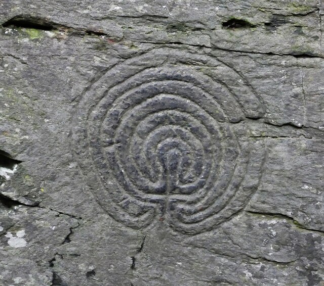
The town's history dates back centuries, with evidence of human settlement in the area since the Neolithic period. Truas has witnessed various influences throughout its past, including Roman occupation and the presence of Celtic tribes. These historical roots are still visible today, with traces of ancient ruins and monuments scattered throughout the town.

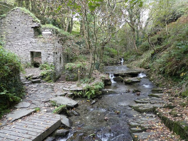
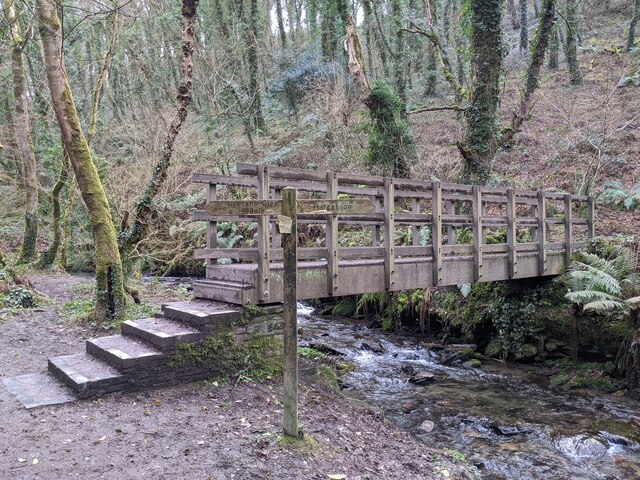
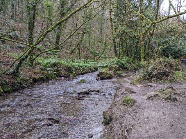
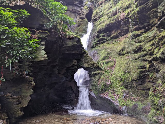
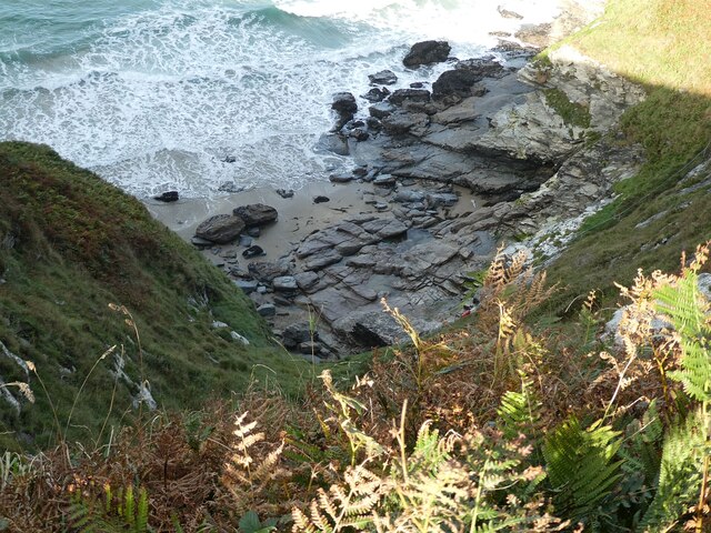
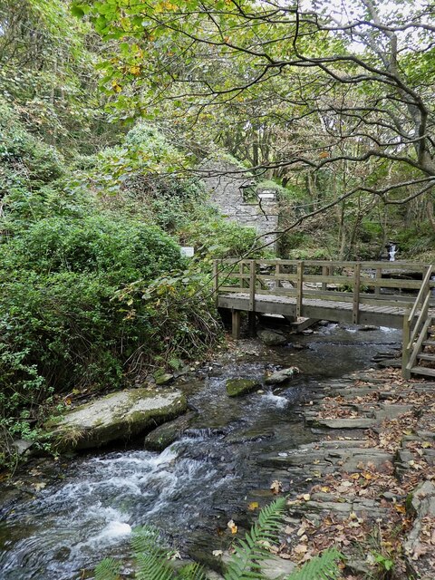
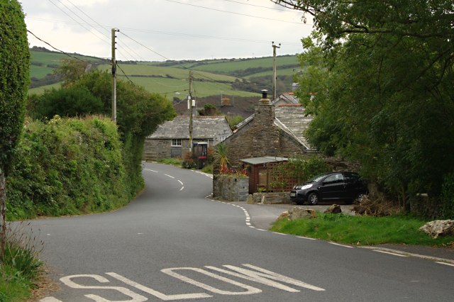
Truas is renowned for its natural beauty, attracting visitors from near and far. The coastal scenery is particularly enchanting, with rugged cliffs, sandy beaches, and clear turquoise waters. The town's beach is a popular spot for sunbathing, swimming, and various water sports activities.

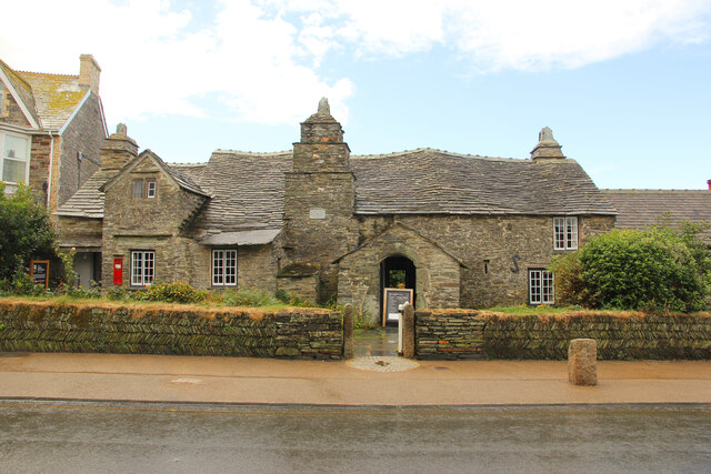
The town center of Truas is quaint and charming, characterized by narrow streets lined with traditional Cornish cottages. It boasts a range of local businesses, including cozy cafes, family-run shops, and traditional pubs serving local delicacies. Truas also hosts a weekly market, where residents and visitors can purchase fresh produce, handmade crafts, and other local goods.

For those with an interest in history and culture, Truas offers several attractions. The Truas Museum showcases artifacts and exhibits that highlight the town's heritage, while the nearby Truas Castle offers panoramic views of the surrounding countryside.

Overall, Truas is a captivating destination that combines natural beauty, historical significance, and a warm community spirit. It is a hidden gem in Cornwall, inviting visitors to explore its treasures and experience the unique charm of this small, coastal town.

If you have any feedback on the listing, please let us know in the comments section below.
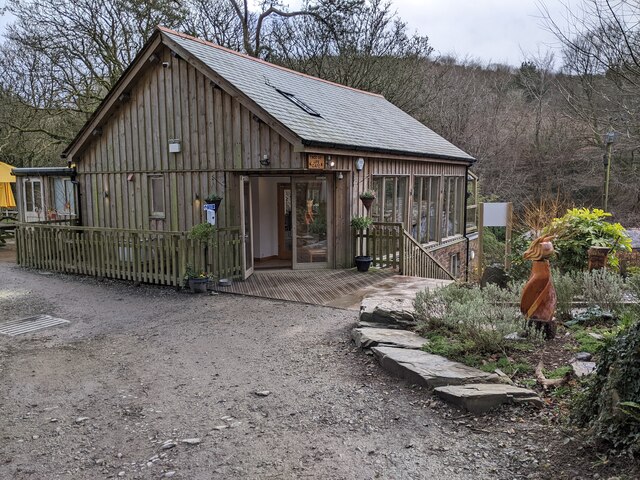
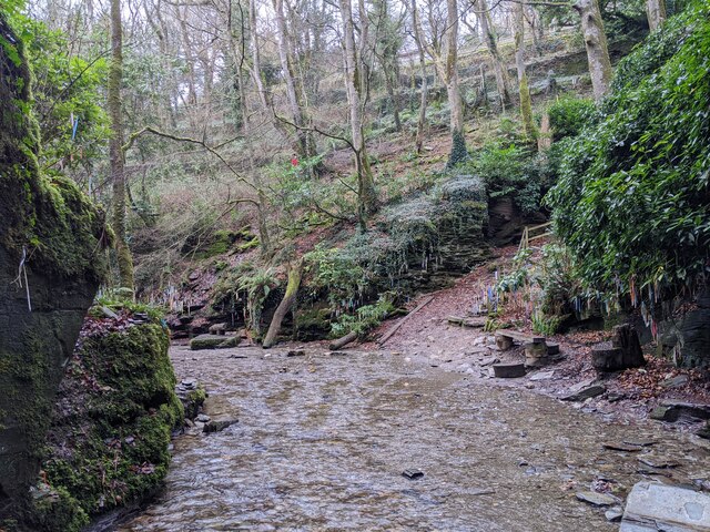
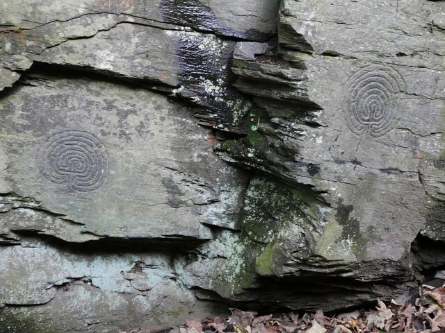
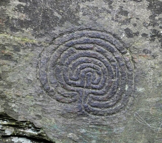
Truas Images

Images are sourced within 2km of 50.654309/-4.733219 or Grid Reference SX0687. Thanks to Geograph Open Source API. All images are credited.

Trewethern Mill, Rocky Valley Looking up the woodland section of Rocky Valley with the ruins of Trewethern Mill on the left. Behind this mill are some ancient Celtic rock carvings.
Trewethern Mill, Rocky Valley
Looking up the woodland section of Rocky Valley with the ruins of Trewethern Mill on the left. Behind this mill are some ancient Celtic rock carvings.
Cut Benchmark Trebarwith Farm Outbuilding CUT BENCHMARK OUTBLDG TREBARWITH FM 0.1M N ANG NW FACE SE SIDE RD Over Datum Newlyn: 105.998m - Above ground Level 0.8m - Last verified 1974
<span class="nowrap"><a title="https://www.bench-marks.org.uk/bm157313" rel="nofollow ugc noopener" href="https://www.bench-marks.org.uk/bm157313">Link</a><img style="margin-left:2px;" alt="External link" title="External link - shift click to open in new window" src="https://s1.geograph.org.uk/img/external.png" width="10" height="10"/></span>
Cut Benchmark Trebarwith Farm Outbuilding
CUT BENCHMARK OUTBLDG TREBARWITH FM 0.1M N ANG NW FACE SE SIDE RD Over Datum Newlyn: 105.998m - Above ground Level 0.8m - Last verified 1974 LinkExternal link
Benchmark Trebarwith Farm CUT BENCHMARK OUTBLDG TREBARWITH FM 0.1M N ANG NW FACE SE SIDE RD Over Datum Newlyn = 105.998m - Last verified 1974 - Above Ground Level 0.8m
<span class="nowrap"><a title="https://www.bench-marks.org.uk/bm157313" rel="nofollow ugc noopener" href="https://www.bench-marks.org.uk/bm157313">Link</a><img style="margin-left:2px;" alt="External link" title="External link - shift click to open in new window" src="https://s1.geograph.org.uk/img/external.png" width="10" height="10"/></span>
Benchmark Trebarwith Farm
CUT BENCHMARK OUTBLDG TREBARWITH FM 0.1M N ANG NW FACE SE SIDE RD Over Datum Newlyn = 105.998m - Last verified 1974 - Above Ground Level 0.8m LinkExternal link
St Piran church, Parish of Tintagel
Parking area for walking to St Nectan's Glen
Footpath and bridge between St Nectan's Glen and Halgabron
Stream in Rocky Valley near St Nectan's Glen and Halgabron
Waterfall at St Nectan's Kieve
Garden building at St Nectan's Glen
Cafe at St Nectan's Glen
Stream at St Nectan's Kieve and lots of clooties hanging from trees
Rocky Valley Ancient Rock Carvings The two maze-like rock carvings seen here are to the rear of <a href="https://www.geograph.org.uk/photo/6981852">SX0789 : Trewethern Mill, Rocky Valley</a> to the east of Tintagel.
According to a rather worn metal plaque at the site they are "Labyrinth pattern carvings probably of the early Bronze Age 1800-1400BC"
The only problem with that being that as the Bronze Age spanned c.3300BC to c.600BC, they would actually be mid to late Bronze Age if the dates are correct.
Note however that the EH Ancient Monument listing <span class="nowrap"><a title="https://historicengland.org.uk/listing/the-list/list-entry/1004620?section=official-list-entry" rel="nofollow ugc noopener" href="https://historicengland.org.uk/listing/the-list/list-entry/1004620?section=official-list-entry">Link</a><img style="margin-left:2px;" alt="External link" title="External link - shift click to open in new window" src="https://s1.geograph.org.uk/img/external.png" width="10" height="10"/></span> states "However, such labyrinths are not exclusively prehistoric, and they became popular in Christian symbolism during the medieval period and later were used in secular contexts."
We will probably never know!
For closer views of the two carvings see:
<a href="https://www.geograph.org.uk/photo/7177389">SX0789 : Rocky Valley Ancient Rock Carving - Left</a>
<a href="https://www.geograph.org.uk/photo/7177390">SX0789 : Rocky Valley Ancient Rock Carving - Right</a>
Rocky Valley Ancient Rock Carvings
The two maze-like rock carvings seen here are to the rear of SX0789 : Trewethern Mill, Rocky Valley to the east of Tintagel. According to a rather worn metal plaque at the site they are "Labyrinth pattern carvings probably of the early Bronze Age 1800-1400BC" The only problem with that being that as the Bronze Age spanned c.3300BC to c.600BC, they would actually be mid to late Bronze Age if the dates are correct. Note however that the EH Ancient Monument listing LinkExternal link states "However, such labyrinths are not exclusively prehistoric, and they became popular in Christian symbolism during the medieval period and later were used in secular contexts." We will probably never know! For closer views of the two carvings see: SX0789 : Rocky Valley Ancient Rock Carving - Left SX0789 : Rocky Valley Ancient Rock Carving - Right
Rocky Valley Ancient Rock Carving - Left The left-hand of the two ancient labyrinthine rock carvings seen together in <a href="https://www.geograph.org.uk/photo/7177387">SX0789 : Rocky Valley Ancient Rock Carvings</a>
See that image for more information, and for its companion see <a href="https://www.geograph.org.uk/photo/7177390">SX0789 : Rocky Valley Ancient Rock Carving - Right</a>
Note that at first sight these left and right-hand images may seem identical, this left-hand one differs (a) in that the base lobe on the right descends below that on the left and (b) the central spike is more 'squashed' (i.e. not as tall) than its companion.
Rocky Valley Ancient Rock Carving - Left
The left-hand of the two ancient labyrinthine rock carvings seen together in SX0789 : Rocky Valley Ancient Rock Carvings See that image for more information, and for its companion see SX0789 : Rocky Valley Ancient Rock Carving - Right Note that at first sight these left and right-hand images may seem identical, this left-hand one differs (a) in that the base lobe on the right descends below that on the left and (b) the central spike is more 'squashed' (i.e. not as tall) than its companion.
Rocky Valley Ancient Rock Carving - Right The right-hand of the two ancient labyrinthine rock carvings seen together in <a href="https://www.geograph.org.uk/photo/7177387">SX0789 : Rocky Valley Ancient Rock Carvings</a>
See that image for more information, and for its companion see <a href="https://www.geograph.org.uk/photo/7177389">SX0789 : Rocky Valley Ancient Rock Carving - Left</a>
See the notes on the 'Left' symbol for comments as to how they vary.
Rocky Valley Ancient Rock Carving - Right
The right-hand of the two ancient labyrinthine rock carvings seen together in SX0789 : Rocky Valley Ancient Rock Carvings See that image for more information, and for its companion see SX0789 : Rocky Valley Ancient Rock Carving - Left See the notes on the 'Left' symbol for comments as to how they vary.
Rocky cove near Bossiney The highly indented north Cornish coast has many such little coves and inlets as this one.
Rocky cove near Bossiney
The highly indented north Cornish coast has many such little coves and inlets as this one.
Rocky Valley - Bridge at Trewethern Mill The path along this apparently unnamed stream crosses from the western to the eastern bank here just before <a href="https://www.geograph.org.uk/photo/6981852">SX0789 : Trewethern Mill, Rocky Valley</a>
Rocky Valley - Bridge at Trewethern Mill
The path along this apparently unnamed stream crosses from the western to the eastern bank here just before SX0789 : Trewethern Mill, Rocky Valley
Rocky Valley - Trevillett Mill grounds Trevillett Mill is towards the southern end of Rocky Valley as it approaches the B3266.
The mill itself can only just be glimpsed among the branches and leaves of the trees in its grounds - if you look closely you should be able to see its waterwheel however.
Rocky Valley - Trevillett Mill grounds
Trevillett Mill is towards the southern end of Rocky Valley as it approaches the B3266. The mill itself can only just be glimpsed among the branches and leaves of the trees in its grounds - if you look closely you should be able to see its waterwheel however.
The Old Post Office Grade I listed, 15th century former Cornish Longhouse with an open hall, parlour and solar to the SE and a screens passage to a service wing to the NW. In the care of The National Trust since 1903.
The Old Post Office
Grade I listed, 15th century former Cornish Longhouse with an open hall, parlour and solar to the SE and a screens passage to a service wing to the NW. In the care of The National Trust since 1903.
Show me another place!

Truas is located at Grid Ref: SX0687 (Lat: 50.654309, Lng: -4.733219)

Unitary Authority: Cornwall

Police Authority: Devon and Cornwall

What 3 Words

///chestnuts.flopped.bliss. Near Tintagel, Cornwall

Related Wikis

Trenale

Trenale is a hamlet in north Cornwall, England, United Kingdom. It is located within the civil parish of Tintagel, to the south-east of Tintagel village...

Trewarmett

Trewarmett (Cornish: Trewerman) is a small hamlet in Cornwall, England, United Kingdom. It lies within the civil parish of Tintagel, 3 miles (5 km) north...

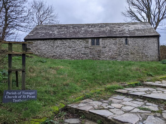
St Paul's Church, Tintagel

The Catholic Church of St Paul the Apostle, in Bossiney Road, Tintagel, Cornwall, England, UK, was built in 1967 and consecrated by the Bishop of Plymouth...

Halgabron

Halgabron (pronounced: Halgáybron; Cornish: Halgigbran, meaning marsh of the carrion-crow) is a hamlet in the parish of Tintagel, Cornwall, England. Halgabron...

Nearby Amenities

Located within 500m of 50.654309,-4.733219
Downrow
Place: hamlet
Lat/Long: 50.6569374/-4.7326987
Barrier: stile
Lat/Long: 50.6587733/-4.7338466
Barrier: stile
Lat/Long: 50.6575053/-4.7351706
Barrier: stile
Lat/Long: 50.6574406/-4.7352156
Barrier: stile
Lat/Long: 50.6561186/-4.737944
Barrier: stile
Lat/Long: 50.6569055/-4.7362255
Power: pole
Lat/Long: 50.650645/-4.7306241
Power: pole
Lat/Long: 50.6511297/-4.7314006
Power: pole
Lat/Long: 50.6516841/-4.7323273
Power: pole
Lat/Long: 50.6521441/-4.7330126
Power: pole
Lat/Long: 50.657465/-4.7299415
Power: pole
Lat/Long: 50.6564821/-4.7299737
Power: pole
Lat/Long: 50.65537/-4.7306818
Power: pole
Lat/Long: 50.6539373/-4.7315548
Power: pole
Lat/Long: 50.6528082/-4.7322616
Power: pole
Lat/Long: 50.6516577/-4.7323984
Power: pole
Lat/Long: 50.6499656/-4.732562
Power: pole
Lat/Long: 50.6520173/-4.7339065
Power: pole
Lat/Long: 50.6517678/-4.7352812
Power: pole
Lat/Long: 50.6510853/-4.7362642
Menadue Cottage
Place: isolated_dwelling
Lat/Long: 50.6503865/-4.7306295
Lower Menadue
Place: isolated_dwelling
Lat/Long: 50.6512948/-4.7338297
Kilcummer Stables
Place: isolated_dwelling
Lat/Long: 50.6513741/-4.7374845
The data included in this document is from www.openstreetmap.org. The data is made available under ODbL.

Have you been to Truas?

Leave your review of Truas below (or comments, questions and feedback).