Troed-y-rhiw-Sion

Settlement in Cardiganshire

Wales

Troed-y-rhiw-Sion

Redevelopment near Adpar This old place has seen better days and redevelopment has started but might have been suspended for some reason.
Redevelopment near Adpar Credit: Jeremy Bolwell

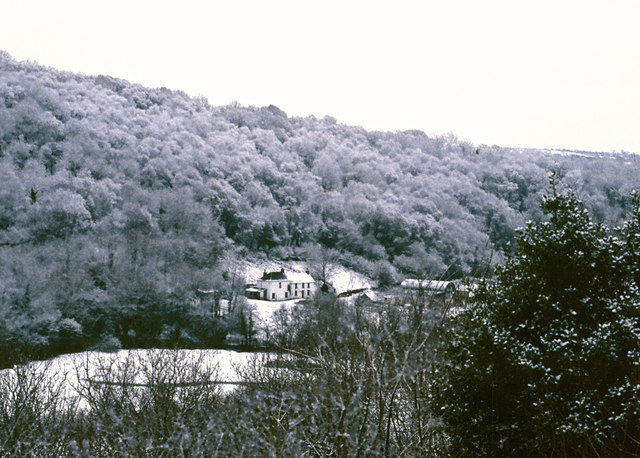
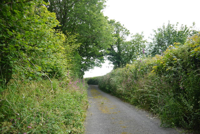
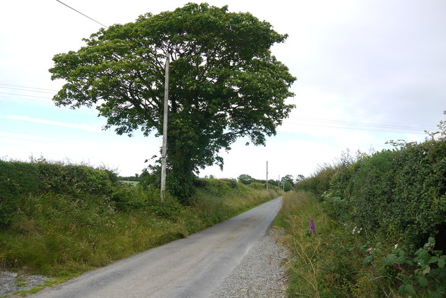
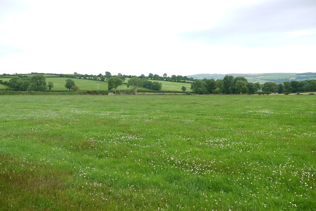
Troed-y-rhiw-Sion is a small village located in the county of Cardiganshire, Wales. Situated in the picturesque Cambrian Mountains, it is surrounded by stunning natural beauty, with lush green valleys and rolling hills as far as the eye can see. The village is nestled on the banks of the River Teifi, which adds to its charm and tranquility.

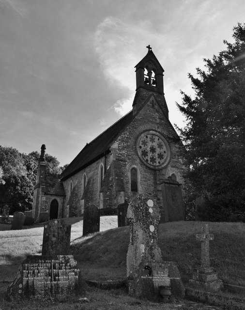
With a population of around 200 residents, Troed-y-rhiw-Sion is a tight-knit community where everyone knows one another. The village is characterized by its traditional stone houses, some of which date back several centuries, showcasing the area's rich history. The village church, St. David's, is another notable landmark, providing a glimpse into the village's religious heritage.

Despite its small size, Troed-y-rhiw-Sion offers a range of amenities for its residents. The village has a local pub, The Teifi Arms, where locals and visitors alike can enjoy a drink and a hearty meal. There is also a small village shop, providing essential groceries and supplies.

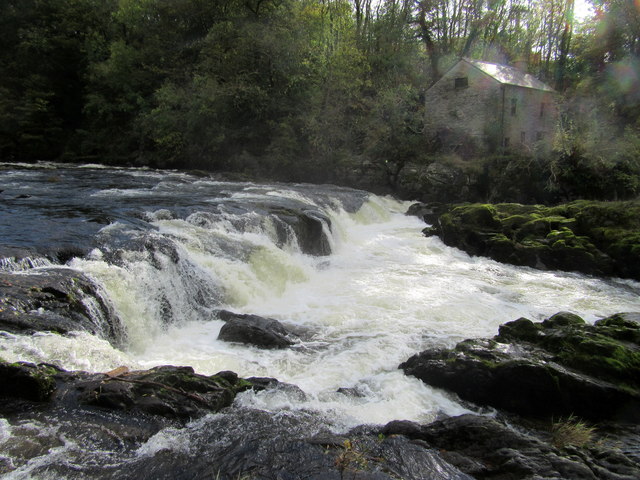
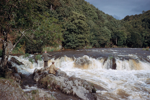
For outdoor enthusiasts, Troed-y-rhiw-Sion is a paradise. The village is surrounded by numerous walking trails and hiking paths, offering breathtaking views of the surrounding countryside. The River Teifi is a popular spot for fishing, attracting anglers from far and wide.

Overall, Troed-y-rhiw-Sion is a charming and idyllic village in Cardiganshire, offering a peaceful retreat for those seeking a slower pace of life and a deep connection with nature.

If you have any feedback on the listing, please let us know in the comments section below.

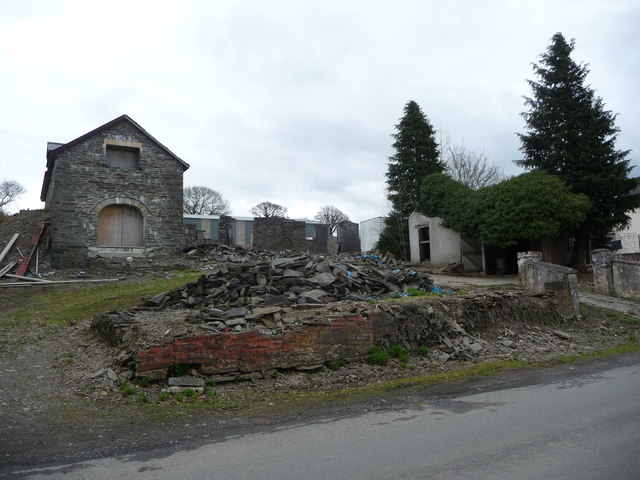
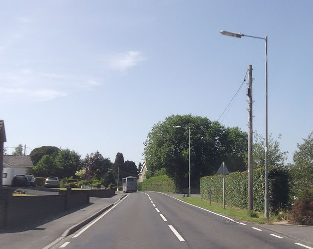
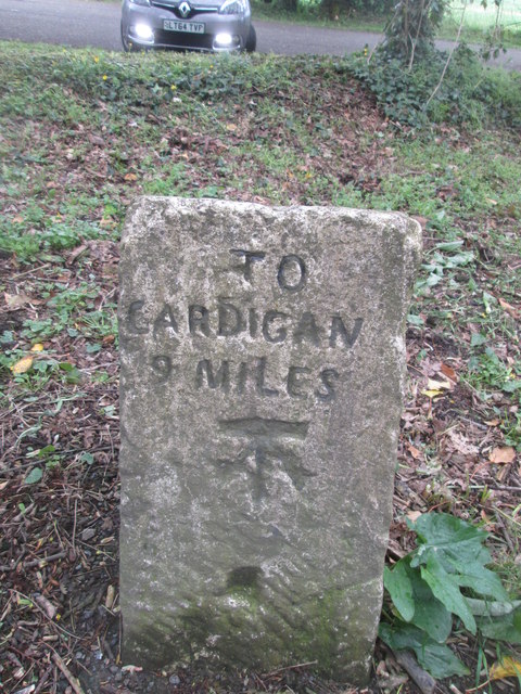
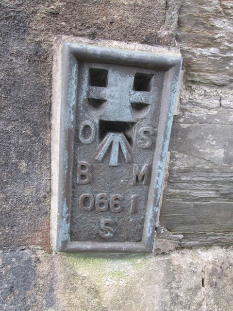
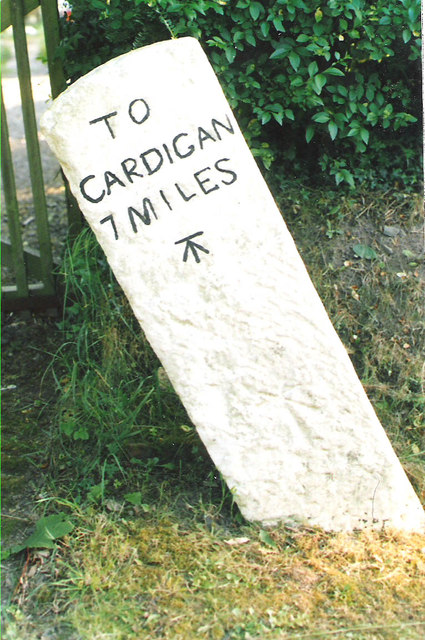
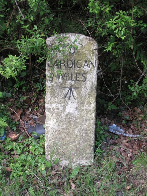
Troed-y-rhiw-Sion Images

Images are sourced within 2km of 52.054228/-4.499134 or Grid Reference SN2842. Thanks to Geograph Open Source API. All images are credited.

Redevelopment near Adpar This old place has seen better days and redevelopment has started but might have been suspended for some reason.
Redevelopment near Adpar
This old place has seen better days and redevelopment has started but might have been suspended for some reason.
Banc-lâs, Cwmceri
Banc-lâs, Cwmceri
A484 approaching Trem-y-ddol junction
Milestone - Cardigan 9 There is an Ordnance Survey cut mark on the milestone. It marks a point 80.3090ft above mean sea level.
Milestone - Cardigan 9
There is an Ordnance Survey cut mark on the milestone. It marks a point 80.3090ft above mean sea level.
Church At Cenarth  The parish church is dedicated to the local saint, St. Llawddog
Church At Cenarth
The parish church is dedicated to the local saint, St. Llawddog
The road up to Brongwyn This steep narrow lane almost overgrown with vegetation in places leads from the B4570 to the B4333.
The road up to Brongwyn
This steep narrow lane almost overgrown with vegetation in places leads from the B4570 to the B4333.
Country Lane near Panteinon This solitary oak tree is on the minor road between Brongwyn and Groesffordd about a mile north of Cwm Cou.
Country Lane near Panteinon
This solitary oak tree is on the minor road between Brongwyn and Groesffordd about a mile north of Cwm Cou.
Field at Groesffordd This lush pasture meadow is just off the minor road between Brongwyn and Groessffordd. The view is south towards Cilfallen.
Field at Groesffordd
This lush pasture meadow is just off the minor road between Brongwyn and Groessffordd. The view is south towards Cilfallen.
Ordnance Survey Flush Bracket (S0661) This OS Flush Bracket can be found on the SW angle of St Llawddog's Church. It marks a point 104.424ft above mean sea level.
Ordnance Survey Flush Bracket (S0661)
This OS Flush Bracket can be found on the SW angle of St Llawddog's Church. It marks a point 104.424ft above mean sea level.
Cenarth falls and water mill, River Teifi It is here that salmon and sea trout (sewin) migration up-river can be observed each year. Sea trout between June and August, and salmon in September and October.
The River Teifi is the longest river which is wholly in Wales and flows 75 miles from its source in the Cambrian mountains to its estuary at Cardigan.
The viewpoint is in Ceredigion and the far bank in Carmarthenshire; the river being the boundary between these two counties for a considerable distance.
Cenarth falls and water mill, River Teifi
It is here that salmon and sea trout (sewin) migration up-river can be observed each year. Sea trout between June and August, and salmon in September and October. The River Teifi is the longest river which is wholly in Wales and flows 75 miles from its source in the Cambrian mountains to its estuary at Cardigan. The viewpoint is in Ceredigion and the far bank in Carmarthenshire; the river being the boundary between these two counties for a considerable distance.
Old Milestone by the B4570, south east of Capel Tygwydd Cardigan tombstone by the B4570, in parish of Beulah (Ceredigion District), by "Milestone", South East of Capel Tygwydd, in front of domestic hedge.

Inscription reads:-
TO
CARDIGAN
7 MILES
Carved bench mark below inscription.

Grade II listed by Cadw. Reference Number: 16822
<span class="nowrap"><a title="https://cadwpublic-api.azurewebsites.net/reports/listedbuilding/FullReport?lang=&id=16822" rel="nofollow ugc noopener" href="https://cadwpublic-api.azurewebsites.net/reports/listedbuilding/FullReport?lang=&id=16822">Link</a><img style="margin-left:2px;" alt="External link" title="External link - shift click to open in new window" src="https://s1.geograph.org.uk/img/external.png" width="10" height="10"/></span>

Surveyed

Milestone Society National ID: CRD_CALA07.
Old Milestone by the B4570, south east of Capel Tygwydd
Cardigan tombstone by the B4570, in parish of Beulah (Ceredigion District), by "Milestone", South East of Capel Tygwydd, in front of domestic hedge. Inscription reads:- TO CARDIGAN 7 MILES Carved bench mark below inscription. Grade II listed by Cadw. Reference Number: 16822 LinkExternal link Surveyed Milestone Society National ID: CRD_CALA07.
Old Milestone by the B4570, Troed-y-rhiw-Siôn Cardigan tombstone by the B4570, in parish of Beulah (Ceredigion District), Troed-y-rhiw-siôn, Northwest of Cwm Cou, on verge, South side of road.

Inscription reads:-
TO
CARDIGAN
8
MILES
Carved benchmark on middle face.

Grade II listed by Cadw.
Reference Number: 17950 <span class="nowrap"><a title="https://cadwpublic-api.azurewebsites.net/reports/listedbuilding/FullReport?lang=&id=17950" rel="nofollow ugc noopener" href="https://cadwpublic-api.azurewebsites.net/reports/listedbuilding/FullReport?lang=&id=17950">Link</a><img style="margin-left:2px;" alt="External link" title="External link - shift click to open in new window" src="https://s1.geograph.org.uk/img/external.png" width="10" height="10"/></span>

Surveyed

Milestone Society National ID: CRD_CALA08
Old Milestone by the B4570, Troed-y-rhiw-Siôn
Cardigan tombstone by the B4570, in parish of Beulah (Ceredigion District), Troed-y-rhiw-siôn, Northwest of Cwm Cou, on verge, South side of road. Inscription reads:- TO CARDIGAN 8 MILES Carved benchmark on middle face. Grade II listed by Cadw. Reference Number: 17950 LinkExternal link Surveyed Milestone Society National ID: CRD_CALA08
Cenarth Falls After heavy rain.
Cenarth Falls
After heavy rain.
Fishermen on Afon Teifi at Cenarth Falls Great to see fishermen at the falls, and there was also a coracle (but not photographed).
Fishermen on Afon Teifi at Cenarth Falls
Great to see fishermen at the falls, and there was also a coracle (but not photographed).
Ordnance Survey Cut Mark This OS cut mark can be found on the north parapet of the bridge. It marks a point 22.085m above mean sea level.
Ordnance Survey Cut Mark
This OS cut mark can be found on the north parapet of the bridge. It marks a point 22.085m above mean sea level.
Ordnance Survey Cut Mark This OS cut mark can be found on the NE parapet of the bridge. It marks a point 33.990m above mean sea level.
Ordnance Survey Cut Mark
This OS cut mark can be found on the NE parapet of the bridge. It marks a point 33.990m above mean sea level.
Ordnance Survey Cut Mark This OS cut mark can be found on the gatepost west side of the old road. It marks a point 77.722m above mean sea level.
Ordnance Survey Cut Mark
This OS cut mark can be found on the gatepost west side of the old road. It marks a point 77.722m above mean sea level.
Ordnance Survey Cut Mark This OS cut mark can be found on the stone at the road junction. It marks a point 134.473m above mean sea level.
Ordnance Survey Cut Mark
This OS cut mark can be found on the stone at the road junction. It marks a point 134.473m above mean sea level.
Show me another place!

Troed-y-rhiw-Sion is located at Grid Ref: SN2842 (Lat: 52.054228, Lng: -4.499134)

Unitary Authority: Ceredigion

Police Authority: Dyfed Powys

What 3 Words

///guru.clashes.mingles. Near Newcastle Emlyn, Ceredigion

Related Wikis

Rhipinllwyd

Rhipinllwyd (or Rhippinllwyd) is a hamlet in the community of Beulah, Ceredigion, Wales, which is 69.3 miles (111.5 km) from Cardiff and 190.7 miles...

Troed-y-rhiw-Sion

Troed-y-rhiw-Sion is a hamlet in the community of Beulah, Ceredigion, Wales, which is 69.3 miles (111.6 km) from Cardiff and 190.9 miles (307.2 km) from...

Pen-y-wenallt

Pen-y-wenallt is a hamlet in Ceredigion (formerly Cardiganshire), Wales. Pen-y-wenallt lies halfway between Cenarth and Pont Ceri, bordering on Carmarthenshire...

Tre-Wen

Tre-Wen is a small village in the community of Beulah, Ceredigion, Wales, which is 68.6 miles (110.4 km) from Cardiff and 190.2 miles (306.1 km) from...

Pont Ceri

Pont Ceri is a small village in the community of Llandyfriog, Ceredigion, Wales, located where the Afon Ceri flows into the River Teifi, two miles (3...

Brongwyn

Brongwyn is a hamlet in the community of Beulah, Ceredigion, Wales, which is 69.5 miles (111.9 km) from Cardiff and 190.7 miles (306.9 km) from London...

Capel Tygwydd

Capel Tygwydd is a hamlet in the community of Beulah, Ceredigion, Wales, which is 70.3 miles (113.1 km) from Cardiff and 191.7 miles (308.5 km) from London...
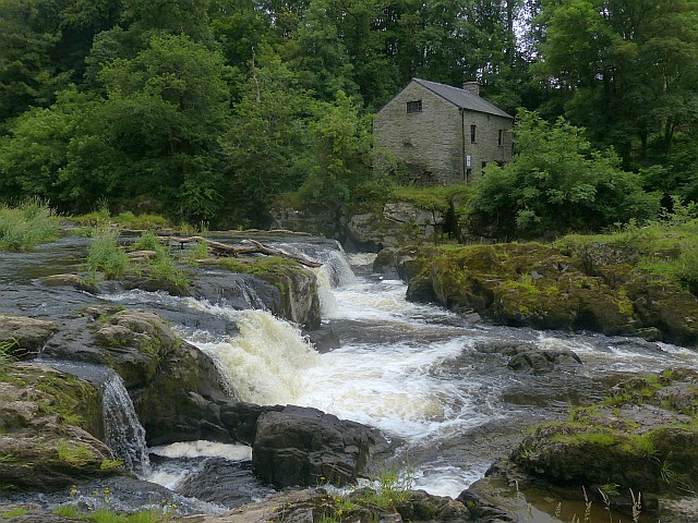
Cenarth Falls

The Cenarth Falls is a cascade of waterfalls just upstream of the road bridge in the village of Cenarth in Ceredigion, bordering Carmarthenshire and Pembrokeshire...

Nearby Amenities

Located within 500m of 52.054228,-4.499134
Direction: 215
Generator Method: photovoltaic
Generator Output Electricity: yes
Generator Solar Modules: 14
Generator Source: solar
Generator Type: solar_photovoltaic_panel
Location: roof
Power: generator
Lat/Long: 52.0511759/-4.4950179
Direction: SW
Generator Method: photovoltaic
Generator Output Electricity: yes
Generator Solar Modules: 16
Generator Source: solar
Generator Type: solar_photovoltaic_panel
Location: roof
Power: generator
Lat/Long: 52.0512833/-4.4954671
Direction: S
Generator Method: photovoltaic
Generator Output Electricity: yes
Generator Solar Modules: 10
Generator Source: solar
Generator Type: solar_photovoltaic_panel
Location: roof
Power: generator
Lat/Long: 52.0520163/-4.4964552
Direction: 235
Generator Method: photovoltaic
Generator Output Electricity: yes
Generator Solar Modules: 16
Generator Source: solar
Generator Type: solar_photovoltaic_panel
Location: roof
Power: generator
Lat/Long: 52.0522587/-4.496478
Direction: SW
Generator Method: photovoltaic
Generator Output Electricity: yes
Generator Solar Modules: 16
Generator Source: solar
Generator Type: solar_photovoltaic_panel
Location: roof
Power: generator
Lat/Long: 52.0521381/-4.4973725
Direction: 125
Generator Method: photovoltaic
Generator Output Electricity: yes
Generator Solar Modules: 16
Generator Source: solar
Generator Type: solar_photovoltaic_panel
Location: roof
Power: generator
Lat/Long: 52.0528063/-4.4977038
Direction: 215
Generator Method: photovoltaic
Generator Output Electricity: yes
Generator Solar Modules: 8
Generator Source: solar
Generator Type: solar_photovoltaic_panel
Location: roof
Power: generator
Lat/Long: 52.0531535/-4.4978245
Direction: SSE
Generator Method: photovoltaic
Generator Output Electricity: yes
Generator Solar Modules: 14
Generator Source: solar
Generator Type: solar_photovoltaic_panel
Location: roof
Power: generator
Lat/Long: 52.0539625/-4.5000641
Direction: SSE
Generator Method: photovoltaic
Generator Output Electricity: yes
Generator Solar Modules: 10
Generator Source: solar
Generator Type: solar_photovoltaic_panel
Location: roof
Power: generator
Lat/Long: 52.0546371/-4.5005026
The data included in this document is from www.openstreetmap.org. The data is made available under ODbL.

Have you been to Troed-y-rhiw-Sion?

Leave your review of Troed-y-rhiw-Sion below (or comments, questions and feedback).