Tre-boeth

Settlement in Glamorgan

Wales

Tre-boeth

Benchmark on Railway Bridge This tiny Benchmark can be found on the SW buttress of the railway bridge on Nantong Way.
Benchmark on Railway Bridge Credit: Adrian Dust

Tre-boeth is a small rural village located in the county of Glamorgan, in South Wales, United Kingdom. Situated in the picturesque countryside, the village is surrounded by rolling hills and lush greenery, making it an ideal destination for nature lovers and those seeking a peaceful retreat.

With a population of around 500 residents, Tre-boeth has a tight-knit community that prides itself on its strong sense of community spirit. The village is known for its friendly and welcoming atmosphere, where residents often come together to organize various events and celebrations.

Despite its small size, Tre-boeth offers a range of amenities and services to cater to its residents' needs. These include a local convenience store, a post office, and a village hall that serves as a hub for social gatherings and community events. The village also boasts a primary school, ensuring that local children have access to quality education without the need to travel far.

Tre-boeth's location in the heart of Glamorgan provides residents with easy access to a variety of outdoor activities. The surrounding countryside offers numerous walking and hiking trails, allowing residents to explore the natural beauty of the area. Additionally, the village is within driving distance of stunning beaches along the Glamorgan Heritage Coast, offering opportunities for leisurely seaside strolls and water sports.

In conclusion, Tre-boeth is a charming rural village in Glamorgan, Wales, that offers a peaceful and close-knit community, as well as easy access to a range of amenities and outdoor activities.

If you have any feedback on the listing, please let us know in the comments section below.
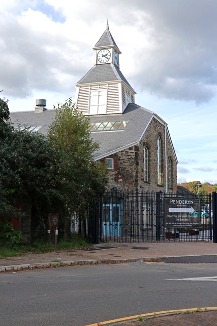
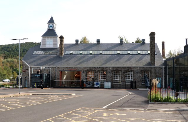
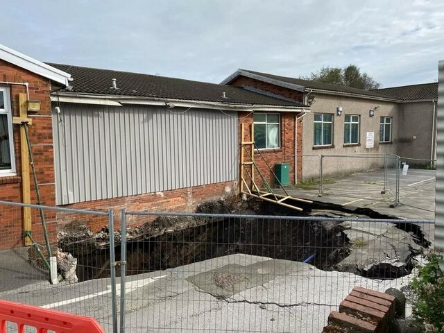
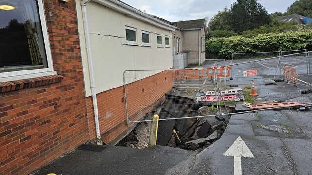
Tre-boeth Images

Images are sourced within 2km of 51.653205/-3.949596 or Grid Reference SS6596. Thanks to Geograph Open Source API. All images are credited.

Benchmark on Railway Bridge This tiny Benchmark can be found on the SW buttress of the railway bridge on Nantong Way.
Benchmark on Railway Bridge
This tiny Benchmark can be found on the SW buttress of the railway bridge on Nantong Way.
Recently Renovated Power House and Clock, Swansea The power house and clock tower of the former Hafod-Morfa Copperworks (closed 1980).
Recently Renovated Power House and Clock, Swansea
The power house and clock tower of the former Hafod-Morfa Copperworks (closed 1980).
Ordnance Survey Cut Mark This OS cut mark can be found on the SW angle of the school. It marks a point 153.278m above mean sea level.
Ordnance Survey Cut Mark
This OS cut mark can be found on the SW angle of the school. It marks a point 153.278m above mean sea level.
Penderyn Distillery, Landore This magnificent looking plant has been assembled in the former powerhouse, later a canteen of a former copperworks at Landore. This building has been thoroughly wrecked but has now been rehabilitated as a new distillery, visitor centre and shop for Penderyn Whisky. This was a hastily grabbed shot as somebody was unhappy with us taking a picture from a public area (the park and ride car park) through an open door.
Penderyn Distillery, Landore
This magnificent looking plant has been assembled in the former powerhouse, later a canteen of a former copperworks at Landore. This building has been thoroughly wrecked but has now been rehabilitated as a new distillery, visitor centre and shop for Penderyn Whisky. This was a hastily grabbed shot as somebody was unhappy with us taking a picture from a public area (the park and ride car park) through an open door.
Penderyn Distillery This is Penderyn's third whisky distillery and the most recent. It is based in the formed Hafod copperworks' powerhouse that then became a canteen. This building had been extremely derelict but has now been rehabilitated.
Penderyn Distillery
This is Penderyn's third whisky distillery and the most recent. It is based in the formed Hafod copperworks' powerhouse that then became a canteen. This building had been extremely derelict but has now been rehabilitated.
Penderyn Distillery, Landore This was the former powerhouse and then a canteen for the Hafod copper works that was Yorkshire Imperial Metals. It has now been beautifully restored as a whisky distillery but was a total wreck when I saw it in 2012 - <a href="https://www.geograph.org.uk/photo/3058971">SS6695 : Remains of Yorkshire Imperial Metals Hafod Works, Landore</a>.
Penderyn Distillery, Landore
This was the former powerhouse and then a canteen for the Hafod copper works that was Yorkshire Imperial Metals. It has now been beautifully restored as a whisky distillery but was a total wreck when I saw it in 2012 - SS6695 : Remains of Yorkshire Imperial Metals Hafod Works, Landore.
Cwmfelin Social Club Swansea Sinkhole Large sinkhole under the carpark and toilets of Cwmfelin Social Club. Underneath is apparently an old tramway, a sewer and a culvert (Burlais Brook)
Sinkhole believed to be around 10m deep
Cwmfelin Social Club Swansea Sinkhole
Large sinkhole under the carpark and toilets of Cwmfelin Social Club. Underneath is apparently an old tramway, a sewer and a culvert (Burlais Brook) Sinkhole believed to be around 10m deep
Cwmfelin Social Club Swansea Sinkhole Sinkhole a few days after it first appeared underneath carpark and the toilets (now demolished)
Cwmfelin Social Club Swansea Sinkhole
Sinkhole a few days after it first appeared underneath carpark and the toilets (now demolished)
Llangyfelach Road Wall, Cut Mark Swansea Cut Mark on wall at Llangyfelach Road.
Llangyfelach Road Wall, Cut Mark Swansea
Cut Mark on wall at Llangyfelach Road.
Cut Mark at Tirdeunaw Close on pillar at junction Cut mark on stone pillar at junction of Llangyfelach Road and Tirdeunaw Close, Swansea
Cut Mark at Tirdeunaw Close on pillar at junction
Cut mark on stone pillar at junction of Llangyfelach Road and Tirdeunaw Close, Swansea
Benchmark Cut Mark: Swansea,  at 27 Penfilia Road A possible Bench Mark found next to telephone style box at Penfilia Road, Swansea
Benchmark Cut Mark: Swansea, at 27 Penfilia Road
A possible Bench Mark found next to telephone style box at Penfilia Road, Swansea
Benchmark at 293 Llangyfelach Road A Cut Benchmark can be found on the right of 293 Llangyfelach Road Swansea
Benchmark at 293 Llangyfelach Road
A Cut Benchmark can be found on the right of 293 Llangyfelach Road Swansea
New Morfa Stadium Swansea's new Football & Rugby 'Liberty Stadium' next to the River Tawe, near the Morfa retail park.
New Morfa Stadium
Swansea's new Football & Rugby 'Liberty Stadium' next to the River Tawe, near the Morfa retail park.
Ruin of former stores at Cnap Llwyd Only 2 corners of masonry remain from this building high on wasteland. This is the view south out to Swansea Bay.
Ruin of former stores at Cnap Llwyd
Only 2 corners of masonry remain from this building high on wasteland. This is the view south out to Swansea Bay.
Ruin on Cnap Llwyd, seen from below The odd corner ruins look like mysterious towers from a distance.
Ruin on Cnap Llwyd, seen from below
The odd corner ruins look like mysterious towers from a distance.
Llewelyn Park A large and sprawling park on a hillside.
Llewelyn Park
A large and sprawling park on a hillside.
Cwmgelli Cemetery A secluded cemetery with some slightly unusual trees.
Cwmgelli Cemetery
A secluded cemetery with some slightly unusual trees.
Bishop Vaughan Roman Catholic School An unusually distinctive school building.
Bishop Vaughan Roman Catholic School
An unusually distinctive school building.
Show me another place!

Tre-boeth is located at Grid Ref: SS6596 (Lat: 51.653205, Lng: -3.949596)

Unitary Authority: Swansea

Police Authority: South Wales

What 3 Words

///punk.policy.likes. Near Landore, Swansea

Related Wikis

Treboeth

Treboeth is a suburb and historical village in the Mynydd-Bach ward of Swansea, Wales. Gwyrosydd Primary School and Welsh language primary school Ysgol...
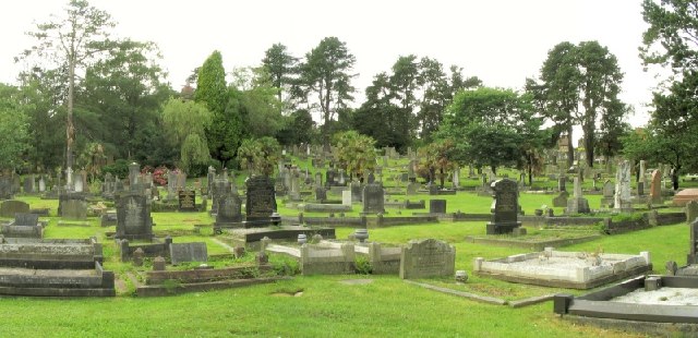
Cwmgelli Cemetery

Cwmgelli Cemetery, also known as Cwmgelly Cemetery, is a cemetery located in the Treboeth area of Swansea, Wales. The cemetery is listed on the Cadw/ICOMOS...

Mynyddbach Chapel

Mynyddbach Chapel is the oldest Independent chapel in Swansea, Wales. In about 1640 a group of people met on the Sabbath and on week nights to read the...

Mynydd-Bach

Mynydd-Bach or Mynydd-bach is a suburban district and community in the City and County of Swansea, Wales, It falls within the coterminous Mynydd-Bach ward...

Nearby Amenities

Located within 500m of 51.653205,-3.949596
Source: bing
Lat/Long: 51.6522757/-3.9486333
Mini Roundabout
Direction: clockwise
Lat/Long: 51.6531507/-3.9532362
Source: bing
Lat/Long: 51.6551041/-3.9487442
Source: bing
Lat/Long: 51.6550923/-3.9489191
Source: bing
Lat/Long: 51.6518684/-3.9485997
Source: bing
Lat/Long: 51.6519979/-3.9486104
Source: bing
Lat/Long: 51.6517138/-3.9475081
Source: bing
Lat/Long: 51.6518236/-3.9451109
Source: bing
Lat/Long: 51.6520119/-3.9448092
Source: bing
Lat/Long: 51.6524821/-3.9444932
Source: bing
Lat/Long: 51.6526916/-3.9439727
Source: bing
Lat/Long: 51.6527932/-3.9432349
Source: bing
Lat/Long: 51.653348/-3.9428353
Source: bing
Lat/Long: 51.6508597/-3.9484857
Bus Stop
John Penry Crescent (NE)
Bus: yes
Naptan AtcoCode: 5810AWC51450
Naptan Bearing: NE
Naptan CommonName: John Penry Crescent (NE)
Naptan Crossing: John Penry Crescent
Naptan NaptanCode: swapapt
Naptan PlusbusZoneRef: SWANSEA
Naptan Street: Heol Cadifor
Naptan Verified: no
Public Transport: platform
Source: naptan_import
Lat/Long: 51.6543556/-3.9565302
Bus Stop
Heol Penar (S)
Bus: yes
Naptan AtcoCode: 5810AWC51451
Naptan Bearing: S
Naptan CommonName: Heol Penar (S)
Naptan Crossing: Heol Penar
Naptan NaptanCode: swapapd
Naptan PlusbusZoneRef: SWANSEA
Naptan Street: Crwys Terrace
Naptan Verified: no
Public Transport: platform
Source: naptan_import
Lat/Long: 51.6554656/-3.9541346
Bus Stop
Heol Penar (NE)
Bus: yes
Naptan AtcoCode: 5810AWC51452
Naptan Bearing: NE
Naptan CommonName: Heol Penar (NE)
Naptan Crossing: Heol Penar
Naptan NaptanCode: swapapg
Naptan PlusbusZoneRef: SWANSEA
Naptan Street: Crwys Terrace
Naptan Verified: no
Public Transport: platform
Source: naptan_import
Lat/Long: 51.6558525/-3.9541224
Bus Stop
Penlan Steps (NE)
Bus: yes
Naptan AtcoCode: 5810AWC51454
Naptan Bearing: NE
Naptan CommonName: Penlan Steps (NE)
Naptan Crossing: Crwys Terrace
Naptan NaptanCode: swajtga
Naptan PlusbusZoneRef: SWANSEA
Naptan Street: Heol Gwrosydd
Naptan Verified: no
Public Transport: platform
Source: naptan_import
Lat/Long: 51.6525439/-3.9540812
Bus Stop
Penlan Steps (SW)
Bus: yes
Naptan AtcoCode: 5810AWC51455
Naptan Bearing: SW
Naptan CommonName: Penlan Steps (SW)
Naptan Crossing: Crwys Terrace
Naptan NaptanCode: swajtgd
Naptan PlusbusZoneRef: SWANSEA
Naptan Street: Heol Gwrosydd
Naptan Verified: no
Public Transport: platform
Source: naptan_import
Lat/Long: 51.6523013/-3.9540708
Bus Stop
Penderry Sherries (SE)
Bus: yes
Naptan AtcoCode: 5810AWC51458
Naptan Bearing: SE
Naptan CommonName: Penderry Sherries (SE)
Naptan Crossing: Penmynydd Road
Naptan NaptanCode: swajtaw
Naptan PlusbusZoneRef: SWANSEA
Naptan Street: Penderry Road
Naptan Verified: no
Public Transport: platform
Source: naptan_import
Lat/Long: 51.6509721/-3.9545051
Bus Stop
Penderry Sherries (NW)
Bus: yes
Naptan AtcoCode: 5810AWC51459
Naptan Bearing: NW
Naptan CommonName: Penderry Sherries (NW)
Naptan Crossing: Penmynydd Road
Naptan NaptanCode: swajtda
Naptan PlusbusZoneRef: SWANSEA
Naptan Street: Penderry Road
Naptan Verified: no
Public Transport: platform
Source: naptan_import
Lat/Long: 51.6504912/-3.9542242
Bus Stop
Tre-boeth PO (S)
Bus: yes
Naptan AtcoCode: 5810AWC52093
Naptan Bearing: S
Naptan CommonName: Tre-boeth PO (S)
Naptan Crossing: Heol Fach
Naptan Landmark: Tre-boeth Post Office
Naptan NaptanCode: swapdwa
Naptan PlusbusZoneRef: SWANSEA
Naptan ShortCommonName: Tre-boeth Library
Naptan Street: Llangyfelach Road
Naptan Verified: no
Public Transport: platform
Source: naptan_import
Lat/Long: 51.6513056/-3.9485056
Bus Stop
Tre-boeth PO (N)
Bus: yes
Naptan AtcoCode: 5810AWC52094
Naptan Bearing: N
Naptan CommonName: Tre-boeth PO (N)
Naptan Crossing: Penlan Road
Naptan Landmark: Tre-boeth Post Office
Naptan NaptanCode: swapdwd
Naptan PlusbusZoneRef: SWANSEA
Naptan ShortCommonName: Tre-boeth Library
Naptan Street: Llangyfelach Road
Naptan Verified: no
Public Transport: platform
Source: naptan_import
Lat/Long: 51.6515369/-3.9486601
Bus Stop
Ford`s Club (N)
Bus: yes
Naptan AtcoCode: 5810AWC52099
Naptan Bearing: N
Naptan CommonName: Ford`s Club (N)
Naptan Crossing: Clifton Court
Naptan NaptanCode: swadmdp
Naptan PlusbusZoneRef: SWANSEA
Naptan Street: Llangyfelach Road
Naptan Verified: no
Public Transport: platform
Source: naptan_import
Lat/Long: 51.6552077/-3.9490923
Bus Stop
Ford`s Club (S)
Bus: yes
Naptan AtcoCode: 5810AWC52100
Naptan Bearing: S
Naptan CommonName: Ford`s Club (S)
Naptan Crossing: Clifton Court
Naptan NaptanCode: swadmdt
Naptan PlusbusZoneRef: SWANSEA
Naptan Street: Llangyfelach Road
Naptan Verified: no
Public Transport: platform
Source: naptan_import
Lat/Long: 51.6552832/-3.9488786
Bus Stop
Tre-boeth Gospel Hall (NE)
Bus: yes
Naptan AtcoCode: 5810AWC52101
Naptan Bearing: NE
Naptan CommonName: Tre-boeth Gospel Hall (NE)
Naptan Crossing: Llangyfelach Road
Naptan NaptanCode: swapdpm
Naptan PlusbusZoneRef: SWANSEA
Naptan Street: Heol Gwrosydd
Naptan Verified: no
Public Transport: platform
Source: naptan_import
Lat/Long: 51.6544906/-3.9494952
Bus Stop
Tre-boeth Gospel Hall (SW)
Bus: yes
Naptan AtcoCode: 5810AWC52102
Naptan Bearing: SW
Naptan CommonName: Tre-boeth Gospel Hall (SW)
Naptan Crossing: Llangyfelach Road
Naptan NaptanCode: swapdpt
Naptan PlusbusZoneRef: SWANSEA
Naptan Street: Heol Gwrosydd
Naptan Verified: no
Public Transport: platform
Source: naptan_import
Lat/Long: 51.6543151/-3.9497768
Bus Stop
Gwrosydd Primary School (NW)
Bus: yes
Naptan AtcoCode: 5810AWO26187
Naptan Bearing: NW
Naptan CommonName: Gwrosydd Primary School (NW)
Naptan Crossing: Penlan Road
Naptan NaptanCode: swapdtm
Naptan PlusbusZoneRef: SWANSEA
Naptan Street: Parkhill Terrace
Naptan Verified: no
Public Transport: platform
Source: naptan_import
Lat/Long: 51.6513535/-3.9521218
Bus Stop
Penlan Road Top (SW)
Bus: yes
Naptan AtcoCode: 5810AWO26188
Naptan Bearing: SW
Naptan CommonName: Penlan Road Top (SW)
Naptan Crossing: Penderry Road
Naptan NaptanCode: swajtdp
Naptan PlusbusZoneRef: SWANSEA
Naptan Street: Penlan Road
Naptan Verified: no
Public Transport: platform
Source: naptan_import
Lat/Long: 51.6512313/-3.954603
Mini Roundabout
Direction: clockwise
Lat/Long: 51.6544839/-3.9488978
Source: bing
Lat/Long: 51.654406/-3.9497092
Source: bing
Lat/Long: 51.6524924/-3.9524577
Source: bing
Lat/Long: 51.6539026/-3.9500339
Source: bing
Lat/Long: 51.6538045/-3.9500259
Source: bing
Lat/Long: 51.6537362/-3.9500607
Source: bing
Lat/Long: 51.653668/-3.9501037
Source: bing
Lat/Long: 51.6533338/-3.9509857
Source: bing
Lat/Long: 51.6522837/-3.9487779
Source: bing
Lat/Long: 51.6523724/-3.9496652
Source: bing
Lat/Long: 51.6524108/-3.9498055
Source: bing
Lat/Long: 51.6524815/-3.9499608
Source: bing
Lat/Long: 51.6526181/-3.9501718
Source: bing
Lat/Long: 51.6525791/-3.9502512
Source: bing
Lat/Long: 51.6538367/-3.9474611
Source: bing
Lat/Long: 51.653119/-3.9485574
Source: bing
Lat/Long: 51.65311/-3.9487201
Source: bing
Lat/Long: 51.6523482/-3.9486388
Source: bing
Lat/Long: 51.6539769/-3.9471834
Source: bing
Lat/Long: 51.6523443/-3.9446193
Source: bing
Lat/Long: 51.6525962/-3.9442854
Source: bing
Lat/Long: 51.6527281/-3.9436808
Source: bing
Lat/Long: 51.6527345/-3.9434164
Source: bing
Lat/Long: 51.6530795/-3.9430243
Source: bing
Lat/Long: 51.6532568/-3.9428497
Source: bing
Lat/Long: 51.6534559/-3.9428618
Source: bing
Lat/Long: 51.6537904/-3.9432032
Source: bing
Lat/Long: 51.6536532/-3.9435851
Source: bing
Lat/Long: 51.6550654/-3.9486237
Source: bing
Lat/Long: 51.6492106/-3.9481608
Place Of Worship
Gospel Hall
Religion: christian
Lat/Long: 51.6547099/-3.9492136
Source: bing
Lat/Long: 51.6487872/-3.9493931
Source: bing
Lat/Long: 51.648886/-3.9492344
Source: bing
Lat/Long: 51.6490464/-3.9500148
Source: bing
Lat/Long: 51.6490983/-3.9502546
Source: bing
Lat/Long: 51.6491039/-3.9500156
Source: bing
Lat/Long: 51.6491075/-3.9512174
Source: bing
Lat/Long: 51.649115/-3.9492305
Source: bing
Lat/Long: 51.6491545/-3.9508276
Source: bing
Lat/Long: 51.6491708/-3.9486124
Source: bing
Lat/Long: 51.6492838/-3.9501156
Source: bing
Lat/Long: 51.6493043/-3.9500982
Source: bing
Lat/Long: 51.6493433/-3.9501709
Source: bing
Lat/Long: 51.6493561/-3.9508935
Source: bing
Lat/Long: 51.6493772/-3.9513816
Source: bing
Lat/Long: 51.6494021/-3.9506311
Source: bing
Lat/Long: 51.6494036/-3.95078
Source: bing
Lat/Long: 51.6494166/-3.9502694
Source: bing
Lat/Long: 51.6494166/-3.9509609
Source: bing
Lat/Long: 51.6494181/-3.9505241
Source: bing
Lat/Long: 51.6494245/-3.9503816
Source: bing
Lat/Long: 51.6494258/-3.9507062
Source: bing
Lat/Long: 51.6494301/-3.9493772
Source: bing
Lat/Long: 51.6494348/-3.9502789
Source: bing
Lat/Long: 51.6494379/-3.9505446
Source: bing
Lat/Long: 51.6494435/-3.950627
Source: bing
Lat/Long: 51.6494563/-3.950385
Source: bing
Lat/Long: 51.6494684/-3.9504029
Source: bing
Lat/Long: 51.6494792/-3.9509658
Source: bing
Lat/Long: 51.6495008/-3.9509928
Source: bing
Lat/Long: 51.6495009/-3.9508613
Source: bing
Lat/Long: 51.6495219/-3.9481892
Source: bing
Lat/Long: 51.6495251/-3.9509775
Source: bing
Lat/Long: 51.6495453/-3.9510548
Source: bing
Lat/Long: 51.6495564/-3.9489006
Source: bing
Lat/Long: 51.6495612/-3.9510676
Source: bing
Lat/Long: 51.6495728/-3.9487781
Source: bing
Lat/Long: 51.6496028/-3.9508796
Crossing
Source: bing
Lat/Long: 51.6496142/-3.9509214
Source: bing
Lat/Long: 51.6496387/-3.9510151
Source: bing
Lat/Long: 51.6496325/-3.9487925
Source: bing
Lat/Long: 51.6496751/-3.950654
Source: bing
Lat/Long: 51.6496956/-3.9507375
Source: bing
Lat/Long: 51.6496993/-3.9508678
Source: bing
Lat/Long: 51.6497176/-3.9508944
Source: bing
Lat/Long: 51.649732/-3.9509518
Source: bing
Lat/Long: 51.6497408/-3.9509869
Source: bing
Lat/Long: 51.6497552/-3.9514383
Source: bing
Lat/Long: 51.6497686/-3.9507763
Source: bing
Lat/Long: 51.6497805/-3.9501214
Source: bing
Lat/Long: 51.649809/-3.9506963
Source: bing
Lat/Long: 51.6498208/-3.9503212
Source: bing
Lat/Long: 51.6498526/-3.9507615
Source: bing
Lat/Long: 51.649864/-3.9506213
Source: bing
Lat/Long: 51.6499051/-3.9514891
Source: bing
Lat/Long: 51.6499432/-3.9504836
Source: bing
Lat/Long: 51.6499597/-3.9505507
Source: bing
Lat/Long: 51.6499662/-3.951585
Source: bing
Lat/Long: 51.6499857/-3.9514649
Source: bing
Lat/Long: 51.6500091/-3.9508092
Source: bing
Lat/Long: 51.6500596/-3.9513322
Source: bing
Lat/Long: 51.650103/-3.9505056
Source: bing
Lat/Long: 51.6501103/-3.9504549
Source: bing
Lat/Long: 51.6501302/-3.9506158
Source: bing
Lat/Long: 51.6501447/-3.9505956
Source: bing
Lat/Long: 51.650165/-3.9507567
Source: bing
Lat/Long: 51.650168/-3.9501666
Source: bing
Lat/Long: 51.6502176/-3.9495875
Source: bing
Lat/Long: 51.6502289/-3.9504157
Source: bing
Lat/Long: 51.6502388/-3.9505358
Source: bing
Lat/Long: 51.650253/-3.9508693
Source: bing
Lat/Long: 51.6502649/-3.9508059
Source: bing
Lat/Long: 51.6502714/-3.9506692
Source: bing
Lat/Long: 51.6502717/-3.9511885
Source: bing
Lat/Long: 51.6503265/-3.9505207
Source: bing
Lat/Long: 51.6503305/-3.9512821
Source: bing
Lat/Long: 51.6503424/-3.9512096
Source: bing
Lat/Long: 51.6503505/-3.9506189
Source: bing
Lat/Long: 51.6503807/-3.9504863
Source: bing
Lat/Long: 51.6503902/-3.9510827
Source: bing
Lat/Long: 51.6503913/-3.9506247
Source: bing
Lat/Long: 51.6504136/-3.9506207
Source: bing
Lat/Long: 51.6504212/-3.950704
Source: bing
Lat/Long: 51.650431/-3.9502873
Source: bing
Lat/Long: 51.6504392/-3.950321
Source: bing
Lat/Long: 51.650519/-3.9511077
Source: bing
Lat/Long: 51.6505473/-3.9513251
Source: bing
Lat/Long: 51.6505692/-3.9489383
Source: bing
Lat/Long: 51.650589/-3.9502258
Source: bing
Lat/Long: 51.6505913/-3.9484423
Source: bing
Lat/Long: 51.6505985/-3.9502648
Source: bing
Lat/Long: 51.6506063/-3.9502082
Source: bing
Lat/Long: 51.6506173/-3.9502529
Source: bing
Lat/Long: 51.650651/-3.9495012
Source: bing
Lat/Long: 51.6506536/-3.9505613
Source: bing
Lat/Long: 51.6506855/-3.9504479
Source: bing
Lat/Long: 51.6506891/-3.9494158
Source: bing
Lat/Long: 51.6507077/-3.9518411
Source: bing
Lat/Long: 51.6507099/-3.9512808
Source: bing
Lat/Long: 51.6507244/-3.943679
Source: bing
Lat/Long: 51.650732/-3.9516673
Source: bing
Lat/Long: 51.6507519/-3.9509535
Source: bing
Lat/Long: 51.6507533/-3.9502879
Source: bing
Lat/Long: 51.650786/-3.9512273
Source: bing
Lat/Long: 51.6507914/-3.9497234
Source: bing
Lat/Long: 51.6508005/-3.9509178
Source: bing
Lat/Long: 51.6508237/-3.9512008
Source: bing
Lat/Long: 51.6508251/-3.9505815
Source: bing
Lat/Long: 51.6508578/-3.9507903
Source: bing
Lat/Long: 51.6508771/-3.9508691
Source: bing
Lat/Long: 51.6508872/-3.9483357
Source: bing
Lat/Long: 51.650888/-3.9507201
Source: bing
Lat/Long: 51.6508988/-3.9507642
Source: bing
Lat/Long: 51.6509287/-3.9507825
Source: bing
Lat/Long: 51.6509427/-3.9438643
Source: bing
Lat/Long: 51.6509473/-3.9513732
Source: bing
Lat/Long: 51.6509778/-3.9514938
Source: bing
Lat/Long: 51.6509878/-3.9514421
Source: bing
Lat/Long: 51.6509887/-3.9510209
Source: bing
Lat/Long: 51.6509917/-3.9498128
Source: bing
Lat/Long: 51.6510028/-3.9494711
Source: bing
Lat/Long: 51.6510316/-3.9499379
Source: bing
Lat/Long: 51.6510367/-3.9499199
Source: bing
Lat/Long: 51.651061/-3.9498917
Source: bing
Lat/Long: 51.6510682/-3.9500878
Source: bing
Lat/Long: 51.6510777/-3.950421
Source: bing
Lat/Long: 51.6511123/-3.9519007
Source: bing
Lat/Long: 51.6511155/-3.9505755
Source: bing
Lat/Long: 51.651126/-3.9441429
Source: bing
Lat/Long: 51.6511519/-3.9514839
Source: bing
Lat/Long: 51.6511622/-3.9440965
Source: bing
Lat/Long: 51.6512141/-3.9505961
Source: bing
Lat/Long: 51.6512156/-3.943126
Source: bing
Lat/Long: 51.6512357/-3.9434259
Source: bing
Lat/Long: 51.6512474/-3.9515214
Source: bing
Lat/Long: 51.6512637/-3.9510408
Source: bing
Lat/Long: 51.651274/-3.9508345
Source: bing
Lat/Long: 51.6512797/-3.9438112
Source: bing
Lat/Long: 51.6512847/-3.9436132
Source: bing
Lat/Long: 51.6513033/-3.9507892
Source: bing
Lat/Long: 51.6513066/-3.9479451
Source: bing
Lat/Long: 51.6513495/-3.943517
Source: bing
Lat/Long: 51.651351/-3.9439441
Source: bing
Lat/Long: 51.6513639/-3.9501637
Source: bing
Lat/Long: 51.6513657/-3.9542601
Source: bing
Lat/Long: 51.6513718/-3.943484
Source: bing
Lat/Long: 51.6513798/-3.943046
Source: bing
Lat/Long: 51.6513855/-3.9440627
Source: bing
Lat/Long: 51.6514827/-3.9439595
Source: bing
Lat/Long: 51.6514886/-3.9440922
Source: bing
Lat/Long: 51.6514972/-3.9434942
Source: bing
Lat/Long: 51.6515029/-3.9429214
Source: bing
Lat/Long: 51.6515467/-3.9543189
Source: bing
Lat/Long: 51.6515592/-3.9435829
Source: bing
Lat/Long: 51.6515621/-3.9440857
Source: bing
Lat/Long: 51.6515722/-3.9438214
Source: bing
Lat/Long: 51.6517023/-3.947384
Source: bing
Lat/Long: 51.6517385/-3.943425
Source: bing
Lat/Long: 51.6517405/-3.9442903
Source: bing
Lat/Long: 51.6517921/-3.9443936
Source: bing
Lat/Long: 51.6517947/-3.9433764
Source: bing
Lat/Long: 51.6519065/-3.9429221
Source: bing
Lat/Long: 51.6519066/-3.9449087
Source: bing
Lat/Long: 51.6519142/-3.9443411
Source: bing
Lat/Long: 51.6519158/-3.943628
Source: bing
Lat/Long: 51.6520659/-3.9442995
Source: bing
Lat/Long: 51.6520673/-3.9438909
Source: bing
Lat/Long: 51.6520929/-3.9445743
Source: bing
Lat/Long: 51.6521104/-3.9442366
Source: bing
Lat/Long: 51.6521126/-3.9430996
Source: bing
Lat/Long: 51.6521162/-3.9441237
Source: bing
Lat/Long: 51.6522088/-3.943572
Source: bing
Lat/Long: 51.6522113/-3.9443217
Source: bing
Lat/Long: 51.6522331/-3.942893
Source: bing
Lat/Long: 51.6523016/-3.9429646
Source: bing
Lat/Long: 51.6523505/-3.9435539
Source: bing
Lat/Long: 51.6523532/-3.9492835
Source: bing
Lat/Long: 51.65237/-3.9438538
Source: bing
Lat/Long: 51.6524724/-3.9524526
Source: bing
Lat/Long: 51.6524725/-3.943143
Source: bing
Lat/Long: 51.6524735/-3.9424394
Source: bing
Lat/Long: 51.6524824/-3.9531322
Source: bing
Lat/Long: 51.6524981/-3.9445855
Source: bing
Lat/Long: 51.6525493/-3.9503461
Source: bing
Lat/Long: 51.6525923/-3.9448296
Source: bing
Lat/Long: 51.6528357/-3.9448566
Source: bing
Lat/Long: 51.6529741/-3.9447181
Source: bing
Lat/Long: 51.6530224/-3.9435333
Source: bing
Lat/Long: 51.6530508/-3.9517233
Source: bing
Lat/Long: 51.653116/-3.9446066
Source: bing
Lat/Long: 51.6531278/-3.9427471
Source: bing
Lat/Long: 51.6531649/-3.9439337
Source: bing
Lat/Long: 51.6531724/-3.9429328
Source: bing
Lat/Long: 51.6533534/-3.9442586
Source: bing
Lat/Long: 51.6533946/-3.9432624
Source: bing
Lat/Long: 51.6534369/-3.9437472
Source: bing
Lat/Long: 51.6535691/-3.9433946
Source: bing
Lat/Long: 51.6536074/-3.9441933
Source: bing
Lat/Long: 51.6538062/-3.9439521
Source: bing
Lat/Long: 51.6543658/-3.9488367
Source: bing
Lat/Long: 51.6544441/-3.9481488
Source: bing
Lat/Long: 51.6544814/-3.9489989
Source: bing
Lat/Long: 51.6545764/-3.9488578
Pub
The Eagle pub
Addr Street: Treboeth
Description: Pub and restaurant
Wikidata: Q80585340
Lat/Long: 51.6570308/-3.949336
Pub
The King's Head Pub
Addr Housenumber: 726
Addr Street: Information Llangyfelach Road |Treboeth, Swansea SA5 9EL, Wales
Description: pub
Phone: +44 1792 773727
Lat/Long: 51.6528131/-3.9484971
Lifestyle Express
Addr Housenumber: 861-863
Addr Street: Llangyfelach Rd, Tre-boeth, Swansea SA5 9AU
Brand: Lifestyle Express
Brand Wikidata: Q61994869
Description: General store
Phone: +44 1792 701321
Shop: convenience
Website: https://www.best-one.co.uk
Lat/Long: 51.6575373/-3.9493432
Direction: SSE
Generator Method: photovoltaic
Generator Output Electricity: yes
Generator Solar Modules: 14
Generator Source: solar
Generator Type: solar_photovoltaic_panel
Location: roof
Power: generator
Lat/Long: 51.6542788/-3.9510082
Direction: 125
Generator Method: photovoltaic
Generator Output Electricity: yes
Generator Solar Modules: 16
Generator Source: solar
Generator Type: solar_photovoltaic_panel
Location: roof
Power: generator
Lat/Long: 51.6535441/-3.9515222
Direction: 125
Generator Method: photovoltaic
Generator Output Electricity: yes
Generator Solar Modules: 16
Generator Source: solar
Generator Type: solar_photovoltaic_panel
Location: roof
Power: generator
Lat/Long: 51.6534888/-3.9515946
Direction: 145
Generator Method: photovoltaic
Generator Output Electricity: yes
Generator Solar Modules: 14
Generator Source: solar
Generator Type: solar_photovoltaic_panel
Location: roof
Power: generator
Lat/Long: 51.6536968/-3.9525592
Direction: SSE
Generator Method: photovoltaic
Generator Output Electricity: yes
Generator Solar Modules: 12
Generator Source: solar
Generator Type: solar_photovoltaic_panel
Location: roof
Power: generator
Lat/Long: 51.6536348/-3.9439524
Direction: SW
Generator Method: photovoltaic
Generator Output Electricity: yes
Generator Solar Modules: 10
Generator Source: solar
Generator Type: solar_photovoltaic_panel
Location: roof
Power: generator
Lat/Long: 51.6539118/-3.9456328
Direction: SSW
Generator Method: photovoltaic
Generator Output Electricity: yes
Generator Solar Modules: 18
Generator Source: solar
Generator Type: solar_photovoltaic_panel
Location: roof
Power: generator
Lat/Long: 51.654602/-3.9460425
Tesco Express
Addr Housenumber: 692
Addr Postcode: SA5 9EL
Addr Street: Llangyfelach Road
Brand: Tesco Express
Brand Wikidata: Q98456772
Contact Website: https://www.tesco.com/store-locator/swansea/692-llangyfelach-road
Fhrs Id: 1333856
Shop: convenience
Lat/Long: 51.6511419/-3.9490167
Direction: 175
Generator Method: photovoltaic
Generator Output Electricity: yes
Generator Solar Modules: 12
Generator Source: solar
Generator Type: solar_photovoltaic_panel
Location: roof
Power: generator
Lat/Long: 51.656759/-3.952296
Direction: 175
Generator Method: photovoltaic
Generator Output Electricity: yes
Generator Solar Modules: 10
Generator Source: solar
Generator Type: solar_photovoltaic_panel
Location: roof
Power: generator
Lat/Long: 51.6567419/-3.9520244
Direction: 145
Generator Method: photovoltaic
Generator Output Electricity: yes
Generator Solar Modules: 11
Generator Source: solar
Generator Type: solar_photovoltaic_panel
Location: roof
Power: generator
Lat/Long: 51.6514733/-3.9443242
Direction: SSW
Generator Method: photovoltaic
Generator Output Electricity: yes
Generator Solar Modules: 16
Generator Source: solar
Generator Type: solar_photovoltaic_panel
Location: roof
Power: generator
Lat/Long: 51.6516459/-3.9452119
Direction: SSW
Generator Method: photovoltaic
Generator Output Electricity: yes
Generator Solar Modules: 6
Generator Source: solar
Generator Type: solar_photovoltaic_panel
Location: roof
Power: generator
Lat/Long: 51.6516607/-3.9453124
Direction: 145
Generator Method: photovoltaic
Generator Output Electricity: yes
Generator Solar Modules: 10
Generator Source: solar
Generator Type: solar_photovoltaic_panel
Location: roof
Power: generator
Lat/Long: 51.6514555/-3.9443064
Direction: 80
Generator Method: photovoltaic
Generator Output Electricity: yes
Generator Solar Modules: 8
Generator Source: solar
Generator Type: solar_photovoltaic_panel
Location: roof
Power: generator
Lat/Long: 51.6490218/-3.9513877
Direction: 260
Generator Method: photovoltaic
Generator Output Electricity: yes
Generator Solar Modules: 5
Generator Source: solar
Generator Type: solar_photovoltaic_panel
Location: roof
Power: generator
Lat/Long: 51.6490165/-3.9514459
Direction: 175
Generator Method: photovoltaic
Generator Output Electricity: yes
Generator Solar Modules: 3
Generator Source: solar
Generator Type: solar_photovoltaic_panel
Location: roof
Power: generator
Lat/Long: 51.6489926/-3.9514986
Direction: WSW
Generator Method: photovoltaic
Generator Output Electricity: yes
Generator Solar Modules: 14
Generator Source: solar
Generator Type: solar_photovoltaic_panel
Location: roof
Power: generator
Lat/Long: 51.6543627/-3.9441046
Direction: SSE
Generator Method: photovoltaic
Generator Output Electricity: yes
Generator Solar Modules: 12
Generator Source: solar
Generator Type: solar_photovoltaic_panel
Location: roof
Power: generator
Lat/Long: 51.65359/-3.943847
Direction: 145
Generator Method: photovoltaic
Generator Output Electricity: yes
Generator Solar Modules: 10
Generator Source: solar
Generator Type: solar_photovoltaic_panel
Location: roof
Power: generator
Lat/Long: 51.6524566/-3.9441047
Direction: 145
Generator Method: photovoltaic
Generator Output Electricity: yes
Generator Solar Modules: 12
Generator Source: solar
Generator Type: solar_photovoltaic_panel
Location: roof
Power: generator
Lat/Long: 51.6521688/-3.9427524
Direction: SSE
Generator Method: photovoltaic
Generator Output Electricity: yes
Generator Solar Modules: 14
Generator Source: solar
Generator Type: solar_photovoltaic_panel
Location: roof
Power: generator
Lat/Long: 51.6542824/-3.9431149
Direction: 215
Generator Method: photovoltaic
Generator Output Electricity: yes
Generator Solar Modules: 16
Generator Source: solar
Generator Type: solar_photovoltaic_panel
Location: roof
Power: generator
Lat/Long: 51.6528987/-3.9529457
Direction: SSE
Generator Method: photovoltaic
Generator Output Electricity: yes
Generator Solar Modules: 6
Generator Source: solar
Generator Type: solar_photovoltaic_panel
Location: roof
Power: generator
Lat/Long: 51.6541655/-3.9499567
Direction: SSE
Generator Method: photovoltaic
Generator Output Electricity: yes
Generator Solar Modules: 2
Generator Source: solar
Generator Type: solar_photovoltaic_panel
Location: roof
Power: generator
Lat/Long: 51.6541523/-3.9500277
Direction: 265
Generator Method: photovoltaic
Generator Output Electricity: yes
Generator Solar Modules: 14
Generator Source: solar
Generator Type: solar_photovoltaic_panel
Location: roof
Power: generator
Lat/Long: 51.6570485/-3.9476429
Direction: 145
Generator Method: photovoltaic
Generator Output Electricity: yes
Generator Solar Modules: 6
Generator Source: solar
Generator Type: solar_photovoltaic_panel
Location: roof
Power: generator
Lat/Long: 51.6567045/-3.945553
Direction: 145
Generator Method: photovoltaic
Generator Output Electricity: yes
Generator Solar Modules: 10
Generator Source: solar
Generator Type: solar_photovoltaic_panel
Location: roof
Power: generator
Lat/Long: 51.656695/-3.9456703
Direction: WSW
Generator Method: photovoltaic
Generator Output Electricity: yes
Generator Solar Modules: 15
Generator Source: solar
Generator Type: solar_photovoltaic_panel
Location: roof
Power: generator
Lat/Long: 51.6551756/-3.9502509
Direction: 125
Generator Method: photovoltaic
Generator Output Electricity: yes
Generator Solar Modules: 15
Generator Source: solar
Generator Type: solar_photovoltaic_panel
Location: roof
Power: generator
Lat/Long: 51.6520302/-3.9548764
Direction: 255
Generator Method: photovoltaic
Generator Output Electricity: yes
Generator Solar Modules: 14
Generator Source: solar
Generator Type: solar_photovoltaic_panel
Location: roof
Power: generator
Lat/Long: 51.6542506/-3.9537238
Direction: 165
Generator Method: photovoltaic
Generator Output Electricity: yes
Generator Solar Modules: 12
Generator Source: solar
Generator Type: solar_photovoltaic_panel
Location: roof
Power: generator
Lat/Long: 51.654654/-3.9557538
Direction: 185
Generator Method: photovoltaic
Generator Output Electricity: yes
Generator Solar Modules: 15
Generator Source: solar
Generator Type: solar_photovoltaic_panel
Location: roof
Power: generator
Lat/Long: 51.6518412/-3.9553852
The data included in this document is from www.openstreetmap.org. The data is made available under ODbL.

Have you been to Tre-boeth?

Leave your review of Tre-boeth below (or comments, questions and feedback).