Cwmgelli

Valley in Glamorgan

Wales

Cwmgelli

Benchmark on Railway Bridge This tiny Benchmark can be found on the SW buttress of the railway bridge on Nantong Way.
Benchmark on Railway Bridge Credit: Adrian Dust

Cwmgelli is a small village located in the beautiful county of Glamorgan, situated in the Welsh Valleys region of South Wales. It is nestled in the heart of the Rhondda Valley, surrounded by stunning rolling hills and breathtaking natural landscapes.

The village is known for its close-knit community and its peaceful, rural atmosphere. It offers a tranquil escape from the bustling city life, making it a popular destination for those seeking a quieter lifestyle. The village is primarily residential, with a mix of traditional stone cottages and more modern houses, providing a diverse range of housing options.

Cwmgelli is home to a handful of local amenities, including a small convenience store, a post office, and a village pub, where residents can gather and socialize. For more extensive shopping and entertainment options, the nearby towns of Pontypridd and Merthyr Tydfil are easily accessible.

The village is surrounded by stunning natural beauty, making it an ideal location for outdoor enthusiasts. The nearby Rhondda Heritage Park offers visitors the chance to explore the rich mining history of the area, with guided tours and interactive exhibits. Additionally, the beautiful Brecon Beacons National Park is just a short drive away, providing ample opportunities for hiking, biking, and other outdoor activities.

Overall, Cwmgelli is a picturesque village that offers a peaceful and idyllic lifestyle in the heart of the Welsh Valleys. Its stunning natural surroundings, close-knit community, and convenient location make it an attractive place to live or visit.

If you have any feedback on the listing, please let us know in the comments section below.
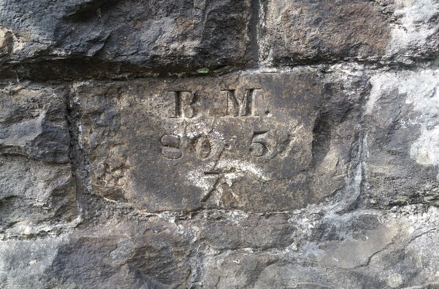
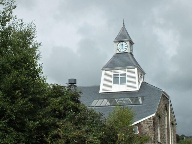
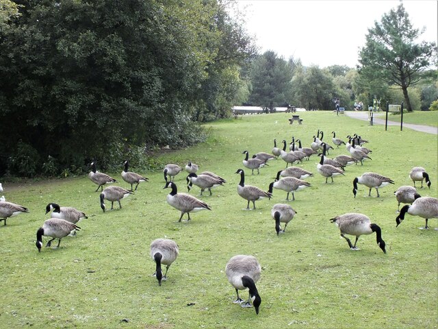
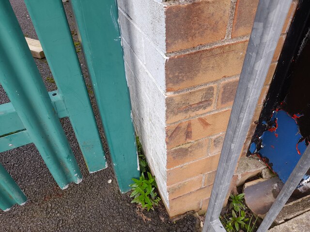
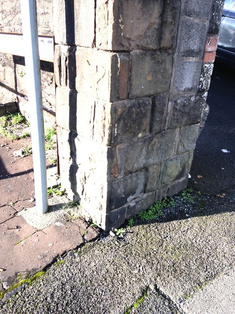
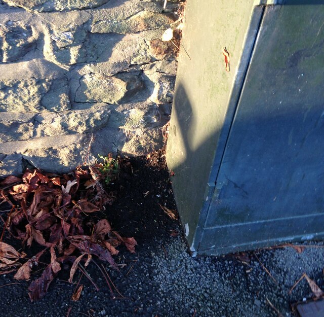
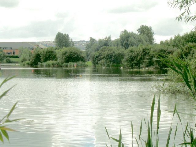
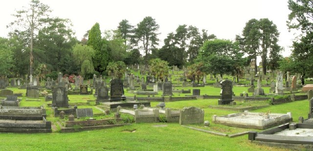
Cwmgelli Images

Images are sourced within 2km of 51.654842/-3.943943 or Grid Reference SS6596. Thanks to Geograph Open Source API. All images are credited.

Benchmark on Railway Bridge This tiny Benchmark can be found on the SW buttress of the railway bridge on Nantong Way.
Benchmark on Railway Bridge
This tiny Benchmark can be found on the SW buttress of the railway bridge on Nantong Way.
Recently Renovated Power House and Clock, Swansea The power house and clock tower of the former Hafod-Morfa Copperworks (closed 1980).
Recently Renovated Power House and Clock, Swansea
The power house and clock tower of the former Hafod-Morfa Copperworks (closed 1980).
Canada Geese, Llyn y Fendrod, Llansamlet, Swansea
Ordnance Survey Cut Mark This OS cut mark can be found on the SW angle of the school. It marks a point 153.278m above mean sea level.
Ordnance Survey Cut Mark
This OS cut mark can be found on the SW angle of the school. It marks a point 153.278m above mean sea level.
Penderyn Distillery, Landore This magnificent looking plant has been assembled in the former powerhouse, later a canteen of a former copperworks at Landore. This building has been thoroughly wrecked but has now been rehabilitated as a new distillery, visitor centre and shop for Penderyn Whisky. This was a hastily grabbed shot as somebody was unhappy with us taking a picture from a public area (the park and ride car park) through an open door.
Penderyn Distillery, Landore
This magnificent looking plant has been assembled in the former powerhouse, later a canteen of a former copperworks at Landore. This building has been thoroughly wrecked but has now been rehabilitated as a new distillery, visitor centre and shop for Penderyn Whisky. This was a hastily grabbed shot as somebody was unhappy with us taking a picture from a public area (the park and ride car park) through an open door.
Penderyn Distillery This is Penderyn's third whisky distillery and the most recent. It is based in the formed Hafod copperworks' powerhouse that then became a canteen. This building had been extremely derelict but has now been rehabilitated.
Penderyn Distillery
This is Penderyn's third whisky distillery and the most recent. It is based in the formed Hafod copperworks' powerhouse that then became a canteen. This building had been extremely derelict but has now been rehabilitated.
Penderyn Distillery, Landore This was the former powerhouse and then a canteen for the Hafod copper works that was Yorkshire Imperial Metals. It has now been beautifully restored as a whisky distillery but was a total wreck when I saw it in 2012 - <a href="https://www.geograph.org.uk/photo/3058971">SS6695 : Remains of Yorkshire Imperial Metals Hafod Works, Landore</a>.
Penderyn Distillery, Landore
This was the former powerhouse and then a canteen for the Hafod copper works that was Yorkshire Imperial Metals. It has now been beautifully restored as a whisky distillery but was a total wreck when I saw it in 2012 - SS6695 : Remains of Yorkshire Imperial Metals Hafod Works, Landore.
Llangyfelach Road Wall, Cut Mark Swansea Cut Mark on wall at Llangyfelach Road.
Llangyfelach Road Wall, Cut Mark Swansea
Cut Mark on wall at Llangyfelach Road.
Cut Mark at Tirdeunaw Close on pillar at junction Cut mark on stone pillar at junction of Llangyfelach Road and Tirdeunaw Close, Swansea
Cut Mark at Tirdeunaw Close on pillar at junction
Cut mark on stone pillar at junction of Llangyfelach Road and Tirdeunaw Close, Swansea
Benchmark Cut Mark: Swansea,  at 27 Penfilia Road A possible Bench Mark found next to telephone style box at Penfilia Road, Swansea
Benchmark Cut Mark: Swansea, at 27 Penfilia Road
A possible Bench Mark found next to telephone style box at Penfilia Road, Swansea
Benchmark at 293 Llangyfelach Road A Cut Benchmark can be found on the right of 293 Llangyfelach Road Swansea
Benchmark at 293 Llangyfelach Road
A Cut Benchmark can be found on the right of 293 Llangyfelach Road Swansea
New Morfa Stadium Swansea's new Football & Rugby 'Liberty Stadium' next to the River Tawe, near the Morfa retail park.
New Morfa Stadium
Swansea's new Football & Rugby 'Liberty Stadium' next to the River Tawe, near the Morfa retail park.
Fendrod Lake Swansea has a "Lakeside" retail park too. This is the lake, which is actually part of the River Fendrod.
Fendrod Lake
Swansea has a "Lakeside" retail park too. This is the lake, which is actually part of the River Fendrod.
Swansea Vale Rail Yard The small Swansea Vale railway is being restored here at the south end of the line.
Swansea Vale Rail Yard
The small Swansea Vale railway is being restored here at the south end of the line.
Ruin of former stores at Cnap Llwyd Only 2 corners of masonry remain from this building high on wasteland. This is the view south out to Swansea Bay.
Ruin of former stores at Cnap Llwyd
Only 2 corners of masonry remain from this building high on wasteland. This is the view south out to Swansea Bay.
Ruin on Cnap Llwyd, seen from below The odd corner ruins look like mysterious towers from a distance.
Ruin on Cnap Llwyd, seen from below
The odd corner ruins look like mysterious towers from a distance.
Llewelyn Park A large and sprawling park on a hillside.
Llewelyn Park
A large and sprawling park on a hillside.
Cwmgelli Cemetery A secluded cemetery with some slightly unusual trees.
Cwmgelli Cemetery
A secluded cemetery with some slightly unusual trees.
Show me another place!

Cwmgelli is located at Grid Ref: SS6596 (Lat: 51.654842, Lng: -3.943943)

Unitary Authority: Swansea

Police Authority: South Wales

What 3 Words

///inform.nests.vibrates. Near Landore, Swansea

Related Wikis

Cwmgelli Cemetery

Cwmgelli Cemetery, also known as Cwmgelly Cemetery, is a cemetery located in the Treboeth area of Swansea, Wales. The cemetery is listed on the Cadw/ICOMOS...

Treboeth

Treboeth is a suburb and historical village in the Mynydd-Bach ward of Swansea, Wales. Gwyrosydd Primary School and Welsh language primary school Ysgol...

Mynydd-Bach

Mynydd-Bach or Mynydd-bach is a suburban district and community in the City and County of Swansea, Wales, It falls within the coterminous Mynydd-Bach ward...

Mynyddbach Chapel

Mynyddbach Chapel is the oldest Independent chapel in Swansea, Wales. In about 1640 a group of people met on the Sabbath and on week nights to read the...

Nearby Amenities

Located within 500m of 51.654842,-3.943943
Source: bing
Lat/Long: 51.6522757/-3.9486333
Source: bing
Lat/Long: 51.6551041/-3.9487442
Source: bing
Lat/Long: 51.6550923/-3.9489191
Source: bing
Lat/Long: 51.6518684/-3.9485997
Source: bing
Lat/Long: 51.6519979/-3.9486104
Source: bing
Lat/Long: 51.6517138/-3.9475081
Source: bing
Lat/Long: 51.6518236/-3.9451109
Source: bing
Lat/Long: 51.6520119/-3.9448092
Source: bing
Lat/Long: 51.6524821/-3.9444932
Source: bing
Lat/Long: 51.6526916/-3.9439727
Source: bing
Lat/Long: 51.6527932/-3.9432349
Source: bing
Lat/Long: 51.653348/-3.9428353
Bus Stop
Tre-boeth PO (N)
Bus: yes
Naptan AtcoCode: 5810AWC52094
Naptan Bearing: N
Naptan CommonName: Tre-boeth PO (N)
Naptan Crossing: Penlan Road
Naptan Landmark: Tre-boeth Post Office
Naptan NaptanCode: swapdwd
Naptan PlusbusZoneRef: SWANSEA
Naptan ShortCommonName: Tre-boeth Library
Naptan Street: Llangyfelach Road
Naptan Verified: no
Public Transport: platform
Source: naptan_import
Lat/Long: 51.6515369/-3.9486601
Bus Stop
Ford`s Club (N)
Bus: yes
Naptan AtcoCode: 5810AWC52099
Naptan Bearing: N
Naptan CommonName: Ford`s Club (N)
Naptan Crossing: Clifton Court
Naptan NaptanCode: swadmdp
Naptan PlusbusZoneRef: SWANSEA
Naptan Street: Llangyfelach Road
Naptan Verified: no
Public Transport: platform
Source: naptan_import
Lat/Long: 51.6552077/-3.9490923
Bus Stop
Ford`s Club (S)
Bus: yes
Naptan AtcoCode: 5810AWC52100
Naptan Bearing: S
Naptan CommonName: Ford`s Club (S)
Naptan Crossing: Clifton Court
Naptan NaptanCode: swadmdt
Naptan PlusbusZoneRef: SWANSEA
Naptan Street: Llangyfelach Road
Naptan Verified: no
Public Transport: platform
Source: naptan_import
Lat/Long: 51.6552832/-3.9488786
Bus Stop
Tre-boeth Gospel Hall (NE)
Bus: yes
Naptan AtcoCode: 5810AWC52101
Naptan Bearing: NE
Naptan CommonName: Tre-boeth Gospel Hall (NE)
Naptan Crossing: Llangyfelach Road
Naptan NaptanCode: swapdpm
Naptan PlusbusZoneRef: SWANSEA
Naptan Street: Heol Gwrosydd
Naptan Verified: no
Public Transport: platform
Source: naptan_import
Lat/Long: 51.6544906/-3.9494952
Bus Stop
Tre-boeth Gospel Hall (SW)
Bus: yes
Naptan AtcoCode: 5810AWC52102
Naptan Bearing: SW
Naptan CommonName: Tre-boeth Gospel Hall (SW)
Naptan Crossing: Llangyfelach Road
Naptan NaptanCode: swapdpt
Naptan PlusbusZoneRef: SWANSEA
Naptan Street: Heol Gwrosydd
Naptan Verified: no
Public Transport: platform
Source: naptan_import
Lat/Long: 51.6543151/-3.9497768
Mini Roundabout
Direction: clockwise
Lat/Long: 51.6544839/-3.9488978
Source: bing
Lat/Long: 51.654406/-3.9497092
Source: bing
Lat/Long: 51.6539026/-3.9500339
Source: bing
Lat/Long: 51.6538045/-3.9500259
Source: bing
Lat/Long: 51.6537362/-3.9500607
Source: bing
Lat/Long: 51.653668/-3.9501037
Source: bing
Lat/Long: 51.6522837/-3.9487779
Source: bing
Lat/Long: 51.6523724/-3.9496652
Source: bing
Lat/Long: 51.6524108/-3.9498055
Source: bing
Lat/Long: 51.6524815/-3.9499608
Source: bing
Lat/Long: 51.6526181/-3.9501718
Source: bing
Lat/Long: 51.6538367/-3.9474611
Source: bing
Lat/Long: 51.653119/-3.9485574
Source: bing
Lat/Long: 51.65311/-3.9487201
Source: bing
Lat/Long: 51.6523482/-3.9486388
Source: bing
Lat/Long: 51.6539769/-3.9471834
Source: bing
Lat/Long: 51.6523443/-3.9446193
Source: bing
Lat/Long: 51.6525962/-3.9442854
Source: bing
Lat/Long: 51.6527281/-3.9436808
Source: bing
Lat/Long: 51.6527345/-3.9434164
Source: bing
Lat/Long: 51.6530795/-3.9430243
Source: bing
Lat/Long: 51.6532568/-3.9428497
Source: bing
Lat/Long: 51.6534559/-3.9428618
Source: bing
Lat/Long: 51.6537904/-3.9432032
Source: bing
Lat/Long: 51.6536532/-3.9435851
Source: bing
Lat/Long: 51.6550654/-3.9486237
Source: bing
Lat/Long: 51.6509616/-3.9417327
Place Of Worship
Gospel Hall
Religion: christian
Lat/Long: 51.6547099/-3.9492136
Source: bing
Lat/Long: 51.6504068/-3.9433567
Source: bing
Lat/Long: 51.6504474/-3.9431521
Source: bing
Lat/Long: 51.6504503/-3.9432721
Source: bing
Lat/Long: 51.6504856/-3.9429783
Source: bing
Lat/Long: 51.6505782/-3.9434659
Source: bing
Lat/Long: 51.6506278/-3.9428491
Source: bing
Lat/Long: 51.6507184/-3.9428783
Source: bing
Lat/Long: 51.6507244/-3.943679
Source: bing
Lat/Long: 51.6508034/-3.942926
Source: bing
Lat/Long: 51.6508145/-3.942989
Source: bing
Lat/Long: 51.6508358/-3.9431091
Source: bing
Lat/Long: 51.6508454/-3.9427091
Source: bing
Lat/Long: 51.6509007/-3.9426107
Source: bing
Lat/Long: 51.6509112/-3.9430691
Source: bing
Lat/Long: 51.6509427/-3.9438643
Source: bing
Lat/Long: 51.6509446/-3.9432721
Source: bing
Lat/Long: 51.651027/-3.9418595
Source: bing
Lat/Long: 51.6510381/-3.9424569
Source: bing
Lat/Long: 51.6510754/-3.9431306
Source: bing
Lat/Long: 51.6511145/-3.9422631
Source: bing
Lat/Long: 51.651126/-3.9441429
Source: bing
Lat/Long: 51.6511479/-3.942017
Source: bing
Lat/Long: 51.651157/-3.9418545
Source: bing
Lat/Long: 51.6511622/-3.9440965
Source: bing
Lat/Long: 51.6512156/-3.943126
Source: bing
Lat/Long: 51.6512357/-3.9434259
Source: bing
Lat/Long: 51.6512501/-3.9417096
Source: bing
Lat/Long: 51.6512797/-3.9438112
Source: bing
Lat/Long: 51.6512847/-3.9436132
Source: bing
Lat/Long: 51.6513066/-3.9479451
Source: bing
Lat/Long: 51.6513495/-3.943517
Source: bing
Lat/Long: 51.651351/-3.9439441
Source: bing
Lat/Long: 51.651359/-3.9421673
Source: bing
Lat/Long: 51.6513718/-3.943484
Source: bing
Lat/Long: 51.6513798/-3.943046
Source: bing
Lat/Long: 51.6513855/-3.9440627
Source: bing
Lat/Long: 51.6514827/-3.9439595
Source: bing
Lat/Long: 51.6514886/-3.9440922
Source: bing
Lat/Long: 51.6514972/-3.9434942
Source: bing
Lat/Long: 51.6515029/-3.9429214
Source: bing
Lat/Long: 51.6515592/-3.9435829
Source: bing
Lat/Long: 51.6515621/-3.9440857
Source: bing
Lat/Long: 51.6515722/-3.9438214
Source: bing
Lat/Long: 51.6515764/-3.9427461
Source: bing
Lat/Long: 51.6515911/-3.942362
Source: bing
Lat/Long: 51.6516456/-3.9424076
Source: bing
Lat/Long: 51.6517023/-3.947384
Source: bing
Lat/Long: 51.6517237/-3.9416903
Source: bing
Lat/Long: 51.6517385/-3.943425
Source: bing
Lat/Long: 51.6517405/-3.9442903
Source: bing
Lat/Long: 51.6517921/-3.9443936
Source: bing
Lat/Long: 51.6517947/-3.9433764
Source: bing
Lat/Long: 51.6518366/-3.9425165
Source: bing
Lat/Long: 51.6519065/-3.9429221
Source: bing
Lat/Long: 51.6519066/-3.9449087
Source: bing
Lat/Long: 51.6519142/-3.9443411
Source: bing
Lat/Long: 51.6519158/-3.943628
Source: bing
Lat/Long: 51.6519837/-3.9415346
Source: bing
Lat/Long: 51.6520659/-3.9442995
Source: bing
Lat/Long: 51.6520673/-3.9438909
Source: bing
Lat/Long: 51.6520929/-3.9445743
Source: bing
Lat/Long: 51.6521104/-3.9442366
Source: bing
Lat/Long: 51.6521126/-3.9430996
Source: bing
Lat/Long: 51.6521162/-3.9441237
Source: bing
Lat/Long: 51.6522088/-3.943572
Source: bing
Lat/Long: 51.6522113/-3.9443217
Source: bing
Lat/Long: 51.6522219/-3.9418836
Source: bing
Lat/Long: 51.6522331/-3.942893
Source: bing
Lat/Long: 51.6522835/-3.9420198
Source: bing
Lat/Long: 51.6523016/-3.9429646
Source: bing
Lat/Long: 51.6523505/-3.9435539
Source: bing
Lat/Long: 51.6523532/-3.9492835
Source: bing
Lat/Long: 51.65237/-3.9438538
Source: bing
Lat/Long: 51.6524586/-3.9419377
Source: bing
Lat/Long: 51.6524725/-3.943143
Source: bing
Lat/Long: 51.6524735/-3.9424394
Source: bing
Lat/Long: 51.6524981/-3.9445855
Source: bing
Lat/Long: 51.6524996/-3.9422141
Source: bing
Lat/Long: 51.6525923/-3.9448296
Source: bing
Lat/Long: 51.6528357/-3.9448566
Source: bing
Lat/Long: 51.6529741/-3.9447181
Source: bing
Lat/Long: 51.6530224/-3.9435333
Source: bing
Lat/Long: 51.653116/-3.9446066
Source: bing
Lat/Long: 51.6531278/-3.9427471
Source: bing
Lat/Long: 51.6531649/-3.9439337
Source: bing
Lat/Long: 51.6531724/-3.9429328
Source: bing
Lat/Long: 51.6532674/-3.9418839
Source: bing
Lat/Long: 51.6532984/-3.9422588
Source: bing
Lat/Long: 51.6533534/-3.9442586
Source: bing
Lat/Long: 51.6533946/-3.9432624
Source: bing
Lat/Long: 51.6534369/-3.9437472
Source: bing
Lat/Long: 51.6535691/-3.9433946
Source: bing
Lat/Long: 51.6536074/-3.9441933
Source: bing
Lat/Long: 51.6538062/-3.9439521
Source: bing
Lat/Long: 51.6543658/-3.9488367
Source: bing
Lat/Long: 51.6544441/-3.9481488
Source: bing
Lat/Long: 51.6544814/-3.9489989
Source: bing
Lat/Long: 51.6545764/-3.9488578
Pub
The Eagle pub
Addr Street: Treboeth
Description: Pub and restaurant
Wikidata: Q80585340
Lat/Long: 51.6570308/-3.949336
Pub
The King's Head Pub
Addr Housenumber: 726
Addr Street: Information Llangyfelach Road |Treboeth, Swansea SA5 9EL, Wales
Description: pub
Phone: +44 1792 773727
Lat/Long: 51.6528131/-3.9484971
Lifestyle Express
Addr Housenumber: 861-863
Addr Street: Llangyfelach Rd, Tre-boeth, Swansea SA5 9AU
Brand: Lifestyle Express
Brand Wikidata: Q61994869
Description: General store
Phone: +44 1792 701321
Shop: convenience
Website: https://www.best-one.co.uk
Lat/Long: 51.6575373/-3.9493432
Direction: SSE
Generator Method: photovoltaic
Generator Output Electricity: yes
Generator Solar Modules: 14
Generator Source: solar
Generator Type: solar_photovoltaic_panel
Location: roof
Power: generator
Lat/Long: 51.6542788/-3.9510082
Direction: SSE
Generator Method: photovoltaic
Generator Output Electricity: yes
Generator Solar Modules: 12
Generator Source: solar
Generator Type: solar_photovoltaic_panel
Location: roof
Power: generator
Lat/Long: 51.6536348/-3.9439524
Direction: SW
Generator Method: photovoltaic
Generator Output Electricity: yes
Generator Solar Modules: 10
Generator Source: solar
Generator Type: solar_photovoltaic_panel
Location: roof
Power: generator
Lat/Long: 51.6539118/-3.9456328
Direction: SSW
Generator Method: photovoltaic
Generator Output Electricity: yes
Generator Solar Modules: 18
Generator Source: solar
Generator Type: solar_photovoltaic_panel
Location: roof
Power: generator
Lat/Long: 51.654602/-3.9460425
Direction: 145
Generator Method: photovoltaic
Generator Output Electricity: yes
Generator Solar Modules: 11
Generator Source: solar
Generator Type: solar_photovoltaic_panel
Location: roof
Power: generator
Lat/Long: 51.6514733/-3.9443242
Direction: SSW
Generator Method: photovoltaic
Generator Output Electricity: yes
Generator Solar Modules: 16
Generator Source: solar
Generator Type: solar_photovoltaic_panel
Location: roof
Power: generator
Lat/Long: 51.6516459/-3.9452119
Direction: SSW
Generator Method: photovoltaic
Generator Output Electricity: yes
Generator Solar Modules: 6
Generator Source: solar
Generator Type: solar_photovoltaic_panel
Location: roof
Power: generator
Lat/Long: 51.6516607/-3.9453124
Direction: 145
Generator Method: photovoltaic
Generator Output Electricity: yes
Generator Solar Modules: 10
Generator Source: solar
Generator Type: solar_photovoltaic_panel
Location: roof
Power: generator
Lat/Long: 51.6514555/-3.9443064
Direction: WSW
Generator Method: photovoltaic
Generator Output Electricity: yes
Generator Solar Modules: 14
Generator Source: solar
Generator Type: solar_photovoltaic_panel
Location: roof
Power: generator
Lat/Long: 51.6543627/-3.9441046
Direction: SSE
Generator Method: photovoltaic
Generator Output Electricity: yes
Generator Solar Modules: 12
Generator Source: solar
Generator Type: solar_photovoltaic_panel
Location: roof
Power: generator
Lat/Long: 51.65359/-3.943847
Direction: 145
Generator Method: photovoltaic
Generator Output Electricity: yes
Generator Solar Modules: 10
Generator Source: solar
Generator Type: solar_photovoltaic_panel
Location: roof
Power: generator
Lat/Long: 51.6524566/-3.9441047
Direction: 145
Generator Method: photovoltaic
Generator Output Electricity: yes
Generator Solar Modules: 12
Generator Source: solar
Generator Type: solar_photovoltaic_panel
Location: roof
Power: generator
Lat/Long: 51.6521688/-3.9427524
Direction: SSE
Generator Method: photovoltaic
Generator Output Electricity: yes
Generator Solar Modules: 14
Generator Source: solar
Generator Type: solar_photovoltaic_panel
Location: roof
Power: generator
Lat/Long: 51.6542824/-3.9431149
Direction: SSE
Generator Method: photovoltaic
Generator Output Electricity: yes
Generator Solar Modules: 6
Generator Source: solar
Generator Type: solar_photovoltaic_panel
Location: roof
Power: generator
Lat/Long: 51.6541655/-3.9499567
Direction: SSE
Generator Method: photovoltaic
Generator Output Electricity: yes
Generator Solar Modules: 2
Generator Source: solar
Generator Type: solar_photovoltaic_panel
Location: roof
Power: generator
Lat/Long: 51.6541523/-3.9500277
Direction: 265
Generator Method: photovoltaic
Generator Output Electricity: yes
Generator Solar Modules: 14
Generator Source: solar
Generator Type: solar_photovoltaic_panel
Location: roof
Power: generator
Lat/Long: 51.6570485/-3.9476429
Direction: 145
Generator Method: photovoltaic
Generator Output Electricity: yes
Generator Solar Modules: 6
Generator Source: solar
Generator Type: solar_photovoltaic_panel
Location: roof
Power: generator
Lat/Long: 51.6567045/-3.945553
Direction: 145
Generator Method: photovoltaic
Generator Output Electricity: yes
Generator Solar Modules: 10
Generator Source: solar
Generator Type: solar_photovoltaic_panel
Location: roof
Power: generator
Lat/Long: 51.656695/-3.9456703
Direction: 165
Generator Method: photovoltaic
Generator Output Electricity: yes
Generator Solar Modules: 14
Generator Source: solar
Generator Type: solar_photovoltaic_panel
Location: roof
Power: generator
Lat/Long: 51.6572513/-3.9393759
Direction: 190
Generator Method: photovoltaic
Generator Output Electricity: yes
Generator Solar Modules: 16
Generator Source: solar
Generator Type: solar_photovoltaic_panel
Location: roof
Power: generator
Lat/Long: 51.6578808/-3.9388197
Direction: 165
Generator Method: photovoltaic
Generator Output Electricity: yes
Generator Solar Modules: 18
Generator Source: solar
Generator Type: solar_photovoltaic_panel
Location: roof
Power: generator
Lat/Long: 51.6584624/-3.9432987
Direction: WSW
Generator Method: photovoltaic
Generator Output Electricity: yes
Generator Solar Modules: 15
Generator Source: solar
Generator Type: solar_photovoltaic_panel
Location: roof
Power: generator
Lat/Long: 51.6551756/-3.9502509
The data included in this document is from www.openstreetmap.org. The data is made available under ODbL.

Have you been to Cwmgelli?

Leave your review of Cwmgelli below (or comments, questions and feedback).