Botley

Settlement in Hampshire Eastleigh

England

Botley

"The Railway" at Botley A pub in the Greene King Brewery estate on Station Hill opposite the entrance to Botley station.
"The Railway" at Botley Credit: Des Blenkinsopp

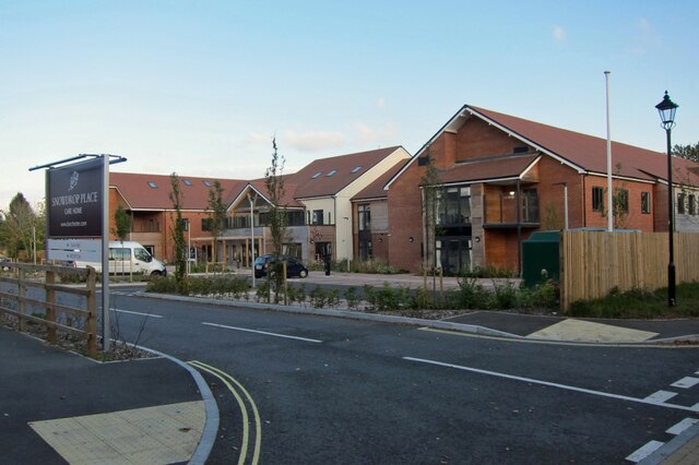
Botley is a small village located in the county of Hampshire, England. Situated roughly 6 miles west of the city of Southampton, Botley is nestled in the picturesque Hamble Valley. With a population of around 7,000 residents, the village exudes a charming and tranquil atmosphere.

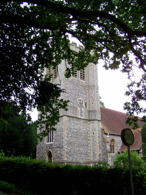
Botley is known for its rich history, dating back to the Roman era. The village was mentioned in the Domesday Book of 1086, highlighting its significance even during medieval times. Today, remnants of its past can still be seen in the form of historic buildings and landmarks such as the 12th-century All Saints Church.

The village boasts a range of amenities to cater to its residents. The local high street offers a variety of shops, including independent retailers, cafes, and pubs. Botley also has a primary school, providing education for the younger members of the community.

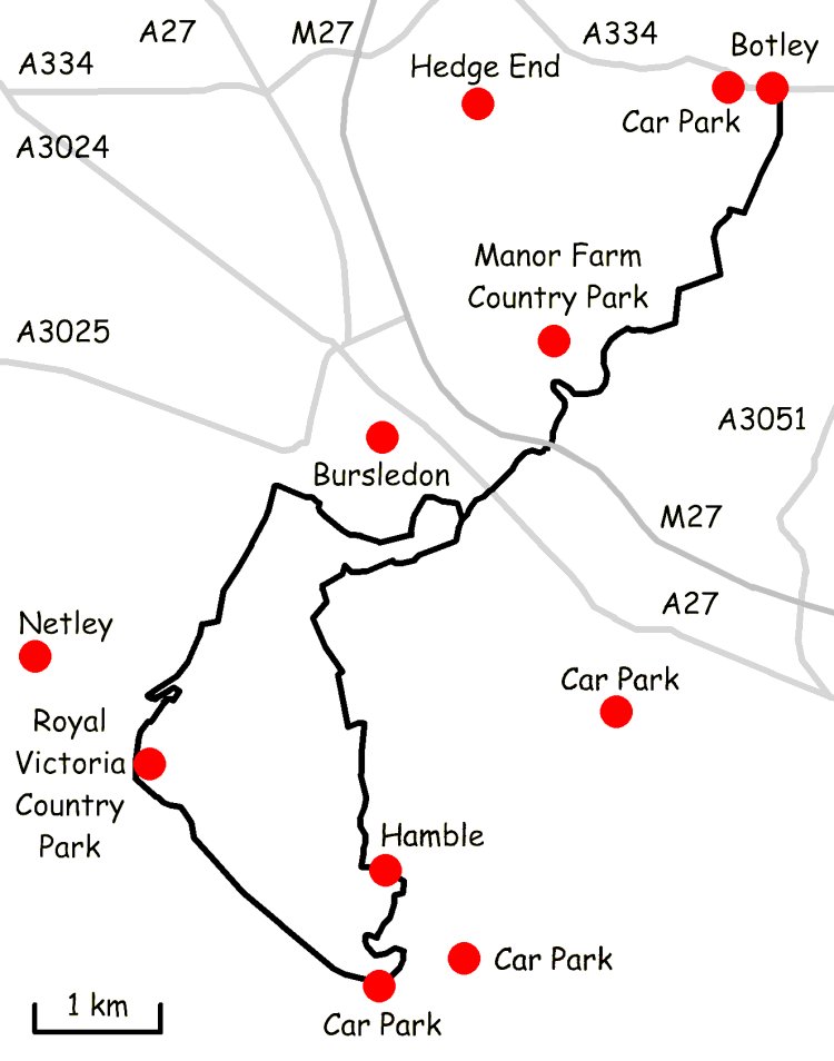
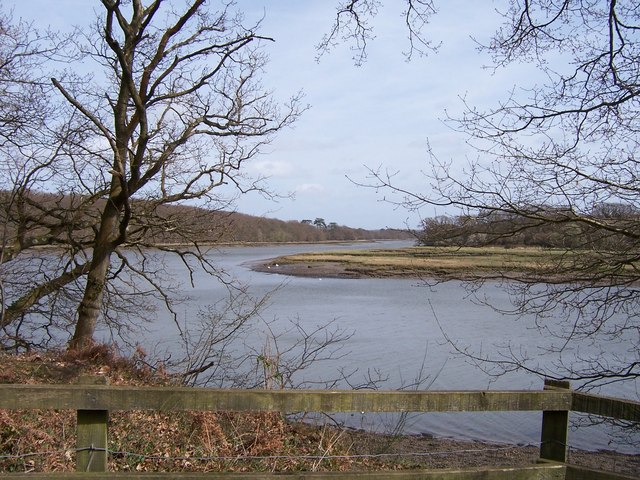
Nature enthusiasts will appreciate the village's proximity to the beautiful River Hamble, which offers scenic walks and boating opportunities. The surrounding countryside is dotted with picturesque landscapes, providing ample space for outdoor activities and exploration.

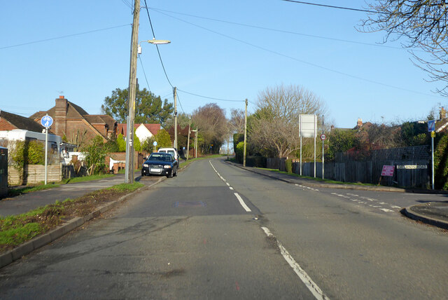
Transport links in Botley are convenient, with regular bus services connecting the village to nearby towns and cities. The M27 motorway is also easily accessible, making Botley an ideal location for commuters.

Overall, Botley offers a delightful blend of history, community, and natural beauty, making it an attractive place to live or visit in Hampshire.

If you have any feedback on the listing, please let us know in the comments section below.
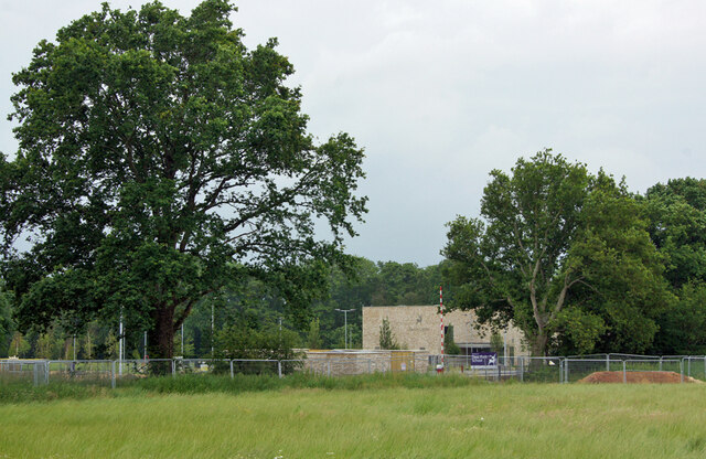
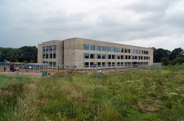
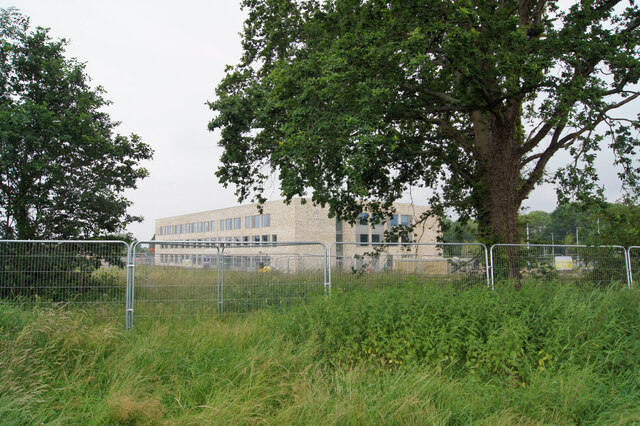
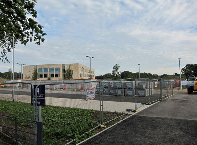
Botley Images

Images are sourced within 2km of 50.914335/-1.2713896 or Grid Reference SU5113. Thanks to Geograph Open Source API. All images are credited.

"The Railway" at Botley A pub in the Greene King Brewery estate on Station Hill opposite the entrance to Botley station.
"The Railway" at Botley
A pub in the Greene King Brewery estate on Station Hill opposite the entrance to Botley station.
Station Hill, Botley Part of a small business estate along Hillsons Road off to the left.
The station is beyond the trees in the background.
Station Hill, Botley
Part of a small business estate along Hillsons Road off to the left. The station is beyond the trees in the background.
Deer Park School, entrance The larger brick building is the Sports Hall. The main school building is out of sight to the left. The school is currently under the final stages of construction, and is due to open in September this year. Currently, the school is surrounded by open fields, though these are destined to shortly be turned into a new housing estate.
Deer Park School, entrance
The larger brick building is the Sports Hall. The main school building is out of sight to the left. The school is currently under the final stages of construction, and is due to open in September this year. Currently, the school is surrounded by open fields, though these are destined to shortly be turned into a new housing estate.
Deer Park School, nearing completion This new secondary school is due to open in September this year. It is currently surrounded by open fields, though very shortly, construction of a new housing estate will swallow them up.
Deer Park School, nearing completion
This new secondary school is due to open in September this year. It is currently surrounded by open fields, though very shortly, construction of a new housing estate will swallow them up.
Deer Park School, under construction The leafy rural setting of the new school will soon change. While most of the larger trees will survive, the fields which surround the school are soon to become a housing development.
Deer Park School, under construction
The leafy rural setting of the new school will soon change. While most of the larger trees will survive, the fields which surround the school are soon to become a housing development.
Deer Park School - now open This view is across the not-yet open car park of the school towards the main building. The school started accepting pupils in September of this year, though clearly parts of the campus are still unfinished.
Deer Park School - now open
This view is across the not-yet open car park of the school towards the main building. The school started accepting pupils in September of this year, though clearly parts of the campus are still unfinished.
Snowdrop Place Care Home Newly opened residential care home operated by Barchester Healthcare.
(See also <a href="https://www.geograph.org.uk/photo/6635397">SU5013 : Snowdrop Place Care Home - under construction</a>).
Snowdrop Place Care Home
Newly opened residential care home operated by Barchester Healthcare. (See also SU5013 : Snowdrop Place Care Home - under construction).
Garden centre café A pleasant place to enjoy a cup of tea and enjoy the autumn sunshine while thinking about all that gardening you could be doing.
Garden centre café
A pleasant place to enjoy a cup of tea and enjoy the autumn sunshine while thinking about all that gardening you could be doing.
A334 towards Wickham Leaving Botley, crossing the River Hamble.
A334 towards Wickham
Leaving Botley, crossing the River Hamble.
A334 High Street, Botley Eastwards towards Wickham.
A334 High Street, Botley
Eastwards towards Wickham.
A334 towards Botley
A334 towards Botley
B3354 Winchester Road, Boorley Green Towards Winchester.
B3354 Winchester Road, Boorley Green
Towards Winchester.
Botley: on Platform 2 This is the line from Fareham to Eastleigh (ahead). The original station buildings - with the exception of the boarded-up signal box - have been demolished and Botley is now an unstaffed halt. The late Ben Brooksbank's <a href="https://www.geograph.org.uk/photo/1859055">SU5213 : Botley Station</a> shows it as it was in 1963.
Botley: on Platform 2
This is the line from Fareham to Eastleigh (ahead). The original station buildings - with the exception of the boarded-up signal box - have been demolished and Botley is now an unstaffed halt. The late Ben Brooksbank's SU5213 : Botley Station shows it as it was in 1963.
Approaching Botley Station The Railway Inn is on the right of the A334, opposite the station (which is masked by trees and part of an industrial estate).
Approaching Botley Station
The Railway Inn is on the right of the A334, opposite the station (which is masked by trees and part of an industrial estate).
Botley: at the corner of Church Lane and Mill Hill High Street is to the left and Winchester Street ahead. The house on the corner is one of many fine Grade II listed 18th-century houses in Botley. The bricks of the single-storey wing on the right are laid in Chinese bond - on their sides, rather than laid flat, they appear larger than bricks laid normally.
Botley: at the corner of Church Lane and Mill Hill
High Street is to the left and Winchester Street ahead. The house on the corner is one of many fine Grade II listed 18th-century houses in Botley. The bricks of the single-storey wing on the right are laid in Chinese bond - on their sides, rather than laid flat, they appear larger than bricks laid normally.
Botley: former maltings, Church Lane Now residential.
Botley: former maltings, Church Lane
Now residential.
Botley: north along Church Lane Looking past  Grade II listed Ivy Cottage towards the former maltings on an April evening.
Botley: north along Church Lane
Looking past Grade II listed Ivy Cottage towards the former maltings on an April evening.
Botley: Cobbetts Cottage, Church Lane This Grade II listed 18th-century house is the only remaining part of the estate of William Cobbett, pamphleteer, journalist and author of "Rural Rides". The south wall is slate-hung.
Botley: Cobbetts Cottage, Church Lane
This Grade II listed 18th-century house is the only remaining part of the estate of William Cobbett, pamphleteer, journalist and author of "Rural Rides". The south wall is slate-hung.
Show me another place!

Botley is located at Grid Ref: SU5113 (Lat: 50.914335, Lng: -1.2713896)

Administrative County: Hampshire

District: Eastleigh

Police Authority: Hampshire

What 3 Words

///shunning.overruns.pulsing. Near Botley, Hampshire

Related Wikis

Botley, Hampshire

Botley is a historic village in Hampshire, England. The village was once described as "the most delightful village in the world" by 18th century journalist...

Strawberry Trail

The Strawberry Trail is a 15-mile footpath through Hampshire, England The trail is part linear and part circular. The linear section connects Botley to...

Edward Sparshott

Edward Sparshott (3 March 1788 – 9 November 1873) was an English officer of the Royal Navy, serving during the Napoleonic Wars. As midshipman on HMS Centaur...

Botley railway station

Botley railway station serves Botley and the surrounding areas in the English county of Hampshire. The station is on the railway line between Eastleigh...

Curdridge

Curdridge is a village and civil parish within the City of Winchester district of Hampshire, England. The parish also contains the similarly named village...

The Curdridge Country Show

The Curdridge Country Show is an annual country fair in Curdridge, Hampshire, England. The event is held mid-July on a Saturday, and attracts up to 7000...

Upper Hamble Estuary and Woods

Upper Hamble Estuary and Woods is a 151.2-hectare (374-acre) biological Site of Special Scientific Interest east of Southampton in Hampshire. It is part...

Curbridge, Hampshire

Curbridge is a village and former civil parish, now in the parish of Curdridge, in the Winchester district, in the county of Hampshire, England. In 1951...

Nearby Amenities

Located within 500m of 50.914335,-1.2713896
Botley
Place: village
Wikidata: Q1241154
Lat/Long: 50.914465/-1.2702405
Bus: yes
Public Transport: stop_position
Lat/Long: 50.9143254/-1.2716802
Man Made: tower
Tower Type: church
Lat/Long: 50.914365/-1.2737585
Bus Stop
Botley School
Bus: yes
Naptan AtcoCode: 1900HA030436
Naptan Bearing: NE
Naptan CommonName: Botley School
Naptan Crossing: High Street
Naptan NaptanCode: hamdmagj
Naptan Street: Mortimer Road
Naptan Verified: no
Public Transport: platform
Source: naptan_import
Lat/Long: 50.9150564/-1.2745104
Bus Stop
Botley School
Bus: yes
Naptan AtcoCode: 1900HA030437
Naptan Bearing: NE
Naptan CommonName: Botley School
Naptan Crossing: High Street
Naptan NaptanCode: hamdmadp
Naptan Street: Mortimer Road
Naptan Verified: no
Public Transport: platform
Source: naptan_import
Lat/Long: 50.9150032/-1.274625
Bus Stop
Botley Square
Bus: yes
Naptan AtcoCode: 1900HA030438
Naptan NaptanCode: hamdmajp
Public Transport: platform
Lat/Long: 50.9142962/-1.2716772
Bus Stop
Botley Square
Bus: yes
Naptan AtcoCode: 1900HA030439
Naptan NaptanCode: hamdmamg
Public Transport: platform
Lat/Long: 50.9144073/-1.2711836
Post Box
Collection Plate: CP1
Collection Times: Mo-Fr 17:15; Sa 12:15
Operator: Royal Mail
Operator Wikidata: Q638098
Post Box Type: pillar
Ref: SO30 416
Royal Cypher: EIIR
Royal Cypher Wikidata: Q33102113
Source: Bing, Survey
Lat/Long: 50.9144715/-1.2706751
Note: Tidal limit
Lat/Long: 50.9112176/-1.2697866
Note: Tidal limit
Lat/Long: 50.9113909/-1.2686137
Post Office
Botley Post Office
Addr City: Southampton
Addr Country: GB
Addr County: Hampshire
Addr Postcode: SO30 2EA
Addr Street: High Street
Addr Village: Botley
Brand: Post Office
Brand Wikidata: Q1783168
Opening Hours: Mo-Fr 09:00-17:30; Sa 09:00-12:45
Operator: The Co-operative
Ref Pol Id: 3946
Source: OS OpenData StreetView
Website: https://www.postoffice.co.uk/branch-finder/1635468/botley
Lat/Long: 50.9145643/-1.2706582
Traffic Calming: cushion
Lat/Long: 50.9147301/-1.2746288
Restaurant
Regginas
Cuisine: italian
Lat/Long: 50.9142465/-1.2710398
Traffic Calming: cushion
Lat/Long: 50.9139302/-1.2749886
William Cobbett
Historic: memorial
Lat/Long: 50.9144486/-1.2707019
Atm
Brand: Cashzone
Brand Wikidata: Q110738461
Fee: no
Network: Allpoint
Network Wikidata: Q4733264
Opening Hours: 24/7
Operator: Cash Zone
Lat/Long: 50.9144934/-1.2706386
Bicycle Parking
Capacity: 4
Covered: no
Lat/Long: 50.914449/-1.2706489
Barrier: stile
Lat/Long: 50.9145975/-1.2643265
Bicycle Parking
Bicycle Parking: stands
Capacity: 4
Covered: no
Lat/Long: 50.9144871/-1.269924
Traffic Calming: cushion
Lat/Long: 50.9130243/-1.2722053
Traffic Calming: cushion
Lat/Long: 50.9130913/-1.273097
Traffic Calming: cushion
Lat/Long: 50.9134251/-1.274541
Traffic Calming: cushion
Lat/Long: 50.9143537/-1.2748135
Worn to be Wild
Phone: +441489795792
Shop: fancy_dress
Lat/Long: 50.9142987/-1.2689518
Pub
Brewery Bar
Lat/Long: 50.914914/-1.2696989
Restaurant
Purbani
Cuisine: indian
Lat/Long: 50.9145759/-1.2700066
Bench
Lat/Long: 50.9164902/-1.2704502
Post Box
Collection Plate: CP7D
Collection Times: Mo-Fr 09:00; Sa 07:00
Post Box Type: lamp
Ref: SO30 158D
Royal Cypher: EIIR
Royal Cypher Wikidata: Q33102113
Lat/Long: 50.9142867/-1.2754479
Historic: memorial
Memorial: war_memorial
Lat/Long: 50.9145316/-1.2736984
Addr City: Botley, Southampton
Addr Street: High Street
Old Phone: +44 1489 782215
Removed Amenity: telephone
Lat/Long: 50.9143814/-1.2709435
Austen's Hair
Addr City: Botley, Southampton
Addr Street: High Street
Phone: +44 1489 795959
Shop: hairdresser
Lat/Long: 50.9144784/-1.2707536
Amanda of Botley
Addr City: Botley, Southampton
Addr Street: High Street
Shop: beauty_therapy
Lat/Long: 50.9144712/-1.2707925
Bus: yes
Public Transport: stop_position
Lat/Long: 50.9143543/-1.2711778
The Computer Man
Addr Housenumber: 17
Addr Postcode: SO30 2EY
Addr Street: High Street
Opening Hours: Mo-Fr 10:00-18:00; Sa 10:00-14:00
Phone: +44 1489785646
Shop: computer
Website: https://www.computermanit.com/
Lat/Long: 50.9142891/-1.2711615
Gents @ 27
Addr City: Botley, Southampton
Addr Housenumber: 27
Addr Postcode: SO30 2EA
Addr Street: High Street
Phone: +44 1489 795869
Shop: hairdresser
Website: https://www.gentsat27.com/
Lat/Long: 50.9142091/-1.2719205
Bench
Backrest: yes
Lat/Long: 50.9107568/-1.2688642
Bench
Backrest: yes
Lat/Long: 50.910794/-1.2688
Bench
Backrest: yes
Lat/Long: 50.9107791/-1.2690333
Bench
Backrest: yes
Lat/Long: 50.9144411/-1.2703699
Bench
Backrest: yes
Lat/Long: 50.9144437/-1.2702305
Fourth Pillar
Office: it
Lat/Long: 50.9143304/-1.2688666
Springs Aquatic
Shop: pet
Lat/Long: 50.9143315/-1.2687145
Entrance: yes
Lat/Long: 50.9143878/-1.2682704
Entrance: yes
Lat/Long: 50.9141693/-1.2682943
Entrance: yes
Lat/Long: 50.9144297/-1.268701
Entrance: yes
Lat/Long: 50.9143252/-1.2682768
Entrance: yes
Lat/Long: 50.9144086/-1.2685357
Entrance: yes
Lat/Long: 50.9142735/-1.2688512
Cafe
Mrs Potts
Lat/Long: 50.9146718/-1.2684233
Entrance: yes
Lat/Long: 50.9144167/-1.2683242
Generator Method: photovoltaic
Generator Output Electricity: yes
Generator Source: solar
Generator Type: solar_photovoltaic_panel
Location: roof
Power: generator
Lat/Long: 50.9165603/-1.2769085
Generator Method: photovoltaic
Generator Output Electricity: yes
Generator Source: solar
Generator Type: solar_photovoltaic_panel
Location: roof
Power: generator
Lat/Long: 50.9165823/-1.2769581
Generator Method: photovoltaic
Generator Output Electricity: yes
Generator Source: solar
Generator Type: solar_photovoltaic_panel
Location: roof
Power: generator
Lat/Long: 50.9166245/-1.2769434
Generator Method: photovoltaic
Generator Output Electricity: yes
Generator Source: solar
Generator Type: solar_photovoltaic_panel
Location: roof
Power: generator
Lat/Long: 50.916611/-1.2768871
Generator Method: photovoltaic
Generator Output Electricity: yes
Generator Source: solar
Generator Type: solar_photovoltaic_panel
Location: roof
Power: generator
Lat/Long: 50.9121/-1.2703183
Generator Method: photovoltaic
Generator Output Electricity: yes
Generator Source: solar
Generator Type: solar_photovoltaic_panel
Location: roof
Power: generator
Lat/Long: 50.9166491/-1.2743604
Generator Method: photovoltaic
Generator Output Electricity: yes
Generator Source: solar
Generator Type: solar_photovoltaic_panel
Location: roof
Power: generator
Lat/Long: 50.9147179/-1.2717909
Generator Method: photovoltaic
Generator Output Electricity: yes
Generator Source: solar
Generator Type: solar_photovoltaic_panel
Location: roof
Power: generator
Lat/Long: 50.9150493/-1.272279
Generator Method: photovoltaic
Generator Output Electricity: yes
Generator Source: solar
Generator Type: solar_photovoltaic_panel
Location: roof
Power: generator
Lat/Long: 50.9150866/-1.275554
Generator Method: photovoltaic
Generator Output Electricity: yes
Generator Source: solar
Generator Type: solar_photovoltaic_panel
Location: roof
Power: generator
Lat/Long: 50.9142605/-1.2760985
Generator Method: photovoltaic
Generator Output Electricity: yes
Generator Source: solar
Generator Type: solar_photovoltaic_panel
Location: roof
Power: generator
Lat/Long: 50.9141421/-1.2756385
Generator Method: photovoltaic
Generator Output Electricity: yes
Generator Source: solar
Generator Type: solar_photovoltaic_panel
Location: roof
Power: generator
Lat/Long: 50.9141049/-1.2755138
Generator Method: photovoltaic
Generator Output Electricity: yes
Generator Source: solar
Generator Type: solar_photovoltaic_panel
Location: roof
Power: generator
Lat/Long: 50.9140888/-1.2754387
Generator Method: photovoltaic
Generator Output Electricity: yes
Generator Source: solar
Generator Type: solar_photovoltaic_panel
Location: roof
Power: generator
Lat/Long: 50.9133887/-1.2720162
Generator Method: photovoltaic
Generator Output Electricity: yes
Generator Source: solar
Generator Type: solar_photovoltaic_panel
Location: roof
Power: generator
Lat/Long: 50.9134682/-1.2726948
Generator Method: photovoltaic
Generator Output Electricity: yes
Generator Source: solar
Generator Type: solar_photovoltaic_panel
Location: roof
Power: generator
Lat/Long: 50.913458/-1.2725741
Generator Method: photovoltaic
Generator Output Electricity: yes
Generator Source: solar
Generator Type: solar_photovoltaic_panel
Location: roof
Power: generator
Lat/Long: 50.9138774/-1.2732285
Generator Method: photovoltaic
Generator Output Electricity: yes
Generator Source: solar
Generator Type: solar_photovoltaic_panel
Location: roof
Power: generator
Lat/Long: 50.9138521/-1.2731266
Generator Method: photovoltaic
Generator Output Electricity: yes
Generator Source: solar
Generator Type: solar_photovoltaic_panel
Location: roof
Power: generator
Lat/Long: 50.9138081/-1.272912
Generator Method: photovoltaic
Generator Output Electricity: yes
Generator Source: solar
Generator Type: solar_photovoltaic_panel
Location: roof
Power: generator
Lat/Long: 50.9137912/-1.2728557
Generator Method: photovoltaic
Generator Output Electricity: yes
Generator Source: solar
Generator Type: solar_photovoltaic_panel
Location: roof
Power: generator
Lat/Long: 50.9132399/-1.2735987
Material: concrete
Waterway: weir
Lat/Long: 50.9153336/-1.2677349
Pub
Hidden Tap - Botley Brewery Ltd
Microbrewery: yes
Lat/Long: 50.9144866/-1.2681316
Pub
CrackleRock
Brewery: yes
Microbrewery: yes
Lat/Long: 50.9145058/-1.2715869
Addr City: Botley
Addr Housenumber: 10
Addr Postcode: SO30 2TW
Addr Street: Bailey Close
Lat/Long: 50.9138774/-1.276065
Defibrillator
Emergency: defibrillator
Lat/Long: 50.9123533/-1.2695079
Defibrillator
Defibrillator Location: outside Botley Market Hall
Emergency: defibrillator
Indoor: no
Lat/Long: 50.914304/-1.2708466
Crossing
Crossing: traffic_signals
Lat/Long: 50.9143662/-1.2708514
The data included in this document is from www.openstreetmap.org. The data is made available under ODbL.

Have you been to Botley?

Leave your review of Botley below (or comments, questions and feedback).