Botloe's Green

Settlement in Gloucestershire Forest of Dean

England

Botloe's Green

Polytunnels by Hopyard Lane There is a lot of soft fruit grown in the Newent area.
Polytunnels by Hopyard Lane Credit: Jonathan Billinger

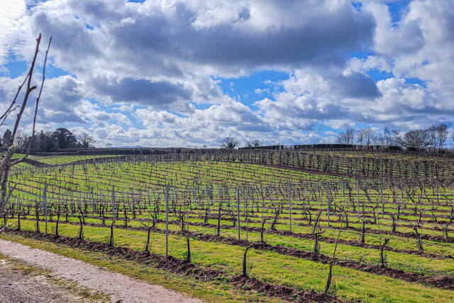
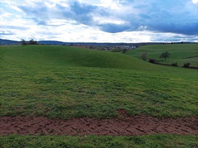
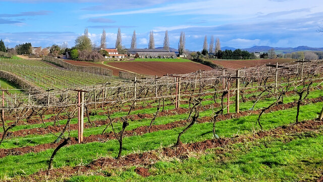
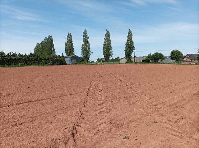
Botloe's Green is a charming village located in the county of Gloucestershire, England. Situated in the picturesque Cotswolds region, it is surrounded by rolling hills and lush green countryside, making it a desirable destination for nature lovers and those seeking tranquility.

The village itself is small but full of character, with quaint stone cottages and a sense of community that is cherished by its residents. Botloe's Green is known for its peaceful atmosphere, offering a welcome escape from the hustle and bustle of city life.

One of the highlights of the village is its beautiful parish church, which dates back to the 12th century. This historical landmark attracts visitors from far and wide, who come to admire its stunning architecture and learn about the area's rich history.

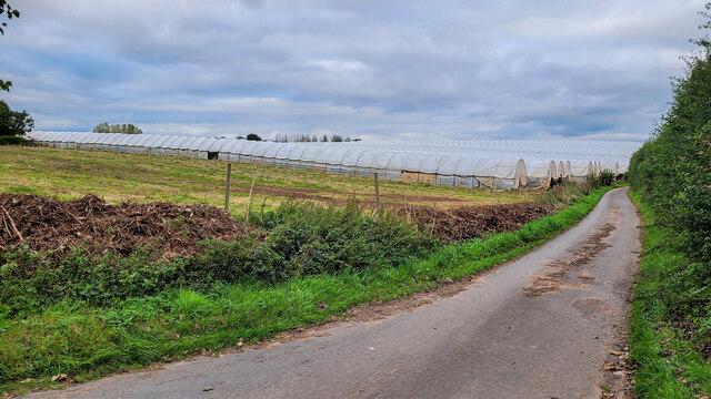
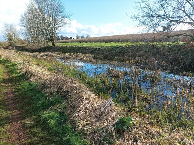
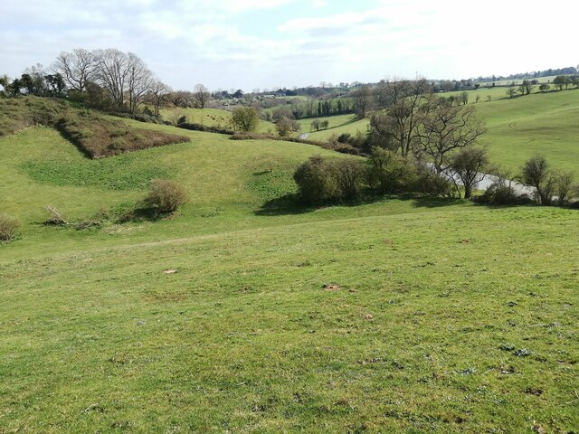
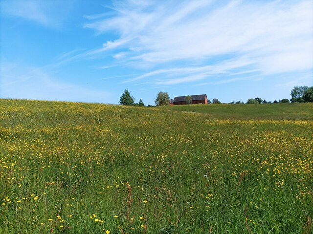
Nature enthusiasts will be delighted by the abundance of walking and cycling trails that surround Botloe's Green. The village is nestled amidst an area of outstanding natural beauty, providing ample opportunities to explore the breathtaking landscapes and spot local wildlife.

Despite its rural setting, Botloe's Green is conveniently located near several larger towns and cities. The bustling market town of Stroud is just a short drive away, offering a range of amenities including shops, restaurants, and entertainment options.

In summary, Botloe's Green is a picturesque village in Gloucestershire that offers a peaceful retreat in the heart of the Cotswolds. With its charming architecture, stunning natural landscapes, and friendly community, it is a hidden gem that is well worth a visit.

If you have any feedback on the listing, please let us know in the comments section below.

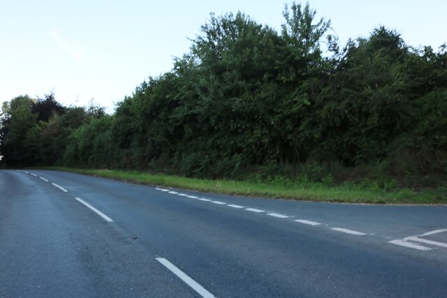
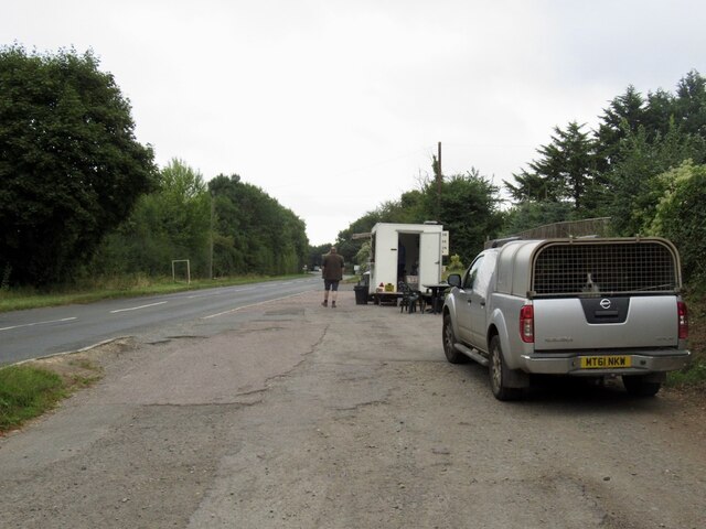
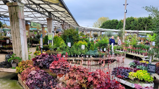
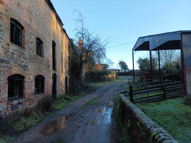
Botloe's Green Images

Images are sourced within 2km of 51.954253/-2.404503 or Grid Reference SO7228. Thanks to Geograph Open Source API. All images are credited.

Polytunnels by Hopyard Lane There is a lot of soft fruit grown in the Newent area.
Polytunnels by Hopyard Lane
There is a lot of soft fruit grown in the Newent area.
Commercial crop of primroses Seed-raised plants at Trioscape's wholesale nursery.
Commercial crop of primroses
Seed-raised plants at Trioscape's wholesale nursery.
Covered area at the garden centre Three Shires Garden Centre in late January.
The bulk of the colour comes from primroses.
Covered area at the garden centre
Three Shires Garden Centre in late January. The bulk of the colour comes from primroses.
Three Choirs Vineyard The March clouds crowd the sky above the source of Three Choirs fortune.
Three Choirs Vineyard
The March clouds crowd the sky above the source of Three Choirs fortune.
Oxenhall Canal Tunnel Southern Portal, 1979 A photograph taken in what looks to be fairly wintry conditions sometime in 1978/79.

It was in a pretty sorry state back then; work was undertaken to renovate it in the 90s (see David Stowell's picture here: <a title="https://www.geograph.org.uk/photo/3682" href="https://www.geograph.org.uk/photo/3682">Link</a> )  but it has, sadly, since fallen back into disrepair (John Winder's picture of 2011: <span class="nowrap"><a title="https://m.geograph.org.uk/photo/5997716" rel="nofollow ugc noopener" href="https://m.geograph.org.uk/photo/5997716">Link</a><img style="margin-left:2px;" alt="External link" title="External link - shift click to open in new window" src="https://s1.geograph.org.uk/img/external.png" width="10" height="10"/></span> )
Oxenhall Canal Tunnel Southern Portal, 1979
A photograph taken in what looks to be fairly wintry conditions sometime in 1978/79. It was in a pretty sorry state back then; work was undertaken to renovate it in the 90s (see David Stowell's picture here: Link ) but it has, sadly, since fallen back into disrepair (John Winder's picture of 2011: LinkExternal link )
The entrance to Bentleys Castle Farm on Dymock Road
Lambs Barn Pitch, Three Ashes By Three Ashes Lane.
Lambs Barn Pitch, Three Ashes
By Three Ashes Lane.
Tea trailer near Newent On the B4215
Tea trailer near Newent
On the B4215
Plant area at Three Shires Garden Centre Some very colourful Heucheras in the foreground.
Plant area at Three Shires Garden Centre
Some very colourful Heucheras in the foreground.
Durbridge Mill buildings Buildings alongside the track through Durbridge Mill Farm.
Durbridge Mill buildings
Buildings alongside the track through Durbridge Mill Farm.
Footpath to Three Ashes Pasture land in a shallow dry valley north of Newent.
Footpath to Three Ashes
Pasture land in a shallow dry valley north of Newent.
Disused canal The disused Herefordshire and Gloucestershire canal, north of Newent.
Disused canal
The disused Herefordshire and Gloucestershire canal, north of Newent.
Rolling hills A field with grassy rolling hills.
Rolling hills
A field with grassy rolling hills.
Old tractor A rusty blue tractor on the edge of a field.
Old tractor
A rusty blue tractor on the edge of a field.
Three Choirs vineyard The main buildings in the centre and a distant view of the Malvern Hills.
Three Choirs vineyard
The main buildings in the centre and a distant view of the Malvern Hills.
Fields near Welsh House Lane Grassy fields and rolling hills near Welsh House Lane.
Fields near Welsh House Lane
Grassy fields and rolling hills near Welsh House Lane.
Footpath towards vineyard A footpath through a muddy field leading towards Three Choirs Vineyard.
Footpath towards vineyard
A footpath through a muddy field leading towards Three Choirs Vineyard.
Field of buttercups A large field of buttercups and other wildflowers.
Field of buttercups
A large field of buttercups and other wildflowers.
Show me another place!

Botloe's Green is located at Grid Ref: SO7228 (Lat: 51.954253, Lng: -2.404503)

Administrative County: Gloucestershire

District: Forest of Dean

Police Authority: Gloucestershire

What 3 Words

///tortoises.elder.dock. Near Newent, Gloucestershire

Nearby Locations

Botloe's Green

Related Wikis

Pauntley

Pauntley is a village and civil parish in the district of Forest of Dean, Gloucestershire, England. In 2019 it had a population of 304. == School == Pauntley...

Castle Tump, Dymock

Castle Tump was a castle in the village of Dymock in Gloucestershire, England. The castle was built in either the 11th or more probably the early 12th...

Oxenhall

Oxenhall is a village and civil parish 10 miles (16 km) north west of Gloucester, in the Forest of Dean district, in the county of Gloucestershire, England...

Newent railway station

Newent railway station served the town of Newent in Gloucestershire, England. It opened on 27 July 1885 when the Newent Railway and the Ross and Ledbury...

Ledbury and Gloucester Railway

The Ledbury and Gloucester Railway (also known as the Daffodil Line), was a railway line in Herefordshire and Gloucestershire, England, running between...

Ketford Bank

Ketford Bank (grid reference SO723308) is a 0.69-hectare (1.7-acre) nature reserve in Gloucestershire.The site is owned and managed by the Gloucestershire...

Brand Green

Brand Green is a village in Gloucestershire, England. == References == == External links == Media related to Brand Green at Wikimedia Commons

Newent

Newent (; originally called "Noent") is a market town and civil parish in the Forest of Dean in Gloucestershire, England. The town is 11 miles (18 km)...

Nearby Amenities

Located within 500m of 51.954253,-2.404503
Cottage Farm
Power: pole
Transformer: distribution
Voltage Primary: 11000
Lat/Long: 51.9558912/-2.4058335
Power: pole
Lat/Long: 51.9566557/-2.4053145
Power: pole
Lat/Long: 51.9575119/-2.4048364
Power: pole
Lat/Long: 51.9579095/-2.4052441
Botloes Farm
Power: pole
Transformer: distribution
Voltage Primary: 11000
Lat/Long: 51.9583214/-2.4056733
Power: pole
Lat/Long: 51.9535849/-2.4114735
Location Transition: yes
Power: pole
Lat/Long: 51.9536151/-2.4101076
Location Transition: yes
Power: pole
Lat/Long: 51.9536341/-2.4089811
Botloes Green
Power: pole
Transformer: distribution
Voltage Primary: 11000
Lat/Long: 51.9536564/-2.4080128
Power: pole
Lat/Long: 51.9530567/-2.4076702
Power: pole
Lat/Long: 51.9525269/-2.4073644
The Scarr East
Power: pole
Transformer: distribution
Voltage Primary: 11000
Lat/Long: 51.952136/-2.4005093
Power: pole
Lat/Long: 51.9521488/-2.401483
Riley Growers - Trans
Power: pole
Transformer: distribution
Voltage Primary: 11000
Lat/Long: 51.9522657/-2.4019839
The Scarr
Power: pole
Transformer: distribution
Voltage Primary: 11000
Lat/Long: 51.9522773/-2.4028979
Power: pole
Lat/Long: 51.9522914/-2.4037595
Power: pole
Lat/Long: 51.9523104/-2.4047291
The Scarr Hall
Power: pole
Transformer: distribution
Voltage Primary: 11000
Lat/Long: 51.9517758/-2.4050399
Power: pole
Lat/Long: 51.9523186/-2.4056827
Power: pole
Lat/Long: 51.9523269/-2.4063063
Power: pole
Lat/Long: 51.9521418/-2.4071404
Power: pole
Lat/Long: 51.95175/-2.4068923
Power: pole
Lat/Long: 51.9511623/-2.4072263
Scarr West
Power: pole
Transformer: distribution
Voltage Primary: 11000
Lat/Long: 51.950949/-2.4075454
Power: pole
Lat/Long: 51.9506696/-2.4079786
The data included in this document is from www.openstreetmap.org. The data is made available under ODbL.

Have you been to Botloe's Green?

Leave your review of Botloe's Green below (or comments, questions and feedback).