Bothen

Settlement in Shetland

Scotland

Bothen

Great Skua (Stercorarius skua) killing Grey Heron (Ardea cinerea), Haroldswick
Great Skua (Stercorarius skua) killing Grey Heron (Ardea cinerea), Haroldswick Credit: Mike Pennington

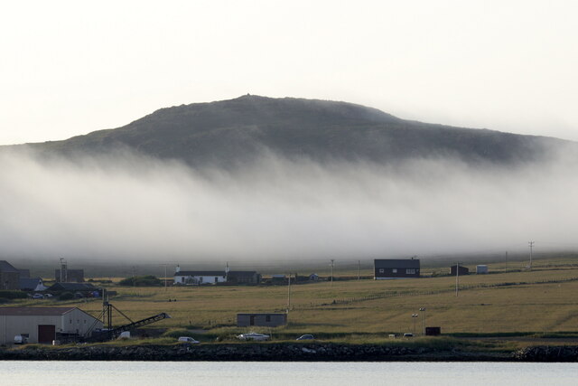
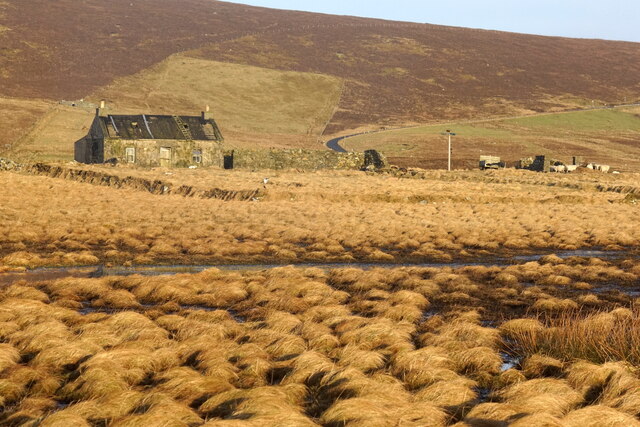
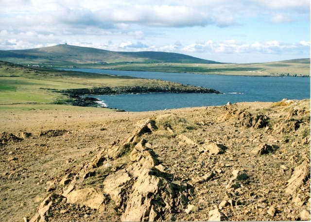
Bothen is a small village located on the island of Shetland, in Scotland. Situated on the eastern coast of the island, Bothen is known for its picturesque landscapes and serene atmosphere. The village is nestled amidst rolling hills, green pastures, and rugged cliffs that overlook the North Sea.

With a population of around 200 people, Bothen offers a close-knit community feel, where residents enjoy a tranquil and peaceful way of life. The village is predominantly residential, with a scattering of traditional cottages and houses, exuding a charming and quaint ambiance.

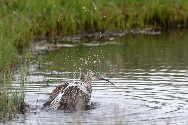
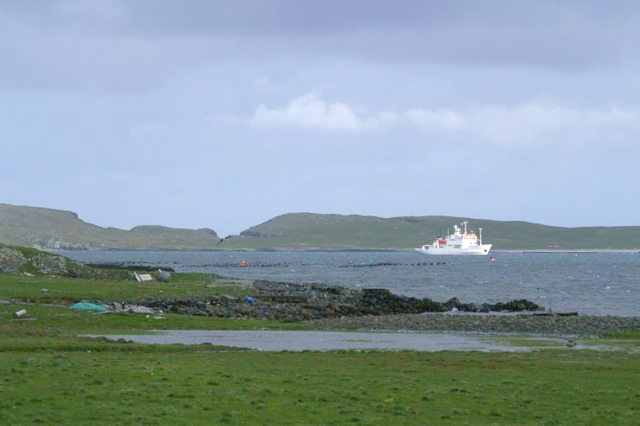
Bothen is surrounded by natural beauty, making it a haven for outdoor enthusiasts. The nearby coastline offers breathtaking views and opportunities for coastal walks, fishing, and birdwatching. The village is also close to several nature reserves, including the Loch of Spiggie, which is renowned for its diverse birdlife.

Despite its small size, Bothen is well-connected to the rest of Shetland. The village has easy access to the main road network, allowing residents to travel to other parts of the island with ease. The nearby town of Lerwick, the capital of Shetland, is approximately 12 miles away and provides a range of amenities, including shops, schools, and healthcare facilities.

Bothen is a hidden gem in Shetland, offering a peaceful and idyllic setting for those seeking a slower pace of life and a deep connection with nature. Its breathtaking landscapes and close-knit community make it a truly special place to call home.

If you have any feedback on the listing, please let us know in the comments section below.

Bothen Images

Images are sourced within 2km of 60.785983/-0.8448004 or Grid Reference HP6312. Thanks to Geograph Open Source API. All images are credited.

Great Skua (Stercorarius skua) killing Grey Heron (Ardea cinerea), Haroldswick
Silage-making, Ungirsta, Haroldswick
Sea haar in front of Muckle Heog, Baltasound
Haar in front of the Heogs, Baltasound
Haar in front of Muckle Heog, Baltasound
Northern Rustic (Standfussiana lucernea), Keen of Hamar
Looking north from Crussa Field
Common Tern (Sterna hirundo), Haroldswick
Curlew (Numenius arquata), Haroldswick
Killer Whales (Orcinus orca), Haroldswick The replica Viking longhouse Skibladner in the background.
Killer Whales (Orcinus orca), Haroldswick
The replica Viking longhouse Skibladner in the background.
Haroldswick pool
Haroldswick pool
Bittern (Botaurus stellaris), Haroldswick An uncommon breeding bird in reedbeds in Britain, which has been close to extinction on several occasions. Birds winter in more widespread locations, but are only rare vagrants in Shetland.
Bittern (Botaurus stellaris), Haroldswick
An uncommon breeding bird in reedbeds in Britain, which has been close to extinction on several occasions. Birds winter in more widespread locations, but are only rare vagrants in Shetland.
Braeview, Quoys, and Tonga from Budigarth, Haroldswick
Glossy Ibis (Plegadis falcinellus), Haroldswick
Westerbrecks, Haroldswick
Male Starling (Sturnus vulgaris), Haroldswick
Mires at Haroldswick, looking towards the Heogs
Nordabrake and Brakefield Crescent from Northdale
Show me another place!

Bothen is located at Grid Ref: HP6312 (Lat: 60.785983, Lng: -0.8448004)

Unitary Authority: Shetland Islands

Police Authority: Highlands and Islands

What 3 Words

///fuzz.maybe.beast. Near Haroldswick, Shetland Islands

Related Wikis

Haroldswick

Haroldswick or Harold's Wick (Old Norse: Haraldsvík, 'Harald's bay'), is on Unst, Shetland Islands, Scotland, and is one of the most northerly settlements...

Valhalla Brewery

The Valhalla Brewery in Unst, Shetland, Scotland, was the northernmost brewery in the United Kingdom. It was opened by the husband and wife team Sonny...

Saxa Vord distillery

Saxa Vord distillery is a Scotch whisky and gin distillery on the island of Unst, part of the Shetland islands. The distillery takes its name from its...

Unst Bus Shelter

The Unst Bus Shelter, also known as Bobby's Bus Shelter, is a bus shelter and bus stop near the village of Baltasound, on the isle of Unst, Shetland Islands...

Burrafirth

Burrafirth links (Old Norse: Borgarfjorðr, meaning "the fjord with a castle") is a strip of land with a few houses on the island of Unst, Shetland, Scotland...

Keen of Hamar

Keen of Hamar is a nature reserve on Unst, in Shetland, Scotland, managed by Scottish Natural Heritage. The reserve is primarily of botanical interest...

Baltasound

Baltasound (or Baltasund) is the largest settlement on the island of Unst in Shetland, Scotland. It comes from the Old Norse man's name Balti (Baltisund...

Balta Sound

Balta Sound is a sound (inlet) on the east coast of the island of Unst in the Shetland Islands, Scotland. The sound is sheltered from the North Sea to...

Nearby Amenities

Located within 500m of 60.785983,-0.8448004
Passing Place
Lat/Long: 60.785518/-0.8490471
Passing Place
Lat/Long: 60.7868959/-0.8359116
Power: pole
Lat/Long: 60.7861674/-0.840486
Power: pole
Lat/Long: 60.7854657/-0.840325
Power: pole
Lat/Long: 60.7867161/-0.8406033
Power: pole
Lat/Long: 60.7827452/-0.8397806
Power: pole
Lat/Long: 60.7845571/-0.8401587
Passing Place
Lat/Long: 60.785891/-0.8384076
Passing Place
Lat/Long: 60.7863124/-0.8390916
Passing Place
Lat/Long: 60.7864481/-0.8362436
Passing Place
Lat/Long: 60.7874542/-0.8401401
Passing Place
Lat/Long: 60.7902545/-0.8442725
Power: pole
Lat/Long: 60.7899028/-0.8479927
Power: pole
Lat/Long: 60.7894394/-0.847998
Power: pole
Lat/Long: 60.787163/-0.8472738
Power: pole
Lat/Long: 60.7858242/-0.8522044
Power: pole
Lat/Long: 60.7864526/-0.8515956
Power: pole
Lat/Long: 60.7870496/-0.8510028
Power: pole
Lat/Long: 60.787657/-0.85041
Power: pole
Lat/Long: 60.7851239/-0.8528642
Ungirsta standing stone
Archaeological Site: megalith
Historic: archaeological_site
Megalith Type: menhir
Note: recorded as https://canmore.org.uk/site/194770/unst-ungirsta
Lat/Long: 60.7861386/-0.841219
Power: pole
Lat/Long: 60.7897443/-0.8467658
Passing Place
Lat/Long: 60.7858322/-0.8539338
Barrier: cattle_grid
Lat/Long: 60.7856599/-0.8521522
Power: pole
Lat/Long: 60.7869517/-0.8461034
Power: pole
Lat/Long: 60.7867619/-0.8450171
Power: pole
Lat/Long: 60.7852145/-0.8460464
Power: pole
Lat/Long: 60.7856399/-0.8457326
Power: pole
Lat/Long: 60.7862146/-0.8453544
Power: pole
Lat/Long: 60.7882657/-0.8498445
Power: pole
Lat/Long: 60.7889569/-0.8491713
Power: pole
Lat/Long: 60.790292/-0.8460063
Power: pole
Lat/Long: 60.7872614/-0.8398221
Power: pole
Lat/Long: 60.7879837/-0.8385279
Power: pole
Lat/Long: 60.7836092/-0.8399951
Power: pole
Lat/Long: 60.786831/-0.8406157
Power: pole
Lat/Long: 60.7870596/-0.8414755
Power: pole
Lat/Long: 60.7875869/-0.8425237
Power: pole
Lat/Long: 60.7879956/-0.843339
Power: pole
Lat/Long: 60.7884298/-0.8441939
Power: pole
Lat/Long: 60.7889002/-0.8451206
Power: pole
Lat/Long: 60.7893017/-0.8459235
Power: pole
Lat/Long: 60.7869768/-0.8448431
Power: pole
Lat/Long: 60.7873553/-0.8445631
The data included in this document is from www.openstreetmap.org. The data is made available under ODbL.

Have you been to Bothen?

Leave your review of Bothen below (or comments, questions and feedback).