Bothel

Settlement in Cumberland Allerdale

England

Bothel

Old Milestone by the A595 near Kirkland Green Metal plate attached to stone post by the A595, in parish of BOTHEL AND THREAPLAND (ALLERDALE District), Overgates, Kirkland Green, on grass verge, on North side of road. Carlisle red stone and curved plate, erected by the Cockermouth & Carlisle turnpike trust in the 19th century. 

Inscription reads:-
CARLISLE
18 MILES
WIGTON
7 MILES
COCKERMOUTH
8½ MILES

Grade II Listed. List Entry Number: 1144497
<span class="nowrap"><a title="https://historicengland.org.uk/listing/the-list/list-entry/1144497" rel="nofollow ugc noopener" href="https://historicengland.org.uk/listing/the-list/list-entry/1144497">Link</a><img style="margin-left:2px;" alt="External link" title="External link - shift click to open in new window" src="https://s1.geograph.org.uk/img/external.png" width="10" height="10"/></span>

Milestone Society National ID: CU_CLCM19.
Old Milestone by the A595 near Kirkland Green Credit: Barbara Todd

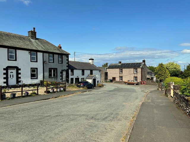
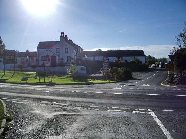
Bothel is a small village located in the county of Cumberland, in the northwest of England. Situated approximately 5 miles southwest of the town of Wigton and 11 miles northwest of the city of Carlisle, Bothel is nestled in the picturesque countryside of the Lake District National Park.

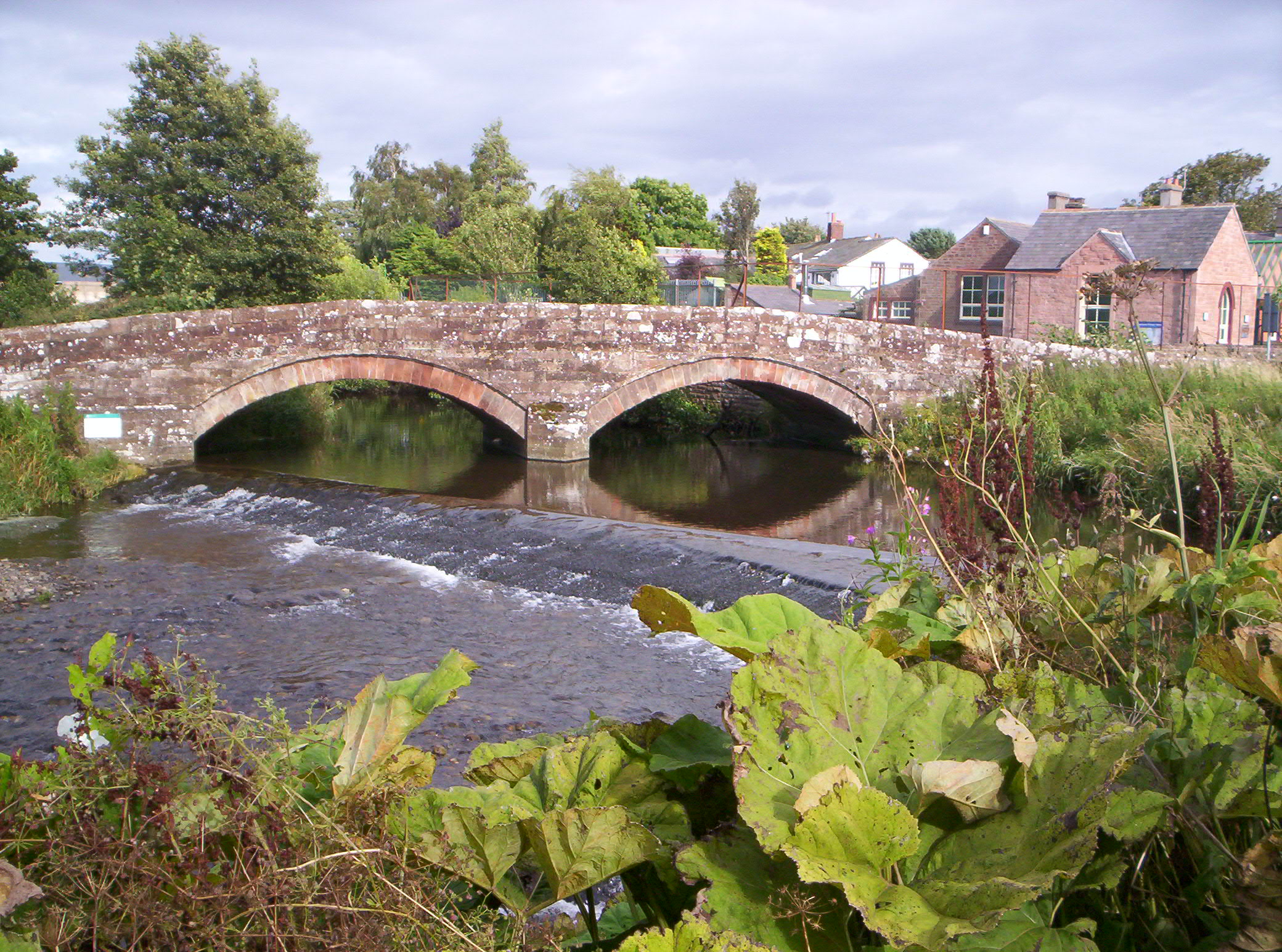
The village is known for its charming rural setting, with rolling green hills, meandering streams, and beautiful woodlands surrounding it. Bothel is home to a close-knit community of around 300 residents who enjoy a tranquil and peaceful lifestyle.

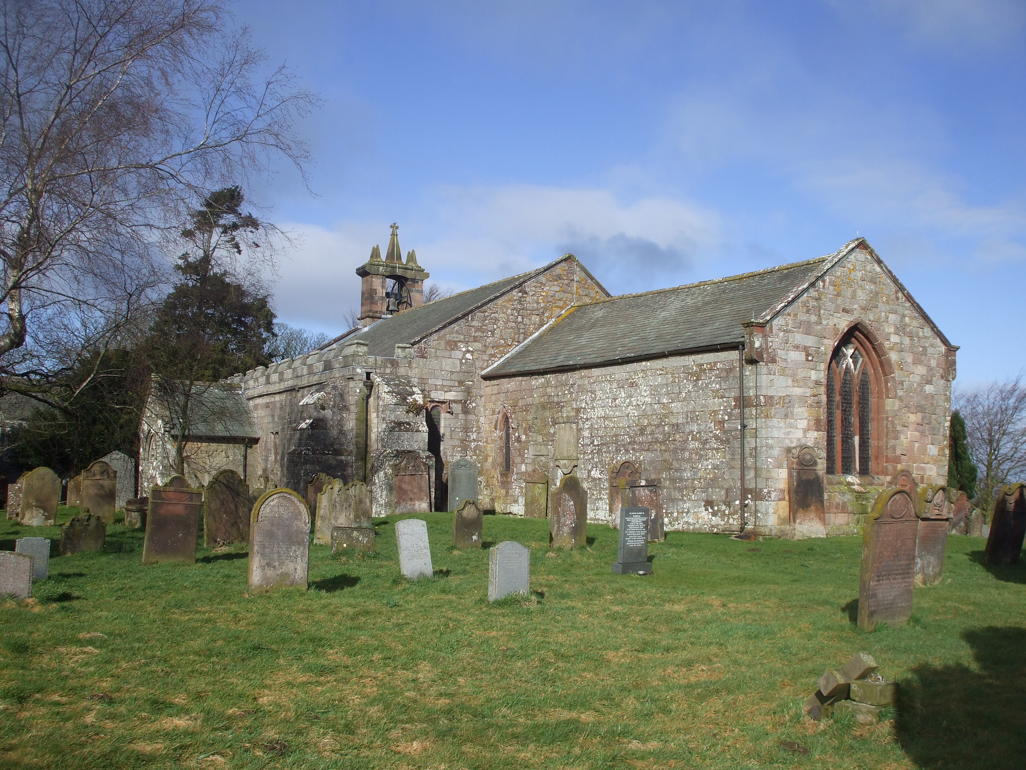
Bothel boasts several notable landmarks, including the historic St. Michael's Church, which dates back to the 12th century. The church features a 14th-century bell tower and is a testament to the village's rich history. Additionally, Bothel is known for its traditional cottages made from local stone, which add to the village's character and charm.

While Bothel is primarily a residential area, it benefits from its proximity to larger towns and cities, offering easy access to amenities and services. The village has a local pub, The Greyhound Inn, which serves as a welcoming hub for residents and visitors alike.

Bothel's location within the Lake District National Park makes it an ideal base for outdoor enthusiasts. The village is surrounded by numerous walking trails, offering breathtaking views of the countryside and nearby lakes, such as Bassenthwaite Lake. The area is also popular for fishing, cycling, and birdwatching.

In summary, Bothel is a quaint and picturesque village in Cumberland, known for its idyllic countryside setting, historic church, and welcoming community. Its location within the Lake District National Park makes it a perfect destination for nature lovers and those seeking a peaceful retreat.

If you have any feedback on the listing, please let us know in the comments section below.

Bothel Images

Images are sourced within 2km of 54.738085/-3.2725532 or Grid Reference NY1838. Thanks to Geograph Open Source API. All images are credited.

Old Milestone by the A595 near Kirkland Green Metal plate attached to stone post by the A595, in parish of BOTHEL AND THREAPLAND (ALLERDALE District), Overgates, Kirkland Green, on grass verge, on North side of road. Carlisle red stone and curved plate, erected by the Cockermouth & Carlisle turnpike trust in the 19th century. 

Inscription reads:-
CARLISLE
18 MILES
WIGTON
7 MILES
COCKERMOUTH
8½ MILES

Grade II Listed. List Entry Number: 1144497
<span class="nowrap"><a title="https://historicengland.org.uk/listing/the-list/list-entry/1144497" rel="nofollow ugc noopener" href="https://historicengland.org.uk/listing/the-list/list-entry/1144497">Link</a><img style="margin-left:2px;" alt="External link" title="External link - shift click to open in new window" src="https://s1.geograph.org.uk/img/external.png" width="10" height="10"/></span>

Milestone Society National ID: CU_CLCM19.
Old Milestone by the A595 near Kirkland Green
Metal plate attached to stone post by the A595, in parish of BOTHEL AND THREAPLAND (ALLERDALE District), Overgates, Kirkland Green, on grass verge, on North side of road. Carlisle red stone and curved plate, erected by the Cockermouth & Carlisle turnpike trust in the 19th century. Inscription reads:- CARLISLE 18 MILES WIGTON 7 MILES COCKERMOUTH 8½ MILES Grade II Listed. List Entry Number: 1144497 LinkExternal link Milestone Society National ID: CU_CLCM19.
Limekiln Bridge, Bothel Limekiln Bridge carries the A595 road across Bothel Beck.
The Greyhound Inn is in the background and there is an Ordnance Survey cut benchmark near this end of the limestone bridge parapet (photograph <a href="https://www.geograph.org.uk/photo/7137011">NY1839 : Benchmark, Limekiln Bridge, Bothel</a>).
The trees have been cut down pending work to improve the road junction.
Limekiln Bridge, Bothel
Limekiln Bridge carries the A595 road across Bothel Beck. The Greyhound Inn is in the background and there is an Ordnance Survey cut benchmark near this end of the limestone bridge parapet (photograph NY1839 : Benchmark, Limekiln Bridge, Bothel). The trees have been cut down pending work to improve the road junction.
Benchmark, Limekiln Bridge, Bothel Detail of the Ordnance Survey cut benchmark on the limestone parapet of Limekiln Bridge. The benchmark marked a height of 132.1552m above mean sea level (Ordnance Datum Newlyn) last verified in 1971 (location photograph <a href="https://www.geograph.org.uk/photo/7136995">NY1839 : Limekiln Bridge, Bothel</a>) and it has subsequently been destroyed.
Benchmark, Limekiln Bridge, Bothel
Detail of the Ordnance Survey cut benchmark on the limestone parapet of Limekiln Bridge. The benchmark marked a height of 132.1552m above mean sea level (Ordnance Datum Newlyn) last verified in 1971 (location photograph NY1839 : Limekiln Bridge, Bothel) and it has subsequently been destroyed.
Benchmark, former Methodist Chapel, Bothel Detail of the Ordnance Survey flush bracket benchmark number S0205 on the north angle, north east face of the former Wesleyan Methodist Chapel.  The benchmark marks a height of 152.1229m above mean sea level (Ordnance Datum Newlyn) last levelled in 1955 and verified in 1969.
Benchmark, former Methodist Chapel, Bothel
Detail of the Ordnance Survey flush bracket benchmark number S0205 on the north angle, north east face of the former Wesleyan Methodist Chapel. The benchmark marks a height of 152.1229m above mean sea level (Ordnance Datum Newlyn) last levelled in 1955 and verified in 1969.
Benchmark, Bothel Detail of the Ordnance Survey cut benchmark on the corner of a barn near the former Methodist Chapel in Bothel.  The benchmark marks a height of 152.2811m above mean sea level (Ordnance Datum Newlyn) last verified in 1969 (location photograph <a href="https://www.geograph.org.uk/photo/7526890">NY1838 : Old farm building, Bothel</a>).
Benchmark, Bothel
Detail of the Ordnance Survey cut benchmark on the corner of a barn near the former Methodist Chapel in Bothel. The benchmark marks a height of 152.2811m above mean sea level (Ordnance Datum Newlyn) last verified in 1969 (location photograph NY1838 : Old farm building, Bothel).
Old farm building, Bothel This old limestone building was originally part of a farm.
The road in the foreground was formerly the A595 from Whitehaven to Carlisle before the village bypass was built.
There is an Ordnance Survey cut benchmark on the sandstone quoin, facing the road on the left hand corner of the building (detail photograph <a href="https://www.geograph.org.uk/photo/7515334">NY1838 : Benchmark, Bothel</a>).
Old farm building, Bothel
This old limestone building was originally part of a farm. The road in the foreground was formerly the A595 from Whitehaven to Carlisle before the village bypass was built. There is an Ordnance Survey cut benchmark on the sandstone quoin, facing the road on the left hand corner of the building (detail photograph NY1838 : Benchmark, Bothel).
Houses in Bothel The road was the A595 from Whitehaven to Carlisle before the completion of Bothel bypass.
Houses in Bothel
The road was the A595 from Whitehaven to Carlisle before the completion of Bothel bypass.
Bothel This road through the village was the A595 from Whitehaven to Carlisle until Bothel was bypass was constructed.
Bothel
This road through the village was the A595 from Whitehaven to Carlisle until Bothel was bypass was constructed.
Direction Sign - Signpost in Bothel Located in a garden hedge beside the junction on School Lane, Bothel. Bothel and Threapland parish. 3 arms, 1 missing, and annulus finial.

Milestone Society National ID: CU_NY1839
Direction Sign - Signpost in Bothel
Located in a garden hedge beside the junction on School Lane, Bothel. Bothel and Threapland parish. 3 arms, 1 missing, and annulus finial. Milestone Society National ID: CU_NY1839
Direction Sign - Signpost in Bothel Located on the north side of the junction south of the village hall in Bothel. Bothel and Threapland parish. 3 arms and annulus finial.

Milestone Society National ID: CU_NY1839A
Direction Sign - Signpost in Bothel
Located on the north side of the junction south of the village hall in Bothel. Bothel and Threapland parish. 3 arms and annulus finial. Milestone Society National ID: CU_NY1839A
Southeast parapet of Limekiln Bridge on east side of A595 Ordnance Survey documents indicate that a benchmark <a href="https://www.geograph.org.uk/photo/7137011">NY1839 : Benchmark, Limekiln Bridge, Bothel</a> levelled at 132.155m above Newlyn Datum was verified in 1971 on the bridge parapet. Evidently the parapet has been rebuilt recently with loss of the mark: compare this image with <a href="https://www.geograph.org.uk/photo/7136995">NY1839 : Limekiln Bridge, Bothel</a>
Southeast parapet of Limekiln Bridge on east side of A595
Ordnance Survey documents indicate that a benchmark NY1839 : Benchmark, Limekiln Bridge, Bothel levelled at 132.155m above Newlyn Datum was verified in 1971 on the bridge parapet. Evidently the parapet has been rebuilt recently with loss of the mark: compare this image with NY1839 : Limekiln Bridge, Bothel
Junction of roads in Bothel The left hand road is the former A595, the right hand one is The Croft. There is a finger signpost <a href="https://www.geograph.org.uk/photo/7617160">NY1839 : Direction Sign - Signpost in Bothel</a> in the hedge at the left hand side of the image
Junction of roads in Bothel
The left hand road is the former A595, the right hand one is The Croft. There is a finger signpost NY1839 : Direction Sign - Signpost in Bothel in the hedge at the left hand side of the image
Bothel village hall at road junction There is an Cumberland Council Council finger signpost <a href="https://www.geograph.org.uk/photo/7617172">NY1839 : Direction Sign - Signpost in Bothel</a>  on the verge at the junction
Bothel village hall at road junction
There is an Cumberland Council Council finger signpost NY1839 : Direction Sign - Signpost in Bothel on the verge at the junction
Milestone on SW side of former A595
Junction of Old Chapel Close with former A595 There is a milestone <a href="https://www.geograph.org.uk/photo/7675835">NY1839 : Milestone on SW side of former A595</a> on the verge at the junction
Junction of Old Chapel Close with former A595
There is a milestone NY1839 : Milestone on SW side of former A595 on the verge at the junction
Benchmark on former chapel on SW side of former A595 Ordnance Survey flush bracket (serial identifier S0205) benchmark levelled at 152.123m above Newlyn Datum in 1955 verified 1969
Benchmark on former chapel on SW side of former A595
Ordnance Survey flush bracket (serial identifier S0205) benchmark levelled at 152.123m above Newlyn Datum in 1955 verified 1969
Former Methodist Chapel on SW side of former A595 There is an Ordnance Survey benchmark <a href="https://www.geograph.org.uk/photo/7675853">NY1838 : Benchmark on former chapel on SW side of former A595</a>  on the near corner, road face, of the building which has a stone inscribed Methodist Chapel 1889-2002
Former Methodist Chapel on SW side of former A595
There is an Ordnance Survey benchmark NY1838 : Benchmark on former chapel on SW side of former A595 on the near corner, road face, of the building which has a stone inscribed Methodist Chapel 1889-2002
Benchmark on building on NW side of former A595 opposite former chapel Ordnance Survey cut mark benchmark levelled at 152.281m above Newlyn Datum verified 1969
Benchmark on building on NW side of former A595 opposite former chapel
Ordnance Survey cut mark benchmark levelled at 152.281m above Newlyn Datum verified 1969
Show me another place!

Bothel is located at Grid Ref: NY1838 (Lat: 54.738085, Lng: -3.2725532)

Administrative County: Cumbria

District: Allerdale

Police Authority: Cumbria

What 3 Words

///scrolled.bright.orders. Near Aspatria, Cumbria

Nearby Locations

Bothel

Related Wikis

Bothel and Threapland

Bothel and Threapland is a civil parish in Cumbria, England, just outside the Lake District National Park. According to the 2001 census, it had a population...

Bothel, Cumbria

Bothel is a small village in Cumbria, England. Bothel was historically within Cumberland. == Location == It is situated just off the main A595 road, 18...

Baggrow

Baggrow is a small village situated north of the Lake District National Park in the English county of Cumbria, historically within Cumberland. In many...

Blennerhasset and Torpenhow

Blennerhasset and Torpenhow (locally and ) is a civil parish in Cumbria, England. According to the 2001 census it had a population of 437, reducing to...
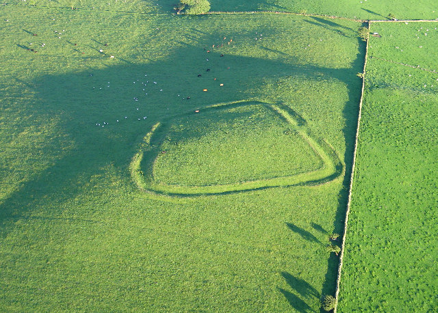
Caer Mote

Caer Mote is a hill of 289 metres (948 ft) in the north of the English Lake District near Bothel, Cumbria. Its summit lies just outside the boundary of...

Threapland, Cumbria

Threapland is a hamlet in the civil parish of Bothel and Threapland, in the Cumberland district, in the ceremonial county of Cumbria, England. Nearby settlements...

St Michael's Church, Torpenhow

St Michael's Church is in the civil parish of Blennerhasset and Torpenhow, Cumbria, England. It is an active Anglican church in the deanery of Derwent...

Harbybrow

Harbybrow is a small settlement in the parish of Allhallows, Cumbria, England. Consisting of two inhabited dwellings - the old manor house and nearby mill...

Nearby Amenities

Located within 500m of 54.738085,-3.2725532
Bothel
Place: village
Source: npe
Wikidata: Q4948627
Wikipedia: en:Bothel, Cumbria
Lat/Long: 54.740692/-3.2729878
Bus Stop
The Old School House
Local Ref: ON
Naptan AtcoCode: 090002121423
Naptan Bearing: S
Naptan CommonName: The Old School House
Naptan Indicator: on
Naptan Landmark: A595 outside The Old School House
Naptan NaptanCode: cumadgdm
Naptan Street: A595(T)
Naptan Verified: no
Source: naptan_import
Lat/Long: 54.7387477/-3.2699547
Bus Stop
The Swallows
Naptan AtcoCode: 090002121424
Naptan Bearing: W
Naptan CommonName: The Swallows
Naptan Indicator: opp
Naptan Landmark: The Swallows
Naptan NaptanCode: cumadgdp
Naptan Street: No name
Naptan Verified: no
Source: naptan_import
Lat/Long: 54.736038/-3.2737996
Bus Stop
School Lane
Naptan AtcoCode: 090002121425
Naptan Bearing: S
Naptan CommonName: School Lane
Naptan Indicator: o/s
Naptan Landmark: Greenfell Cottage
Naptan NaptanCode: cumadgdt
Naptan Street: School Lane
Naptan Verified: no
Source: naptan_import
Lat/Long: 54.7376198/-3.2729483
Bus Stop
Park Road
Local Ref: AT
Naptan AtcoCode: 090002121426
Naptan Bearing: E
Naptan CommonName: Park Road
Naptan Indicator: at
Naptan Landmark: junction with main road at Springfield
Naptan NaptanCode: cumadgdw
Naptan Street: A595(T)
Naptan Verified: no
Source: naptan_import
Lat/Long: 54.7376907/-3.2713351
Old Smithy
Naptan AtcoCode: 090002124165
Naptan Bearing: NE
Naptan BusStopType: CUS
Naptan CommonName: Old Smithy
Naptan Indicator: near
Naptan Landmark: Old Smithy
Naptan NaptanCode: cumdptdt
Naptan Street: No Name
Naptan Verified: no
Source: naptan_import
Lat/Long: 54.7378706/-3.2730338
Bus Stop
Gale Rigg
Local Ref: AT
Naptan AtcoCode: 090002124166
Naptan Bearing: E
Naptan CommonName: Gale Rigg
Naptan Indicator: at
Naptan Landmark: Gale Rigg
Naptan NaptanCode: cumdptdw
Naptan Street: No Name
Naptan Verified: no
Source: naptan_import
Lat/Long: 54.7415124/-3.2711441
Ghyllside
Naptan AtcoCode: 090002124167
Naptan Bearing: W
Naptan BusStopType: CUS
Naptan CommonName: Ghyllside
Naptan Indicator: near
Naptan Landmark: Ghyllside
Naptan NaptanCode: cumdptga
Naptan Street: No Name
Naptan Verified: no
Source: naptan_import
Lat/Long: 54.741389/-3.2709073
Post Box
Ref: CA7 184
Lat/Long: 54.7380032/-3.2724378
Post Box
Post Box Type: lamp
Ref: CA7 242
Lat/Long: 54.7411849/-3.2723114
Bench
Lat/Long: 54.7411965/-3.2723825
Community Centre
Village Hall
Community Centre: village_hall
Lat/Long: 54.7402437/-3.273452
Generator Method: photovoltaic
Generator Output Electricity: yes
Generator Source: solar
Generator Type: solar_photovoltaic_panel
Location: roof
Power: generator
Lat/Long: 54.7401724/-3.2734071
Telephone
Booth: KX100
Covered: booth
Man Made: telephone_box
Lat/Long: 54.7369691/-3.2734743
Advertising: board
Lat/Long: 54.7370119/-3.2734392
Man Made: village_sign
Lat/Long: 54.7358004/-3.273508
Advertising: board
Lat/Long: 54.7411953/-3.2723549
Power: pole
Lat/Long: 54.7418024/-3.2749146
Power: pole
Lat/Long: 54.74222/-3.2749311
Power: pole
Lat/Long: 54.7360033/-3.2758488
Power: pole
Lat/Long: 54.7355749/-3.2769112
Power: pole
Lat/Long: 54.736378/-3.2795113
Power: pole
Lat/Long: 54.7366894/-3.2780955
Power: pole
Lat/Long: 54.7348505/-3.2761692
Power: pole
Lat/Long: 54.734662/-3.2759935
Power: pole
Lat/Long: 54.7338791/-3.2752143
The data included in this document is from www.openstreetmap.org. The data is made available under ODbL.

Have you been to Bothel?

Leave your review of Bothel below (or comments, questions and feedback).