Boswin

Settlement in Cornwall

England

Boswin

Track and pasture, Wendron The footpath approaching Pollangreen Farm from the west.
Track and pasture, Wendron Credit: Andrew Smith

Boswin is a small village located in the county of Cornwall, in southwestern England. Situated near the town of Helston, Boswin is nestled in a picturesque countryside setting, surrounded by rolling hills and lush green fields. The village is home to a tight-knit community and offers a tranquil and idyllic atmosphere.

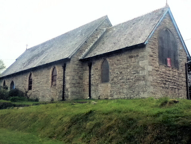
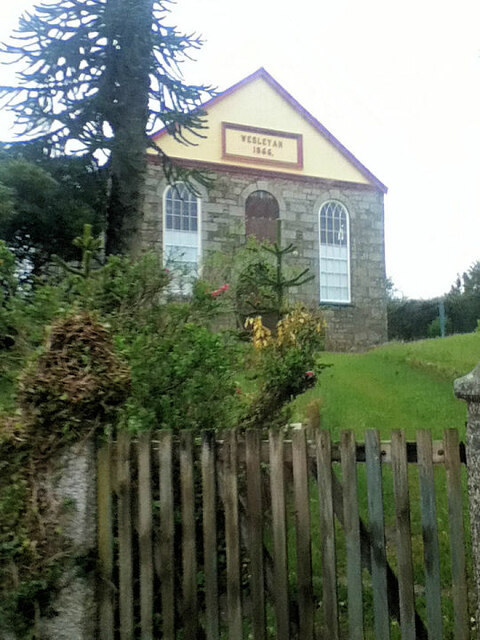
One of the notable features of Boswin is its rich history, dating back several centuries. The village is known for its historic buildings and landmarks, including the 14th-century St. Mary's Church, which stands as a testament to the area's long-standing religious heritage. Additionally, Boswin boasts a number of traditional cottages and farmsteads, showcasing the region's architectural heritage.

Despite its small size, Boswin offers a range of amenities for its residents and visitors. The village has a local pub, where locals often gather to socialize and enjoy a pint, as well as a small convenience store that caters to the basic needs of the community. For more extensive shopping and entertainment options, residents typically venture to nearby Helston or other larger towns in the region.

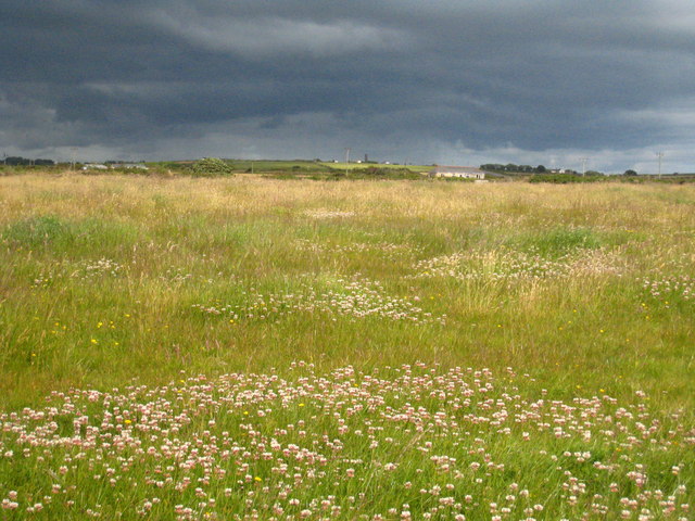
Nature enthusiasts will appreciate Boswin's proximity to the breathtaking Cornish coastline, with its rugged cliffs, sandy beaches, and stunning ocean views. The village also benefits from its location near the Lizard Peninsula, which offers numerous opportunities for outdoor activities such as hiking, fishing, and birdwatching.

In conclusion, Boswin is a charming village in Cornwall, offering a peaceful and scenic retreat for those seeking an escape from the hustle and bustle of city life. With its rich history, natural beauty, and close-knit community, Boswin is a hidden gem worth exploring.

If you have any feedback on the listing, please let us know in the comments section below.
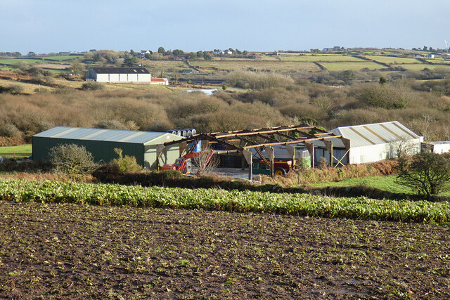
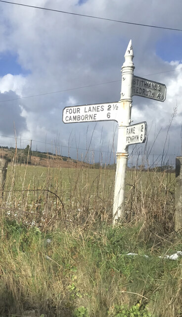
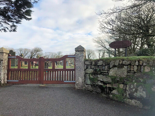
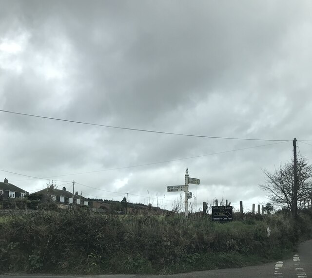
Boswin Images

Images are sourced within 2km of 50.162883/-5.230925 or Grid Reference SW6934. Thanks to Geograph Open Source API. All images are credited.

Track and pasture, Wendron The footpath approaching Pollangreen Farm from the west.
Track and pasture, Wendron
The footpath approaching Pollangreen Farm from the west.
Farm buildings at Penmarth, Wendron The wooded area is Polhigey Moor with Menerlue Farm seen beyond.  In the foreground is a crop of beets for fodder.
Farm buildings at Penmarth, Wendron
The wooded area is Polhigey Moor with Menerlue Farm seen beyond. In the foreground is a crop of beets for fodder.
Fingerpost Milestone Society National ID: CW_SW7035A
Fingerpost
Milestone Society National ID: CW_SW7035A
Penmarth Methodist Church
Penmarth Methodist Hall
Carmenellis Churchyard
Old Direction Sign - Signpost by Penmarth, Wendron parish Cone finial - arm 3 has rivetted repair; Visick Cone by the UC road, in parish of Wendron (Kerrier District), Penmarth, behind hedge on raised field.

Grade II listed.
List Entry Number: 1142040 <span class="nowrap"><a title="https://historicengland.org.uk/listing/the-list/list-entry/1142040" rel="nofollow ugc noopener" href="https://historicengland.org.uk/listing/the-list/list-entry/1142040">Link</a><img style="margin-left:2px;" alt="External link" title="External link - shift click to open in new window" src="https://s1.geograph.org.uk/img/external.png" width="10" height="10"/></span>

Surveyed.

Milestone Society National ID: CW_SW7035A
Old Direction Sign - Signpost by Penmarth, Wendron parish
Cone finial - arm 3 has rivetted repair; Visick Cone by the UC road, in parish of Wendron (Kerrier District), Penmarth, behind hedge on raised field. Grade II listed. List Entry Number: 1142040 LinkExternal link Surveyed. Milestone Society National ID: CW_SW7035A
Pasture at Garlidna The chimney on the horizon is this one: <a href="https://www.geograph.org.uk/photo/886987">SW7132 : Isolated ruined chimney in a field next to Retanna House Farm</a>.
Pasture at Garlidna
Cattle at Pollangreen Farm
Camping field at 'Out in the Open' A 'gay friendly' camp site near Porkellis, seen on a dreary wet day <span class="nowrap"><a title="http://www.outintheopen.co.uk/Out%20in%20the%20Open.html" rel="nofollow ugc noopener" href="http://www.outintheopen.co.uk/Out%20in%20the%20Open.html">Link</a><img style="margin-left:2px;" alt="External link" title="External link - shift click to open in new window" src="https://s1.geograph.org.uk/img/external.png" width="10" height="10"/></span>
Camping field at 'Out in the Open'
A 'gay friendly' camp site near Porkellis, seen on a dreary wet day LinkExternal link
Sign at the entrance to the camping field at 'Out in the Open' The decoration on top of the fence post is two rather bedraggled Barbie dolls on a surfboard.  See also <a href="https://www.geograph.org.uk/photo/2460631">SW7033 : Camping field at 'Out in the Open'</a>.
Sign at the entrance to the camping field at 'Out in the Open'
The decoration on top of the fence post is two rather bedraggled Barbie dolls on a surfboard. See also SW7033 : Camping field at 'Out in the Open'.
Shepherds' huts at Lower Dacum Farm Part of the 'Out in the Open' campsite, these traditional shepherds' huts offer a novel form of accommodation <span class="nowrap"><a title="http://www.outintheopen.co.uk/Shepherd%27s%20Huts.html" rel="nofollow ugc noopener" href="http://www.outintheopen.co.uk/Shepherd%27s%20Huts.html">Link</a><img style="margin-left:2px;" alt="External link" title="External link - shift click to open in new window" src="https://s1.geograph.org.uk/img/external.png" width="10" height="10"/></span>.
Shepherds' huts at Lower Dacum Farm
Part of the 'Out in the Open' campsite, these traditional shepherds' huts offer a novel form of accommodation LinkExternal link.
Heathland, Wendron A mixture of damp grass and woodland on Porkellis Moor is viewed from the road at New England Farm.
Heathland, Wendron
A mixture of damp grass and woodland on Porkellis Moor is viewed from the road at New England Farm.
Former St Christopher's Church
Former Wesleyan Chapel
Former Chapel
Former Chapel
Trinity Methodist Church
Old Milestone by the B3297 in Burras Carved stone post by the B3297, in parish of Wendron (Kerrier District), Burhos, Burras village green, beside clapper bridge, on West side of road. Erected by the Local Highways Board in the 19th century. 

Inscription reads:-
REDRUTH / 5 / MILES : : HELSTON / 5 / MILES 

Grade II Listed. List Entry Number: 1142022
<span class="nowrap"><a title="https://historicengland.org.uk/listing/the-list/list-entry/1142022" rel="nofollow ugc noopener" href="https://historicengland.org.uk/listing/the-list/list-entry/1142022">Link</a><img style="margin-left:2px;" alt="External link" title="External link - shift click to open in new window" src="https://s1.geograph.org.uk/img/external.png" width="10" height="10"/></span>

Milestone Society National ID: CW_RRHL05
Old Milestone by the B3297 in Burras
Carved stone post by the B3297, in parish of Wendron (Kerrier District), Burhos, Burras village green, beside clapper bridge, on West side of road. Erected by the Local Highways Board in the 19th century. Inscription reads:- REDRUTH / 5 / MILES : : HELSTON / 5 / MILES Grade II Listed. List Entry Number: 1142022 LinkExternal link Milestone Society National ID: CW_RRHL05
Show me another place!

Boswin is located at Grid Ref: SW6934 (Lat: 50.162883, Lng: -5.230925)

Unitary Authority: Cornwall

Police Authority: Devon and Cornwall

What 3 Words

///requests.demotion.daring. Near Wendron, Cornwall

Nearby Locations

Boswin

Related Wikis

Boswin

Boswin is a hamlet in Cornwall, England, United Kingdom, situated in a former mining area south of Redruth. According to the Post Office the population...

Halwin

Halwin is a hamlet in Cornwall, England which adjoins Porkellis and is northeast of Wendron (where the 2011 census population was included). == References ==

Porkellis

Porkellis (Cornish: Porthkellys) is a village in Cornwall, England, United Kingdom. It is approximately three and a half miles north-east of Helston, and...

Halabezack

Halabezack is a hamlet that lies 5 miles (8.0 km) west of Penryn in Cornwall, England.Halabezack is in the civil parish of Wendron (where the 2011 census...

Nearby Amenities

Located within 500m of 50.162883,-5.230925
Power: pole
Lat/Long: 50.1656809/-5.2302565
Power: pole
Lat/Long: 50.1643017/-5.2256447
Power: pole
Lat/Long: 50.1649895/-5.2279219
Power: pole
Lat/Long: 50.166367/-5.232549
Boswin
Name Kw: Boswenn
Place: locality
Wikidata: Q4948363
Lat/Long: 50.1627024/-5.2312572
Place: farm
Lat/Long: 50.1626331/-5.227136
The data included in this document is from www.openstreetmap.org. The data is made available under ODbL.

Have you been to Boswin?

Leave your review of Boswin below (or comments, questions and feedback).