Àird Shlèite

Settlement in Inverness-shire

Scotland

Àird Shlèite

South Skye skyline Looking along the cost towards Aird.
South Skye skyline Credit: Mark Percy

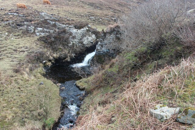
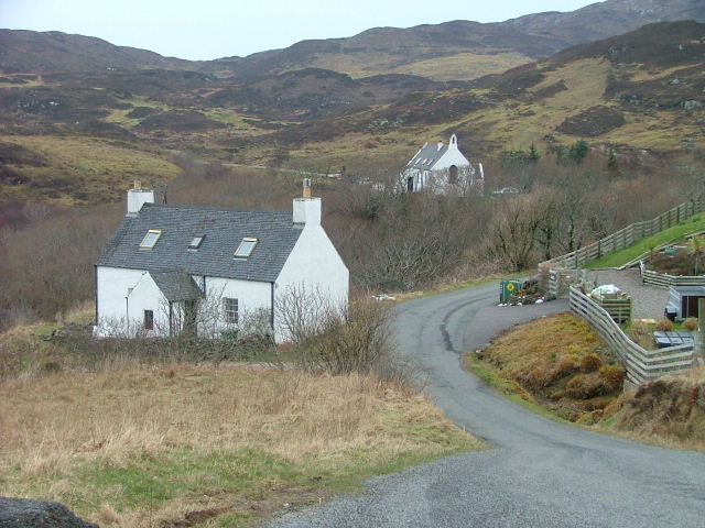
Àird Shlèite is a small rural village located in the Inverness-shire region of Scotland. Situated near the shores of Loch Sleet, the village is surrounded by stunning natural beauty, including rolling hills and lush greenery. The village itself is made up of a few scattered houses, a church, and a small community center.

The residents of Àird Shlèite primarily work in agriculture and tourism, with many farms and bed and breakfasts in the surrounding area. The village is known for its peaceful atmosphere and friendly community, making it a popular destination for those looking to escape the hustle and bustle of city life.

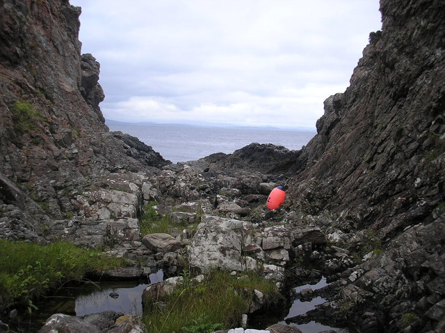
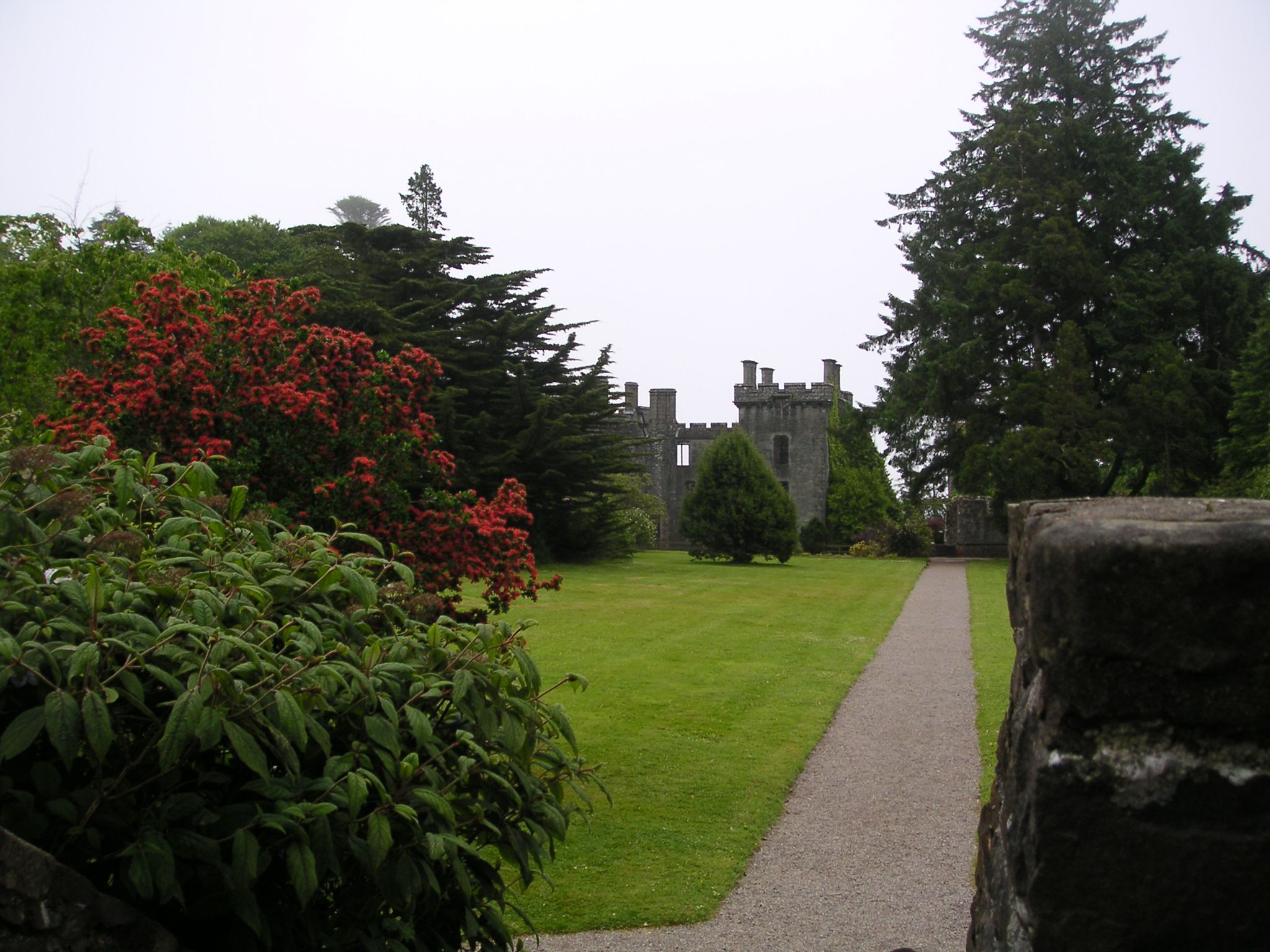
Visitors to Àird Shlèite can enjoy a variety of outdoor activities, including hiking, fishing, and birdwatching. The nearby Loch Sleet also offers opportunities for water sports such as kayaking and sailing. The village is also a great base for exploring the wider Inverness-shire region, with its historic castles, scenic drives, and charming villages.

Overall, Àird Shlèite is a picturesque and tranquil village that offers a perfect retreat for those seeking a peaceful and relaxing getaway in the Scottish Highlands.

If you have any feedback on the listing, please let us know in the comments section below.

Àird Shlèite Images

Images are sourced within 2km of 57.027948/-5.9730032 or Grid Reference NG5900. Thanks to Geograph Open Source API. All images are credited.

South Skye skyline Looking along the cost towards Aird.
South Skye skyline
Looking along the cost towards Aird.
Track to the Point of Sleat
Waterfall by the track to Point of Sleat
White Sail Over the sea to Skye (Sound of Sleat)
White Sail
Over the sea to Skye (Sound of Sleat)
Rough grazings west of An Aìrd Both black cattle and sheep are grazed here on the hill to the west of the settlement at the south end of Sleat. The houses of An Aìrd are scattered in the distance, with a view beyond to the mainland.
Rough grazings west of An Aìrd
Both black cattle and sheep are grazed here on the hill to the west of the settlement at the south end of Sleat. The houses of An Aìrd are scattered in the distance, with a view beyond to the mainland.
Telephone box, Aird of Sleat
Leir Mhaodail A view from the ferry to the Isle of Rum.
Leir Mhaodail
A view from the ferry to the Isle of Rum.
Bottlenose Dolphin off Leir Mhaodail One of a school of about twenty which frequent the waters round the Point of Sleat. Incredibly difficult to get a good photograph!
Bottlenose Dolphin off Leir Mhaodail
One of a school of about twenty which frequent the waters round the Point of Sleat. Incredibly difficult to get a good photograph!
Leir Mhaodail Headland just east of the Point of Sleat. In the foreground, a Bottlenose Dolphin - one of a school of about twenty which frequent the waters round the Point of Sleat. Incredibly difficult to get a good photograph!
Leir Mhaodail
Headland just east of the Point of Sleat. In the foreground, a Bottlenose Dolphin - one of a school of about twenty which frequent the waters round the Point of Sleat. Incredibly difficult to get a good photograph!
Leir Mhaodail The tip of the headland of Leir Mhaodail with the peninsula of the Point of Sleat <a href="https://www.geograph.org.uk/gridref/NM5699">NM5699</a> beyond.
Leir Mhaodail
The tip of the headland of Leir Mhaodail with the peninsula of the Point of Sleat NM5699 beyond.
Ard Thurinish Rocky headland east of the Point of Sleat. Scattered houses of An Aird beyond.
Ard Thurinish
Rocky headland east of the Point of Sleat. Scattered houses of An Aird beyond.
Leir Mhaodail Headland near the Point of Sleat, Isle of Skye.
Leir Mhaodail
Headland near the Point of Sleat, Isle of Skye.
Small Rocky Gorge, round from point This is a small rocky gorge just around from the point, much stuff washed up on the shore, possibly good fishing.
Small Rocky Gorge, round from point
This is a small rocky gorge just around from the point, much stuff washed up on the shore, possibly good fishing.
Portion of Shoreline A portion of shoreline in this square, large boulders, much rubbish washed-up.
Dog in picture is Floss
Portion of Shoreline
A portion of shoreline in this square, large boulders, much rubbish washed-up. Dog in picture is Floss
Àrd Thurinish Àrd Thurinish (wheat point) lies south of the settlement of An Àird at the south end of Sleat. It juts into one of only five grid-squares on Skye that are not in the NG myriad.
The island on the horizon is Eigg.
Àrd Thurinish
Àrd Thurinish (wheat point) lies south of the settlement of An Àird at the south end of Sleat. It juts into one of only five grid-squares on Skye that are not in the NG myriad. The island on the horizon is Eigg.
Grazings, An Àird View northwards towards more boggy land. I was being followed by a flock of hungry sheep. There are unfriendly notices at the road end which as well spouting nonsense about "no unauthorised cycles", warned about not approaching stock!  Sheep are meant to run away!
Grazings, An Àird
View northwards towards more boggy land. I was being followed by a flock of hungry sheep. There are unfriendly notices at the road end which as well spouting nonsense about "no unauthorised cycles", warned about not approaching stock! Sheep are meant to run away!
Moorland, An Àird Heather and bog at the southern end of Sleat. It is grazed by cattle in Summer.
Moorland, An Àird
Heather and bog at the southern end of Sleat. It is grazed by cattle in Summer.
Show me another place!

Àird Shlèite is located at Grid Ref: NG5900 (Lat: 57.027948, Lng: -5.9730032)

Unitary Authority: Highland

Police Authority: Highlands and Islands

Also known as: Aird of Sleat

What 3 Words

///laugh.crowns.weaned. Near Armadale, Highland

Related Wikis

Aird of Sleat

Aird of Sleat (Scottish Gaelic: Àird Shlèite) is a village on the Isle of Skye in Scotland. It is at the southern end of the Sleat peninsula, 4 miles...

Ardvasar

Ardvasar (Scottish Gaelic: Àird a’ Bhàsair) is a village near the southern end of the Sleat peninsula, on the Isle of Skye in Scotland. It is just to the...

Armadale, Skye

Armadale (Scottish Gaelic: Armadal) is a village near the southern end of the Sleat peninsula on the Isle of Skye, in the Highland council area of Scotland...
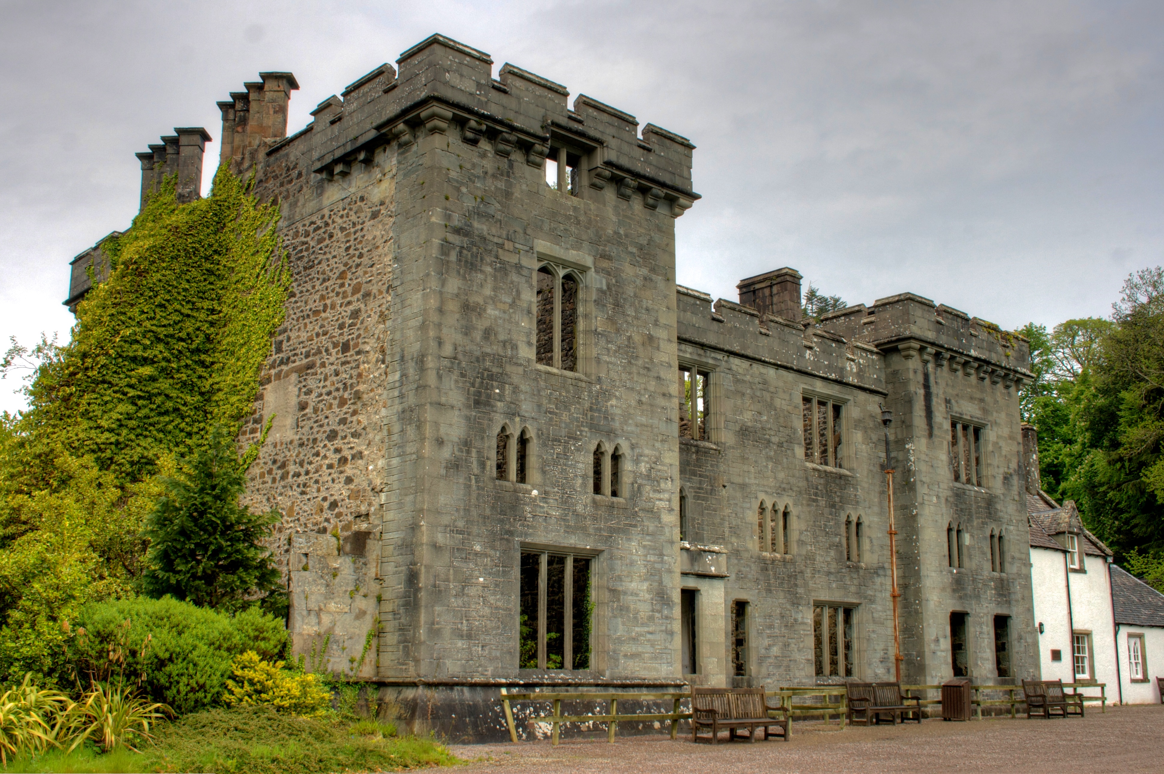
Armadale Castle

Armadale Castle is a ruined country house in Armadale, Skye, former home of the MacDonalds. A mansion house was first built here around 1790, facing south...

Nearby Amenities

Located within 500m of 57.027948,-5.9730032
An Stac
Place: locality
Lat/Long: 57.0319798/-5.9753457
Port na Long
Natural: bay
Lat/Long: 57.0298636/-5.9700222
The data included in this document is from www.openstreetmap.org. The data is made available under ODbL.

Have you been to Àird Shlèite?

Leave your review of Àird Shlèite below (or comments, questions and feedback).