Titsey

Settlement in Surrey Tandridge

England

Titsey

Botley Hill Farmhouse Public House A tea-room back in the 80s, but now a pub offering a range of entertainments.
Botley Hill Farmhouse Public House Credit: Richard Mascall

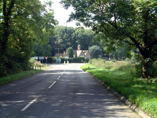
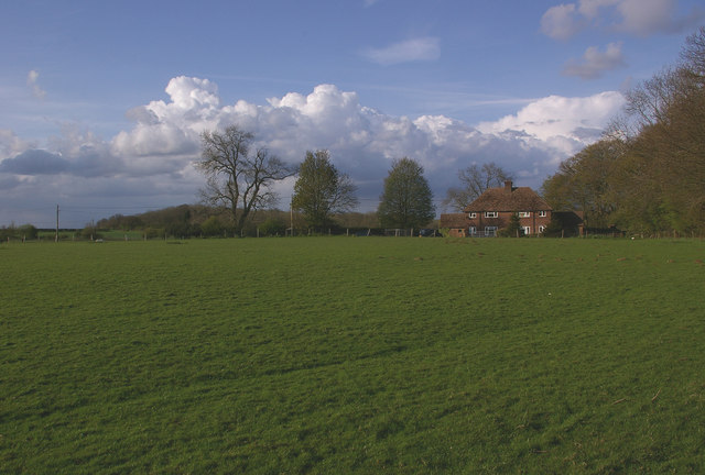
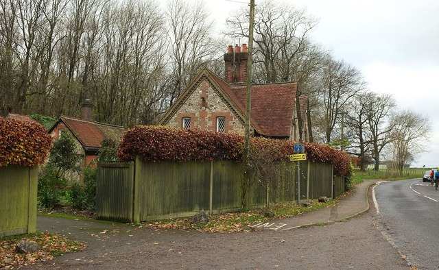
Titsey is a picturesque village located in the county of Surrey, England. Situated on the North Downs, it is part of the Tandridge district and lies approximately 16 miles south of London. The village is surrounded by stunning countryside, offering panoramic views of the Surrey Hills Area of Outstanding Natural Beauty.

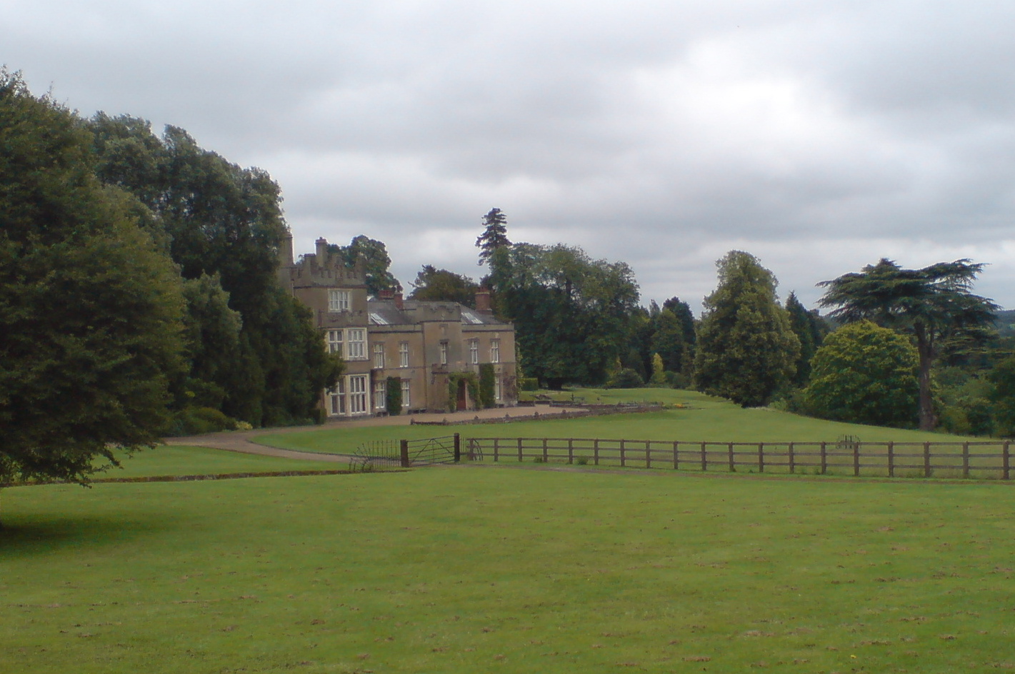
Titsey is renowned for its historic Titsey Place, a grand Georgian mansion that has been home to the Gresham family for over 400 years. The house is set within a sprawling estate that spans over 2,500 acres and includes lush gardens, woodlands, and farmland. Visitors to Titsey Place can explore the beautifully landscaped gardens, take guided tours of the house, and learn about the rich history of the Gresham family.

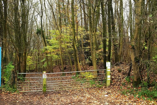
In addition to its impressive estate, Titsey also boasts a charming village center with a few local amenities, including a village hall and a small church. The village is surrounded by miles of scenic walking and cycling trails, making it a popular destination for outdoor enthusiasts.

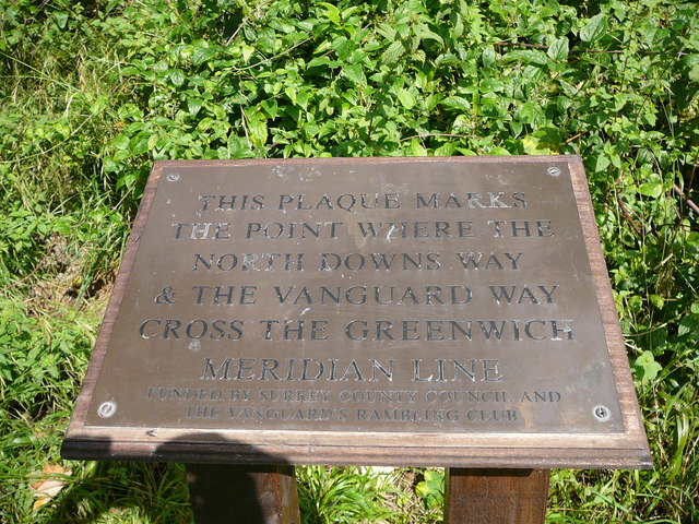
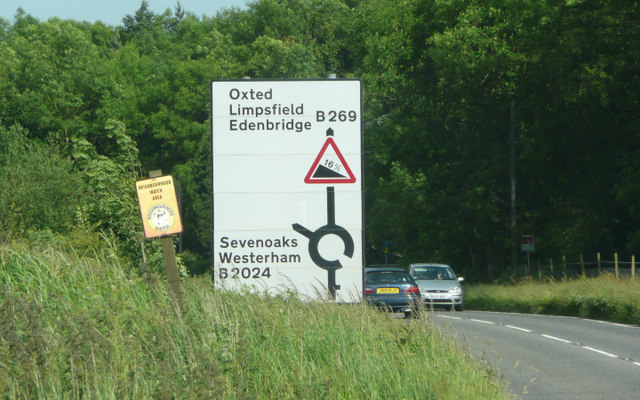
Titsey is well connected to the surrounding areas, with nearby towns such as Oxted and Westerham offering a range of shops, restaurants, and services. The village is also conveniently located near major transport links, with easy access to the M25 motorway and regular train services to London from nearby Oxted station.

Overall, Titsey is a tranquil and idyllic village that offers a perfect blend of natural beauty, history, and rural charm. It is a haven for nature lovers and history enthusiasts seeking a retreat from the hustle and bustle of city life.

If you have any feedback on the listing, please let us know in the comments section below.

Titsey Images

Images are sourced within 2km of 51.276129/0.018375 or Grid Reference TQ4054. Thanks to Geograph Open Source API. All images are credited.

Botley Hill Farmhouse Public House A tea-room back in the 80s, but now a pub offering a range of entertainments.
Botley Hill Farmhouse Public House
A tea-room back in the 80s, but now a pub offering a range of entertainments.
Botley Hill junction of B269 and B2024, CR6 Looking west from B2024 Clarks Lane. The B269 goes down Titsey Hill to the left, and, as Croydon Road, northwest towards Warlingham.
Botley Hill junction of B269 and B2024, CR6
Looking west from B2024 Clarks Lane. The B269 goes down Titsey Hill to the left, and, as Croydon Road, northwest towards Warlingham.
Botley Hill trig point The highest trig point on the North Downs (benchmark at 266.88m), and until recently most references claimed that this also marked the highest point of the whole of the North Downs.  However, in practice, this is not the case.  Firstly the land seems to rise slightly to the east, and there is another area slightly to the west which also lies above the 265m contour, with the same 267m spot height (although older maps give the latter point a slightly lower height than the trig point when measured in feet). But more significantly, old 1 inch maps show a spot height of 882 feet next to the water tower in the next square over (see <a href="https://www.geograph.org.uk/photo/788446">TQ3855 : Woldingham water tower</a>), compared with only 877 feet at the trig point, implying that the true summit point of the North Downs could well be there.

This has since been confirmed by surveys.

Unfortunately, views to the south at this point are blocked by the woodland of Titsey Plantation, and the nature of the plateau means that the expected view north over London is not available.

Behind is one of a number of masts near Botley Hill, this one beside Botley Hill Farm.
Botley Hill trig point
The highest trig point on the North Downs (benchmark at 266.88m), and until recently most references claimed that this also marked the highest point of the whole of the North Downs. However, in practice, this is not the case. Firstly the land seems to rise slightly to the east, and there is another area slightly to the west which also lies above the 265m contour, with the same 267m spot height (although older maps give the latter point a slightly lower height than the trig point when measured in feet). But more significantly, old 1 inch maps show a spot height of 882 feet next to the water tower in the next square over (see TQ3855 : Woldingham water tower), compared with only 877 feet at the trig point, implying that the true summit point of the North Downs could well be there. This has since been confirmed by surveys. Unfortunately, views to the south at this point are blocked by the woodland of Titsey Plantation, and the nature of the plateau means that the expected view north over London is not available. Behind is one of a number of masts near Botley Hill, this one beside Botley Hill Farm.
Botley Hill mast Botley Hill Farm, now a pub, is to the right of the mast.
Botley Hill mast
Botley Hill Farm, now a pub, is to the right of the mast.
Park Lane Cottages The slight rise in the ground between the foreground and the cottages is often claimed to be the highest point on the North Downs, in that visitors to the trig point (see <a href="https://www.geograph.org.uk/photo/788400">TQ3955 : Botley Hill trig point</a>), whose spot height is the highest point marked on current maps, can see that this land is slightly higher than the trig point itself.  In fact, old maps suggest that the true highest point is around 1km further west (see description that goes with <a href="https://www.geograph.org.uk/photo/788400">TQ3955 : Botley Hill trig point</a> for discussion).  

What is certain, though, is that this is the highest house on the North Downs.
Park Lane Cottages
The slight rise in the ground between the foreground and the cottages is often claimed to be the highest point on the North Downs, in that visitors to the trig point (see TQ3955 : Botley Hill trig point), whose spot height is the highest point marked on current maps, can see that this land is slightly higher than the trig point itself. In fact, old maps suggest that the true highest point is around 1km further west (see description that goes with TQ3955 : Botley Hill trig point for discussion). What is certain, though, is that this is the highest house on the North Downs.
The Ridge This lane runs along the route of a trackway following the crest of the North Downs - this stretch on Botley Hill is the highest road on the North Downs.  To the right is Titsey Plantation.
The Ridge
This lane runs along the route of a trackway following the crest of the North Downs - this stretch on Botley Hill is the highest road on the North Downs. To the right is Titsey Plantation.
The Meridian Line Plaque at a point where the North Downs Way crosses it.
Titsey Hill - Steep Hill 16% Titsey Hill, Oxted. 16% steep hill down sign.
Titsey Hill - Steep Hill 16%
Titsey Hill, Oxted. 16% steep hill down sign.
The Ridge Road through Titsey Plantation.
The Ridge
Road through Titsey Plantation.
In Titsey Plantation In the fairly level part above the steep drop down the scarp of the downs. The trees here appear to be mostly chestnut.
In Titsey Plantation
In the fairly level part above the steep drop down the scarp of the downs. The trees here appear to be mostly chestnut.
Country west of Botley Hill It is surprising how much open country is to be found inside the south-east sector of the M25.
Country west of Botley Hill
It is surprising how much open country is to be found inside the south-east sector of the M25.
Cottages on Titsey Hill A pair of listed flint cottages, also seen in <a href="https://www.geograph.org.uk/photo/2901422">TQ3955 : Titsey Hill at the junction of  Clarks Way</a>. They date from about 1870 <span class="nowrap"><a title="http://www.historicengland.org.uk/listing/the-list/list-entry/1189950" rel="nofollow ugc noopener" href="http://www.historicengland.org.uk/listing/the-list/list-entry/1189950">Link</a><img style="margin-left:2px;" alt="External link" title="External link - shift click to open in new window" src="https://s1.geograph.org.uk/img/external.png" width="10" height="10"/></span> . A wash house block at the rear is also listed. In the foreground is the top of Pitchfont Lane, used by the North Down Way, and on the right is the B269.
Cottages on Titsey Hill
A pair of listed flint cottages, also seen in TQ3955 : Titsey Hill at the junction of Clarks Way. They date from about 1870 LinkExternal link . A wash house block at the rear is also listed. In the foreground is the top of Pitchfont Lane, used by the North Down Way, and on the right is the B269.
Pitchfont Lane This is Limpsfield CP 73, a Byway open to all traffic according to the maps, but apparently not in practice. It's followed by the North Downs Way as it plunges down the scarp through Titsey Plantation. The scene, with the gate at the top, also appears in sunnier weather at <a href="https://www.geograph.org.uk/photo/2716879">TQ3955 : Gate on Pitchfont Lane</a>.
Pitchfont Lane
This is Limpsfield CP 73, a Byway open to all traffic according to the maps, but apparently not in practice. It's followed by the North Downs Way as it plunges down the scarp through Titsey Plantation. The scene, with the gate at the top, also appears in sunnier weather at TQ3955 : Gate on Pitchfont Lane.
View from Titsey Plantation From the red route around the Titsey estate, mid-way up the chalk scarp, looking across fields to the M25.
View from Titsey Plantation
From the red route around the Titsey estate, mid-way up the chalk scarp, looking across fields to the M25.
Path through Titsey Plantation The red route through the estate woodlands here follows a path part way up the chalk scarp.
Path through Titsey Plantation
The red route through the estate woodlands here follows a path part way up the chalk scarp.
Path through Titsey Plantation A gloomy day among late autumn trees. This looks the other way along the path shown in <a href="https://www.geograph.org.uk/photo/4746485">TQ3954 : Path through Titsey Plantation</a>.
Path through Titsey Plantation
A gloomy day among late autumn trees. This looks the other way along the path shown in TQ3954 : Path through Titsey Plantation.
Path through Titsey Plantation Further along the path shown in <a href="https://www.geograph.org.uk/photo/4746490">TQ3954 : Path through Titsey Plantation</a>.
Path through Titsey Plantation
Further along the path shown in TQ3954 : Path through Titsey Plantation.
West end of Titsey Plantation From the steep zig-zag path shown in <a href="https://www.geograph.org.uk/photo/2719769">TQ3854 : Zig-Zag Path in Titsey Plantation</a>, with yew and beech.
West end of Titsey Plantation
From the steep zig-zag path shown in TQ3854 : Zig-Zag Path in Titsey Plantation, with yew and beech.
Show me another place!

Titsey is located at Grid Ref: TQ4054 (Lat: 51.276129, Lng: 0.018375)

Administrative County: Surrey

District: Tandridge

Police Authority: Surrey

What 3 Words

///stow.image.pulse. Near Oxted, Surrey

Related Wikis

Titsey Place

Titsey Place is an English country house near Oxted in Surrey, England. It was successively the seat of the Gresham and Leveson-Gower families and is now...
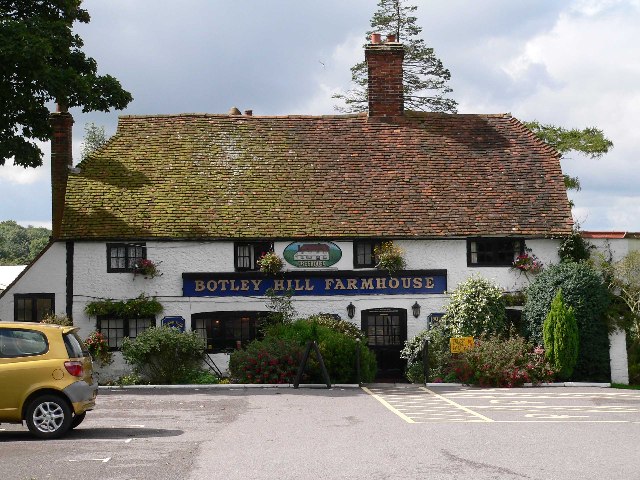
Botley Hill

Botley Hill is a hill in Surrey and is the highest point of the North Downs, with a height of 269.6 metres (885 ft). The Prime Meridian crosses the hill...

Titsey

Titsey is a rural village and a civil parish on the North Downs almost wholly within the M25 London Orbital Motorway in the Tandridge District of Surrey...

Clacket Lane services

Clacket Lane services is a motorway service station on the M25 motorway midway between junctions 5 and 6, in Surrey, United Kingdom, adjacent to the parish...

Tatsfield Receiving Station

The Tatsfield Receiving Station – known formally as the BBC Engineering Measurement and Receiving Station – was a radio broadcasting signals-receiving...

Church of St Peter, Limpsfield

The Anglican Church of St Peter in Limpsfield, Surrey, England dates from the 12th century. It is a Grade I listed building. It is known for the number...

Limpsfield

Limpsfield is a village and civil parish in Surrey, England, at the foot of the North Downs close to Oxted railway station and the A25. The composer Frederick...

Oxted School

Oxted School is a coeducational secondary school and sixth form located in the English town of Oxted, Surrey. It was opened in 1929 as the first mixed...

Nearby Amenities

Located within 500m of 51.276129,0.018375
Titsey
Created By: Potlatch 0.6a
Place: hamlet
Source: npe
Lat/Long: 51.2760892/0.0190469
Bus Stop
Church
Naptan AtcoCode: 40004410129A
Naptan Bearing: NW
Naptan CommonName: Church
Naptan Indicator: Just Before
Naptan Landmark: Church
Naptan NaptanCode: surdpapg
Naptan Street: Titsey Road
Naptan Verified: no
Public Transport: platform
Source: naptan_import
Wheelchair: no
Lat/Long: 51.2756043/0.0183876
Bus Stop
Church
Naptan AtcoCode: 40004410129B
Naptan Bearing: SE
Naptan CommonName: Church
Naptan Indicator: Just after
Naptan Landmark: Church
Naptan NaptanCode: surdpapj
Naptan Street: Titsey Road
Naptan Verified: no
Public Transport: platform
Source: naptan_import
Wheelchair: no
Lat/Long: 51.2755093/0.0186363
Passing Place
Lat/Long: 51.2770792/0.0174392
Titsey Place
Historic: manor
Place: isolated_dwelling
Tourism: attraction
Website: https://www.titsey.org
Wikidata: Q7810234
Lat/Long: 51.2773222/0.0158952
Howards Lodge
Place: isolated_dwelling
Lat/Long: 51.2757584/0.0181268
Titsey Court
Place: isolated_dwelling
Wikidata: Q26280898
Lat/Long: 51.2760202/0.0188779
Glebelands
Place: isolated_dwelling
Lat/Long: 51.276698/0.0215601
Evelyn Avenue
Place: isolated_dwelling
Lat/Long: 51.2776444/0.0220858
Cafe
Titsey Cafe
Opening Hours: We, Sa, Su, PH 12:30-17:00
Lat/Long: 51.2789738/0.0133608
Barrier: stile
Lat/Long: 51.2783768/0.0244705
Post Box
Brand: Royal Mail
Brand Wikidata: Q638098
Brand Wikipedia: en:Royal Mail
Collection Times: Mo-Fr 16:00; Sa 07:00
Operator: Royal Mail
Operator Wikidata: Q638098
Post Box Mounting: brick_wall
Post Box Type: wall
Ref: RH8 19
Royal Cypher: EIIR
Royal Cypher Wikidata: Q33102113
Lat/Long: 51.2763034/0.0187735
Listed Status: Grade II
Note: red telephone box has been removed
Removed Amenity: telephone
Lat/Long: 51.2754264/0.0186847
Leisure: picnic_table
Lat/Long: 51.2790829/0.0131462
Leisure: picnic_table
Lat/Long: 51.279049/0.0131835
Leisure: picnic_table
Lat/Long: 51.2790236/0.0132106
Leisure: picnic_table
Lat/Long: 51.2790893/0.0130819
Leisure: picnic_table
Lat/Long: 51.2790554/0.0130988
Leisure: picnic_table
Lat/Long: 51.2790194/0.0131395
Leisure: picnic_table
Lat/Long: 51.2790952/0.0129811
Leisure: picnic_table
Lat/Long: 51.2790663/0.0130012
Bench
Lat/Long: 51.2770858/0.0156859
Bench
Lat/Long: 51.2770983/0.0159361
Bench
Lat/Long: 51.2787842/0.0141819
The data included in this document is from www.openstreetmap.org. The data is made available under ODbL.

Have you been to Titsey?

Leave your review of Titsey below (or comments, questions and feedback).