Boskednan

Settlement in Cornwall

England

Boskednan

The buildings at Bosporthennis These are no longer completely abandoned (see: <a title="https://www.geograph.org.uk/photo/71726)," href="https://www.geograph.org.uk/photo/71726),">Link</a> but have been restored as a holiday home. So just abandoned for the majority of the year.
The buildings at Bosporthennis Credit: David Medcalf

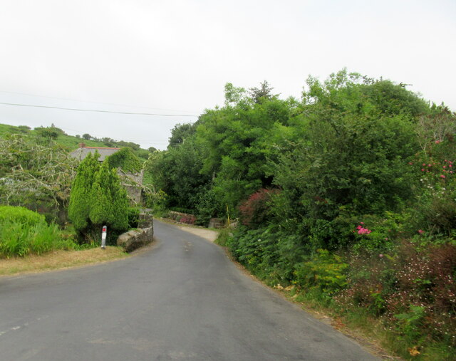
Boskednan is a small hamlet located in the county of Cornwall, England. Situated in the western part of the county, Boskednan is nestled within the rugged landscape of the Penwith Peninsula. The hamlet is positioned about 4 miles northwest of the town of Penzance and is surrounded by picturesque countryside.

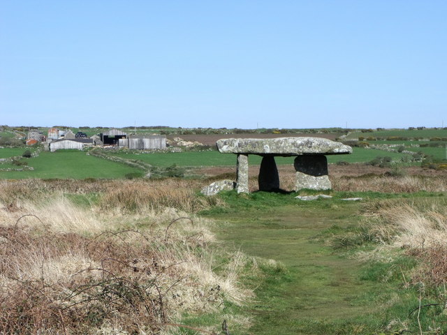
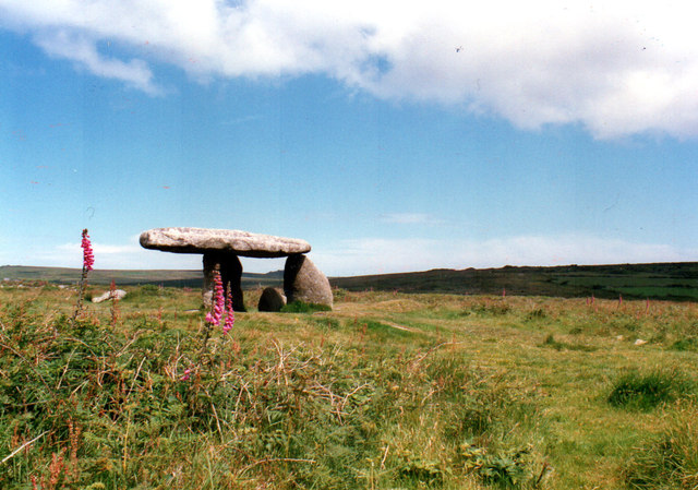
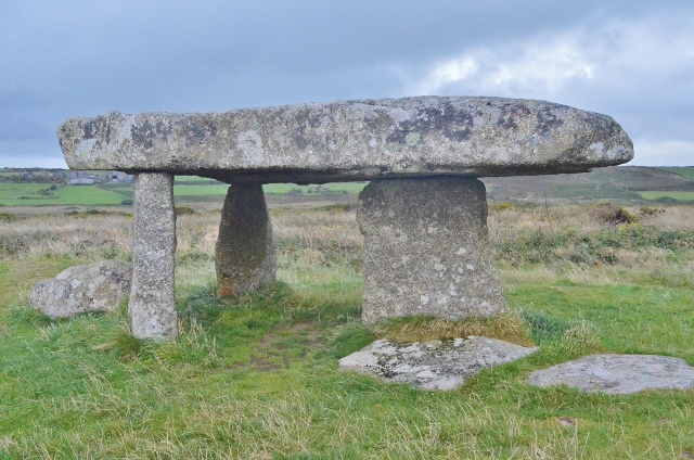
One of the notable features of Boskednan is its ancient stone circle, known as the Boskednan Circle. This prehistoric monument is believed to date back to the late Neolithic or early Bronze Age, making it around 4,000 to 5,000 years old. The circle consists of 19 granite stones, arranged in an almost perfect circle, with a diameter of approximately 22 meters. The purpose and significance of the circle remain somewhat mysterious, with theories ranging from religious rituals to astronomical observations.

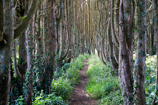
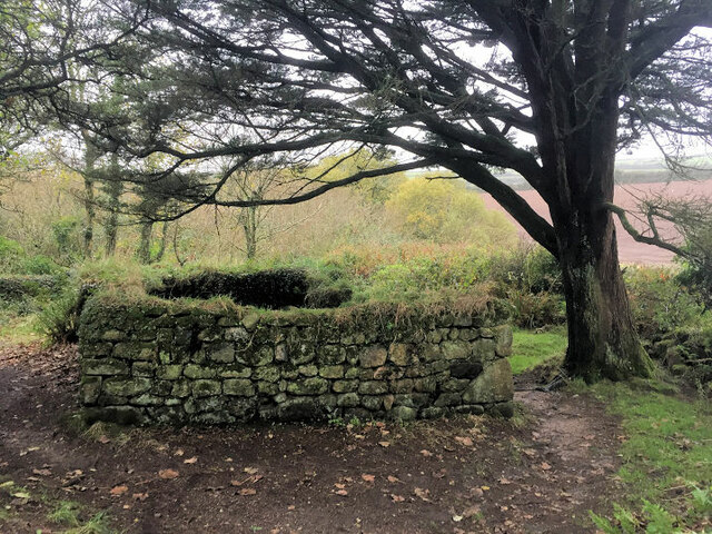
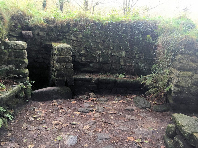
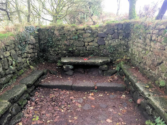
Aside from the stone circle, Boskednan is characterized by its tranquil and rural setting. The hamlet is surrounded by rolling hills, farmland, and scattered woodland, creating a peaceful and natural environment. The area is a haven for wildlife, with various bird species, mammals, and plant life thriving in the diverse habitats.

Although Boskednan is a relatively small settlement, it is well-connected to nearby towns and attractions. The popular tourist destination of St Ives is within easy reach, offering stunning beaches, art galleries, and a vibrant cultural scene. Additionally, the ancient site of the Merry Maidens stone circle and the iconic Land's End are both located just a short drive away from Boskednan, making it an ideal base for exploring the rich history and natural beauty of Cornwall.

If you have any feedback on the listing, please let us know in the comments section below.

Boskednan Images

Images are sourced within 2km of 50.156064/-5.582643 or Grid Reference SW4434. Thanks to Geograph Open Source API. All images are credited.

The buildings at Bosporthennis These are no longer completely abandoned (see: <a title="https://www.geograph.org.uk/photo/71726)," href="https://www.geograph.org.uk/photo/71726),">Link</a> but have been restored as a holiday home. So just abandoned for the majority of the year.
The buildings at Bosporthennis
These are no longer completely abandoned (see: Link but have been restored as a holiday home. So just abandoned for the majority of the year.
Footpath near Holy Madron Well
Ding Dong mines in Penwith
Chimney and shaft buildings as part of Ding Dong Mines in Penwith
Madron Well Chapel
Madron Well Chapel
Inside Madron Well Chapel
Madron Well Chapel
Madron Well Chapel
Road junction and bridge over stream, Newmill
Fields near Higher Kerrowe
Lanyon Quoit, Cornwall
Engine house at Ding Dong mine, Cornwall
Standing out Another redundant milk-churn stand in Penwith.
Standing out
Another redundant milk-churn stand in Penwith.
Madron Chapel
Madron Chapel
Ding Dong Mine Engine House
Lanyon Quoit 1987
Lanyon Quoit 1987
Lanyon Quoit The giant's table; the top is 13 tonnes. This is an ancient burial chamber.
Lanyon Quoit
The giant's table; the top is 13 tonnes. This is an ancient burial chamber.
Madron Chapel An ancient chapel with the altar stone in situ.
Madron Chapel
An ancient chapel with the altar stone in situ.
Madron Chapel A view of the pre-Christian chapel and well.
Madron Chapel
A view of the pre-Christian chapel and well.
Show me another place!

Boskednan is located at Grid Ref: SW4434 (Lat: 50.156064, Lng: -5.582643)

Unitary Authority: Cornwall

Police Authority: Devon and Cornwall

What 3 Words

///pitch.tune.agree. Near Penzance, Cornwall

Related Wikis

Boskednan

Boskednan (Cornish: Boskednan) is a hamlet near Mulfra Hill northwest of Penzance in west Cornwall, England, United Kingdom. It is in the civil parish...

Carfury Standing Stone

Carfury Standing Stone is a standing stone in Penwith, Cornwall, about 4km northwest of Penzance. Also called Cuckoo Rock, the stone stands around 3m tall...
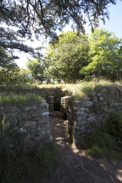
Bodrifty

Bodrifty is the modern name of an Iron Age village, now in ruins, in Cornwall, England, United Kingdom. It is 700 yards west of Mulfra Hill in Penwith...
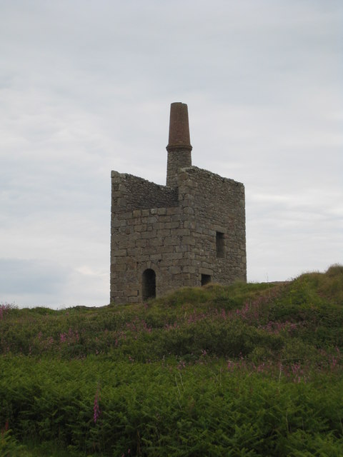
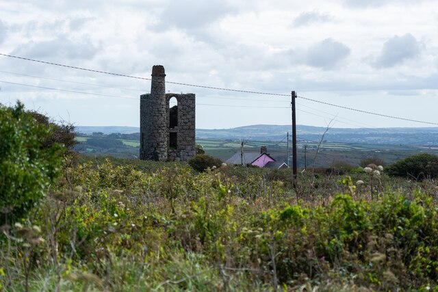
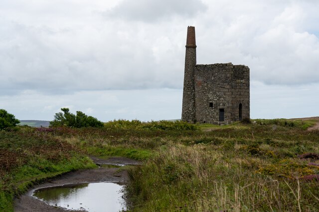
Ding Dong mines

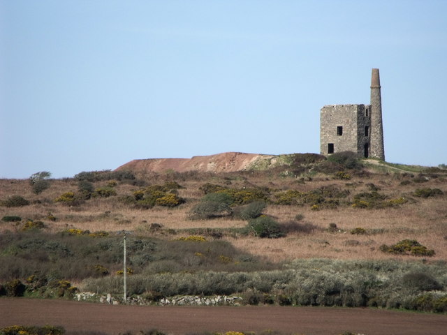
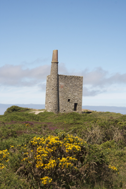
The Ding Dong mines lie in an old and extensive mining area situated in the parish of Madron, in Penwith, Cornwall, England. They are about two miles...

Nearby Amenities

Located within 500m of 50.156064,-5.582643
Tredinnick
Is In: Cornwall, England, UK
Name Kw: Treredenek
Place: hamlet
Lat/Long: 50.1581577/-5.5783578
Boskednan
Is In: Cornwall, England, UK
Name Kw: Boskednan
Place: hamlet
Wikidata: Q2623571
Lat/Long: 50.1565766/-5.5838876
Boskednan Farm
Addr Postcode: TR20 8XX
Addr Street: Newmill
Phone: +441736333873
Tourism: apartment
Lat/Long: 50.1561761/-5.5829469
Disused Amenity: post_box
Note: Aperture is blocked. Post box out of use
Ref: TR20 155
Lat/Long: 50.1560987/-5.5827177
Power: pole
Lat/Long: 50.1588254/-5.5784766
Power: pole
Lat/Long: 50.1565661/-5.577397
Power: pole
Lat/Long: 50.1586169/-5.5782184
Power: pole
Lat/Long: 50.1579997/-5.5778659
Power: pole
Lat/Long: 50.1597514/-5.5790872
Power: pole
Lat/Long: 50.1574609/-5.5778322
Power: pole
Lat/Long: 50.155239/-5.576724
Power: pole
Lat/Long: 50.1543502/-5.5763062
Power: pole
Lat/Long: 50.1559176/-5.577057
Power: pole
Transformer: distribution
Lat/Long: 50.1546671/-5.5838308
Power: pole
Lat/Long: 50.154973/-5.5834419
Power: pole
Lat/Long: 50.1556733/-5.5825447
Power: pole
Lat/Long: 50.156231/-5.5818084
Power: pole
Transformer: distribution
Lat/Long: 50.1573944/-5.5838737
Power: pole
Lat/Long: 50.1572019/-5.5829778
Power: pole
Lat/Long: 50.1566417/-5.5828035
Power: pole
Lat/Long: 50.1568324/-5.5814946
Power: pole
Lat/Long: 50.1569991/-5.5805558
Power: pole
Lat/Long: 50.1572174/-5.5792415
The data included in this document is from www.openstreetmap.org. The data is made available under ODbL.

Have you been to Boskednan?

Leave your review of Boskednan below (or comments, questions and feedback).