Boscoppa

Settlement in Cornwall

England

Boscoppa

St Austell station platforms and the top of High Cross Street
St Austell station platforms and the top of High Cross Street Credit: Tom Page

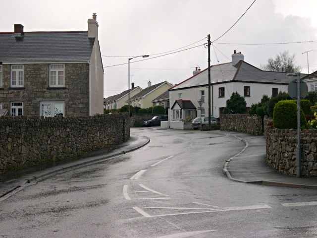
Boscoppa is a small village located in the county of Cornwall, England. Situated about 2 miles southeast of St Austell, it is nestled in the picturesque countryside of the region. Boscoppa is primarily a residential area, known for its tranquil atmosphere and close-knit community.

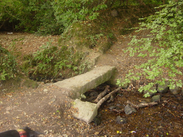
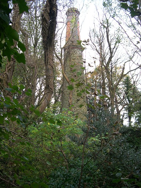
The village is surrounded by lush green fields, rolling hills, and dense woodlands, offering residents and visitors alike ample opportunities for outdoor activities and leisurely walks. The area is also home to several farms, which contribute to the rural charm of Boscoppa.

Although small in size, Boscoppa benefits from its close proximity to St Austell, a bustling town that provides a range of amenities and services. The town offers supermarkets, shops, restaurants, and leisure facilities, ensuring that residents have easy access to all their daily needs.

Boscoppa itself is known for its friendly and welcoming community. The village hosts various events throughout the year, including fairs, charity fundraisers, and community gatherings, fostering a strong sense of togetherness among its inhabitants.

For those seeking to explore the area, Boscoppa is conveniently located near many popular destinations in Cornwall. The Eden Project, a renowned ecological park, is just a short drive away, as are the beautiful beaches and coastal towns that Cornwall is famous for.

In summary, Boscoppa is a picturesque village in Cornwall, offering a peaceful and rural lifestyle while being within easy reach of the amenities and attractions of nearby St Austell.

If you have any feedback on the listing, please let us know in the comments section below.
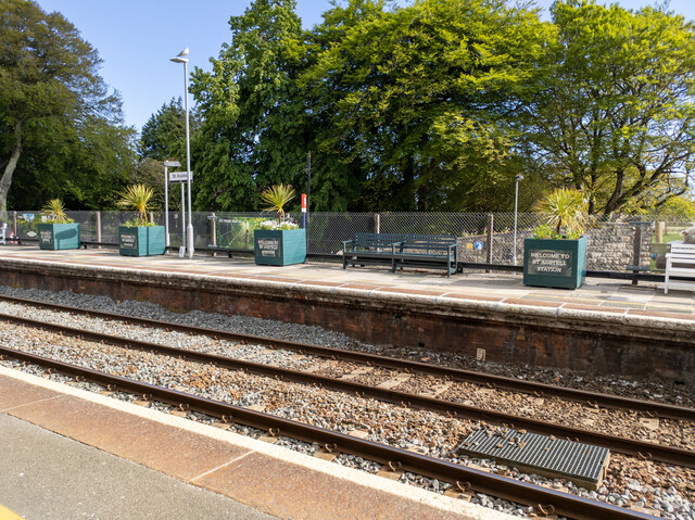
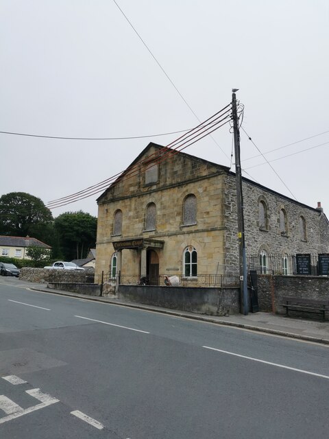
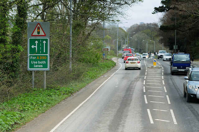
Boscoppa Images

Images are sourced within 2km of 50.348991/-4.768359 or Grid Reference SX0353. Thanks to Geograph Open Source API. All images are credited.

St Austell station platforms and the top of High Cross Street
Charlestown Chapel Charlestown is a village and port on the south coast of Cornwall. It is situated approximately 2 miles south east of St Austell town centre.
The port at Charlestown developed in the late-18th century from the fishing village of West Polmear. Charlestown has remained relatively unchanged since. Today the main focus of the village is tourism.
Wikipedia: <span class="nowrap"><a title="https://en.wikipedia.org/wiki/Charlestown,_Cornwall" rel="nofollow ugc noopener" href="https://en.wikipedia.org/wiki/Charlestown,_Cornwall">Link</a><img style="margin-left:2px;" alt="External link" title="External link - shift click to open in new window" src="https://s1.geograph.org.uk/img/external.png" width="10" height="10"/></span>
Charlestown Chapel
Charlestown is a village and port on the south coast of Cornwall. It is situated approximately 2 miles south east of St Austell town centre. The port at Charlestown developed in the late-18th century from the fishing village of West Polmear. Charlestown has remained relatively unchanged since. Today the main focus of the village is tourism. Wikipedia: LinkExternal link
St Austell, Southbourne Road The A390 on the southern outskirts of St Austell.
St Austell, Southbourne Road
The A390 on the southern outskirts of St Austell.
St Austell, Polmear Road A390 approaching Mount Charles Roundabout.
St Austell, Polmear Road
A390 approaching Mount Charles Roundabout.
Railway Bridge Crossing Holmbush Road The A390 on the outskirts of St Austell.
Railway Bridge Crossing Holmbush Road
The A390 on the outskirts of St Austell.
Holmbush Road, St Austell The A390  runs for 60 miles between Tavistock and a roundabout with the A30 at Three Burrows, 5 miles north west of the city of Truro in Cornwall, via Lostwithiel, St Blazey, and St Austell. It is an important road as it forms part of the main route (the Truro to Dobwalls section) from Truro to Plymouth. It can be used to travel along the spine of Cornwall as a more leisurely drive instead of using the A30.
Holmbush Road, St Austell
The A390 runs for 60 miles between Tavistock and a roundabout with the A30 at Three Burrows, 5 miles north west of the city of Truro in Cornwall, via Lostwithiel, St Blazey, and St Austell. It is an important road as it forms part of the main route (the Truro to Dobwalls section) from Truro to Plymouth. It can be used to travel along the spine of Cornwall as a more leisurely drive instead of using the A30.
A390 Holmbush Road The A390  runs for 60 miles between Tavistock and a roundabout with the A30 at Three Burrows, 5 miles north west of the city of Truro in Cornwall, via Lostwithiel, St Blazey, and St Austell. It is an important road as it forms part of the main route (the Truro to Dobwalls section) from Truro to Plymouth. It can be used to travel along the spine of Cornwall as a more leisurely drive instead of using the A30.
A390 Holmbush Road
The A390 runs for 60 miles between Tavistock and a roundabout with the A30 at Three Burrows, 5 miles north west of the city of Truro in Cornwall, via Lostwithiel, St Blazey, and St Austell. It is an important road as it forms part of the main route (the Truro to Dobwalls section) from Truro to Plymouth. It can be used to travel along the spine of Cornwall as a more leisurely drive instead of using the A30.
Holmbush Road (A390) The A390  runs for 60 miles between Tavistock and a roundabout with the A30 at Three Burrows, 5 miles north west of the city of Truro in Cornwall, via Lostwithiel, St Blazey, and St Austell. It is an important road as it forms part of the main route (the Truro to Dobwalls section) from Truro to Plymouth. It can be used to travel along the spine of Cornwall as a more leisurely drive instead of using the A30.
Holmbush Road (A390)
The A390 runs for 60 miles between Tavistock and a roundabout with the A30 at Three Burrows, 5 miles north west of the city of Truro in Cornwall, via Lostwithiel, St Blazey, and St Austell. It is an important road as it forms part of the main route (the Truro to Dobwalls section) from Truro to Plymouth. It can be used to travel along the spine of Cornwall as a more leisurely drive instead of using the A30.
Signpost in Charlestown Art gallery
Signpost in Charlestown
Art gallery
Old Milestone by Victoria Road, Mount Charles, St Austell Carved stone post by the UC road, in parish of ST AUSTELL (RESTORMEL District), Victoria Road, by No.11, Mount Charles, half buried in pavement until 1992, on North side of road. Erected by a private estate in the 19th century. 

Inscription reads:-
: PENRICE / 2 MILES : : ST / AUSTLE / 3/4 : 

Grade II listed. List Entry Number: 1394421

Milestone Society National ID: CW_PCSA02.
Old Milestone by Victoria Road, Mount Charles, St Austell
Carved stone post by the UC road, in parish of ST AUSTELL (RESTORMEL District), Victoria Road, by No.11, Mount Charles, half buried in pavement until 1992, on North side of road. Erected by a private estate in the 19th century. Inscription reads:- : PENRICE / 2 MILES : : ST / AUSTLE / 3/4 : Grade II listed. List Entry Number: 1394421 Milestone Society National ID: CW_PCSA02.
Fingerpost on Poltair Road National ID
CW_SX0152
Fingerpost on Poltair Road
National ID CW_SX0152
Great Western Railway boundary 1911 CW_GWRAUS01em
Great Western Railway boundary 1911
CW_GWRAUS01em
GPO stone
GPO stone
Benchmark on brewery wall
Builder’s mark
Builder’s mark
Train station sign
Train station sign
Postbox
Postbox
Stink pipe
Stink pipe
Show me another place!

Boscoppa is located at Grid Ref: SX0353 (Lat: 50.348991, Lng: -4.768359)

Unitary Authority: Cornwall

Police Authority: Devon and Cornwall

What 3 Words

///sprays.rails.stooping. Near St Austell, Cornwall

Nearby Locations

Boscoppa

Related Wikis

Boscoppa

Boscoppa (Cornish: Boskoppa) is a settlement in the amalgamation of St Austell in Cornwall, England, United Kingdom. Originally Boscoppa was a separate...

Bethel, Cornwall

Bethel is a suburb on the east side of St Austell in Cornwall, England, United Kingdom (where the population was included). Bethel is included within the...

Carclaze

Carclaze is a suburb of the town of St Austell in mid-Cornwall, England, United Kingdom. The suburb forms part of the civil parish of Treverbyn and gives...

Tregrehan Mills

Tregrehan Mills is a hamlet west of St Blazey, Cornwall, England, United Kingdom. == See also == Tregrehan House == References ==

Holmbush, Cornwall

Holmbush is a village in Cornwall, England that is situated in the suburban area of St Austell (where the population at the 2011 census was included)....

Wheal Eliza

Wheal Eliza is a cricket ground in Holmbush, to the east of St Austell, Cornwall. The ground is bordered to the south by Holmbush Road, to the east by...

The Cornwall College Group

The Cornwall College Group (TCCG; Cornish: Kolji Kernow) is a further education college situated on eight sites throughout Cornwall and Devon, England...

Penrice Academy

Penrice Academy is a secondary academy school and former specialist Language College in St Austell, Cornwall, England. The school has an enrollment of...

Nearby Amenities

Located within 500m of 50.348991,-4.768359
Mini Roundabout
Direction: clockwise
Lat/Long: 50.3478261/-4.7671512
Mini Roundabout
Direction: clockwise
Lat/Long: 50.346312/-4.7650606
Mini Roundabout
Direction: clockwise
Lat/Long: 50.3461301/-4.7650772
Mini Roundabout
Direction: clockwise
Lat/Long: 50.3471871/-4.7671766
Generator Method: photovoltaic
Generator Output Electricity: yes
Generator Source: solar
Generator Type: solar_photovoltaic_panel
Location: roof
Power: generator
Lat/Long: 50.3506448/-4.7735233
Generator Method: photovoltaic
Generator Output Electricity: yes
Generator Source: solar
Generator Type: solar_photovoltaic_panel
Location: roof
Power: generator
Lat/Long: 50.3508313/-4.7740424
Generator Method: photovoltaic
Generator Output Electricity: yes
Generator Source: solar
Generator Type: solar_photovoltaic_panel
Location: roof
Power: generator
Lat/Long: 50.34919/-4.7748926
Generator Method: photovoltaic
Generator Output Electricity: yes
Generator Source: solar
Generator Type: solar_photovoltaic_panel
Location: roof
Power: generator
Lat/Long: 50.345053/-4.7658134
Generator Method: photovoltaic
Generator Output Electricity: yes
Generator Source: solar
Generator Type: solar_photovoltaic_panel
Location: roof
Power: generator
Lat/Long: 50.3504308/-4.7683722
Generator Method: photovoltaic
Generator Output Electricity: yes
Generator Source: solar
Generator Type: solar_photovoltaic_panel
Location: roof
Power: generator
Lat/Long: 50.3501399/-4.7678652
Generator Method: photovoltaic
Generator Output Electricity: yes
Generator Source: solar
Generator Type: solar_photovoltaic_panel
Location: roof
Power: generator
Lat/Long: 50.349279/-4.7703624
Generator Method: photovoltaic
Generator Output Electricity: yes
Generator Source: solar
Generator Type: solar_photovoltaic_panel
Location: roof
Power: generator
Lat/Long: 50.3459534/-4.7699735
Generator Method: photovoltaic
Generator Output Electricity: yes
Generator Source: solar
Generator Type: solar_photovoltaic_panel
Location: roof
Power: generator
Lat/Long: 50.3461468/-4.7692117
Generator Method: photovoltaic
Generator Output Electricity: yes
Generator Source: solar
Generator Type: solar_photovoltaic_panel
Location: roof
Power: generator
Lat/Long: 50.3477985/-4.7616828
Generator Method: photovoltaic
Generator Output Electricity: yes
Generator Source: solar
Generator Type: solar_photovoltaic_panel
Location: roof
Power: generator
Lat/Long: 50.347588/-4.7629648
Generator Method: photovoltaic
Generator Output Electricity: yes
Generator Source: solar
Generator Type: solar_photovoltaic_panel
Location: roof
Power: generator
Lat/Long: 50.3480843/-4.7627315
Generator Method: photovoltaic
Generator Output Electricity: yes
Generator Source: solar
Generator Type: solar_photovoltaic_panel
Location: roof
Power: generator
Lat/Long: 50.3480741/-4.7628066
Generator Method: photovoltaic
Generator Output Electricity: yes
Generator Source: solar
Generator Type: solar_photovoltaic_panel
Location: roof
Power: generator
Lat/Long: 50.3478943/-4.7638392
Generator Method: photovoltaic
Generator Output Electricity: yes
Generator Source: solar
Generator Type: solar_photovoltaic_panel
Location: roof
Power: generator
Lat/Long: 50.3479491/-4.7636086
Generator Method: photovoltaic
Generator Output Electricity: yes
Generator Source: solar
Generator Type: solar_photovoltaic_panel
Location: roof
Power: generator
Lat/Long: 50.3481785/-4.7638634
Generator Method: photovoltaic
Generator Output Electricity: yes
Generator Source: solar
Generator Type: solar_photovoltaic_panel
Location: roof
Power: generator
Lat/Long: 50.3470608/-4.7666609
Generator Method: photovoltaic
Generator Output Electricity: yes
Generator Source: solar
Generator Type: solar_photovoltaic_panel
Location: roof
Power: generator
Lat/Long: 50.3474185/-4.7681361
Generator Method: photovoltaic
Generator Output Electricity: yes
Generator Source: solar
Generator Type: solar_photovoltaic_panel
Location: roof
Power: generator
Lat/Long: 50.3478909/-4.771108
Generator Method: photovoltaic
Generator Output Electricity: yes
Generator Source: solar
Generator Type: solar_photovoltaic_panel
Location: roof
Power: generator
Lat/Long: 50.3473056/-4.7710463
Generator Method: photovoltaic
Generator Output Electricity: yes
Generator Source: solar
Generator Type: solar_photovoltaic_panel
Location: roof
Power: generator
Lat/Long: 50.3471395/-4.7706816
Generator Method: photovoltaic
Generator Output Electricity: yes
Generator Source: solar
Generator Type: solar_photovoltaic_panel
Location: roof
Power: generator
Lat/Long: 50.3464669/-4.7676131
Generator Method: photovoltaic
Generator Output Electricity: yes
Generator Source: solar
Generator Type: solar_photovoltaic_panel
Location: roof
Power: generator
Lat/Long: 50.3465011/-4.767538
Generator Method: photovoltaic
Generator Output Electricity: yes
Generator Source: solar
Generator Type: solar_photovoltaic_panel
Location: roof
Power: generator
Lat/Long: 50.3462358/-4.7673368
Generator Method: photovoltaic
Generator Output Electricity: yes
Generator Source: solar
Generator Type: solar_photovoltaic_panel
Location: roof
Power: generator
Lat/Long: 50.3463453/-4.7664034
Generator Method: photovoltaic
Generator Output Electricity: yes
Generator Source: solar
Generator Type: solar_photovoltaic_panel
Location: roof
Power: generator
Lat/Long: 50.3463796/-4.7658187
Generator Method: photovoltaic
Generator Output Electricity: yes
Generator Source: solar
Generator Type: solar_photovoltaic_panel
Location: roof
Power: generator
Lat/Long: 50.3454655/-4.7656658
Generator Method: photovoltaic
Generator Output Electricity: yes
Generator Source: solar
Generator Type: solar_photovoltaic_panel
Location: roof
Power: generator
Lat/Long: 50.3479577/-4.7627395
Generator Method: photovoltaic
Generator Output Electricity: yes
Generator Source: solar
Generator Type: solar_photovoltaic_panel
Location: roof
Power: generator
Lat/Long: 50.3479697/-4.7626671
Generator Method: photovoltaic
Generator Output Electricity: yes
Generator Source: solar
Generator Type: solar_photovoltaic_panel
Location: roof
Power: generator
Lat/Long: 50.3489076/-4.7638875
Generator Method: photovoltaic
Generator Output Electricity: yes
Generator Source: solar
Generator Type: solar_photovoltaic_panel
Location: roof
Power: generator
Lat/Long: 50.350169/-4.7651589
Generator Method: photovoltaic
Generator Output Electricity: yes
Generator Source: solar
Generator Type: solar_photovoltaic_panel
Location: roof
Power: generator
Lat/Long: 50.3505404/-4.763673
Generator Method: photovoltaic
Generator Output Electricity: yes
Generator Source: solar
Generator Type: solar_photovoltaic_panel
Location: roof
Power: generator
Lat/Long: 50.3509717/-4.7685304
Generator Method: photovoltaic
Generator Output Electricity: yes
Generator Source: solar
Generator Type: solar_photovoltaic_panel
Location: roof
Power: generator
Lat/Long: 50.3496607/-4.7714058
Generator Method: photovoltaic
Generator Output Electricity: yes
Generator Source: solar
Generator Type: solar_photovoltaic_panel
Location: roof
Power: generator
Lat/Long: 50.3489966/-4.771277
Generator Method: photovoltaic
Generator Output Electricity: yes
Generator Source: solar
Generator Type: solar_photovoltaic_panel
Location: roof
Power: generator
Lat/Long: 50.3490051/-4.7712019
Generator Method: photovoltaic
Generator Output Electricity: yes
Generator Source: solar
Generator Type: solar_photovoltaic_panel
Location: roof
Power: generator
Lat/Long: 50.3492362/-4.7701022
Generator Method: photovoltaic
Generator Output Electricity: yes
Generator Source: solar
Generator Type: solar_photovoltaic_panel
Location: roof
Power: generator
Lat/Long: 50.3498113/-4.769488
Generator Method: photovoltaic
Generator Output Electricity: yes
Generator Source: solar
Generator Type: solar_photovoltaic_panel
Location: roof
Power: generator
Lat/Long: 50.3499431/-4.7689435
Generator Method: photovoltaic
Generator Output Electricity: yes
Generator Source: solar
Generator Type: solar_photovoltaic_panel
Location: roof
Power: generator
Lat/Long: 50.3505815/-4.7667334
Generator Method: photovoltaic
Generator Output Electricity: yes
Generator Source: solar
Generator Type: solar_photovoltaic_panel
Location: roof
Power: generator
Lat/Long: 50.350311/-4.7665456
Generator Method: photovoltaic
Generator Output Electricity: yes
Generator Source: solar
Generator Type: solar_photovoltaic_panel
Location: roof
Power: generator
Lat/Long: 50.3499088/-4.7670928
Generator Method: photovoltaic
Generator Output Electricity: yes
Generator Source: solar
Generator Type: solar_photovoltaic_panel
Location: roof
Power: generator
Lat/Long: 50.3499379/-4.7668326
Generator Method: photovoltaic
Generator Output Electricity: yes
Generator Source: solar
Generator Type: solar_photovoltaic_panel
Location: roof
Power: generator
Lat/Long: 50.3494416/-4.7657651
Generator Method: photovoltaic
Generator Output Electricity: yes
Generator Source: solar
Generator Type: solar_photovoltaic_panel
Location: roof
Power: generator
Lat/Long: 50.3483274/-4.7672966
Generator Method: photovoltaic
Generator Output Electricity: yes
Generator Source: solar
Generator Type: solar_photovoltaic_panel
Location: roof
Power: generator
Lat/Long: 50.3479936/-4.7665778
Generator Method: photovoltaic
Generator Output Electricity: yes
Generator Source: solar
Generator Type: solar_photovoltaic_panel
Location: roof
Power: generator
Lat/Long: 50.347867/-4.766036
Generator Method: photovoltaic
Generator Output Electricity: yes
Generator Source: solar
Generator Type: solar_photovoltaic_panel
Location: roof
Power: generator
Lat/Long: 50.3475092/-4.7650328
Generator Method: photovoltaic
Generator Output Electricity: yes
Generator Source: solar
Generator Type: solar_photovoltaic_panel
Location: roof
Power: generator
Lat/Long: 50.3473603/-4.7624499
Boscoppa
Name Kw: Boskoppa
Place: suburb
Lat/Long: 50.3455424/-4.7643904
Generator Method: photovoltaic
Generator Output Electricity: yes
Generator Source: solar
Generator Type: solar_photovoltaic_panel
Location: roof
Power: generator
Lat/Long: 50.3478824/-4.7615272
Generator Method: photovoltaic
Generator Output Electricity: yes
Generator Source: solar
Generator Type: solar_photovoltaic_panel
Location: roof
Power: generator
Lat/Long: 50.3493868/-4.7667173
Generator Method: photovoltaic
Generator Output Electricity: yes
Generator Source: solar
Generator Type: solar_photovoltaic_panel
Location: roof
Power: generator
Lat/Long: 50.3488306/-4.7665885
Generator Method: photovoltaic
Generator Output Electricity: yes
Generator Source: solar
Generator Type: solar_photovoltaic_panel
Location: roof
Power: generator
Lat/Long: 50.3470694/-4.7672161
Generator Method: photovoltaic
Generator Output Electricity: yes
Generator Source: solar
Generator Type: solar_photovoltaic_panel
Location: roof
Power: generator
Lat/Long: 50.3467698/-4.7694531
Generator Method: photovoltaic
Generator Output Electricity: yes
Generator Source: solar
Generator Type: solar_photovoltaic_panel
Location: roof
Power: generator
Lat/Long: 50.3502768/-4.7670203
Traffic Calming: table
Lat/Long: 50.346673/-4.7640548
Ford: yes
Lat/Long: 50.3490837/-4.7741223
Bus Stop
Brockstone Road
Bus: yes
Long Name: Boscoppa Brockstone Road (SE-bound)
Naptan AdministrativeAreaCode: 73
Naptan AtcoCode: 0800COA15643
Naptan Bearing: SE
Naptan BusStopType: CUS
Naptan CommonName: Brockstone Road
Naptan Indicator: SE-bound
Naptan LocalityName: Boscoppa
Naptan ModificationDate: 2018-11-07 15:18:37
Naptan NptgLocalityCode: E0004474
Naptan ParentLocalityName: St Austell
Naptan RegionCode: corgjgwm
Naptan Verified: no
Public Transport: platform
Lat/Long: 50.3467171/-4.7655908
Bus Stop
Phernyssick Road
Bench: no
Bin: no
Bus: yes
Lit: yes
Long Name: Boscoppa Phernyssick Road (SE-bound)
Naptan AdministrativeAreaCode: 73
Naptan AtcoCode: 0800COC30972
Naptan Bearing: SE
Naptan BusStopType: CUS
Naptan CommonName: Phernyssick Road
Naptan Indicator: SE-bound
Naptan LocalityName: Boscoppa
Naptan ModificationDate: 2021-07-07 13:30:46
Naptan NptgLocalityCode: E0004474
Naptan ParentLocalityName: St Austell
Naptan RegionCode: cordjpja
Naptan Street: Phernyssick Road
Naptan Verified: no
Public Transport: platform
Shelter: no
Tactile Paving: yes
Lat/Long: 50.3484488/-4.7681401
Bus Stop
Landrew Road
Bus: yes
Long Name: Boscoppa, opp Landrew Road
Naptan AdministrativeAreaCode: 73
Naptan AtcoCode: 0800COC30970
Naptan Bearing: SE
Naptan BusStopType: CUS
Naptan CommonName: Landrew Road
Naptan Indicator: opp
Naptan LocalityName: Boscoppa
Naptan ModificationDate: 2015-04-25 12:22:40
Naptan NptgLocalityCode: E0004474
Naptan ParentLocalityName: St Austell
Naptan RegionCode: cordjpdw
Naptan Street: Phernyssick Road
Naptan Verified: no
Public Transport: platform
Lat/Long: 50.34946/-4.77026
Bus Stop
Roslyn Close
Bus: yes
Long Name: Boscoppa, opp Roslyn Close
Naptan AdministrativeAreaCode: 73
Naptan AtcoCode: 0800COC30967
Naptan Bearing: SE
Naptan BusStopType: CUS
Naptan CommonName: Roslyn Close
Naptan Indicator: opp
Naptan LocalityName: Boscoppa
Naptan ModificationDate: 2015-04-25 12:22:40
Naptan NptgLocalityCode: E0004474
Naptan ParentLocalityName: St Austell
Naptan RegionCode: cordjpdp
Naptan Street: Phernyssick Road
Naptan Verified: no
Public Transport: platform
Lat/Long: 50.3498083/-4.7711934
Bus Stop
Emlyn Fields
Bus: yes
Long Name: Boscoppa Emlyn Fields (SE-bound)
Naptan AdministrativeAreaCode: 73
Naptan AtcoCode: 0800COC30965
Naptan Bearing: SE
Naptan BusStopType: CUS
Naptan CommonName: Emlyn Fields
Naptan Indicator: SE-bound
Naptan LocalityName: Boscoppa
Naptan ModificationDate: 2015-01-07 08:56:10
Naptan NptgLocalityCode: E0004474
Naptan ParentLocalityName: St Austell
Naptan RegionCode: cordjpad
Naptan Street: Phernyssick Road
Naptan Verified: no
Public Transport: platform
Lat/Long: 50.3505764/-4.7735245
Bus Stop
Phernyssick Road
Bench: no
Bin: no
Bus: yes
Lit: yes
Long Name: Boscoppa Phernyssick Road (NW-bound)
Naptan AdministrativeAreaCode: 73
Naptan AtcoCode: 0800COC30971
Naptan Bearing: NW
Naptan BusStopType: CUS
Naptan CommonName: Phernyssick Road
Naptan Indicator: NW-bound
Naptan LocalityName: Boscoppa
Naptan ModificationDate: 2021-07-07 13:30
Naptan NptgLocalityCode: E0004474
Naptan ParentLocalityName: St Austell
Naptan RegionCode: cordjpgt
Naptan Street: Phernyssick Road
Naptan Verified: no
Public Transport: platform
Shelter: no
Tactile Paving: no
Lat/Long: 50.34826/-4.76791
Bus Stop
Landrew Road
Bus: yes
Long Name: Boscoppa Landrew Road (NW-bound)
Naptan AdministrativeAreaCode: 73
Naptan AtcoCode: 0800COC30969
Naptan Bearing: NW
Naptan BusStopType: CUS
Naptan CommonName: Landrew Road
Naptan Indicator: NW-bound
Naptan LocalityName: Boscoppa
Naptan ModificationDate: 2021-07-07 13:30
Naptan NptgLocalityCode: E0004474
Naptan ParentLocalityName: St Austell
Naptan RegionCode: cordjpdt
Naptan Street: Phernyssick Road
Naptan Verified: no
Public Transport: platform
Lat/Long: 50.3494/-4.77033
Bus Stop
Roslyn Close
Bus: yes
Long Name: Boscoppa Roslyn Close (NW-bound)
Naptan AdministrativeAreaCode: 73
Naptan AtcoCode: 0800COC30968
Naptan Bearing: NW
Naptan BusStopType: CUS
Naptan CommonName: Roslyn Close
Naptan Indicator: NW-bound
Naptan LocalityName: Boscoppa
Naptan ModificationDate: 2021-07-07 13:30
Naptan NptgLocalityCode: E0004474
Naptan ParentLocalityName: St Austell
Naptan RegionCode: cordjpdm
Naptan Street: Phernyssick Road
Naptan Verified: no
Public Transport: platform
Lat/Long: 50.3497767/-4.7712714
Bus Stop
Emlyn Fields
Bus: yes
Long Name: Boscoppa Emlyn Fields (NW-bound)
Naptan AdministrativeAreaCode: 73
Naptan AtcoCode: 0800COC30966
Naptan Bearing: NW
Naptan BusStopType: CUS
Naptan CommonName: Emlyn Fields
Naptan Indicator: NW-bound
Naptan LocalityName: Boscoppa
Naptan ModificationDate: 2015-01-07 08:57
Naptan NptgLocalityCode: E0004474
Naptan ParentLocalityName: St Austell
Naptan RegionCode: cordjmwt
Naptan Street: Phernyssick Road
Naptan Verified: no
Public Transport: platform
Lat/Long: 50.3505474/-4.7737275
Fire Hydrant
Emergency: fire_hydrant
Fire Hydrant Diameter: 100
Fire Hydrant Position: sidewalk
Fire Hydrant Type: underground
Survey Date: 2024-04-13
Lat/Long: 50.3446334/-4.7672638
Post Box
Collection Times: Mo-Fr 09:00; Sa 07:00
Operator: Royal Mail
Operator Wikidata: Q638098
Post Box Mounting: pier
Post Box Type: lamp
Ref: PL25 56D
Royal Cypher: EIIR
Survey Date: 2024-04-13
Lat/Long: 50.3493462/-4.770193
Fire Hydrant
Emergency: fire_hydrant
Fire Hydrant Position: lane
Fire Hydrant Type: underground
Survey Date: 2024-04-13
Lat/Long: 50.3479115/-4.7670751
Post Box
Collection Times: Mo-Fr 09:00; Sa 07:00
Operator: Royal Mail
Operator Wikidata: Q638098
Post Box Mounting: pier
Post Box Type: lamp
Ref: PL25 186D
Royal Cypher: EIIR
Survey Date: 2024-04-13
Lat/Long: 50.3491901/-4.7659746
Bus Stop
Bench: no
Shelter: no
Survey Date: 2024-04-13
Lat/Long: 50.3495738/-4.7657196
Bus Stop
Survey Date: 2024-04-13
Lat/Long: 50.3491465/-4.7638785
Bus Stop
Bench: no
Shelter: no
Survey Date: 2024-04-13
Lat/Long: 50.3477905/-4.762353
Post Box
Collection Times: Mo-Fr 09:00; Sa 07:00
Operator: Royal Mail
Operator Wikidata: Q638098
Post Box Mounting: renedered_pillar
Post Box Type: wall
Ref: PL25 106D
Survey Date: 2024-04-13
Lat/Long: 50.3468149/-4.7629057
Bus Stop
Bench: no
Shelter: no
Survey Date: 2024-04-13
Lat/Long: 50.3468415/-4.7635249
Fire Hydrant
Emergency: fire_hydrant
Fire Hydrant Diameter: 150
Fire Hydrant Position: lane
Fire Hydrant Type: underground
Survey Date: 2024-04-13
Lat/Long: 50.3462378/-4.7650442
Traffic Calming: yes
Lat/Long: 50.3460622/-4.7683778
Traffic Calming: yes
Lat/Long: 50.3455642/-4.7685861
Traffic Calming: yes
Lat/Long: 50.3450113/-4.7688656
Traffic Calming: yes
Lat/Long: 50.3464797/-4.7680221
Traffic Calming: yes
Lat/Long: 50.3469066/-4.7675239
The data included in this document is from www.openstreetmap.org. The data is made available under ODbL.

Have you been to Boscoppa?

Leave your review of Boscoppa below (or comments, questions and feedback).