Bosbury

Settlement in Herefordshire

England

Bosbury

The detached tower at Bosbury
The detached tower at Bosbury Credit: mym

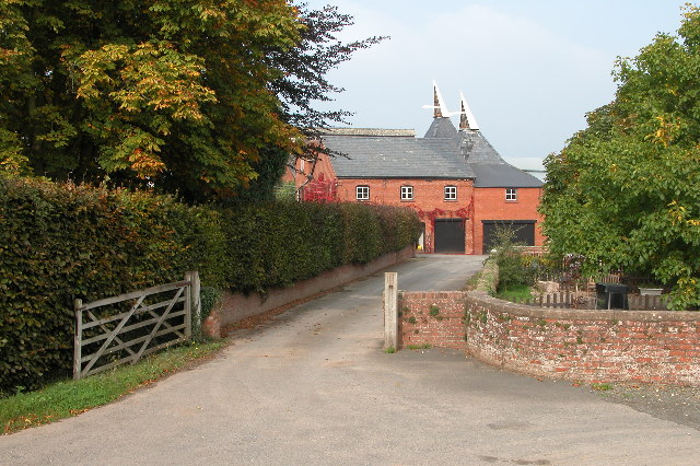
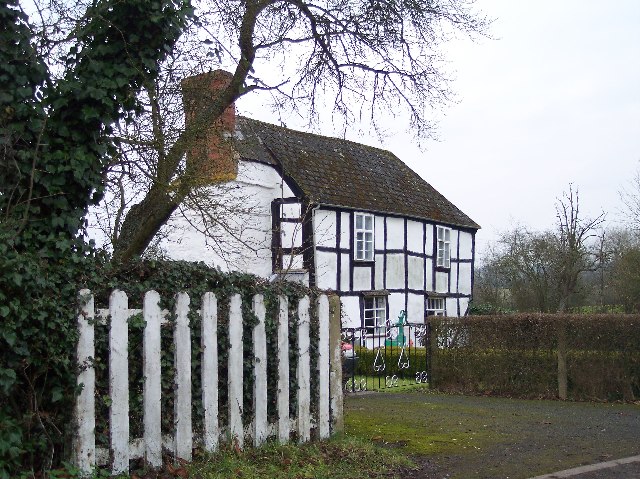
Bosbury is a picturesque village located in the county of Herefordshire, England. Situated approximately 4 miles northeast of Ledbury, it is nestled in the scenic Herefordshire countryside. The village is renowned for its charming rural beauty and tranquil atmosphere.

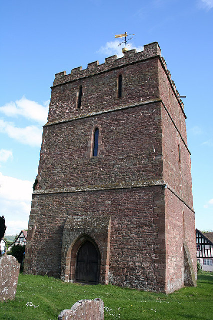
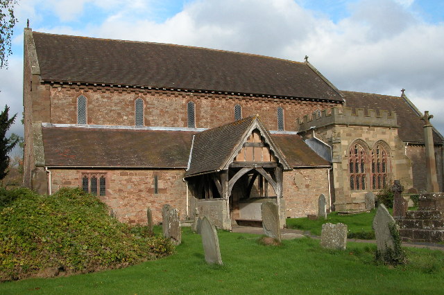
Bosbury is a small community with a population of around 500 residents. It boasts a rich history dating back to at least the Anglo-Saxon period, as evidenced by the presence of a medieval church, St. Peter's, which stands at the heart of the village. This Grade I listed building features a magnificent 12th-century tower and is a popular attraction for history enthusiasts.

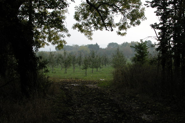
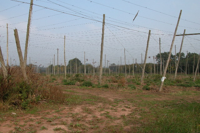
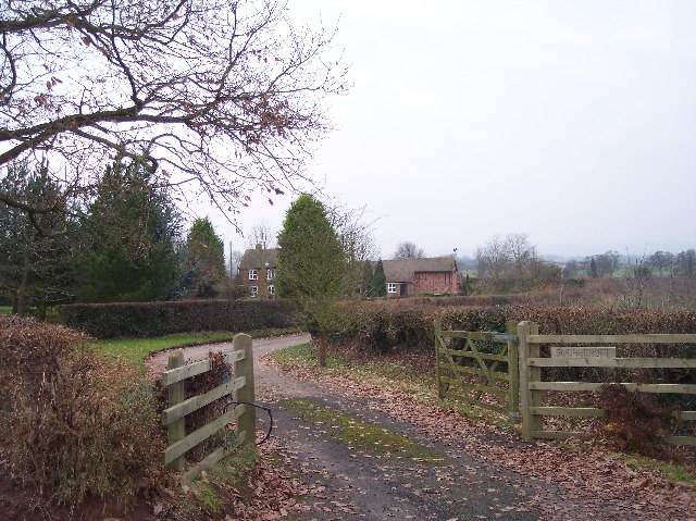
The village is surrounded by rolling hills and lush green fields, making it an ideal location for outdoor activities such as hiking, cycling, and horse riding. The area is also known for its apple orchards, which produce the famous Herefordshire cider.

Bosbury has a close-knit community that organizes various events throughout the year, including the Bosbury Fete and the Bosbury Scarecrow Festival. The village has a primary school, a village hall, and a local pub, The Bell Inn, which serves as a social hub for residents and visitors alike.

The proximity of Bosbury to the market town of Ledbury provides easy access to a wider range of amenities, including shops, restaurants, and leisure facilities. Additionally, the village is well-connected by road, with the A438 running through it, linking to nearby towns and cities.

Overall, Bosbury offers a quintessential English countryside experience, with its idyllic setting, rich heritage, and warm community spirit.

If you have any feedback on the listing, please let us know in the comments section below.
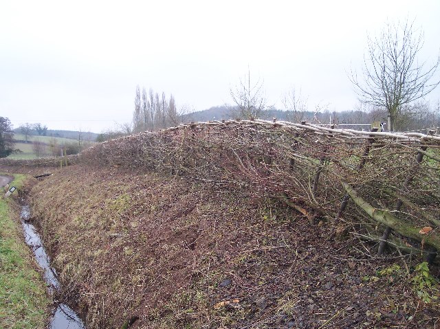
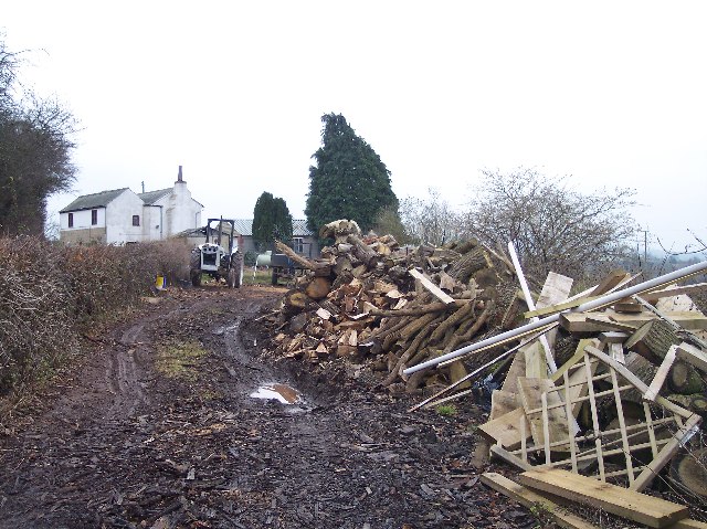
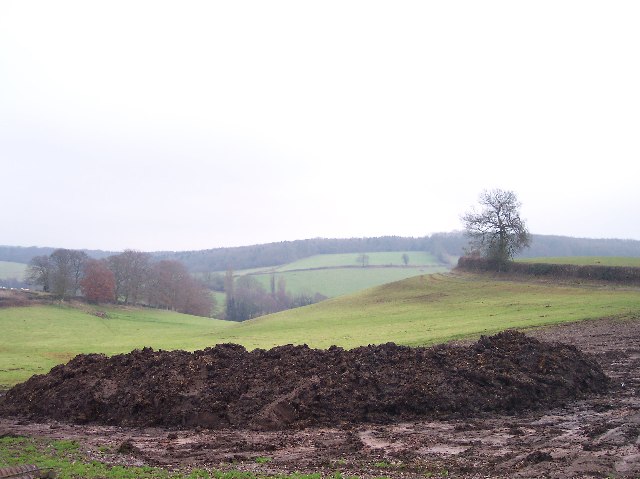
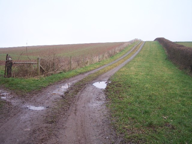
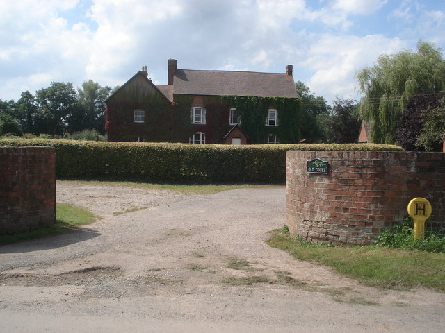
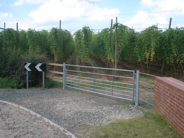
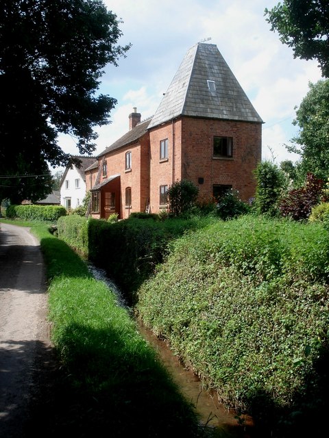
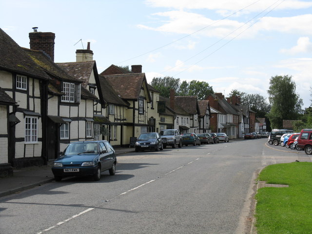
Bosbury Images

Images are sourced within 2km of 52.088171/-2.4450089 or Grid Reference SO6943. Thanks to Geograph Open Source API. All images are credited.

The detached tower at Bosbury
Apple Orchard near Staplow This apple orchard is beside the B4214 just north of Staplow.
Apple Orchard near Staplow
This apple orchard is beside the B4214 just north of Staplow.
Hop field at Cold Green Hop fields such as this are a common sight in Herefordshire.
Hop field at Cold Green
Hop fields such as this are a common sight in Herefordshire.
Hop kilns at Coldgreen Farm
Holy Trinity Church, Bosbury The church is unusual in that the tower is detached from the church. Pevsner describes the church as being 'A large and consistent church of the transition between Norman and Early English'.
Holy Trinity Church, Bosbury
The church is unusual in that the tower is detached from the church. Pevsner describes the church as being 'A large and consistent church of the transition between Norman and Early English'.
Sugarcroft Viewed from the east.
Sugarcroft
Viewed from the east.
Long Acre With an old orchard with possibly more mistletoe than apples.
Long Acre
With an old orchard with possibly more mistletoe than apples.
Lane to Dodd's Mill Looking NE
Lane to Dodd's Mill
Looking NE
Newly-Laid Hedge, Catley Farms Just recently laid. The cuttings were still piled up by the roadside.
Newly-Laid Hedge, Catley Farms
Just recently laid. The cuttings were still piled up by the roadside.
Old Buildings, Great Catley Ripe for conversion ? a nice mixture of stone, brick and timber.
Old Buildings, Great Catley
Ripe for conversion ? a nice mixture of stone, brick and timber.
Great Catley Mixture of half-timbered front with a brick side.
Great Catley
Mixture of half-timbered front with a brick side.
Cottage near Harbour Hill Viewed from the north. Good stock of wood.
Cottage near Harbour Hill
Viewed from the north. Good stock of wood.
Dung Hill for Muck Spreading Looking east from the gate to Shinscroft Farm. muck spreading has already started at the higher slopes of the field.
Dung Hill for Muck Spreading
Looking east from the gate to Shinscroft Farm. muck spreading has already started at the higher slopes of the field.
Track to The Merrings Looking NE up the farm track whilst the public footpath turns off diagonally across the field to the left.
Track to The Merrings
Looking NE up the farm track whilst the public footpath turns off diagonally across the field to the left.
Footpath to Cold Green Farm Looking SW along the well marked path across a freshly ploughed and planted field towards an unnamed (on the O.S. 1:25000 maps) copse.
Footpath to Cold Green Farm
Looking SW along the well marked path across a freshly ploughed and planted field towards an unnamed (on the O.S. 1:25000 maps) copse.
Old Court Entrance to this Bosbury farmhouse.
Old Court
Entrance to this Bosbury farmhouse.
Hop field at Bosbury Viewed from the bend in the lane as it crosses the stream. Since 2005 more hops are now grown in Hereford/Worcester than in Kent.
Hop field at Bosbury
Viewed from the bend in the lane as it crosses the stream. Since 2005 more hops are now grown in Hereford/Worcester than in Kent.
Catley Cross Farm Looking westwards along the lane. A converted oast house makes up the end of the dwelling house on this side.
Catley Cross Farm
Looking westwards along the lane. A converted oast house makes up the end of the dwelling house on this side.
Show me another place!

Bosbury is located at Grid Ref: SO6943 (Lat: 52.088171, Lng: -2.4450089)

Unitary Authority: County of Herefordshire

Police Authority: West Mercia

What 3 Words

///growth.bump.crazy. Near Evesbatch, Herefordshire

Nearby Locations

Bosbury Bosbury

Related Wikis

Bosbury

Bosbury is a village and civil parish in Herefordshire, England, approximately 3.5 miles (5.6 km) north of Ledbury. The small River Leadon flows through...

Coddington, Herefordshire

Coddington is a hamlet and civil parish in eastern Herefordshire, England, about 3 miles (4.8 km) north of Ledbury. The west side of the parish covers...

Upleadon Preceptory

Upleadon Preceptory was a priory in Herefordshire, England at grid reference SO66504270. == References ==

Hope End

Hope End is an area and former estate of Herefordshire, England, near the Malvern Hills, noted for its literary associations. As described by a 19th-century...

Fromes Hill

Fromes Hill is a hamlet in the civil parish of Bishop's Frome, in Herefordshire, England, and is about 15 miles (24 km) east from the city and county town...

A4103 road

The A4103 is an A-road which runs from Worcester to the A480 in Stretton Sugwas, a village 2 miles (3.2 km) west of Hereford. The road is a primary route...

Wellington Heath

Wellington Heath is a small village and civil parish in Herefordshire, England, approximately 1.5 miles (2.4 km) north of Ledbury. The population was recorded...

Munsley

Munsley is a village and civil parish 9 miles (14 km) east of Hereford, in the county of Herefordshire, England. In 2001 the parish had a population of...

Nearby Amenities

Located within 500m of 52.088171,-2.4450089
Bosbury
Place: village
Population: 714
Source: npe
Wikidata: Q3784360
Lat/Long: 52.0888169/-2.445252
Bus Stop
Forge Bank
Bus: yes
Naptan AtcoCode: 2090A067600
Naptan Bearing: SW
Naptan BusStopType: CUS
Naptan CommonName: Forge Bank
Naptan Indicator: adj no 30
Naptan Landmark: Housing estate
Naptan NaptanCode: heradgdw
Naptan Street: Forge Bank
Naptan Verified: no
Public Transport: platform
Source: naptan_import
Lat/Long: 52.0879295/-2.440044
Bus Stop
Bell Inn
Bus: yes
Naptan AtcoCode: 2090A067700
Naptan Bearing: W
Naptan BusStopType: CUS
Naptan CommonName: Bell Inn
Naptan Indicator: adj
Naptan Landmark: Bell Inn (PH)- opp. Church
Naptan NaptanCode: heradgja
Naptan Street: B4220
Naptan Verified: no
Public Transport: platform
Source: naptan_import
Lat/Long: 52.0880919/-2.4453045
Bus Stop
Bell Inn
Bus: yes
Naptan AtcoCode: 2090A144600
Naptan Bearing: E
Naptan BusStopType: CUS
Naptan CommonName: Bell Inn
Naptan Indicator: opp
Naptan Landmark: Bell Inn- Church
Naptan NaptanCode: heragdtg
Naptan Street: B4220
Naptan Verified: no
Public Transport: platform
Source: naptan_import
Lat/Long: 52.0881315/-2.445629
Bus Stop
Forge Bank
Bus: yes
Naptan AtcoCode: 2090A20179
Naptan Bearing: NE
Naptan BusStopType: CUS
Naptan CommonName: Forge Bank
Naptan Indicator: adj no 23
Naptan Landmark: Housing Estate
Naptan NaptanCode: herapapa
Naptan Street: Forge Bank
Naptan Verified: no
Public Transport: platform
Source: naptan_import
Lat/Long: 52.0879281/-2.440438
Post Box
Collection Plate: CP7
Collection Times: Mo-Fr 15:45; Sa 11:00
Historic Operator: Post Office
Post Box Type: lamp
Ref: HR8 361
Royal Cypher: EIIR
Royal Cypher Wikidata: Q33102113
Lat/Long: 52.0883972/-2.4417209
Barrier: kissing_gate
Foot: yes
Lat/Long: 52.0888164/-2.4475466
Power: pole
Lat/Long: 52.0858818/-2.4463235
Power: pole
Lat/Long: 52.0859097/-2.4444017
Power: pole
Lat/Long: 52.0863754/-2.4427296
Power: pole
Lat/Long: 52.0866676/-2.4416861
Power: pole
Lat/Long: 52.087002/-2.4404554
Power: pole
Lat/Long: 52.0873513/-2.4392291
Power: pole
Lat/Long: 52.0875438/-2.4386337
Power: pole
Lat/Long: 52.087696/-2.4379501
The Bosbury Barbers
Shop: hairdresser
Lat/Long: 52.0881371/-2.446661
Power: pole
Lat/Long: 52.0849025/-2.4481332
Power: pole
Lat/Long: 52.0858552/-2.4476774
Power: pole
Lat/Long: 52.0867471/-2.4472796
Power: pole
Lat/Long: 52.0870552/-2.4475378
Power: pole
Lat/Long: 52.0872449/-2.4466399
Bosbury School
Power: pole
Transformer: distribution
Voltage Primary: 11000
Lat/Long: 52.0875445/-2.4452039
Barrier: stile
Foot: yes
Lat/Long: 52.0877881/-2.447789
Power: pole
Lat/Long: 52.0880036/-2.4483736
Power: pole
Lat/Long: 52.0884937/-2.4488117
Power: pole
Lat/Long: 52.0885336/-2.449125
Power: pole
Lat/Long: 52.0886431/-2.4501984
Power: pole
Lat/Long: 52.0887323/-2.4489165
Power: pole
Lat/Long: 52.0887574/-2.4515851
Power: pole
Lat/Long: 52.0894049/-2.4482475
Power: pole
Lat/Long: 52.089793/-2.4475784
Power: pole
Lat/Long: 52.0902953/-2.4467409
Old Court Bosbury
Power: pole
Transformer: distribution
Voltage Primary: 11000
Lat/Long: 52.0903345/-2.4444165
Power: pole
Lat/Long: 52.090386/-2.4466047
Barrier: stile
Foot: yes
Lat/Long: 52.0903874/-2.4505721
Entrance: yes
Lat/Long: 52.0884374/-2.4459398
Bishops Palace
Historic: ruins
Historic 1: archaeological_site
Lat/Long: 52.0890179/-2.4453887
War Memorial
Historic: memorial
Lat/Long: 52.0881008/-2.4461129
The Pound (Village Pump)
Historic: monument
Lat/Long: 52.0887011/-2.4450494
Heritage: 2
Heritage Operator: Historic England
Historic: memorial
Listed Status: Grade II
Memorial: Stedman Memorial
Lat/Long: 52.0886405/-2.445429
Taylor Memorial
Heritage: 2
Heritage Operator: Historic England
Historic: memorial
Listed Status: Grade II
Lat/Long: 52.0886578/-2.445431
Heritage: 2
Heritage Operator: Historic England
Historic: wayside_cross
Listed Status: Grade II
Source: survey
Lat/Long: 52.0883647/-2.4458588
Source: survey
Tourism: artwork
Lat/Long: 52.0881782/-2.446735
Defibrillator
Emergency: defibrillator
Source: survey
Lat/Long: 52.0881321/-2.4467122
Post Office
Bosbury Post Office
Addr City: Ledbury
Addr Country: GB
Addr Housename: Bosbury Parish Hall
Addr Place: Bosbury
Addr Postcode: HR8 1PX
Opening Hours: Tu 15:00-17:00
Ref Pol Id: 97792
Lat/Long: 52.0882319/-2.4466236
Fire Hydrant
Emergency: fire_hydrant
Fire Hydrant Type: underground
Source: survey
Lat/Long: 52.0886998/-2.4381374
Fire Hydrant
Emergency: fire_hydrant
Fire Hydrant Type: underground
Source: survey
Lat/Long: 52.0886982/-2.4404991
Telephone
Booth: K6
Covered: booth
Listed Status: Grade II
Phone: +44 1531 640200
Source: survey
Lat/Long: 52.0882087/-2.4446002
Fire Hydrant
Emergency: fire_hydrant
Fire Hydrant Type: underground
Source: survey
Lat/Long: 52.0881899/-2.4449511
Power: pole
Lat/Long: 52.0903615/-2.4450716
Bosbury
Power: pole
Transformer: distribution
Voltage Primary: 11000
Lat/Long: 52.0873599/-2.4478027
Power: pole
Lat/Long: 52.0873842/-2.4459527
Bosbury Sewage Station East
Power: pole
Transformer: distribution
Voltage Primary: 11000
Lat/Long: 52.091052/-2.4403871
Power: pole
Lat/Long: 52.0909588/-2.4396287
The Firs (Bosbury)
Power: transformer
Transformer: distribution
Voltage Primary: 11000
Lat/Long: 52.0879784/-2.4407941
Power: pole
Lat/Long: 52.0838534/-2.4454303
Lower Mill
Power: pole
Transformer: distribution
Voltage Primary: 11000
Lat/Long: 52.0842498/-2.4456087
Power: pole
Lat/Long: 52.0850641/-2.4459507
Bosbury Sewage Plant
Power: pole
Transformer: distribution
Voltage Primary: 11000
Lat/Long: 52.085891/-2.4452989
Old Court Cottages
Power: pole
Transformer: distribution
Voltage Primary: 11000
Lat/Long: 52.0915945/-2.4477598
Power: pole
Lat/Long: 52.0908736/-2.4471416
Power: pole
Lat/Long: 52.0883006/-2.4520332
The data included in this document is from www.openstreetmap.org. The data is made available under ODbL.

Have you been to Bosbury?

Leave your review of Bosbury below (or comments, questions and feedback).