Thixendale

Settlement in Yorkshire Ryedale

England

Thixendale

Maize windbreak at The Warrens
Maize windbreak at The Warrens Credit: Sandy Gerrard

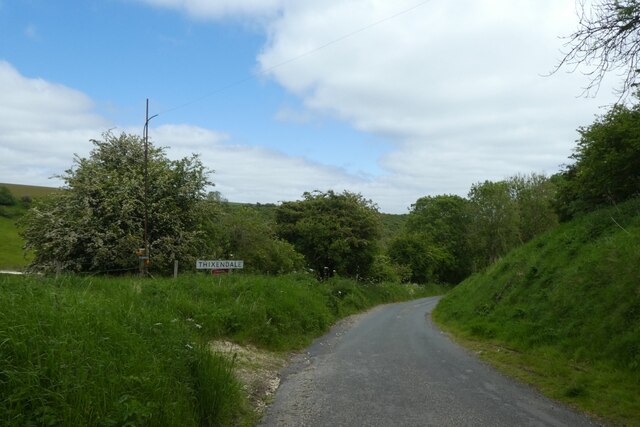
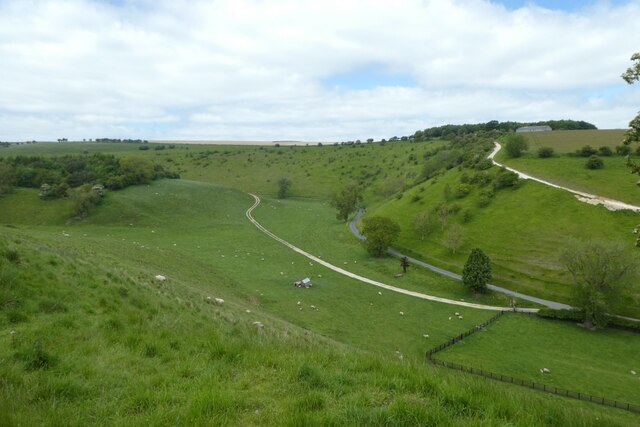
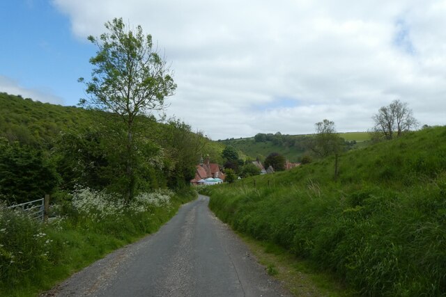
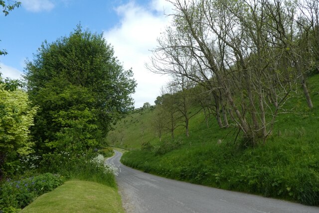
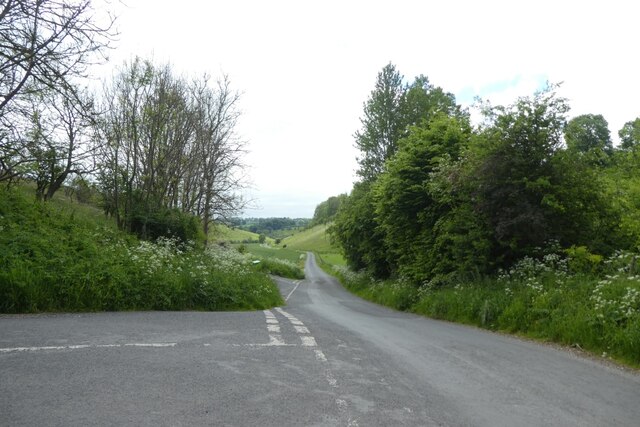
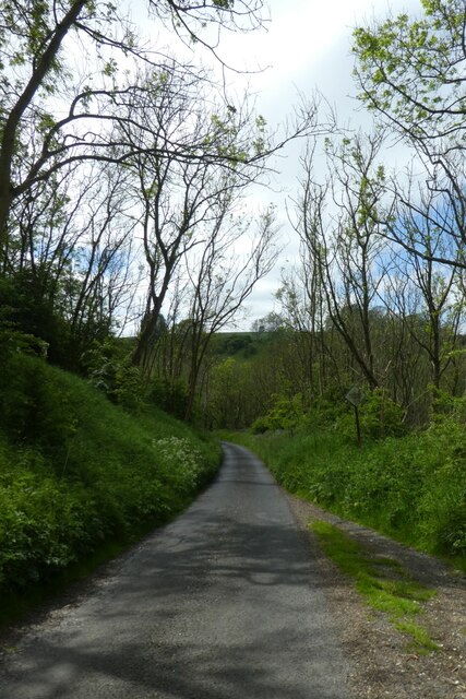
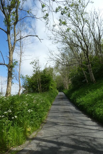
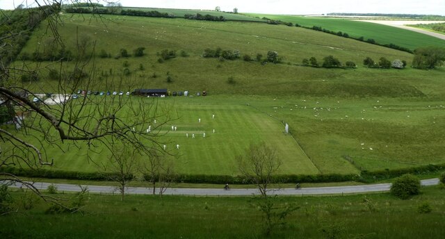
Thixendale is a picturesque village located in the county of Yorkshire, England. Situated within the Yorkshire Wolds, this small rural community is known for its stunning natural beauty and tranquil atmosphere.

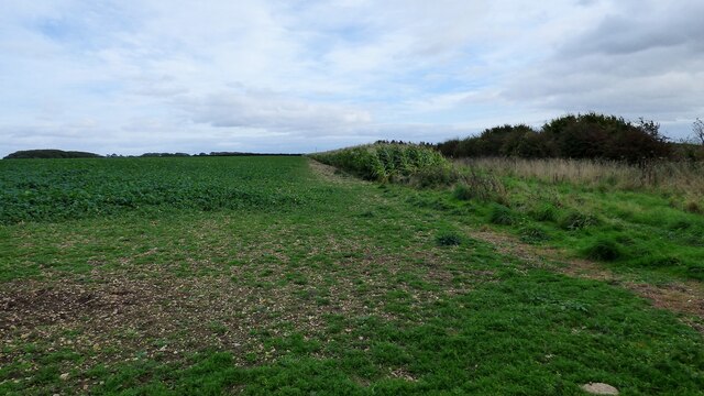
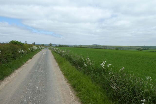
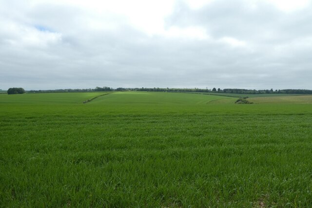
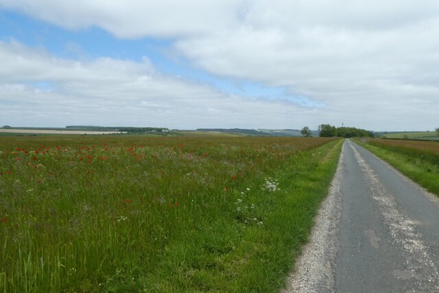
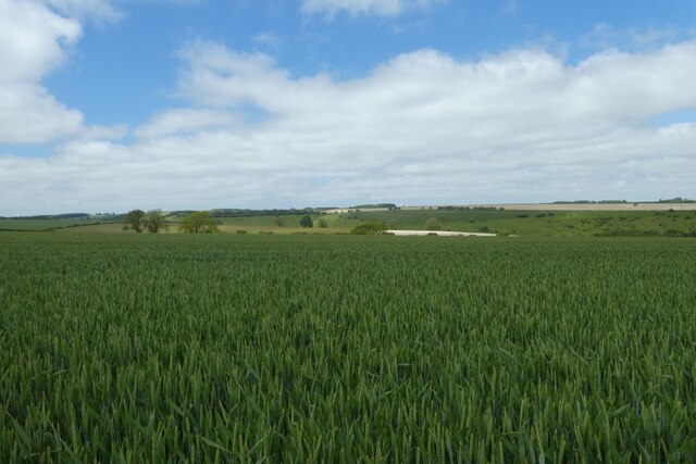
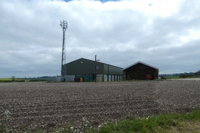
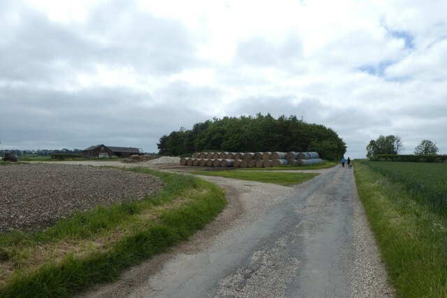
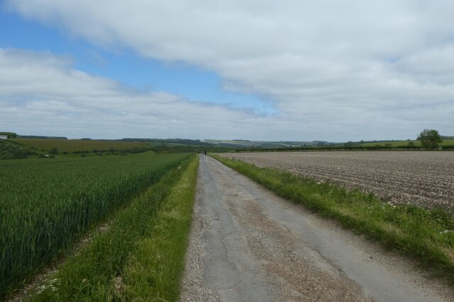
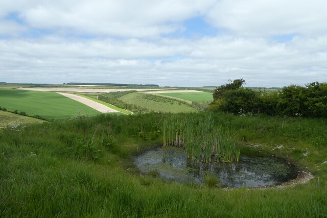
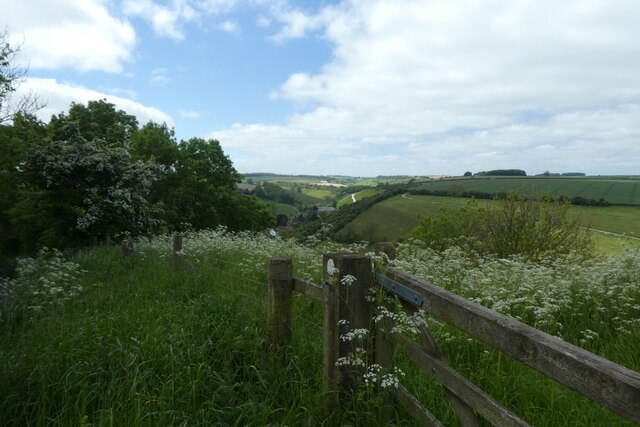
The village is nestled amidst rolling hills and verdant countryside, offering breathtaking views and ample opportunities for outdoor activities such as hiking, cycling, and birdwatching. Thixendale is surrounded by farmland, with fields of crops and grazing livestock dotting the landscape.

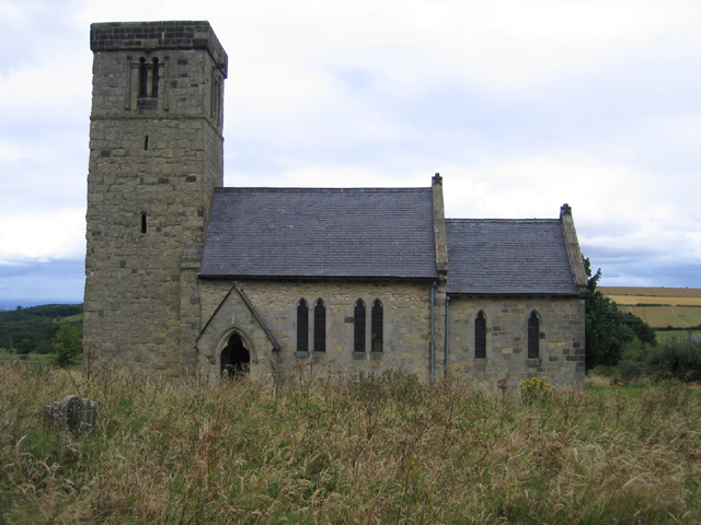
One of the main attractions of Thixendale is its charming medieval church, St. Mary's Church, which dates back to the 12th century. This historic place of worship features beautiful stained glass windows and an ancient graveyard that adds to the village's timeless appeal.

Despite its small size, Thixendale boasts a strong sense of community, with a close-knit population that takes pride in maintaining the village's heritage and traditions. The local pub, The Cross Keys, serves as a popular gathering spot for residents and visitors alike, offering a warm welcome and a chance to sample traditional Yorkshire cuisine.

Thixendale is also home to several art galleries and craft shops, showcasing the talents of local artists and artisans. The village has become a hub for creativity, with many artists drawing inspiration from the surrounding natural landscape.

Overall, Thixendale is a hidden gem in the heart of Yorkshire, offering a peaceful retreat from the hustle and bustle of modern life. Its unspoiled beauty and sense of community make it a truly special place to visit or call home.

If you have any feedback on the listing, please let us know in the comments section below.

Thixendale Images

Images are sourced within 2km of 54.039198/-0.716151 or Grid Reference SE8461. Thanks to Geograph Open Source API. All images are credited.

Maize windbreak at The Warrens
Road near Martinholme Farm Looking along the road leading to Thixendale.
Road near Martinholme Farm
Looking along the road leading to Thixendale.
Fields at Martinholme Looking into Long Dale from the road to Thixendale.
Fields at Martinholme
Looking into Long Dale from the road to Thixendale.
Poppies along the road to Thixendale Looking along the road as it starts to descend into the village.
Poppies along the road to Thixendale
Looking along the road as it starts to descend into the village.
Wheat fields above Thixendale Looking across farmland on the tops above the village.
Wheat fields above Thixendale
Looking across farmland on the tops above the village.
Farm buildings above Thixendale A communications mast and farm buildings standing above the village.
Farm buildings above Thixendale
A communications mast and farm buildings standing above the village.
Bales along the road from Thixendale Looking along the road heading away from the village.
Bales along the road from Thixendale
Looking along the road heading away from the village.
Wheat field beside the road Looking along the road as it descends into the village.
Wheat field beside the road
Looking along the road as it descends into the village.
Descending the road into Thixendale Dropping down to the village at the bottom of the dale.
Descending the road into Thixendale
Dropping down to the village at the bottom of the dale.
Steep sided valley Looking down into Thixen Dale to the west of the village.
Steep sided valley
Looking down into Thixen Dale to the west of the village.
Road coming into the village Looking along one of the roads coming into Thixendale.
Road coming into the village
Looking along one of the roads coming into Thixendale.
Road through Water Dale Looking along the road heading towards Fridaythorpe via Water Dale.
Road through Water Dale
Looking along the road heading towards Fridaythorpe via Water Dale.
Road through Thixen Dale With the steep road leading to Fridaythorpe on the left.
Road through Thixen Dale
With the steep road leading to Fridaythorpe on the left.
Road climbing out of Thixendale This road heads to Fridaythorpe by the hilly route.
Road climbing out of Thixendale
This road heads to Fridaythorpe by the hilly route.
Climbing the hill east of Thixendale This road is the hillier route to Fridaythorpe.
Climbing the hill east of Thixendale
This road is the hillier route to Fridaythorpe.
Cricket match from above Looking down on the cricket pitch in Thixendale from a road climbing steeply out of the village.
Cricket match from above
Looking down on the cricket pitch in Thixendale from a road climbing steeply out of the village.
Pool above Thixendale Looking across Water Dale from a road leading up and out of the village towards Fridaythorpe.
Pool above Thixendale
Looking across Water Dale from a road leading up and out of the village towards Fridaythorpe.
Gate above Thixendale The gate is near to a small pond beside the road above the village.
Gate above Thixendale
The gate is near to a small pond beside the road above the village.
Show me another place!

Thixendale is located at Grid Ref: SE8461 (Lat: 54.039198, Lng: -0.716151)

Division: East Riding

Administrative County: North Yorkshire

District: Ryedale

Police Authority: North Yorkshire

What 3 Words

///wharfs.denoting.obscuring. Near Kirby Underdale, East Yorkshire

Related Wikis

Thixendale

Thixendale is a village and civil parish in North Yorkshire, England. Historically part of the East Riding of Yorkshire, it is located in the Yorkshire...

Burdale railway station

Burdale railway station was a station on the Malton and Driffield Junction Railway in North Yorkshire, England. == History and description == Burdale...

Burdale, North Yorkshire

Burdale is a hamlet in North Yorkshire, England, 8 miles (13 km) south-east of Malton. It lies in a deep valley (or dale), also known as Burdale, in the...

Uncleby

Uncleby is a hamlet in the East Riding of Yorkshire, England. It forms part of the civil parish of Kirby Underdale. It is situated approximately 6.5 miles...

Wharram Percy

Wharram Percy is a deserted medieval village and former civil parish near Wharram-le-Street, now in the parish of Wharram, on the western edge of the chalk...

Wharram

Wharram is a civil parish in North Yorkshire, England. It lies on the Yorkshire Wolds, 6 miles (10 km) south-east of Malton. The principal settlement is...

Buckrose

Buckrose was a wapentake of the historic East Riding of Yorkshire, England consisting of the north-west part of the county; its territory is now partly...

Painsthorpe

Painsthorpe is a hamlet in the East Riding of Yorkshire, England. It is located about 1 mile (1.6 km) east of the village of Kirby Underdale, the area...

Nearby Amenities

Located within 500m of 54.039198,-0.716151
Thixendale
Place: village
Source: NPE
Lat/Long: 54.0393423/-0.7137233
Pub
The Cross Keys
Accommodation: yes
Addr City: Malton
Addr Housename: The Cross Keys
Addr Place: Thixendale
Addr Postcode: YO17 9TG
Floor Material: carpet
Food: yes
Opening Hours: Mo 18:00-23:00, Th 18:00-23:00, Fr 16:00-23:00, Sa 12:00-23:00, Su 12:00-13:00
Phone: +44 1377 288 316, +44 7359 587 613
Real Ale: 2 local beers + Tetleys
Wheelchair: no
Wheelchair Description: Steps in pub
Lat/Long: 54.0383112/-0.7112936
Post Box
Collection Times: Mo-Fr 16:15; Sa 10:15
Operator: Royal Mail
Post Box Type: lamp
Postal Code: YO17
Ref: YO17 49
Royal Cypher: EIIR
Royal Cypher Wikidata: Q33102113
Lat/Long: 54.0392869/-0.7162625
Telephone
Booth: K6
Covered: booth
Phone: +44 1377 288211
Lat/Long: 54.0392903/-0.7162825
Information: guidepost
Tourism: information
Lat/Long: 54.0396759/-0.7180931
Bench
Lat/Long: 54.0396744/-0.7180743
Information: guidepost
Note: Signage for public bridleway only
Tourism: information
Lat/Long: 54.0401128/-0.7223447
Information: guidepost
Tourism: information
Lat/Long: 54.0385667/-0.7107951
Defibrillator
Defibrillator Location: outside Thixendale Village Hall, Thixendale, YO17 9TG
Emergency: defibrillator
Indoor: no
Lat/Long: 54.0390418/-0.7159945
Information: guidepost
Tourism: information
Lat/Long: 54.0383246/-0.7120194
Information: board
Tourism: information
Lat/Long: 54.0391365/-0.7162013
Generator Method: photovoltaic
Generator Output Electricity: yes
Generator Source: solar
Generator Type: solar_photovoltaic_panel
Power: generator
Lat/Long: 54.0383963/-0.7106818
Generator Method: photovoltaic
Generator Output Electricity: yes
Generator Source: solar
Generator Type: solar_photovoltaic_panel
Power: generator
Lat/Long: 54.0381584/-0.7102795
Generator Method: photovoltaic
Generator Output Electricity: yes
Generator Source: solar
Generator Type: solar_photovoltaic_panel
Power: generator
Lat/Long: 54.0381143/-0.7104257
Generator Method: photovoltaic
Generator Output Electricity: yes
Generator Source: solar
Generator Type: solar_photovoltaic_panel
Power: generator
Lat/Long: 54.0381419/-0.7104887
Generator Method: photovoltaic
Generator Output Electricity: yes
Generator Source: solar
Generator Type: solar_photovoltaic_panel
Power: generator
Lat/Long: 54.0380513/-0.7106188
Information: guidepost
Tourism: information
Lat/Long: 54.0369108/-0.7117965
Information: guidepost
Tourism: information
Lat/Long: 54.0376487/-0.7108149
Material: wood
Power: pole
Lat/Long: 54.0367475/-0.7106486
Line Management: branch
Material: wood
Power: pole
Lat/Long: 54.0371382/-0.7118727
Material: wood
Power: pole
Lat/Long: 54.0373764/-0.7126349
Material: wood
Power: pole
Lat/Long: 54.0376313/-0.7134302
Material: wood
Power: pole
Lat/Long: 54.038004/-0.7146073
Design: h-frame
Material: wood
Power: tower
Transformer: distribution
Lat/Long: 54.0384189/-0.7158847
Material: wood
Power: pole
Lat/Long: 54.0366987/-0.7122428
Material: wood
Power: pole
Lat/Long: 54.035965/-0.7128696
Material: wood
Power: pole
Lat/Long: 54.0352779/-0.7134421
Information: route_marker
Tourism: information
Lat/Long: 54.0391631/-0.7093459
The data included in this document is from www.openstreetmap.org. The data is made available under ODbL.

Have you been to Thixendale?

Leave your review of Thixendale below (or comments, questions and feedback).