Ridgeway, The

Settlement in Worcestershire / Warwickshire Wychavon

England

Ridgeway, The

The Salt Way joins The Ridgeway at New End
The Salt Way joins The Ridgeway at New End Credit: Jeff Gogarty

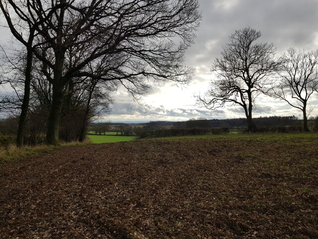
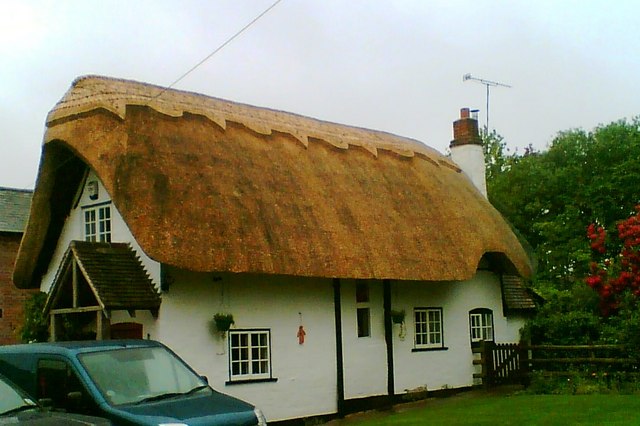
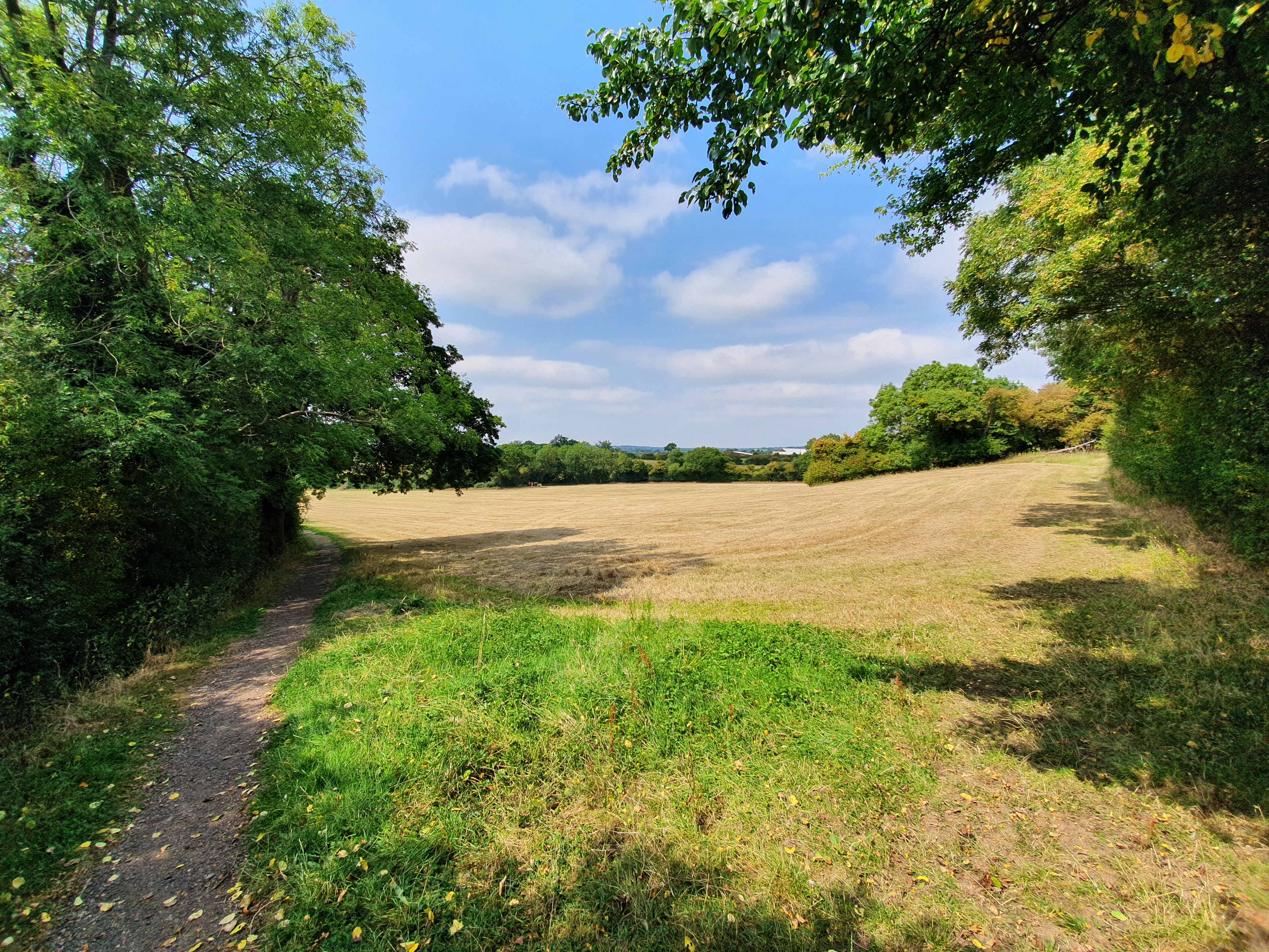
Ridgeway, The, is a small village located on the border of Worcestershire and Warwickshire counties in England. Situated in the picturesque countryside, this rural community is known for its natural beauty and peaceful atmosphere. The village is surrounded by rolling hills and green fields, offering stunning views and a tranquil environment for residents and visitors alike.

Despite its small size, Ridgeway has a rich history that dates back several centuries. The village is home to a medieval church, St. Mary Magdalene, which serves as a prominent landmark and a reminder of its past. The church's architecture and historical significance attract tourists and history enthusiasts from far and wide.

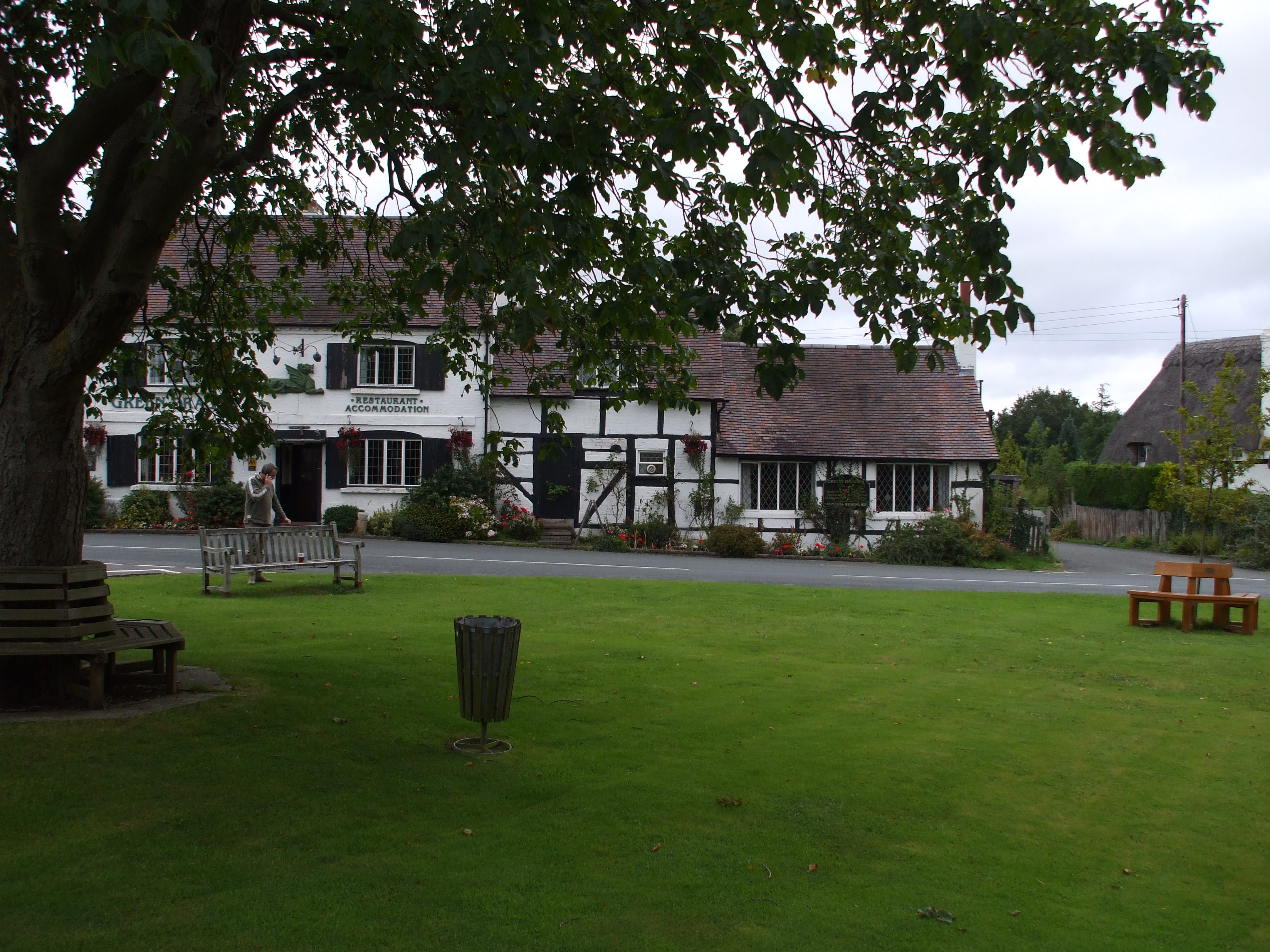
The village features a handful of amenities to cater to its residents' needs. These include a primary school, a local pub, and a small convenience store for basic necessities. Additionally, there are several walking and cycling paths that allow residents to explore the surrounding countryside and enjoy the fresh air.

Ridgeway benefits from its proximity to larger towns and cities. The nearby town of Redditch provides additional amenities, including shopping centers, restaurants, and leisure facilities. The village is also well-connected to major road networks, making it accessible for commuters.

Overall, Ridgeway offers a charming and idyllic setting for those seeking a peaceful countryside lifestyle. Its natural beauty, historical landmarks, and close-knit community make it an attractive place to live or visit for a quiet retreat.

If you have any feedback on the listing, please let us know in the comments section below.

Ridgeway, The Images

Images are sourced within 2km of 52.238177/-1.9428436 or Grid Reference SP0460. Thanks to Geograph Open Source API. All images are credited.

The Salt Way joins The Ridgeway at New End
Nevill Arms at New End Take from where the Millennium Way joins the Ridgeway.
Nevill Arms at New End
Take from where the Millennium Way joins the Ridgeway.
Deer running across a field Near 145 Park Farm, Alcester and taken from the Millennium Way.
Deer running across a field
Near 145 Park Farm, Alcester and taken from the Millennium Way.
Fields on the west of Coughton Park woodland
Field edge near Hanging Well, Warwickshire
Fields off footpath, near Hanging Well, Warwickshire
Junction of Alcester Heath and Whitemoor Road, Warwickshire
Pond on The Ridgeway, near to New End
House with helicopter, The Ridgeway
Power lines crossing near the Monarch's Way
View over North Worcestershire from the Ridgeway Beyond the hills in the distant is the Teme Valley. The land in between was originally mainly the Forest of Feckenham.
View over North Worcestershire from the Ridgeway
Beyond the hills in the distant is the Teme Valley. The land in between was originally mainly the Forest of Feckenham.
Tree next to the Monarch's Way
Cattle near Lower Park Farm, New End Taken from the Monarch's Way.
Cattle near Lower Park Farm, New End
Taken from the Monarch's Way.
Pylon and farm buildings From Botany Bay Garden Centre.
Pylon and farm buildings
From Botany Bay Garden Centre.
Cemetery and plant hire  On Edgioake Lane, Astwood Bank.
Cemetery and plant hire
On Edgioake Lane, Astwood Bank.
Walkers pass old buildings for livestock
Power lines above horses
Farm near The Ridgeway from a footpath
Show me another place!

Ridgeway, The is located at Grid Ref: SP0460 (Lat: 52.238177, Lng: -1.9428436)

Administrative County: Worcestershire

District: Wychavon

Police Authority: West Mercia

What 3 Words

///mush.thrashing.cartoons. Near Astwood Bank, Worcestershire

Related Wikis

Redditch (UK Parliament constituency)

Redditch is a constituency in Worcestershire, England, represented in the House of Commons of the UK Parliament since 2017 by Rachel Maclean of the Conservative...

Cookhill

Cookhill is a village and civil parish in Worcestershire, England, on the county border near Alcester. It is close to a former Cistercian Priory of the...

Ridgeway Secondary School

Ridgeway Secondary School is a coeducational secondary school located in Astwood Bank (near Redditch) in the English county of Worcestershire.Established...

Holberrow Green

Holberrow Green is a village in Worcestershire, England. == External links == Media related to Holberrow Green at Wikimedia Commons

Astwood Bank

Astwood Bank is a district within Redditch. Astwood Bank is near the Warwickshire - Worcestershire border, near villages such as Studley, Sambourne, Callow...

Ham Green, Worcestershire

Ham Green is a hamlet outside Redditch, Worcestershire. It lies in between the villages of Feckenham, Callow Hill, Elcocks Brook & Cruise Hill.

Sambourne

Sambourne, formerly spelled Sambourn, is a village and civil parish 1.5 miles (2.4 km) north-west of Coughton, 4.5 miles (7.2 km) south of Redditch, 12...

Cookhill Priory

Cookhill Priory was a Cistercian nunnery near Cookhill in Worcestershire, England. == History == The Priory is believed to be founded by Isabel de Mauduit...

Nearby Amenities

Located within 500m of 52.238177,-1.9428436
Power: pole
Lat/Long: 52.2343214/-1.9427058
Power: pole
Lat/Long: 52.2387085/-1.9355921
Power: pole
Lat/Long: 52.2340721/-1.9413268
Power: pole
Lat/Long: 52.2388163/-1.9365301
Edgiock
Place: locality
Lat/Long: 52.2419088/-1.9441021
Power: pole
Lat/Long: 52.2346345/-1.9443007
Power: pole
Lat/Long: 52.2354087/-1.94848
Power: pole
Lat/Long: 52.2348634/-1.9456315
Power: pole
Lat/Long: 52.2351426/-1.9470852
Post Box
Collection Times: Mo-Fr 15:15; Sa 07:00
Operator: Royal Mail
Operator Wikidata: Q638098
Post Box Type: lamp
Ref: B96 10
Royal Cypher: EIIR
Royal Cypher Wikidata: Q33102113
Source: survey
Lat/Long: 52.2407022/-1.9428624
Barrier: yes
Lat/Long: 52.2397127/-1.9424741
Power: pole
Lat/Long: 52.238939/-1.9374635
New End Poultry Farm
Power: pole
Transformer: distribution
Voltage Primary: 11000
Lat/Long: 52.2390421/-1.9384432
Edgioake Lane Manor Farm
Power: pole
Transformer: distribution
Voltage Primary: 11000
Lat/Long: 52.2425586/-1.9417403
Power: pole
Lat/Long: 52.2391571/-1.9393672
Power: pole
Lat/Long: 52.2398469/-1.9452024
Power: pole
Lat/Long: 52.2346486/-1.9383647
Power: pole
Lat/Long: 52.235155/-1.9390158
Power: pole
Lat/Long: 52.2356178/-1.9391868
Dogbut Farm
Power: pole
Transformer: distribution
Voltage Primary: 11000
Lat/Long: 52.2365873/-1.9395261
Power: pole
Lat/Long: 52.2368904/-1.9396032
Power: pole
Lat/Long: 52.2371158/-1.9396837
Dragon Farm
Power: pole
Transformer: distribution
Voltage Primary: 11000
Lat/Long: 52.2374924/-1.9401953
Power: pole
Lat/Long: 52.2381909/-1.9402269
Power: pole
Lat/Long: 52.2389419/-1.9402604
Power: pole
Lat/Long: 52.2393755/-1.9411502
Power: pole
Lat/Long: 52.2392704/-1.9402627
Power: pole
Lat/Long: 52.2394872/-1.9421071
Villa Farm
Power: pole
Transformer: distribution
Voltage Primary: 11000
Lat/Long: 52.2396408/-1.9434569
Power: pole
Lat/Long: 52.2397513/-1.9443796
Power: pole
Lat/Long: 52.2399426/-1.9460298
Power: pole
Lat/Long: 52.2400453/-1.94687
Power: pole
Lat/Long: 52.2401463/-1.9477391
Hill Farm Edgioake
Power: pole
Transformer: distribution
Voltage Primary: 11000
Lat/Long: 52.2379145/-1.9487569
Power: pole
Lat/Long: 52.2385896/-1.9487077
Muzzy Hill
Power: pole
Transformer: distribution
Voltage Primary: 11000
Lat/Long: 52.2394207/-1.9486584
Power: pole
Lat/Long: 52.240244/-1.9485893
Barrier: stile
Bicycle: no
Foot: yes
Horse: no
Material: wood
Motor Vehicle: no
Stile: stepover
Lat/Long: 52.2400375/-1.9376509
The data included in this document is from www.openstreetmap.org. The data is made available under ODbL.

Have you been to Ridgeway, The?

Leave your review of Ridgeway, The below (or comments, questions and feedback).