End, New

Settlement in Worcestershire / Warwickshire Wychavon

England

End, New

Track off Whitemoor Lane
Track off Whitemoor Lane Credit: P Gaskell

End, New is a small village located on the border of Worcestershire and Warwickshire counties in England. Situated in the picturesque countryside, this rural settlement is home to a close-knit community of approximately 400 residents.

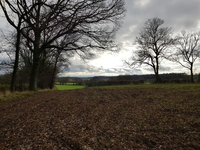
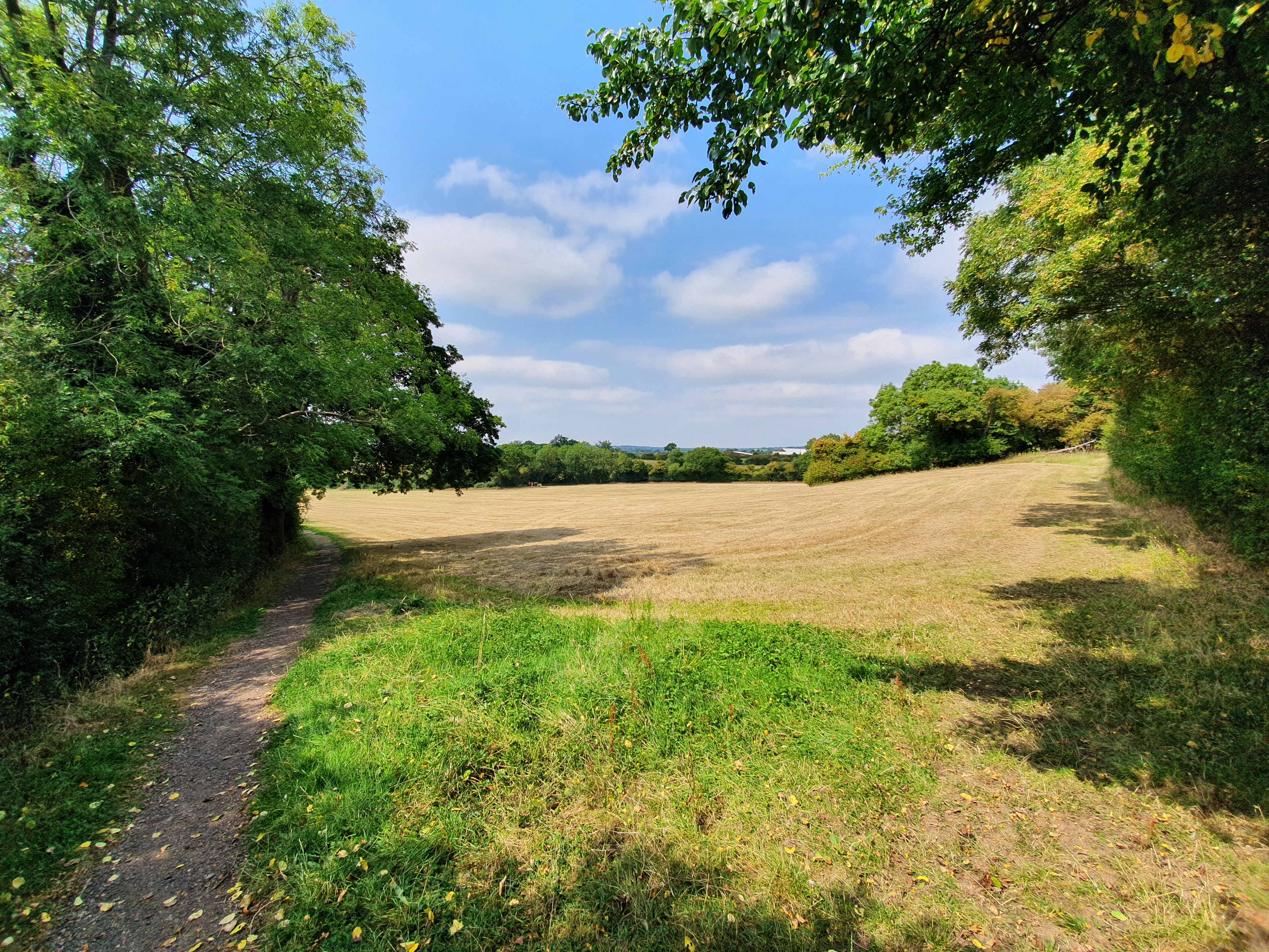
The village of End, New is characterized by its peaceful and idyllic surroundings. Surrounded by rolling hills, lush green fields, and meandering streams, it offers a serene escape from the hustle and bustle of city life. The area is renowned for its natural beauty, making it a popular destination for nature lovers and outdoor enthusiasts.

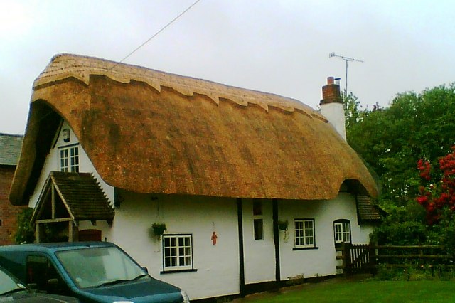
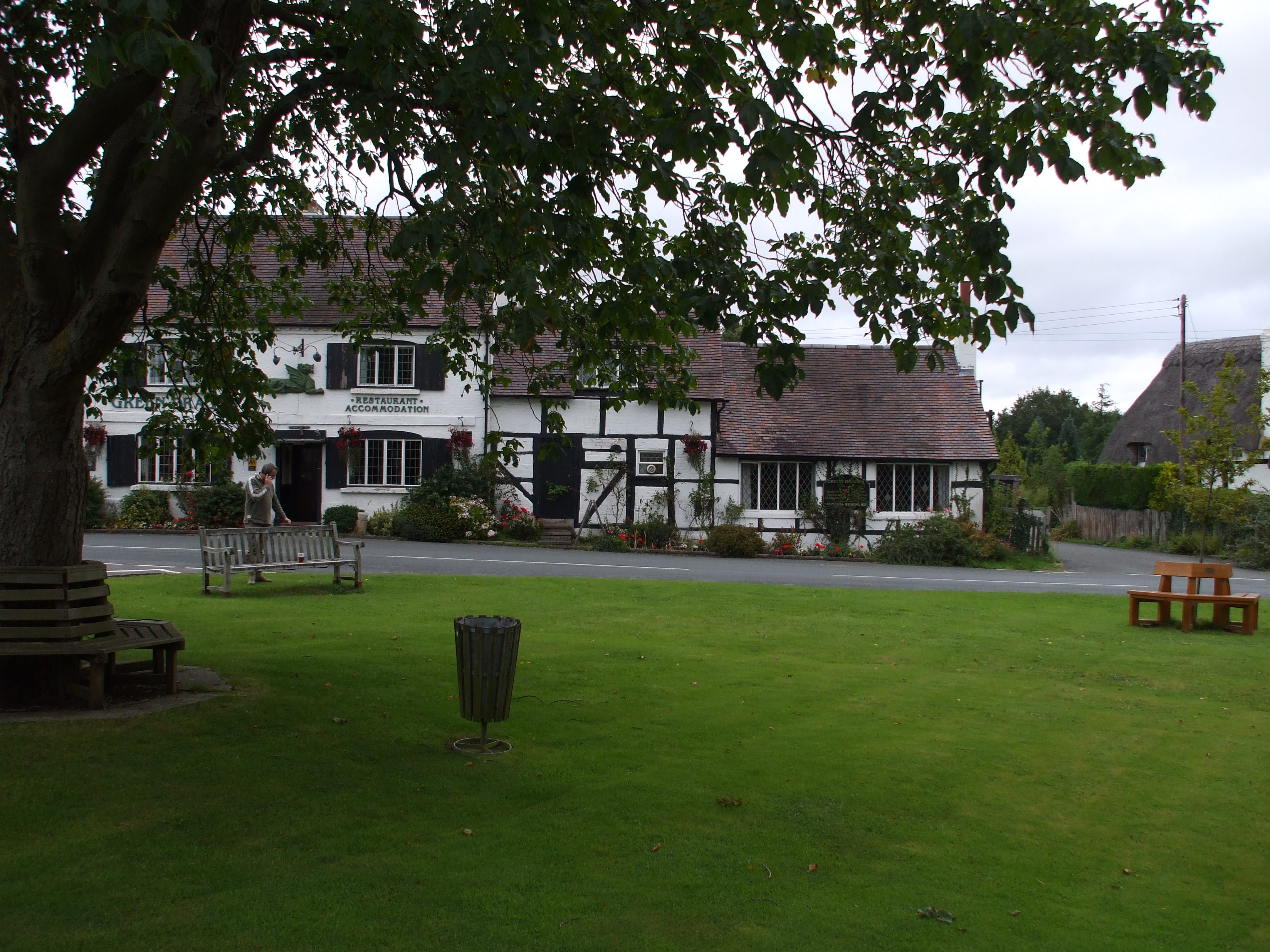
The village itself consists of a cluster of traditional stone cottages, giving it a charming and quaint atmosphere. There is a local village church that dates back several centuries, serving as a reminder of the area's rich history. The community takes great pride in preserving its heritage, and traditional events and festivals are held throughout the year to celebrate local customs.

While End, New may be small in size, it offers a range of amenities to cater to its residents' needs. These include a village hall, a small convenience store, and a primary school, providing essential services and facilities within close proximity.

Overall, End, New, Worcestershire / Warwickshire is a peaceful and picturesque village, offering a tranquil lifestyle amidst stunning natural beauty. Its rich history and tight-knit community make it an attractive place to live for those seeking a slower pace of life in the heart of the English countryside.

If you have any feedback on the listing, please let us know in the comments section below.

End, New Images

Images are sourced within 2km of 52.23852/-1.9286238 or Grid Reference SP0460. Thanks to Geograph Open Source API. All images are credited.

Track off Whitemoor Lane
The Salt Way joins The Ridgeway at New End
Nevill Arms at New End Take from where the Millennium Way joins the Ridgeway.
Nevill Arms at New End
Take from where the Millennium Way joins the Ridgeway.
Deer running across a field Near 145 Park Farm, Alcester and taken from the Millennium Way.
Deer running across a field
Near 145 Park Farm, Alcester and taken from the Millennium Way.
Bridleway on edge of wood, Coughton Park
Bridleway through Coughton Park woodland There was an unusual lack of bird activity in these woods.
Bridleway through Coughton Park woodland
There was an unusual lack of bird activity in these woods.
Fields on the west of Coughton Park woodland
Field edge near Hanging Well, Warwickshire
Fields off footpath, near Hanging Well, Warwickshire
Junction of Alcester Heath and Whitemoor Road, Warwickshire
Pond on The Ridgeway, near to New End
House with helicopter, The Ridgeway
Power lines crossing near the Monarch's Way
View over North Worcestershire from the Ridgeway Beyond the hills in the distant is the Teme Valley. The land in between was originally mainly the Forest of Feckenham.
View over North Worcestershire from the Ridgeway
Beyond the hills in the distant is the Teme Valley. The land in between was originally mainly the Forest of Feckenham.
Tree next to the Monarch's Way
Cattle near Lower Park Farm, New End Taken from the Monarch's Way.
Cattle near Lower Park Farm, New End
Taken from the Monarch's Way.
Pylon and farm buildings From Botany Bay Garden Centre.
Pylon and farm buildings
From Botany Bay Garden Centre.
Cemetery and plant hire  On Edgioake Lane, Astwood Bank.
Cemetery and plant hire
On Edgioake Lane, Astwood Bank.
Show me another place!

End, New is located at Grid Ref: SP0460 (Lat: 52.23852, Lng: -1.9286238)

Administrative County: Worcestershire

District: Wychavon

Police Authority: West Mercia

What 3 Words

///playroom.latched.kitchen. Near Astwood Bank, Worcestershire

Related Wikis

Cookhill

Cookhill is a village and civil parish in Worcestershire, England, on the county border near Alcester. It is close to a former Cistercian Priory of the...

Ridgeway Secondary School

Ridgeway Secondary School is a coeducational secondary school located in Astwood Bank (near Redditch) in the English county of Worcestershire.Established...

Redditch (UK Parliament constituency)

Redditch is a constituency in Worcestershire, England, represented in the House of Commons of the UK Parliament since 2017 by Rachel Maclean of the Conservative...

Sambourne

Sambourne, formerly spelled Sambourn, is a village and civil parish 1.5 miles (2.4 km) north-west of Coughton, 4.5 miles (7.2 km) south of Redditch, 12...

Astwood Bank

Astwood Bank is a district within Redditch. Astwood Bank is near the Warwickshire - Worcestershire border, near villages such as Studley, Sambourne, Callow...

Coughton railway station

Coughton railway station serving Coughton, Warwickshire was a station on the Barnt Green to Evesham line. The station was opened by the Evesham and Redditch...

Holberrow Green

Holberrow Green is a village in Worcestershire, England. == External links == Media related to Holberrow Green at Wikimedia Commons

Cookhill Priory

Cookhill Priory was a Cistercian nunnery near Cookhill in Worcestershire, England. == History == The Priory is believed to be founded by Isabel de Mauduit...

Nearby Amenities

Located within 500m of 52.23852,-1.9286238
Bus Stop
Nevill Arms
Bus: yes
Naptan AtcoCode: 2000G030900
Naptan Bearing: N
Naptan CommonName: Nevill Arms
Naptan Indicator: adj
Naptan Landmark: Public House
Naptan NaptanCode: wocdpwjp
Naptan Street: Evesham Road
Naptan Verified: no
Public Transport: platform
Source: naptan_import
Lat/Long: 52.2391962/-1.9264251
Wood Lane
Naptan AtcoCode: 2000G054300
Naptan Bearing: NE
Naptan BusStopType: CUS
Naptan CommonName: Wood Lane
Naptan Indicator: adj
Naptan NaptanCode: wocdwtpm
Naptan Street: Wood Lane
Naptan Verified: no
Source: naptan_import
Lat/Long: 52.2343068/-1.9288932
Bus Stop
New End- Neville Arms
Bus: yes
Naptan AtcoCode: 2000G323365
Naptan Bearing: S
Naptan CommonName: New End- Neville Arms
Naptan Indicator: opp
Naptan Landmark: Neville Arms Inn
Naptan NaptanCode: wocgajpg
Naptan Street: Evesham Road
Naptan Verified: no
Public Transport: platform
Source: naptan_import
Lat/Long: 52.2391691/-1.9262054
Power: tower
Source: bing
Lat/Long: 52.2421708/-1.9320569
Power: tower
Source: bing
Lat/Long: 52.2368069/-1.932812
Power: tower
Source: bing
Lat/Long: 52.2396184/-1.932369
Power: pole
Lat/Long: 52.2382942/-1.9312581
Wood Lane
Power: pole
Transformer: distribution
Voltage Primary: 11000
Lat/Long: 52.2347919/-1.9267855
Power: pole
Lat/Long: 52.2383785/-1.9321293
Power: pole
Lat/Long: 52.2367251/-1.9284386
Power: pole
Lat/Long: 52.2352694/-1.9272175
Power: pole
Lat/Long: 52.2385227/-1.9338305
Barrier: kissing_gate
Foot: yes
Lat/Long: 52.2372493/-1.9286285
Power: pole
Lat/Long: 52.2371663/-1.9287831
Power: pole
Lat/Long: 52.2362941/-1.928102
New End
Place: hamlet
Lat/Long: 52.2380104/-1.92762
Power: pole
Lat/Long: 52.2384469/-1.9329832
Power: pole
Lat/Long: 52.2386033/-1.9347061
Barrier: stile
Foot: yes
Lat/Long: 52.2368472/-1.9300483
Power: pole
Lat/Long: 52.2387085/-1.9355921
Power: pole
Lat/Long: 52.2381363/-1.9295203
New End
Power: pole
Transformer: distribution
Voltage Primary: 11000
Lat/Long: 52.2382134/-1.930355
Barrier: stile
Foot: yes
Lat/Long: 52.236584/-1.930805
Power: pole
Lat/Long: 52.2376376/-1.9291402
Power: pole
Lat/Long: 52.23579/-1.9277125
Barrier: stile
Foot: yes
Material: wood
Lat/Long: 52.2382162/-1.9262843
Give Way
Source: Warwicks CC Aerial Imagery 2013
Lat/Long: 52.2395028/-1.9262069
Give Way
Source: Warwicks CC Aerial Imagery 2013
Lat/Long: 52.2399044/-1.92616
Give Way
Source: Warwicks CC Aerial Imagery 2013
Lat/Long: 52.2398888/-1.9259401
Post Box
Collection Times: Mo-Fr 15:15; Sa 09:15
Operator: Royal Mail
Operator Wikidata: Q638098
Post Box Type: wall
Ref: B96 28
Royal Cypher: EVIIR
Royal Cypher Wikidata: Q33102324
Source: survey
Lat/Long: 52.2386509/-1.926668
Defibrillator
Emergency: defibrillator
Ref: AH75
Source: survey
Lat/Long: 52.2386723/-1.9266704
Generator Method: photovoltaic
Generator Output Electricity: yes
Generator Source: solar
Generator Type: solar_photovoltaic_panel
Location: roof
Power: generator
Lat/Long: 52.23703/-1.9268399
Location Transition: yes
Power: pole
Lat/Long: 52.2423434/-1.9304898
Power: pole
Lat/Long: 52.2417329/-1.930237
Power: pole
Lat/Long: 52.2408521/-1.9287644
Evesham Road New End
Power: pole
Transformer: distribution
Voltage Primary: 11000
Lat/Long: 52.2410143/-1.9279215
Power: pole
Lat/Long: 52.240699/-1.9295302
Power: pole
Lat/Long: 52.240885/-1.9308452
Lower Park Farm
Power: pole
Transformer: distribution
Voltage Primary: 11000
Lat/Long: 52.2399093/-1.9315392
Power: pole
Lat/Long: 52.2390429/-1.9313843
The data included in this document is from www.openstreetmap.org. The data is made available under ODbL.

Have you been to End, New?

Leave your review of End, New below (or comments, questions and feedback).