Abbotsbury

Settlement in Dorset

England

Abbotsbury

View above Chesil Beach Taken from the viewpoint at the southern end of Abbotsbury Gardens.
View above Chesil Beach Credit: Trevor Harris

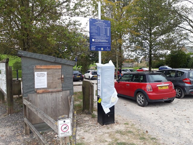
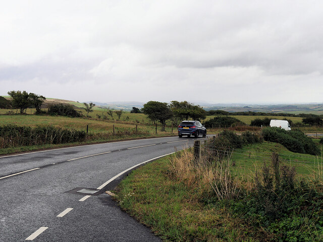
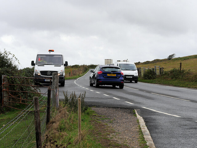
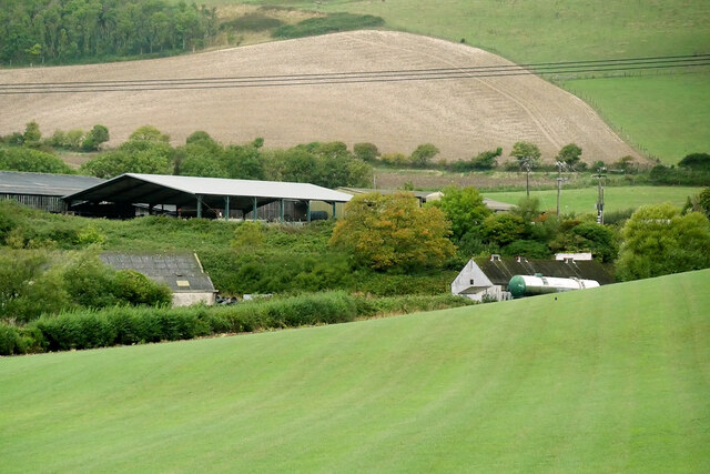
Abbotsbury is a historic village located on the coast of Dorset, England. Situated on the Jurassic Coast, a UNESCO World Heritage site, Abbotsbury is renowned for its natural beauty and rich history. The village lies about nine miles west of the county town of Dorchester and is easily accessible by road.

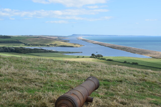
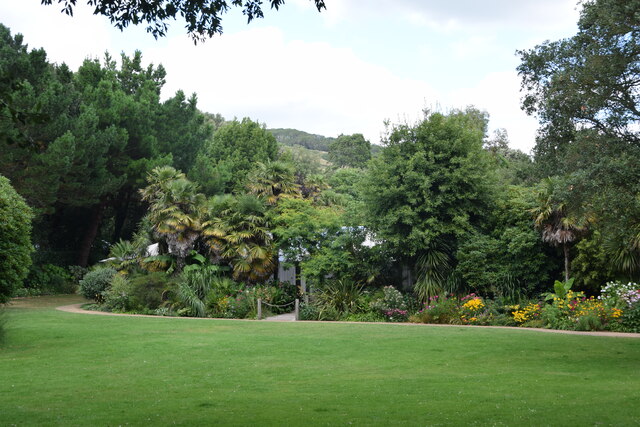
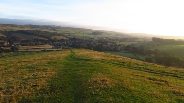
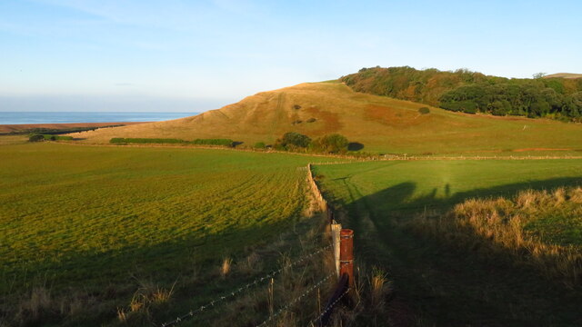
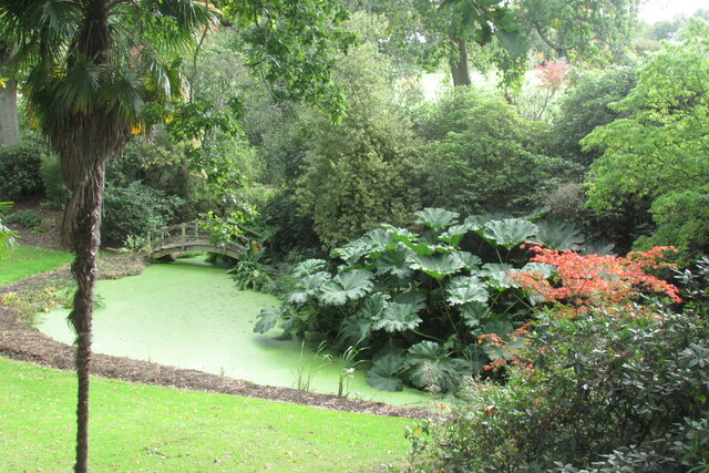
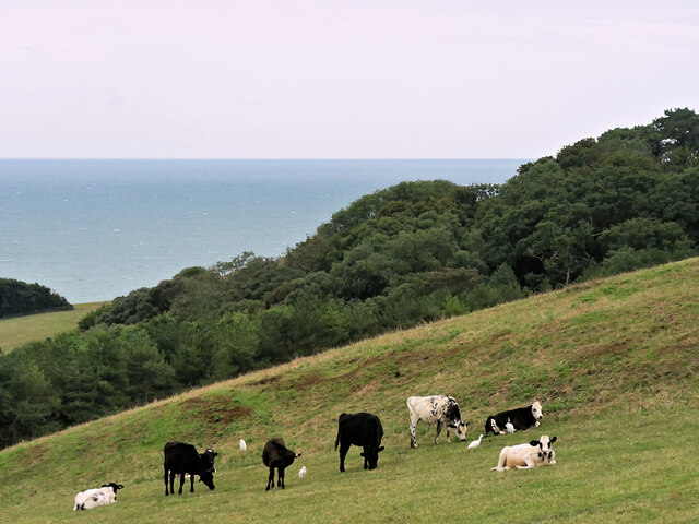
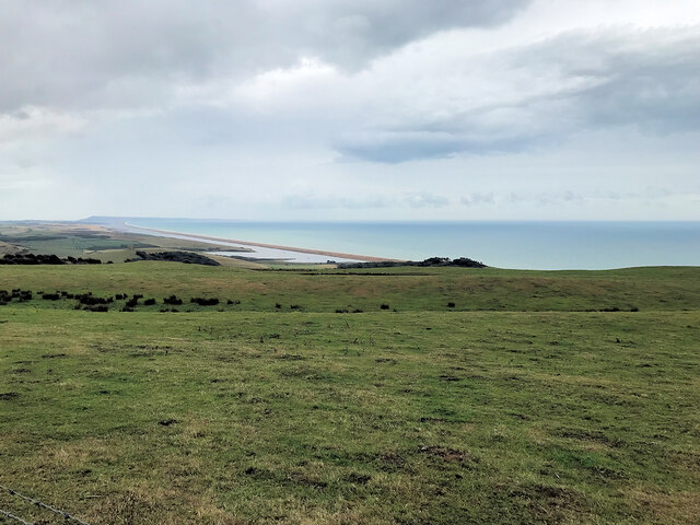
One of Abbotsbury's most notable features is its stunning landscape. The village is surrounded by rolling hills and picturesque countryside, offering breathtaking views of the English Channel and Chesil Beach. It is also home to the Abbotsbury Subtropical Gardens, which boasts a wide variety of exotic plants and flowers, making it a popular destination for nature enthusiasts.

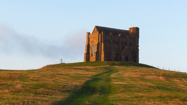
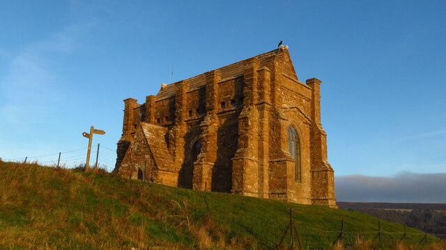
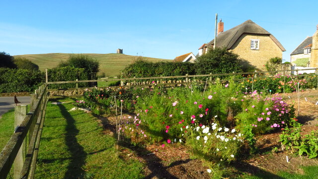
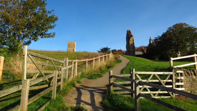
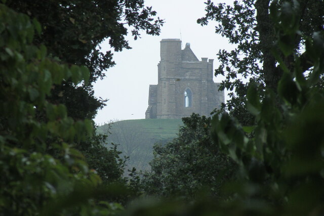
The village itself has a charming and quaint character, with its narrow streets and traditional thatched cottages. The centerpiece of Abbotsbury is the 14th-century St. Catherine's Chapel, perched on a hilltop overlooking the village. This historic landmark attracts visitors from far and wide, offering panoramic views of the surrounding countryside.

Abbotsbury is also famous for its swannery, which is the only managed colony of nesting mute swans in the world. Visitors can witness the swans in their natural habitat, exploring the tranquil lagoon and observing their nesting behavior.

Additionally, Abbotsbury hosts various cultural events and festivals throughout the year, including the Abbotsbury Garland Day, a traditional celebration where locals parade through the village wearing flower garlands.

With its stunning natural scenery, rich history, and vibrant community, Abbotsbury is a delightful destination for both locals and tourists seeking to immerse themselves in the beauty and charm of rural Dorset.

If you have any feedback on the listing, please let us know in the comments section below.

Abbotsbury Images

Images are sourced within 2km of 50.665592/-2.5995265 or Grid Reference SY5785. Thanks to Geograph Open Source API. All images are credited.

View above Chesil Beach Taken from the viewpoint at the southern end of Abbotsbury Gardens.
View above Chesil Beach
Taken from the viewpoint at the southern end of Abbotsbury Gardens.
Abbotsbury Subtropical Gardens The micro-climate in this sheltered valley allows a profusion of subtropical and other plants.
Abbotsbury Subtropical Gardens
The micro-climate in this sheltered valley allows a profusion of subtropical and other plants.
Early morning St Catherine's Chapel, Abbotsbury St Catherine's Chapel is a surviving part of St Peter's Abbey. During the Dissolution of the Monasteries it was saved as it was a landmark used by mariners.
Early morning St Catherine's Chapel, Abbotsbury
St Catherine's Chapel is a surviving part of St Peter's Abbey. During the Dissolution of the Monasteries it was saved as it was a landmark used by mariners.
View towards Abbotsbury from St Catherine's Chapel
Early morning St Catherine's Chapel, Abbotsbury St Catherine's Chapel is a surviving part of St Peter's Abbey. During the Dissolution of the Monasteries it was saved as it was a landmark used by mariners.
Early morning St Catherine's Chapel, Abbotsbury
St Catherine's Chapel is a surviving part of St Peter's Abbey. During the Dissolution of the Monasteries it was saved as it was a landmark used by mariners.
On the coast path heading west from Chapel Hill, Abbotsbury
Garden by St Peter's Abbey, Abbotsbury
Path leading up to remains of St Peter's Abbey, Abbotsbury
Newly Installed Car Park Pay and Display Machine at Abbotsbury
Chapel Hill from Abbotsbury Gardens A misty day on the Dorset coast but St Catherine's Chapel is in view from the gardens.
Chapel Hill from Abbotsbury Gardens
A misty day on the Dorset coast but St Catherine's Chapel is in view from the gardens.
Abbotsbury Gardens One of several pools surrounded by exotic trees from warmer climes.
Abbotsbury Gardens
One of several pools surrounded by exotic trees from warmer climes.
Cattle Grazing, Abbotsbury Hill
B3157, Abbotsbury Hill The B3157 runs 18.5 miles from Weymouth to West Bay, via Abbotsbury.
<span class="nowrap"><a title="https://www.sabre-roads.org.uk/wiki/index.php?title=B3157" rel="nofollow ugc noopener" href="https://www.sabre-roads.org.uk/wiki/index.php?title=B3157">Link</a><img style="margin-left:2px;" alt="External link" title="External link - shift click to open in new window" src="https://s1.geograph.org.uk/img/external.png" width="10" height="10"/></span>
B3157, Abbotsbury Hill
The B3157 runs 18.5 miles from Weymouth to West Bay, via Abbotsbury. LinkExternal link
Layby at Abbotsbury Hill The B3157 runs 18.5 miles from Weymouth to West Bay, via Abbotsbury.
<span class="nowrap"><a title="https://www.sabre-roads.org.uk/wiki/index.php?title=B3157" rel="nofollow ugc noopener" href="https://www.sabre-roads.org.uk/wiki/index.php?title=B3157">Link</a><img style="margin-left:2px;" alt="External link" title="External link - shift click to open in new window" src="https://s1.geograph.org.uk/img/external.png" width="10" height="10"/></span>
Layby at Abbotsbury Hill
The B3157 runs 18.5 miles from Weymouth to West Bay, via Abbotsbury. LinkExternal link
Wears Hill Beacon
Wears Hill Beacon
View from Abbotsbury Hill
Evershot Farm, Portesham
Gate to sea viewpoint
Show me another place!

Abbotsbury is located at Grid Ref: SY5785 (Lat: 50.665592, Lng: -2.5995265)

Unitary Authority: Dorset

Police Authority: Dorset

What 3 Words

///spending.polar.shares. Near Chickerell, Dorset

Related Wikis

St Nicholas' Church, Abbotsbury

St Nicholas' Church is a Church of England church in Abbotsbury, Dorset, England. The earliest parts of the church date to the 14th century origin, with...

Abbotsbury

Abbotsbury is a village and civil parish in the English county of Dorset. The settlement is in the unitary authority of Dorset about 1 mile (1.6 km) inland...
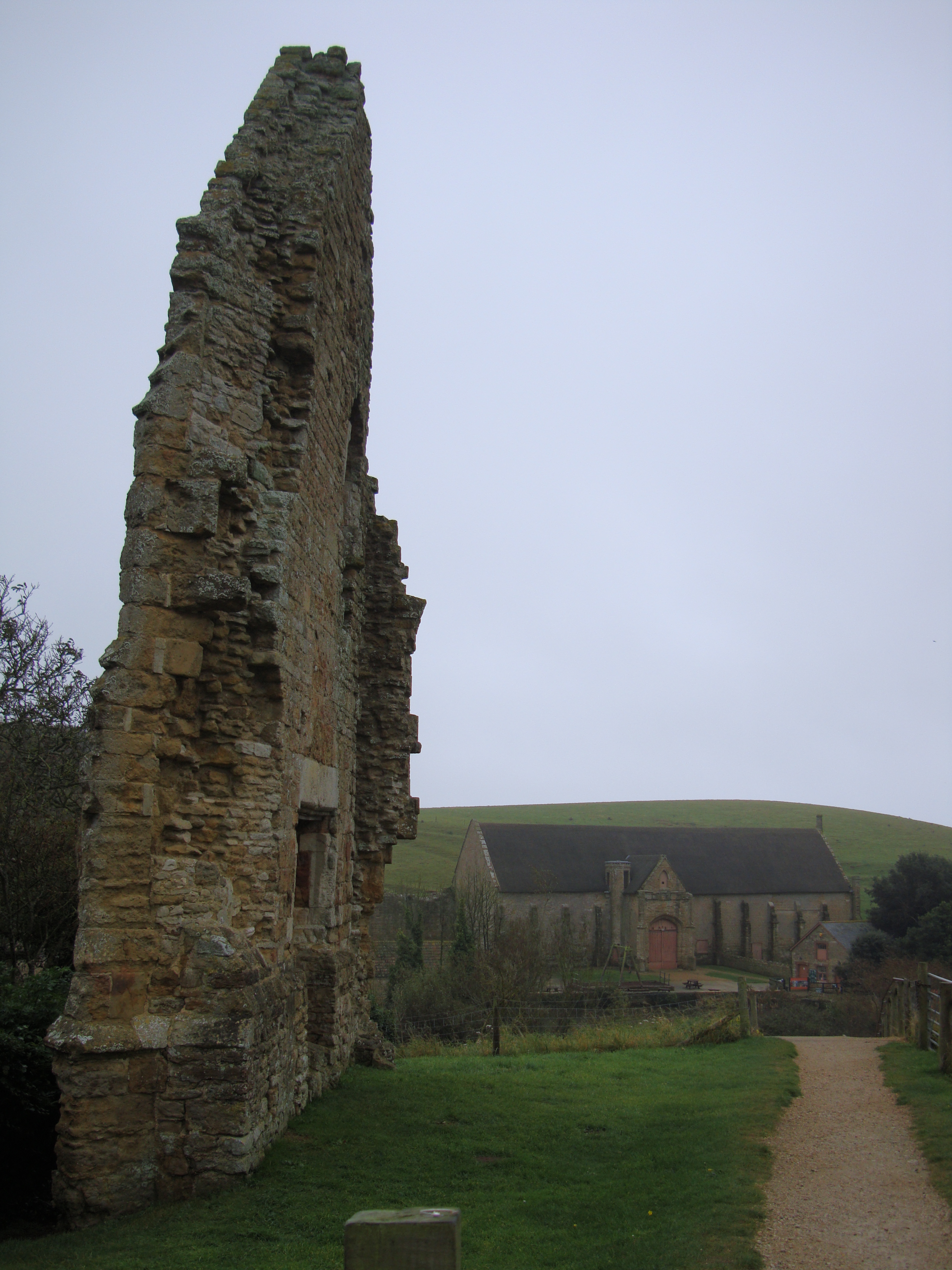
Abbotsbury Abbey

Abbotsbury Abbey, dedicated to Saint Peter, was a Benedictine monastery in the village of Abbotsbury in Dorset, England. The abbey was founded in the 11th...

Abbotsbury Blind Lane

Abbotsbury Blind Lane (grid reference SY576856) is a 0.4 hectares (0.99 acres) geological Site of Special Scientific Interest in Dorset, notified in 1986...

Related Videos

Welcome to Gorwell Farm in beautiful Dorset

Enjoy a holiday at Gorwell Farm Holiday Cottages. Gorwell Farm offers self catering holiday cottages in Dorset. This 4-star farm ...

WALKS IN DORSET at ABBOTSBURY, CHESIL BEACH & ABBOTSBURY CASTLE (THE JURASSIC COAST) [4K]

This is another video in my series “Walks in Dorset” accompanied by my Whippet (Logan). In this episode, I visit the village of ...

Nearby Amenities

Located within 500m of 50.665592,-2.5995265
Abbotsbury
Is In: Dorset, England, UK
Place: village
Lat/Long: 50.6663204/-2.5989684
Abbotsbury Children's Farm
Addr Postcode: DT3 4JJ
Email: info@abbotsbury-tourism.co.uk
Phone: +44 1305 871817
Tourism: attraction
Website: http://www.abbotsbury-tourism.co.uk/childrens_farm/index.htm
Lat/Long: 50.6633781/-2.5988367
Turning Circle
Lat/Long: 50.6662976/-2.5966746
Addr City: Abbotsbury
Addr Country: GB
Addr Housenumber: 2
Addr Street: Back Street
Lat/Long: 50.6664699/-2.6002861
Addr City: Abbotsbury
Addr Country: GB
Addr Housenumber: 20
Addr Street: Market Street
Wikidata: Q26467221
Lat/Long: 50.666381/-2.6003043
Addr City: Abbotsbury
Addr Country: GB
Addr Housenumber: 8
Addr Street: Market Street
Lat/Long: 50.6658767/-2.5996981
Addr City: Abbotsbury
Addr Country: GB
Addr Housenumber: 26
Addr Street: Rodden Row
Lat/Long: 50.6656286/-2.5994411
Dansel Gallery
Check Date: 2023-06-04
Shop: art
Website: https://www.danselgallery.co.uk/
Lat/Long: 50.6657949/-2.5986893
Addr City: Abbotsbury
Addr Country: GB
Addr Housenumber: 1
Addr Street: Rosemary Lane
Lat/Long: 50.6658137/-2.5977412
Addr City: Abbotsbury
Addr Country: GB
Addr Housenumber: 10
Addr Street: Rosemary Lane
Lat/Long: 50.6657521/-2.5981217
Addr City: Abbotsbury
Addr Country: GB
Addr Housenumber: 12
Addr Street: Rosemary Lane
Entrance: yes
Lat/Long: 50.6657495/-2.5981922
Addr City: Abbotsbury
Addr Country: GB
Addr Housenumber: 14
Addr Street: Rodden Row
Lat/Long: 50.6657432/-2.5983619
Addr City: Abbotsbury
Addr Country: GB
Addr Housenumber: 16
Addr Street: Rodden Row
Lat/Long: 50.6657405/-2.5984352
Addr City: Abbotsbury
Addr Country: GB
Addr Housenumber: 18
Addr Street: Rodden Row
Lat/Long: 50.6657369/-2.5985172
Addr City: Abbotsbury
Addr Country: GB
Addr Housenumber: 20
Addr Street: Rodden Row
Lat/Long: 50.6657161/-2.5989976
Addr City: Abbotsbury
Addr Country: GB
Addr Housenumber: 22
Addr Street: Rodden Row
Lat/Long: 50.665707/-2.5990845
Addr City: Abbotsbury
Addr Country: GB
Addr Housenumber: 6
Addr Street: Rodden Row
Lat/Long: 50.6657553/-2.5979493
Addr City: Abbotsbury
Addr Country: GB
Addr Housenumber: 8
Addr Street: Rodden Row
Lat/Long: 50.6657536/-2.5980639
Entrance: yes
Lat/Long: 50.6657465/-2.598272
Addr City: Abbotsbury
Addr Country: GB
Addr Street: Rodden Row
Entrance: yes
Lat/Long: 50.6657561/-2.5978492
Addr Country: GB
Addr Housenumber: 1
Addr Street: Church Street
Source: survey
Lat/Long: 50.6654942/-2.5994437
Addr Country: GB
Addr Housenumber: 15
Addr Street: Rodden Row
Lat/Long: 50.6655556/-2.5988375
Addr Country: GB
Addr Housenumber: 17
Addr Street: Rodden Row
Lat/Long: 50.6656205/-2.5990324
Addr Country: GB
Addr Housenumber: 19
Addr Street: Rodden Row
Wikidata: Q26412142
Lat/Long: 50.6656083/-2.5991773
Addr Country: GB
Addr Housenumber: 21
Addr Street: Rodden Row
Wikidata: Q26467307
Lat/Long: 50.6655794/-2.5993151
Addr Country: GB
Addr Housenumber: 3
Addr Street: Church Street
Source: survey
Lat/Long: 50.6654148/-2.5994189
Addr Country: GB
Addr Housenumber: 5
Addr Street: Church Street
Source: survey
Lat/Long: 50.6653409/-2.5993958
Patricia's B&B
Source: survey
Tourism: guest_house
Lat/Long: 50.6655738/-2.5992899
Entrance: main
Lat/Long: 50.6655388/-2.5983209
Entrance: main
Lat/Long: 50.6655946/-2.5981293
Entrance: main
Lat/Long: 50.6655961/-2.5980254
Entrance: yes
Lat/Long: 50.6656221/-2.5989015
Cafe
Bellenies Bakehouse & Tea Room
Lat/Long: 50.6663332/-2.6007737
Purple Nanny
Shop: craft
Website: https://www.purplenanny.co.uk/
Lat/Long: 50.6663121/-2.6006539
Addr Country: GB
Addr Housenumber: 31
Addr Street: West Street
Lat/Long: 50.6663067/-2.6051106
Addr Country: GB
Addr Housenumber: 32
Addr Street: West Street
Lat/Long: 50.6663486/-2.6047365
Addr Country: GB
Addr Housenumber: 33
Addr Street: West Street
Lat/Long: 50.6663552/-2.604606
Addr Country: GB
Addr Housenumber: 35a
Addr Street: West Street
Lat/Long: 50.6663785/-2.6042123
Addr Country: GB
Addr Housenumber: 36
Addr Street: West Street
Lat/Long: 50.6663889/-2.6041503
Addr Country: GB
Addr Housenumber: 37
Addr Street: West Street
Lat/Long: 50.6664056/-2.6039862
Addr Country: GB
Addr Housenumber: 4
Addr Street: West Street
Source: survey
Wikidata: Q26412109
Lat/Long: 50.6663496/-2.6035487
Addr Country: GB
Addr Housenumber: 5
Addr Street: West Street
Source: survey
Lat/Long: 50.6663452/-2.603662
Addr Country: GB
Addr Housenumber: 7
Addr Street: West Street
Lat/Long: 50.6663408/-2.6039511
Addr Country: GB
Addr Housenumber: 8
Addr Street: West Street
Lat/Long: 50.666281/-2.6045046
Addr Country: GB
Addr Housenumber: 9
Addr Street: West Street
Wikidata: Q26412111
Lat/Long: 50.6662717/-2.6046538
Entrance: yes
Lat/Long: 50.6663541/-2.6046581
Entrance: yes
Lat/Long: 50.6663613/-2.6044397
Entrance: yes
Lat/Long: 50.6664016/-2.6047965
Shoreline Silver
Shop: jewelry
Lat/Long: 50.6664043/-2.6047352
Addr Country: GB
Addr Housename: Chapel View Cottages
Addr Housenumber: 2
Addr Street: West Street
Lat/Long: 50.6665433/-2.6028842
Addr Country: GB
Addr Housename: Chapel View Cottages
Addr Housenumber: 1
Addr Street: West Street
Lat/Long: 50.6665566/-2.6030578
Addr Country: GB
Addr Housenumber: 1
Addr Street: Red Lane
Lat/Long: 50.6666833/-2.60142
Addr Country: GB
Addr Housenumber: 2`
Addr Street: Red Lane
Lat/Long: 50.6666616/-2.6014937
Addr Country: GB
Addr Housenumber: 3
Addr Street: Red Lane
Lat/Long: 50.6667132/-2.6015706
Addr Country: GB
Addr Housenumber: 4
Addr Street: Red Lane
Lat/Long: 50.666781/-2.6016311
Addr Country: GB
Addr Housenumber: 44
Addr Street: West Street
Source: survey
Lat/Long: 50.6664814/-2.6025244
Addr Country: GB
Addr Housenumber: 45
Addr Street: West Street
Source: survey
Lat/Long: 50.6664897/-2.602379
Addr Country: GB
Addr Housenumber: 46
Addr Street: West Street
Source: survey
Lat/Long: 50.6664945/-2.6022957
Addr Country: GB
Addr Housenumber: 48
Addr Street: West Street
Source: survey
Wikidata: Q26609866
Lat/Long: 50.6664955/-2.6020556
Addr Country: GB
Addr Housenumber: 49
Addr Street: West Street
Source: survey
Lat/Long: 50.6665014/-2.6018773
Addr Country: GB
Addr Housenumber: 5
Addr Street: Red Lane
Wikidata: Q26467267
Lat/Long: 50.6668527/-2.6017245
Entrance: yes
Lat/Long: 50.6664721/-2.6026858
Entrance: yes
Lat/Long: 50.6664767/-2.6026055
Bench
Lat/Long: 50.6665833/-2.6013525
Bench
Lat/Long: 50.6665917/-2.6012908
Bench
Lat/Long: 50.6665775/-2.6011897
Entrance: yes
Lat/Long: 50.6668883/-2.60177
Addr Country: GB
Addr Housenumber: 1
Addr Street: Hand's Lane
Lat/Long: 50.6665344/-2.596399
Addr Country: GB
Addr Housenumber: 10
Addr Street: Hand's Lane
Source: survey
Lat/Long: 50.6667209/-2.5951174
Addr Country: GB
Addr Housenumber: 2
Addr Street: Hand's Lane
Lat/Long: 50.6665338/-2.5963731
Addr Country: GB
Addr Housenumber: 3
Addr Street: Rosemary Lane
Source: survey
Lat/Long: 50.6662654/-2.5973691
Addr Country: GB
Addr Housenumber: 7
Addr Street: Hand's Lane
Source: survey
Lat/Long: 50.6666617/-2.5954835
Addr Country: GB
Addr Housenumber: 8
Addr Street: Hand's Lane
Source: survey
Lat/Long: 50.6666608/-2.5954533
Addr Country: GB
Addr Housenumber: 9
Addr Street: Hand's Lane
Source: survey
Lat/Long: 50.6667218/-2.5951499
Addr Country: GB
Addr Housename: Whitehill Cottages
Addr Housenumber: 1
Addr Street: Back Street
Lat/Long: 50.6667592/-2.5986969
Addr Country: GB
Addr Housename: Whitehill Cottages
Addr Housenumber: 2
Addr Street: Back Street
Lat/Long: 50.6667961/-2.5985436
Addr Country: GB
Addr Housename: Whitehill Cottages
Addr Housenumber: 3
Addr Street: Back Street
Lat/Long: 50.6668052/-2.5985058
Addr Country: GB
Addr Housenumber: 10
Addr Street: Back Street
Lat/Long: 50.666686/-2.598291
Addr Country: GB
Addr Housenumber: 10a
Addr Street: Back Street
Lat/Long: 50.6666882/-2.5982379
Addr Country: GB
Addr Housenumber: 4
Addr Street: Back Street
Lat/Long: 50.666579/-2.5986901
Addr Country: GB
Addr Housenumber: 6
Addr Street: Back Street
Lat/Long: 50.6665869/-2.5986422
Addr Country: GB
Addr Housenumber: 7
Addr Street: Back Street
Lat/Long: 50.666689/-2.5990361
Addr Country: GB
Addr Housenumber: 8
Addr Street: Back Street
Lat/Long: 50.6666135/-2.5984338
Addr Country: GB
Addr Housenumber: 8a
Addr Street: Back Street
Lat/Long: 50.6666451/-2.598348
Cafe
The Old Schoolhouse Tea Rooms
Addr City: Abbotsbury
Addr County: Dorset
Addr Housenumber: 1
Addr Postcode: DT3 4JP
Addr Street: Back Street
Wikidata: Q26412156
Lat/Long: 50.6666125/-2.6003312
Material: wood
Power: pole
Source: bing
Lat/Long: 50.6660467/-2.5934783
Material: wood
Power: pole
Source: bing
Lat/Long: 50.6664815/-2.593265
Material: wood
Power: pole
Source: bing
Lat/Long: 50.6669706/-2.5957411
Material: wood
Power: pole
Source: bing
Lat/Long: 50.6670051/-2.5943065
Material: wood
Power: pole
Source: bing
Transformer: distribution
Lat/Long: 50.6670555/-2.5930182
Post Box
Post Box Type: wall
Ref: DT3 76
Ref GB Uprn: 10015285419
Royal Cypher: VR
Royal Cypher Wikidata: Q33102356
Lat/Long: 50.6662575/-2.6048814
Historic: memorial
Memorial: war_memorial
Lat/Long: 50.6651/-2.5994695
Tourist Information#
Board Type: history
Check Date: 2023-06-05
Information: board
Tourism: information
Lat/Long: 50.6650371/-2.5973506
Post Office
Abbotsbury Post Office
Addr City: Weymouth
Addr Country: GB
Addr Postcode: DT3 4LF
Addr Street: Chapel Lane
Addr Village: Abbotsbury
Brand: Post Office
Brand Wikidata: Q1783168
Opening Hours: Mo-Sa 08:00-18:00; Su 09:00-13:00
Ref Pol Id: 134776
Website: https://www.postoffice.co.uk/branch-finder/3335186/abbotsbury
Lat/Long: 50.6664205/-2.6015431
Post Box
Collection Times: Mo-Fr 16:30; Sa 11:00
Operator: Royal Mail
Operator Wikidata: Q638098
Post Box Mounting: render_wall
Post Box Type: wall
Ref: DT3 78
Royal Cypher: EIIR
Royal Cypher Wikidata: Q33102113
Lat/Long: 50.6663639/-2.6007761
Information: guidepost
Tourism: information
Lat/Long: 50.6664025/-2.6014757
Telephone
Booth: K6
Covered: booth
Listed Status: Grade II
Lat/Long: 50.6665684/-2.6001991
Information: guidepost
Tourism: information
Lat/Long: 50.6668378/-2.5983463
Information: guidepost
Tourism: information
Lat/Long: 50.6694485/-2.6019052
Bus Stop
Ilchester Arms
Bench: no
Bus: yes
Naptan AtcoCode: 1200DOY29340
Naptan Bearing: NW
Naptan CommonName: Ilchester Arms
Naptan Indicator: NW-bound
Naptan NaptanCode: doradwjm
Naptan Street: Market Street
Naptan Verified: no
Public Transport: platform
Shelter: no
Lat/Long: 50.6663087/-2.6004353
Bus Stop
Ilchester Arms
Bench: no
Bus: yes
Naptan AtcoCode: 1200DOB20251
Naptan Bearing: SE
Naptan CommonName: Ilchester Arms
Naptan Indicator: SE-bound
Naptan NaptanCode: doradwjp
Naptan Street: Market Street
Naptan Verified: no
Public Transport: platform
Shelter: no
Lat/Long: 50.6664484/-2.6005604
Upalong
Tourism: guest_house
Wikidata: Q26412110
Lat/Long: 50.6662659/-2.6045286
Barrier: stile
Lat/Long: 50.6618498/-2.601625
Leisure: picnic_table
Lat/Long: 50.665362/-2.5969648
Abbotsbury Abbey Remains
Archaeological Site: ruin
Historic: archaeological_site
Historic Civilization: medieval
Lat/Long: 50.6644918/-2.5986808
Defibrillator
Defibrillator Location: On wall of building next to entrance
Emergency: defibrillator
Indoor: no
Lat/Long: 50.666528/-2.6006397
Give Way
Source: Bing
Lat/Long: 50.6655657/-2.5995192
Give Way
Source: Bing
Lat/Long: 50.6663911/-2.6004673
Bus Stop
Swan Inn
Bus: yes
Naptan AtcoCode: 1200DOA25663
Naptan Bearing: W
Naptan CommonName: Swan Inn
Naptan Indicator: W-bound
Naptan NaptanCode: dordmtwg
Naptan Verified: no
Public Transport: platform
Lat/Long: 50.6655038/-2.5968322
Playground: swing
Lat/Long: 50.6646103/-2.6050681
Playground: swing
Lat/Long: 50.6645712/-2.6046275
Playground: roundabout
Wheelchair: no
Lat/Long: 50.6645151/-2.6049708
Playground: climbingframe
Lat/Long: 50.6645962/-2.6048381
Playground: climbingframe
Lat/Long: 50.6646749/-2.6046423
Leisure: picnic_table
Lat/Long: 50.6647475/-2.6045732
Leisure: picnic_table
Lat/Long: 50.664711/-2.6044545
Playground: seesaw
Lat/Long: 50.6646132/-2.6047127
Leisure: picnic_table
Lat/Long: 50.6646808/-2.604773
Bicycle Parking
Lat/Long: 50.6645759/-2.6043747
Entrance: tower
Lat/Long: 50.6649937/-2.5991587
Entrance: main
Lat/Long: 50.6650645/-2.5989651
Bus Stop
Swan Inn
Bus: yes
Naptan AtcoCode: 1200DOA25664
Naptan Bearing: E
Naptan CommonName: Swan Inn
Naptan Indicator: E-bound
Naptan NaptanCode: dordmtwj
Naptan Verified: no
Public Transport: platform
Lat/Long: 50.6655103/-2.5965534
The data included in this document is from www.openstreetmap.org. The data is made available under ODbL.

Have you been to Abbotsbury?

Leave your review of Abbotsbury below (or comments, questions and feedback).