Mwmbwls

Settlement in Glamorgan

Wales

Mwmbwls

Ordnance Survey Cut Mark This OS cut mark can be found on the wall between Nos 364 & 366 Mumbles Road. It marks a point 7.001m above mean sea level.
Ordnance Survey Cut Mark Credit: Adrian Dust

Mwmbwls is a small village located in the county of Glamorgan, Wales. Situated in the southern part of the country, it is surrounded by beautiful countryside and is known for its picturesque landscapes and quaint charm.

The village is home to a close-knit community of approximately 500 residents. The houses in Mwmbwls are predominantly traditional stone cottages, adding to the village's character and historical atmosphere. The local economy is largely based on agriculture, with many residents engaged in farming and livestock rearing.

Mwmbwls boasts a rich history, with evidence of human settlement dating back to the Neolithic period. The village is also known for its ancient church, St. Mary's, which dates back to the 12th century. The church is a popular attraction for visitors, showcasing beautiful stained glass windows and intricate architectural details.

Nature enthusiasts will find plenty to explore in the surrounding areas of Mwmbwls. The village is located near the stunning Glamorgan Heritage Coast, offering breathtaking views of the Bristol Channel and opportunities for coastal walks. The nearby countryside is also ideal for hiking and cycling, with numerous trails and paths to discover.

While Mwmbwls may be a small village, it offers a tranquil and idyllic setting for those seeking a peaceful escape from the hustle and bustle of city life. Its warm community spirit, historical charm, and stunning natural surroundings make it a hidden gem in the heart of Glamorgan.

If you have any feedback on the listing, please let us know in the comments section below.
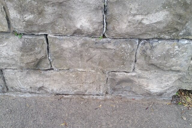
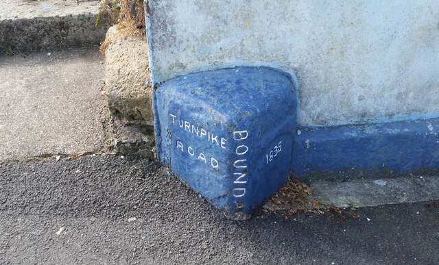
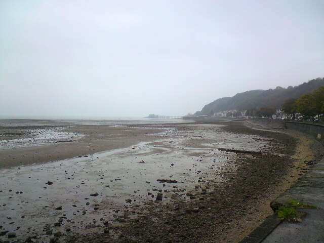
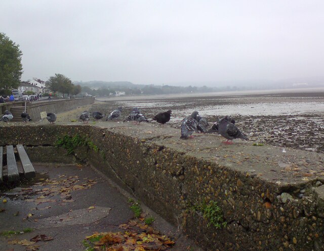
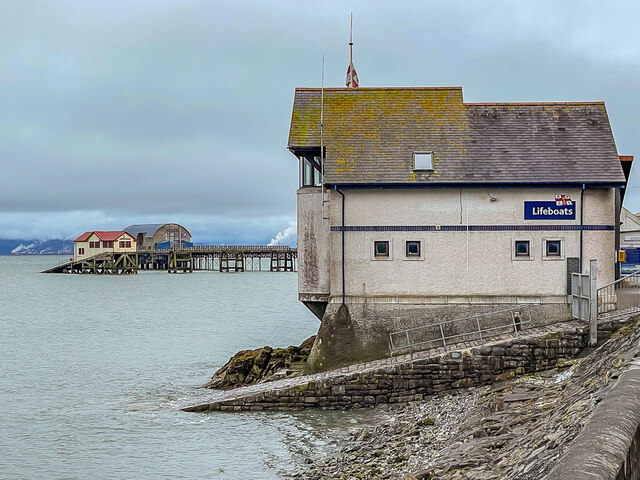
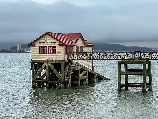
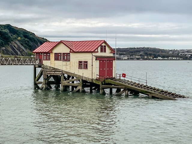
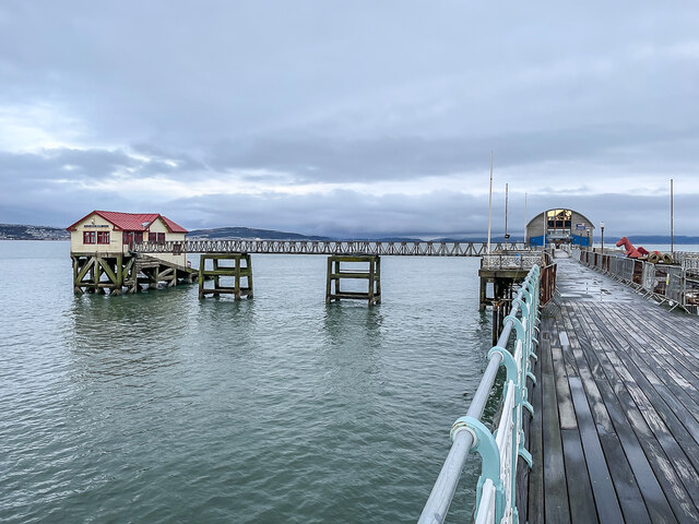
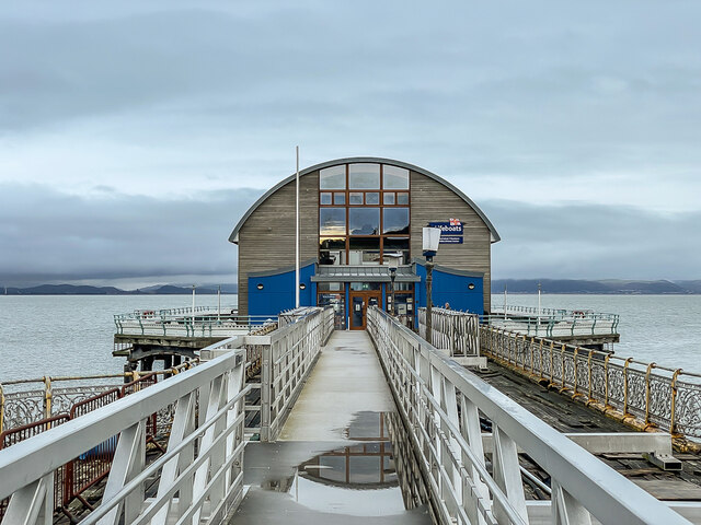
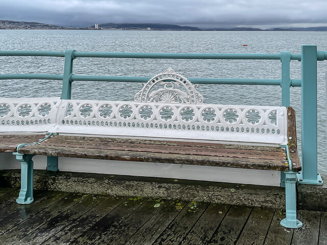
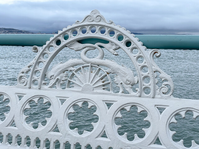
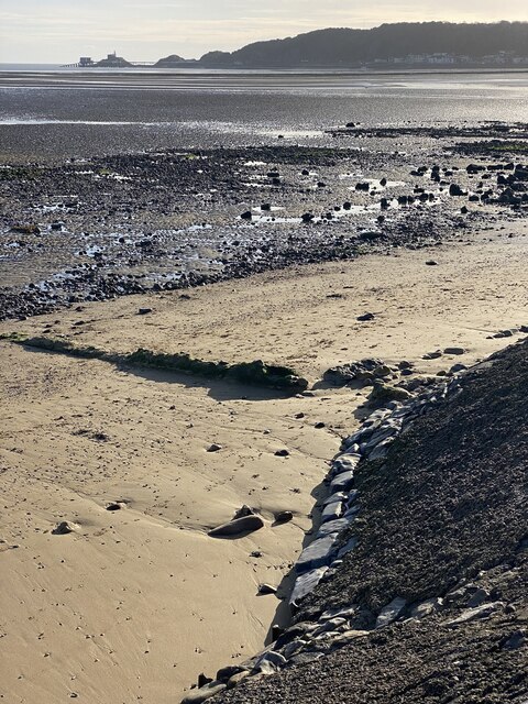
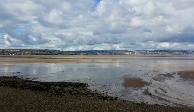
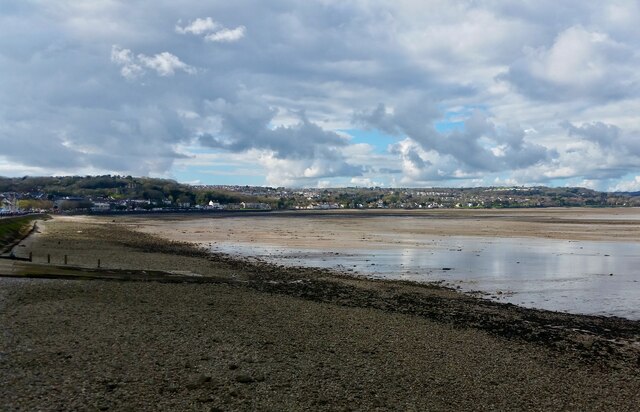
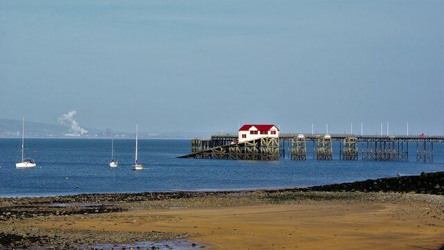
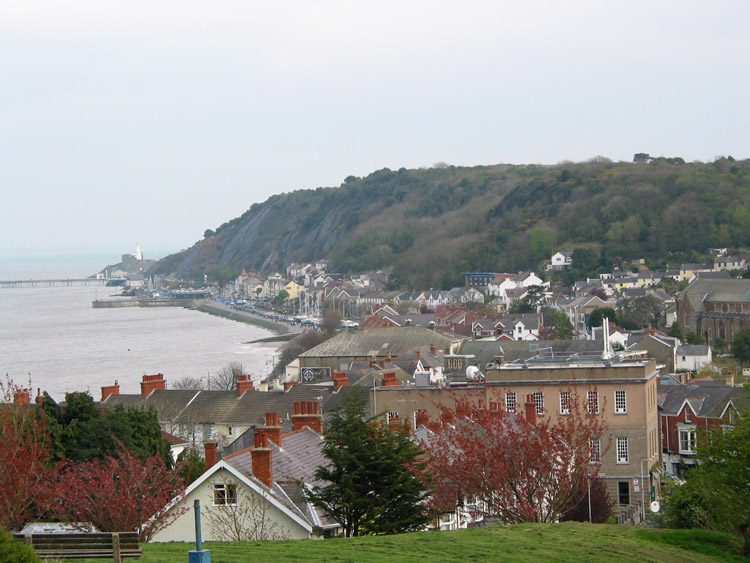
Mwmbwls Images

Images are sourced within 2km of 51.574122/-3.999896 or Grid Reference SS6188. Thanks to Geograph Open Source API. All images are credited.

Ordnance Survey Cut Mark This OS cut mark can be found on the wall between Nos 364 & 366 Mumbles Road. It marks a point 7.001m above mean sea level.
Ordnance Survey Cut Mark
This OS cut mark can be found on the wall between Nos 364 & 366 Mumbles Road. It marks a point 7.001m above mean sea level.
Turnpike Boundary Stone
Mumbles foreshore Looking towards Mumbles and the pier from Oystermouth.
Mumbles foreshore
Looking towards Mumbles and the pier from Oystermouth.
Newton Road, Mumbles The B4593 out of Oystermouth. On the corner of Castle Avenue is  the Ostreme Community Centre. In 1978 Ostreme Community Association obtained a 35 year lease from All Saints' Church, Oystermouth to refurbish their derelict church hall and run it as a community centre. In 1980 after major work, Ostreme Centre opened to the public as an independent community hall managed by volunteers.
<span class="nowrap"><a title="http://www.ostremecentre.co.uk/about-us/" rel="nofollow ugc noopener" href="http://www.ostremecentre.co.uk/about-us/">Link</a><img style="margin-left:2px;" alt="External link" title="External link - shift click to open in new window" src="https://s1.geograph.org.uk/img/external.png" width="10" height="10"/></span>
Newton Road, Mumbles
The B4593 out of Oystermouth. On the corner of Castle Avenue is the Ostreme Community Centre. In 1978 Ostreme Community Association obtained a 35 year lease from All Saints' Church, Oystermouth to refurbish their derelict church hall and run it as a community centre. In 1980 after major work, Ostreme Centre opened to the public as an independent community hall managed by volunteers. LinkExternal link
Oystermouth pigeons 
At most seaside resorts it is the gulls that gather on the seawall scavenging for visitors' titbits as they sit watching the tide. But this is Oystermouth and we are within the city of Swansea so here it is urban pigeons that congregate on the seawall.
Oystermouth pigeons
At most seaside resorts it is the gulls that gather on the seawall scavenging for visitors' titbits as they sit watching the tide. But this is Oystermouth and we are within the city of Swansea so here it is urban pigeons that congregate on the seawall.
Lifeboat stations Three lifeboat stations at Mumbles.  Nearest is the inshore lifeboat station, established in 1965, and in the background are the old and new lifeboat stations, the nearer operating from 1922 to 2014 and the one beyond, situated at the end of Mumbles Pier, opened in 2014.
Lifeboat stations
Three lifeboat stations at Mumbles. Nearest is the inshore lifeboat station, established in 1965, and in the background are the old and new lifeboat stations, the nearer operating from 1922 to 2014 and the one beyond, situated at the end of Mumbles Pier, opened in 2014.
Old Mumbles Lifeboat Station The old Mumbles Lifeboat Station, in operation from 1922 to 2014.  In the left background is Meridian Tower in Swansea.
Old Mumbles Lifeboat Station
The old Mumbles Lifeboat Station, in operation from 1922 to 2014. In the left background is Meridian Tower in Swansea.
Old Mumbles Lifeboat Station The old Mumbles Lifeboat Station, in operation from 1922 to 2014.
Old Mumbles Lifeboat Station
The old Mumbles Lifeboat Station, in operation from 1922 to 2014.
Mumbles Lifeboat Station - old and new Past and present lifeboat stations on Mumbles Pier. the old one on the left, in operation from 1922 to 2014, and the new one, situated at the pier end, opened in 2014.
Mumbles Lifeboat Station - old and new
Past and present lifeboat stations on Mumbles Pier. the old one on the left, in operation from 1922 to 2014, and the new one, situated at the pier end, opened in 2014.
Mumbles Lifeboat Station The lifeboat station at the end of Mumbles Pier, opened in 2014.
Mumbles Lifeboat Station
The lifeboat station at the end of Mumbles Pier, opened in 2014.
Mumbles Pier Looking along Mumbles Pier to the lifeboat station, opened in 2014. at the end.  Evening sunshine is reflecting off the glass of the station in otherwise grey conditions.
Mumbles Pier
Looking along Mumbles Pier to the lifeboat station, opened in 2014. at the end. Evening sunshine is reflecting off the glass of the station in otherwise grey conditions.
Seat, Mumbles Pier A seat at the end of Mumbles Pier, with intertwined dolphins on the seat back (see <a href="https://www.geograph.org.uk/photo/7025865">SS6387 : Seat back, Mumbles Pier</a> for a close up).  In the distance is Swansea, with the Meridian Tower prominent.
Seat, Mumbles Pier
A seat at the end of Mumbles Pier, with intertwined dolphins on the seat back (see SS6387 : Seat back, Mumbles Pier for a close up). In the distance is Swansea, with the Meridian Tower prominent.
Seat back, Mumbles Pier Close up of intertwined dolphins on a seat back on Mumbles Pier.  See <a href="https://www.geograph.org.uk/photo/7025859">SS6387 : Seat, Mumbles Pier</a> for a wider view.
Seat back, Mumbles Pier
Close up of intertwined dolphins on a seat back on Mumbles Pier. See SS6387 : Seat, Mumbles Pier for a wider view.
Christmas bollards Knitted covers to bollards by the entrance to Mumbles Pier, advertising a Santa's Grotto in the building beyond.
Christmas bollards
Knitted covers to bollards by the entrance to Mumbles Pier, advertising a Santa's Grotto in the building beyond.
Mumbles Head View across Swansea Bay towards Mumbles Head at low tide.
Mumbles Head
View across Swansea Bay towards Mumbles Head at low tide.
Swansea Bay
Swansea Bay
Swansea Bay
Swansea Bay
The 1922 Mumbles Lifeboat Station A new station was built in 2014. Margam steel works can be seen across Swansea Bay
The 1922 Mumbles Lifeboat Station
A new station was built in 2014. Margam steel works can be seen across Swansea Bay
Show me another place!

Mwmbwls is located at Grid Ref: SS6188 (Lat: 51.574122, Lng: -3.999896)

Unitary Authority: Swansea

Police Authority: South Wales

Also known as: The Mumbles

What 3 Words

///sofas.error.churn. Near Bishopston, Swansea

Related Wikis

Mumbles (district)

The Mumbles is a district of Swansea, Wales, located on the south-east corner of the unitary authority area. It is also a local government community using...

All Saints' Church, Oystermouth

All Saints' Church, Oystermouth is an Anglican church in the Diocese of Swansea and Brecon, South Wales. It is located in Mumbles and is a Grade II listed...

Oystermouth railway station

Oystermouth railway station served the village of Oystermouth, in the historical county of Glamorgan, Wales, from 1807 to 1960 on the Swansea and Mumbles...

Oystermouth Castle

Oystermouth Castle (Welsh: Castell Ystum Llwynarth) is a Norman stone castle in Wales, overlooking Swansea Bay on the east side of the Gower Peninsula...

Nearby Amenities

Located within 500m of 51.574122,-3.999896
Mumbles
Is In: Swansea
Landuse: residential
Name Cy: Y Mwmbwls
Place: village
Postal Code: SA3 4
Wikidata: Q1952591
Lat/Long: 51.5722675/-3.9945034
Crossing
Crossing: marked
Crossing Island: no
Crossing Markings: yes
Tactile Paving: yes
Lat/Long: 51.5727296/-3.9937425
Traffic Signals
Lat/Long: 51.5751641/-4.005144
Traffic Signals
Lat/Long: 51.5752096/-4.0050335
Mini Roundabout
Direction: clockwise
Lat/Long: 51.5758545/-3.9988911
Barrier: bollard
Bollard: fixed
Lat/Long: 51.5726564/-4.0025934
Give Way
Direction: backward
Lat/Long: 51.57315/-3.9954608
Give Way
Direction: backward
Lat/Long: 51.5731327/-3.9955091
Traffic Signals
Button Operated: yes
Crossing: traffic_signals
Tactile Paving: yes
Traffic Signals Sound: yes
Traffic Signals Vibration: yes
Lat/Long: 51.5748664/-3.9982248
Oystermouth
Is In: Mumbles
Name Cy: Ystumllwynarth
Place: suburb
Wikidata: Q13656930
Lat/Long: 51.5750744/-4.0012641
Bus Stop
Oystermouth Square
Bench: yes
Bus: yes
Lit: yes
Naptan AtcoCode: 5810AWC50029
Naptan Bearing: N
Naptan CommonName: Oystermouth Square (N)
Naptan Crossing: Newton Road
Naptan NaptanCode: swajpap
Naptan PlusbusZoneRef: SWANSEA
Naptan Street: Mumbles Road
Public Transport: platform
Shelter: yes
Source: naptan_import
Tactile Paving: no
Lat/Long: 51.5763518/-3.9991053
Bus Stop
Oystermouth Square
Bench: yes
Bin: yes
Bus: yes
Lit: no
Naptan AtcoCode: 5810AWC50030
Naptan Bearing: S
Naptan CommonName: Oystermouth Square (S)
Naptan Crossing: Newton Road
Naptan NaptanCode: swajpat
Naptan PlusbusZoneRef: SWANSEA
Naptan Street: Mumbles Road
Public Transport: platform
Shelter: yes
Source: naptan_import
Tactile Paving: no
Lat/Long: 51.5753039/-3.9984239
Bus Stop
Southend Park
Bus: yes
Naptan AtcoCode: 5810AWC50031
Naptan Bearing: NW
Naptan CommonName: Southend Park (NW)
Naptan Crossing: Promenade Terrace
Naptan NaptanCode: swajpaw
Naptan PlusbusZoneRef: SWANSEA
Naptan Street: Mumbles Road
Public Transport: platform
Source: naptan_import
Lat/Long: 51.5727275/-3.9939865
Bus Stop
Southend Park
Bus: yes
Naptan AtcoCode: 5810AWC50032
Naptan Bearing: E
Naptan CommonName: Southend Park (E)
Naptan Crossing: Promenade Terrace
Naptan NaptanCode: swajpda
Naptan PlusbusZoneRef: SWANSEA
Naptan Street: Mumbles Road
Public Transport: platform
Source: naptan_import
Lat/Long: 51.5727233/-3.9931707
Bus Stop
Underhill Park
Bench: no
Bus: yes
Naptan AtcoCode: 5810AWC50047
Naptan Bearing: S
Naptan CommonName: Underhill Park
Naptan Crossing: Newton Road
Naptan Landmark: Mumbles Baptist Church
Naptan NaptanCode: swajpdg
Naptan PlusbusZoneRef: SWANSEA
Naptan Street: Langland Road
Public Transport: platform
Shelter: no
Source: naptan_import
Tactile Paving: no
Lat/Long: 51.5749305/-4.0050728
Bus Stop
Oystermouth Primary School
Bench: yes
Bus: yes
Lit: yes
Naptan AtcoCode: 5810AWC50048
Naptan Bearing: E
Naptan CommonName: Oystermouth Primary School
Naptan Crossing: Langland Road
Naptan Landmark: Oystermouth Primary School
Naptan NaptanCode: swajpaj
Naptan PlusbusZoneRef: SWANSEA
Naptan Street: Newton Road
Public Transport: platform
Shelter: yes
Source: naptan_import
Tactile Paving: no
Lat/Long: 51.5753577/-4.0044634
Bus Stop
Oystermouth RBL Club
Bench: yes
Bin: no
Bus: yes
Lit: yes
Naptan AtcoCode: 5810AWC50049
Naptan Bearing: W
Naptan CommonName: Oystermouth RBL Club
Naptan Crossing: Chapel Street
Naptan Landmark: Oystermouth RBL Club
Naptan NaptanCode: swajmwg
Naptan PlusbusZoneRef: SWANSEA
Naptan ShortCommonName: Oystermouth Royal British Legion Club
Naptan Street: Newton Road
Public Transport: platform
Shelter: yes
Source: naptan_import
Tactile Paving: no
Lat/Long: 51.5755061/-4.0013315
Bus Stop
Castle Avenue
Bus: yes
Naptan AtcoCode: 5810AWC50050
Naptan Bearing: E
Naptan CommonName: Castle Avenue
Naptan Crossing: Castle Avenue
Naptan NaptanCode: swajmwp
Naptan PlusbusZoneRef: SWANSEA
Naptan Street: Newton Road
Public Transport: platform
Shelter: no
Source: naptan_import
Lat/Long: 51.5756129/-4.0000734
Bus Stop
Cambridge Close
Bus: yes
Naptan AtcoCode: 5810AWO26334
Naptan Bearing: W
Naptan CommonName: Cambridge Close (W)
Naptan Crossing: Somerset Road
Naptan NaptanCode: swajmwm
Naptan PlusbusZoneRef: SWANSEA
Naptan Street: Cambridge Road
Naptan Verified: no
Public Transport: platform
Source: naptan_import
Lat/Long: 51.5704734/-4.0027698
Crossing
Crossing: unmarked
Crossing Island: yes
Crossing Markings: no
Tactile Paving: yes
Lat/Long: 51.5757999/-3.9988314
Crossing
Crossing: marked
Crossing Island: no
Crossing Markings: yes
Crossing Ref: zebra
Tactile Paving: yes
Lat/Long: 51.5754137/-4.0028241
Crossing
Crossing: unmarked
Crossing Island: yes
Crossing Markings: no
Tactile Paving: yes
Lat/Long: 51.5759587/-3.9989052
Noexit: yes
Lat/Long: 51.5724683/-3.9938512
Noexit: yes
Lat/Long: 51.5725/-3.9939598
Oystermouth
Lat/Long: 51.5757981/-3.9981469
Restaurant
Mumtaz
Addr Housenumber: 478-480
Addr Postcode: SA3 4BX
Addr Street: Mumbles Road
Cuisine: indian
Fhrs Id: 732780
Source: GPS
Source Addr: FHRS Open Data
Lat/Long: 51.5771431/-3.9992165
Recycling
Recycling Type: container
Lat/Long: 51.5768414/-4.0001111
Fast Food
Dragon Boat
Addr Housenumber: 606
Addr Postcode: SA3 4DL
Addr Street: Mumbles Road
Addr Suburb: Mumbles
Cuisine: chinese
Fhrs Id: 1095203
Source Addr: FHRS Open Data
Lat/Long: 51.5727698/-3.9943456
Cafe
Joe's
Addr Housenumber: 526
Addr Postcode: SA3 4DH
Addr Street: Mumbles Road
Cuisine: ice_cream
Fhrs Id: 103714
Wheelchair: yes
Lat/Long: 51.574574/-3.9982677
Mumbles Fine Wines
Shop: alcohol
Lat/Long: 51.5746167/-3.998297
Coco Blush
Atm: yes
Brand Wikidata: Q2740021
Brand Wikipedia: en:NatWest
Check Date: 2024-01-14
Shop: clothes
Lat/Long: 51.574533/-3.9982294
Bank
Swansea Building Society
Atm: yes
Check Date: 2024-02-26
Lat/Long: 51.5759477/-3.9991454
The Co-operative Food
Addr Housenumber: 145-147
Addr Postcode: SA3 4DN
Addr Street: Mumbles Road
Brand: The Co-operative Food
Brand Wikidata: Q107617274
Check Date: 2024-01-14
Fhrs Id: 930821
Opening Hours: Mo-Sa 06:00-23:00; Su 11:00-17:00
Operator: Central England Co-operative
Operator Wikidata: Q16986583
Payment Cash: yes
Payment Credit Cards: yes
Payment Debit Cards: yes
Shop: convenience
Website: https://www.coop.co.uk/store-finder/SA3-4DN/147-mumbles-road
Lat/Long: 51.5746252/-3.997687
Addr Housenumber: 5
Addr Street: Gower Place
Tourism: self_catering
Lat/Long: 51.5744625/-4.0008502
Captain's Cabin
Shop: newsagent
Lat/Long: 51.5744255/-3.9981661
Tesco Express
Addr Housenumber: 31-33
Addr Postcode: SA3 4BB
Addr Street: Newton Road
Atm: yes
Brand: Tesco Express
Brand Wikidata: Q98456772
Check Date: 2024-02-26
Contact Website: https://www.tesco.com/store-locator/swansea/newton-rd
Fhrs Id: 912468
Opening Hours: Mo-Su 07:00-23:00
Shop: convenience
Source Addr: FHRS Open Data
Lat/Long: 51.5754922/-4.0002689
Olives and Oils
Addr Housenumber: 28
Addr Postcode: SA3 4AX
Addr Street: Newton Road
Addr Suburb: Mumbles
Check Date: 2024-02-26
Fhrs Id: 62198
Shop: deli
Source Addr: FHRS Open Data
Lat/Long: 51.5756272/-4.0002269
Cafe
Mumbles Coffee
Addr Housenumber: 34-36
Addr Postcode: SA3 4AX
Addr Street: Newton Road
Check Date: 2024-02-05
Fhrs Id: 442812
Internet Access: wlan
Internet Access Fee: customers
Opening Hours: Mo-Sa 08:00-16:00
Outdoor Seating: yes
Payment Cash: yes
Payment Credit Cards: yes
Payment Debit Cards: yes
Lat/Long: 51.575715/-4.000521
Restaurant
Gin & Juice
Lat/Long: 51.5746761/-3.9975962
Restaurant
Bistrot Pierre
Addr Housename: Oyster Wharf
Addr Postcode: SA3 4DN
Addr Street: Mumbles Road
Addr Suburb: Mumbles
Addr Unit: 3
Fhrs Id: 1008697
Indoor Seating: yes
Outdoor Seating: yes
Source Addr: FHRS Open Data
Lat/Long: 51.57478/-3.997398
Source: PGS
Lat/Long: 51.5748041/-3.9975923
Post Box
Lat/Long: 51.5756114/-4.000443
Crossing
Crossing: unmarked
Crossing Island: no
Crossing Markings: no
Kerb: lowered
Tactile Paving: no
Lat/Long: 51.5730206/-3.9934014
Gower Gallery
Shop: art
Lat/Long: 51.5744819/-3.9981922
Solo Ladies Fashion
Shop: clothes
Lat/Long: 51.5751671/-3.9986057
Joshua's
Male: yes
Shop: hairdresser
Lat/Long: 51.5752305/-3.9986444
Joules
Branch: of Mumbles
Brand: Joules
Brand Wikidata: Q25351738
Contact Website: https://www.joules.com/store-locator/store/joules-of-mumbles
Shop: clothes
Lat/Long: 51.5752837/-3.998675
Seasalt
Branch: Cornwall
Brand: Seasalt
Brand Wikidata: Q107344382
Check Date: 2024-01-14
Opening Hours: Mo-Sa 09:30-17:30; Su 10:00-16:00
Shop: clothes
Lat/Long: 51.5753299/-3.9987035
Oyster Cabs Ltd
Office: yes
Lat/Long: 51.5754977/-3.9988318
Elizabeth Antiques
Shop: antiques
Lat/Long: 51.5755906/-3.9988654
Fast Food
Greggs
Addr Housenumber: 2-4
Addr Postcode: SA3 4AT
Addr Street: Newton Road
Addr Suburb: Mumbles
Brand: Greggs
Brand Wikidata: Q3403981
Brand Wikipedia: en:Greggs
Check Date: 2024-02-26
Contact Website: https://www.greggs.co.uk/shop-finder?shop-code=5290
Cuisine: sandwich;bakery
Fhrs Id: 1214364
Payment Cash: yes
Payment Mastercard: yes
Payment Visa: yes
Shop: bakery
Source Addr: FHRS Open Data
Takeaway: yes
Lat/Long: 51.5758983/-3.9991233
FairyTales of Mumbles
Check Date: 2024-02-26
Shop: gift
Lat/Long: 51.5759882/-3.9991636
The Lovespoon Gallery
Check Date: 2024-02-26
Shop: art
Lat/Long: 51.5760327/-3.9991836
Fat Face
Brand: Fat Face
Brand Wikidata: Q5437186
Brand Wikipedia: en:Fat Face
Shop: clothes
Lat/Long: 51.5758237/-3.9991956
Judith Roberts Opticians
Check Date: 2024-02-26
Opening Hours: Mo-Fr 09:00-17:30; Sa 09:00-13:00; Su off
Shop: optician
Lat/Long: 51.575799/-3.9992938
Wales Air Ambulance Charity
Opening Hours: Mo-Sa 09:30-16:30
Shop: charity
Lat/Long: 51.5756213/-3.9994417
Cash Hardware Stores
Shop: hardware
Lat/Long: 51.5756034/-3.9995004
UNO
Shop: yes
Lat/Long: 51.5755809/-3.9996058
Rowberry
Shop: shoes
Lat/Long: 51.5755662/-3.9996866
Travel House
Shop: travel_agency
Lat/Long: 51.5755502/-3.9997714
Goose Island
Shop: clothes
Lat/Long: 51.5755334/-3.9998784
Disused Amenity: fast_food
Lat/Long: 51.5754651/-4.0016309
Bank
Prinicipality Banking Society
Opening Hours: Mo-Fr 09:30-16:30; Sa 09:00-12:00
Lat/Long: 51.5754452/-4.0016979
Events Venue
Cafe Play Mumbles
Lat/Long: 51.575686/-4.0001961
Waste Basket
Lat/Long: 51.5755052/-4.0001874
Waste Basket
Lat/Long: 51.5756344/-3.9999047
Waste Basket
Lat/Long: 51.5755541/-3.9998504
Waste Basket
Lat/Long: 51.5757717/-3.999313
Waste Basket
Lat/Long: 51.5758648/-3.9990181
Specsavers
Brand: Specsavers
Brand Wikidata: Q2000610
Check Date: 2024-02-26
Opening Hours: Mo-Sa 09:00-17:30; Su 10:00-16:00
Shop: optician
Lat/Long: 51.5757874/-3.9993404
Pharmacy
Mumbles Pharmacy
Brand: Kevin Thomas
Check Date: 2024-02-26
Dispensing: yes
Healthcare: pharmacy
Opening Hours: Mo-Th 09:00-18:00; Fr 08:30-18:00; Sa 09:00-13:00; Su 13:30-15:30
Lat/Long: 51.5757713/-3.9994097
Barclays
Brand: Barclays
Brand Wikidata: Q245343
Brand Wikipedia: en:Barclays
Check Date: 2024-02-26
Disused Amenity: bank
Lat/Long: 51.5757255/-3.9996012
Cream
Check Date: 2024-02-26
Opening Hours: Mo-Sa 10:00-17:00; Su 11:00-16:00
Shop: clothes
Lat/Long: 51.575704/-3.9996889
Mumbles Shoe Repairs
Craft: shoemaker
Lat/Long: 51.5756405/-4.0000064
Tenovus
Check Date: 2024-02-26
Shop: charity
Lat/Long: 51.5756614/-3.9998988
Tuckers Butchers Ltd
Addr Housenumber: 20
Addr Postcode: SA3 4AX
Addr Street: Newton Road
Addr Suburb: Mumbles
Check Date: 2024-02-26
Fhrs Id: 1031783
Shop: butcher
Source Addr: FHRS Open Data
Lat/Long: 51.5756786/-3.9998105
RSPCA
Brand: RSPCA
Brand Wikidata: Q584819
Brand Wikipedia: en:Royal Society for the Prevention of Cruelty to Animals
Check Date: 2024-02-26
Shop: charity
Lat/Long: 51.5755136/-3.999999
Cafe
Mad Hatter's
Lat/Long: 51.5755038/-4.0001077
Cheers
Check Date: 2024-02-26
Shop: wine
Lat/Long: 51.5756195/-4.0003289
Donna Louise
Check Date: 2024-02-26
Clothes: children
Shop: clothes
Lat/Long: 51.5756336/-4.0004327
Fast Food
Newton Packed Meals
Lat/Long: 51.5755456/-4.0018959
Bar
Cru 42
Addr Housenumber: 42
Addr Postcode: SA3 4BQ
Addr Street: Newton Road
Addr Suburb: Mumbles
Fhrs Id: 1247364
Source Addr: FHRS Open Data
Wikidata: Q80585134
Lat/Long: 51.5755419/-4.001985
Cafe
Cha-tÅ·
Lat/Long: 51.5755412/-4.0020635
Kindle House
Shop: yes
Lat/Long: 51.575539/-4.0021348
RAW
Shop: hairdresser
Lat/Long: 51.5755353/-4.0022109
ROCO Mumbles
Shop: hairdresser
Lat/Long: 51.5754791/-4.0034019
Oyster Gallery
Shop: art
Wikidata: Q86106345
Lat/Long: 51.5754909/-4.003201
Simpsons
Office: estate_agent
Lat/Long: 51.5754932/-4.0030774
Mumbles Barbers
Shop: hairdresser
Lat/Long: 51.5755028/-4.0029847
Cafe
Cafe Valance
Lat/Long: 51.5755338/-4.0023
4 Brother's Barber
Shop: hairdresser
Lat/Long: 51.5755294/-4.0023963
Cover to Cover
Shop: books
Lat/Long: 51.5755131/-4.0026638
John Francis
Office: estate_agent
Lat/Long: 51.575468/-4.0037942
Restaurant
Ray's Authentic Thai
Cuisine: thai
Lat/Long: 51.5752907/-4.0037775
Restaurant
Nintey-Three
Lat/Long: 51.5752952/-4.0036848
Gill Clement
Shop: jewelry
Lat/Long: 51.5752996/-4.0035992
Restaurant
The Golden Curry
Cuisine: indian
Lat/Long: 51.5753033/-4.003516
Peter Lynn & Partners
Office: financial_advisor
Lat/Long: 51.5753092/-4.0034423
Cafe
Chai
Lat/Long: 51.5753159/-4.0033674
Icon
Shop: hairdresser
Lat/Long: 51.5753218/-4.0032807
Stephanie Allin
Craft: dressmaker
Lat/Long: 51.5753262/-4.0032141
Northern Star
Shop: jewelry
Lat/Long: 51.5753292/-4.0031464
Dawsons
Office: estate_agent
Lat/Long: 51.5753373/-4.0030643
Closeout Surf Co
Shop: yes
Lat/Long: 51.5753439/-4.0029859
Pebble
Shop: clothes
Lat/Long: 51.5753506/-4.0029063
Lara Johnson
Shop: hairdresser
Lat/Long: 51.5753565/-4.0028397
Camper & Beach Gifts
Shop: gift
Lat/Long: 51.5753727/-4.0026852
Mumbles Flooring
Craft: floorer
Lat/Long: 51.5753964/-4.00218
Restaurant
Jones Bar & Kitchen
Lat/Long: 51.5753816/-4.0024284
Maureen Cottey
Shop: florist
Lat/Long: 51.5753794/-4.0025045
Direction: SSE
Generator Method: photovoltaic
Generator Output Electricity: yes
Generator Solar Modules: 4
Generator Source: solar
Generator Type: solar_photovoltaic_panel
Location: roof
Power: generator
Lat/Long: 51.5761636/-4.0000293
Direction: ENE
Generator Method: photovoltaic
Generator Output Electricity: yes
Generator Solar Modules: 6
Generator Source: solar
Generator Type: solar_photovoltaic_panel
Location: roof
Power: generator
Lat/Long: 51.5762057/-3.9999951
Direction: 170
Generator Method: photovoltaic
Generator Output Electricity: yes
Generator Solar Modules: 16
Generator Source: solar
Generator Type: solar_photovoltaic_panel
Location: roof
Power: generator
Lat/Long: 51.574895/-4.0048532
Direction: 175
Generator Method: photovoltaic
Generator Output Electricity: yes
Generator Solar Modules: 8
Generator Source: solar
Generator Type: solar_photovoltaic_panel
Location: roof
Power: generator
Lat/Long: 51.5749225/-4.0025049
Direction: 195
Generator Method: photovoltaic
Generator Output Electricity: yes
Generator Solar Modules: 24
Generator Source: solar
Generator Type: solar_photovoltaic_panel
Location: roof
Power: generator
Lat/Long: 51.5724233/-3.996415
Direction: 175
Generator Method: photovoltaic
Generator Output Electricity: yes
Generator Solar Modules: 8
Generator Source: solar
Generator Type: solar_photovoltaic_panel
Location: roof
Power: generator
Lat/Long: 51.572202/-4.0040948
Direction: 175
Generator Method: photovoltaic
Generator Output Electricity: yes
Generator Solar Modules: 12
Generator Source: solar
Generator Type: solar_photovoltaic_panel
Location: roof
Power: generator
Lat/Long: 51.5722103/-4.0040204
Direction: 195
Generator Method: photovoltaic
Generator Output Electricity: yes
Generator Solar Modules: 4
Generator Source: solar
Generator Type: solar_photovoltaic_panel
Location: roof
Power: generator
Lat/Long: 51.572536/-3.9972837
Direction: 195
Generator Method: photovoltaic
Generator Output Electricity: yes
Generator Solar Modules: 12
Generator Source: solar
Generator Type: solar_photovoltaic_panel
Location: roof
Power: generator
Lat/Long: 51.5725614/-3.9972143
Direction: 145
Generator Method: photovoltaic
Generator Output Electricity: yes
Generator Solar Modules: 8
Generator Source: solar
Generator Type: solar_photovoltaic_panel
Location: roof
Power: generator
Lat/Long: 51.5713815/-3.9952734
Direction: SSW
Generator Method: photovoltaic
Generator Output Electricity: yes
Generator Solar Modules: 18
Generator Source: solar
Generator Type: solar_photovoltaic_panel
Location: roof
Power: generator
Lat/Long: 51.5708183/-3.9951691
Direction: SW
Generator Method: photovoltaic
Generator Output Electricity: yes
Generator Solar Modules: 14
Generator Source: solar
Generator Type: solar_photovoltaic_panel
Location: roof
Power: generator
Lat/Long: 51.5705903/-3.9960925
Direction: S
Generator Method: photovoltaic
Generator Output Electricity: yes
Generator Solar Modules: 20
Generator Source: solar
Generator Type: solar_photovoltaic_panel
Location: roof
Power: generator
Lat/Long: 51.5711867/-3.9986318
Direction: 195
Generator Method: photovoltaic
Generator Output Electricity: yes
Generator Solar Modules: 15
Generator Source: solar
Generator Type: solar_photovoltaic_panel
Location: roof
Power: generator
Lat/Long: 51.5706532/-3.9996685
Direction: 185
Generator Method: photovoltaic
Generator Output Electricity: yes
Generator Solar Modules: 8
Generator Source: solar
Generator Type: solar_photovoltaic_panel
Location: roof
Power: generator
Lat/Long: 51.5709148/-4.0002938
Direction: 175
Generator Method: photovoltaic
Generator Output Electricity: yes
Generator Solar Modules: 9
Generator Source: solar
Generator Type: solar_photovoltaic_panel
Location: roof
Power: generator
Lat/Long: 51.570276/-4.0026035
Direction: 175
Generator Method: photovoltaic
Generator Output Electricity: yes
Generator Solar Modules: 12
Generator Source: solar
Generator Type: solar_photovoltaic_panel
Location: roof
Power: generator
Lat/Long: 51.5706166/-4.0031701
Direction: SSW
Generator Method: photovoltaic
Generator Output Electricity: yes
Generator Solar Modules: 12
Generator Source: solar
Generator Type: solar_photovoltaic_panel
Location: roof
Power: generator
Lat/Long: 51.5759544/-4.0059811
Direction: 175
Generator Method: photovoltaic
Generator Output Electricity: yes
Generator Solar Modules: 16
Generator Source: solar
Generator Type: solar_photovoltaic_panel
Location: roof
Power: generator
Lat/Long: 51.5739073/-4.005211
Post Office
Mumbles Post Office
Addr City: The Mumbles, Swansea
Addr Housenumber: 9
Addr Postcode: SA3 4AR
Addr Street: Newton Road
Brand: Post Office
Brand Wikidata: Q1783168
Brand Wikipedia: en:Post Office Ltd
Contact Website: https://www.postoffice.co.uk/branch-finder/4716426/mumbles
Ref Pol Id: 134922
Lat/Long: 51.5755879/-3.9993652
Noexit: yes
Lat/Long: 51.5735214/-3.9956948
Give Way
Direction: backward
Lat/Long: 51.5769395/-3.9990032
Addr Flats: 1-2
Entrance: home
Lat/Long: 51.5729114/-3.9946473
Addr Flats: 3-4
Entrance: home
Lat/Long: 51.5729473/-3.9947752
Addr Flats: 5
Entrance: home
Lat/Long: 51.5729647/-3.9948434
Traffic Signals
Button Operated: yes
Crossing: traffic_signals
Crossing Island: no
Tactile Paving: yes
Traffic Signals Sound: yes
Traffic Signals Vibration: no
Lat/Long: 51.5755501/-4.0009345
Entrance: yes
Lat/Long: 51.5754122/-4.000952
Entrance: main
Lat/Long: 51.575465/-4.0013281
Parking Entrance
Maxheight: 2.1
Operator: Marks and Spencer plc
Parking: underground
Lat/Long: 51.5754674/-4.0010364
Life Ring
Emergency: life_ring
Support: fence
Lat/Long: 51.5743831/-3.9960237
Life Ring
Emergency: life_ring
Support: fence
Lat/Long: 51.5732846/-3.993342
Entrance: yes
Lat/Long: 51.5732876/-3.9953521
Entrance: yes
Lat/Long: 51.5733194/-3.9954284
Pub
Mumbales
Addr Housenumber: 56
Addr Postcode: SA3 4BQ
Addr Street: Newton Road
Addr Suburb: Mumbles
Fhrs Id: 1386821
Source Addr: FHRS Open Data
Lat/Long: 51.5755123/-4.0025605
Restaurant
Name En: G&T (Gin and Tapas, Mumbles)
Lat/Long: 51.5754395/-4.0024539
Cafe
Mumbles Coffee
Addr Housename: Castleton Walk Arcade
Addr Housenumber: 26
Addr Postcode: SA3 4AX
Addr Street: Newton Road
Addr Suburb: Mumbles
Addr Unit: 1-3
Check Date: 2024-02-26
Check Date Currency XBT: 2023-10-24
Currency XBT: yes
Fhrs Id: 665460
Opening Hours: Mo-Sa 07:30-14:00; Su 09:00-14:00
Payment Lightning: yes
Source Addr: FHRS Open Data
Survey Date: 2022-10-28
Website: https://www.mumblescoffee.co.uk/
Lat/Long: 51.5756285/-4.0001588
Bench
Lat/Long: 51.5773612/-4.0015072
Bench
Lat/Long: 51.5771481/-4.0013516
Bench
Lat/Long: 51.5769785/-4.0012044
Post Box
Collection Times: Mo-Fr 09:00; Sa 07:00
Operator: Royal Mail
Operator Wikidata: Q638098
Post Box Type: wall
Royal Cypher: VR
Lat/Long: 51.573494/-3.9973774
Belle Esprit
Shop: beauty
Lat/Long: 51.5742574/-4.0036865
Black Sand
Shop: tattoo
Lat/Long: 51.5740857/-4.0036355
Post Box
Operator: Royal Mail
Operator Wikidata: Q638098
Post Box Type: wall
Lat/Long: 51.5726491/-4.0000454
Drinking Water
Access: yes
Bottle: yes
Covered: no
Fee: no
Indoor: no
Lit: no
Wheelchair: yes
Lat/Long: 51.5765642/-4.0015646
Microlot by Mumbles Coffee
Addr City: Mumbles
Addr Housenumber: 28
Addr Postcode: SA3 4AA
Addr Street: Dunns Lane
Fhrs Id: 1375719
Shop: coffee
Lat/Long: 51.5745275/-3.9999739
Pharmacy
Castle Pharmacy
Healthcare: pharmacy
Lat/Long: 51.574067/-4.0038816
Natural: shrub
Lat/Long: 51.5750071/-3.9974239
Natural: shrub
Lat/Long: 51.5749376/-3.9972676
Natural: shrub
Lat/Long: 51.5749563/-3.9972887
Natural: shrub
Lat/Long: 51.5749256/-3.997249
Natural: shrub
Lat/Long: 51.5749145/-3.9972288
Natural: shrub
Lat/Long: 51.5767888/-4.0017813
Natural: shrub
Lat/Long: 51.5767532/-4.0015978
Natural: shrub
Lat/Long: 51.5766588/-4.0018415
Natural: shrub
Lat/Long: 51.5765394/-4.001853
Natural: shrub
Lat/Long: 51.576575/-4.0016838
Natural: shrub
Lat/Long: 51.5764343/-4.0018214
Natural: shrub
Lat/Long: 51.5764859/-4.0015892
Natural: shrub
Lat/Long: 51.5764271/-4.001658
Natural: shrub
Lat/Long: 51.5763755/-4.0016666
Natural: shrub
Lat/Long: 51.5764236/-4.0015778
Natural: shrub
Lat/Long: 51.5762953/-4.001787
Natural: shrub
Lat/Long: 51.5762508/-4.0018444
Natural: shrub
Lat/Long: 51.5763096/-4.0020565
Natural: shrub
Lat/Long: 51.5763933/-4.0019935
Natural: shrub
Lat/Long: 51.5764343/-4.0021081
Natural: shrub
Lat/Long: 51.5765109/-4.0020852
Natural: shrub
Lat/Long: 51.5765786/-4.0023776
Natural: shrub
Lat/Long: 51.5765376/-4.0022773
Natural: shrub
Lat/Long: 51.5765198/-4.0024206
Natural: shrub
Lat/Long: 51.5764663/-4.0024722
Natural: shrub
Lat/Long: 51.5764557/-4.0022916
Natural: shrub
Lat/Long: 51.5764004/-4.0023231
Natural: shrub
Lat/Long: 51.5764022/-4.0024091
Natural: shrub
Lat/Long: 51.5763327/-4.0023719
Natural: shrub
Lat/Long: 51.5766623/-4.0026585
Natural: shrub
Lat/Long: 51.577277/-4.0021741
Natural: shrub
Lat/Long: 51.5772431/-4.0014058
Natural: shrub
Lat/Long: 51.5772039/-4.001294
Natural: shrub
Lat/Long: 51.5773037/-4.0012968
Natural: shrub
Lat/Long: 51.5773892/-4.0012796
Natural: shrub
Lat/Long: 51.5772609/-4.001185
Natural: shrub
Lat/Long: 51.5775299/-4.0009815
Natural: shrub
Lat/Long: 51.5776689/-4.0010646
Natural: shrub
Lat/Long: 51.5777117/-4.0011707
Natural: shrub
Lat/Long: 51.5777687/-4.001079
Natural: shrub
Lat/Long: 51.5777633/-4.0014373
Natural: shrub
Lat/Long: 51.5776333/-4.001486
Natural: shrub
Lat/Long: 51.5769723/-4.0010302
Natural: shrub
Lat/Long: 51.5768351/-4.001056
Natural: shrub
Lat/Long: 51.5767567/-4.001013
Natural: shrub
Lat/Long: 51.5766908/-4.0010818
Natural: shrub
Lat/Long: 51.576657/-4.0012338
Natural: shrub
Lat/Long: 51.5766997/-4.0009442
Natural: shrub
Lat/Long: 51.5768138/-4.0008984
Natural: shrub
Lat/Long: 51.5769741/-4.0008697
Natural: shrub
Lat/Long: 51.5766178/-4.0014774
Natural: shrub
Lat/Long: 51.5766107/-4.0013943
Natural: shrub
Lat/Long: 51.5766071/-4.0013054
Natural: shrub
Lat/Long: 51.5766053/-4.0012051
Natural: shrub
Lat/Long: 51.576534/-4.0012682
Natural: shrub
Lat/Long: 51.5764467/-4.0014717
Natural: shrub
Lat/Long: 51.5765002/-4.0013914
Natural: shrub
Lat/Long: 51.5765234/-4.0010073
Natural: shrub
Lat/Long: 51.5766374/-4.0009442
Source: PGS
Lat/Long: 51.5750363/-3.9982735
Source: PGS
Lat/Long: 51.5750363/-3.9982735
School
Juniors
Addr Postcode: SA3 4BE
Addr Street: Newton Road
Internet Access: wlan
Name Cy: Iau
Lat/Long: 51.575662/-4.0043534
School
Infants
Addr Postcode: SA3 4BE
Addr Street: Newton Road
Internet Access: wlan
Name Cy: Babanod
Lat/Long: 51.5760173/-4.0041603
The data included in this document is from www.openstreetmap.org. The data is made available under ODbL.

Have you been to Mwmbwls?

Leave your review of Mwmbwls below (or comments, questions and feedback).