Black Stones

Coastal Marsh, Saltings in Glamorgan
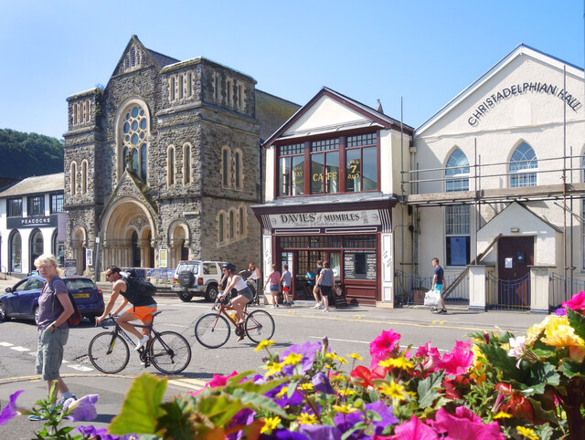
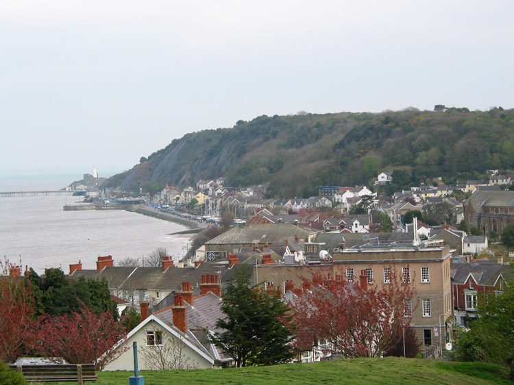
Wales

Black Stones

Clock and Railings, Mumbles Pier Mumbles Pier has quite an extensive shore based section with shops, amusements and eating places before you get onto the pier itself. This is right at the east end of the premises and shows some of the newly restored ironwork which is such a feature of the late Victorian pier which opened in 1898.
It is one of the very few privately run piers left in the UK.
Clock and Railings, Mumbles Pier Credit: Des Blenkinsopp

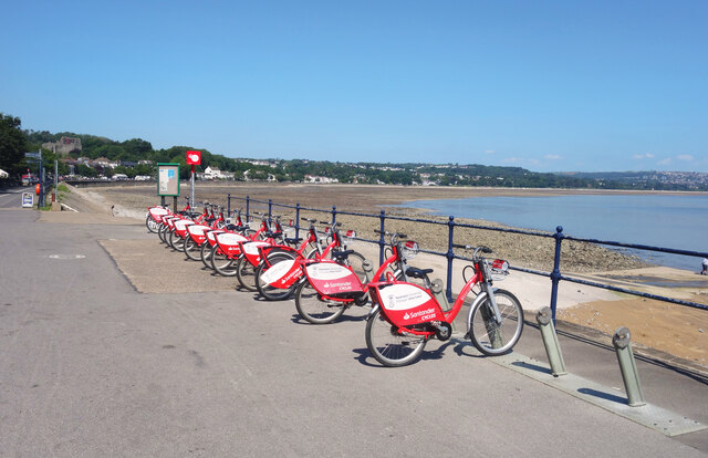
Black Stones is a coastal marsh and saltings located in Glamorgan, Wales. It is situated along the southern coast of the country, near the town of Ogmore-by-Sea. The area is known for its unique ecosystem and stunning natural beauty.

The marsh is characterized by its vast stretch of flat, open land, which is covered in tall grasses, reeds, and other marsh plants. These plants provide crucial habitat and food sources for a variety of bird species, making Black Stones a popular destination for birdwatchers and nature enthusiasts.

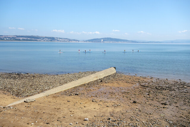
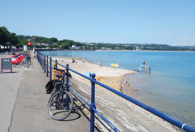
The saltings, or salt marshes, are a distinct feature of the area. These are intertidal areas, where the land meets the sea and is influenced by the tides. As the name suggests, these marshes have a higher salt content due to the regular influx of saltwater from the sea. This unique environment supports a different range of plant and animal species that are adapted to tolerate the salinity.

Black Stones offers stunning coastal views, with the dramatic juxtaposition of the marshland against the vastness of the ocean. The area is also home to a variety of wildlife, including wading birds, such as curlews, redshanks, and herons, as well as ducks and geese. Seals can often be spotted on the nearby rocky outcrops.

The marsh and saltings are an important natural habitat and have been designated as a Site of Special Scientific Interest (SSSI) to protect and preserve their unique ecological value. Visitors to Black Stones can enjoy walking along the coastal paths, birdwatching, and taking in the serene beauty of this coastal marsh and saltings.

If you have any feedback on the listing, please let us know in the comments section below.
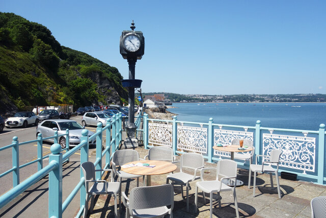
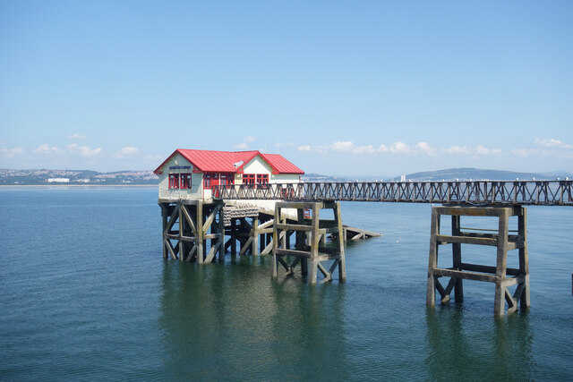
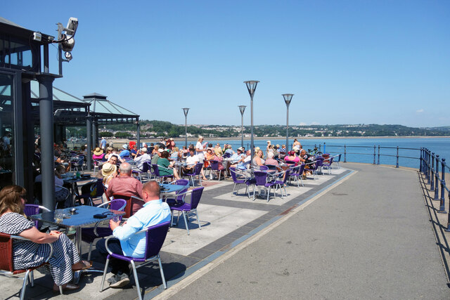
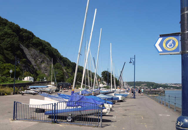
Black Stones Images

Images are sourced within 2km of 51.579546/-3.9965404 or Grid Reference SS6188. Thanks to Geograph Open Source API. All images are credited.

Clock and Railings, Mumbles Pier Mumbles Pier has quite an extensive shore based section with shops, amusements and eating places before you get onto the pier itself. This is right at the east end of the premises and shows some of the newly restored ironwork which is such a feature of the late Victorian pier which opened in 1898.
It is one of the very few privately run piers left in the UK.
Clock and Railings, Mumbles Pier
Mumbles Pier has quite an extensive shore based section with shops, amusements and eating places before you get onto the pier itself. This is right at the east end of the premises and shows some of the newly restored ironwork which is such a feature of the late Victorian pier which opened in 1898. It is one of the very few privately run piers left in the UK.
Mumbles Pier A view along the recently refurbished section of the pier towards the new lifeboat station at the end. The old station is on the left and restoration work was still in progress at the far end when this picture was taken.
Mumbles Pier
A view along the recently refurbished section of the pier towards the new lifeboat station at the end. The old station is on the left and restoration work was still in progress at the far end when this picture was taken.
Pirates of Mumbles Pier External bit of the amusements hall in the pier head building.
Pirates of Mumbles Pier
External bit of the amusements hall in the pier head building.
Cafe by the Sea Another picture featuring the beautifully refurbished Victorian ironwork on Mumbles Pier which opened in 1898.
Cafe by the Sea
Another picture featuring the beautifully refurbished Victorian ironwork on Mumbles Pier which opened in 1898.
Thank You, We'll Let You Know The End Of The Pier Show isn't what it was. 
A surreal scene on the bit of Mumbles Pier still under restoration. Work in progress, definitely.
Thank You, We'll Let You Know
The End Of The Pier Show isn't what it was. A surreal scene on the bit of Mumbles Pier still under restoration. Work in progress, definitely.
Mumbles Pier, Old Lifeboat Station The first station on the pier, which replaced an original station on the shore.
The station seen here has now been replaced by a new much larger facility at the end of the main pier.
Mumbles Pier, Old Lifeboat Station
The first station on the pier, which replaced an original station on the shore. The station seen here has now been replaced by a new much larger facility at the end of the main pier.
Busy at Verdi's A hot sunny day has brought people out onto the terrace at Verdi's restaurant
Busy at Verdi's
A hot sunny day has brought people out onto the terrace at Verdi's restaurant
Gigs on the Quay Three rowing gigs among the other boats stored on the hard standing along here beside the bay. The wooded slope of Mumbles Hill rises in the background.
Gigs on the Quay
Three rowing gigs among the other boats stored on the hard standing along here beside the bay. The wooded slope of Mumbles Hill rises in the background.
Boats by the Coast Path The familiar blue and yellow Wales Coast Path logo points the way uphill where the path gets back onto the cliffs after following the promenade all round the edge of Swansea Bay.
Boats by the Coast Path
The familiar blue and yellow Wales Coast Path logo points the way uphill where the path gets back onto the cliffs after following the promenade all round the edge of Swansea Bay.
Hire Bikes by the Beach A cycleway runs beside the bay all the way from Mumbles Head into Swansea.
A rack of Santander hire bikes is just here.
Hire Bikes by the Beach
A cycleway runs beside the bay all the way from Mumbles Head into Swansea. A rack of Santander hire bikes is just here.
Paddleboarders and Pipe Paddleboarders enjoying a very calm sea off the small patch of beach which is in SS6187.
Paddleboarders and Pipe
Paddleboarders enjoying a very calm sea off the small patch of beach which is in SS6187.
Memorial by Myrtle Terrace On the corner of Myrtle Terrace and Mumbles Road is a rather forgotten looking stone memorial celebrating the marriage of the Prince of Wales (later King Edward 7th) and Princess Alexandra in 1863.
Memorial by Myrtle Terrace
On the corner of Myrtle Terrace and Mumbles Road is a rather forgotten looking stone memorial celebrating the marriage of the Prince of Wales (later King Edward 7th) and Princess Alexandra in 1863.
Devon Place, Mumbles Residential street one block in from the sea front.
Devon Place, Mumbles
Residential street one block in from the sea front.
Shop Fronts, Mumbles Road A short terrace of shops with a bit extra added to the top of the facade for effect.
Shop Fronts, Mumbles Road
A short terrace of shops with a bit extra added to the top of the facade for effect.
Religion & Cakes, Mumbles Road Mumbles Methodist Church, opened 1878, and the Christadelphian Hall, with Davies of Mumbles, bakers and confectioners, in between.
Religion & Cakes, Mumbles Road
Mumbles Methodist Church, opened 1878, and the Christadelphian Hall, with Davies of Mumbles, bakers and confectioners, in between.
Low Tide at Oystermouth Low tide exposes a large beach, unfortunately not blessed with the wide expanses of sand found elsewhere.
The notice on the railings refers to the Covid epidemic of 2020/21.
Low Tide at Oystermouth
Low tide exposes a large beach, unfortunately not blessed with the wide expanses of sand found elsewhere. The notice on the railings refers to the Covid epidemic of 2020/21.
High Tide at Oystermouth The high tide comes right up to the sea wall. A concrete slipway is a makeshift beach for these people.
High Tide at Oystermouth
The high tide comes right up to the sea wall. A concrete slipway is a makeshift beach for these people.
Ordnance Survey Cut Mark This OS cut mark can be found on the wall between Nos 364 & 366 Mumbles Road. It marks a point 7.001m above mean sea level.
Ordnance Survey Cut Mark
This OS cut mark can be found on the wall between Nos 364 & 366 Mumbles Road. It marks a point 7.001m above mean sea level.
Show me another place!

Black Stones is located at Grid Ref: SS6188 (Lat: 51.579546, Lng: -3.9965404)

Unitary Authority: Swansea

Police Authority: South Wales

What 3 Words

///tickles.household.hurtles. Near Bishopston, Swansea

Related Wikis

Oystermouth railway station

Oystermouth railway station served the village of Oystermouth, in the historical county of Glamorgan, Wales, from 1807 to 1960 on the Swansea and Mumbles...

West Cross

West Cross is a suburban area of Swansea, Wales, located to the south of Swansea city centre, near Mumbles falling within the West Cross ward. == Description... ==

Oystermouth Castle

Oystermouth Castle (Welsh: Castell Ystum Llwynarth) is a Norman stone castle in Wales, overlooking Swansea Bay on the east side of the Gower Peninsula...

All Saints' Church, Oystermouth

All Saints' Church, Oystermouth (officially "All Saints, Oystermouth") is an Anglican church in the diocese of Swansea and Brecon, south Wales. It is located...

Mumbles Beach

Mumbles Beach is a very small sheltered area of sand and rock pools sandwiched between Swansea Bay beach and Bracelet Bay in the south eastern corner of...

Mumbles (district)

The Mumbles is a district of Swansea, Wales, located on the south-east corner of the unitary authority area. It is also a local government community using...

West Cross railway station

West Cross railway station served the suburb of West Cross, in the historical county of Glamorgan, Wales, from 1807 to 1960 on the Swansea and Mumbles...

West Cross (electoral ward)

West Cross is the name of an electoral ward in the Mumbles community and a suburb in the City and County of Swansea, Wales, UK. The ward falls within...

Related Videos

Castle On The Hill #travel #wales

Visited the castle in Mumbles near Swansea today and actually got some sunshine! #swansea #wales #travel.

Walking in Clyne Gardens Swansea

Walking outdoors, even in the rain, in a lical park, is a great way to keep yourself fit. Wear the correct waterproof clothing to keep ...

MUMBLES near Swansea, Wales

MUMBLES near Swansea, Wales. A full seafront walking tour of this welsh seaside holiday village, from Mumbles Pier to ...

Walking the Wales Coast Path: From Rotherslade to Caswell Bay, Mumbles, Swansea, Wales, UK (Oct'23)

Join me on a leisurely stroll along the picturesque coastline of Mumbles, from the charming Rotherslade Bay to the vibrant ...

Nearby Amenities

Located within 500m of 51.579546,-3.9965404
Traffic Signals
Button Operated: yes
Crossing: traffic_signals
Tactile Paving: yes
Traffic Signals Sound: yes
Lat/Long: 51.5804795/-4.0010943
Mini Roundabout
Direction: clockwise
Lat/Long: 51.5758545/-3.9988911
Norton
Created By: Potlatch 0.8c
Is In: Swansea
Place: suburb
Wikidata: Q107032731
Lat/Long: 51.5805136/-4.0022083
Bus Stop
Norton Avenue
Bench: no
Bus: yes
Naptan AtcoCode: 5810AWC50027
Naptan Bearing: S
Naptan CommonName: Norton Avenue (S)
Naptan Crossing: Norton Avenue
Naptan NaptanCode: swajpag
Naptan PlusbusZoneRef: SWANSEA
Naptan Street: Mumbles Road
Public Transport: platform
Shelter: no
Source: naptan_import
Lat/Long: 51.5808164/-4.0011172
Bus Stop
Oystermouth Square
Bench: yes
Bus: yes
Lit: yes
Naptan AtcoCode: 5810AWC50029
Naptan Bearing: N
Naptan CommonName: Oystermouth Square (N)
Naptan Crossing: Newton Road
Naptan NaptanCode: swajpap
Naptan PlusbusZoneRef: SWANSEA
Naptan Street: Mumbles Road
Public Transport: platform
Shelter: yes
Source: naptan_import
Tactile Paving: no
Lat/Long: 51.5763518/-3.9991053
Bus Stop
Oystermouth Square
Bench: yes
Bin: yes
Bus: yes
Lit: no
Naptan AtcoCode: 5810AWC50030
Naptan Bearing: S
Naptan CommonName: Oystermouth Square (S)
Naptan Crossing: Newton Road
Naptan NaptanCode: swajpat
Naptan PlusbusZoneRef: SWANSEA
Naptan Street: Mumbles Road
Public Transport: platform
Shelter: yes
Source: naptan_import
Tactile Paving: no
Lat/Long: 51.5753039/-3.9984239
Bus Stop
Norton Avenue
Bus: yes
Naptan AtcoCode: 5810AWC50051
Naptan Bearing: N
Naptan CommonName: Norton Avenue (N)
Naptan Crossing: Norton Avenue
Naptan NaptanCode: swapmam
Naptan PlusbusZoneRef: SWANSEA
Naptan Street: Mumbles Road
Public Transport: platform
Source: naptan_import
Lat/Long: 51.5812705/-4.0013825
Crossing
Crossing: unmarked
Crossing Island: yes
Crossing Markings: no
Tactile Paving: yes
Lat/Long: 51.5757999/-3.9988314
Norton Road Halt
Lat/Long: 51.5801736/-4.0007771
Fixme: continues
Lat/Long: 51.5788772/-4.0006686
West Cross Halt
Lat/Long: 51.5826727/-4.0008465
Bicycle Parking
Bicycle Parking: stands
Capacity: 6
Covered: no
Lat/Long: 51.5823726/-4.0009338
Crossing
Crossing: unmarked
Crossing Island: yes
Crossing Markings: no
Tactile Paving: yes
Lat/Long: 51.5759587/-3.9989052
Oystermouth
Lat/Long: 51.5757981/-3.9981469
Restaurant
Mumtaz
Addr Housenumber: 478-480
Addr Postcode: SA3 4BX
Addr Street: Mumbles Road
Cuisine: indian
Fhrs Id: 732780
Source: GPS
Source Addr: FHRS Open Data
Lat/Long: 51.5771431/-3.9992165
Recycling
Recycling Type: container
Lat/Long: 51.5768414/-4.0001111
Bank
Swansea Building Society
Atm: yes
Check Date: 2024-02-26
Lat/Long: 51.5759477/-3.9991454
Joules
Branch: of Mumbles
Brand: Joules
Brand Wikidata: Q25351738
Contact Website: https://www.joules.com/store-locator/store/joules-of-mumbles
Shop: clothes
Lat/Long: 51.5752837/-3.998675
Seasalt
Branch: Cornwall
Brand: Seasalt
Brand Wikidata: Q107344382
Check Date: 2024-01-14
Opening Hours: Mo-Sa 09:30-17:30; Su 10:00-16:00
Shop: clothes
Lat/Long: 51.5753299/-3.9987035
Oyster Cabs Ltd
Office: yes
Lat/Long: 51.5754977/-3.9988318
Elizabeth Antiques
Shop: antiques
Lat/Long: 51.5755906/-3.9988654
Fast Food
Greggs
Addr Housenumber: 2-4
Addr Postcode: SA3 4AT
Addr Street: Newton Road
Addr Suburb: Mumbles
Brand: Greggs
Brand Wikidata: Q3403981
Brand Wikipedia: en:Greggs
Check Date: 2024-02-26
Contact Website: https://www.greggs.co.uk/shop-finder?shop-code=5290
Cuisine: sandwich;bakery
Fhrs Id: 1214364
Payment Cash: yes
Payment Mastercard: yes
Payment Visa: yes
Shop: bakery
Source Addr: FHRS Open Data
Takeaway: yes
Lat/Long: 51.5758983/-3.9991233
FairyTales of Mumbles
Check Date: 2024-02-26
Shop: gift
Lat/Long: 51.5759882/-3.9991636
The Lovespoon Gallery
Check Date: 2024-02-26
Shop: art
Lat/Long: 51.5760327/-3.9991836
Fat Face
Brand: Fat Face
Brand Wikidata: Q5437186
Brand Wikipedia: en:Fat Face
Shop: clothes
Lat/Long: 51.5758237/-3.9991956
Judith Roberts Opticians
Check Date: 2024-02-26
Opening Hours: Mo-Fr 09:00-17:30; Sa 09:00-13:00; Su off
Shop: optician
Lat/Long: 51.575799/-3.9992938
Wales Air Ambulance Charity
Opening Hours: Mo-Sa 09:30-16:30
Shop: charity
Lat/Long: 51.5756213/-3.9994417
Cash Hardware Stores
Shop: hardware
Lat/Long: 51.5756034/-3.9995004
UNO
Shop: yes
Lat/Long: 51.5755809/-3.9996058
Rowberry
Shop: shoes
Lat/Long: 51.5755662/-3.9996866
Travel House
Shop: travel_agency
Lat/Long: 51.5755502/-3.9997714
Events Venue
Cafe Play Mumbles
Lat/Long: 51.575686/-4.0001961
Waste Basket
Lat/Long: 51.5756344/-3.9999047
Waste Basket
Lat/Long: 51.5755541/-3.9998504
Waste Basket
Lat/Long: 51.5757717/-3.999313
Waste Basket
Lat/Long: 51.5758648/-3.9990181
Specsavers
Brand: Specsavers
Brand Wikidata: Q2000610
Check Date: 2024-02-26
Opening Hours: Mo-Sa 09:00-17:30; Su 10:00-16:00
Shop: optician
Lat/Long: 51.5757874/-3.9993404
Pharmacy
Mumbles Pharmacy
Brand: Kevin Thomas
Check Date: 2024-02-26
Dispensing: yes
Healthcare: pharmacy
Opening Hours: Mo-Th 09:00-18:00; Fr 08:30-18:00; Sa 09:00-13:00; Su 13:30-15:30
Lat/Long: 51.5757713/-3.9994097
Barclays
Brand: Barclays
Brand Wikidata: Q245343
Brand Wikipedia: en:Barclays
Check Date: 2024-02-26
Disused Amenity: bank
Lat/Long: 51.5757255/-3.9996012
Cream
Check Date: 2024-02-26
Opening Hours: Mo-Sa 10:00-17:00; Su 11:00-16:00
Shop: clothes
Lat/Long: 51.575704/-3.9996889
Mumbles Shoe Repairs
Craft: shoemaker
Lat/Long: 51.5756405/-4.0000064
Tenovus
Check Date: 2024-02-26
Shop: charity
Lat/Long: 51.5756614/-3.9998988
Tuckers Butchers Ltd
Addr Housenumber: 20
Addr Postcode: SA3 4AX
Addr Street: Newton Road
Addr Suburb: Mumbles
Check Date: 2024-02-26
Fhrs Id: 1031783
Shop: butcher
Source Addr: FHRS Open Data
Lat/Long: 51.5756786/-3.9998105
Direction: SSE
Generator Method: photovoltaic
Generator Output Electricity: yes
Generator Solar Modules: 4
Generator Source: solar
Generator Type: solar_photovoltaic_panel
Location: roof
Power: generator
Lat/Long: 51.5761636/-4.0000293
Direction: ENE
Generator Method: photovoltaic
Generator Output Electricity: yes
Generator Solar Modules: 6
Generator Source: solar
Generator Type: solar_photovoltaic_panel
Location: roof
Power: generator
Lat/Long: 51.5762057/-3.9999951
Direction: 175
Generator Method: photovoltaic
Generator Output Electricity: yes
Generator Solar Modules: 6
Generator Source: solar
Generator Type: solar_photovoltaic_panel
Location: roof
Power: generator
Lat/Long: 51.580719/-4.0021985
Post Office
Mumbles Post Office
Addr City: The Mumbles, Swansea
Addr Housenumber: 9
Addr Postcode: SA3 4AR
Addr Street: Newton Road
Brand: Post Office
Brand Wikidata: Q1783168
Brand Wikipedia: en:Post Office Ltd
Contact Website: https://www.postoffice.co.uk/branch-finder/4716426/mumbles
Ref Pol Id: 134922
Lat/Long: 51.5755879/-3.9993652
Give Way
Direction: backward
Lat/Long: 51.5769395/-3.9990032
Bus Stop
Bus: yes
Public Transport: platform
Lat/Long: 51.5810053/-4.0019511
Bus Stop
Castle Acre
Bench: no
Bus: yes
Public Transport: platform
Shelter: no
Tactile Paving: no
Lat/Long: 51.5801665/-4.0017848
Post Box
Operator: Royal Mail
Operator Wikidata: Q638098
Post Box Type: wall
Lat/Long: 51.5800767/-4.0012269
Bench
Lat/Long: 51.5773612/-4.0015072
Bench
Lat/Long: 51.5771481/-4.0013516
Bench
Lat/Long: 51.5769785/-4.0012044
Drinking Water
Access: yes
Bottle: yes
Covered: no
Fee: no
Indoor: no
Lit: no
Wheelchair: yes
Lat/Long: 51.5765642/-4.0015646
Natural: shrub
Lat/Long: 51.5767888/-4.0017813
Natural: shrub
Lat/Long: 51.5767532/-4.0015978
Natural: shrub
Lat/Long: 51.5766588/-4.0018415
Natural: shrub
Lat/Long: 51.5765394/-4.001853
Natural: shrub
Lat/Long: 51.576575/-4.0016838
Natural: shrub
Lat/Long: 51.5764859/-4.0015892
Natural: shrub
Lat/Long: 51.5764271/-4.001658
Natural: shrub
Lat/Long: 51.5763755/-4.0016666
Natural: shrub
Lat/Long: 51.5764236/-4.0015778
Natural: shrub
Lat/Long: 51.577277/-4.0021741
Natural: shrub
Lat/Long: 51.5772431/-4.0014058
Natural: shrub
Lat/Long: 51.5772039/-4.001294
Natural: shrub
Lat/Long: 51.5773037/-4.0012968
Natural: shrub
Lat/Long: 51.5773892/-4.0012796
Natural: shrub
Lat/Long: 51.5772609/-4.001185
Natural: shrub
Lat/Long: 51.5775299/-4.0009815
Natural: shrub
Lat/Long: 51.5776689/-4.0010646
Natural: shrub
Lat/Long: 51.5777117/-4.0011707
Natural: shrub
Lat/Long: 51.5777687/-4.001079
Natural: shrub
Lat/Long: 51.5777633/-4.0014373
Natural: shrub
Lat/Long: 51.5776333/-4.001486
Natural: shrub
Lat/Long: 51.5769723/-4.0010302
Natural: shrub
Lat/Long: 51.5768351/-4.001056
Natural: shrub
Lat/Long: 51.5767567/-4.001013
Natural: shrub
Lat/Long: 51.5766908/-4.0010818
Natural: shrub
Lat/Long: 51.576657/-4.0012338
Natural: shrub
Lat/Long: 51.5766997/-4.0009442
Natural: shrub
Lat/Long: 51.5768138/-4.0008984
Natural: shrub
Lat/Long: 51.5769741/-4.0008697
Natural: shrub
Lat/Long: 51.5766178/-4.0014774
Natural: shrub
Lat/Long: 51.5766107/-4.0013943
Natural: shrub
Lat/Long: 51.5766071/-4.0013054
Natural: shrub
Lat/Long: 51.5766053/-4.0012051
Natural: shrub
Lat/Long: 51.576534/-4.0012682
Natural: shrub
Lat/Long: 51.5764467/-4.0014717
Natural: shrub
Lat/Long: 51.5765002/-4.0013914
Natural: shrub
Lat/Long: 51.5765234/-4.0010073
Natural: shrub
Lat/Long: 51.5766374/-4.0009442
The data included in this document is from www.openstreetmap.org. The data is made available under ODbL.

Have you been to Black Stones?

Leave your review of Black Stones below (or comments, questions and feedback).