Boot

Settlement in Cumberland Copeland

England

Boot

A fine bridge over the River Esk
A fine bridge over the River Esk Credit: David Medcalf

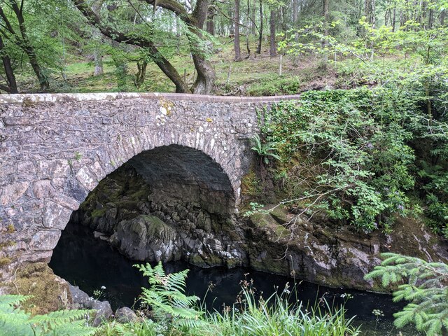
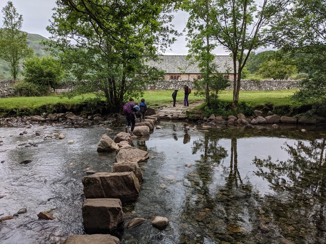
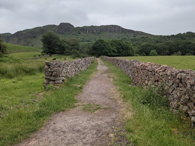
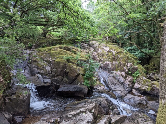
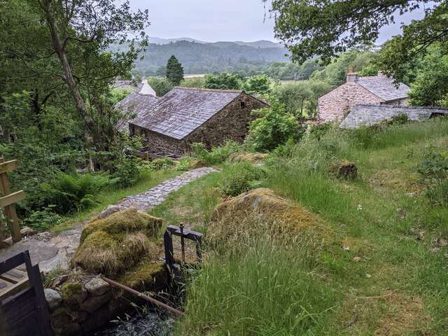
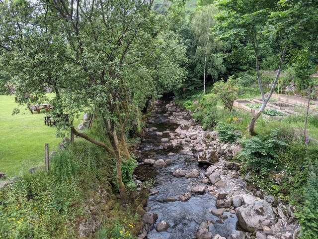
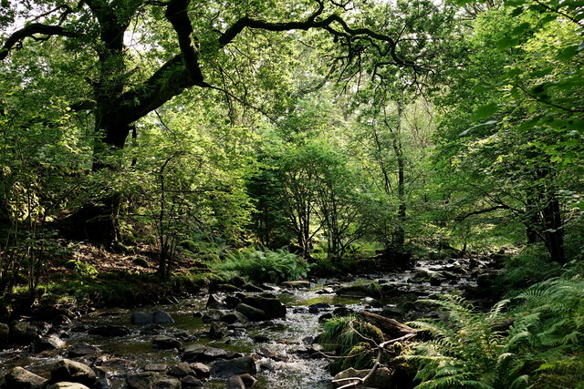
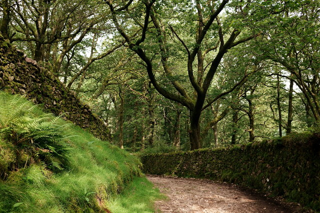
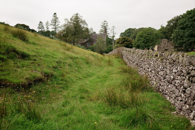
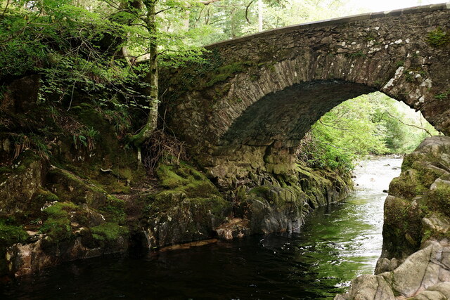
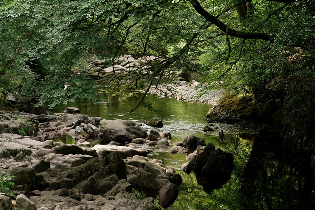
Boot is a small village located in the Lake District National Park, in the county of Cumbria, England. Situated in the western part of the park, Boot is nestled in the picturesque Eskdale Valley. The village is surrounded by stunning natural beauty, with rolling hills, lush green fields, and breathtaking views of the nearby mountains.

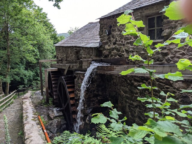
Despite its small size, Boot boasts a rich history and is known for its connection to the local mining industry. In the 19th century, the village was a significant center for iron ore mining, and remnants of this industrial heritage can still be seen today. The Boot Mill Museum offers visitors a glimpse into the area's mining past, displaying artifacts and providing information about the village's industrial history.

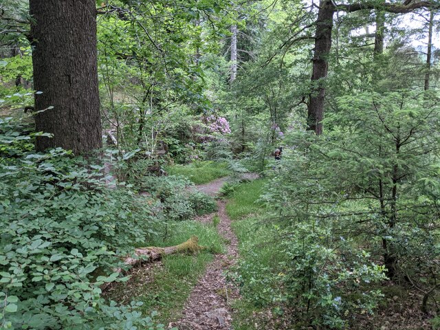
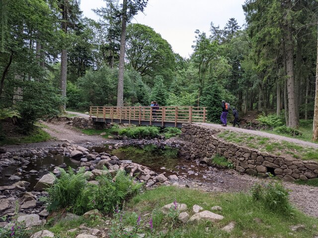
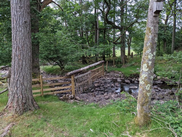
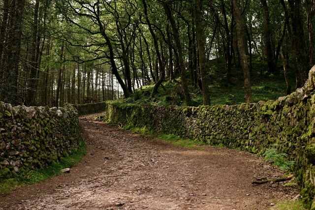
Boot is also a popular destination for outdoor enthusiasts. The village serves as a starting point for many hiking trails, including routes that lead to England's highest peak, Scafell Pike. The nearby Eskdale Valley offers opportunities for walking, cycling, and exploring the stunning countryside.

In terms of amenities, Boot offers a few options for accommodation, including guesthouses and self-catering cottages. The village is also home to a traditional pub, where visitors can enjoy a meal or a drink after a day of exploring.

Overall, Boot is a charming village that combines natural beauty with a fascinating history. Its location in the Lake District National Park makes it an ideal destination for those seeking outdoor adventures or simply a peaceful retreat in the heart of nature.

If you have any feedback on the listing, please let us know in the comments section below.

Boot Images

Images are sourced within 2km of 54.39862/-3.268439 or Grid Reference NY1701. Thanks to Geograph Open Source API. All images are credited.

A fine bridge over the River Esk
A path through the woods near Dalegarth
A new bridge over Birker Beck I think the previous bridge (see: <a title="https://www.geograph.org.uk/photo/4455179)" href="https://www.geograph.org.uk/photo/4455179)">Link</a> was probably damaged by floods.
Curiously the beck, referred to in some other geographs as Stanley Ghyll Beck, is named on the OS 1:50k map, but not on the 1:25k map.
A new bridge over Birker Beck
I think the previous bridge (see: Link was probably damaged by floods. Curiously the beck, referred to in some other geographs as Stanley Ghyll Beck, is named on the OS 1:50k map, but not on the 1:25k map.
A hanging fence across Birker Beck To discourage sheep from using the stream bed as an escape to greener pastures.
A hanging fence across Birker Beck
To discourage sheep from using the stream bed as an escape to greener pastures.
The stepping stones - a fun way to cross the Esk
The bridleway to the footbridge across the Esk
Wildflowers and trees Near Esk View Farm.
Wildflowers and trees
Near Esk View Farm.
Diverted power source The water wheels at Eskdale Mill are not in use today, so the water is spilled back into the stream.
Diverted power source
The water wheels at Eskdale Mill are not in use today, so the water is spilled back into the stream.
Water-smoothed rocks in Whillan Beck
Top of the power supply The water is extracted here to drive the water wheels at Eskdale Mill, whose rooftops are visible.
Top of the power supply
The water is extracted here to drive the water wheels at Eskdale Mill, whose rooftops are visible.
Whillan Beck from the mill bridge
Stanley Ghyll Beck Seen from the start of the climb up to the waterfall.
Stanley Ghyll Beck
Seen from the start of the climb up to the waterfall.
Eskdale Track up to the new Stanley Force viewing platform. Most walkers take the path in the ravine to reach the viewing platform, returning via this track.
Eskdale
Track up to the new Stanley Force viewing platform. Most walkers take the path in the ravine to reach the viewing platform, returning via this track.
Eskdale Track down to the road, from the new Stanley Force viewing platform.
Eskdale
Track down to the road, from the new Stanley Force viewing platform.
Eskdale View towards Dalegarth Hall, from the track.
Eskdale
View towards Dalegarth Hall, from the track.
Eskdale Trough House bridge and the River Esk.
Eskdale
Trough House bridge and the River Esk.
Eskdale River Esk from Trough House Bridge.
Eskdale
River Esk from Trough House Bridge.
'River Mite' Passing through Beckfoot station, with a train for Ravenglass.
'River Mite'
Passing through Beckfoot station, with a train for Ravenglass.
Show me another place!

Boot is located at Grid Ref: NY1701 (Lat: 54.39862, Lng: -3.268439)

Administrative County: Cumbria

District: Copeland

Police Authority: Cumbria

What 3 Words

///bluff.spires.pipe. Near Seascale, Cumbria

Nearby Locations

Hollins Coppice Boot

Related Wikis

Boot, Cumbria

Boot is a small village in Eskdale, Cumbria, in the Lake District of England. It forms part of the Borough of Copeland. There are two roads from which...

Dalegarth railway station

Dalegarth railway station is the easterly terminus of the 15-inch gauge Ravenglass and Eskdale Railway in Cumbria, England. It has a café and shop for...

Eskdale, Cumbria

Eskdale is a glacial valley and civil parish in the western Lake District National Park in Cumbria, England. It forms part of the Borough of Copeland...

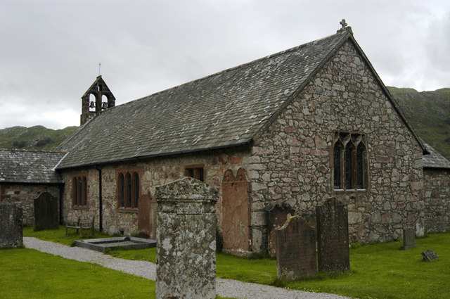
St Catherine's Church, Boot

St Catherine's Church is in the village of Boot, Cumbria, England. It is the Anglican parish church of Eskdale, Cumbria, and is in the deanery of Calder...

Nearby Amenities

Located within 500m of 54.39862,-3.268439
Barrier: stile
Foot: yes
Material: stone
Stile: stepover
Lat/Long: 54.3990252/-3.2628828
Barrier: stile
Bicycle: no
Foot: yes
Material: wood
Stile: stepover
Lat/Long: 54.3990522/-3.2625965
Barrier: stile
Foot: yes
Lat/Long: 54.3992598/-3.261105
Bus Stop
Post Office
Local Ref: AT
Naptan AtcoCode: 090050082185
Naptan Bearing: S
Naptan BusStopType: CUS
Naptan CommonName: Post Office
Naptan Indicator: at
Naptan Landmark: Boot Post Office
Naptan NaptanCode: cumatwdj
Naptan Street: No name
Naptan Verified: no
Source: naptan_import
Lat/Long: 54.3985415/-3.2700359
Barrier: stile
Foot: yes
Lat/Long: 54.3987404/-3.265788
Barrier: stile
Foot: yes
Lat/Long: 54.3988407/-3.2635618
Barrier: stile
Foot: yes
Lat/Long: 54.398948/-3.2631874
Barrier: kissing_gate
Foot: yes
Lat/Long: 54.3991512/-3.2682187
Barrier: stile
Lat/Long: 54.4021763/-3.2653015
Barrier: stile
Material: stone
Source: survey;bing;gps
Stile: squeezer
Lat/Long: 54.3993123/-3.2691086
Boot
Board Type: history
Information: board
Tourism: information
Lat/Long: 54.3985793/-3.2700285
Post Box
Collection Times: Mo-Fr 15:45; Sa 11:30
Post Box Type: lamp
Ref: CA19 116
Royal Cypher: EIIR
Royal Cypher Wikidata: Q33102113
Lat/Long: 54.3986037/-3.2700313
Nab Gill Iron Mine
Disused: yes
Man Made: mine
Mineral: iron
Note: Tunnels reputedly 700m into the mountainside
Tourism: viewpoint
Lat/Long: 54.4001116/-3.2727228
Boot Bank
Place: locality
Lat/Long: 54.4021246/-3.2720782
Toilets
Access: customers
Operator: Brook House Inn
Toilets Disposal: flush
Toilets Position: seated;urinal
Lat/Long: 54.3964103/-3.271452
Entrance: yes
Lat/Long: 54.3964151/-3.2713943
Entrance: main
Lat/Long: 54.3962328/-3.2712047
Boot
Place: village
Wikidata: Q893113
Wikipedia: en:Boot, Cumbria
Lat/Long: 54.3984112/-3.2695449
Power: pole
Lat/Long: 54.3977471/-3.2749363
Telephone
Booth: K6
Covered: booth
Operator: BT(British Telecom)
Payment Coins: yes
Lat/Long: 54.3985727/-3.2701325
Common Crag
Place: locality
Lat/Long: 54.396329/-3.2677081
Charging Station
Access: customers
Bicycle: yes
Motorcar: no
Operator: Boot Inn
Website: https://www.visitlakedistrict.com/explore/travel/electric-bike-charging-point-rydal-hall-tea-room-p1414501
Lat/Long: 54.3981988/-3.2703453
Ford: yes
Lat/Long: 54.3994357/-3.2712757
Ford: yes
Lat/Long: 54.3989157/-3.2724128
Power: pole
Lat/Long: 54.398245/-3.2738971
Power: pole
Lat/Long: 54.3984746/-3.2726338
Power: pole
Lat/Long: 54.3986831/-3.2714695
Power: pole
Lat/Long: 54.3988262/-3.2707282
Power: pole
Lat/Long: 54.3943955/-3.2708092
Power: pole
Lat/Long: 54.3945053/-3.2708273
Power: pole
Lat/Long: 54.3950157/-3.2705243
Power: pole
Lat/Long: 54.3954516/-3.2704271
Power: pole
Lat/Long: 54.3958177/-3.2707759
Power: pole
Lat/Long: 54.3955104/-3.2732054
Power: pole
Lat/Long: 54.3957578/-3.272487
Power: pole
Lat/Long: 54.3960252/-3.2717229
Power: pole
Lat/Long: 54.3962937/-3.2709245
Power: pole
Lat/Long: 54.3965244/-3.270229
Power: pole
Lat/Long: 54.3967174/-3.269623
Power: pole
Lat/Long: 54.3966986/-3.2711074
Power: pole
Lat/Long: 54.3972532/-3.2708921
Power: pole
Lat/Long: 54.3976681/-3.2707416
Power: pole
Lat/Long: 54.3978645/-3.2707034
The data included in this document is from www.openstreetmap.org. The data is made available under ODbL.

Have you been to Boot?

Leave your review of Boot below (or comments, questions and feedback).