Terhill

Settlement in Somerset Somerset West and Taunton

England

Terhill

Old Milestone, Cothelstone By Cothelstone Manor, Cothelstone. Metal plate attached to stone post by the UC road, in parish of COTHELSTONE (TAUNTON DEANE District), by entrance to Cothelstone Manor, in front of stone wall on grass verge, on North side of road. Harford iron plate, erected by the Bridgwater turnpike trust in the 18th century. The benchmark would have represented 315.2 ft Above Sea Level when the MS was situated on the opposite side of the road, hence the BM is not recorded in the OS database. 
An older image can be seen at <a title="https://www.geograph.org.uk/photo/6050694" href="https://www.geograph.org.uk/photo/6050694">Link</a>

Inscription reads: 9 / Miles / to / Bridgewater / Harford & Co. Bristol.

Grade II Listed: 1059191 <span class="nowrap"><a title="https://historicengland.org.uk/listing/the-list/list-entry/1059191" rel="nofollow ugc noopener" href="https://historicengland.org.uk/listing/the-list/list-entry/1059191">Link</a><img style="margin-left:2px;" alt="External link" title="External link - shift click to open in new window" src="https://s1.geograph.org.uk/img/external.png" width="10" height="10"/></span>

Milestone Society National ID: SO_BG08w
Old Milestone, Cothelstone Credit: Sheron Vowden

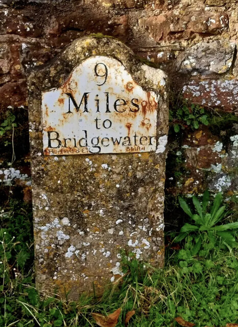
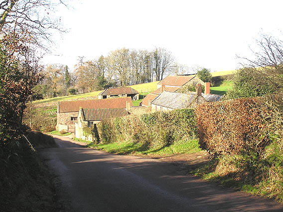
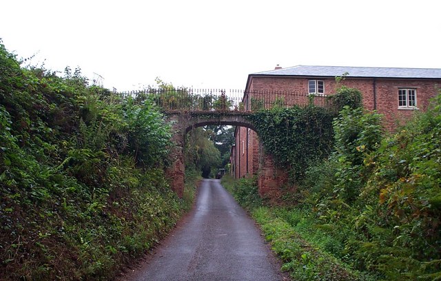
Terhill is a small village located in the county of Somerset, in the southwestern part of England. Situated on the outskirts of the larger town of Bridgewater, Terhill is nestled in a picturesque countryside setting, surrounded by rolling hills and lush green fields. The village is known for its tranquil and idyllic atmosphere, making it an attractive destination for those seeking a peaceful retreat.

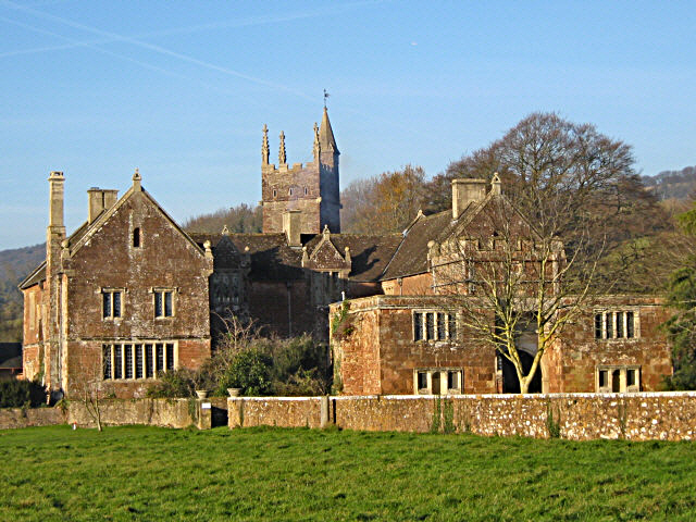
Terhill has a rich history, with evidence of human habitation dating back to ancient times. The village features several well-preserved historic buildings, including a medieval church that stands as a testament to its past. The local community takes great pride in preserving the village's heritage and has made efforts to maintain its traditional charm.

Despite its small size, Terhill offers a range of amenities to its residents and visitors. There is a local pub that serves as a social hub for the community, providing a welcoming and friendly atmosphere. Additionally, the village boasts a primary school, a convenience store, and a post office, ensuring that basic needs are met within the village itself.

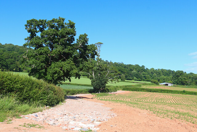
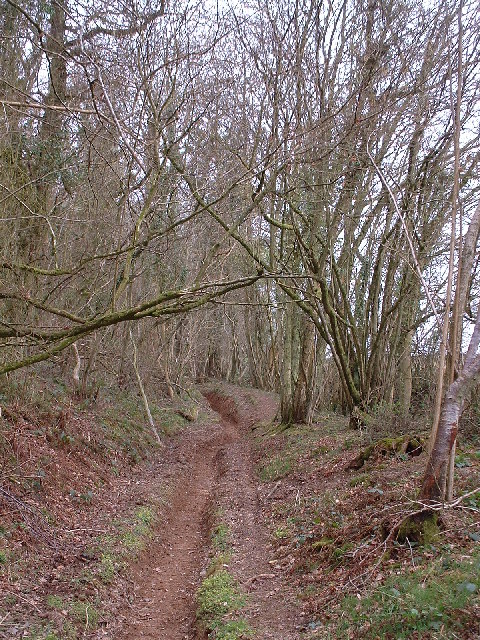
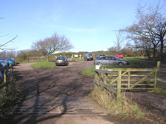
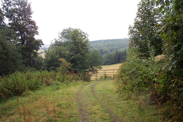
For those who enjoy outdoor activities, Terhill offers plenty of opportunities for exploring the surrounding countryside. The village is surrounded by beautiful walking trails and nature reserves, allowing visitors to immerse themselves in the natural beauty of the area. Nearby attractions include a picturesque river that winds through the landscape, providing a tranquil spot for fishing and boating enthusiasts.

In summary, Terhill is a charming and historic village in Somerset, England, known for its peaceful ambiance and scenic surroundings. With its rich history, friendly community, and access to the beautiful countryside, Terhill offers a delightful destination for both residents and tourists seeking a tranquil escape.

If you have any feedback on the listing, please let us know in the comments section below.
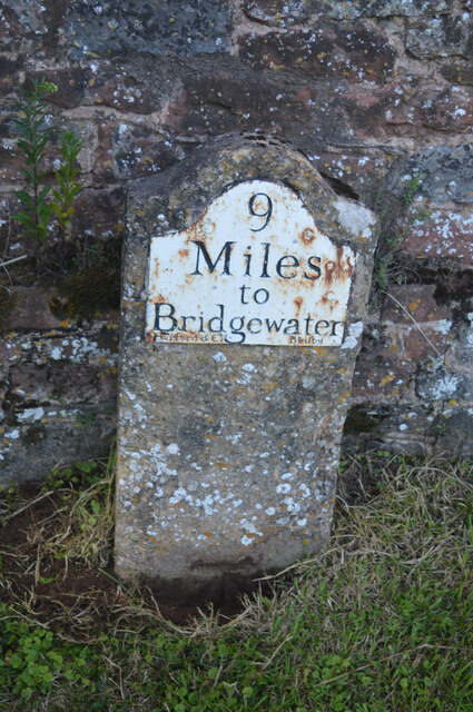
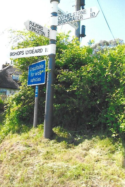
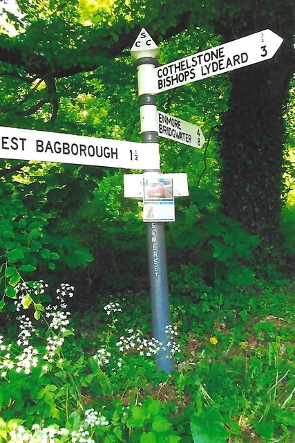
Terhill Images

Images are sourced within 2km of 51.086125/-3.177938 or Grid Reference ST1732. Thanks to Geograph Open Source API. All images are credited.

Old Milestone, Cothelstone By Cothelstone Manor, Cothelstone. Metal plate attached to stone post by the UC road, in parish of COTHELSTONE (TAUNTON DEANE District), by entrance to Cothelstone Manor, in front of stone wall on grass verge, on North side of road. Harford iron plate, erected by the Bridgwater turnpike trust in the 18th century. The benchmark would have represented 315.2 ft Above Sea Level when the MS was situated on the opposite side of the road, hence the BM is not recorded in the OS database. 
An older image can be seen at <a title="https://www.geograph.org.uk/photo/6050694" href="https://www.geograph.org.uk/photo/6050694">Link</a>

Inscription reads: 9 / Miles / to / Bridgewater / Harford & Co. Bristol.

Grade II Listed: 1059191 <span class="nowrap"><a title="https://historicengland.org.uk/listing/the-list/list-entry/1059191" rel="nofollow ugc noopener" href="https://historicengland.org.uk/listing/the-list/list-entry/1059191">Link</a><img style="margin-left:2px;" alt="External link" title="External link - shift click to open in new window" src="https://s1.geograph.org.uk/img/external.png" width="10" height="10"/></span>

Milestone Society National ID: SO_BG08w
Old Milestone, Cothelstone
By Cothelstone Manor, Cothelstone. Metal plate attached to stone post by the UC road, in parish of COTHELSTONE (TAUNTON DEANE District), by entrance to Cothelstone Manor, in front of stone wall on grass verge, on North side of road. Harford iron plate, erected by the Bridgwater turnpike trust in the 18th century. The benchmark would have represented 315.2 ft Above Sea Level when the MS was situated on the opposite side of the road, hence the BM is not recorded in the OS database. An older image can be seen at Link Inscription reads: 9 / Miles / to / Bridgewater / Harford & Co. Bristol. Grade II Listed: 1059191 LinkExternal link Milestone Society National ID: SO_BG08w
Direction Sign – Signpost north of Bishops Lydeard village Located on the north side of a junction on Cothelstone Road north of the village in Bishops Lydeard parish. 3 arms and pyramid finial. See also <a title="https://www.geograph.org.uk/photo/5824731" href="https://www.geograph.org.uk/photo/5824731">Link</a> and <a title="https://www.geograph.org.uk/photo/1602231" href="https://www.geograph.org.uk/photo/1602231">Link</a>.

Milestone Society National ID: SO_ST1730
Direction Sign – Signpost north of Bishops Lydeard village
Located on the north side of a junction on Cothelstone Road north of the village in Bishops Lydeard parish. 3 arms and pyramid finial. See also Link and Link. Milestone Society National ID: SO_ST1730
Direction Sign – Signpost northeast of Bishops Lydeard village Located on the north side of a junction on Cothelstone Road northeast of the village in Bishops Lydeard parish. 4 arms and pyramid finial. See also <a title="https://www.geograph.org.uk/photo/5824819" href="https://www.geograph.org.uk/photo/5824819">Link</a> and <a title="https://www.geograph.org.uk/photo/2885672" href="https://www.geograph.org.uk/photo/2885672">Link</a>.

Milestone Society National ID: SO_ST1730A
Direction Sign – Signpost northeast of Bishops Lydeard village
Located on the north side of a junction on Cothelstone Road northeast of the village in Bishops Lydeard parish. 4 arms and pyramid finial. See also Link and Link. Milestone Society National ID: SO_ST1730A
Direction Sign – Signpost at Park End, Broomfield Located at Park End on the northeast side of the junction on Cothelstone Road in Broomfield parish. 3 arms and pyramid finial. See also <a title="https://www.geograph.org.uk/photo/5813136" href="https://www.geograph.org.uk/photo/5813136">Link</a> and <a title="https://www.geograph.org.uk/photo/1140340" href="https://www.geograph.org.uk/photo/1140340">Link</a>.

Milestone Society National ID: SO_ST1833C
Direction Sign – Signpost at Park End, Broomfield
Located at Park End on the northeast side of the junction on Cothelstone Road in Broomfield parish. 3 arms and pyramid finial. See also Link and Link. Milestone Society National ID: SO_ST1833C
Near Crowcombe Field and trees near Crowcombe.
Near Crowcombe
Field and trees near Crowcombe.
Old Milestone by Cothelstone Manor, Cothelstone parish Metal plate attached to stone post by the UC road, in parish of COTHELSTONE (TAUNTON DEANE District), by entrance to Cothelstone Manor, in front of stone wall on grass verge, on North side of road. Harford iron plate, erected by the Bridgwater turnpike trust in the 18th century. 

Inscription reads:-
9
Miles
to
Bridgewater
Maker:-
Harford & Co. Bristol.

Grade II Listed. 
List Entry Number: 1059191 <span class="nowrap"><a title="https://historicengland.org.uk/listing/the-list/list-entry/1059191" rel="nofollow ugc noopener" href="https://historicengland.org.uk/listing/the-list/list-entry/1059191">Link</a><img style="margin-left:2px;" alt="External link" title="External link - shift click to open in new window" src="https://s1.geograph.org.uk/img/external.png" width="10" height="10"/></span>

Milestone Society National ID: SO_BG08w.
Old Milestone by Cothelstone Manor, Cothelstone parish
Metal plate attached to stone post by the UC road, in parish of COTHELSTONE (TAUNTON DEANE District), by entrance to Cothelstone Manor, in front of stone wall on grass verge, on North side of road. Harford iron plate, erected by the Bridgwater turnpike trust in the 18th century. Inscription reads:- 9 Miles to Bridgewater Maker:- Harford & Co. Bristol. Grade II Listed. List Entry Number: 1059191 LinkExternal link Milestone Society National ID: SO_BG08w.
Woodland near Cothelstone Hill
Lydeard Hill car park, Quantock Hills
Tilbury Farm, Bagborough
The Rising Sun, Bagborough In small words below the "Rising Sun", it says Established 1573!
The Rising Sun, Bagborough
In small words below the "Rising Sun", it says Established 1573!
Bagborough House from the church path
Stoneage Barton Farm. A large pile of manure, plenty of corrugated iron, an undulating barn roof and no shortage of mud makes this a typical working farm. The farmhouse is the furthermost building.
Stoneage Barton Farm.
A large pile of manure, plenty of corrugated iron, an undulating barn roof and no shortage of mud makes this a typical working farm. The farmhouse is the furthermost building.
Shopnoller Farm, Shopnoller The strangely named hamlet of Shopnoller is about one kilometre off the main A358, down some very narrow lanes.
Shopnoller Farm, Shopnoller
The strangely named hamlet of Shopnoller is about one kilometre off the main A358, down some very narrow lanes.
Outer Gate Arch, Cothelstone Manor Rebels from the Duke of Monmouth's army were hung on this arch after the Battle of Sedgemoor 1685. The daughter of the poet P.B.Shelley is buried in the church yard in the rear of the photo.
Outer Gate Arch, Cothelstone Manor
Rebels from the Duke of Monmouth's army were hung on this arch after the Battle of Sedgemoor 1685. The daughter of the poet P.B.Shelley is buried in the church yard in the rear of the photo.
Cothelstone Manor and church
The view from the road round Cothelstone Hill
Terhill This enormous building is being refurbished as all the windows are new. The little bridge crossing the lane looks like an "over-the-top" solution as the lane carries virtually no traffic!
Terhill
This enormous building is being refurbished as all the windows are new. The little bridge crossing the lane looks like an "over-the-top" solution as the lane carries virtually no traffic!
Seven Sisters This group of trees can be seen for miles around as they are the only tall trees on the top of Cothelstone Hill.
Seven Sisters
This group of trees can be seen for miles around as they are the only tall trees on the top of Cothelstone Hill.
Show me another place!

Terhill is located at Grid Ref: ST1732 (Lat: 51.086125, Lng: -3.177938)

Administrative County: Somerset

District: Somerset West and Taunton

Police Authority: Avon and Somerset

What 3 Words

///melts.woof.stormed. Near Bishops Lydeard, Somerset

Related Wikis

West Bagborough Hoard

The West Bagborough Hoard is a hoard of 670 Roman coins and 72 pieces of hacksilver found in October 2001 by metal detectorist James Hawkesworth near...
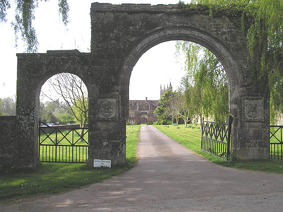
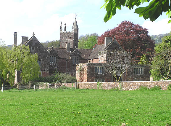
Cothelstone Manor

Cothelstone Manor in Cothelstone, Somerset, England was built in the mid-16th century, largely demolished by the parliamentary troops in 1646 and rebuilt...

West Bagborough

West Bagborough is a village and civil parish in Somerset, England, about 5 miles (8.0 km) north of Taunton. In 2011, the village had a population of 358...

Cothelstone

Cothelstone is a village and civil parish in Somerset, England, situated in the Quantock Hills six miles north of Taunton. The parish, which includes the...
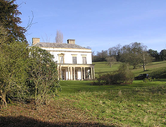
Bagborough House

Bagborough House in West Bagborough, Somerset, England was built circa 1730. It was designated a Grade II* listed building on 4 May 1984.Bagborough House...

Church of St Pancras, West Bagborough

The Anglican Church of St Pancras in West Bagborough, Somerset, England was built in the 15th century. It is a Grade II* listed building. == History... ==

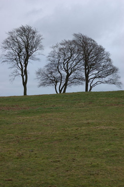
Seven Sisters (Quantock Hills)

The Seven Sisters is a clump of beech trees on Cothelstone Hill in the Quantock Hills, England. Originally planted in the 18th century, they form a well...

Cockercombe tuff

Cockercombe Tuff is a greenish-grey, hard pyroclastic rock, formed by the compression of volcanic ash containing high quantities of chlorite, which gives...

Nearby Amenities

Located within 500m of 51.086125,-3.177938
Brand: National Grid
Brand Wikidata: Q1465461
Material: wood
Operator: National Grid Electricity Distribution Plc
Operator Old: Western Power Distribution
Operator Wikidata: Q7988183
Owner: National Grid Electricity Distribution (South West) Plc
Owner Wikidata: Q114397866
Power: pole
Lat/Long: 51.0825624/-3.1810544
Brand: National Grid
Brand Wikidata: Q1465461
Material: wood
Operator: National Grid Electricity Distribution Plc
Operator Old: Western Power Distribution
Operator Wikidata: Q7988183
Owner: National Grid Electricity Distribution (South West) Plc
Owner Wikidata: Q114397866
Power: pole
Lat/Long: 51.0853589/-3.1838494
Brand: National Grid
Brand Wikidata: Q1465461
Material: wood
Operator: National Grid Electricity Distribution Plc
Operator Old: Western Power Distribution
Operator Wikidata: Q7988183
Owner: National Grid Electricity Distribution (South West) Plc
Owner Wikidata: Q114397866
Power: pole
Lat/Long: 51.086345/-3.1848471
Brand: National Grid
Brand Wikidata: Q1465461
Material: wood
Operator: National Grid Electricity Distribution Plc
Operator Old: Western Power Distribution
Operator Wikidata: Q7988183
Owner: National Grid Electricity Distribution (South West) Plc
Owner Wikidata: Q114397866
Power: pole
Lat/Long: 51.0834824/-3.1819637
Brand: National Grid
Brand Wikidata: Q1465461
Material: wood
Operator: National Grid Electricity Distribution Plc
Operator Old: Western Power Distribution
Operator Wikidata: Q7988183
Owner: National Grid Electricity Distribution (South West) Plc
Owner Wikidata: Q114397866
Power: pole
Lat/Long: 51.0844074/-3.1829186
Post Box
Operator: Royal Mail
Operator Wikidata: Q638098
Lat/Long: 51.0863256/-3.1798834
The data included in this document is from www.openstreetmap.org. The data is made available under ODbL.

Have you been to Terhill?

Leave your review of Terhill below (or comments, questions and feedback).