Bont goch

Settlement in Cardiganshire

Wales

Bont goch

Road junction near Bont-goch
Road junction near Bont-goch Credit: John Lord

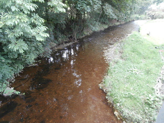
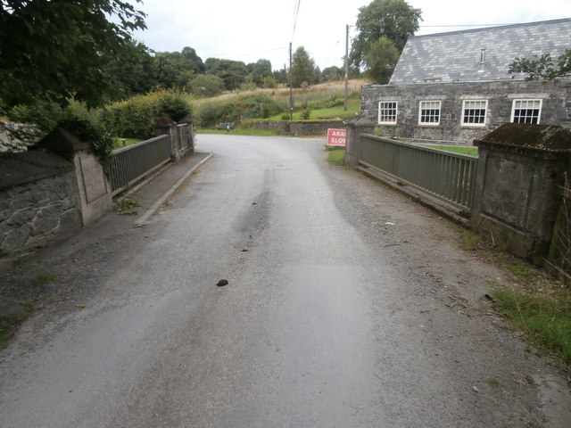
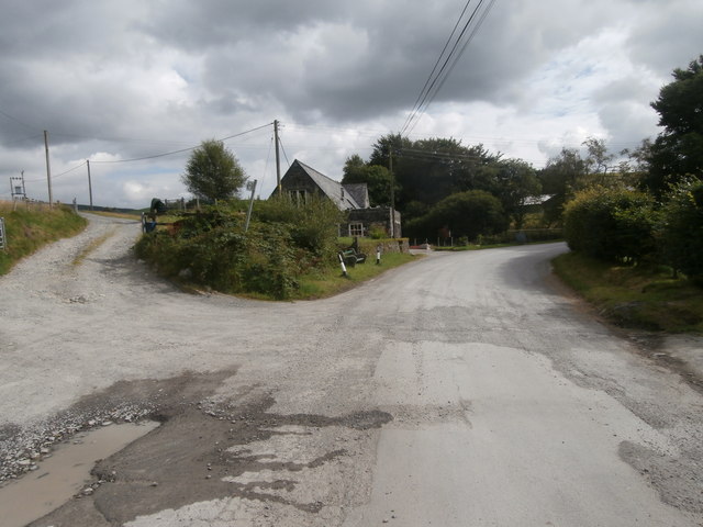
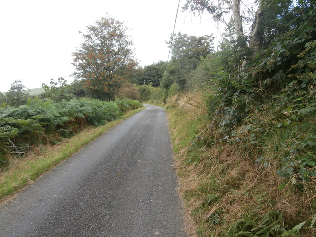
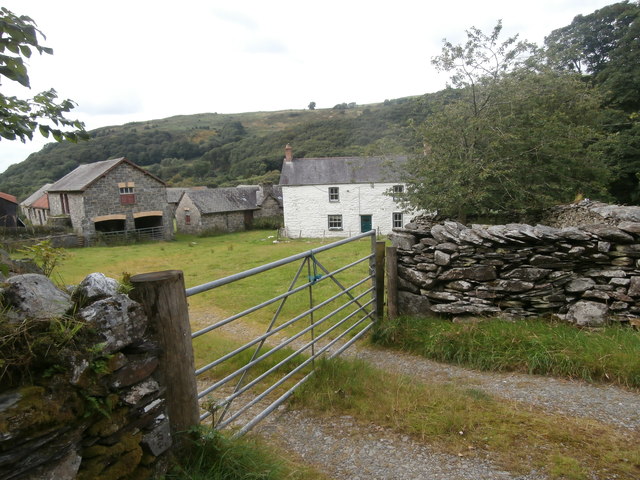
Bont-goch is a small village located in the county of Cardiganshire, Wales. Situated in the beautiful and picturesque countryside, it is surrounded by rolling hills and stunning natural landscapes. The village is set on the banks of the River Ystwyth, which adds to its charm and tranquility.

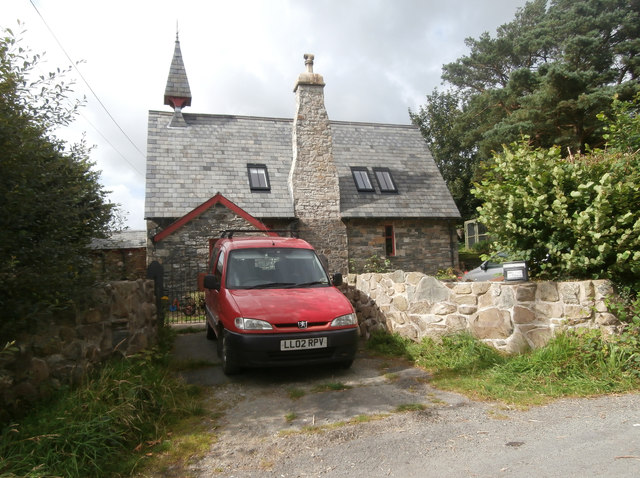
With a population of around 300 residents, Bont-goch is known for its close-knit community and friendly atmosphere. The village features a few traditional Welsh stone houses, giving it a quaint and traditional feel. The local economy is primarily based on agriculture, with many residents involved in farming and livestock rearing.

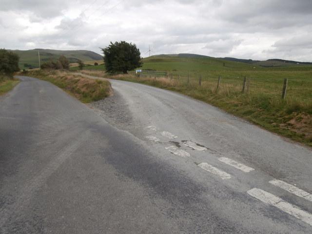
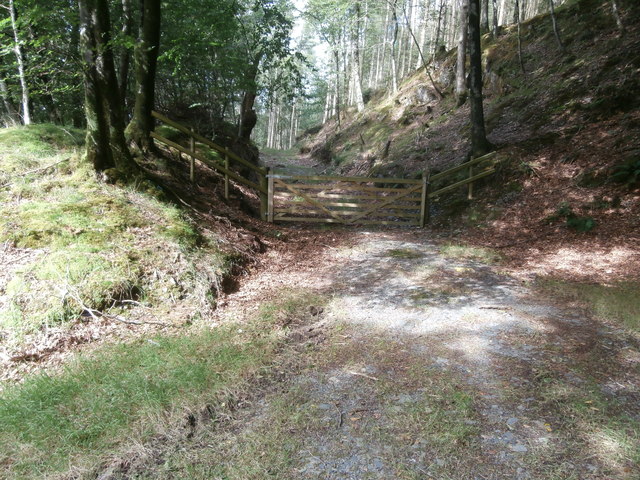
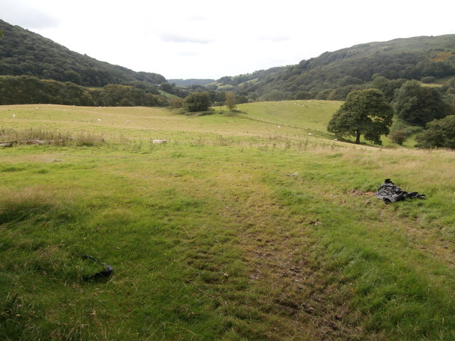
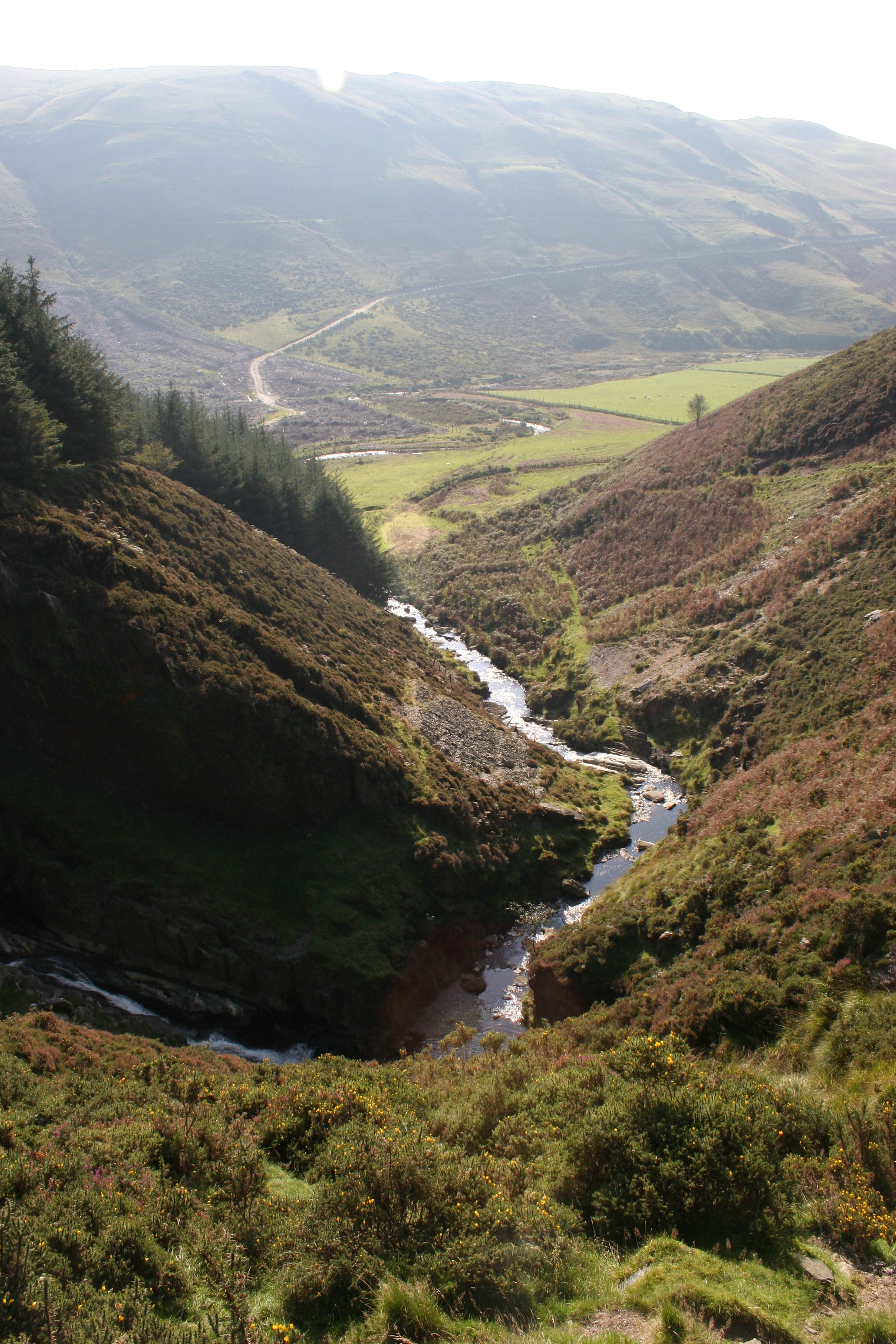
One of the main attractions in Bont-goch is its natural beauty. The area is popular among outdoor enthusiasts, offering numerous walking and hiking trails. The nearby Cambrian Mountains provide a stunning backdrop for these activities and offer breathtaking views of the surrounding countryside.

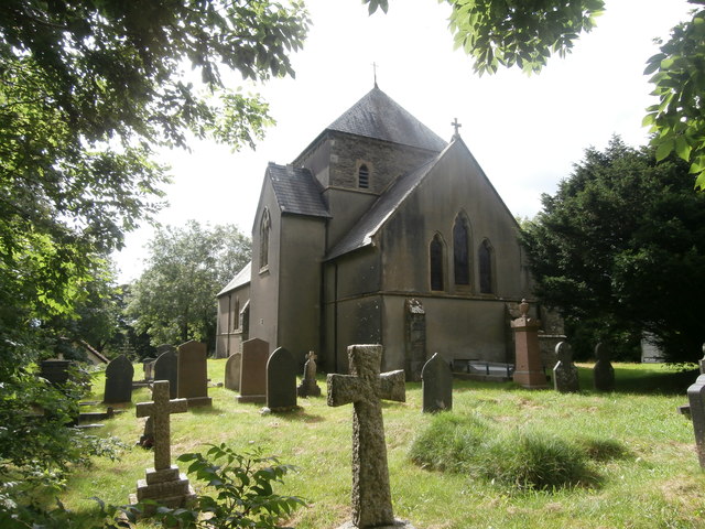
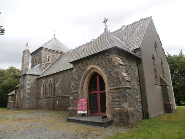
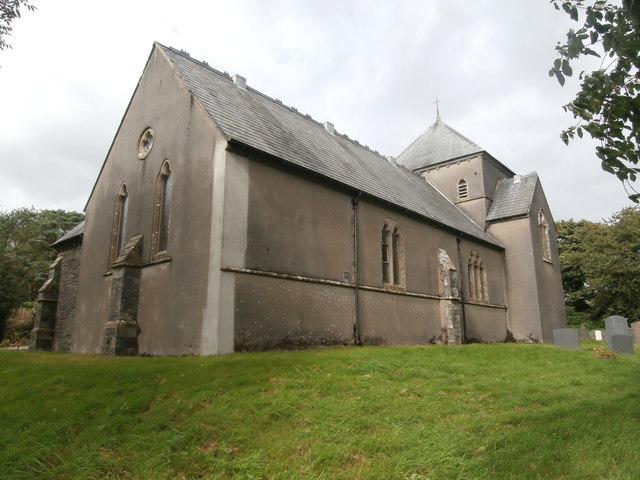
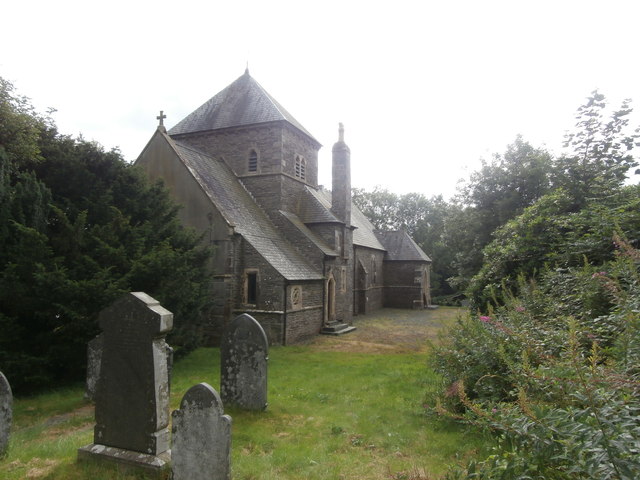
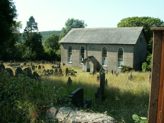
For those interested in history, Bont-goch is also home to a few historic landmarks. The village church, dating back to the 12th century, stands as a testament to the area's rich heritage. Additionally, there are several ancient burial mounds scattered throughout the region, providing a glimpse into the area's past.

Although Bont-goch is a small village, it benefits from its close proximity to larger towns such as Aberystwyth, which is approximately 8 miles away. This allows residents to access a wider range of amenities and services without compromising the peaceful and rural lifestyle that Bont-goch offers.

In summary, Bont-goch is a picturesque village in Cardiganshire, Wales, known for its natural beauty, close-knit community, and historic landmarks. It offers a peaceful and rural lifestyle while still being within reach of larger towns and amenities.

If you have any feedback on the listing, please let us know in the comments section below.

Bont goch Images

Images are sourced within 2km of 52.459018/-3.936578 or Grid Reference SN6886. Thanks to Geograph Open Source API. All images are credited.

Road junction near Bont-goch
Afon Leri at Bont-goch
The road bridge at Bont-goch
The old school, Bont-goch, now a dwelling
Church of St Peter, Bont-goch (Elerch) Designed by William Butterfield and completed in 1868.
Church of St Peter, Bont-goch (Elerch)
Designed by William Butterfield and completed in 1868.
Church of St Peter, Bont-goch (Elerch)
Bont-goch
Bont-goch
The road a little way north of Bont-goch
Track into the woods between Bont-goch and Cwmere
Pasture near Cwmere
Pasture near Cwmere
Cwmere farm
Cwmere farm
Phone-box at Cwmere
Phone-box at Cwmere
Ordnance Survey Cut Mark This OS cut mark can be found on the SE parapet of the bridge. It marks a point 174.483m above mean sea level.
Ordnance Survey Cut Mark
This OS cut mark can be found on the SE parapet of the bridge. It marks a point 174.483m above mean sea level.
Ordnance Survey Cut Mark This OS cut mark can be found on the NW face of St Pater's Church. It marks a point 193.566m above mean sea level.
Ordnance Survey Cut Mark
This OS cut mark can be found on the NW face of St Pater's Church. It marks a point 193.566m above mean sea level.
Eglwys Sant Pedr / St Peter's Church, Bont-goch (Elerch) The church was completed in 1868 and designed by the architect, William Butterfield.
Eglwys Sant Pedr / St Peter's Church, Bont-goch (Elerch)
The church was completed in 1868 and designed by the architect, William Butterfield.
Hen bwmp dwr / An old water pump Note the modern hosepipe.
Hen bwmp dwr / An old water pump
Note the modern hosepipe.
Show me another place!

Bont goch is located at Grid Ref: SN6886 (Lat: 52.459018, Lng: -3.936578)

Unitary Authority: Ceredigion

Police Authority: Dyfed Powys

Also known as: Bont-goch, Pont-goch

What 3 Words

///olive.hoot.hexes. Near Bow Street, Ceredigion

Related Wikis

Bont Goch

Bont Goch (also known as Bontgoch or Elerch) is a village in Ceredigion, Wales, 2 miles (3.2 km) northeast of Aberystwyth. With Talybont, it is in the...

Salem, Ceredigion

Salem is a small Welsh village in Ceredigion, located between the Afon Stewi and Nant Seilo rivers. The closest village is Penrhyn-coch. The Salem Independent...

Pen-Rhiw-Newydd

Penrhiwnewydd is a hamlet in the community of Trefeurig, Ceredigion, Wales, which is 74.1 miles (119.2 km) from Cardiff and 175.3 miles (282 km) from London...

Broginin

Broginin is a hamlet in the community of Trefeurig, Ceredigion, Wales, which is 74.6 miles (120 km) from Cardiff and 175.7 miles (282.8 km) from London...

Cwmsymlog

Cwmsymlog is a short valley, sheltering a hamlet of the same name, in Ceredigion, in the west of Wales. Once an important mining area, but the mining slowly...

Pen-bont-rhyd-y-beddau

Pen-bont-rhyd-y-beddau is a small village in the community of Trefeurig, Ceredigion, Wales, which is 73.7 miles (118.6 km) from Cardiff and 174.8 miles...

Craig-y-pistyll

Craig-y-pistyll is a Site of Special Scientific Interest in Ceredigion, west Wales. It is a reservoir with a dam at one end which supplies water to the...

Cynnull-mawr

Cynnull-mawr is a small village in the community of Ceulanamaesmawr, Ceredigion, Wales, which is 76.3 miles (122.8 km) from Cardiff and 176.9 miles (284...

Nearby Amenities

Located within 500m of 52.459018,-3.936578
Bontgoch
Alt Name: Elerch
Is In: Ceredigion, Wales, UK
Old Name: Bont Goch
Place: village
Source: local_knowledge
Wikidata: Q15999254
Lat/Long: 52.4595634/-3.9385348
Post Box
Post Box Mounting: brick_pillar
Post Box Type: wall
Ref: SY24 135
Lat/Long: 52.457316/-3.9399885
Building: yes
Lat/Long: 52.4566463/-3.9396137
Building: yes
Lat/Long: 52.4578781/-3.9371422
Place Of Worship
Saint Peter
Religion: christian
Wikidata: Q17743804
Lat/Long: 52.4601621/-3.9381201
Direction: 80
Generator Method: photovoltaic
Generator Output Electricity: yes
Generator Solar Modules: 8
Generator Source: solar
Generator Type: solar_photovoltaic_panel
Location: roof
Power: generator
Lat/Long: 52.4588296/-3.9387019
Direction: 260
Generator Method: photovoltaic
Generator Output Electricity: yes
Generator Solar Modules: 8
Generator Source: solar
Generator Type: solar_photovoltaic_panel
Location: roof
Power: generator
Lat/Long: 52.4588622/-3.9387542
Direction: SSE
Generator Method: photovoltaic
Generator Output Electricity: yes
Generator Solar Modules: 8
Generator Source: solar
Generator Type: solar_photovoltaic_panel
Location: roof
Power: generator
Lat/Long: 52.4607965/-3.9358896
Direction: SSE
Generator Method: photovoltaic
Generator Output Electricity: yes
Generator Solar Modules: 8
Generator Source: solar
Generator Type: solar_photovoltaic_panel
Location: roof
Power: generator
Lat/Long: 52.460763/-3.9360479
Direction: 175
Generator Method: photovoltaic
Generator Output Electricity: yes
Generator Solar Modules: 8
Generator Source: solar
Generator Type: solar_photovoltaic_panel
Location: roof
Power: generator
Lat/Long: 52.4604966/-3.9372388
Direction: 165
Generator Method: photovoltaic
Generator Output Electricity: yes
Generator Solar Modules: 22
Generator Source: solar
Generator Type: solar_photovoltaic_panel
Location: roof
Power: generator
Lat/Long: 52.4603519/-3.93884
Telephone
Booth: K6
Covered: booth
Lat/Long: 52.4575176/-3.9397277
The data included in this document is from www.openstreetmap.org. The data is made available under ODbL.

Have you been to Bont goch?

Leave your review of Bont goch below (or comments, questions and feedback).