Tamworth

Settlement in Surrey

England

Tamworth

Mitcham Junction North-bound Thameslink train.
Mitcham Junction Credit: Peter Trimming

Tamworth is a small village located in Surrey, England. It is known for its picturesque countryside landscapes and charming historic buildings. The village is situated along the River Mole, providing residents and visitors with beautiful views and opportunities for outdoor activities such as fishing and hiking.

Tamworth is a tight-knit community with a population of around 1,500 residents. The village has a strong sense of community spirit, with locals often coming together for events and celebrations. The village has a primary school, a church, and a few local shops and pubs that serve as gathering places for residents.

Tamworth is well-connected to nearby towns and cities, with easy access to major roadways and public transportation. The village is just a short drive away from the bustling town of Guildford and the city of London, making it a convenient location for those who work in the city but prefer a quieter, more rural lifestyle.

Overall, Tamworth is a peaceful and charming village that offers a true taste of English countryside living.

If you have any feedback on the listing, please let us know in the comments section below.
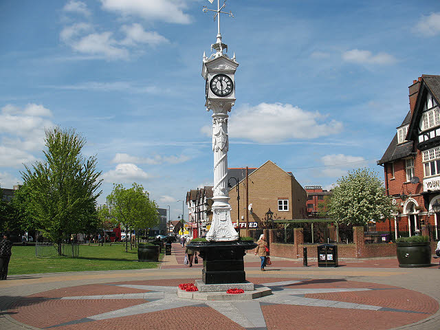
Tamworth Images

Images are sourced within 2km of 51.402186/-0.148307 or Grid Reference TQ2868. Thanks to Geograph Open Source API. All images are credited.

Mitcham Junction North-bound Thameslink train.
Mitcham Junction
North-bound Thameslink train.
Tramlink Wimbledon service arriving at Mitcham Junction.
Tramlink
Wimbledon service arriving at Mitcham Junction.
Tramlink Wimbledon tram, approaching Mitcham.
Tramlink
Wimbledon tram, approaching Mitcham.
Tramlink Trams passing, just outside Mitcham.
Tramlink
Trams passing, just outside Mitcham.
Tramlink Wimbledon tram approaching Mitcham.
Tramlink
Wimbledon tram approaching Mitcham.
Tramlink View towards the Therapia Lane depot.
Tramlink
View towards the Therapia Lane depot.
Tramlink Wimbledon service, approaching the Beddington Lane stop. In the background, the Therapia Lane depot can be seen.
Tramlink
Wimbledon service, approaching the Beddington Lane stop. In the background, the Therapia Lane depot can be seen.
Beddington Farmlands The wetlands area saw gulls numbering in their hundreds (mainly black-headed) and a few grumpy-looking herons.
Beddington Farmlands
The wetlands area saw gulls numbering in their hundreds (mainly black-headed) and a few grumpy-looking herons.
Beddington Farmlands The wetlands area saw gulls numbering in their hundreds (mainly black-headed) and a few grumpy-looking herons.
Beddington Farmlands
The wetlands area saw gulls numbering in their hundreds (mainly black-headed) and a few grumpy-looking herons.
Beddington Farmlands The wetlands area saw gulls numbering in their hundreds and a few grumpy-looking herons.
Beddington Farmlands
The wetlands area saw gulls numbering in their hundreds and a few grumpy-looking herons.
Beddington Farmlands The wetlands area saw gulls numbering in their hundreds (mainly Black-headed) and a few grumpy-looking herons.
Beddington Farmlands
The wetlands area saw gulls numbering in their hundreds (mainly Black-headed) and a few grumpy-looking herons.
Beddington Farmlands Swan, coots and gulls.
Beddington Farmlands
Swan, coots and gulls.
Beddington Farmlands Swans and gulls.
Beddington Farmlands
Swans and gulls.
Beddington Farmlands Swans and gulls.
Beddington Farmlands
Swans and gulls.
Heads and Tails Two heads, three tails and a couple of gulls.
Heads and Tails
Two heads, three tails and a couple of gulls.
Beddington Farmlands Swans and gull.
Beddington Farmlands
Swans and gull.
Beddington Farmlands Swans and gull.
Beddington Farmlands
Swans and gull.
Beddington Farmlands Heron and gulls.
Beddington Farmlands
Heron and gulls.
Show me another place!

Tamworth is located at Grid Ref: TQ2868 (Lat: 51.402186, Lng: -0.148307)

Unitary Authority: Merton

Police Authority: Metropolitan

What 3 Words

///text.aspect.slug. Near Mitcham, London

Nearby Locations

Tamworth

Related Wikis

Mitcham

Mitcham is an area within the London Borough of Merton in Southwest London, England. It is centred 7.2 miles (11.6 km) southwest of Charing Cross. Originally...

Streatham Park Cemetery

South London Crematorium and Streatham Park Cemetery is a cemetery and crematorium on Rowan Road in Streatham Vale. It has always been privately owned...

St Mark's Academy

St Mark's Academy is a mixed Church of England secondary school and sixth form located in the Eastfields area of the London Borough of Merton, England...

Mitcham Eastfields railway station

Mitcham Eastfields (initially known as Eastfields during planning and construction) is a railway station in London, United Kingdom, which opened on 2 June...

Nearby Amenities

Located within 500m of 51.402186,-0.148307
Traffic Signals
Lat/Long: 51.4021323/-0.1543296
Traffic Signals
Traffic Signals: signal
Lat/Long: 51.4001695/-0.1444892
Mini Roundabout
Lat/Long: 51.4040891/-0.1508503
Ref GB Tflcid: RWG215772
Traffic Calming: cushion
Lat/Long: 51.4036768/-0.1503002
Traffic Calming: cushion
Lat/Long: 51.4004183/-0.1449661
Barrier: bollard
Bicycle: yes
Bollard: removable
Foot: yes
Motor Vehicle: no
Lat/Long: 51.401844/-0.1492457
Post Box
Operator: Royal Mail
Operator Wikidata: Q638098
Ref: CR4 25
Lat/Long: 51.4005157/-0.1497364
Post Box
Collection Times: Mo-Fr 09:00; Sa 07:00
Operator: Royal Mail
Operator Wikidata: Q638098
Post Box Type: pillar
Ref: CR4 4D
Royal Cypher: EIIR
Royal Cypher Wikidata: Q33102113
Lat/Long: 51.3992152/-0.1457847
Turning Circle
Lat/Long: 51.4049436/-0.1533739
Ref GB Tflcid: RWG215774
Traffic Calming: cushion
Lat/Long: 51.4025898/-0.1485999
Turning Circle
Lat/Long: 51.4057381/-0.1513761
Barrier: lift_gate
Lat/Long: 51.4028946/-0.1530215
Ref GB Tflcid: RWG215555
Traffic Calming: cushion
Lat/Long: 51.4008854/-0.145898
Barrier: bollard
Lat/Long: 51.4018152/-0.1489823
Post Box
Operator: Royal Mail
Operator Wikidata: Q638098
Ref: CR4 43
Lat/Long: 51.4015831/-0.1470813
Bus Stop
Cedars Avenue
Bus: yes
Naptan AtcoCode: 490004911E1
Naptan Bearing: N
Naptan CommonName: Cedars Av Mitcham Common
Naptan Verified: no
Public Transport: platform
Ref: 75725
Source Ref: naptan
Lat/Long: 51.4023378/-0.154717
Bus Stop
Cedars Avenue
Bus: yes
Naptan AtcoCode: 490004911W1
Naptan Bearing: N
Naptan CommonName: Cedars Av Mitcham Common
Naptan Street: COMMONSIDE EAST
Naptan Verified: no
Public Transport: platform
Ref: 73707
Source Ref: naptan
Lat/Long: 51.4022967/-0.1549845
Bus Stop
Cedars Avenue
Bus: yes
Naptan AtcoCode: 490012475N
Naptan Bearing: N
Naptan CommonName: Stainbank Road
Naptan Verified: no
Public Transport: platform
Lat/Long: 51.4046273/-0.1515482
Bus Stop
Tamworth Park
Bus: yes
Naptan AtcoCode: 490013150E
Naptan Bearing: E
Naptan CommonName: Tamworth Park
Naptan Verified: no
Public Transport: platform
Ref: 73477
Source Ref: naptan
Lat/Long: 51.400459/-0.1497164
Bus Stop
Tamworth Park
Bus: yes
Naptan AtcoCode: 490013150W
Naptan Bearing: W
Naptan CommonName: Tamworth Park
Naptan Verified: no
Public Transport: platform
Ref: 71660
Source Ref: naptan
Lat/Long: 51.4006336/-0.1505384
Bus Stop
Pentlands Close
Bus: yes
Naptan AtcoCode: 490015306W
Naptan Bearing: W
Naptan CommonName: Cedars Avenue Pentlands Close
Naptan Verified: no
Public Transport: platform
Ref: 49445
Source Ref: naptan
Lat/Long: 51.4013957/-0.1525803
Bus Stop
Sherwood Park Road
Bench: yes
Bin: yes
Bus: yes
Bus Bay: no
Kerb: raised
Naptan AtcoCode: 490013425N
Naptan Bearing: N
Naptan CommonName: The Horse & Groom
Public Transport: platform
Shelter: yes
Lat/Long: 51.4004779/-0.144116
Bus Stop
Sherwood Park Road
Bench: yes
Bin: yes
Bus: yes
Bus Bay: no
Kerb: raised
Naptan AtcoCode: 490013425S
Naptan Bearing: S
Naptan CommonName: The Horse & Groom
Naptan Street: MANOR ROAD
Passenger Information Display: yes
Public Transport: platform
Shelter: yes
Lat/Long: 51.3998688/-0.1447222
Crossing
Crossing: unmarked
Crossing Island: no
Crossing Markings: no
Proposed Traffic Calming: table
Lat/Long: 51.399077/-0.1461627
Mini Roundabout
Lat/Long: 51.39903/-0.1458892
Ref GB Tflcid: RWG215760
Traffic Calming: hump
Lat/Long: 51.4066682/-0.1478899
Bus Stop
Tamworth Park
Bus: yes
Naptan AtcoCode: 490018878N
Naptan Bearing: N
Public Transport: platform
Lat/Long: 51.4024266/-0.14852
Bus Stop
Tamworth Park
Bus: yes
Naptan AtcoCode: 490018878E
Public Transport: platform
Lat/Long: 51.4016937/-0.1473023
Bus Stop
Sherwood Park Road
Bench: no
Bin: no
Bus: yes
Bus Bay: no
Kerb: raised
Naptan AtcoCode: 490018879N
Public Transport: platform
Shelter: no
Lat/Long: 51.4007317/-0.145701
Addr City: Mitcham
Addr Housenumber: 92
Addr Postcode: CR4 1DA
Addr Street: Tamworth Lane
Source: survey;code-point open
Lat/Long: 51.4051397/-0.1522971
Addr City: Mitcham
Addr Housenumber: 89
Addr Postcode: CR4 1DG
Addr Street: Tamworth Lane
Source: survey;code-point open
Lat/Long: 51.4052958/-0.1519002
Addr City: Mitcham
Addr Flats: 1-5
Addr Housename: Vesta House
Addr Postcode: CR4 1GL
Addr Street: Esquiline Lane
Source: survey;code-point open
Lat/Long: 51.4050142/-0.1521502
Addr City: Mitcham
Addr Flats: 11-15
Addr Housename: Juliet House
Addr Postcode: CR4 1GL
Addr Street: Esquiline Lane
Source: survey;code-point open
Lat/Long: 51.4040312/-0.1547199
Crossing
Crossing: unmarked
Crossing Markings: no
Lat/Long: 51.4020856/-0.1544285
Crossing
Crossing: unmarked
Crossing Markings: no
Lat/Long: 51.4020568/-0.1543638
Traffic Signals
Bicycle: yes
Traffic Signals Direction: forward
Lat/Long: 51.4020497/-0.154466
Traffic Calming: bump
Lat/Long: 51.3999566/-0.1440435
Barrier: bollard
Lat/Long: 51.3996787/-0.1429315
Crossing
Crossing: unmarked
Crossing Island: yes
Crossing Markings: no
Surface: asphalt
Tactile Paving: yes
Lat/Long: 51.3991359/-0.1457564
Bench
Lat/Long: 51.398107/-0.1503675
Bench
Lat/Long: 51.3987503/-0.1477002
Generator Method: photovoltaic
Generator Output Electricity: yes
Generator Source: solar
Generator Type: solar_photovoltaic_panel
Location: roof
Power: generator
Lat/Long: 51.404408/-0.1427794
Generator Method: photovoltaic
Generator Output Electricity: yes
Generator Source: solar
Generator Type: solar_photovoltaic_panel
Location: roof
Power: generator
Lat/Long: 51.4043837/-0.1427498
Traffic Calming: table
Lat/Long: 51.4016261/-0.1418041
Bicycle Parking
Bicycle Parking: post_hoop
Capacity: 8
Ref GB Tflcid: RWG207392
Lat/Long: 51.4004624/-0.1443035
Bicycle Parking
Bicycle Parking: stands
Capacity: 2
Ref GB Tflcid: RWG207401
Lat/Long: 51.3989923/-0.1462273
Ref GB Tflcid: RWG215773
Traffic Calming: cushion
Lat/Long: 51.4030916/-0.149374
Ref GB Tflcid: RWG215608
Traffic Calming: cushion
Lat/Long: 51.3998968/-0.1483806
Ref GB Tflcid: RWG290550
Traffic Calming: cushion
Lat/Long: 51.3987893/-0.1454309
Ref GB Tflcid: RWG215768
Traffic Calming: hump
Lat/Long: 51.4038446/-0.1514818
Ref GB Tflcid: RWG215593
Traffic Calming: hump
Lat/Long: 51.4016331/-0.1530183
Ref GB Tflcid: RWG215579
Traffic Calming: cushion
Lat/Long: 51.4017668/-0.1475275
Ref GB Tflcid: RWG215765
Traffic Calming: cushion
Lat/Long: 51.4052511/-0.152121
Ref GB Tflcid: RWG215575
Traffic Calming: cushion
Lat/Long: 51.4014084/-0.146953
Ref GB Tflcid: RWG215610
Traffic Calming: cushion
Lat/Long: 51.4003436/-0.1495895
Ref GB Tflcid: RWG215604
Traffic Calming: cushion
Lat/Long: 51.3994528/-0.1471793
Ref GB Tflcid: RWG215587
Traffic Calming: hump
Lat/Long: 51.4033481/-0.1525471
Ref GB Tflcid: RWG215594
Traffic Calming: cushion
Lat/Long: 51.4011468/-0.1517344
Ref GB Tflcid: RWG290553
Traffic Calming: hump
Lat/Long: 51.3984582/-0.144568
Ref GB Tflcid: RWG215588
Traffic Calming: hump
Lat/Long: 51.4027075/-0.1534982
Ref GB Tflcid: RWG215769
Traffic Calming: cushion
Lat/Long: 51.4044669/-0.1512481
Ref GB Tflcid: RWG218069
Traffic Calming: cushion
Lat/Long: 51.4008047/-0.1508289
Ref GB Tflcid: RWG215571
Traffic Calming: hump
Lat/Long: 51.4008665/-0.1433108
Ref GB Tflcid: RWG215580
Traffic Calming: cushion
Lat/Long: 51.402216/-0.1481335
Bicycle Parking
Bicycle Parking: stands
Capacity: 12
Ref GB Tflcid: RWG207428
Lat/Long: 51.4050928/-0.1522644
Bicycle Parking
Bicycle Parking: stands
Capacity: 12
Ref GB Tflcid: RWG207396
Lat/Long: 51.4036619/-0.1521156
Bench
Lat/Long: 51.3984029/-0.1517786
The data included in this document is from www.openstreetmap.org. The data is made available under ODbL.

Have you been to Tamworth?

Leave your review of Tamworth below (or comments, questions and feedback).