Tamworth

Settlement in Staffordshire / Warwickshire Tamworth

England

Tamworth

Bonehill Road  (7) This photograph <a href="https://www.geograph.org.uk/photo/2434787">SK1903 : Bonehill Road  (6)</a> shows another view of Bonehill Road.
Bonehill Road (7) Credit: Chris' Buet

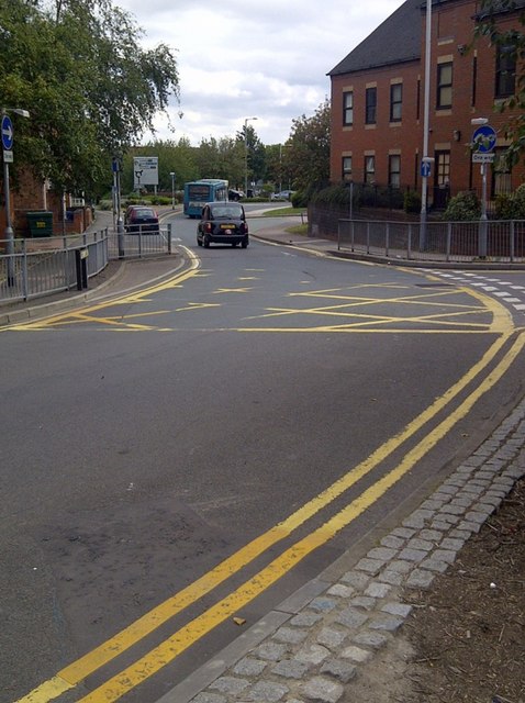
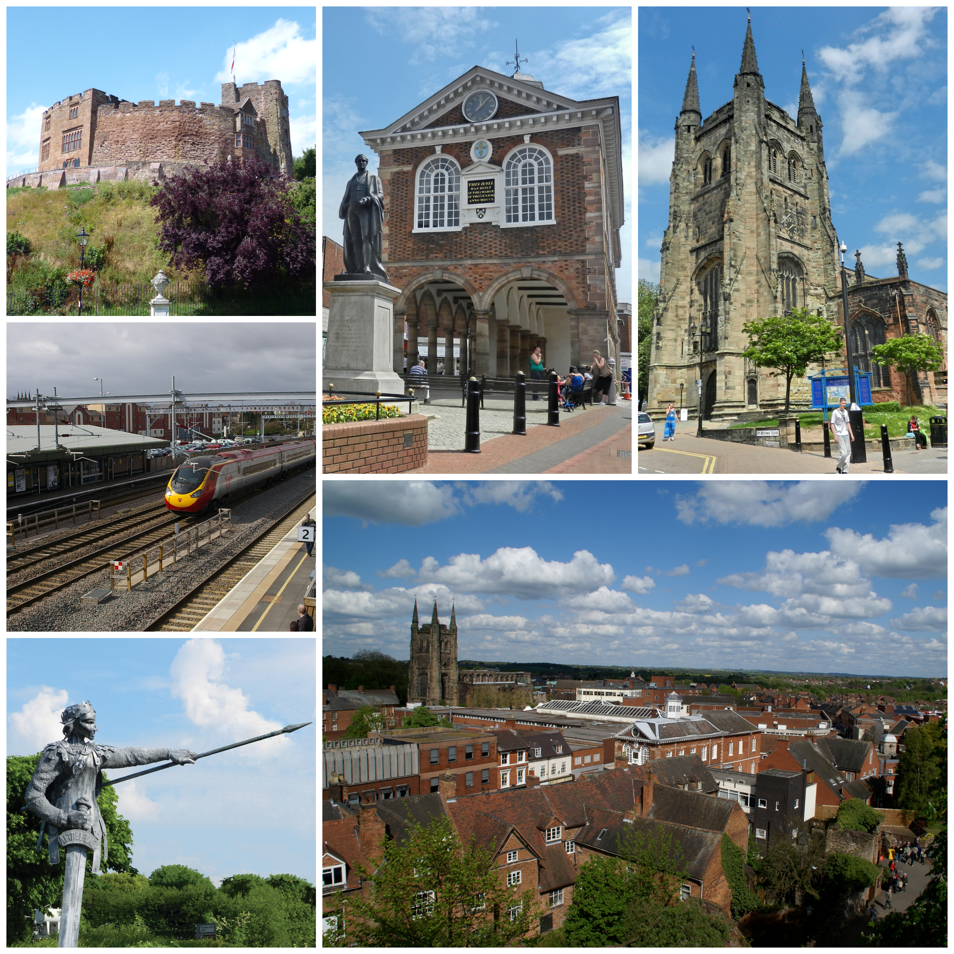
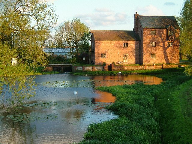
Tamworth is a historic town located in the county of Staffordshire, on the border with Warwickshire in England. It lies approximately 14 miles northeast of Birmingham and 103 miles northwest of London. The town sits on the River Tame and is known for its rich heritage and historical landmarks.

Tamworth is home to Tamworth Castle, a beautifully preserved motte and bailey castle dating back to the 11th century. The castle offers visitors a glimpse into the town's past, with its interactive displays and exhibits showcasing its medieval history. Another notable landmark is St Editha's Church, an impressive Grade I listed building with a striking spire that dominates the town's skyline.

The town center boasts a mix of modern shopping facilities and traditional markets, providing a vibrant shopping experience. Tamworth also hosts a variety of cultural events throughout the year, including the Tamworth Music Festival, which celebrates the town's musical heritage and attracts visitors from far and wide.

In addition to its historical and cultural attractions, Tamworth offers a range of recreational activities. The town is surrounded by picturesque countryside, with opportunities for walking, cycling, and exploring the nearby Staffordshire Moorlands. Tamworth also has a number of parks and green spaces, including the popular Castle Grounds, which provide a tranquil setting for relaxation and outdoor activities.

With excellent transport links, Tamworth is easily accessible by road and rail. The town has its own train station, providing convenient connections to major cities such as Birmingham and London. Overall, Tamworth offers a mix of history, culture, and natural beauty, making it an appealing destination for both residents and visitors alike.

If you have any feedback on the listing, please let us know in the comments section below.
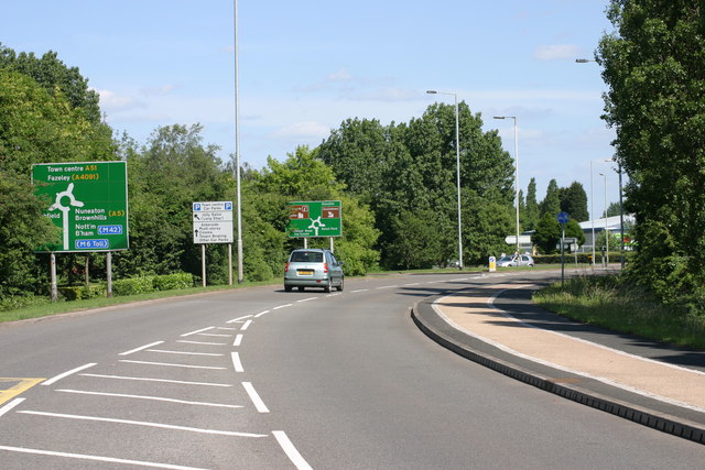
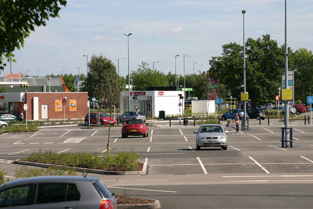
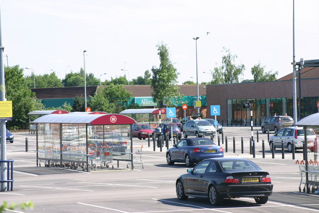
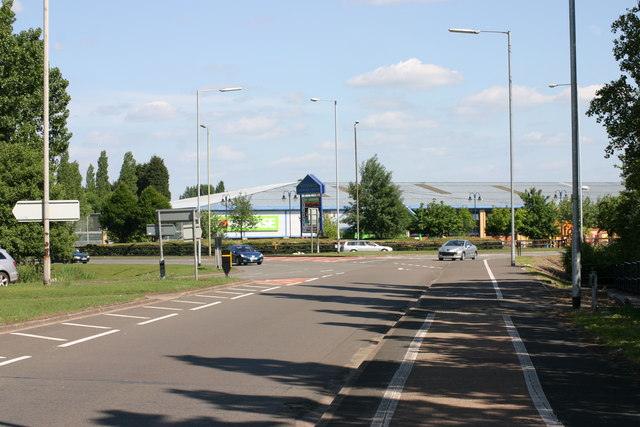
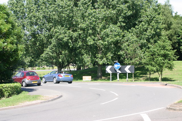
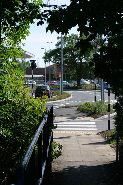
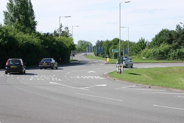
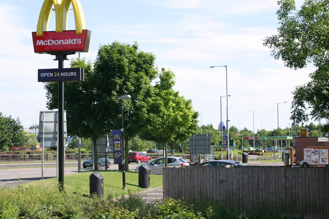
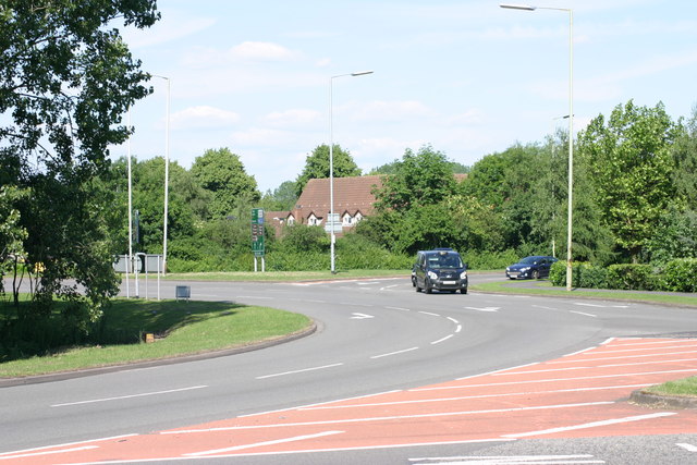
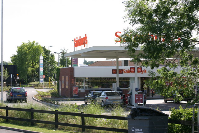
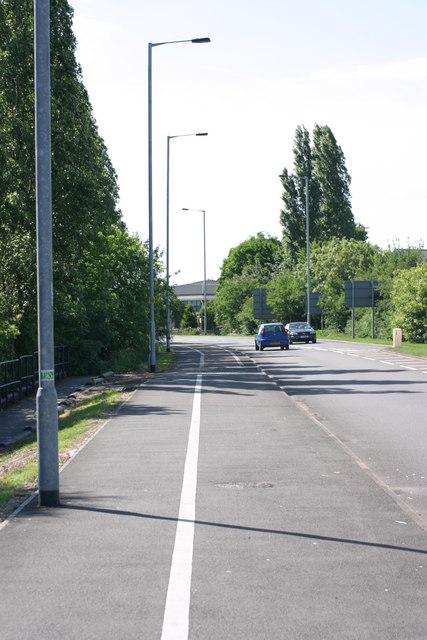
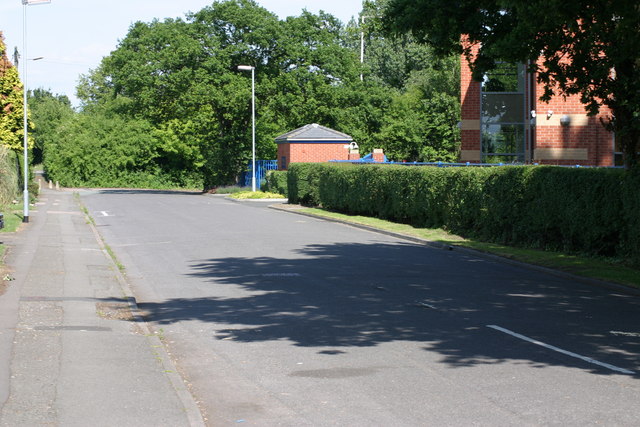
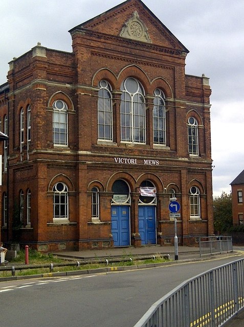
Tamworth Images

Images are sourced within 2km of 52.633434/-1.6924478 or Grid Reference SK2004. Thanks to Geograph Open Source API. All images are credited.

Bonehill Road  (7) This photograph <a href="https://www.geograph.org.uk/photo/2434787">SK1903 : Bonehill Road  (6)</a> shows another view of Bonehill Road.
Bonehill Road (7)
This photograph SK1903 : Bonehill Road (6) shows another view of Bonehill Road.
The Jolly Sailor, Retail park  (4) The above photograph shows a view the car park which part of the Jolly Sailor, retail park. This photograph <a href="https://www.geograph.org.uk/photo/2437906">SK1903 : The Jolly Sailor, Retail Park  (2)</a> shows another view of this retail park.
The Jolly Sailor, Retail park (4)
The above photograph shows a view the car park which part of the Jolly Sailor, retail park. This photograph SK1903 : The Jolly Sailor, Retail Park (2) shows another view of this retail park.
The Jolly Sailor, Retail park  (10) This photograph <a href="https://www.geograph.org.uk/photo/2439862">SK1903 : The Jolly Sailor, Retail park  (3)</a> shows another view of this Retail park.
The Jolly Sailor, Retail park (10)
This photograph SK1903 : The Jolly Sailor, Retail park (3) shows another view of this Retail park.
Bonehill Road  (10) The above photograph shows a view of Bonehill Road, exiting a traffic island. The traffic island which is just about visible, located to the left of this photograph, joins on to this stretch of Bonehill Road. This photograph <a href="https://www.geograph.org.uk/photo/2437749">SK2003 : Bonehill Road  (7)</a> shows a view of Bonehill Road approaching the traffic Island mentioned above. Ventura retail park can be seen in the background.
Bonehill Road (10)
The above photograph shows a view of Bonehill Road, exiting a traffic island. The traffic island which is just about visible, located to the left of this photograph, joins on to this stretch of Bonehill Road. This photograph SK2003 : Bonehill Road (7) shows a view of Bonehill Road approaching the traffic Island mentioned above. Ventura retail park can be seen in the background.
Bonehill Road  (11) The above photograph shows a section of Bonehill Road, joining a traffic island along the (A453) This photograph <a href="https://www.geograph.org.uk/photo/2443771">SK1903 : Bonehill Road  (9)</a> shows another view Bonehill Road.
Bonehill Road (11)
The above photograph shows a section of Bonehill Road, joining a traffic island along the (A453) This photograph SK1903 : Bonehill Road (9) shows another view Bonehill Road.
Traffic Island, next to Bonehill Road  (1) This photograph <a href="https://www.geograph.org.uk/photo/2443755">SK1903 : Bonehill Road  (8)</a> shows another view of a section of Bonehill Road.
Traffic Island, next to Bonehill Road (1)
This photograph SK1903 : Bonehill Road (8) shows another view of a section of Bonehill Road.
Traffic Island, next to Bonehill Road  (2) The above photograph shows a view of a section of the Traffic island next to Bonehill Road. This photograph <a href="https://www.geograph.org.uk/photo/2428095">SK1903 : Bonehill Road  (5)</a> shows a view of Bonehill Road.
Traffic Island, next to Bonehill Road (2)
The above photograph shows a view of a section of the Traffic island next to Bonehill Road. This photograph SK1903 : Bonehill Road (5) shows a view of Bonehill Road.
Traffic island, next to Bitterscote Drive  (1) This photograph <a href="https://www.geograph.org.uk/photo/2439871">SK2003 : The Jolly Sailor, Retail park  (4)</a> shows a view of the Jolly Sailor Retail Park, which is next to this section of traffic island.
Traffic island, next to Bitterscote Drive (1)
This photograph SK2003 : The Jolly Sailor, Retail park (4) shows a view of the Jolly Sailor Retail Park, which is next to this section of traffic island.
Path leading to, The Jolly Sailor Retail Park This photograph <a href="https://www.geograph.org.uk/photo/2440520">SK1903 : The Jolly Sailor, Retail Park  (7)</a> shows a view of that Retail park.
Path leading to, The Jolly Sailor Retail Park
This photograph SK1903 : The Jolly Sailor, Retail Park (7) shows a view of that Retail park.
Traffic Island, Next to Bonehill Road  (3) This photograph <a href="https://www.geograph.org.uk/photo/2444547">SK2003 : Traffic Island, next to Bonehill Road  (1)</a> shows another view of this Traffic Island.
Traffic Island, Next to Bonehill Road (3)
This photograph SK2003 : Traffic Island, next to Bonehill Road (1) shows another view of this Traffic Island.
Mc Donalds  (6) This photograph <a href="https://www.geograph.org.uk/photo/1498020">SK2003 : Mc Donalds  (2)</a> shows another view of this Fast Food Outlet.
Mc Donalds (6)
This photograph SK2003 : Mc Donalds (2) shows another view of this Fast Food Outlet.
Traffic Island, next to Bitterscote Drive  (2) This photograph <a href="https://www.geograph.org.uk/photo/2444689">SK2003 : Traffic Island, Next to Bonehill Road  (3)</a> shows another view this Traffic island, but the photograph shows the section next to Bonehill Road.
Traffic Island, next to Bitterscote Drive (2)
This photograph SK2003 : Traffic Island, Next to Bonehill Road (3) shows another view this Traffic island, but the photograph shows the section next to Bonehill Road.
The Jolly Sailor, retail park  (12) The above photograph shows a Sainsbury's petrol station, located on the Jolly Sailor retail park. This photograph <a href="https://www.geograph.org.uk/photo/2439884">SK1903 : The Jolly Sailor, Retail park  (6)</a> shows another view of this retail park.
The Jolly Sailor, retail park (12)
The above photograph shows a Sainsbury's petrol station, located on the Jolly Sailor retail park. This photograph SK1903 : The Jolly Sailor, Retail park (6) shows another view of this retail park.
Path located along Bonehill Road  (A453)  (3) This photograph <a href="https://www.geograph.org.uk/photo/2437850">SK1903 : Path located along Bonehill Road  (A453)  (2)</a> shows another section of path located along the Bonehill road.
Path located along Bonehill Road (A453) (3)
This photograph SK1903 : Path located along Bonehill Road (A453) (2) shows another section of path located along the Bonehill road.
Dunstall Lane  (3) This photograph <a href="https://www.geograph.org.uk/photo/2431353">SK1903 : Dunstall Lane  (2)</a> shows another view of the above lane.
Dunstall Lane (3)
This photograph SK1903 : Dunstall Lane (2) shows another view of the above lane.
Victoria Mews An old building converted into flats. Victoria Road in Tamworth B79 comprises 109 properties. Over half of them are residential (i.e. there are a total of 67 homes in Victoria Road).
Victoria Mews
An old building converted into flats. Victoria Road in Tamworth B79 comprises 109 properties. Over half of them are residential (i.e. there are a total of 67 homes in Victoria Road).
One Way System Victoria Road is off to the right hand side of the one way system.
One Way System
Victoria Road is off to the right hand side of the one way system.
War Memorial War Memorial - outside St Editha's Church
War Memorial
War Memorial - outside St Editha's Church
Show me another place!

Tamworth is located at Grid Ref: SK2004 (Lat: 52.633434, Lng: -1.6924478)

Administrative County: Staffordshire

District: Tamworth

Police Authority: Staffordshire

What 3 Words

///quench.depend.pushy. Near Tamworth, Staffordshire

Related Wikis

Church of St Editha, Tamworth

The Church of St Editha is a Church of England parish church and Grade I listed building in Tamworth, Staffordshire, England. == History == The church...

Tamworth, Staffordshire

Tamworth (, ) is a market town and borough in Staffordshire, England, 14 miles (23 km) north-east of Birmingham. The town borders North Warwickshire to...
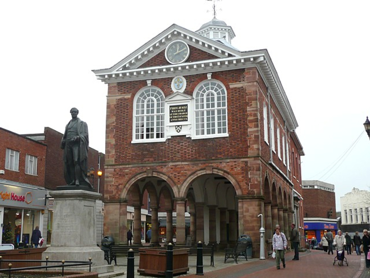
Tamworth Town Hall

Tamworth Town Hall is a municipal building in Market Street, Tamworth, Staffordshire, England. The town hall, which is the meeting place of Tamworth Borough...

River Anker

The River Anker is a river in England that flows through the centre of Nuneaton. It is a major tributary of the River Tame, which it joins in Tamworth...
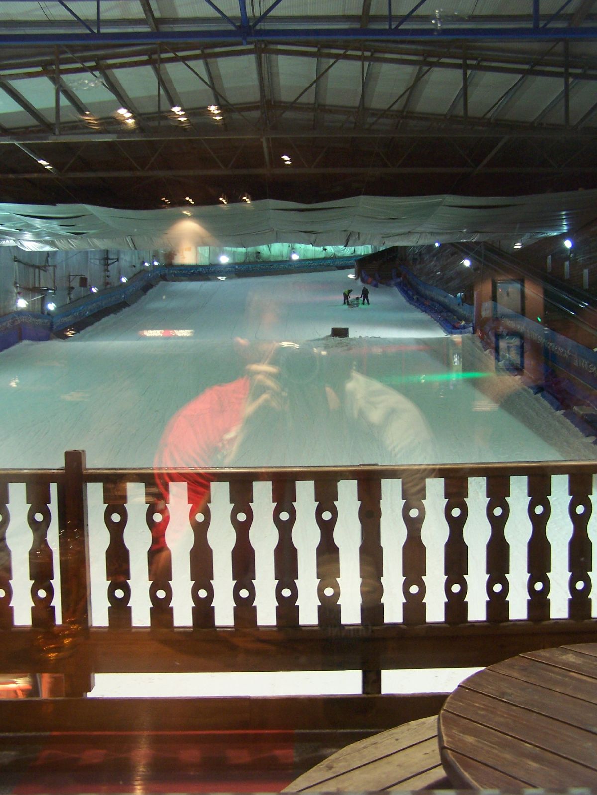
Snowdome

The Snowdome is an indoor ski slope just off the A5 road in Tamworth, Staffordshire, England. It opened in May 1994 and was the first full-sized recreational...
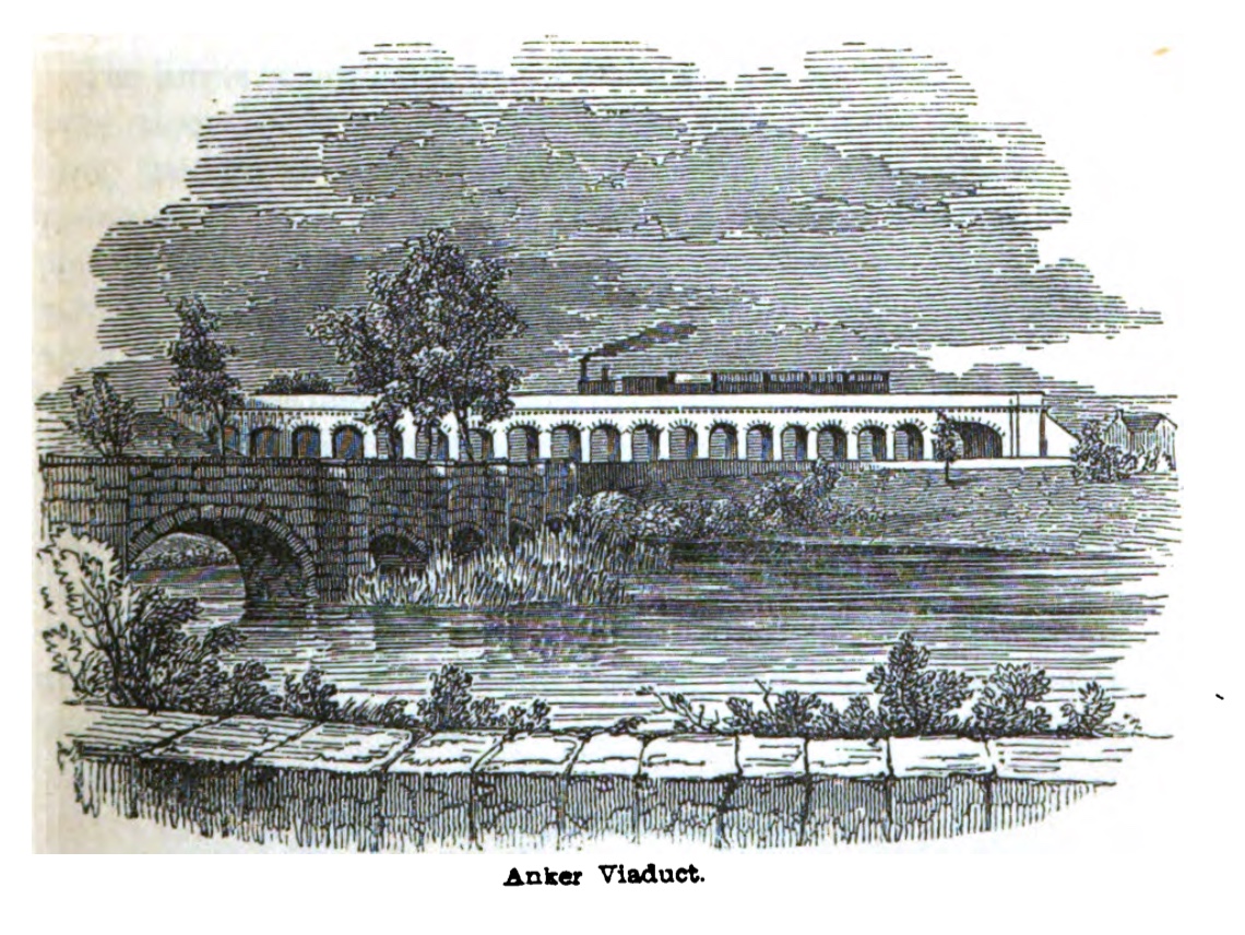
Bolehall Viaduct

Bolehall Viaduct (formerly the Anker Viaduct), known locally as The 19 Arches is a 807 feet (246 m) viaduct on the former Birmingham and Derby Junction...

Tamworth railway station

Tamworth is a split-level railway station which serves the market town of Tamworth in Staffordshire, England. It is an interchange between two main lines...

Tamworth F.C.

Tamworth Football Club is an English association football club based in Tamworth, Staffordshire. The club participates in the National League North. The...

Nearby Amenities

Located within 500m of 52.633434,-1.6924478
Tamworth
Name En: Tamworth
Name Ru: Тамуэрт
Place: town
Wikidata: Q704864
Wikipedia: en:Tamworth, Staffordshire
Wikipedia Ru: Тамуэрт_(Великобритания)
Lat/Long: 52.6345819/-1.6948438
Crossing
Crossing: traffic_signals
Kerb: lowered
Tactile Paving: yes
Lat/Long: 52.6331308/-1.6907014
Crossing
Crossing: traffic_signals
Lat/Long: 52.631659/-1.6886229
Traffic Signals
Lat/Long: 52.6339093/-1.6975246
Crossing
Lat/Long: 52.6321844/-1.6916905
Traffic Signals
Lat/Long: 52.6332/-1.6880674
Parking Entrance
Lat/Long: 52.6324592/-1.6918635
Barrier: bollard
Bollard: fixed
Foot: yes
Lat/Long: 52.6331357/-1.6938555
Barrier: bollard
Bicycle: no
Bollard: rising
Foot: yes
Horse: no
Motor Vehicle: no
Source: photograph
Lat/Long: 52.633893/-1.6928576
Parking Entrance
Lat/Long: 52.6319136/-1.6926201
Crossing
Crossing: traffic_signals
Lat/Long: 52.6363766/-1.695221
Note: 20 mph speed limit sign westbound
Lat/Long: 52.6364277/-1.6953487
Crossing
Crossing: traffic_signals
Lat/Long: 52.6363066/-1.694389
Crossing
Crossing: traffic_signals
Lat/Long: 52.6361846/-1.6948014
Crossing
Crossing: traffic_signals
Lat/Long: 52.636577/-1.6945874
Traffic Signals
Source: survey
Lat/Long: 52.6361456/-1.6949612
Note: 30 mph speed limit sign eastbound
Lat/Long: 52.6364596/-1.6953142
Crossing
Button Operated: yes
Crossing: traffic_signals
Crossing Island: no
Tactile Paving: yes
Traffic Signals Vibration: yes
Lat/Long: 52.6368637/-1.6882954
Bus Stop
Bus Interchange, Stand R
Bus: yes
Local Ref: R
Naptan AtcoCode: 3800C902401
Naptan Bearing: N
Naptan CommonName: Bus Interchange
Naptan Indicator: Stand R
Naptan Landmark: Bus Interchange
Naptan PlusbusZoneRef: TAMWORTH
Naptan Street: Corporation St
Naptan Verified: no
Public Transport: platform
Route Ref: 2
Source: naptan_import
Lat/Long: 52.634083/-1.6958635
Bus Stop
Bus Interchange, Stand Q
Bus: yes
Local Ref: Q
Naptan AtcoCode: 3800C902402
Naptan Bearing: N
Naptan CommonName: Bus Interchange
Naptan Indicator: Stand Q
Naptan Landmark: Bus Interchange
Naptan PlusbusZoneRef: TAMWORTH
Naptan Street: Corporation Street
Naptan Verified: no
Public Transport: platform
Route Ref: 3;3E;16;16A
Shelter: yes
Source: naptan_import
Lat/Long: 52.6342481/-1.6958661
Bus Stop
Bus Interchange, Stand P
Bus: yes
Local Ref: P
Naptan AtcoCode: 3800C902403
Naptan Bearing: N
Naptan CommonName: Bus Interchange
Naptan Indicator: Stand P
Naptan Landmark: Bus Interchange
Naptan PlusbusZoneRef: TAMWORTH
Naptan Street: Corporation Street
Naptan Verified: no
Public Transport: platform
Route Ref: 48;110;118;119;766;767;785;786
Shelter: yes
Source: NaPTAN data
Lat/Long: 52.6346242/-1.6958415
Bus Stop
Bus Interchange, Stand N
Bus: yes
Local Ref: N
Naptan AtcoCode: 3800C902405
Naptan Bearing: N
Naptan CommonName: Bus Interchange
Naptan Indicator: Stand N
Naptan Landmark: Bus Interchange
Naptan PlusbusZoneRef: TAMWORTH
Naptan Street: Corporation Street
Naptan Verified: no
Public Transport: platform
Route Ref: 765
Shelter: yes
Source: NaPTAN data
Lat/Long: 52.6351272/-1.6961639
Bus Interchange
Naptan AtcoCode: 3800C904400
Naptan Bearing: SW
Naptan BusStopType: CUS
Naptan CommonName: Bus Interchange
Naptan Indicator: Adj
Naptan Landmark: Bus Interchange
Naptan PlusbusZoneRef: TAMWORTH
Naptan Street: Victoria Rd
Naptan Verified: no
Source: naptan_import
Lat/Long: 52.6334837/-1.6922454
Bus Stop
Bus Interchange
Bus: yes
Local Ref: B1
Naptan AtcoCode: 3800C904401
Naptan Bearing: SW
Naptan CommonName: Bus Interchange
Naptan Indicator: Stand B1
Naptan Landmark: Bus Interchange
Naptan PlusbusZoneRef: TAMWORTH
Naptan Street: Victoria Rd
Naptan Verified: no
Public Transport: platform
Source: naptan_import
Lat/Long: 52.6336661/-1.691935
Bus Stop
Bus Interchange
Bus: yes
Local Ref: B2
Naptan AtcoCode: 3800C904402
Naptan Bearing: SW
Naptan CommonName: Bus Interchange
Naptan Indicator: Stand B2
Naptan Landmark: Bus Interchange
Naptan PlusbusZoneRef: TAMWORTH
Naptan Street: Victoria Road
Naptan Verified: no
Public Transport: platform
Source: naptan_import
Lat/Long: 52.6337772/-1.6916743
Bus Stop
Bus Interchange
Bus: yes
Local Ref: B3
Naptan AtcoCode: 3800C904403
Naptan Bearing: SW
Naptan CommonName: Bus Interchange
Naptan Indicator: Stand B3
Naptan Landmark: Bus Interchange
Naptan PlusbusZoneRef: TAMWORTH
Naptan Street: Victoria Rd
Naptan Verified: no
Public Transport: platform
Source: naptan_import
Lat/Long: 52.6338927/-1.6914151
Bus Stop
Tamworth Railway Station
Bus: yes
Naptan AtcoCode: 3800C909001
Naptan Bearing: SE
Naptan CommonName: Tamworth Railway Station
Naptan Indicator: Adj
Naptan PlusbusZoneRef: TAMWORTH
Naptan Street: Offa Drive
Naptan Verified: no
Public Transport: platform
Source: naptan_import
Lat/Long: 52.6371525/-1.689146
Bus Stop
Upper Gungate
Bus: yes
Naptan AtcoCode: 3800C909501
Naptan Bearing: E
Naptan CommonName: Upper Gungate
Naptan Indicator: Adj
Naptan PlusbusZoneRef: TAMWORTH
Naptan Street: Albert Street
Naptan Verified: no
Public Transport: platform
Source: naptan_import
Lat/Long: 52.636463/-1.6936283
Bus Stop
Arriva Bus Depot
Bus: yes
Naptan AtcoCode: 3800C909801
Naptan Bearing: NE
Naptan CommonName: Arriva Bus Depot
Naptan Indicator: Opp
Naptan PlusbusZoneRef: TAMWORTH
Naptan Street: Aldergate
Naptan Verified: no
Public Transport: platform
Source: naptan_import
Lat/Long: 52.635516/-1.6959253
Bus Stop
Arriva Bus Depot
Bus: yes
Naptan AtcoCode: 3800C909802
Naptan Bearing: SW
Naptan CommonName: Arriva Bus Depot
Naptan Indicator: Adj
Naptan PlusbusZoneRef: TAMWORTH
Naptan Street: Aldergate
Naptan Verified: no
Public Transport: platform
Source: naptan_import
Lat/Long: 52.6354529/-1.6958814
Bus Stop
Boot Inn
Bus: yes
Naptan AtcoCode: 3800C922501
Naptan Bearing: W
Naptan CommonName: Boot Inn
Naptan Indicator: Adj
Naptan Landmark: Boot Inn
Naptan PlusbusZoneRef: TAMWORTH
Naptan Street: Lichfield Street
Naptan Verified: no
Public Transport: platform
Source: naptan_import
Lat/Long: 52.6338704/-1.6992761
Bus Stop
Three Tuns PH
Bus: yes
Naptan AtcoCode: 3800C922502
Naptan Bearing: E
Naptan CommonName: Three Tuns PH
Naptan Indicator: Opp
Naptan Landmark: Three Tuns PH
Naptan PlusbusZoneRef: TAMWORTH
Naptan Street: Lichfield Street
Naptan Verified: no
Public Transport: platform
Source: naptan_import
Lat/Long: 52.6339705/-1.6986713
Bus Stop
Hospital Street
Bus: yes
Naptan AtcoCode: 3800C922801
Naptan Bearing: N
Naptan CommonName: Hospital Street
Naptan Indicator: Adj
Naptan Landmark: Hospital Street
Naptan PlusbusZoneRef: TAMWORTH
Naptan Street: Upper Gungate
Naptan Verified: no
Public Transport: platform
Source: naptan_import
Lat/Long: 52.6368795/-1.6947928
Bus Stop
Aldi Store
Bus: yes
Naptan AtcoCode: 3800C925501
Naptan Bearing: N
Naptan CommonName: Aldi Store
Naptan Indicator: Adj
Naptan Landmark: Aldi Store
Naptan PlusbusZoneRef: TAMWORTH
Naptan Street: Saxon Dr
Naptan Verified: no
Public Transport: platform
Source: naptan_import
Lat/Long: 52.6339313/-1.6880606
Bus Stop
Aldi Store
Bus: yes
Naptan AtcoCode: 3800C925502
Naptan Bearing: S
Naptan CommonName: Aldi Store
Naptan Indicator: Adj
Naptan Landmark: Aldi Store
Naptan PlusbusZoneRef: TAMWORTH
Naptan Street: Saxon Dr
Naptan Verified: no
Public Transport: platform
Source: naptan_import
Lat/Long: 52.634029/-1.6876166
Bus Stop
Job Centre
Bus: yes
Naptan AtcoCode: 3800C925701
Naptan Bearing: S
Naptan CommonName: Job Centre
Naptan Indicator: Adj
Naptan Landmark: Job Centre
Naptan PlusbusZoneRef: TAMWORTH
Naptan Street: Mill Ln
Naptan Verified: no
Public Transport: platform
Source: naptan_import
Lat/Long: 52.6330841/-1.6906672
Bus Stop
Penny Court
Bus: yes
Naptan AtcoCode: 3800C930001
Naptan Bearing: W
Naptan CommonName: Penny Court
Naptan Indicator: Adj
Naptan Landmark: Penny Court
Naptan PlusbusZoneRef: TAMWORTH
Naptan Street: Offa Dr
Naptan Verified: no
Public Transport: platform
Source: naptan_import
Lat/Long: 52.6374018/-1.6916416
Tamworth Information Centre
Addr Postcode: B79 7DN
Addr Street: Corporation Street
Information: office
Level: 0
Note: Inside Tamworth Assembly Rooms building
Opening Hours: Mo-Sa 09:00-17:00, Su closed
Tourism: information
Website: https://www.tamworth.gov.uk/tamworth-information-centre
Lat/Long: 52.6344056/-1.6957316
Bicycle Parking
Capacity: 4
Lat/Long: 52.6331112/-1.695817
Crossing
Crossing: traffic_signals
Lat/Long: 52.6375177/-1.6926716
Saturn
Group: Planet Walk
Tourism: artwork
Lat/Long: 52.6313495/-1.6969169
The Gym
Addr Housename: Namco Station
Addr Postcode: B79 7ND
Addr Street: Castle Grounds
Brand: The Gym
Brand Wikidata: Q48815022
Brand Wikipedia: en:The Gym Group
Leisure: fitness_centre
Opening Hours: 24/7
Source: survey
Website: https://www.thegymgroup.com/find-a-gym/tamworth-gyms/tamworth/
Lat/Long: 52.6295012/-1.6953288
Jupiter
Group: Planet Walk
Tourism: artwork
Lat/Long: 52.6317012/-1.6951914
Restaurant
Clyde's Bar & Grill
Addr City: Tamworth
Addr Housename: Namco Funscape
Addr Postcode: B79 7ND
Addr Street: Riverdrive
Opening Hours: Mo-Th 12:00-21:00, Fr-Sa 12:00-22:00, Su 12:00-21:00
Operator: Wimpy
Phone: +44 1827 67935
Source: survey
Website: https://www.clydesbarandgrill.co.uk/
Lat/Long: 52.6294253/-1.6953619
Post Box
Brand: Royal Mail
Brand Wikidata: Q638098
Brand Wikipedia: en:Royal Mail
Operator: Royal Mail
Operator Wikidata: Q638098
Post Box Type: pillar
Ref: B79 1208
Royal Cypher: EIIR
Royal Cypher Wikidata: Q33102113
Source: survey
Lat/Long: 52.6364285/-1.6938659
Barrier: bollard
Bollard: rising
Foot: yes
Lat/Long: 52.6351973/-1.693659
Taxi
Tamworth Taxi Rank
Source: survey
Lat/Long: 52.6346216/-1.6961675
Post Box
Brand: Royal Mail
Brand Wikidata: Q638098
Brand Wikipedia: en:Royal Mail
Operator: Royal Mail
Operator Wikidata: Q638098
Post Box Type: pillar
Ref: B79 1388
Royal Cypher: EIIR
Royal Cypher Wikidata: Q33102113
Source: survey
Lat/Long: 52.6329727/-1.698986
Telephone
Booth: KX100
Covered: booth
Operator: BT
Source: survey
Lat/Long: 52.6338819/-1.6985118
Note: 20 mph speed limit sign NW direction, 30 mph speed limit sign SE direction
Lat/Long: 52.6348912/-1.6973154
Source: survey
Traffic Calming: cushion
Lat/Long: 52.6352746/-1.6983637
Addr Housenumber: 17
Addr Street: Offa Street
Source: survey
Lat/Long: 52.6356561/-1.6976122
Citizens Advice Bureau
Addr Housename: Philip Dix Centre
Addr Postcode: B79 7DN
Addr Street: Corporation Street
Level: 0
Note: Inside Philip Dix Centre building. Walk in service Tuesday & Thursday 10:00-14:00. Telephone advice Monday, Tuesday & Thursday 10:00-14:00
Office: ngo
Opening Hours: Mo 09:00-17:00, Tu-We 09:00-20:00, Th 09:00-17:00, Fr 09:00-16:30, Sa-Su closed
Phone: +44 1827 305950
Source: survey
Website: https://www.brancab.org.uk/tamworth_citizens_advice_bureau.html
Lat/Long: 52.6349285/-1.6962399
Barrier: bollard
Bollard: rising
Foot: yes
Lat/Long: 52.6332177/-1.6971575
Samaritans
Addr Housename: Philip Dix Centre
Addr Postcode: B79 7DN
Addr Street: Corporation Street
Level: 1
Note: Inside Philip Dix Centre building
Office: ngo
Opening Hours: Mo 15:30-22:00, Tu 19:00-22:00, We 10:00-22:00, Th 19:00-22:00, Fr 10:00-22:00, Sa 10:00-13:00, Su 10:00-19:00
Phone: +44 1827 215888, +44 116 123
Source: survey
Website: https://www.samaritans.org/branches/samaritans-tamworth
Lat/Long: 52.6348018/-1.6963106
Barrier: bollard
Foot: yes
Lat/Long: 52.6341327/-1.6982091
Bus Stop
Bus Interchange, Stand O
Bus: yes
Local Ref: O
Naptan AtcoCode: 3800C902404
Naptan Bearing: N
Naptan CommonName: Bus Interchange
Naptan Indicator: Stand O
Naptan Landmark: Bus Interchange
Naptan PlusbusZoneRef: TAMWORTH
Naptan Street: Corporation Street
Naptan Verified: no
Public Transport: platform
Route Ref: 65;110;785;786
Shelter: yes
Source: NaPTAN data
Lat/Long: 52.6349548/-1.6959592
Bench
Backrest: yes
Source: photograph
Lat/Long: 52.6335663/-1.6976042
Man Made: surveillance
Source: photograph
Surveillance: public
Lat/Long: 52.6338638/-1.6973871
Crossing
Crossing: traffic_signals
Crossing Ref: puffin
Source: photograph
Lat/Long: 52.6337122/-1.6974976
Bicycle Parking
Bicycle Parking: stands
Capacity: 5
Covered: no
Source: photograph
Lat/Long: 52.6334657/-1.6976048
Bench
Backrest: yes
Source: photograph
Lat/Long: 52.6338136/-1.6974449
Atm
Lat/Long: 52.6329823/-1.6955834
Pharmacy
Healthcare: pharmacy
Source: survey
Lat/Long: 52.6346205/-1.6975468
Post Box
Brand: Royal Mail
Brand Wikidata: Q638098
Brand Wikipedia: en:Royal Mail
Collection Times: Mo-Fr 18:30; Sa 11:30
Note: Ref unreadable
Operator: Royal Mail
Operator Wikidata: Q638098
Post Box Design: type_k
Post Box Type: pillar
Ref: B78 1216
Royal Cypher: EIIR
Royal Cypher Wikidata: Q33102113
Source: survey
Lat/Long: 52.6330829/-1.6938352
Post Box
Brand: Royal Mail
Brand Wikidata: Q638098
Brand Wikipedia: en:Royal Mail
Collection Times: Mo-Fr 18:30; Sa 12:30
Operator: Royal Mail
Operator Wikidata: Q638098
Post Box Type: pillar
Ref: B79 405
Royal Cypher: EIIR
Royal Cypher Wikidata: Q33102113
Source: survey
Lat/Long: 52.6338842/-1.6940799
Bus Stop
Tamworth, Aldergate
Bus: yes
Public Transport: platform
Route Ref: 110
Shelter: no
Source: survey
Lat/Long: 52.6359134/-1.6952154
Cafe
Costa
Brand: Costa
Brand Wikidata: Q608845
Brand Wikipedia: en:Costa Coffee
Cuisine: coffee_shop
Description: Part of petrol station
Operator: BP
Takeaway: yes
Lat/Long: 52.6366034/-1.6944087
Post Box
Brand: Royal Mail
Brand Wikidata: Q638098
Brand Wikipedia: en:Royal Mail
Collection Times: Mo-Fr 18:45; Sa 12:30
Operator: Royal Mail
Operator Wikidata: Q638098
Post Box Type: pillar
Ref: B79 405
Royal Cypher: EIIR
Royal Cypher Wikidata: Q33102113
Source: survey
Lat/Long: 52.6338685/-1.6941046
Bench
Backrest: yes
Source: photograph
Lat/Long: 52.6328336/-1.6945757
Bicycle Parking
Bicycle Parking: stands
Source: photograph
Lat/Long: 52.6328312/-1.6947321
Barrier: bollard
Foot: yes
Source: photograph
Lat/Long: 52.6331224/-1.6954791
Clock
Display: analog
Source: photograph
Support: wall_mounted
Visibility: street
Lat/Long: 52.6330724/-1.6955399
Waste Basket
Source: photograph
Lat/Long: 52.6330438/-1.6950089
Waste Basket
Check Date: 2022-10-10
Source: photograph
Lat/Long: 52.6328294/-1.694868
Telephone
Booth: KX100
Check Date: 2022-10-10
Covered: booth
Operator: BT
Source: photograph
Lat/Long: 52.6331276/-1.6938732
Waste Basket
Source: photograph
Lat/Long: 52.632961/-1.6941968
Waste Basket
Check Date: 2022-10-10
Source: photograph
Lat/Long: 52.6332998/-1.6926241
Bench
Backrest: no
Check Date: 2022-10-10
Source: photograph
Lat/Long: 52.6333101/-1.6926363
Entrance: yes
Source: photograph
Lat/Long: 52.6330906/-1.6937245
Man Made: surveillance
Source: photograph
Surveillance: public
Lat/Long: 52.633327/-1.692566
Waste Basket
Check Date: 2022-10-10
Source: photograph
Lat/Long: 52.633141/-1.69308
Waste Basket
Check Date: 2022-10-10
Source: photograph
Lat/Long: 52.6332045/-1.6929057
Telephone
Booth: KX100
Check Date: 2022-10-10
Covered: booth
Operator: British Telecom
Payment Coins: yes
Lat/Long: 52.6331039/-1.6938607
Barrier: entrance
Foot: permissive
Lat/Long: 52.6331406/-1.6929986
Waste Basket
Check Date: 2022-10-10
Source: photograph
Lat/Long: 52.633025/-1.6935495
Waste Basket
Source: photograph
Lat/Long: 52.6329718/-1.693949
Entrance: yes
Source: photograph
Lat/Long: 52.6336049/-1.6927513
Entrance: main
Lat/Long: 52.6334275/-1.6922928
Entrance: yes
Note: Entrance to first floor (John Joseph Hairdressing)
Source: photograph
Lat/Long: 52.6336422/-1.6927826
Entrance: main
Source: survey
Lat/Long: 52.6333676/-1.6927573
Man Made: surveillance
Note: Attached to Home Bargains
Source: photograph
Surveillance: outdoor
Lat/Long: 52.6330574/-1.6938395
Check Date: 2022-10-10
Man Made: surveillance
Source: photograph
Surveillance: public
Surveillance Type: camera
Lat/Long: 52.6341368/-1.6930361
Entrance: yes
Source: photograph
Lat/Long: 52.6332671/-1.6929669
Barrier: bollard
Bicycle: no
Bollard: rising
Foot: yes
Horse: no
Motor Vehicle: no
Lat/Long: 52.6333403/-1.692614
Entrance: main
Source: survey
Lat/Long: 52.6333096/-1.6928775
Clock
Check Date: 2022-10-10
Display: analog
Faces: 4
Source: photograph
Support: pole
Visibility: street
Lat/Long: 52.6345544/-1.6931427
Bench
Backrest: yes
Note: Bench circles round tree
Source: photograph
Lat/Long: 52.6339539/-1.6944648
Bench
Backrest: yes
Note: Bench circles round tree
Source: photograph
Lat/Long: 52.6339584/-1.6944162
Waste Basket
Source: photograph
Lat/Long: 52.6336422/-1.694885
Clock
Display: analog
Source: photograph
Support: wall_mounted
Lat/Long: 52.6340787/-1.694621
Waste Basket
Source: photograph
Lat/Long: 52.6339278/-1.6943078
Waste Basket
Source: photograph
Lat/Long: 52.6333278/-1.6949232
Bench
Backrest: yes
Source: photograph
Lat/Long: 52.633674/-1.6948949
Bench
Backrest: yes
Note: Benches circling tree
Source: photograph
Lat/Long: 52.6338178/-1.6947487
Colin Grazier Memorial
Artist Wikidata: Q7961706
Artist Name: Walenty Pytel
Artwork Type: sculpture
Historic: memorial
Source: photograph
Subject Wikidata: Q5145155
Tourism: artwork
Wikidata: Q114596024
Lat/Long: 52.633837/-1.6944486
Waste Basket
Source: photograph
Lat/Long: 52.6339447/-1.6946307
Entrance: yes
Source: photograph
Lat/Long: 52.6338519/-1.6957377
Bench
Backrest: yes
Source: photograph
Lat/Long: 52.633744/-1.6949258
Waste Basket
Source: photograph
Lat/Long: 52.6338397/-1.6957916
Bench
Backrest: yes
Source: photograph
Lat/Long: 52.6338238/-1.6949539
Entrance: yes
Source: photograph
Lat/Long: 52.6338365/-1.6958048
Entrance: yes
Source: photograph
Lat/Long: 52.6340989/-1.6957105
Milestone
Historic: yes
Note: Sutton 8, Birm. 15, Measham 9, Ashby 13, Breedon 18 1/4, Cas. Don. 22, Sawley 25 1/2, Nott. 35
Source: photograph;survey
Lat/Long: 52.6370472/-1.6947358
Man Made: surveillance
Source: photograph
Surveillance: public
Lat/Long: 52.6338549/-1.6966309
Pharmacy
Well Pharmacy
Addr City: Tamworth
Addr Housenumber: 1-5
Addr Postcode: B79 7DH
Addr Street: Church Street
Brand: Well Pharmacy
Brand Wikidata: Q7726524
Dispensing: yes
Healthcare: pharmacy
Source: photograph
Website: https://finder.well.co.uk/store/tamworth-church-street
Lat/Long: 52.633977/-1.6972405
Pluto
Group: Planet Walk
Tourism: artwork
Lat/Long: 52.6314446/-1.6936212
Travelodge Tamworth Central
Addr Postcode: B79 7PB
Addr Street: Bolebridge Street
Brand: Travelodge
Brand Wikidata: Q9361374
Brand Wikipedia: en:Travelodge UK
Contact Website: https://www.travelodge.co.uk/hotels/551/Tamworth-Central-hotel
Internet Access: wlan
Internet Access Fee: customers
Internet Access Ssid: Travelodge WiFi
Tourism: hotel
Lat/Long: 52.6318599/-1.6880539
Lidl
Addr Country: GB
Addr Postcode: B79 7AG
Addr Street: Bolebridge Street
Brand: Lidl
Brand Wikidata: Q151954
Brand Wikipedia: en:Lidl
Fhrs Id: 466469
Shop: supermarket
Website: https://www.lidl.co.uk/s/en-GB/store-finder/tamworth/bolebridge-street/
Lat/Long: 52.6321529/-1.6886806
Crossing
Crossing: uncontrolled
Lat/Long: 52.6316545/-1.6880834
Entrance: yes
Lat/Long: 52.6357292/-1.6981485
Crossing
Crossing: traffic_signals
Lat/Long: 52.631556/-1.6887055
Traffic Signals
Source: bing
Lat/Long: 52.6377743/-1.694333
Crossing
Crossing: uncontrolled
Lat/Long: 52.6370315/-1.6933511
Traffic Signals
Source: Bing
Lat/Long: 52.6375749/-1.6942648
Traffic Signals
Crossing: traffic_signals
Source: Bing
Lat/Long: 52.6374914/-1.6942976
Traffic Signals
Source: Bing
Lat/Long: 52.6375145/-1.6945487
Neptune
Group: Planet Walk
Tourism: artwork
Lat/Long: 52.6296421/-1.6926932
Venus
Tourism: artwork
Lat/Long: 52.6314726/-1.6951304
Uranus
Group: Planet Walk
Tourism: artwork
Lat/Long: 52.6298647/-1.6960822
Sun
Group: Planet Walk
Tourism: artwork
Lat/Long: 52.6314107/-1.6950607
Earth
Group: Planet Walk
Tourism: artwork
Lat/Long: 52.6313623/-1.6951319
Mercury
Group: Planet Walk
Tourism: artwork
Lat/Long: 52.6314335/-1.694948
Mars
Group: Planet Walk
Tourism: artwork
Lat/Long: 52.6313214/-1.6949301
Crossing
Crossing: uncontrolled
Lat/Long: 52.6322083/-1.6888945
Entrance: yes
Lat/Long: 52.6334853/-1.6909499
Entrance: yes
Lat/Long: 52.6330888/-1.6917437
Entrance: yes
Lat/Long: 52.6331181/-1.6915359
Entrance: yes
Lat/Long: 52.6327026/-1.6938003
Toilets
Fee: no
Toilets Disposal: flush
Unisex: yes
Lat/Long: 52.6323136/-1.6930455
Recycling
Recycling Cans: no
Recycling Clothes: yes
Recycling Glass: no
Recycling Glass Bottles: yes
Recycling Paper: no
Recycling Plastic: no
Recycling Type: container
Lat/Long: 52.6346663/-1.6965543
Bicycle Parking
Capacity: 10
Style: penny_fathing
Lat/Long: 52.633936/-1.6947253
Bicycle Parking
Bicycle Parking: stands
Capacity: 8
Lat/Long: 52.6324565/-1.6950494
Bicycle Parking
Bicycle Parking: stands
Capacity: 6
Covered: no
Lat/Long: 52.6314171/-1.6959606
Bicycle Parking
Bicycle Parking: stands
Capacity: 10
Lat/Long: 52.631549/-1.6958573
Entrance: main
Lat/Long: 52.6318261/-1.6908222
Cafe
Costa
Brand: Costa
Brand Wikidata: Q608845
Brand Wikipedia: en:Costa Coffee
Cuisine: coffee_shop
Takeaway: yes
Lat/Long: 52.6320509/-1.6908702
Bicycle Parking
Lat/Long: 52.6314619/-1.6905408
Dave Owen Cycles
Addr Housename: The Activity Centre
Addr Postcode: B79 7ND
Addr Street: Castle Grounds
Opening Hours: Mo-Sa 09:00-17:00, Su 09:00-16:45
Shop: bicycle
Lat/Long: 52.6300559/-1.695555
Bench
Backrest: yes
Lat/Long: 52.6315858/-1.6942148
Bench
Backrest: yes
Lat/Long: 52.6316388/-1.6947576
Bench
Backrest: yes
Lat/Long: 52.631796/-1.6950546
Bench
Backrest: yes
Lat/Long: 52.6315579/-1.6957367
Bench
Backrest: yes
Check Date: 2022-05-15
Lat/Long: 52.6304882/-1.6970771
Bench
Backrest: yes
Check Date: 2022-05-15
Lat/Long: 52.6312359/-1.6957653
Bench
Backrest: yes
Check Date: 2022-05-15
Lat/Long: 52.6311723/-1.6958223
Bench
Backrest: yes
Check Date: 2022-05-15
Lat/Long: 52.6310349/-1.695716
Bench
Backrest: yes
Lat/Long: 52.6308965/-1.6956251
Recycling
Recycling Cans: no
Recycling Clothes: no
Recycling Glass: no
Recycling Glass Bottles: yes
Recycling Paper: no
Recycling Plastic: no
Recycling Type: container
Lat/Long: 52.6298441/-1.6951384
Covered: no
Leisure: picnic_table
Lat/Long: 52.6313105/-1.6956359
Leisure: picnic_table
Lat/Long: 52.6312853/-1.6955103
Covered: no
Leisure: picnic_table
Lat/Long: 52.6312069/-1.6955067
Covered: no
Leisure: picnic_table
Lat/Long: 52.6313266/-1.695374
Covered: no
Leisure: picnic_table
Lat/Long: 52.6312466/-1.6954067
Bench
Backrest: yes
Check Date: 2023-08-10
Lat/Long: 52.6306084/-1.6961497
Bench
Backrest: yes
Check Date: 2023-08-10
Lat/Long: 52.6305981/-1.6961898
Bench
Backrest: yes
Check Date: 2023-08-10
Lat/Long: 52.6303681/-1.6960141
Bench
Backrest: yes
Check Date: 2023-08-10
Lat/Long: 52.6303606/-1.6960542
Bench
Backrest: yes
Check Date: 2023-08-10
Lat/Long: 52.6304588/-1.6960634
Bench
Backrest: yes
Check Date: 2023-08-10
Lat/Long: 52.6304485/-1.6961035
Bench
Backrest: yes
Check Date: 2023-08-10
Lat/Long: 52.6305326/-1.696105
Bench
Backrest: yes
Check Date: 2023-08-10
Lat/Long: 52.6305233/-1.6961482
Bench
Backrest: yes
Lat/Long: 52.6309971/-1.6891499
Bench
Backrest: yes
Lat/Long: 52.6309694/-1.688887
Bench
Backrest: yes
Lat/Long: 52.6310451/-1.6887328
Bench
Backrest: yes
Lat/Long: 52.6310199/-1.6885102
Bench
Backrest: yes
Lat/Long: 52.6309336/-1.6892626
Bench
Backrest: yes
Lat/Long: 52.6311879/-1.6910283
Bench
Backrest: yes
Lat/Long: 52.6310411/-1.6904245
Bench
Backrest: yes
Lat/Long: 52.6311953/-1.6908107
Bench
Backrest: yes
Lat/Long: 52.6315232/-1.6961279
Bench
Backrest: yes
Lat/Long: 52.6313834/-1.6967118
Bench
Backrest: yes
Lat/Long: 52.6302016/-1.6953941
Bench
Backrest: yes
Check Date: 2023-08-10
Lat/Long: 52.6302735/-1.6959796
Bench
Backrest: yes
Check Date: 2022-05-15
Lat/Long: 52.6305637/-1.6948301
Bench
Backrest: yes
Check Date: 2022-05-15
Lat/Long: 52.6305835/-1.6947476
Bench
Backrest: yes
Check Date: 2023-08-10
Lat/Long: 52.6307638/-1.6953187
Bench
Backrest: yes
Check Date: 2023-08-10
Lat/Long: 52.6307117/-1.6952921
Bench
Backrest: yes
Check Date: 2022-05-15
Lat/Long: 52.6306172/-1.6952426
Bench
Backrest: yes
Check Date: 2022-05-15
Lat/Long: 52.6305576/-1.6951833
Bicycle Parking
Bicycle Parking: stands
Capacity: 12
Covered: no
Lat/Long: 52.6309128/-1.6953735
Bench
Backrest: yes
Lat/Long: 52.6320439/-1.694775
Bench
Backrest: yes
Lat/Long: 52.6318489/-1.6958712
Bench
Backrest: yes
Lat/Long: 52.6318864/-1.6956901
Bench
Backrest: yes
Lat/Long: 52.6319425/-1.6954232
Bench
Backrest: yes
Lat/Long: 52.6319596/-1.6953428
Bench
Backrest: yes
Lat/Long: 52.632019/-1.6950249
Bench
Backrest: yes
Check Date: 2023-02-10
Lat/Long: 52.6322096/-1.6961146
Bench
Backrest: yes
Check Date: 2023-02-10
Lat/Long: 52.632218/-1.6960756
Bench
Backrest: yes
Check Date: 2023-02-10
Lat/Long: 52.6322507/-1.6959138
Bench
Backrest: yes
Check Date: 2023-02-10
Lat/Long: 52.6322595/-1.6958798
Bench
Backrest: yes
Lat/Long: 52.6323112/-1.6956984
Bench
Backrest: yes
Lat/Long: 52.6326262/-1.6956056
Bench
Backrest: yes
Lat/Long: 52.6325624/-1.6955145
Bench
Backrest: yes
Lat/Long: 52.6324916/-1.6954164
Bench
Backrest: yes
Lat/Long: 52.6325979/-1.6952553
Bench
Backrest: yes
Lat/Long: 52.6325738/-1.6952226
Bench
Backrest: yes
Lat/Long: 52.6342694/-1.6948149
Bench
Backrest: yes
Lat/Long: 52.6342708/-1.6947563
Lest We Forget
Historic: memorial
Lat/Long: 52.6342877/-1.6950261
Bicycle Parking
Covered: no
Lat/Long: 52.6348259/-1.6953062
Bench
Backrest: yes
Lat/Long: 52.6345998/-1.6950695
Bicycle Parking
Covered: no
Lat/Long: 52.6345991/-1.6951512
Bench
Backrest: yes
Lat/Long: 52.6346532/-1.69579
Bench
Backrest: yes
Lat/Long: 52.6346102/-1.6957962
Post Box
Post Box Type: pillar
Royal Cypher: EIIR
Royal Cypher Wikidata: Q33102113
Lat/Long: 52.6343371/-1.6960242
Bench
Backrest: yes
Lat/Long: 52.6346758/-1.6940735
Bench
Backrest: yes
Lat/Long: 52.6350264/-1.6951098
Bench
Backrest: yes
Lat/Long: 52.6350101/-1.6950148
Entrance: yes
Lat/Long: 52.6348197/-1.6952356
Bench
Backrest: yes
Lat/Long: 52.6350417/-1.6956433
Bench
Backrest: yes
Lat/Long: 52.6350596/-1.6958171
Bench
Lat/Long: 52.6353655/-1.6957265
Bench
Backrest: yes
Lat/Long: 52.6352435/-1.6959699
Bench
Backrest: yes
Lat/Long: 52.6351439/-1.695983
Bench
Backrest: yes
Lat/Long: 52.635316/-1.6955663
Bench
Backrest: yes
Lat/Long: 52.6352272/-1.6954311
Bench
Backrest: yes
Lat/Long: 52.6351448/-1.6952929
Robert Peel statue
Artwork Type: statue
Tourism: artwork
Tourism 1: artwork
Wikidata: Q26491486
Lat/Long: 52.6330893/-1.695699
Entrance: yes
Lat/Long: 52.6324315/-1.6948426
Crossing
Crossing: traffic_signals
Lat/Long: 52.6320763/-1.6918438
Entrance: main
Lat/Long: 52.631563/-1.6893778
Crossing
Crossing: uncontrolled
Lat/Long: 52.631773/-1.6878621
Crossing
Crossing: uncontrolled
Lat/Long: 52.6316366/-1.6878391
Entrance: main
Lat/Long: 52.6321205/-1.6887619
Entrance: main
Lat/Long: 52.6318398/-1.6879554
Crossing
Crossing: marked
Crossing Ref: zebra
Kerb: lowered
Tactile Paving: yes
Lat/Long: 52.634454/-1.6908773
Man Made: surveillance
Source: survey
Lat/Long: 52.6355982/-1.6919047
Entrance: main
Lat/Long: 52.6356071/-1.6917762
Entrance: yes
Lat/Long: 52.63402/-1.6928412
Entrance: yes
Lat/Long: 52.6341704/-1.6929189
Atm
Lat/Long: 52.6339778/-1.6928087
Waste Basket
Check Date: 2022-10-10
Lat/Long: 52.6339584/-1.6929572
Waste Basket
Lat/Long: 52.6339183/-1.692821
Bench
Backrest: yes
Lat/Long: 52.6338844/-1.6929034
Bench
Backrest: yes
Lat/Long: 52.6339016/-1.6928119
Entrance: yes
Lat/Long: 52.6339099/-1.6927564
Entrance: yes
Lat/Long: 52.6338006/-1.6926669
Entrance: yes
Lat/Long: 52.6336997/-1.6925835
Waste Basket
Lat/Long: 52.6336356/-1.6927103
Waste Basket
Lat/Long: 52.6336649/-1.6926057
Entrance: yes
Lat/Long: 52.6335339/-1.6924126
Entrance: yes
Lat/Long: 52.6336159/-1.6925066
Entrance: yes
Lat/Long: 52.6336402/-1.6925286
Entrance: yes
Lat/Long: 52.6335611/-1.6927163
John Joseph Hairdressers
Addr Housenumber: 2A
Addr Postcode: B79 7HH
Addr Street: Colehill
Phone: +44 1827 69999
Shop: hairdresser
Lat/Long: 52.6336147/-1.6928163
Entrance: yes
Lat/Long: 52.6334189/-1.6926619
Entrance: main
Lat/Long: 52.6338664/-1.6919103
Royal Naval Association Tamworth
Addr Housename: Unitarian Building
Addr Postcode: B79 7HL
Addr Street: Victoria Road
Club: yes
Office: yes
Lat/Long: 52.6338898/-1.6919157
Entrance: main
Lat/Long: 52.6337404/-1.6918862
Entrance: main
Lat/Long: 52.6337433/-1.6918798
Entrance: main
Lat/Long: 52.6337212/-1.691932
Entrance: main
Lat/Long: 52.6336985/-1.6919869
Entrance: main
Lat/Long: 52.6340234/-1.6912562
Entrance: main
Lat/Long: 52.6339949/-1.6913217
Barrier: bollard
Lat/Long: 52.6341271/-1.6910896
Barrier: bollard
Lat/Long: 52.6341034/-1.6911457
Barrier: bollard
Lat/Long: 52.6340747/-1.691211
Bicycle Parking
Bicycle Parking: stands
Capacity: 6
Check Date: 2023-02-10
Covered: no
Lat/Long: 52.634077/-1.6910746
Telephone
Booth: KX100
Covered: booth
Lat/Long: 52.6341034/-1.691027
Entrance: yes
Lat/Long: 52.6336039/-1.6940136
Entrance: yes
Lat/Long: 52.6333054/-1.6938975
Entrance: main
Lat/Long: 52.6336827/-1.6920251
Entrance: main
Lat/Long: 52.6336294/-1.6921538
Waste Basket
Check Date: 2023-02-10
Lat/Long: 52.6322294/-1.6960327
Waste Basket
Check Date: 2023-02-10
Lat/Long: 52.6322668/-1.6958463
Waste Basket
Check Date: 2023-02-10
Lat/Long: 52.632699/-1.6955848
Waste Basket
Lat/Long: 52.6326673/-1.695629
Waste Basket
Lat/Long: 52.6325492/-1.6954909
Bench
Backrest: yes
Check Date: 2023-02-10
Lat/Long: 52.6325126/-1.6958691
Waste Basket
Lat/Long: 52.632034/-1.6947466
Waste Basket
Lat/Long: 52.6322256/-1.6948955
Entrance: main
Lat/Long: 52.6335047/-1.6921302
Entrance: main
Lat/Long: 52.6335462/-1.6920367
Entrance: main
Lat/Long: 52.6335992/-1.6919158
Entrance: main
Lat/Long: 52.6336618/-1.6917723
Entrance: yes
Lat/Long: 52.6333553/-1.692208
Entrance: main
Lat/Long: 52.6332973/-1.6921282
Entrance: main
Lat/Long: 52.6332359/-1.692042
Entrance: main
Lat/Long: 52.6332113/-1.6920041
Entrance: main
Lat/Long: 52.6331844/-1.6919592
Entrance: main
Lat/Long: 52.6331236/-1.6918647
Waste Basket
Lat/Long: 52.6330424/-1.6916147
Waste Basket
Check Date: 2023-02-10
Lat/Long: 52.6336439/-1.6920975
Waste Basket
Lat/Long: 52.6337234/-1.6918627
Waste Basket
Check Date: 2023-02-10
Lat/Long: 52.6338752/-1.6915406
Leisure: picnic_table
Lat/Long: 52.6334063/-1.691759
Waste Basket
Lat/Long: 52.6331208/-1.6907629
Bench
Backrest: yes
Lat/Long: 52.6331755/-1.6913845
Entrance: main
Lat/Long: 52.633275/-1.6930439
Entrance: main
Lat/Long: 52.6332494/-1.6931118
Entrance: main
Lat/Long: 52.6332217/-1.6931963
Entrance: main
Lat/Long: 52.6333034/-1.692539
Entrance: main
Lat/Long: 52.6332715/-1.6926284
Entrance: main
Lat/Long: 52.6332308/-1.6927417
Entrance: yes
Lat/Long: 52.633181/-1.6928795
Entrance: yes
Lat/Long: 52.6331387/-1.6929291
Entrance: main
Lat/Long: 52.6330781/-1.693226
Entrance: main
Lat/Long: 52.633111/-1.6930969
Entrance: main
Lat/Long: 52.6330566/-1.6933149
Atm
Check Date: 2022-10-10
Operator: Santander
Lat/Long: 52.6330472/-1.6933507
Entrance: main
Lat/Long: 52.6330284/-1.6934383
Entrance: main
Lat/Long: 52.6329956/-1.6936156
Entrance: main
Lat/Long: 52.6331143/-1.6935995
Entrance: main
Lat/Long: 52.633128/-1.6935391
Entrance: main
Lat/Long: 52.6331467/-1.6934554
Entrance: main
Lat/Long: 52.633182/-1.6933198
Entrance: yes
Lat/Long: 52.6329564/-1.694424
Entrance: yes
Lat/Long: 52.6330044/-1.6941476
Entrance: main
Lat/Long: 52.6350332/-1.6936992
Entrance: yes
Lat/Long: 52.6349061/-1.6935664
Entrance: yes
Lat/Long: 52.6348419/-1.693532
Waste Basket
Lat/Long: 52.6348541/-1.6935163
Bicycle Parking
Covered: no
Lat/Long: 52.6348956/-1.6934138
Waste Basket
Lat/Long: 52.6348623/-1.6933519
Entrance: main
Lat/Long: 52.6346466/-1.6933709
Entrance: yes
Lat/Long: 52.6347047/-1.6934115
Entrance: main
Lat/Long: 52.6345732/-1.6933182
Entrance: main
Lat/Long: 52.6345339/-1.6932929
Entrance: yes
Lat/Long: 52.6345003/-1.6932712
Entrance: main
Lat/Long: 52.6341715/-1.6931362
Waste Basket
Check Date: 2022-10-10
Lat/Long: 52.6341623/-1.6930501
Barrier: bollard
Foot: yes
Lat/Long: 52.6347254/-1.6946284
Entrance: yes
Lat/Long: 52.6346702/-1.6951365
Entrance: main
Lat/Long: 52.6341189/-1.6946815
Turning Circle
Lat/Long: 52.6342301/-1.6950034
Bench
Backrest: yes
Note: Benches circling tree
Lat/Long: 52.6338278/-1.694556
Bench
Backrest: yes
Note: Benches circling tree
Lat/Long: 52.6338958/-1.6943225
Waste Basket
Lat/Long: 52.6337824/-1.6941346
Waste Basket
Lat/Long: 52.6335535/-1.6941124
Entrance: yes
Lat/Long: 52.6336275/-1.6947165
Entrance: yes
Lat/Long: 52.6336416/-1.6946179
Entrance: yes
Lat/Long: 52.6336541/-1.6945332
Entrance: yes
Lat/Long: 52.6336836/-1.6943415
Entrance: yes
Lat/Long: 52.6336212/-1.6947594
Addr City: Tamworth
Addr Housename: Tamworth Co-operative Society
Addr Housenumber: 5
Addr Street: Colehill
Disused Shop: yes
Lat/Long: 52.6339969/-1.6931042
Attack
Board Type: history
Information: board
Tourism: information
Lat/Long: 52.6322058/-1.6961694
Saxon Tamworth
Board Type: history
Information: board
Tourism: information
Lat/Long: 52.632445/-1.6951303
The Bailey as Pleasure Gardens
Board Type: history
Information: board
Tourism: information
Lat/Long: 52.6326074/-1.6956594
Entrance: yes
Lat/Long: 52.633936/-1.6952239
Recycling
Recycling Cans: no
Recycling Clothes: yes
Recycling Glass Bottles: no
Recycling Paper: no
Recycling Plastic: no
Recycling Type: container
Lat/Long: 52.6341706/-1.6952642
Barrier: bollard
Lat/Long: 52.634313/-1.6951466
Barrier: bollard
Lat/Long: 52.6343129/-1.6952995
Access: destination
Barrier: lift_gate
Lat/Long: 52.6343129/-1.6952304
Waste Basket
Lat/Long: 52.6337327/-1.6950029
Entrance: yes
Lat/Long: 52.6338157/-1.6950694
Atm
Drive Through: no
Lat/Long: 52.6335996/-1.6949854
Entrance: yes
Lat/Long: 52.6336581/-1.6950105
Entrance: yes
Lat/Long: 52.6336133/-1.6949915
Entrance: yes
Lat/Long: 52.6335578/-1.694981
Entrance: yes
Lat/Long: 52.633509/-1.694982
Entrance: yes
Lat/Long: 52.6334557/-1.6949818
Entrance: yes
Lat/Long: 52.6334056/-1.6950276
Entrance: yes
Lat/Long: 52.6333563/-1.6950299
Entrance: yes
Lat/Long: 52.6333189/-1.695033
Entrance: yes
Lat/Long: 52.6332641/-1.6950356
Entrance: yes
Lat/Long: 52.6331391/-1.6950833
Entrance: yes
Lat/Long: 52.6340591/-1.6935511
Entrance: yes
Lat/Long: 52.6340914/-1.6932995
Entrance: yes
Lat/Long: 52.6348195/-1.6935023
Entrance: yes
Lat/Long: 52.6338332/-1.6929299
Entrance: yes
Lat/Long: 52.6337179/-1.6928453
Entrance: yes
Lat/Long: 52.6331514/-1.6949657
Entrance: yes
Lat/Long: 52.6332251/-1.6949367
Entrance: yes
Lat/Long: 52.6332638/-1.6949348
Entrance: yes
Lat/Long: 52.6333123/-1.6949339
Entrance: yes
Lat/Long: 52.6333469/-1.6948832
Entrance: yes
Lat/Long: 52.6331516/-1.6955464
Entrance: yes
Lat/Long: 52.633099/-1.6949577
Entrance: yes
Lat/Long: 52.6329568/-1.6949182
Entrance: yes
Lat/Long: 52.6330298/-1.6949397
Entrance: yes
Lat/Long: 52.6330821/-1.6949537
Waste Basket
Check Date: 2022-10-10
Lat/Long: 52.6329265/-1.6948919
Entrance: yes
Lat/Long: 52.6329139/-1.6947421
Entrance: yes
Lat/Long: 52.6329161/-1.6947147
Entrance: yes
Lat/Long: 52.632929/-1.6946119
Entrance: yes
Lat/Long: 52.6329454/-1.6945017
Waste Basket
Check Date: 2023-02-10
Lat/Long: 52.6330031/-1.6940986
Bench
Backrest: yes
Check Date: 2022-10-10
Lat/Long: 52.6330351/-1.6950913
Bench
Backrest: yes
Check Date: 2022-10-10
Lat/Long: 52.6330198/-1.6950943
Bench
Backrest: yes
Lat/Long: 52.633002/-1.6950972
Waste Basket
Check Date: 2022-10-10
Lat/Long: 52.6329889/-1.69508
Entrance: yes
Lat/Long: 52.6329062/-1.6951705
Entrance: yes
Lat/Long: 52.632926/-1.6953124
Entrance: yes
Lat/Long: 52.6328/-1.6948542
Atm
Check Date: 2023-02-10
Drive Through: no
Lat/Long: 52.6328912/-1.6950717
Entrance: yes
Lat/Long: 52.6327706/-1.6948367
Entrance: yes
Lat/Long: 52.6328052/-1.6946763
Atm
Drive Through: no
Lat/Long: 52.6328141/-1.6946333
Atm
Drive Through: no
Lat/Long: 52.6328225/-1.694591
Atm
Drive Through: no
Lat/Long: 52.6328312/-1.6945496
Entrance: yes
Lat/Long: 52.63285/-1.6944489
Entrance: yes
Lat/Long: 52.6327733/-1.6947311
Entrance: yes
Lat/Long: 52.6327577/-1.6948
Entrance: yes
Lat/Long: 52.6328618/-1.6943151
Entrance: yes
Lat/Long: 52.6328857/-1.6941891
Entrance: yes
Lat/Long: 52.632932/-1.6940886
Entrance: yes
Lat/Long: 52.6329537/-1.693971
Entrance: yes
Lat/Long: 52.6328417/-1.6938884
Entrance: yes
Lat/Long: 52.6327374/-1.6938389
Rowland & Sayers School of Dance
Addr Housenumber: 12b
Addr Postcode: B79 7LN
Addr Street: George Street
Contact Phone: +44 1827 55787
Contact Website: http://rowlandandsayersdanceschool.co.uk/
Dance Style: ballet;ballroom;latin_dance
Dance Teaching: yes
Leisure: dance
Type: dance
Lat/Long: 52.6328679/-1.6939185
Entrance: yes
Lat/Long: 52.6327341/-1.6937898
Entrance: yes
Lat/Long: 52.632797/-1.6938676
Waste Basket
Lat/Long: 52.6328577/-1.6938565
Entrance: yes
Lat/Long: 52.6331507/-1.6956276
Entrance: yes
Lat/Long: 52.6331508/-1.6957257
Entrance: yes
Lat/Long: 52.6331515/-1.6957971
Atm
Drive Through: no
Lat/Long: 52.6331538/-1.695905
Entrance: yes
Lat/Long: 52.6331591/-1.6960385
Atm
Lat/Long: 52.6331649/-1.6961675
Entrance: yes
Lat/Long: 52.6338508/-1.6955032
Entrance: yes
Lat/Long: 52.6329779/-1.6955381
Entrance: yes
Lat/Long: 52.6352003/-1.6937373
Bicycle Parking
Covered: no
Lat/Long: 52.6351813/-1.6937109
Entrance: yes
Lat/Long: 52.6352877/-1.6937853
Entrance: yes
Lat/Long: 52.6353164/-1.6938046
Entrance: yes
Lat/Long: 52.6353414/-1.6938205
Entrance: yes
Lat/Long: 52.6353848/-1.693849
Entrance: yes
Lat/Long: 52.635404/-1.6938617
Entrance: yes
Lat/Long: 52.6355155/-1.6939549
Entrance: yes
Lat/Long: 52.6354453/-1.6938905
Board Type: history
Information: board
Tourism: information
Lat/Long: 52.6352585/-1.6936164
Waste Basket
Lat/Long: 52.6352209/-1.693604
Rise and Fall of the Bailey
Board Type: history
Information: board
Tourism: information
Lat/Long: 52.6327124/-1.6954172
Entrance: yes
Lat/Long: 52.6347852/-1.6936439
Entrance: yes
Lat/Long: 52.6348138/-1.6936391
Entrance: yes
Lat/Long: 52.634799/-1.6937135
Entrance: yes
Lat/Long: 52.6347748/-1.6938344
Entrance: yes
Lat/Long: 52.6354793/-1.6955334
Entrance: yes
Lat/Long: 52.6347811/-1.6940081
Entrance: yes
Lat/Long: 52.6347597/-1.6937511
Entrance: yes
Lat/Long: 52.6347202/-1.6939275
Waste Basket
Lat/Long: 52.6346801/-1.6941162
Waste Basket
Lat/Long: 52.634382/-1.6948739
Barrier: bollard
Lat/Long: 52.6348676/-1.695504
Barrier: bollard
Lat/Long: 52.6348552/-1.6954684
Barrier: bollard
Lat/Long: 52.6348311/-1.6954135
Barrier: bollard
Lat/Long: 52.6348444/-1.695441
Entrance: yes
Lat/Long: 52.6348051/-1.6957545
Entrance: yes
Lat/Long: 52.6344485/-1.6958111
Entrance: yes
Lat/Long: 52.6340674/-1.6957111
Entrance: yes
Lat/Long: 52.6339894/-1.695676
Entrance: yes
Lat/Long: 52.6338377/-1.6959666
Clock
Display: analog
Support: wall_mounted
Visibility: street
Lat/Long: 52.6338377/-1.6959678
Entrance: yes
Lat/Long: 52.6338552/-1.696167
Entrance: yes
Lat/Long: 52.6338563/-1.6962546
Entrance: yes
Lat/Long: 52.6358166/-1.6941599
Entrance: yes
Lat/Long: 52.6358649/-1.6941938
Entrance: yes
Lat/Long: 52.6359/-1.6942198
Entrance: yes
Lat/Long: 52.63587/-1.6944177
Entrance: yes
Lat/Long: 52.6356813/-1.6943619
Entrance: yes
Lat/Long: 52.6357459/-1.694134
Entrance: yes
Lat/Long: 52.635736/-1.6941275
Entrance: yes
Lat/Long: 52.6356524/-1.6940439
Entrance: yes
Lat/Long: 52.6355795/-1.69409
Entrance: yes
Lat/Long: 52.6355675/-1.6943334
Entrance: yes
Lat/Long: 52.6360692/-1.6943406
Entrance: yes
Lat/Long: 52.6360175/-1.6943059
Entrance: yes
Lat/Long: 52.635984/-1.6942829
Entrance: yes
Lat/Long: 52.6359607/-1.694266
Entrance: yes
Lat/Long: 52.6359882/-1.6944871
Waste Basket
Lat/Long: 52.6359807/-1.6945258
Bench
Backrest: yes
Lat/Long: 52.6359717/-1.6945691
Bench
Backrest: yes
Lat/Long: 52.6360143/-1.6944838
Board Type: history
Information: board
Tourism: information
Lat/Long: 52.6339557/-1.6943399
Waste Basket
Lat/Long: 52.6360013/-1.6947978
Entrance: yes
Lat/Long: 52.6361833/-1.6942267
Entrance: yes
Lat/Long: 52.6357296/-1.6939143
Waste Basket
Lat/Long: 52.6360482/-1.6941118
Waste Basket
Lat/Long: 52.6331286/-1.6959822
Bench
Backrest: yes
Check Date: 2022-10-10
Lat/Long: 52.6330931/-1.6955873
Bench
Backrest: yes
Check Date: 2022-10-10
Lat/Long: 52.6330502/-1.6956032
Entrance: yes
Lat/Long: 52.6329891/-1.6956545
Entrance: yes
Lat/Long: 52.6330353/-1.6960163
Entrance: yes
Lat/Long: 52.6330215/-1.6959281
Entrance: yes
Lat/Long: 52.6330045/-1.6957949
Entrance: yes
Lat/Long: 52.6329934/-1.6956987
Entrance: yes
Lat/Long: 52.6330846/-1.696279
Entrance: yes
Lat/Long: 52.6330698/-1.696203
Entrance: yes
Lat/Long: 52.6330547/-1.6961246
Entrance: yes
Lat/Long: 52.6357374/-1.6944403
Waste Basket
Lat/Long: 52.6352445/-1.6959213
Entrance: yes
Lat/Long: 52.6331082/-1.6964271
Entrance: yes
Lat/Long: 52.633113/-1.6964606
In Gold
Addr Housenumber: 33a
Addr Postcode: B79 7LR
Addr Street: Market Street
Building Levels: 2
Office: recruitment_agency
Phone: +44 1827 55500
Website: http://www.ingoldrecruitment.co.uk/
Lat/Long: 52.633103/-1.6964655
Entrance: yes
Lat/Long: 52.6331225/-1.6965271
Entrance: yes
Lat/Long: 52.6331244/-1.6965398
Pub
The Bow Street Runner
Addr Housename: The Castle Hotel
Addr Postcode: B79 7NB
Addr Street: Lady Bank
Website: http://www.castlehoteltamworth.co.uk/vodka-bar.htm
Lat/Long: 52.6331552/-1.6971694
Entrance: yes
Lat/Long: 52.6331718/-1.6970242
Entrance: yes
Lat/Long: 52.6331862/-1.6972196
Entrance: yes
Lat/Long: 52.6331075/-1.6973147
Entrance: yes
Lat/Long: 52.6328287/-1.6974503
Entrance: yes
Lat/Long: 52.6328842/-1.6974225
Nightclub
Decadence
Addr Housename: The Castle Hotel
Addr Postcode: B79 7NB
Addr Street: Lady Bank
Phone: +44 1827 317700
Website: http://www.castlehoteltamworth.co.uk/decadence.htm
Lat/Long: 52.6328185/-1.6973999
Entrance: yes
Lat/Long: 52.6331652/-1.6969327
Entrance: yes
Lat/Long: 52.6331576/-1.6968461
Entrance: yes
Lat/Long: 52.6331457/-1.6967151
Entrance: yes
Lat/Long: 52.6331419/-1.6966767
Entrance: yes
Lat/Long: 52.6331697/-1.6962371
Entrance: yes
Lat/Long: 52.633176/-1.6963773
Entrance: yes
Lat/Long: 52.6331923/-1.6965588
The Lucky Kiss
Addr Housenumber: 4
Addr Postcode: B79 7LU
Addr Street: Market Street
Leisure: pitch
Phone: +44 1827 54694
Sport: billiards
Lat/Long: 52.6332126/-1.6965551
Entrance: yes
Lat/Long: 52.633213/-1.6967444
Waste Basket
Lat/Long: 52.6332305/-1.6971051
Waste Basket
Lat/Long: 52.6331581/-1.6963219
Waste Basket
Lat/Long: 52.6363551/-1.6952792
Entrance: yes
Lat/Long: 52.6356915/-1.6955624
Restaurant
Christopher's
Addr Housenumber: 13-14
Addr Postcode: B79 7DL
Addr Street: Aldergate
Building Levels: 3
Delivery: no
Takeaway: no
Website: https://thepeelaldergate.com/christophers/
Lat/Long: 52.635513/-1.6960971
Entrance: yes
Lat/Long: 52.6354888/-1.6960723
Entrance: yes
Lat/Long: 52.6353554/-1.6963926
Entrance: yes
Lat/Long: 52.6349787/-1.6962051
Entrance: yes
Lat/Long: 52.6348655/-1.6964674
Waste Basket
Lat/Long: 52.634714/-1.6964988
Waste Basket
Lat/Long: 52.6345681/-1.6965774
Access: private
Barrier: lift_gate
Lat/Long: 52.6347109/-1.6964471
Bench
Backrest: yes
Lat/Long: 52.635047/-1.6962892
Bench
Backrest: yes
Lat/Long: 52.6350242/-1.6963402
Waste Basket
Lat/Long: 52.6349803/-1.6964636
Waste Basket
Lat/Long: 52.6362479/-1.6954642
Waste Basket
Lat/Long: 52.6362675/-1.6954373
Bicycle Parking
Covered: no
Lat/Long: 52.635466/-1.6919447
Recycling
Recycling Cans: no
Recycling Clothes: yes
Recycling Glass: no
Recycling Glass Bottles: yes
Recycling Paper: no
Recycling Plastic: no
Recycling Type: container
Lat/Long: 52.6351227/-1.6920789
Waste Basket
Lat/Long: 52.6350011/-1.6919819
Bicycle Parking
Covered: no
Lat/Long: 52.6354362/-1.6924117
Entrance: yes
Lat/Long: 52.635631/-1.6930528
Waste Basket
Lat/Long: 52.6355758/-1.6923419
Entrance: yes
Lat/Long: 52.6354056/-1.6936397
Entrance: yes
Lat/Long: 52.6354413/-1.6934926
Entrance: yes
Lat/Long: 52.6355722/-1.6937882
Waste Basket
Lat/Long: 52.6355231/-1.69375
Barrier: bollard
Bicycle: yes
Foot: yes
Horse: yes
Motor Vehicle: permissive
Lat/Long: 52.6332077/-1.6966772
Entrance: yes
Lat/Long: 52.6333779/-1.6966081
Waste Basket
Lat/Long: 52.6332026/-1.6967062
Entrance: yes
Lat/Long: 52.6335531/-1.6966166
Entrance: yes
Lat/Long: 52.6335996/-1.6966131
Entrance: yes
Lat/Long: 52.6336876/-1.6966609
Entrance: yes
Lat/Long: 52.6338579/-1.6963624
Entrance: yes
Lat/Long: 52.6338613/-1.6966024
Entrance: yes
Lat/Long: 52.6338599/-1.6964949
Waste Basket
Lat/Long: 52.6338625/-1.6964332
Entrance: yes
Lat/Long: 52.6338617/-1.6966517
Entrance: yes
Lat/Long: 52.6337632/-1.6966041
Entrance: yes
Lat/Long: 52.633863/-1.6967402
Entrance: yes
Lat/Long: 52.6338656/-1.6968943
Entrance: yes
Lat/Long: 52.6338672/-1.6969805
Entrance: yes
Lat/Long: 52.6338681/-1.697118
Entrance: yes
Lat/Long: 52.6338717/-1.6972605
Entrance: yes
Lat/Long: 52.6338571/-1.6973601
Entrance: yes
Lat/Long: 52.6337372/-1.6973659
Entrance: yes
Lat/Long: 52.6334403/-1.6973875
Entrance: yes
Lat/Long: 52.6335642/-1.6973797
Entrance: yes
Lat/Long: 52.6336689/-1.6973712
Telephone
Booth: KX100
Covered: booth
Lat/Long: 52.6333806/-1.6976285
Entrance: yes
Lat/Long: 52.6334886/-1.6973853
Bench
Backrest: yes
Lat/Long: 52.6334386/-1.6976223
Bench
Backrest: yes
Lat/Long: 52.6334085/-1.6976276
Entrance: yes
Lat/Long: 52.6340966/-1.696002
Entrance: yes
Lat/Long: 52.633991/-1.6959992
Waste Basket
Lat/Long: 52.6343725/-1.6960231
Entrance: yes
Lat/Long: 52.6339457/-1.6962213
Entrance: yes
Lat/Long: 52.6339462/-1.696275
Entrance: yes
Lat/Long: 52.6339451/-1.6963789
Entrance: yes
Lat/Long: 52.6339451/-1.6964569
Entrance: yes
Lat/Long: 52.6339462/-1.6965325
Entrance: yes
Lat/Long: 52.633948/-1.6966424
Entrance: yes
Lat/Long: 52.633948/-1.696649
So n So's
Addr Housenumber: 9
Addr Postcode: B79 7DH
Addr Street: Church Street
Shop: tailor
Lat/Long: 52.6339564/-1.6966717
Post Office
Tamworth Post Office
Addr Housenumber: 1-5
Addr Postcode: B79 7DH
Addr Street: Church Street
Brand: Post Office
Brand Wikidata: Q1783168
Ref Pol Id: 22725
Lat/Long: 52.6339806/-1.6970281
Entrance: yes
Lat/Long: 52.633949/-1.6967596
Entrance: yes
Lat/Long: 52.6351974/-1.6967129
Entrance: yes
Lat/Long: 52.6351858/-1.696745
Entrance: yes
Lat/Long: 52.6351631/-1.6968177
Entrance: yes
Lat/Long: 52.6351574/-1.696904
Entrance: yes
Lat/Long: 52.6350908/-1.6969509
Entrance: yes
Lat/Long: 52.6349502/-1.6970737
Entrance: yes
Lat/Long: 52.634666/-1.6972034
Entrance: yes
Lat/Long: 52.6347797/-1.6971837
Entrance: yes
Lat/Long: 52.6347295/-1.6976954
Entrance: yes
Lat/Long: 52.6345914/-1.6975146
Entrance: yes
Lat/Long: 52.6348691/-1.698111
Entrance: yes
Lat/Long: 52.6349732/-1.6980425
Waste Basket
Lat/Long: 52.6348856/-1.6983438
Entrance: yes
Lat/Long: 52.6344527/-1.6973599
Entrance: yes
Lat/Long: 52.6341712/-1.6974848
Entrance: yes
Lat/Long: 52.634031/-1.6975111
Entrance: yes
Lat/Long: 52.6342115/-1.6976008
Barrier: bollard
Lat/Long: 52.6344024/-1.6980676
Barrier: bollard
Lat/Long: 52.6344014/-1.698026
Entrance: yes
Lat/Long: 52.6341803/-1.6980536
Access: private
Barrier: lift_gate
Lat/Long: 52.6346065/-1.6981001
The Motte
Board Type: history
Information: board
Tourism: information
Lat/Long: 52.6323095/-1.6963253
Bench
Backrest: yes
Lat/Long: 52.6322541/-1.6974713
Waste Basket
Lat/Long: 52.6321999/-1.6972526
Entrance: yes
Lat/Long: 52.6332605/-1.6975385
Entrance: yes
Lat/Long: 52.6340124/-1.6983457
Entrance: yes
Lat/Long: 52.6340135/-1.6984509
Entrance: yes
Lat/Long: 52.6340094/-1.698555
Entrance: yes
Lat/Long: 52.6340045/-1.6986519
Entrance: yes
Lat/Long: 52.634161/-1.6986391
Entrance: yes
Lat/Long: 52.633983/-1.6987751
Waste Basket
Lat/Long: 52.6340215/-1.6982741
Entrance: yes
Lat/Long: 52.6342133/-1.6982818
Entrance: yes
Lat/Long: 52.6343215/-1.6982519
Entrance: yes
Lat/Long: 52.6343904/-1.6982285
Entrance: yes
Lat/Long: 52.6345377/-1.6987932
Waste Basket
Lat/Long: 52.6348968/-1.6971451
Entrance: yes
Lat/Long: 52.6346945/-1.6970677
Entrance: yes
Lat/Long: 52.6346284/-1.6971052
Entrance: yes
Lat/Long: 52.6345726/-1.697529
Crossing
Crossing: traffic_signals
Kerb: lowered
Tactile Paving: yes
Lat/Long: 52.6347336/-1.6971084
Entrance: yes
Lat/Long: 52.6345285/-1.6971605
Entrance: yes
Lat/Long: 52.6344869/-1.6971865
Entrance: yes
Lat/Long: 52.6346462/-1.6967793
Bicycle Parking
Bicycle Parking: stands
Covered: no
Mapillary: 801651383822902
Survey Date: 2018-09-07
Lat/Long: 52.6339861/-1.6976637
Entrance: yes
Lat/Long: 52.6339907/-1.6977826
Waste Basket
Lat/Long: 52.6339993/-1.697851
Waste Basket
Lat/Long: 52.6315162/-1.6961811
Waste Basket
Lat/Long: 52.6313477/-1.6968369
Waste Basket
Lat/Long: 52.6312427/-1.6962495
Entrance: yes
Lat/Long: 52.6333989/-1.6877973
Waste Basket
Check Date: 2023-02-10
Lat/Long: 52.6343942/-1.6906678
Entrance: yes
Lat/Long: 52.6343472/-1.6904869
Entrance: yes
Lat/Long: 52.6345434/-1.6902295
Waste Basket
Check Date: 2023-02-10
Lat/Long: 52.6340469/-1.6911417
Crossing
Crossing: traffic_signals
Crossing Ref: pelican
Kerb: lowered
Tactile Paving: yes
Lat/Long: 52.6338772/-1.697744
Waste Basket
Lat/Long: 52.6337858/-1.697853
Bench
Backrest: yes
Lat/Long: 52.6337817/-1.6977954
Entrance: yes
Lat/Long: 52.6339648/-1.6990109
Entrance: yes
Lat/Long: 52.6339793/-1.6991394
Entrance: yes
Lat/Long: 52.6337896/-1.6988111
Entrance: yes
Lat/Long: 52.633811/-1.6992341
Entrance: yes
Lat/Long: 52.6336986/-1.6991105
Entrance: yes
Lat/Long: 52.6338155/-1.6993029
Entrance: yes
Lat/Long: 52.6338639/-1.6997209
Entrance: yes
Lat/Long: 52.6338678/-1.699797
Entrance: yes
Lat/Long: 52.6340894/-1.6992181
Entrance: yes
Lat/Long: 52.634006/-1.6994294
Entrance: yes
Lat/Long: 52.6340107/-1.6995863
Waste Basket
Lat/Long: 52.6332917/-1.6982411
Waste Basket
Lat/Long: 52.6330029/-1.6989577
Entrance: yes
Lat/Long: 52.6328654/-1.699303
Entrance: yes
Lat/Long: 52.6339725/-1.6988857
Entrance: yes
Lat/Long: 52.6366216/-1.6954658
Entrance: yes
Lat/Long: 52.6366145/-1.6951255
Entrance: yes
Lat/Long: 52.6366423/-1.6943773
Compressed Air
Lat/Long: 52.6368906/-1.694079
Recycling
Recycling Cans: no
Recycling Clothes: yes
Recycling Glass: no
Recycling Glass Bottles: no
Recycling Paper: no
Recycling Plastic: no
Recycling Type: container
Lat/Long: 52.6369466/-1.6927223
Crossing
Crossing: uncontrolled
Lat/Long: 52.6371105/-1.6935178
Entrance: yes
Lat/Long: 52.6371245/-1.693394
Entrance: yes
Lat/Long: 52.6371031/-1.6939564
Barrier: bollard
Lat/Long: 52.6370568/-1.6944029
Crossing
Crossing: uncontrolled
Lat/Long: 52.6370561/-1.6938845
Crossing
Crossing: traffic_signals
Crossing Ref: pelican
Kerb: lowered
Tactile Paving: yes
Lat/Long: 52.6364539/-1.6918282
Crossing
Crossing: traffic_signals
Crossing Ref: pelican
Kerb: lowered
Tactile Paving: yes
Lat/Long: 52.6363759/-1.694235
Entrance: yes
Lat/Long: 52.6373997/-1.694696
Bicycle Parking
Covered: no
Lat/Long: 52.6334699/-1.6880446
Traffic Signals
Lat/Long: 52.6330458/-1.6883852
Traffic Signals
Lat/Long: 52.6334442/-1.6882565
Man Made: street_cabinet
Operator: Openreach
Street Cabinet: communications
Lat/Long: 52.6351374/-1.6895303
Source: survey
Traffic Calming: bump
Lat/Long: 52.635169/-1.6886037
Brand: National Grid
Brand Wikidata: Q1465461
Operator: National Grid Electricity Distribution Plc
Operator Old: Western Power Distribution
Operator Wikidata: Q7988183
Owner: National Grid Electricity Distribution (East Midlands) Plc
Owner Wikidata: Q114348127
Power: substation
Ref: 420 2620
Source: survey
Lat/Long: 52.6353841/-1.6925988
Vending Machine
Vending: parking_tickets
Lat/Long: 52.6354731/-1.6911124
Information: guidepost
Source: survey
Tourism: information
Lat/Long: 52.6354827/-1.6922579
Maxheight: 2
Lat/Long: 52.6355731/-1.6909645
Vending Machine
Vending: parking_tickets
Lat/Long: 52.6357746/-1.6910616
Crossing
Button Operated: yes
Crossing: traffic_signals
Crossing Island: no
Tactile Paving: yes
Traffic Signals Vibration: yes
Lat/Long: 52.6364241/-1.6885217
Man Made: surveillance
Lat/Long: 52.6364529/-1.6877923
Man Made: street_cabinet
Operator: BT
Street Cabinet: communications
Lat/Long: 52.6365662/-1.6882611
Man Made: street_cabinet
Street Cabinet: traffic_signals
Lat/Long: 52.6369333/-1.6883153
Man Made: street_cabinet
Ref: 409
Street Cabinet: traffic_signals
Lat/Long: 52.6364115/-1.6918882
Information: guidepost
Source: survey
Tourism: information
Lat/Long: 52.6364942/-1.6909786
Information: guidepost
Source: survey
Tourism: information
Lat/Long: 52.636477/-1.6883218
Bench
Backrest: no
Source: survey
Lat/Long: 52.6340575/-1.6910879
Maxheight: 2
Lat/Long: 52.6352103/-1.6910549
Argyles Solicitors
Office: lawyer
Lat/Long: 52.6363121/-1.6901188
Clinic
Albert Road Osteopaths
Healthcare: clinic
Lat/Long: 52.6363232/-1.6933397
Clinic
Footsteps Treatment Clinic
Healthcare: clinic
Source: survey
Lat/Long: 52.6363219/-1.693238
Dentist
Tamworth Dental & Implant Clinc
Healthcare: dentist
Source: survey
Lat/Long: 52.6363219/-1.693157
Man Made: street_cabinet
Street Cabinet: communications
Lat/Long: 52.6357845/-1.6913437
Traffic Signals
Source: bing
Lat/Long: 52.6362728/-1.694452
Man Made: surveillance
Source: survey
Lat/Long: 52.6363375/-1.694452
Man Made: street_cabinet
Source: survey
Lat/Long: 52.6364288/-1.6941869
Man Made: street_cabinet
Source: survey
Lat/Long: 52.6364322/-1.6940896
Traffic Signals
Source: bing
Lat/Long: 52.6364367/-1.6952295
Crossing
Crossing: traffic_signals
Lat/Long: 52.6364625/-1.6948087
Traffic Signals
Source: bing
Lat/Long: 52.6364833/-1.6946709
Man Made: street_cabinet
Operator: BT
Street Cabinet: communications
Lat/Long: 52.6346328/-1.6902022
Man Made: street_cabinet
Operator: BT
Street Cabinet: communications
Lat/Long: 52.6355188/-1.6898753
Barrier: bollard
Bollard: fixed
Lat/Long: 52.6361722/-1.68823
Barrier: bollard
Bollard: fixed
Lat/Long: 52.6362222/-1.6883323
Barrier: bollard
Lat/Long: 52.636271/-1.6883032
Barrier: bollard
Lat/Long: 52.63629/-1.6882833
Barrier: bollard
Lat/Long: 52.6363107/-1.6882463
Barrier: bollard
Lat/Long: 52.6363365/-1.6882278
Barrier: bollard
Lat/Long: 52.6363529/-1.6882335
Barrier: bollard
Lat/Long: 52.6363598/-1.688262
Barrier: bollard
Lat/Long: 52.6363624/-1.6882989
Defibrillator
Emergency: defibrillator
Lat/Long: 52.6328995/-1.695121
Aethelflaeda Monument
Artwork Type: sculpture
Tourism: artwork
Lat/Long: 52.6365593/-1.6878625
Bicycle Parking
Access: yes
Bicycle Parking: loops
Covered: no
Fee: no
Lat/Long: 52.6296931/-1.6946898
Nightclub
Vinyl
Addr City: Tamworth
Addr Postcode: B79 7BD
Addr Street: Spinning School Lane
Lat/Long: 52.6354297/-1.6936192
Entrance: yes
Lat/Long: 52.6369868/-1.6896409
Entrance: yes
Lat/Long: 52.6369355/-1.6893847
Entrance: yes
Lat/Long: 52.6368703/-1.6891003
Entrance: yes
Lat/Long: 52.6368061/-1.6888251
Entrance: yes
Lat/Long: 52.6367148/-1.6885948
Entrance: yes
Lat/Long: 52.63661/-1.6885165
Entrance: yes
Lat/Long: 52.6367122/-1.6889842
The Loft Salon
Addr City: Tamworth
Addr Housenumber: 4A
Addr Postcode: B79 7DJ
Addr Street: Aldergate
Phone: +44 1827 55505
Shop: hairdresser
Lat/Long: 52.6347366/-1.697211
Entrance: yes
Lat/Long: 52.6338391/-1.6994082
Waste Basket
Lat/Long: 52.6335535/-1.6883833
Entrance: yes
Lat/Long: 52.635432/-1.6981011
Bench
Backrest: yes
Lat/Long: 52.6321253/-1.6995
Bench
Backrest: yes
Lat/Long: 52.6321178/-1.6994362
Waste Basket
Lat/Long: 52.6321129/-1.6993713
Bench
Backrest: yes
Lat/Long: 52.6320759/-1.6986362
Bench
Backrest: yes
Lat/Long: 52.6320421/-1.698223
Defibrillator
Emergency: defibrillator
Indoor: no
Lat/Long: 52.6340207/-1.6980288
Waste Basket
Lat/Long: 52.6352748/-1.6984345
Waste Basket
Lat/Long: 52.6362094/-1.6980581
Waste Basket
Lat/Long: 52.6328422/-1.6945546
Waste Basket
Lat/Long: 52.6306049/-1.6875999
Waste Basket
Lat/Long: 52.6308925/-1.6891181
Waste Basket
Lat/Long: 52.6309502/-1.6872289
Waste Basket
Lat/Long: 52.6318353/-1.688097
Bicycle Parking
Bicycle Parking: stands
Covered: yes
Lat/Long: 52.6318212/-1.6880726
Waste Basket
Lat/Long: 52.6323791/-1.6893113
Give Way
Direction: backward
Lat/Long: 52.6352256/-1.6964236
Barrier: bollard
Bollard: fixed
Foot: yes
Motor Vehicle: no
Lat/Long: 52.6361887/-1.6882844
Give Way
Direction: backward
Lat/Long: 52.6342972/-1.6908053
Bicycle Parking
Access: yes
Bicycle Parking: loops
Capacity: 8
Covered: no
Fee: no
Lat/Long: 52.6365564/-1.6944848
Clock
Display: sundial
Support: wall_mounted
Visibility: street
Lat/Long: 52.634057/-1.6941989
Edward Farmer
Historic: memorial
Material: stone
Wikidata: Q114860116
Lat/Long: 52.6343668/-1.6949563
Artwork Subject: St. Efitha's Church
Artwork Type: mural
Material: brick
Tourism: artwork
Wikidata: Q114855958
Lat/Long: 52.6345463/-1.6931988
Waste Basket
Source: photograph
Lat/Long: 52.6330425/-1.69556
Entrance: main
Lat/Long: 52.6331236/-1.6918647
Mr Vape
Addr City: Tamworth
Addr Housenumber: 35,35A
Addr Postcode: B79 7LJ
Addr Street: George Street
Shop: e-cigarette
Lat/Long: 52.6332721/-1.6931111
Defibrillator
Defibrillator Location: Mounted on the wall to the left of the entrance to Royal Naval Association Tamworth
Emergency: defibrillator
Indoor: no
Lat/Long: 52.6338632/-1.6919176
Defibrillator
Emergency: defibrillator
Indoor: no
Lat/Long: 52.6339523/-1.6951146
Parking Entrance
Lat/Long: 52.6325469/-1.6919192
Events Venue
The Cavern Room
Addr City: Tamworth
Addr Housenumber: 32
Addr Postcode: B79 7HL
Addr Street: Victoria Road
Lat/Long: 52.634829/-1.6897318
Pub
The Old Bank House
Lat/Long: 52.6331524/-1.697617
Entrance: main
Lat/Long: 52.6331451/-1.6975686
Waste Basket
Lat/Long: 52.6324606/-1.695018
Insid the Castle Bailey
Board Type: history
Information: board
Tourism: information
Lat/Long: 52.6325102/-1.6958836
Stone Urn
Artwork Type: sculpture
Tourism: artwork
Lat/Long: 52.6322457/-1.697432
The Anchor & Stone Urns
Board Type: history
Information: board
Tourism: information
Lat/Long: 52.6322205/-1.6972938
Dips
Capacity: 1
Fitness Station: captains_chair
Leisure: fitness_centre
Sport: fitness
Lat/Long: 52.6304452/-1.6963322
Chest Press
Capacity: 2
Fitness Station: chest_press
Leisure: fitness_centre
Sport: fitness
Lat/Long: 52.6304582/-1.6965723
Leg Press
Capacity: 2
Fitness Station: leg_press
Leisure: fitness_centre
Sport: fitness
Lat/Long: 52.6305013/-1.6964167
Leg Raise
Capacity: 1
Fitness Station: captains_chair
Leisure: fitness_centre
Sport: fitness
Lat/Long: 52.6304183/-1.6963162
Colin Grazier
Board Type: history
Information: board
Tourism: information
Lat/Long: 52.6338432/-1.6944809
St. Editha's Church
Board Type: history
Information: board
Tourism: information
Lat/Long: 52.6338321/-1.6947497
Defibrillator
Emergency: defibrillator
Lat/Long: 52.6348453/-1.6960639
Tamworth Enterprise Centre
Addr Housename: Philip Dix Centre
Addr Postcode: B79 7DN
Addr Street: Corporation Street
Level: 0
Office: ngo
Source: survey
Lat/Long: 52.6349162/-1.6963685
Spinning Bike
Capacity: 1
Fitness Station: exercise_bike
Leisure: fitness_centre
Sport: fitness
Lat/Long: 52.6303215/-1.6963269
Recumbent Bike
Capacity: 1
Fitness Station: exercise_bike
Leisure: fitness_centre
Sport: fitness
Lat/Long: 52.6302612/-1.6963604
Hand Bike
Capacity: 1
Fitness Station: hand_bike
Leisure: fitness_centre
Sport: fitness
Lat/Long: 52.6302685/-1.6965254
Capacity: 1
Fitness Station: elliptical_trainer
Leisure: fitness_centre
Sport: fitness
Lat/Long: 52.630293/-1.6966514
Capacity: 1
Fitness Station: elliptical_trainer
Leisure: fitness_centre
Sport: fitness
Lat/Long: 52.6303524/-1.6966742
Lat Pull Down
Capacity: 2
Fitness Station: chest_press
Leisure: fitness_centre
Sport: fitness
Lat/Long: 52.6304346/-1.6967145
70
Artwork Type: sculpture
Tourism: artwork
Lat/Long: 52.6312657/-1.6967862
Bench
Backrest: yes
Shape: curved
Lat/Long: 52.6312437/-1.6967949
Platinum Jubilee
Artwork Type: sculpture
Tourism: artwork
Lat/Long: 52.6312197/-1.6970055
Bench
Backrest: yes
Shape: curved
Lat/Long: 52.6312099/-1.6969465
Bench
Backrest: yes
Shape: curved
Lat/Long: 52.6312445/-1.6969961
Bench
Backrest: yes
Shape: curved
Lat/Long: 52.6312864/-1.6969129
Iceland
Addr Housename: Ankerside Centre
Addr Postcode: B79 7LQ
Addr Unit: 50
Brand: Iceland
Brand Wikidata: Q721810
Opening Hours: Mo-Sa 09:00-18:00; Su 10:00-16:00
Shop: frozen_food
Website: https://www.iceland.co.uk/store-finder/store?StoreID=976&StoreName=TAMWORTH
Lat/Long: 52.6326396/-1.6932544
Ellis Brigham
Shop: clothes
Lat/Long: 52.6290242/-1.6916765
The data included in this document is from www.openstreetmap.org. The data is made available under ODbL.

Have you been to Tamworth?

Leave your review of Tamworth below (or comments, questions and feedback).