Boltongate

Settlement in Cumberland Allerdale

England

Boltongate

Looking up Carlisegate Lane Lane going North away from Boltongate.
Looking up Carlisegate Lane Credit: Martin

Boltongate is a small village located in the county of Cumberland, in the northwest of England. Situated in the Allerdale district, the village lies approximately 6 miles southwest of the town of Wigton. Historically, it was part of the ancient district of Cumberland, which was later merged into Cumbria.

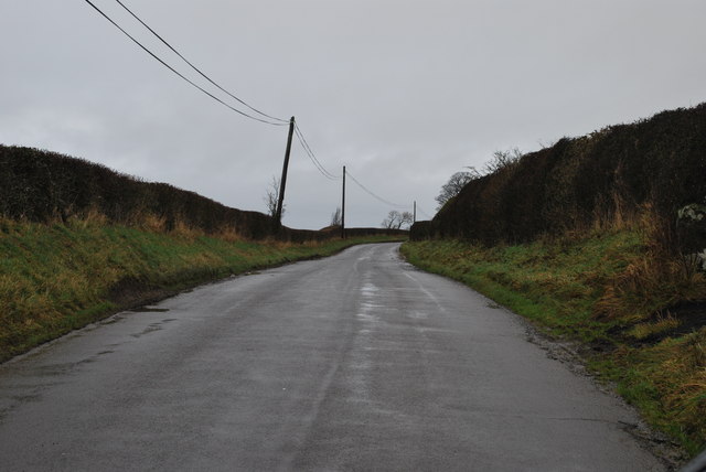
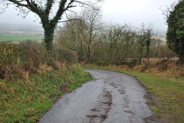
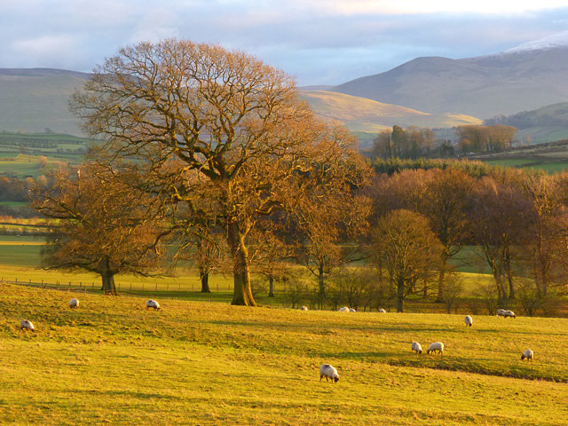
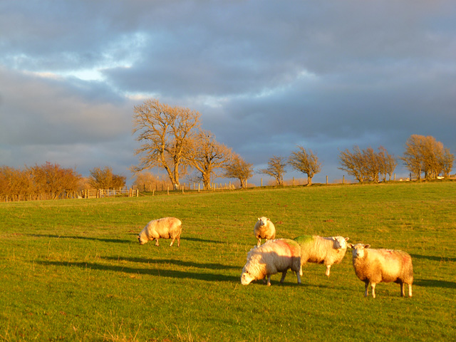
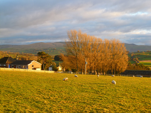
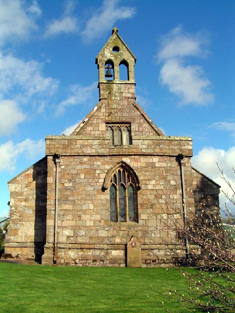
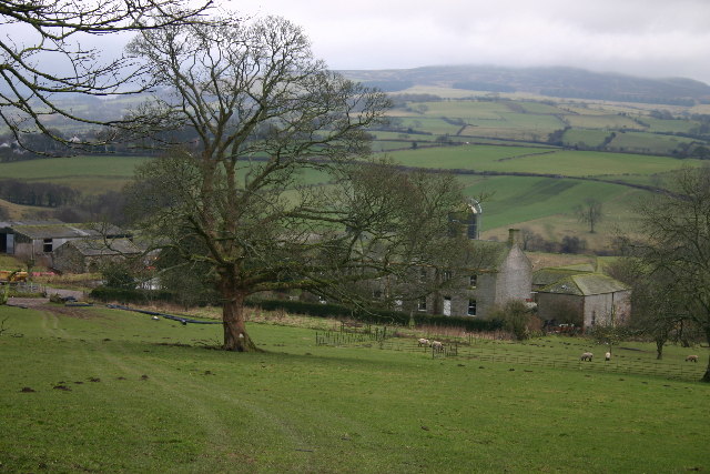
The village is known for its picturesque countryside setting, surrounded by rolling hills and farmland. The landscape is dotted with traditional stone-built houses, giving Boltongate a charming and quaint atmosphere. The village is also home to a small number of local amenities, including a village hall and a church, which dates back to the 12th century.

One of the notable features of Boltongate is the ancient stone circle located nearby. Known as the "Boltongate Circle," it is believed to be over 4,000 years old and is a popular attraction for visitors interested in archaeology and history. The circle consists of several standing stones arranged in a circular pattern, with some reaching up to 7 feet in height.

The village's rural location makes it an ideal base for outdoor activities such as hiking, cycling, and exploring the nearby Lake District National Park. The stunning natural beauty of the surrounding area attracts tourists looking for a peaceful retreat away from the hustle and bustle of city life.

Overall, Boltongate offers a glimpse into rural English life, with its tranquil setting, historical landmarks, and close proximity to the stunning landscapes of Cumbria.

If you have any feedback on the listing, please let us know in the comments section below.

Boltongate Images

Images are sourced within 2km of 54.755781/-3.198776 or Grid Reference NY2240. Thanks to Geograph Open Source API. All images are credited.

Looking up Carlisegate Lane Lane going North away from Boltongate.
Looking up Carlisegate Lane
Lane going North away from Boltongate.
Lane North of Boltongate Lane to the North of Boltongate, looking back towards Boltongate.
Lane North of Boltongate
Lane to the North of Boltongate, looking back towards Boltongate.
Lane leading away from Boltongate
Lane North of Boltongate looking back towards Boltongate
Disused Quarry North of Boltongate The grass clearing leads up to the disused quarry shown on the OS map.
Disused Quarry North of Boltongate
The grass clearing leads up to the disused quarry shown on the OS map.
Pasture, Boltons A view from the road to the east of Boltongate. Bakestall is the small peak in the background, just below Skiddaw's snow-line.
Pasture, Boltons
A view from the road to the east of Boltongate. Bakestall is the small peak in the background, just below Skiddaw's snow-line.
Farmland, Boltons Buildings at The Close are in the background.
Farmland, Boltons
Buildings at The Close are in the background.
Pasture, Boltons With evening sunshine picking out the Caldbeck Fells.
Pasture, Boltons
With evening sunshine picking out the Caldbeck Fells.
Pasture, Boltons Sheep garzing to the north of Boltongate.
Pasture, Boltons
Sheep garzing to the north of Boltongate.
Pasture, Boltons A view towards the Caldbeck Fells from Boltongate.
Pasture, Boltons
A view towards the Caldbeck Fells from Boltongate.
Boltongate Church This little church  looks very similar to small parish churches across Cumbria, but is unique, possessing the only stone tunnel-vaulted church roof in England.
Boltongate Church
This little church looks very similar to small parish churches across Cumbria, but is unique, possessing the only stone tunnel-vaulted church roof in England.
Catlands Hill Looking north, over the Solway Plain.
Catlands Hill
Looking north, over the Solway Plain.
Headend Quarry Also known as Sandale Quarry, this has become a designated County Wildlife Site. A joint initiative has implemented cleaning up vandalism and fly tipping and erecting seating and information boards. Interesting wildflowers are found here, along with a wide range of birds.
Headend Quarry
Also known as Sandale Quarry, this has become a designated County Wildlife Site. A joint initiative has implemented cleaning up vandalism and fly tipping and erecting seating and information boards. Interesting wildflowers are found here, along with a wide range of birds.
Ellen Bank Farm
Ellen Bank Farm
Carlislegate Lane Mis-spelt on OS map. Connects Boltongate with Carlislegate.
Carlislegate Lane
Mis-spelt on OS map. Connects Boltongate with Carlislegate.
Field Entrance Seemingly over-ornate for a field gate, this entrance was at the eastern end of some parkland, in the middle of which stood Quarry Hill House, visible in distance.
Field Entrance
Seemingly over-ornate for a field gate, this entrance was at the eastern end of some parkland, in the middle of which stood Quarry Hill House, visible in distance.
Dual Carriageway Presumably shared access didn't work here. Another example is at <a href="https://www.geograph.org.uk/gridref/NY2142">NY2142</a>
Dual Carriageway
Presumably shared access didn't work here. Another example is at NY2142
Jenny Bridge The stream below is tiny and overgrown.
Jenny Bridge
The stream below is tiny and overgrown.
Show me another place!

Boltongate is located at Grid Ref: NY2240 (Lat: 54.755781, Lng: -3.198776)

Administrative County: Cumbria

District: Allerdale

Police Authority: Cumbria

What 3 Words

///unguarded.circle.dockers. Near Wigton, Cumbria

Nearby Locations

Boltongate

Related Wikis

All Saints Church, Boltongate

All Saints' Church is in the village of Boltongate, Cumbria, England. It is an active Anglican parish church in the deanery of Solway, the archdeaconry...

Boltongate

Boltongate is a village in Cumbria, England. It is situated about 10 miles (16 km) north-east of Cockermouth. It is located just outside the Lake District...

Ireby Old Church

Ireby Old Church is a redundant Anglican church, of which only the chancel remains. It stands in an isolated position 1 mile (2 km) to the west of the...

Ireby, Cumbria

Ireby is a village in Cumbria, England with a population of around 180. Between 1974 and 2023, it was in Allerdale district, Cumbria. Since April 2023...

Nearby Amenities

Located within 500m of 54.755781,-3.198776
Boltongate
Place: hamlet
Source: npe
Wikidata: Q3003116
Wikipedia: en:Boltongate
Lat/Long: 54.7558929/-3.1996713
War Memorial (N bound)
Naptan AtcoCode: 090002100600
Naptan Bearing: N
Naptan BusStopType: CUS
Naptan CommonName: War Memorial (N bound)
Naptan Indicator: near
Naptan Landmark: Junction with B5299
Naptan NaptanCode: cumdmtwj
Naptan Street: B5299 Junction
Naptan Verified: no
Source: naptan_import
Lat/Long: 54.7563097/-3.1992854
War Memorial (S bound)
Naptan AtcoCode: 090002103342
Naptan Bearing: SW
Naptan BusStopType: CUS
Naptan CommonName: War Memorial (S bound)
Naptan Indicator: near
Naptan Landmark: War Memorial
Naptan NaptanCode: cumdmtwm
Naptan Street: B5299
Naptan Verified: no
Source: naptan_import
Lat/Long: 54.7562255/-3.1990588
Post Box
Post Box Type: lamp
Ref: CA7 181
Source: survey
Lat/Long: 54.7563327/-3.1993543
Bench
Lat/Long: 54.7563062/-3.199349
Grit Bin
Lat/Long: 54.7563062/-3.1991844
Defibrillator
Defibrillator Location: Boltongate
Emergency: defibrillator
Indoor: no
Lat/Long: 54.7562778/-3.1989786
Give Way
Direction: forward
Lat/Long: 54.7563574/-3.1990741
Power: pole
Lat/Long: 54.757191/-3.192343
Power: pole
Lat/Long: 54.7575512/-3.1937009
Power: pole
Lat/Long: 54.7578768/-3.1949328
Power: pole
Lat/Long: 54.7582382/-3.1962928
Power: pole
Lat/Long: 54.7584886/-3.1972477
Power: pole
Lat/Long: 54.7587999/-3.1984052
Power: pole
Lat/Long: 54.7591219/-3.199635
Power: pole
Lat/Long: 54.759302/-3.2015799
Power: pole
Lat/Long: 54.7593986/-3.2026279
Power: pole
Lat/Long: 54.7587152/-3.2043579
Power: pole
Lat/Long: 54.7578756/-3.2043537
Power: pole
Lat/Long: 54.7576299/-3.2043393
Power: pole
Lat/Long: 54.7567879/-3.2042917
Power: pole
Lat/Long: 54.7560734/-3.2036965
Power: pole
Lat/Long: 54.7551658/-3.2028966
Power: pole
Lat/Long: 54.7542187/-3.203343
Power: pole
Lat/Long: 54.7531309/-3.2038494
Power: pole
Lat/Long: 54.7566734/-3.2031033
Power: pole
Lat/Long: 54.7565601/-3.2019127
Power: pole
Lat/Long: 54.756436/-3.2006808
The data included in this document is from www.openstreetmap.org. The data is made available under ODbL.

Have you been to Boltongate?

Leave your review of Boltongate below (or comments, questions and feedback).