Swanbridge

Settlement in Glamorgan

Wales

Swanbridge

St Mary's Well Bay just west of Lavernock Point The foreshore here is like layers of sloping pavement where the thin strata of Blue Lias limestone overlay one another.
St Mary's Well Bay just west of Lavernock Point Credit: Penny Mayes

Swanbridge is a charming village located in the county of Glamorgan, Wales. Situated on the coast, it offers breathtaking views of the Bristol Channel and is nestled between the towns of Sully and Penarth. With a population of around 1,500 residents, it exudes a close-knit community atmosphere.

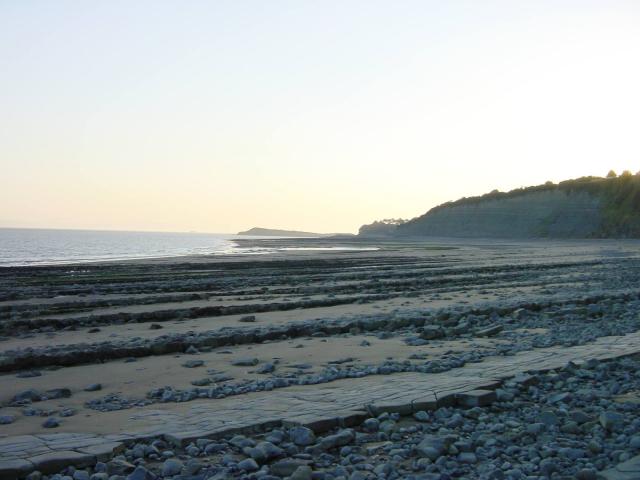
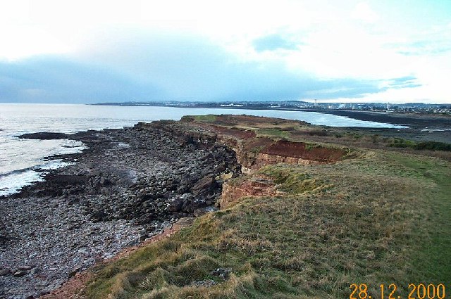
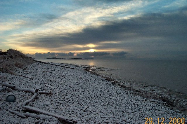
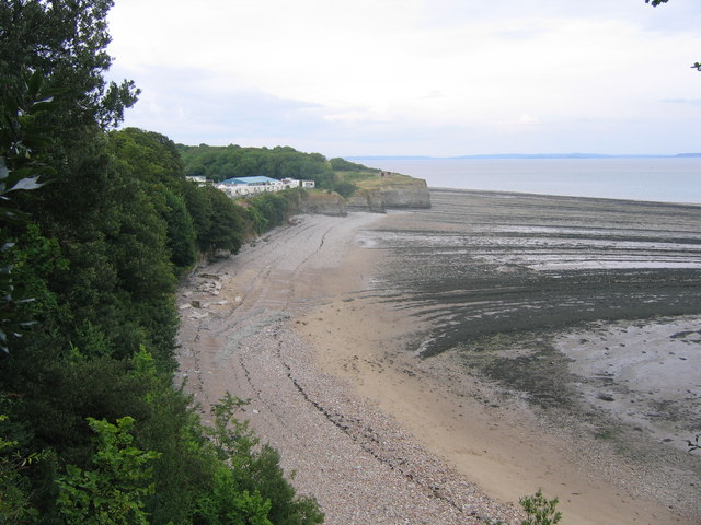
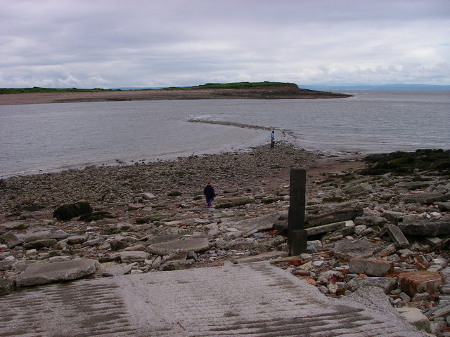
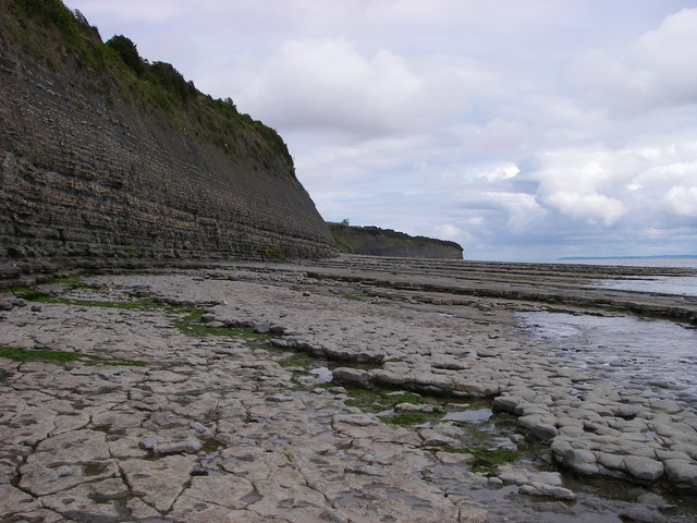
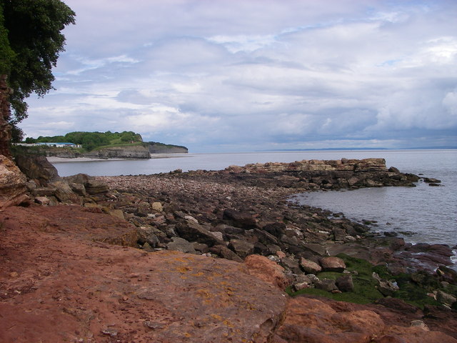
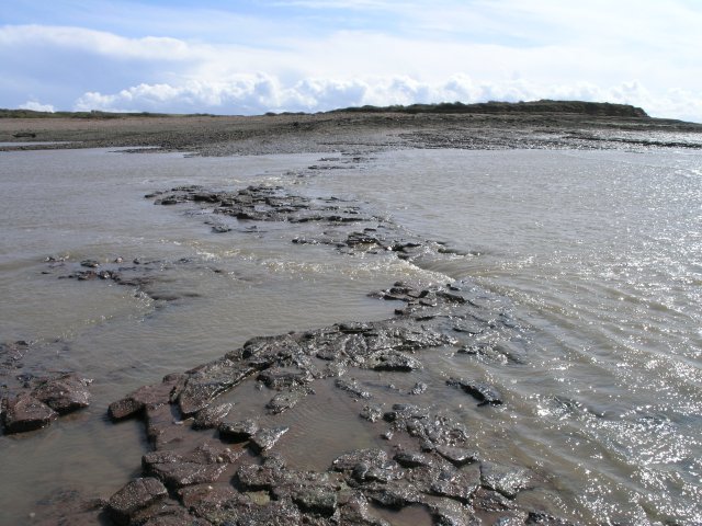
One of the standout features of Swanbridge is its iconic landmark, Swanbridge Bay. This picturesque beach is a popular destination for locals and visitors alike, offering a tranquil setting for relaxation or a pleasant stroll along the shoreline. The bay also boasts a diverse range of wildlife, making it a haven for nature enthusiasts.

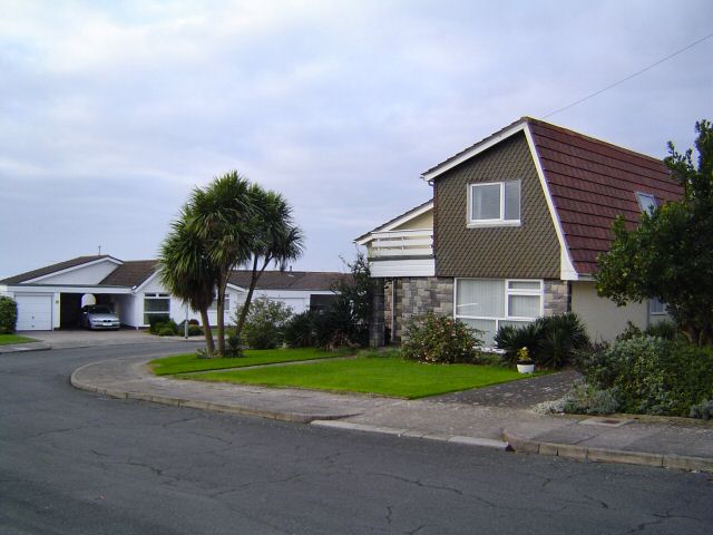
The village itself retains much of its historical charm, with many traditional buildings and cottages lining the streets. Its rich history can be traced back to ancient times, and remnants of a Roman villa have been discovered nearby. Additionally, the area played a significant role in World War II, with several defense structures still visible today.

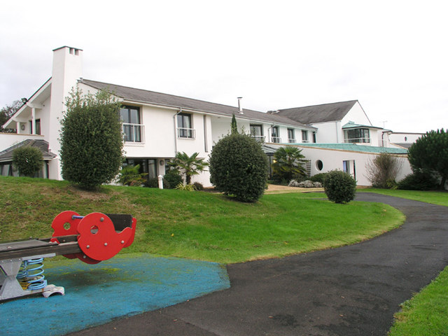
Swanbridge is also home to a handful of amenities, including a local pub, a convenience store, and a primary school, providing the essentials for residents' daily needs. For a wider range of services, the nearby towns of Sully and Penarth offer a broader selection of shops, restaurants, and leisure facilities.

Overall, Swanbridge is a delightful village that combines natural beauty, historical significance, and a strong sense of community. Whether it's exploring the stunning coastline, immersing oneself in the village's rich heritage, or simply enjoying the peaceful surroundings, Swanbridge has something to offer everyone.

If you have any feedback on the listing, please let us know in the comments section below.

Swanbridge Images

Images are sourced within 2km of 51.40436/-3.20299 or Grid Reference ST1667. Thanks to Geograph Open Source API. All images are credited.

St Mary's Well Bay just west of Lavernock Point The foreshore here is like layers of sloping pavement where the thin strata of Blue Lias limestone overlay one another.
St Mary's Well Bay just west of Lavernock Point
The foreshore here is like layers of sloping pavement where the thin strata of Blue Lias limestone overlay one another.
Sully Island The west view taken from on top of this small island. The rock strata are gently inclining. The water is part of the Bristol Channel and is pretty muddy! In the distance lies Barry.
Sully Island
The west view taken from on top of this small island. The rock strata are gently inclining. The water is part of the Bristol Channel and is pretty muddy! In the distance lies Barry.
Sully Beach A midwinter view of Sully Beach. The island is in the mid distance.
Sully Beach
A midwinter view of Sully Beach. The island is in the mid distance.
Sully Houses An example of one of the residential streets of Sully. Just behind these houses lies the Bristol Channel.
Sully Houses
An example of one of the residential streets of Sully. Just behind these houses lies the Bristol Channel.
Sully High Street The high street is the main Penarth to Barry Road. On either side of this road lie the residential streets of the ribbon development that comprises a large part of Sully.
Sully High Street
The high street is the main Penarth to Barry Road. On either side of this road lie the residential streets of the ribbon development that comprises a large part of Sully.
The edge of Sully Looking back at Sully from a field near Cog.
The edge of Sully
Looking back at Sully from a field near Cog.
Sheep near Cog, Sully A field of happy feeding sheep. What more to say?
Sheep near Cog, Sully
A field of happy feeding sheep. What more to say?
Cosmeston Lake The lakes in Cosmeston Lakes Country Park are man made from disused quarry workings and now are an important bird sanctuary and recreational area.
Cosmeston Lake
The lakes in Cosmeston Lakes Country Park are man made from disused quarry workings and now are an important bird sanctuary and recreational area.
Cosmeston Medieval Village This reconstructed medieval village is at Cosmeston Lakes, south of Penarth, and even the sheep are carefully chosen to fit in.
Cosmeston Medieval Village
This reconstructed medieval village is at Cosmeston Lakes, south of Penarth, and even the sheep are carefully chosen to fit in.
St. Mary's Well Bay Low tide at St. Mary's Well Bay, looking across to the caravan park above the bay
St. Mary's Well Bay
Low tide at St. Mary's Well Bay, looking across to the caravan park above the bay
Cosmeston Lakes Country Park Cosmeston Lakes Country Park had its origins with the advent of limestone quarrying in the early 1890s. The quarrying ceased in 1970. Springs flooded parts of the quarried area creating lakes. The quarry spoil areas were landscaped and together with the lakes form the main features of the park which includes over 100 hectares of woodland, grassland and wetlands.
Cosmeston Lakes Country Park
Cosmeston Lakes Country Park had its origins with the advent of limestone quarrying in the early 1890s. The quarrying ceased in 1970. Springs flooded parts of the quarried area creating lakes. The quarry spoil areas were landscaped and together with the lakes form the main features of the park which includes over 100 hectares of woodland, grassland and wetlands.
Ty Hafan, Children's Hospice for Wales This new facility is set in extensive park like grounds overlooking the sea.
Ty Hafan, Children's Hospice for Wales
This new facility is set in extensive park like grounds overlooking the sea.
The Sand Spit St Mary's Well Bay
Shingle spit reaching out to Sully Island View across from Swanbridge at half tide towards this small island composed of warm orange Triassic sandstone.  The mainland coast is undergoing active erosion.
Shingle spit reaching out to Sully Island
View across from Swanbridge at half tide towards this small island composed of warm orange Triassic sandstone. The mainland coast is undergoing active erosion.
Lower Lias cliffs west of Lavernock Point Tide and waves have generated a coastal rock platform from the mudstones and limestones of the Lower Lias whilst the cliff retreats inland at the expense of the S & W Wales Wildlife Trust nature reserve atop it.
Lower Lias cliffs west of Lavernock Point
Tide and waves have generated a coastal rock platform from the mudstones and limestones of the Lower Lias whilst the cliff retreats inland at the expense of the S & W Wales Wildlife Trust nature reserve atop it.
St Mary's Well Bay This truly is a bay of two halves - the west side (foreground) is carved from warm-coloured Triassic sandstones which dip moderately steeply southwards.  The far side (east) is backed by cliffs of the Lower Lias limestones and mudstones which have a 'cold' feel to them.  Ball Rock is seen in the middle foreground at high tide.
St Mary's Well Bay
This truly is a bay of two halves - the west side (foreground) is carved from warm-coloured Triassic sandstones which dip moderately steeply southwards. The far side (east) is backed by cliffs of the Lower Lias limestones and mudstones which have a 'cold' feel to them. Ball Rock is seen in the middle foreground at high tide.
Cosmeston Lake
Cosmeston Lake
Causeway revealed! You feel like Moses parting the red sea if you stand at the edge of the causeway to Sully Island as the tide rapidly recedes - within the space of a minute this transformed from a body of water to something that could be crossed using walking boots rather than wellingtons!  The picture was taken about half way through this transformation.

For some strange reason the water flow was going in the opposite direction to the obvious local water flow at this point - I guess this was down to wind direction and wave flow at the minute or so we were there.
Causeway revealed!
You feel like Moses parting the red sea if you stand at the edge of the causeway to Sully Island as the tide rapidly recedes - within the space of a minute this transformed from a body of water to something that could be crossed using walking boots rather than wellingtons! The picture was taken about half way through this transformation. For some strange reason the water flow was going in the opposite direction to the obvious local water flow at this point - I guess this was down to wind direction and wave flow at the minute or so we were there.
Show me another place!

Swanbridge is located at Grid Ref: ST1667 (Lat: 51.40436, Lng: -3.20299)

Unitary Authority: The Vale of Glamorgan

Police Authority: South Wales

Also known as: Swan Bridge

What 3 Words

///huddling.inches.withdrew. Near Dinas Powys, Vale of Glamorgan

Related Wikis

Swanbridge railway station

Swanbridge railway station was located on the now disused railway line between Penarth and Cadoxton, which closed in the 1960s. == History and description... ==

The Captain's Wife

The Captain's Wife is a public house in the former fishing hamlet of Swanbridge in Sully, between Barry and Penarth, Vale of Glamorgan, south Wales. The...

Sully, Vale of Glamorgan

Sully (Welsh: Sili) is a village in the community of Sully and Lavernock, in the Vale of Glamorgan, Wales, lying on the northern coast of the Bristol Channel...

Sully Centurions Cricket Club Ground

Sully Centurions Cricket Club Ground is a cricket ground in Sully, Glamorgan. The first recorded match on the ground was in 2002, when Wales Minor Counties...

Nearby Amenities

Located within 500m of 51.40436,-3.20299
Swanbridge
Historic Railway: station
Railway: site
Wikidata: Q29379317
Wikipedia: en:Swanbridge railway station
Lat/Long: 51.4053658/-3.2011484
Swanbridge
Place: hamlet
Lat/Long: 51.40093/-3.1994031
Sully Indoor Bowls Stadium
Leisure: pitch
Sport: bowls
Lat/Long: 51.4035484/-3.2049569
Sully Sports and Social Club
Club: sport
Lat/Long: 51.4035412/-3.2060719
Restaurant
Seashore Grill
Lat/Long: 51.4004648/-3.1995216
Sully Sports FC
Club: sport
Lat/Long: 51.4037069/-3.2077572
Direction: 215
Generator Method: photovoltaic
Generator Output Electricity: yes
Generator Solar Modules: 6
Generator Source: solar
Generator Type: solar_photovoltaic_panel
Location: roof
Power: generator
Lat/Long: 51.4048681/-3.2088467
Direction: 125
Generator Method: photovoltaic
Generator Output Electricity: yes
Generator Solar Modules: 6
Generator Source: solar
Generator Type: solar_photovoltaic_panel
Location: roof
Power: generator
Lat/Long: 51.4048447/-3.2088879
Direction: E
Generator Method: photovoltaic
Generator Output Electricity: yes
Generator Solar Modules: 6
Generator Source: solar
Generator Type: solar_photovoltaic_panel
Location: roof
Power: generator
Lat/Long: 51.4029824/-3.2085228
Direction: S
Generator Method: photovoltaic
Generator Output Electricity: yes
Generator Solar Modules: 11
Generator Source: solar
Generator Type: solar_photovoltaic_panel
Location: roof
Power: generator
Lat/Long: 51.4029589/-3.2086059
Direction: S
Generator Method: photovoltaic
Generator Output Electricity: yes
Generator Solar Modules: 16
Generator Source: solar
Generator Type: solar_photovoltaic_panel
Location: roof
Power: generator
Lat/Long: 51.4047744/-3.2062674
Direction: S
Generator Method: photovoltaic
Generator Output Electricity: yes
Generator Solar Modules: 16
Generator Source: solar
Generator Type: solar_photovoltaic_panel
Location: roof
Power: generator
Lat/Long: 51.4049585/-3.2059103
Direction: 175
Generator Method: photovoltaic
Generator Output Electricity: yes
Generator Solar Modules: 2
Generator Source: solar
Generator Type: solar_photovoltaic_panel
Location: roof
Power: generator
Lat/Long: 51.4053542/-3.207467
Direction: 175
Generator Method: photovoltaic
Generator Output Electricity: yes
Generator Solar Modules: 3
Generator Source: solar
Generator Type: solar_photovoltaic_panel
Location: roof
Power: generator
Lat/Long: 51.4053546/-3.2075478
Direction: 175
Generator Method: photovoltaic
Generator Output Electricity: yes
Generator Solar Modules: 11
Generator Source: solar
Generator Type: solar_photovoltaic_panel
Location: roof
Power: generator
Lat/Long: 51.4053205/-3.2075612
Post Box
Collection Times: Mo-Fr 09:00; Sa 07:00
Operator: Royal Mail
Operator Wikidata: Q638098
Post Box Type: wall
Ref: CF64 185D
Royal Cypher: EIIR
Lat/Long: 51.4015019/-3.2012909
The data included in this document is from www.openstreetmap.org. The data is made available under ODbL.

Have you been to Swanbridge?

Leave your review of Swanbridge below (or comments, questions and feedback).