Bolitho

Settlement in Cornwall

England

Bolitho

Unusual steps on the footpath you take to Crowan Beacon
Unusual steps on the footpath you take to Crowan Beacon Credit: thejackrustles

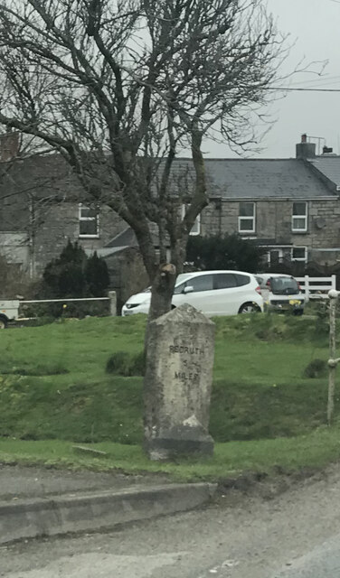
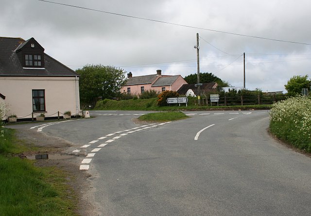
Bolitho is a small village located in the county of Cornwall, in the southwestern part of England. Situated near the coast, it offers residents and visitors stunning views of the Atlantic Ocean. With a population of around 500 people, Bolitho maintains a close-knit community atmosphere.

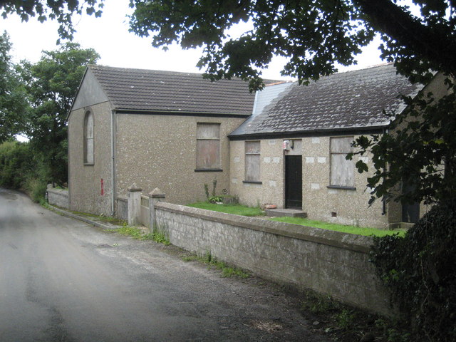
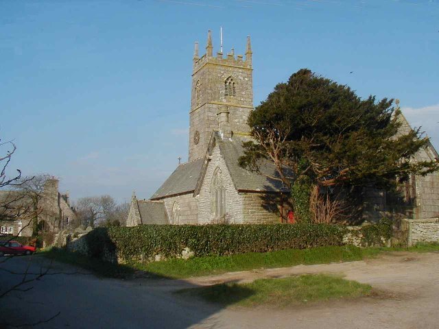
The village is known for its picturesque charm, with traditional Cornish stone cottages lining the narrow streets. The local parish church, St. Petroc's, stands as a prominent landmark, showcasing its medieval architecture and serving as a gathering place for religious events.

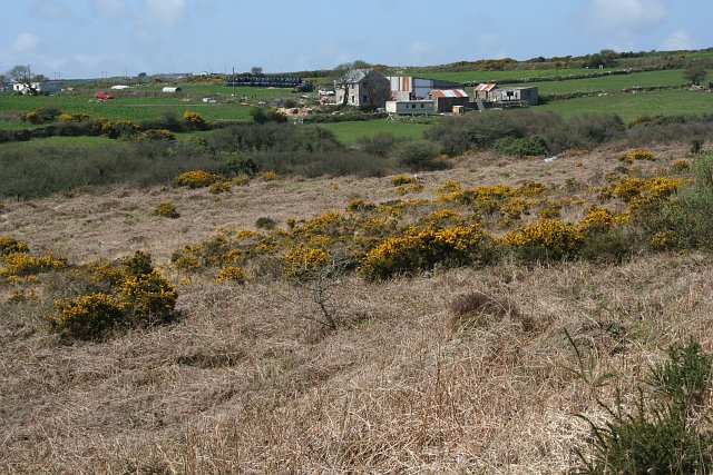
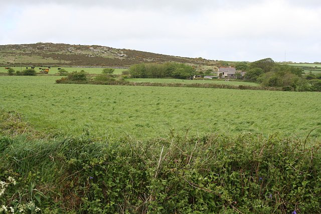
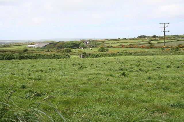
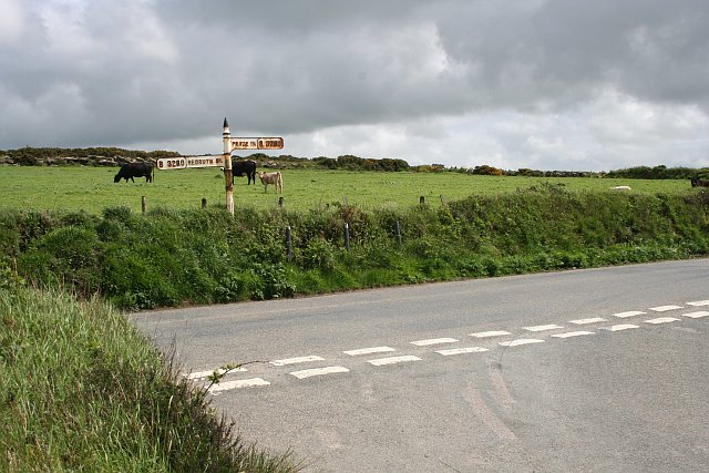
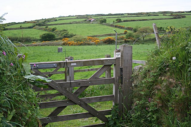
Bolitho is surrounded by lush green fields and rolling hills, providing ample opportunities for outdoor activities such as hiking and cycling. The nearby coastal cliffs offer panoramic views and are a popular spot for birdwatching. The village is also in close proximity to several sandy beaches, providing residents and tourists with opportunities for swimming, sunbathing, and water sports.

Despite its small size, Bolitho boasts a few amenities for its residents, including a local pub, a village hall, and a small convenience store. Nearby towns and cities provide additional services and amenities, ensuring that residents have access to a wider range of facilities.

Overall, Bolitho is a charming village that offers a tranquil and picturesque setting for residents and visitors alike. With its beautiful natural surroundings and close-knit community, it is a place that captures the essence of the Cornish countryside.

If you have any feedback on the listing, please let us know in the comments section below.

Bolitho Images

Images are sourced within 2km of 50.165879/-5.265301 or Grid Reference SW6634. Thanks to Geograph Open Source API. All images are credited.

Unusual steps on the footpath you take to Crowan Beacon
Last section of Open Access land
Old Milestone by the B3297 in Burras Carved stone post by the B3297, in parish of Wendron (Kerrier District), Burhos, Burras village green, beside clapper bridge, on West side of road. Erected by the Local Highways Board in the 19th century. 

Inscription reads:-
REDRUTH / 5 / MILES : : HELSTON / 5 / MILES 

Grade II Listed. List Entry Number: 1142022
<span class="nowrap"><a title="https://historicengland.org.uk/listing/the-list/list-entry/1142022" rel="nofollow ugc noopener" href="https://historicengland.org.uk/listing/the-list/list-entry/1142022">Link</a><img style="margin-left:2px;" alt="External link" title="External link - shift click to open in new window" src="https://s1.geograph.org.uk/img/external.png" width="10" height="10"/></span>

Milestone Society National ID: CW_RRHL05
Old Milestone by the B3297 in Burras
Carved stone post by the B3297, in parish of Wendron (Kerrier District), Burhos, Burras village green, beside clapper bridge, on West side of road. Erected by the Local Highways Board in the 19th century. Inscription reads:- REDRUTH / 5 / MILES : : HELSTON / 5 / MILES Grade II Listed. List Entry Number: 1142022 LinkExternal link Milestone Society National ID: CW_RRHL05
Calvadnack and Farmland Calvadnack is an area of open access heathland.  There is a footpath marked on the OS map crossing it from north to south, however the footpath could not be found.  The northern half of Calvadnack is used for rough cattle grazing and is passable but the vegetation makes the southern half impassable, even in the springtime before the bracken has regrown.
Calvadnack and Farmland
Calvadnack is an area of open access heathland. There is a footpath marked on the OS map crossing it from north to south, however the footpath could not be found. The northern half of Calvadnack is used for rough cattle grazing and is passable but the vegetation makes the southern half impassable, even in the springtime before the bracken has regrown.
Farm Buildings at Releath Releath is a small farm-based hamlet.
Farm Buildings at Releath
Releath is a small farm-based hamlet.
Pasture and Heathland across the Valley Taken from near Higher Releath and looking across the square towards Boquio Farm.
Pasture and Heathland across the Valley
Taken from near Higher Releath and looking across the square towards Boquio Farm.
Pasture and Carn Meor Farm
Southern Slope of Crowan Beacon Pasture land gives way to heathland where the granite boulders become too large and numerous on the higher hills.
Southern Slope of Crowan Beacon
Pasture land gives way to heathland where the granite boulders become too large and numerous on the higher hills.
Road Junction near Blackrock Farm There is a small scattering of houses and a couple of farms here.
Road Junction near Blackrock Farm
There is a small scattering of houses and a couple of farms here.
Cargenwen Looking diagonally across the square from the southeast corner.
Cargenwen
Looking diagonally across the square from the southeast corner.
Road Junction and Crowan Beacon This shot looks up to the edge of the heathland at the summit of Crowan Beacon.
Road Junction and Crowan Beacon
This shot looks up to the edge of the heathland at the summit of Crowan Beacon.
Gate and Fields This double gate is the start of a bridlepath which leads from the road out over this patchwork of pasture fields.  The gates allow horses to be taken on the bridlepath without letting out any stock which might be in the fields.
Gate and Fields
This double gate is the start of a bridlepath which leads from the road out over this patchwork of pasture fields. The gates allow horses to be taken on the bridlepath without letting out any stock which might be in the fields.
Fields around the River Cober The River Cober flows south from here, near Burras, to Helston and reaches the sea at Loe Bar <a href="https://www.geograph.org.uk/gridref/SW6424">SW6424</a>.
Fields around the River Cober
The River Cober flows south from here, near Burras, to Helston and reaches the sea at Loe Bar SW6424.
Fields and power lines near Burras Overlooking the valley of the River Cober.
Fields and power lines near Burras
Overlooking the valley of the River Cober.
Cross roads on the B3297
Burras
Burras
Burras Methodist Church
Burras Methodist chapel The C19 chapel seen across the River Cober, which flows (to the left) under this interesting footbridge.
Burras Methodist chapel
The C19 chapel seen across the River Cober, which flows (to the left) under this interesting footbridge.
Show me another place!

Bolitho is located at Grid Ref: SW6634 (Lat: 50.165879, Lng: -5.265301)

Unitary Authority: Cornwall

Police Authority: Devon and Cornwall

What 3 Words

///funds.debit.destroyer. Near Wendron, Cornwall

Nearby Locations

Bolitho Black Rock

Related Wikis

Bolitho, Cornwall

Bolitho ( bÉ™-LY-thoh, Cornish: Bosleythow) is a village in west Cornwall, and a Cornish surname. The Bolitho Family own large estates in west Cornwall...

Burras

Burras is a village in west Cornwall, England, United Kingdom, approximately five miles (8 km) south of Redruth on the B3297 road. It is in the civil parish...

Farms Common

Farms Common is a hamlet in the parish of Wendron, Cornwall, England. == References ==

Boquio

Boquio is a small upland area south of Bolitho in west Cornwall, United Kingdom. It is situated approximately halfway between Praze-an-Beeble and Wendron...

Releath

Releath (Cornish: Reslegh) is a hamlet southwest of Burras in west Cornwall, England. == References ==

Lezerea

Lezerea (Cornish: Lysgre, meaning herd's ruin) is a farmstead near Wendron in Cornwall, England, UK. Lezerea is in the civil parish of Wendron, situated...

Crowan

Crowan (Cornish: Egloskrewen (village) or Pluw Grewen (parish)) is a village and civil parish in Cornwall, England, United Kingdom. It is about three-and...

Boswyn

Boswyn is a hamlet in west Cornwall, England, United Kingdom, approximately one mile south of Troon. It is in the civil parish of Camborne. == References ==

Nearby Amenities

Located within 500m of 50.165879,-5.265301
Generator Method: photovoltaic
Generator Output Electricity: small_installation
Generator Source: solar
Generator Type: solar_photovoltaic_panel
Location: platform
Power: generator
Source: bing
Lat/Long: 50.1667276/-5.259081
Fixme: continue
Lat/Long: 50.1662109/-5.2710772
The data included in this document is from www.openstreetmap.org. The data is made available under ODbL.

Have you been to Bolitho?

Leave your review of Bolitho below (or comments, questions and feedback).