Bolingey

Settlement in Cornwall

England

Bolingey

Perranporth beach, 1 Overall view from the south side of the bay.
Perranporth beach, 1 Credit: Jonathan Billinger

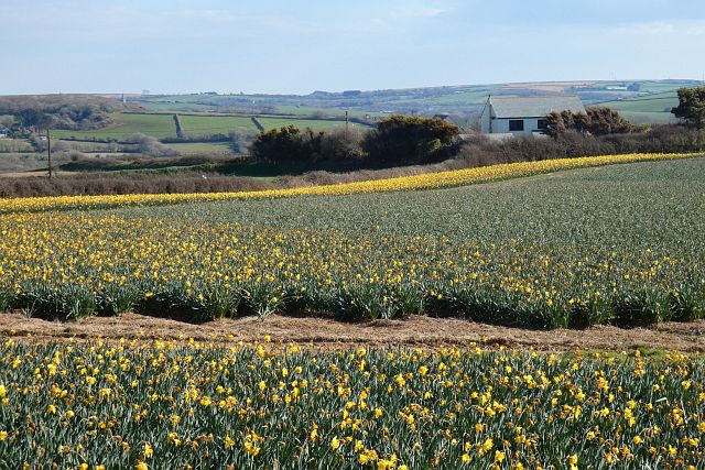
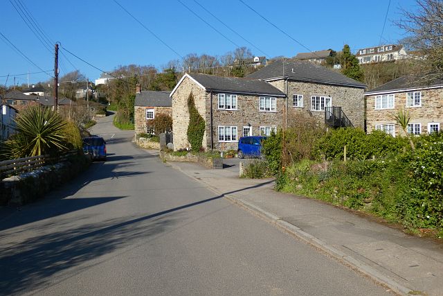
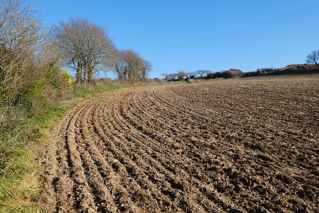
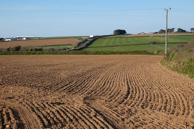
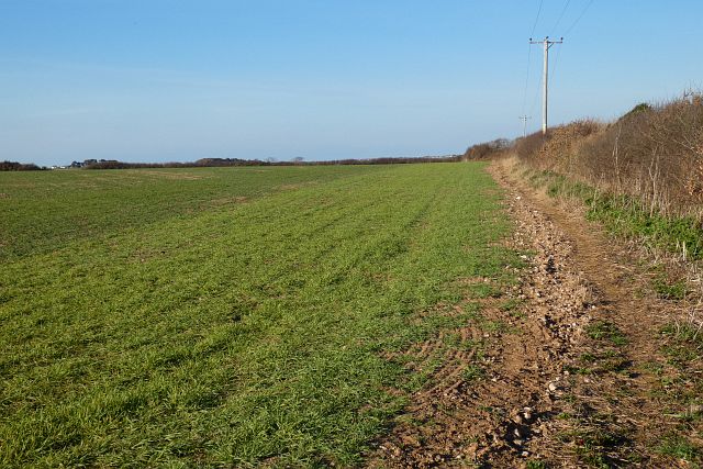
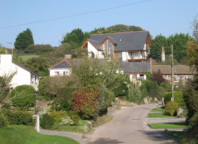
Bolingey is a small village located in the southwestern county of Cornwall, England. Situated in the civil parish of Perranzabuloe, the village is nestled between the larger towns of Newquay and Perranporth. Bolingey is known for its picturesque setting, with rolling hills and charming countryside views.

The village is home to a close-knit community, with a population of around 300 residents. Despite its small size, Bolingey has a rich history, dating back to the medieval era. The name "Bolingey" is derived from the Cornish language, and its exact meaning is debated among historians.

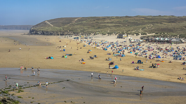
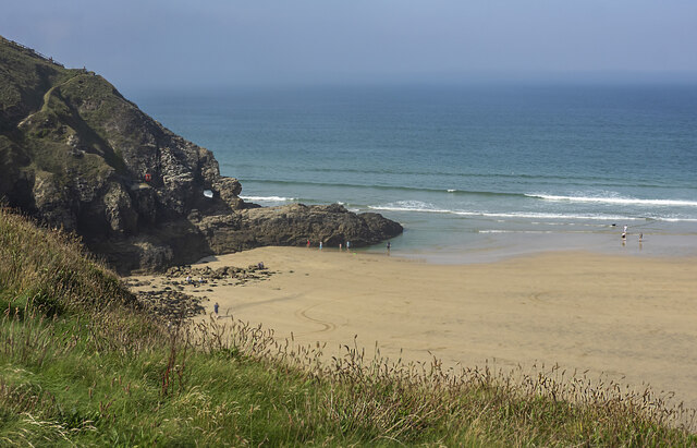
Bolingey is a popular destination for nature enthusiasts and outdoor lovers. The surrounding area offers various walking trails and cycling routes, allowing visitors to explore the beautiful countryside and enjoy the tranquility of the rural setting. The nearby Perranporth Beach, known for its golden sands and clear waters, attracts both locals and tourists alike during the summer months.

Although Bolingey doesn't have its own amenities, such as shops or pubs, it benefits from its proximity to Newquay and Perranporth, where residents can find a range of services and facilities. The village maintains a sense of peacefulness, making it an ideal place for those seeking a quiet and idyllic retreat.

Overall, Bolingey is a charming village in Cornwall, offering a glimpse into the region's natural beauty and rural charm. Its historical significance and peaceful atmosphere make it an attractive destination for both residents and visitors looking to explore the picturesque countryside of Cornwall.

If you have any feedback on the listing, please let us know in the comments section below.

Bolingey Images

Images are sourced within 2km of 50.336528/-5.145013 or Grid Reference SW7653. Thanks to Geograph Open Source API. All images are credited.

Perranporth beach, 1 Overall view from the south side of the bay.
Perranporth beach, 1
Overall view from the south side of the bay.
Clifftop path above Perranporth beach A fine morning in early September.
Clifftop path above Perranporth beach
A fine morning in early September.
Droskyn Point Viewed from the clifftop above Perranporth.
Droskyn Point
Viewed from the clifftop above Perranporth.
Perranporth beach, 2 Chapel Rock takes centre stage with Droskyn Point beyond.
Perranporth beach, 2
Chapel Rock takes centre stage with Droskyn Point beyond.
Perranporth beach, 3 A surfing lesson in progress along with onlookers.
Perranporth beach, 3
A surfing lesson in progress along with onlookers.
Stone Stile SW7551a At field boundary about halfway along the footpath.
Sheep stile with two protruding steps on each side. Worn with use and rather dilapidated.
Public footpath 314/19/1 silver from Penwartha to the B3284 beside the electricity sub-station.
Stone Stile SW7551a
At field boundary about halfway along the footpath. Sheep stile with two protruding steps on each side. Worn with use and rather dilapidated. Public footpath 314/19/1 silver from Penwartha to the B3284 beside the electricity sub-station.
Stone Stile SW7551c From fields to path beside the electricity sub-station.
Sheep stile with two steps each side. Worn with use and rather dilapidated.
Public footpath 314/19/1 from Penwartha to the B3284 beside the electricity sub-station.
Stone Stile SW7551c
From fields to path beside the electricity sub-station. Sheep stile with two steps each side. Worn with use and rather dilapidated. Public footpath 314/19/1 from Penwartha to the B3284 beside the electricity sub-station.
Stone Stile SW7551d From path beside the electricity sub-station to the B3284 road.
Horizontal granite blocks with gaps between filled with soil. A step stile.
Public footpath 314/19/1 from Penwartha to the B3284 beside the electricity sub-station.
Stone Stile SW7551d
From path beside the electricity sub-station to the B3284 road. Horizontal granite blocks with gaps between filled with soil. A step stile. Public footpath 314/19/1 from Penwartha to the B3284 beside the electricity sub-station.
Holiday chalets, Perranzabuloe The southern edge of Perran Sands Holiday Centre.
Holiday chalets, Perranzabuloe
The southern edge of Perran Sands Holiday Centre.
Ramoth Way, Perranporth, Perranzabuloe This private road has seen a lot of recent development and redevelopment including the replacement of a single house with three 3-storey ones seen on the left.
Ramoth Way, Perranporth, Perranzabuloe
This private road has seen a lot of recent development and redevelopment including the replacement of a single house with three 3-storey ones seen on the left.
Farmland, Perranzabuloe Daffodils to the west of Reen Cross.
Farmland, Perranzabuloe
Daffodils to the west of Reen Cross.
Mill Road, Bolingey, Perranzabuloe Bolingey is close to, but retains a serparate identity from, the neighbouring Perranporth.
Mill Road, Bolingey, Perranzabuloe
Bolingey is close to, but retains a serparate identity from, the neighbouring Perranporth.
Farmland, Perranzabuloe A footpath follows the edge of the field, climbing away from Trevellance Farm.
Farmland, Perranzabuloe
A footpath follows the edge of the field, climbing away from Trevellance Farm.
Farmland, Perranzabuloe Arable land above Penwartha with the B3284 Ellestan Farm to the left.
Farmland, Perranzabuloe
Arable land above Penwartha with the B3284 Ellestan Farm to the left.
Farmland, Perranzabuloe A footpath follows the edge of this field on its way to Penwartha.
Farmland, Perranzabuloe
A footpath follows the edge of this field on its way to Penwartha.
Stone Stile SW7652a Churchyard of St Pirans Church
Cattle stile
One of four similar stiles on this footpath, coded SW7652a, b, c, d. A fifth stile was removed some years ago when the deer farm was fenced.
Public footpath 314/24/4 Gold from St Pirans Church to Penwartha.
Stone Stile SW7652a
Churchyard of St Pirans Church Cattle stile One of four similar stiles on this footpath, coded SW7652a, b, c, d. A fifth stile was removed some years ago when the deer farm was fenced. Public footpath 314/24/4 Gold from St Pirans Church to Penwartha.
Stone Stile SW7652b At field boundary.
Cattle stile.
One of four similar stiles on this footpath, coded SW7652a, b, c, d. A fifth stile was removed some years ago when the deer farm was fenced.
Public footpath 314/23/1 Gold from St Pirans Church to Penwartha.
Stone Stile SW7652b
At field boundary. Cattle stile. One of four similar stiles on this footpath, coded SW7652a, b, c, d. A fifth stile was removed some years ago when the deer farm was fenced. Public footpath 314/23/1 Gold from St Pirans Church to Penwartha.
Stone Stile SW7652c At field boundary.
Cattle stile.
One of four similar stiles on this footpath, coded SW7652a, b, c, d. A fifth stile was removed some years ago when the deer farm was fenced.
Public footpath 314/23/1 Gold from St Pirans Church to Penwartha.
Stone Stile SW7652c
At field boundary. Cattle stile. One of four similar stiles on this footpath, coded SW7652a, b, c, d. A fifth stile was removed some years ago when the deer farm was fenced. Public footpath 314/23/1 Gold from St Pirans Church to Penwartha.
Show me another place!

Bolingey is located at Grid Ref: SW7653 (Lat: 50.336528, Lng: -5.145013)

Unitary Authority: Cornwall

Police Authority: Devon and Cornwall

What 3 Words

///convey.wizard.clocked. Near Perranporth, Cornwall

Nearby Locations

Bolingey

Related Wikis

Bolingey

Bolingey (Cornish: Melinji) is a village on the north coast of Cornwall, England, United Kingdom. It is half-a-mile south of the small seaside resort of...

Penwartha Coombe

Penwartha Coombe is a hamlet south of Perranporth, Cornwall, England. == References ==

Cocks, Cornwall

Cocks is a hamlet in the parish of Perranzabuloe in Cornwall, England. Cocks is southeast of Perranporth. == References == == External links == Media...

Perranporth

Perranporth (Standard Written Form: Porthperan) is a seaside resort town on the north coast of Cornwall, England, United Kingdom. It is 2.1 miles east...

Nearby Amenities

Located within 500m of 50.336528,-5.145013
Bolingey
Is In: Cornwall, England, UK
Is In Country: England
Is In Country Code: GB
Is In County: Cornwall
Name Kw: Melinji
Place: village
Source: npe
Wikidata: Q4939468
Lat/Long: 50.3371771/-5.1431757
Bus Stop
Bottom Reen Hill
Bus: yes
Naptan AtcoCode: 0800COC31670
Naptan Bearing: SE
Naptan CommonName: Bottom Reen Hill
Naptan Crossing: Bone Mill Road
Naptan NaptanCode: coraptmd
Naptan Street: Reen Hill
Naptan Verified: no
Public Transport: platform
Source: naptan_import
Lat/Long: 50.3384744/-5.141193
Man Made: mast
Tower Type: communication
Lat/Long: 50.3374773/-5.1516176
Pub
Bolingey Inn
Addr City: Perranporth
Addr Hamlet: Bolingey
Addr Postcode: TR6 0DH
Addr Street: Penwartha Road
Contact Facebook: https://www.facebook.com/TheBolingeyinn/
Fhrs Id: 569067
Source Addr: FHRS Open Data
Lat/Long: 50.336279/-5.1442252
Post Box
Lat/Long: 50.3376241/-5.1416834
Telephone
Lat/Long: 50.3375927/-5.1416033
Power: pole
Lat/Long: 50.3363706/-5.1461479
Power: pole
Lat/Long: 50.3368722/-5.1471993
Power: pole
Lat/Long: 50.3366608/-5.1492901
Power: pole
Lat/Long: 50.3390575/-5.1486732
Power: pole
Lat/Long: 50.3378446/-5.1495329
Power: pole
Lat/Long: 50.3372411/-5.1499634
Power: pole
Lat/Long: 50.3365418/-5.1504676
Power: pole
Lat/Long: 50.3357037/-5.1510671
Power: pole
Lat/Long: 50.335702/-5.142484
Power: pole
Lat/Long: 50.3350943/-5.1430057
Power: pole
Lat/Long: 50.3343384/-5.1437031
Power: pole
Lat/Long: 50.3329524/-5.1440102
Man Made: adit
Lat/Long: 50.3386328/-5.1442139
Post Box
Collection Times: Mo-Fr 09:00; Sa 07:00; Su off
Operator: Royal Mail
Operator Wikidata: Q638098
Post Box Mounting: stone_wall
Post Box Type: wall
Ref: TR6 87D
Source: survey;aerial imagery
Lat/Long: 50.3373877/-5.1443928
Post Box
Collection Times: Mo-Fr 09:00; Sa 07:00; Su off
Operator: Royal Mail
Operator Wikidata: Q638098
Post Box Design: type_n
Post Box Mounting: pier
Post Box Type: pillar
Ref: TR6 117D
Royal Cypher: EIIR
Royal Cypher Wikidata: Q33102113
Lat/Long: 50.338478/-5.1411618
The data included in this document is from www.openstreetmap.org. The data is made available under ODbL.

Have you been to Bolingey?

Leave your review of Bolingey below (or comments, questions and feedback).