Stodmarsh

Settlement in Kent Canterbury

England

Stodmarsh

Building site, Island Road The advertisement board reads “A development of 25 homes for rent & shared ownership delivered in partnership with Canterbury City Council”
Building site, Island Road Credit: John Baker

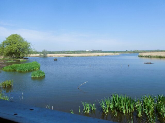
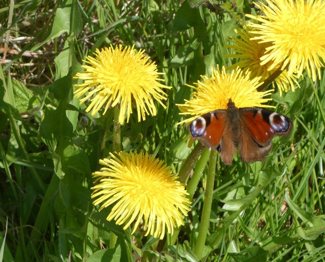
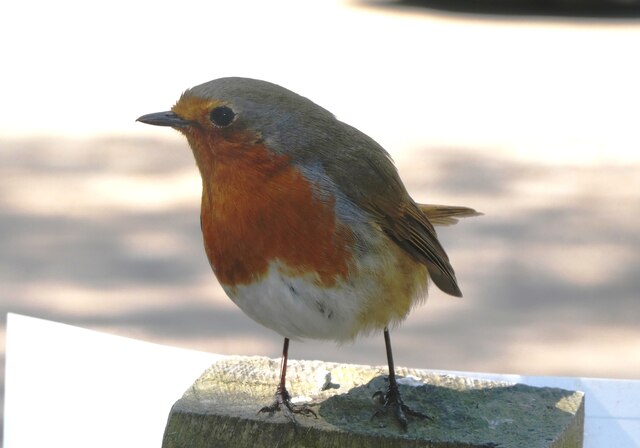
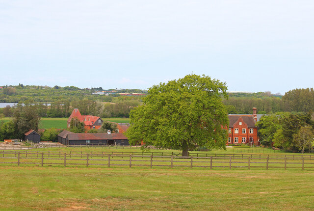
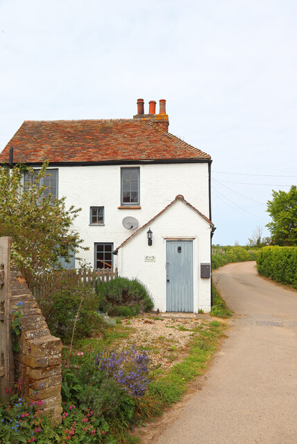
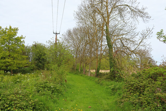
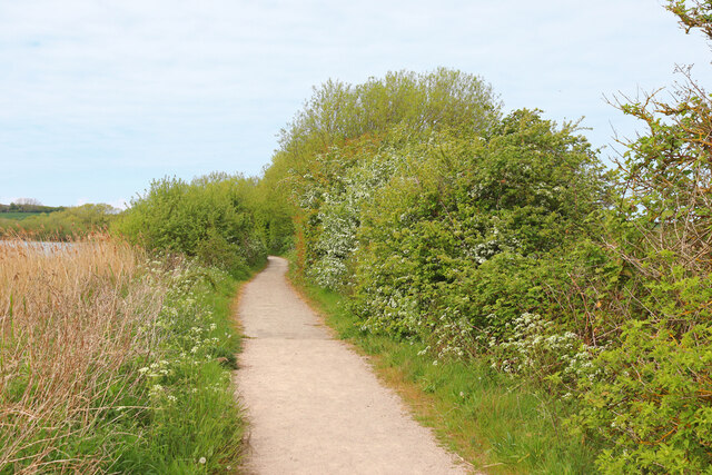
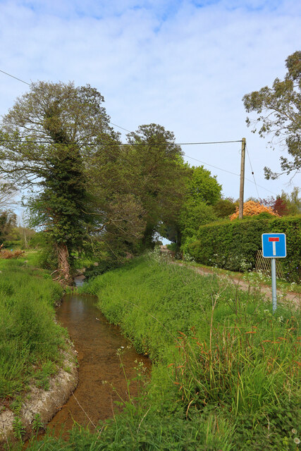
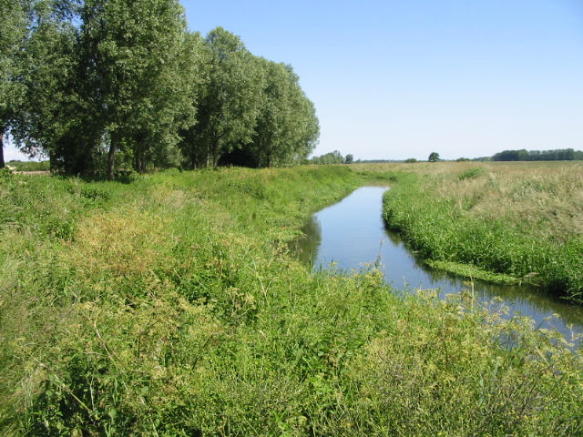
Stodmarsh is a small village located in the county of Kent, England. Situated approximately six miles east of the historic city of Canterbury, it falls within the Canterbury local government district. The village is nestled within the Stodmarsh National Nature Reserve, which is renowned for its diverse flora and fauna, making it a haven for nature enthusiasts and birdwatchers.

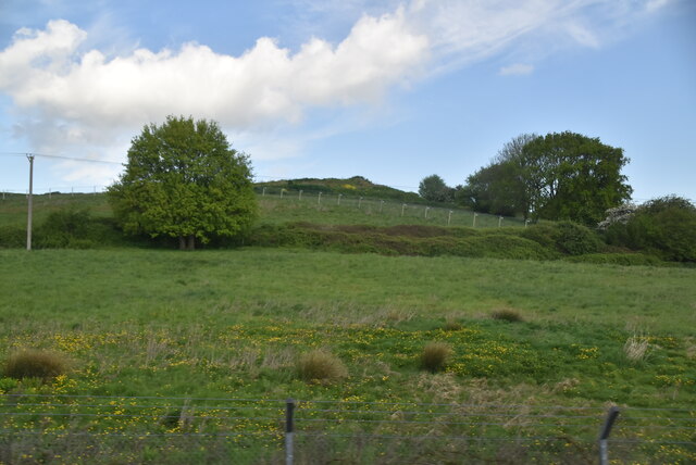
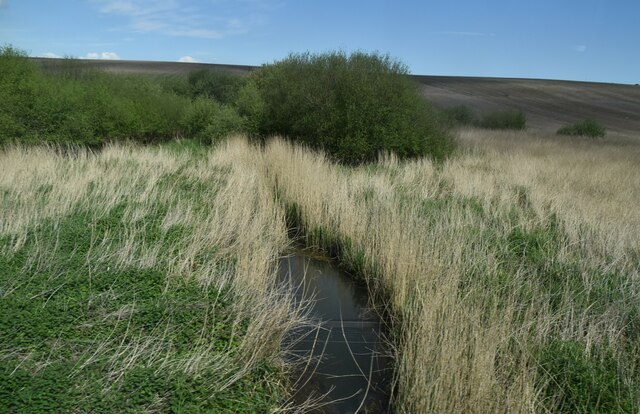
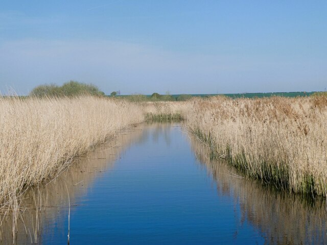
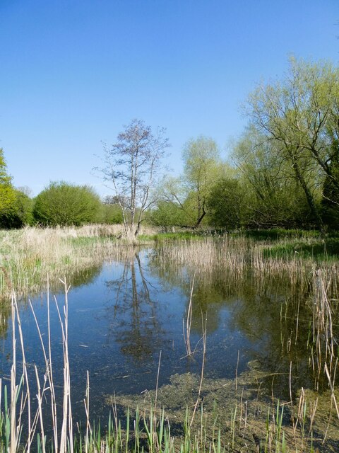
Stodmarsh is surrounded by picturesque countryside, characterized by its wetland areas, marshes, and reedbeds. These natural features attract a wide variety of bird species, including rare and endangered ones such as the bittern and the marsh harrier. The reserve also supports an array of other wildlife, including badgers, otters, and water voles.

The village itself is small, with a population of around 300 residents. It has a charming rural character, with a scattering of traditional cottages and farmhouses. Stodmarsh is known for its strong sense of community, with various social events and gatherings taking place throughout the year.

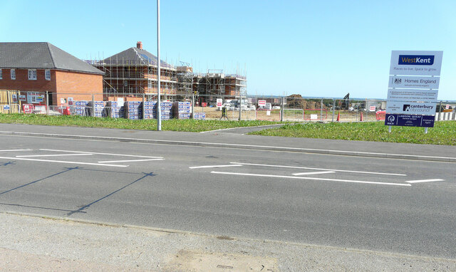
While Stodmarsh offers a tranquil and peaceful setting, it is conveniently located near Canterbury, which provides residents with access to a range of amenities, including shops, schools, and healthcare facilities. The village is well-connected to nearby towns and cities via a network of roads, making it easily accessible for both residents and visitors.

In summary, Stodmarsh offers a unique living environment for those seeking a peaceful and natural setting, surrounded by the beauty of the Stodmarsh National Nature Reserve, while still providing easy access to the amenities of nearby Canterbury.

If you have any feedback on the listing, please let us know in the comments section below.

Stodmarsh Images

Images are sourced within 2km of 51.301209/1.181199 or Grid Reference TR2160. Thanks to Geograph Open Source API. All images are credited.

Building site, Island Road The advertisement board reads “A development of 25 homes for rent & shared ownership delivered in partnership with Canterbury City Council”
Building site, Island Road
The advertisement board reads “A development of 25 homes for rent & shared ownership delivered in partnership with Canterbury City Council”
Pastureland
Pastureland
Drainage channel
Drainage channel
Stodmarsh National Nature Reserve View from Reedbed Hide on the south side of the reserve.
Stodmarsh National Nature Reserve
View from Reedbed Hide on the south side of the reserve.
Stodmarsh National Nature Reserve View from the footpath of one of the drainage ditches through the reedbeds.
Stodmarsh National Nature Reserve
View from the footpath of one of the drainage ditches through the reedbeds.
Stodmarsh National Nature reserve Dandelions and peacock butterfly by one of the footpaths.
Stodmarsh National Nature reserve
Dandelions and peacock butterfly by one of the footpaths.
Stodmarsh National Nature Reserve Southern end of a lake in the reserve.
Stodmarsh National Nature Reserve
Southern end of a lake in the reserve.
Robin in the car park of Stodmarsh National Nature Reserve Robins and blue tits are fed by visitors and, therefore, become extremely tame. They appear so friendly but, of course, it's cupboard love.
Robin in the car park of Stodmarsh National Nature Reserve
Robins and blue tits are fed by visitors and, therefore, become extremely tame. They appear so friendly but, of course, it's cupboard love.
Black Horse Lane Part of a housing estate called The Hoplands for which planning permission has been granted by Canterbury City Council under application number CA//16/00404. 

An  “outline planning application for a neighbourhood extension for the creation of up to 250 houses including affordable housing, neighbourhood centre (comprising Class A1 food store (400sq.m), Class D1 medical centre (380sq.m), Class D1 dentist (150sq.m), Class A1 pharmacy (150sq.m), Class D1 nursery (120sq.m) and Class A1 convenience retail (360sq.m)), commercial estate (comprising Class B1 business floorspace (up to 5572sq.m), Class D1 apprenticeship centre (616sq.m) and Class D1/D2 community building (up to 672sq.m)), parish parkland and associated access, parking, amenity space and landscaping”.
Black Horse Lane
Part of a housing estate called The Hoplands for which planning permission has been granted by Canterbury City Council under application number CA//16/00404. An “outline planning application for a neighbourhood extension for the creation of up to 250 houses including affordable housing, neighbourhood centre (comprising Class A1 food store (400sq.m), Class D1 medical centre (380sq.m), Class D1 dentist (150sq.m), Class A1 pharmacy (150sq.m), Class D1 nursery (120sq.m) and Class A1 convenience retail (360sq.m)), commercial estate (comprising Class B1 business floorspace (up to 5572sq.m), Class D1 apprenticeship centre (616sq.m) and Class D1/D2 community building (up to 672sq.m)), parish parkland and associated access, parking, amenity space and landscaping”.
Black Horse Lane Part of a housing estate called The Hoplands for which planning permission has been granted by Canterbury City Council under application number CA//16/00404. An  “outline planning application for a neighbourhood extension for the creation of up to 250 houses including affordable housing, neighbourhood centre (comprising Class A1 food store (400sq.m), Class D1 medical centre (380sq.m), Class D1 dentist (150sq.m), Class A1 pharmacy (150sq.m), Class D1 nursery (120sq.m) and Class A1 convenience retail (360sq.m)), commercial estate (comprising Class B1 business floorspace (up to 5572sq.m), Class D1 apprenticeship centre (616sq.m) and Class D1/D2 community building (up to 672sq.m)), parish parkland and associated access, parking, amenity space and landscaping”.

The road is one of the furthest parts of this length of <a href="https://www.geograph.org.uk/photo/7309735">TR2061 : Black Horse Lane</a>.
Black Horse Lane
Part of a housing estate called The Hoplands for which planning permission has been granted by Canterbury City Council under application number CA//16/00404. An “outline planning application for a neighbourhood extension for the creation of up to 250 houses including affordable housing, neighbourhood centre (comprising Class A1 food store (400sq.m), Class D1 medical centre (380sq.m), Class D1 dentist (150sq.m), Class A1 pharmacy (150sq.m), Class D1 nursery (120sq.m) and Class A1 convenience retail (360sq.m)), commercial estate (comprising Class B1 business floorspace (up to 5572sq.m), Class D1 apprenticeship centre (616sq.m) and Class D1/D2 community building (up to 672sq.m)), parish parkland and associated access, parking, amenity space and landscaping”. The road is one of the furthest parts of this length of TR2061 : Black Horse Lane.
Lakehill Road Part of a housing estate called The Hoplands for which planning permission has been granted by Canterbury City Council under application number CA//16/00404.
Lakehill Road
Part of a housing estate called The Hoplands for which planning permission has been granted by Canterbury City Council under application number CA//16/00404.
Unnamed Road Part of a housing estate called The Hoplands for which planning permission has been granted by Canterbury City Council under application number CA//16/00404.
Unnamed Road
Part of a housing estate called The Hoplands for which planning permission has been granted by Canterbury City Council under application number CA//16/00404.
Stodmarsh Court Farm Farm near Stodmarsh.
Stodmarsh Court Farm
Farm near Stodmarsh.
Lambkin Wall House in Stodmarsh.
Lambkin Wall
House in Stodmarsh.
Near Stodmarsh Church Power lines and trees.
Near Stodmarsh Church
Power lines and trees.
Lampen Wall Path in Stodmarsh Nature Reserve.
Lampen Wall
Path in Stodmarsh Nature Reserve.
Stream near Stodmarsh Stream at the road junction for Stodmarsh.
Stream near Stodmarsh
Stream at the road junction for Stodmarsh.
Show me another place!

Stodmarsh is located at Grid Ref: TR2160 (Lat: 51.301209, Lng: 1.181199)

Administrative County: Kent

District: Canterbury

Police Authority: Kent

What 3 Words

///infects.stupidly.wardrobe. Near Littlebourne, Kent

Nearby Locations

Stodmarsh

Related Wikis

Stodmarsh

Stodmarsh is a small village in the civil parish of Wickhambreaux, in the Canterbury district, in east Kent, England. It is 5 miles to the east of Canterbury...

Stodmarsh SSSI

Stodmarsh SSSI is a 623.2-hectare (1,540-acre) biological Site of Special Scientific Interest near Stodmarsh, north-east of Canterbury in Kent. Parts of...

Chislet Colliery Halt railway station

Chislet Colliery Halt was a minor station on the Ashford to Ramsgate line. It opened in September 1919 and closed in 1971. == History == Chislet Colliery...

Preston Marshes

Preston Marshes is a 43.4-hectare (107-acre) biological Site of Special Scientific Interest east of Canterbury in Kent.This site in the valley of the River...

Nearby Amenities

Located within 500m of 51.301209,1.181199
Pub
The Red Lion
Addr City: Canterbury
Addr Postcode: CT3 4BA
Addr Street: Stodmarsh Road
Addr Village: Stodmarsh
Contact Phone: +44 1227 721339
Contact Twitter: RLatStodmarsh
Contact Website: http://www.theredlionstodmarsh.co.uk/
Fhrs Id: 1601580
Opening Hours: Mo off; Tu-Th 11:30-23:00; Fr-Sa 11:30-00:00; Su 11:30-18:00
Source Addr: FHRS Open Data
Lat/Long: 51.3006936/1.1822507
Defibrillator
Booth: K6
Covered: booth
Defibrillator Location: inside red phone box in Stodmarsh
Disused Amenity: telephone
Emergency: defibrillator
Listed Status: Grade II
Man Made: telephone_box
Note: In former telephone kiosk
Lat/Long: 51.3009062/1.1832147
Post Box
Post Box Type: wall
Postal Code: CT3
Ref: CT3 107
Royal Cypher: EVIIR
Royal Cypher Wikidata: Q33102324
Source: survey
Lat/Long: 51.3009081/1.183252
Stodmarsh
Is In: Kent, England, UK
Place: hamlet
Source: NPE maps
Wikidata: Q7618319
Lat/Long: 51.3008647/1.1827564
Toilets
Lat/Long: 51.3042446/1.1851937
Bicycle Parking
Bicycle Parking: stands
Capacity: 6
Covered: no
Cyclestreets Id: 29227
Lat/Long: 51.3040278/1.1847772
Barrier: stile
Lat/Long: 51.2988034/1.1754349
Shelter
Lat/Long: 51.3042967/1.1852509
Barrier: stile
Lat/Long: 51.2997438/1.1786562
The data included in this document is from www.openstreetmap.org. The data is made available under ODbL.

Have you been to Stodmarsh?

Leave your review of Stodmarsh below (or comments, questions and feedback).