Staple Hill

Settlement in Gloucestershire

England

Staple Hill

Downend (Glos) St Augustine of Canterbury RC Church Really a suburb of Bristol, but South Glos people  are fiercely independent. This Catholic Church is a notable feature in this sea of 1950s and 1960s housing.
Downend (Glos) St Augustine of Canterbury RC Church Credit: ChurchCrawler

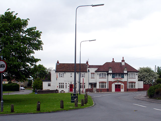
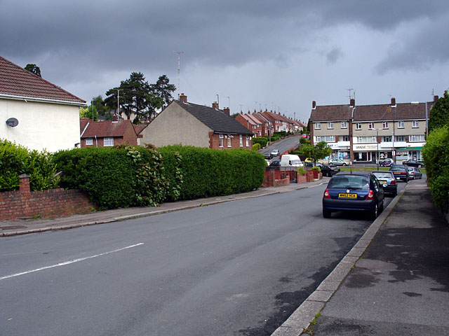
Staple Hill is a small suburban area located in the South Gloucestershire county in England. It is situated approximately 6 miles northeast of the city of Bristol, making it an ideal residential area for commuters. The area is part of the larger town of Mangotsfield and is bordered by Fishponds to the south and Downend to the east.

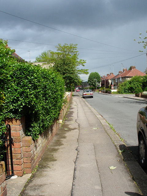
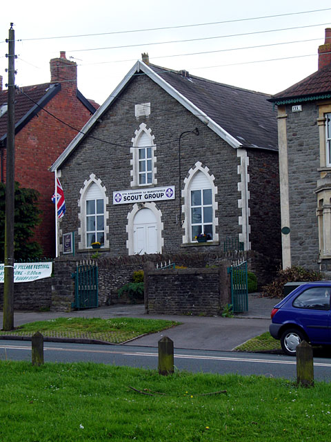
Staple Hill is primarily a residential area, with a mix of housing ranging from Victorian terraced houses to more modern developments. The community is made up of a diverse range of residents, including families, professionals, and retirees. The area offers a range of amenities, including local shops, supermarkets, pubs, and restaurants, providing residents with convenient access to everyday essentials.

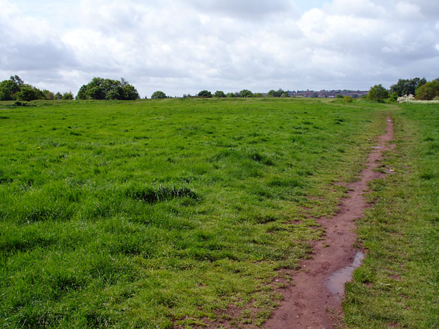
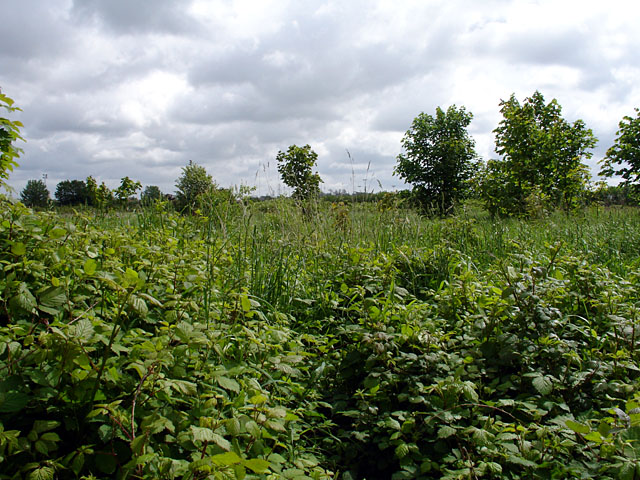
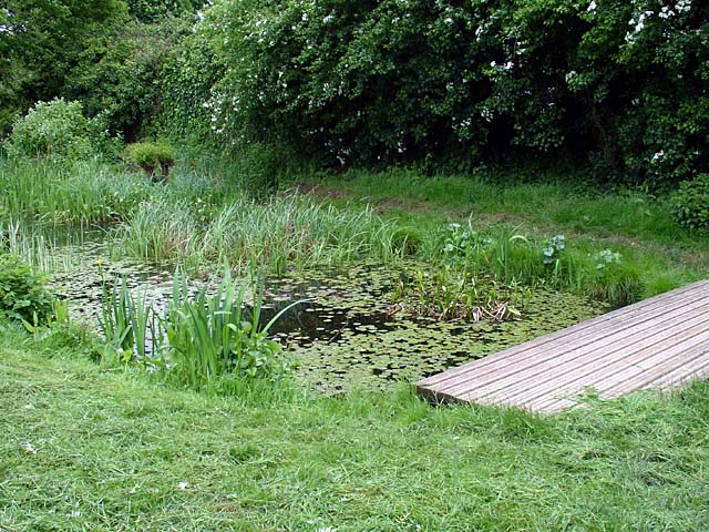
Nature lovers can enjoy the nearby Page Park, a well-maintained public park that offers open green spaces, a children's playground, and a variety of recreational facilities. Additionally, the Bristol and Bath Railway Path, a popular cycling and walking route, runs adjacent to Staple Hill, providing residents with opportunities for outdoor activities.

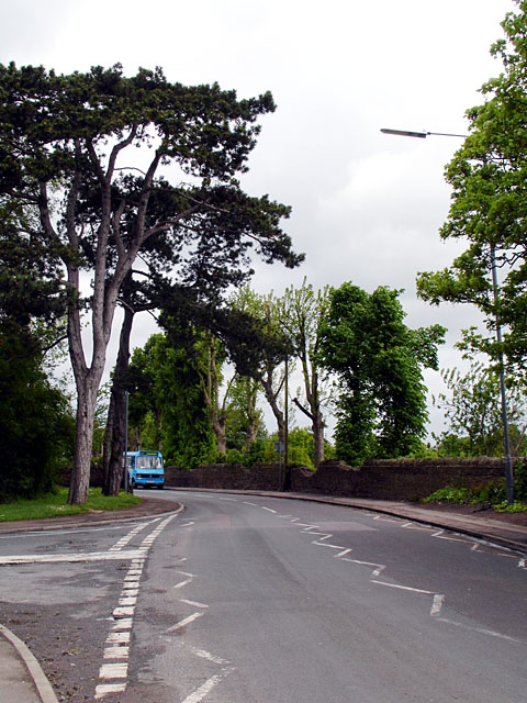
Transport links in Staple Hill are excellent, with regular bus services connecting the area to Bristol city center and surrounding towns. The nearby Bristol Parkway train station provides further transport options, offering direct trains to destinations including London, Cardiff, and Birmingham.

Overall, Staple Hill offers a peaceful suburban lifestyle with easy access to nearby urban amenities, making it an attractive place to live for those seeking a balance between city convenience and a quieter residential environment.

If you have any feedback on the listing, please let us know in the comments section below.
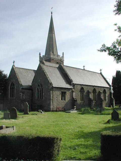
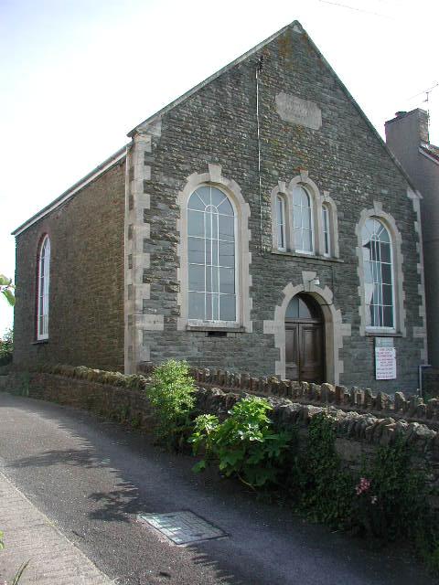
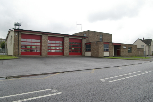
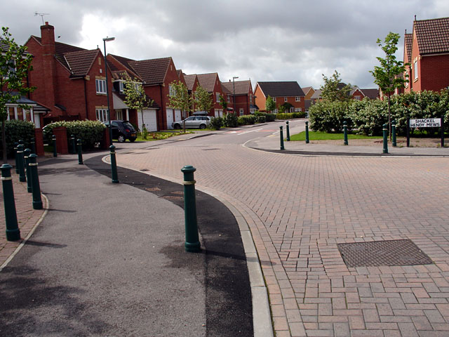
Staple Hill Images

Images are sourced within 2km of 51.480241/-2.49505 or Grid Reference ST6575. Thanks to Geograph Open Source API. All images are credited.

Downend (Glos) St Augustine of Canterbury RC Church Really a suburb of Bristol, but South Glos people  are fiercely independent. This Catholic Church is a notable feature in this sea of 1950s and 1960s housing.
Downend (Glos) St Augustine of Canterbury RC Church
Really a suburb of Bristol, but South Glos people are fiercely independent. This Catholic Church is a notable feature in this sea of 1950s and 1960s housing.
Mangotsfield (Glos) St James Church
Shortwood (Glos) Primitive Methodist Chapel
Kingswood Fire Station Kingswood Fire Station, Tenniscourt Road, Bristol is station number 10 of Avon Fire & Rescue Service
Kingswood Fire Station
Kingswood Fire Station, Tenniscourt Road, Bristol is station number 10 of Avon Fire & Rescue Service
Cycle Path in Vinny Green This area is predominantly new housing, and the developers seemed to have installed plenty of cycle paths, however some of the junctions with roads could have been designed better.
Cycle Path in Vinny Green
This area is predominantly new housing, and the developers seemed to have installed plenty of cycle paths, however some of the junctions with roads could have been designed better.
Emerson's Green Looking down Shackel Hendy Mews.

Very quiet roads, hardly met a single pedestrian along my journey.
Emerson's Green
Looking down Shackel Hendy Mews. Very quiet roads, hardly met a single pedestrian along my journey.
Rodway Hill Rodway Hill covers an area of around 34.5 acres. The name Rodway comes from the Celtic words 'rod' which means feed and 'way' which means watery. The land originally belonged to the King, and in Saxon times deer, hare, rabbit, wolf, fox and boar were all found here.
Information from a notice board near the road-side.
Rodway Hill
Rodway Hill covers an area of around 34.5 acres. The name Rodway comes from the Celtic words 'rod' which means feed and 'way' which means watery. The land originally belonged to the King, and in Saxon times deer, hare, rabbit, wolf, fox and boar were all found here. Information from a notice board near the road-side.
Stile on Rodway Road This stile is at the end of a path joining Rodway Hill Road and Cossham Street.
Stile on Rodway Road
This stile is at the end of a path joining Rodway Hill Road and Cossham Street.
Burley Grove Road junction where Burley Grove joins Mangotsfield Road, looking west. The small road which borders the grassy area is Broad St.
Burley Grove
Road junction where Burley Grove joins Mangotsfield Road, looking west. The small road which borders the grassy area is Broad St.
Looking along Burley Grove
The Lamb Inn, Mangotsfield This was originally comprised of 3 cottages, and date from 1596. There are references to a brewhouse in 1737. Most of the present structure dates from the 19th century.
The Lamb Inn, Mangotsfield
This was originally comprised of 3 cottages, and date from 1596. There are references to a brewhouse in 1737. Most of the present structure dates from the 19th century.
67th Kingswood 1st Mangotsfield Scout Group Taken from on Mangotsfield Common, this building was bought by the 67th Kingswood 1st Mangotsfield Scout Troop  in 1970 and renamed Baden Hall. It was originally the Wesleyan Methodist Church, which was built on land which was once part of the Hill House Estate.
67th Kingswood 1st Mangotsfield Scout Group
Taken from on Mangotsfield Common, this building was bought by the 67th Kingswood 1st Mangotsfield Scout Troop in 1970 and renamed Baden Hall. It was originally the Wesleyan Methodist Church, which was built on land which was once part of the Hill House Estate.
Looking along Rodway Hill Road At the junction of Rodway Hill Road and Manor Road, with a local bus just coming into view.
Rodway Hill Farm is behind the wall, although the land looked very overgrown.
Looking along Rodway Hill Road
At the junction of Rodway Hill Road and Manor Road, with a local bus just coming into view. Rodway Hill Farm is behind the wall, although the land looked very overgrown.
Rodway Hill Farm Marked on the map as Rodway Hill Farm.
Rodway Hill Farm
Marked on the map as Rodway Hill Farm.
Mangotsfield War Memorial The War Memorial is situated on the cross-roads in the centre of Mangotsfield.
Mangotsfield War Memorial
The War Memorial is situated on the cross-roads in the centre of Mangotsfield.
Looking along Burley Grove Looking out of grid square ST6575 into ST6576, the grid line is near the white van. The road beyond (going up a slight hill) is Almond Way. This is an area which contains council/housing association housing.
Looking along Burley Grove
Looking out of grid square ST6575 into ST6576, the grid line is near the white van. The road beyond (going up a slight hill) is Almond Way. This is an area which contains council/housing association housing.
Vinny Green Wildlife Pond This pond has been fenced off.
Vinny Green Wildlife Pond
This pond has been fenced off.
Emersons Green Lane This junction of Emersons Green Lane and Guest Avenue, is a cross-roads at which you must go straight on, no-matter which direction you approach it from, due to the narrowness and the bollards. View of the same junction from a different direction <a href="https://www.geograph.org.uk/photo/174593">ST6676 : Guest Avenue Crossroads</a>.
The lane running in this direction appears on maps 100 years ago, whereas the road crossing it is much newer.
Emersons Green Lane
This junction of Emersons Green Lane and Guest Avenue, is a cross-roads at which you must go straight on, no-matter which direction you approach it from, due to the narrowness and the bollards. View of the same junction from a different direction ST6676 : Guest Avenue Crossroads. The lane running in this direction appears on maps 100 years ago, whereas the road crossing it is much newer.
Show me another place!

Staple Hill is located at Grid Ref: ST6575 (Lat: 51.480241, Lng: -2.49505)

Unitary Authority: South Gloucestershire

Police Authority: Avon and Somerset

What 3 Words

///cafe.tell.admire. Near Mangotsfield, Gloucestershire

Related Wikis

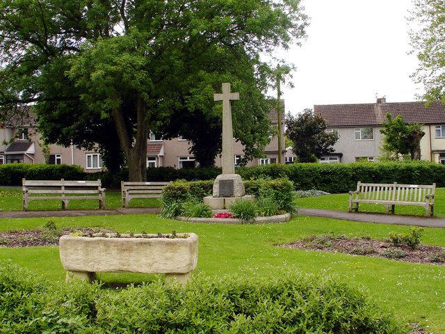
Page Park, Staple Hill

Page Park is a park in the Staple Hill area of South Gloucestershire.In 1910, the park was donated to the people of Staple Hill by Arthur William Page...

Mangotsfield

Mangotsfield is a village and former civil parish in the unitary authority area of South Gloucestershire, in the ceremonial county of Gloucestershire,...

Staple Hill, Gloucestershire

Staple Hill is a suburb of Bristol, England, lying outside the city boundary in South Gloucestershire, in the ceremonial county of Gloucestershire. It...

Mangotsfield School

Mangotsfield School is a secondary school located in Mangotsfield in South Gloucestershire, north of the Kingswood suburb of Bristol. == History == The...

Related Videos

Staple Hill green walk, Sunday, 14 November 2021

Discovering Carson's Copse and Lyde Green.

Terry's Guide to Kingswood, Bristol

Kingswood a lovely little suburb. get yerself down there like. Plenty to so n see. .

Car MOT Day Walking Through Page Park Staple Hill October 2023 DJI Pocket 2 Wind Noise Testing

downend #bristol #staplehill #pagepark #staplehillmotorcompany #dji #djipocket2 #pocket2 Car MOT day Walking through Page ...

Nearby Amenities

Located within 500m of 51.480241,-2.49505
Post Box
Post Box Type: pillar
Ref: BS16 444
Royal Cypher: GR
Royal Cypher Wikidata: Q33102273
Lat/Long: 51.4811023/-2.4926519
Post Box
Post Box Type: lamp
Ref: BS16 467
Royal Cypher: EIIR
Royal Cypher Wikidata: Q33102113
Lat/Long: 51.4808845/-2.4967063
Traffic Signals
Lat/Long: 51.4808947/-2.5003508
Turning Circle
Lat/Long: 51.4781157/-2.4988525
Post Box
Postal Code: BS16
Ref: BS16 407
Lat/Long: 51.4777492/-2.4998844
Bus Stop
Haythorn Court
Naptan AtcoCode: 0170SGA01580
Naptan Bearing: N
Naptan CommonName: Haythorn Court
Naptan NaptanCode: sglpmpw
Naptan PlusbusZoneRef: BRSTLTM
Naptan Street: Hill House Road
Naptan Verified: no
Source: naptan_import
Lat/Long: 51.4823441/-2.4959952
Bus Stop
Park Road
Naptan AtcoCode: 0170SGA10035
Naptan Bearing: N
Naptan CommonName: Park Road
Naptan Crossing: Clarence Avenue
Naptan NaptanCode: sgldwmj
Naptan PlusbusZoneRef: BRSTLTM
Naptan Street: Park Road
Naptan Verified: no
Source: naptan_import
Lat/Long: 51.4825693/-2.5006401
Bus Stop
Park Road
Naptan AtcoCode: 0170SGA10036
Naptan Bearing: S
Naptan CommonName: Park Road
Naptan Crossing: Clarence Avenue
Naptan NaptanCode: sgldwmt
Naptan PlusbusZoneRef: BRSTLTM
Naptan Street: Park Road
Naptan Verified: no
Source: naptan_import
Lat/Long: 51.4827768/-2.5004839
Bus Stop
Park Road
Naptan AtcoCode: 0170SGA10037
Naptan Bearing: E
Naptan CommonName: Park Road
Naptan Crossing: Park Road
Naptan NaptanCode: sgldwpj
Naptan PlusbusZoneRef: BRSTLTM
Naptan Street: South View
Naptan Verified: no
Source: naptan_import
Lat/Long: 51.4833863/-2.5000645
Bus Stop
Hill House Road
Naptan AtcoCode: 0170SGA10038
Naptan Bearing: E
Naptan CommonName: Hill House Road
Naptan Crossing: Hill House Road
Naptan NaptanCode: sglgawg
Naptan PlusbusZoneRef: BRSTLTM
Naptan Street: South View
Naptan Verified: no
Source: naptan_import
Lat/Long: 51.4834586/-2.4966174
Bus Stop
Teewell Hill
Naptan AtcoCode: 0170SGB20014
Naptan Bearing: W
Naptan CommonName: Teewell Hill
Naptan Crossing: Saunders Road
Naptan NaptanCode: sgldwgp
Naptan PlusbusZoneRef: BRSTLTM
Naptan Street: Broad Street
Naptan Verified: no
Source: naptan_import
Lat/Long: 51.4808734/-2.5019176
Bus Stop
Jubilee Road
Naptan AtcoCode: 0170SGB20324
Naptan Bearing: NW
Naptan CommonName: Jubilee Road
Naptan Crossing: Baglyn Avenue
Naptan NaptanCode: sglgdgj
Naptan PlusbusZoneRef: BRSTLTM
Naptan Street: Station Road
Naptan Verified: no
Source: naptan_import
Lat/Long: 51.4767465/-2.4954934
Bus Stop
Jubilee Road
Naptan AtcoCode: 0170SGB20325
Naptan Bearing: E
Naptan CommonName: Jubilee Road
Naptan Crossing: Station Road
Naptan NaptanCode: sglgdaj
Naptan PlusbusZoneRef: BRSTLTM
Naptan Street: Jubilee Road
Naptan Verified: no
Source: naptan_import
Lat/Long: 51.4776623/-2.4958057
Bus Stop
Station Road
Naptan AtcoCode: 0170SGB20326
Naptan Bearing: NE
Naptan CommonName: Station Road
Naptan NaptanCode: sglgapw
Naptan PlusbusZoneRef: BRSTLTM
Naptan Street: N/A
Naptan Verified: no
Source: naptan_import
Lat/Long: 51.4786734/-2.497665
Bus Stop
Station Road
Naptan AtcoCode: 0170SGB20327
Naptan Bearing: W
Naptan CommonName: Station Road
Naptan Crossing: Eastleigh Close
Naptan NaptanCode: sglgamg
Naptan PlusbusZoneRef: BRSTLTM
Naptan Street: Station Road
Naptan Verified: no
Source: naptan_import
Lat/Long: 51.478684/-2.4987111
Bus Stop
Charnell Road
Naptan AtcoCode: 0170SGB20328
Naptan Bearing: N
Naptan CommonName: Charnell Road
Naptan Crossing: Teewell Avenue
Naptan NaptanCode: sgldwtj
Naptan PlusbusZoneRef: BRSTLTM
Naptan Street: Teewell Hill
Naptan Verified: no
Source: naptan_import
Lat/Long: 51.479578/-2.4999305
Bus Stop
Staple Hill Police Station
Naptan AtcoCode: 0170SGB20329
Naptan Bearing: E
Naptan CommonName: Staple Hill Police Station
Naptan Crossing: Teewell Hill
Naptan NaptanCode: sgldwpw
Naptan PlusbusZoneRef: BRSTLTM
Naptan Street: Broad Street
Naptan Verified: no
Source: naptan_import
Lat/Long: 51.4809358/-2.499931
Bus Stop
Hillhouse Road
Naptan AtcoCode: 0170SGB20330
Naptan Bearing: E
Naptan CommonName: Hillhouse Road
Naptan Crossing: The Hawthornes
Naptan NaptanCode: sglgawj
Naptan PlusbusZoneRef: BRSTLTM
Naptan Street: Broad Street
Naptan Verified: no
Source: naptan_import
Lat/Long: 51.4810581/-2.4965337
Bus Stop
Hillhouse Road
Naptan AtcoCode: 0170SGB20331
Naptan Bearing: W
Naptan CommonName: Hillhouse Road
Naptan Crossing: White Lodge Road
Naptan NaptanCode: sglgatp
Naptan PlusbusZoneRef: BRSTLTM
Naptan Street: Broad Street
Naptan Verified: no
Source: naptan_import
Lat/Long: 51.4809041/-2.4968057
Bus Stop
Burley Grove
Naptan AtcoCode: 0170SGB20332
Naptan Bearing: W
Naptan CommonName: Burley Grove
Naptan Crossing: Broad Street
Naptan NaptanCode: sglgjaw
Naptan PlusbusZoneRef: BRSTLTM
Naptan Street: Mangotsfield Road
Naptan Verified: no
Source: naptan_import
Lat/Long: 51.4812681/-2.492086
Bus Stop
Burley Grove
Naptan AtcoCode: 0170SGB20333
Naptan Bearing: E
Naptan CommonName: Burley Grove
Naptan Crossing: Burley Grove
Naptan NaptanCode: sglgjgd
Naptan PlusbusZoneRef: BRSTLTM
Naptan Street: Mangotsfield Road
Naptan Verified: no
Source: naptan_import
Lat/Long: 51.4814955/-2.4916451
Bus Stop
Mangotsfield Road
Naptan AtcoCode: 0170SGB20334
Naptan Bearing: E
Naptan CommonName: Mangotsfield Road
Naptan Crossing: Westering Close
Naptan NaptanCode: sglgmdt
Naptan PlusbusZoneRef: BRSTLTM
Naptan Street: Mangotsfield Road
Naptan Verified: no
Source: naptan_import
Lat/Long: 51.4822957/-2.4887706
Bus Stop
Charnill Brow
Naptan AtcoCode: 0170SGB20362
Naptan Bearing: S
Naptan CommonName: Charnill Brow
Naptan Crossing: Mangotsfield Road
Naptan NaptanCode: sglgjwj
Naptan PlusbusZoneRef: BRSTLTM
Naptan Street: Charnhill Drive
Naptan Verified: no
Source: naptan_import
Lat/Long: 51.481635/-2.489786
Bus Stop
Charnhill Brow
Naptan AtcoCode: 0170SGB20363
Naptan Bearing: N
Naptan CommonName: Charnhill Brow
Naptan Crossing: Mangotsfield Road
Naptan NaptanCode: sglgjtw
Naptan PlusbusZoneRef: BRSTLTM
Naptan Street: Charnhill Drive
Naptan Verified: no
Source: naptan_import
Lat/Long: 51.4815803/-2.4899726
Bus Stop
Charnhill Crescent
Naptan AtcoCode: 0170SGB20364
Naptan Bearing: W
Naptan CommonName: Charnhill Crescent
Naptan NaptanCode: sglgjap
Naptan PlusbusZoneRef: BRSTLTM
Naptan Street: Charnhill Drive
Naptan Verified: no
Source: naptan_import
Lat/Long: 51.4791882/-2.492179
Bus Stop
Charnhill Crescent
Naptan AtcoCode: 0170SGB20365
Naptan Bearing: E
Naptan CommonName: Charnhill Crescent
Naptan NaptanCode: sglgjaj
Naptan PlusbusZoneRef: BRSTLTM
Naptan Street: Charnhill Drive
Naptan Verified: no
Source: naptan_import
Lat/Long: 51.4792563/-2.4922417
Bus Stop
Signal Road
Naptan AtcoCode: 0170SGB20366
Naptan Bearing: W
Naptan CommonName: Signal Road
Naptan Crossing: Teewell Hill
Naptan NaptanCode: sglgajm
Naptan PlusbusZoneRef: BRSTLTM
Naptan Street: Signal Road
Naptan Verified: no
Source: naptan_import
Lat/Long: 51.4790058/-2.4991611
Bus Stop
Gerrish Avenue
Naptan AtcoCode: 0170SGB20389
Naptan Bearing: W
Naptan CommonName: Gerrish Avenue
Naptan Crossing: Albion Close
Naptan NaptanCode: sglgjad
Naptan PlusbusZoneRef: BRSTLTM
Naptan Street: Gerrish Avenue
Naptan Verified: no
Source: naptan_import
Lat/Long: 51.4842404/-2.4924638
Bus Stop
Hill House Road
Naptan AtcoCode: 0170SGB20390
Naptan Bearing: W
Naptan CommonName: Hill House Road
Naptan Crossing: Hill House Road
Naptan NaptanCode: sglgawd
Naptan PlusbusZoneRef: BRSTLTM
Naptan Street: South View
Naptan Verified: no
Source: naptan_import
Lat/Long: 51.4833056/-2.4966589
Bus Stop
Park Road
Naptan AtcoCode: 0170SGB20394
Naptan Bearing: W
Naptan CommonName: Park Road
Naptan Crossing: Park Road
Naptan NaptanCode: sgldwpg
Naptan PlusbusZoneRef: BRSTLTM
Naptan Street: South View
Naptan Verified: no
Source: naptan_import
Lat/Long: 51.4833174/-2.5002306
Bus Stop
Teewell Hill
Naptan AtcoCode: 0170SGY38492
Naptan Bearing: E
Naptan CommonName: Teewell Hill
Naptan Crossing: Lydney Road
Naptan NaptanCode: sgldwjd
Naptan PlusbusZoneRef: BRSTLTM
Naptan Street: Broad Street
Naptan Verified: no
Source: naptan_import
Lat/Long: 51.4810016/-2.5013574
Bus Stop
Charnell Road
Naptan AtcoCode: 0170SGY38494
Naptan Bearing: S
Naptan CommonName: Charnell Road
Naptan Crossing: Teewell Avenue
Naptan NaptanCode: sgldwtp
Naptan PlusbusZoneRef: BRSTLTM
Naptan Street: Teewell Hill
Naptan Verified: no
Source: naptan_import
Lat/Long: 51.4801175/-2.4999364
Staple Hill War Memorial
HE Ref: 1425490
Description: The memorial takes the form of an obelisk with a tapering shaft, in hammered stone, set on a high, square-section plinth with a moulded base and cornice. At the base of each face of the obelisk is a bronze relief of a laurel wreath with two draped flags.
Heritage Operator: he
Historic: memorial
Leisure: park
Listed Status: Grade II
Material: stone
Memorial: war_memorial
Wikidata: Q26677202
Lat/Long: 51.4811857/-2.4993185
Post Box
Post Box Type: pillar
Ref: BS16 545
Lat/Long: 51.4789246/-2.4933643
Barrier: cycle_barrier
Lat/Long: 51.4788468/-2.4960633
Barrier: cycle_barrier
Lat/Long: 51.4787907/-2.4971482
Barrier: cycle_barrier
Lat/Long: 51.4800507/-2.4968801
Barrier: cycle_barrier
Lat/Long: 51.4800892/-2.4973843
Barrier: bollard
Lat/Long: 51.4816687/-2.4897096
Barrier: stile
Lat/Long: 51.4816469/-2.4974925
Power: substation
Lat/Long: 51.4845944/-2.4958383
Cafe
Bean Tree Cafe
Addr City: Bristol
Addr Housenumber: 21
Addr Postcode: BS16 5LB
Addr Street: Park Road
Outdoor Seating: yes
Lat/Long: 51.4819875/-2.4989788
Colour: grey
Man Made: street_cabinet
Street Cabinet: telecom
Lat/Long: 51.4834103/-2.4983598
Colour: grey
Man Made: street_cabinet
Street Cabinet: telecom
Lat/Long: 51.4840436/-2.496152
TEEWELL AVE O/D S/S
Brand: National Grid
Brand Wikidata: Q1465461
Operator: National Grid Electricity Distribution Plc
Operator Old: Western Power Distribution
Operator Wikidata: Q7988183
Owner: National Grid Electricity Distribution (South West) Plc
Owner Wikidata: Q114397866
Power: substation
Ref: 1548
Lat/Long: 51.4797545/-2.5006498
Man Made: street_cabinet
Lat/Long: 51.4790867/-2.4973903
Grit Bin
Colour: yellow
Material: plastic
Lat/Long: 51.4788973/-2.4935752
Man Made: street_cabinet
Lat/Long: 51.4793018/-2.4916988
Colour: green
Man Made: street_cabinet
Lat/Long: 51.4789835/-2.4940175
Waste Basket
Lat/Long: 51.481229/-2.4883811
Bench
Lat/Long: 51.4812334/-2.4883426
Colour: grey
Man Made: street_cabinet
Lat/Long: 51.479742/-2.4932896
Grit Bin
Colour: yellow
Material: plastic
Lat/Long: 51.4801958/-2.495966
Grit Bin
Colour: yellow
Material: plastic
Lat/Long: 51.4798644/-2.4975981
Grit Bin
Colour: yellow
Material: plastic
Lat/Long: 51.4795756/-2.4962499
Communication Mobile Phone: yes
Man Made: mast
Operator: Vodafone
Tower Construction: tube
Tower Type: communication
Lat/Long: 51.4809749/-2.5010651
Colour: green
Man Made: street_cabinet
Lat/Long: 51.4809562/-2.4955609
Colour: green
Man Made: street_cabinet
Lat/Long: 51.4811165/-2.4958231
Colour: green
Man Made: street_cabinet
Lat/Long: 51.481106/-2.4957645
Colour: green
Man Made: street_cabinet
Lat/Long: 51.4811146/-2.4956875
Colour: green
Man Made: street_cabinet
Lat/Long: 51.4813428/-2.4923225
Colour: grey
Man Made: street_cabinet
Lat/Long: 51.4813378/-2.4922876
Colour: green
Man Made: street_cabinet
Lat/Long: 51.4818992/-2.4897336
Colour: green
Man Made: street_cabinet
Lat/Long: 51.4818625/-2.4898291
Power: pole
Lat/Long: 51.4759132/-2.4937433
Power: pole
Lat/Long: 51.476158/-2.4942758
Power: pole
Lat/Long: 51.4763041/-2.4942248
Power: pole
Lat/Long: 51.4764027/-2.4948028
Power: pole
Lat/Long: 51.4764804/-2.4946151
Power: pole
Lat/Long: 51.4766124/-2.4952722
Power: pole
Lat/Long: 51.4767443/-2.4951998
Power: pole
Lat/Long: 51.4767903/-2.4956773
Power: pole
Lat/Long: 51.4769941/-2.4961236
Power: pole
Lat/Long: 51.4772055/-2.4965802
Power: pole
Lat/Long: 51.4770228/-2.4970619
Power: pole
Lat/Long: 51.4768524/-2.4975259
Power: pole
Lat/Long: 51.4767563/-2.4980798
Power: pole
Lat/Long: 51.4766769/-2.4986404
Power: pole
Lat/Long: 51.4763416/-2.4980875
Colour: grey
Man Made: street_cabinet
Lat/Long: 51.4766685/-2.4990128
Colour: grey
Man Made: street_cabinet
Lat/Long: 51.4766922/-2.4978734
Barrier: block
Bicycle: yes
Foot: yes
Motor Vehicle: no
Lat/Long: 51.4790537/-2.4993145
Man Made: pumping_station
Operator: Wales and West
Pumping Station: gas
Lat/Long: 51.4812256/-2.5003219
Toilets
Access: yes
Unisex: yes
Wheelchair: yes
Lat/Long: 51.4820266/-2.4991769
Defibrillator
Defibrillator Location: On outside wall of Bean Tree cafe adjecent to toilet entrance.
Emergency: defibrillator
Indoor: no
Operator: SWAST
Ref: SS0044
Lat/Long: 51.4820391/-2.4991264
Leisure: pitch
Sport: table_tennis
Lat/Long: 51.481352/-2.4969858
Bicycle Parking
Lat/Long: 51.4810434/-2.4981038
Power: pole
Lat/Long: 51.4813368/-2.4958638
Power: pole
Lat/Long: 51.481681/-2.4958854
Power: pole
Lat/Long: 51.4820441/-2.4958971
Drinking Water
Lat/Long: 51.4814285/-2.4979131
The data included in this document is from www.openstreetmap.org. The data is made available under ODbL.

Have you been to Staple Hill?

Leave your review of Staple Hill below (or comments, questions and feedback).