Stanton
Settlement in Monmouthshire
Wales
Stanton

Stanton is a small village located in the county of Monmouthshire, Wales. Situated on the eastern edge of the Brecon Beacons National Park, it is surrounded by picturesque countryside and offers stunning views of rolling hills and tranquil landscapes.
The village itself is characterized by its charming rural atmosphere and traditional architecture. It is primarily made up of stone cottages and farmhouses, giving it a quaint and timeless feel. The community is close-knit, with a population of around 300 residents who take pride in their village and its heritage.
Stanton is well-known for its agricultural activities, with farming being a significant part of the local economy. The fertile land surrounding the village is utilized for grazing livestock and cultivating crops, contributing to the area's natural beauty and productivity.
Despite its small size, Stanton boasts a lively community spirit. The village is home to a few local businesses, including a village shop and a pub, which serve as gathering places for both residents and visitors. The village hall also hosts various events throughout the year, such as community meetings, celebrations, and recreational activities.
For outdoor enthusiasts, Stanton offers plenty of opportunities to explore the surrounding countryside. The village is located near several walking and cycling trails, including the famous Offa's Dyke Path, which runs along the Welsh-English border. This makes Stanton an ideal base for outdoor adventures and discovering the natural wonders of Monmouthshire.
Overall, Stanton provides a tranquil and idyllic setting for those seeking a peaceful rural retreat, with its stunning landscapes, strong sense of community, and access to outdoor activities.
If you have any feedback on the listing, please let us know in the comments section below.
Stanton Images
Images are sourced within 2km of 51.883273/-3.0038739 or Grid Reference SO3121. Thanks to Geograph Open Source API. All images are credited.

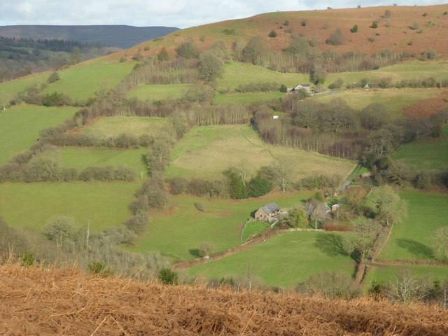


![View south west from the hill edge at Gaer The view is across a green valley towards the slopes of the Sugar Loaf [Y Fal]. Taken from near the boundary of the hill fort of Twyn y Gaer.](https://s2.geograph.org.uk/geophotos/06/74/93/6749390_59f718fa.jpg)


Stanton is located at Grid Ref: SO3121 (Lat: 51.883273, Lng: -3.0038739)
Unitary Authority: Monmouthshire
Police Authority: Gwent
What 3 Words
///local.acoustics.monk. Near Llancillo, Herefordshire
Nearby Locations
Related Wikis

Llwyn-celyn Farmhouse, Llanvihangel Crucorney
Llwyn-celyn Farmhouse, Llanvihangel Crucorney, Monmouthshire is a farmhouse of late medieval origins. It is a Grade I listed building. == History == The...

Pen y Clawdd Castle
Pen y Clawdd Castle is a ditched mound with a double moat, roughly circular in shape, with a diameter of approximately 28m to 30m and about 2.4m high....

Pen-y-Clawdd Court
Pen-y-Clawdd Court is a Grade I listed country house in Llanvihangel Crucorney, Monmouthshire, Wales, situated 1 mile (1.6 km) to the southwest of the...
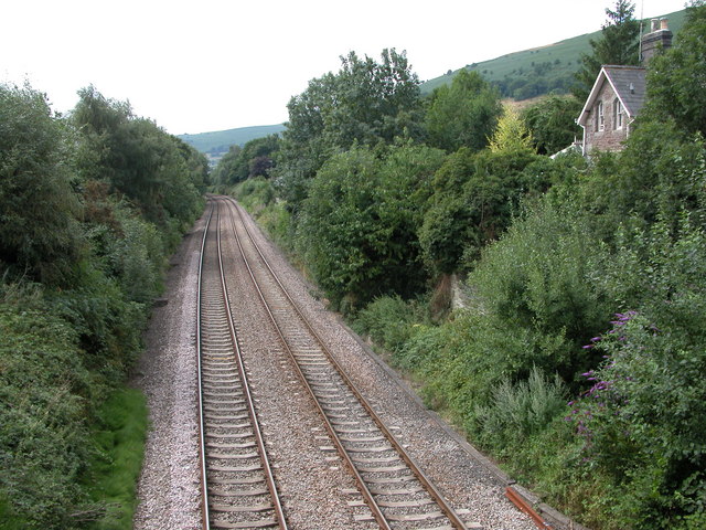
Llanvihangel railway station
Llanvihangel railway station was a former station which served the Monmouthshire village of Llanvihangel Crucorney. It was located on the Welsh Marches...
Nearby Amenities
Located within 500m of 51.883273,-3.0038739Have you been to Stanton?
Leave your review of Stanton below (or comments, questions and feedback).