Bodelva
Settlement in Cornwall
England
Bodelva
Bodelva is a small rural village located in Cornwall, England. Situated approximately 6 miles northeast of St Austell, it is nestled in the picturesque countryside of the region. Bodelva is known for its tranquil and idyllic setting, surrounded by rolling hills and farmland.
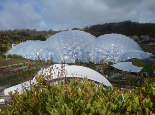
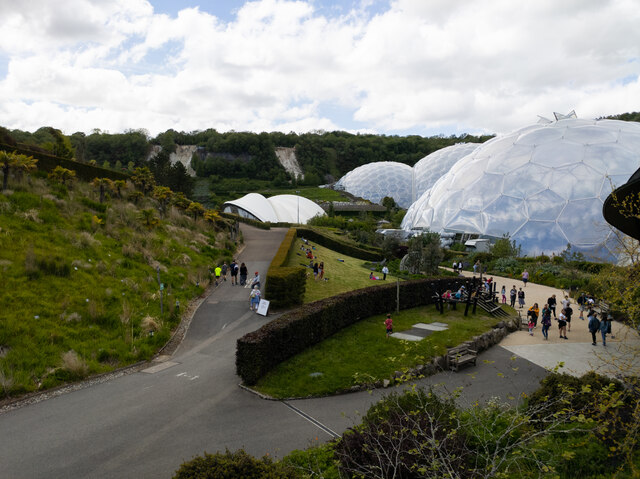
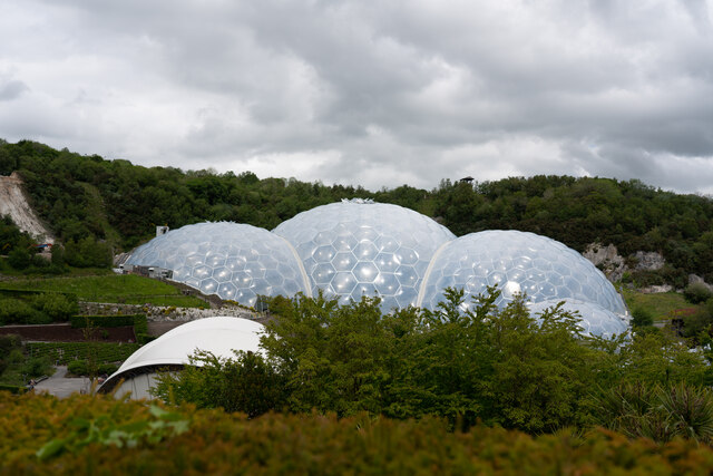
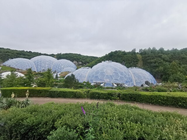
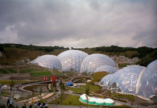
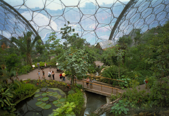
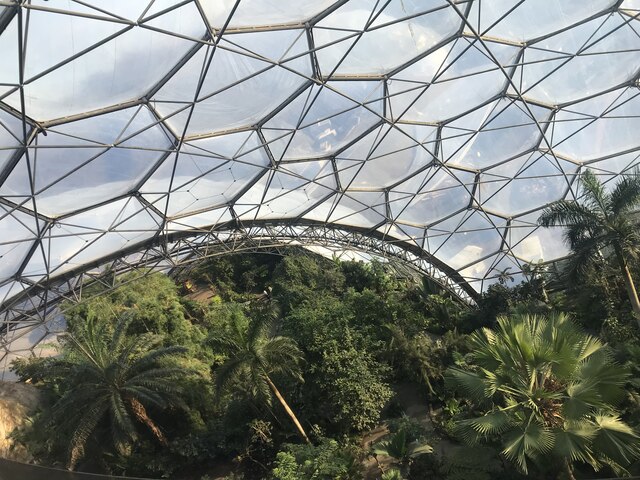
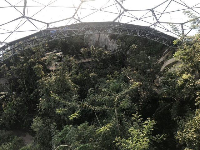
One of the prominent features of Bodelva is its proximity to the world-renowned Eden Project, which is just a stone's throw away. The Eden Project is a popular tourist attraction, showcasing stunning botanical gardens housed within giant biomes, and offering educational and environmental experiences.
Despite its small size, Bodelva offers a range of amenities and facilities for both residents and visitors. The village is home to a traditional pub, serving locally sourced food and beverages, as well as a convenience store to cater to everyday needs. Bodelva also has a primary school, providing education for local children.
The village acts as a gateway to the beautiful Cornish coastline, with several stunning beaches nearby, including the popular Par Sands Beach and the picturesque Polkerris Beach. These coastal areas offer opportunities for swimming, water sports, and scenic walks along the cliffs.
Bodelva has a strong sense of community, with regular events and activities taking place throughout the year. The village also benefits from excellent transport links, with the A390 road passing through, connecting it to nearby towns and the wider Cornwall region.
In summary, Bodelva is a charming and peaceful village, offering a blend of rural beauty and access to nearby attractions. Its close proximity to the Eden Project and the stunning Cornish coastline makes it an attractive destination for both locals and tourists alike.
If you have any feedback on the listing, please let us know in the comments section below.
Bodelva Images
Images are sourced within 2km of 50.361062/-4.737282 or Grid Reference SX0554. Thanks to Geograph Open Source API. All images are credited.

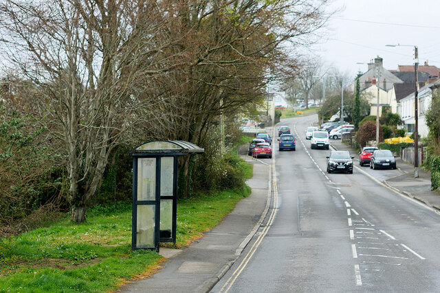
![Bridge Street, St Blazey St Blazey (Cornish: Lanndreth) is a small town in Cornwall, 3 miles (4.8 km) east of St Austell. The town takes its name from the Armenian Saint Blaise who, in Christian tradition, is believed to have &quot;cure[d] toothache, sore throats and cattle diseases&quot;.
The local mining industries once dominated the town; historically copper and tin were mined in and around the parish, whilst more recently china clay has been the principal commodity mined. <a href="https://www.geograph.org.uk/photo/1701065">SX0554 : The Eden Project</a> is located about a mile and a half (2 km) from the centre of the town and the large number of visitors this attracts has led to the development of tourism in the town.
St Blazey. (2022, April 23). In Wikipedia. <span class="nowrap"><a title="https://en.wikipedia.org/wiki/St_Blazey" rel="nofollow ugc noopener" href="https://en.wikipedia.org/wiki/St_Blazey">Link</a><img style="margin-left:2px;" alt="External link" title="External link - shift click to open in new window" src="https://s1.geograph.org.uk/img/external.png" width="10" height="10"/></span>](https://s3.geograph.org.uk/geophotos/07/34/75/7347531_986ab475.jpg)
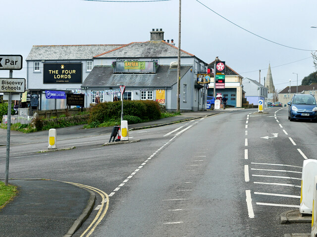

![Rose Hill, St Blazey St Blazey (Cornish: Lanndreth) is a small town in Cornwall, 3 miles (4.8 km) east of St Austell. The town takes its name from the Armenian Saint Blaise who, in Christian tradition, is believed to have &quot;cure[d] toothache, sore throats and cattle diseases&quot;.
The local mining industries once dominated the town; historically copper and tin were mined in and around the parish, whilst more recently china clay has been the principal commodity mined. <a href="https://www.geograph.org.uk/photo/1701065">SX0554 : The Eden Project</a> is located about a mile and a half (2 km) from the centre of the town and the large number of visitors this attracts has led to the development of tourism in the town.
St Blazey. (2022, April 23). In Wikipedia. <span class="nowrap"><a title="https://en.wikipedia.org/wiki/St_Blazey" rel="nofollow ugc noopener" href="https://en.wikipedia.org/wiki/St_Blazey">Link</a><img style="margin-left:2px;" alt="External link" title="External link - shift click to open in new window" src="https://s1.geograph.org.uk/img/external.png" width="10" height="10"/></span>](https://s1.geograph.org.uk/geophotos/07/34/75/7347541_fcb16d1e.jpg)
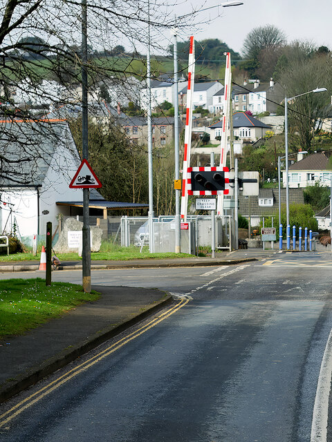
![Church Hill, St Blazey St Blazey (Cornish: Lanndreth) is a small town in Cornwall, 3 miles (4.8 km) east of St Austell. The town takes its name from the Armenian Saint Blaise who, in Christian tradition, is believed to have &quot;cure[d] toothache, sore throats and cattle diseases&quot;. The church, which was built between 1440 and 1445, is dedicated to Saint Blaise. It is a Grade II* listed building (List Entry Number:
1289700 <span class="nowrap"><a title="https://historicengland.org.uk/listing/the-list/list-entry/1289700" rel="nofollow ugc noopener" href="https://historicengland.org.uk/listing/the-list/list-entry/1289700">Link</a><img style="margin-left:2px;" alt="External link" title="External link - shift click to open in new window" src="https://s1.geograph.org.uk/img/external.png" width="10" height="10"/></span> Historic England).
The local mining industries once dominated the town; historically copper and tin were mined in and around the parish, whilst more recently china clay has been the principal commodity mined. <a href="https://www.geograph.org.uk/photo/1701065">SX0554 : The Eden Project</a> is located about a mile and a half (2 km) from the centre of the town and the large number of visitors this attracts has led to the development of tourism in the town.
St Blazey. (2022, April 23). In Wikipedia. <span class="nowrap"><a title="https://en.wikipedia.org/wiki/St_Blazey" rel="nofollow ugc noopener" href="https://en.wikipedia.org/wiki/St_Blazey">Link</a><img style="margin-left:2px;" alt="External link" title="External link - shift click to open in new window" src="https://s1.geograph.org.uk/img/external.png" width="10" height="10"/></span>](https://s3.geograph.org.uk/geophotos/07/34/75/7347543_38528efc.jpg)
Bodelva is located at Grid Ref: SX0554 (Lat: 50.361062, Lng: -4.737282)
Unitary Authority: Cornwall
Police Authority: Devon and Cornwall
What 3 Words
///votes.heartburn.alerting. Near Par, Cornwall
Nearby Locations
Related Wikis

Bodelva
Bodelva (Cornish: Boselwydh) is a hamlet in south Cornwall, England, UK, in the civil parish of St Blaise. It is about 1 mile (1.6 km) west of St Blazey...

Eden Project
The Eden Project (Cornish: Edenva) is a visitor attraction in Cornwall, England. The project is located in a reclaimed china clay pit, located 2 km (1...

Clay Trails
The Clay Trails are a series of bicycle trails located in mid Cornwall, England, United Kingdom. The trails pass through the St Austell moorland which...

World Pasty Championships
The World Pasty Championships were an annual event held in Cornwall to celebrate the Cornish Pasty and its variants, with entrants from around the world...
Nearby Amenities
Located within 500m of 50.361062,-4.737282Have you been to Bodelva?
Leave your review of Bodelva below (or comments, questions and feedback).