Boddin

Settlement in Angus

Scotland

Boddin

North End of Lunan Beach Tide was on its way in, and a very blustery day whipping up the surf. In the distance on the RHS are The Limekilns at Boddin.
North End of Lunan Beach Credit: Jacqueline Hamilton

Boddin is a small settlement located in the county of Angus, Scotland. Situated in the northeastern part of the country, Boddin is surrounded by picturesque landscapes and rolling hills that are characteristic of the region. The settlement is nestled between the larger towns of Brechin and Montrose, offering a peaceful and rural environment for its residents.

Boddin is known for its agricultural heritage, with much of the surrounding land used for farming and livestock grazing. The area is particularly renowned for its production of high-quality crops, including barley, oats, and potatoes. The fertile soil and favorable climate create ideal conditions for agriculture, contributing to the local economy and providing employment opportunities for the community.

The settlement itself consists of a small number of residential properties, many of which are traditional stone-built houses. Boddin offers a close-knit community atmosphere, with residents often engaging in social activities and events together. The local primary school serves the educational needs of the area, ensuring that children have access to quality education without the need to travel long distances.

While Boddin may be small in size, its natural beauty and peaceful ambiance make it an attractive place to reside for those seeking a tranquil rural lifestyle. Its proximity to larger towns ensures that residents have access to essential amenities and services while enjoying the tranquility of countryside living.

If you have any feedback on the listing, please let us know in the comments section below.

Boddin Images

Images are sourced within 2km of 56.667868/-2.4747752 or Grid Reference NO7153. Thanks to Geograph Open Source API. All images are credited.

North End of Lunan Beach Tide was on its way in, and a very blustery day whipping up the surf. In the distance on the RHS are The Limekilns at Boddin.
North End of Lunan Beach
Tide was on its way in, and a very blustery day whipping up the surf. In the distance on the RHS are The Limekilns at Boddin.
Road passing Nether Dysart Road passing Nether Dysart heading towards Lunan
Road passing Nether Dysart
Road passing Nether Dysart heading towards Lunan
Natural Arch One of many arches in the cliffs both north and south of Lunan Bay.
Natural Arch
One of many arches in the cliffs both north and south of Lunan Bay.
Buckie Den 'Den' is the Scots term for a deep narrow glen. This one is spanned by the main east coast railway to and from Aberdeen. The seaward end of the den is covered by a profusion of wild flowers, though it has to be admitted that many of them are invasive aliens, like Himalayan Balsam.
Buckie Den
'Den' is the Scots term for a deep narrow glen. This one is spanned by the main east coast railway to and from Aberdeen. The seaward end of the den is covered by a profusion of wild flowers, though it has to be admitted that many of them are invasive aliens, like Himalayan Balsam.
Nether Dysart Straw bales waiting to be collected at Nether Dysart Farm.
Nether Dysart
Straw bales waiting to be collected at Nether Dysart Farm.
Looking towards Upper Dysart Upper Dysart itself is in the next square, but all the stubble fields in the foreground are in this square. The yellow lorry on the left is on the A92, which passes along the far edge of the second field.
Looking towards Upper Dysart
Upper Dysart itself is in the next square, but all the stubble fields in the foreground are in this square. The yellow lorry on the left is on the A92, which passes along the far edge of the second field.
Moon Jellyfish on Lunan Bay Beach, Angus This photo of a Moon Jellyfish (Aurelia aurita) was taken at a short distance from it and from almost directly above. Although large numbers of them can be stranded on the beach, often near the mouth of the River Lunan, this particular specimen was on its own. They are plankton feeders and have a mild, harmless sting. The distinctive four coloured gonads can be seen in this photo.
Moon Jellyfish on Lunan Bay Beach, Angus
This photo of a Moon Jellyfish (Aurelia aurita) was taken at a short distance from it and from almost directly above. Although large numbers of them can be stranded on the beach, often near the mouth of the River Lunan, this particular specimen was on its own. They are plankton feeders and have a mild, harmless sting. The distinctive four coloured gonads can be seen in this photo.
Cave in cliffs at Lunan Bay This cave has two entrances. It is positioned near the junction of the cliffs and the sandy beach at Lunan Bay.
Cave in cliffs at Lunan Bay
This cave has two entrances. It is positioned near the junction of the cliffs and the sandy beach at Lunan Bay.
North end of Lunan Bay
Coastal grazing, Braehead of Lunan
Railway bridge, Braehead of Lunan On the East Coast Main Line.
Railway bridge, Braehead of Lunan
On the East Coast Main Line.
National Cycle Route 1 Heading north, Braehead of Lunan.
National Cycle Route 1
Heading north, Braehead of Lunan.
Nether Dysart
Nether Dysart
Crop field, Nether Dysart
National Cycle Route 1 heading north  At Nether Dysart.
National Cycle Route 1 heading north
At Nether Dysart.
Farmland towards East Mains of Dysart
Country road towards Ferryden
Salmon nets below cliffs at Lunan
Show me another place!

Boddin is located at Grid Ref: NO7153 (Lat: 56.667868, Lng: -2.4747752)

Unitary Authority: Angus

Police Authority: Tayside

What 3 Words

///them.pops.scorched. Near Montrose, Angus

Related Wikis

Boddin, Angus

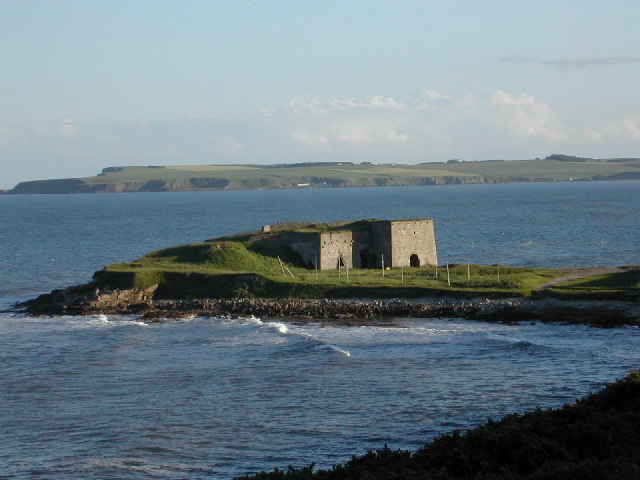
Boddin is a coastal village in Angus, Scotland, two miles south of Montrose. There are lime kilns at Boddin Point. == References ==

Lunan Bay railway station

Lunan Bay railway station served the village of Lunan, Angus, Scotland from 1883 to 1964 on the North British, Arbroath and Montrose Railway. == History... ==
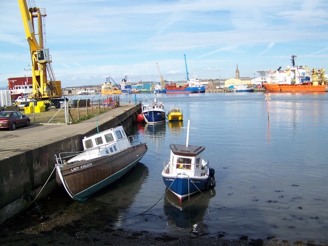
Ferryden

Ferryden is a village in Angus, Scotland in the community council area of Ferryden & Craig. It lies southerly adjacent to the town of Montrose on the south...

Lunan Water

The Lunan Water is an easterly flowing river in Angus, Scotland, that discharges to the North Sea 11 kilometres (6.8 mi) north of the town of Arbroath...

Lunan, Angus

Lunan is a hamlet in Angus, Scotland, in the parish of the same name, 6 kilometres (3.7 mi) south of Montrose. The hamlet overlooks Lunan Bay, which is...

Red Castle, Angus

Red Castle of Lunan is a ruined fortified house on the coast of Angus, Scotland. It is about 4 miles (6.4 km) south-southwest of Montrose. == History... ==

Arbikie distillery

Arbikie distillery is a scotch whisky, vodka and gin distillery in Inverkeilor, Angus, Scotland. == History == The distillery was built in 2013 on the...
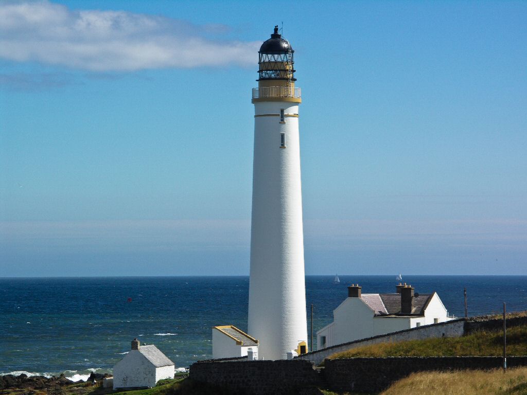
Scurdie Ness

Scurdie Ness is a headland located on the South side of the River South Esk estuary, Montrose, Angus, Scotland. The River leads from the North Sea into...

Nearby Amenities

Located within 500m of 56.667868,-2.4747752
Source: PGS
Lat/Long: 56.6721822/-2.4764479
Created By: almien_coastlines
Source: PGS
Lat/Long: 56.672278/-2.475098
Source: PGS
Lat/Long: 56.672272/-2.4742297
Lunan Bay
Natural: bay
Lat/Long: 56.6711813/-2.477584
The data included in this document is from www.openstreetmap.org. The data is made available under ODbL.

Have you been to Boddin?

Leave your review of Boddin below (or comments, questions and feedback).