St Paul's

Settlement in Gloucestershire Gloucester

England

St Paul's

Arches near Gloucester Cathedral
Arches near Gloucester Cathedral Credit: Helena Downton

St Paul's is a small village located in the county of Gloucestershire, England. Situated in the picturesque Cotswolds, it is surrounded by rolling hills and stunning countryside, making it an ideal destination for nature lovers and outdoor enthusiasts.

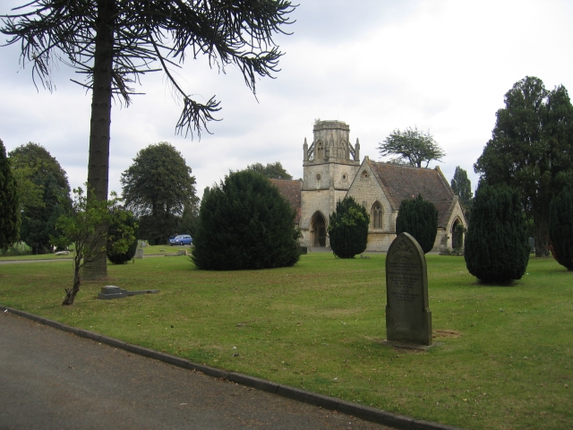
The village is known for its charming and traditional architecture, with many of its buildings dating back centuries. St Paul's is home to a beautiful parish church, which is the focal point of the village and showcases stunning stained glass windows and intricate stonework.

Although small in size, St Paul's offers a range of amenities for its residents and visitors. There is a local pub, serving delicious traditional British food and ales, where locals gather to socialize and enjoy the cozy atmosphere. Additionally, the village has a small convenience store, providing essential groceries and everyday items.

For those seeking outdoor activities, St Paul's is surrounded by scenic walking and cycling trails, offering breathtaking views of the countryside. The village is also located near several historical landmarks and attractions, providing opportunities for exploration and cultural enrichment.

St Paul's prides itself on its tight-knit community and friendly atmosphere. The villagers often organize local events and festivals, fostering a sense of community spirit and bringing people together.

Overall, St Paul's offers a peaceful and idyllic setting, providing a welcome escape from the hustle and bustle of city life. Whether you're looking for a relaxing getaway or a chance to immerse yourself in the natural beauty of the Cotswolds, St Paul's is a charming destination worth visiting.

If you have any feedback on the listing, please let us know in the comments section below.
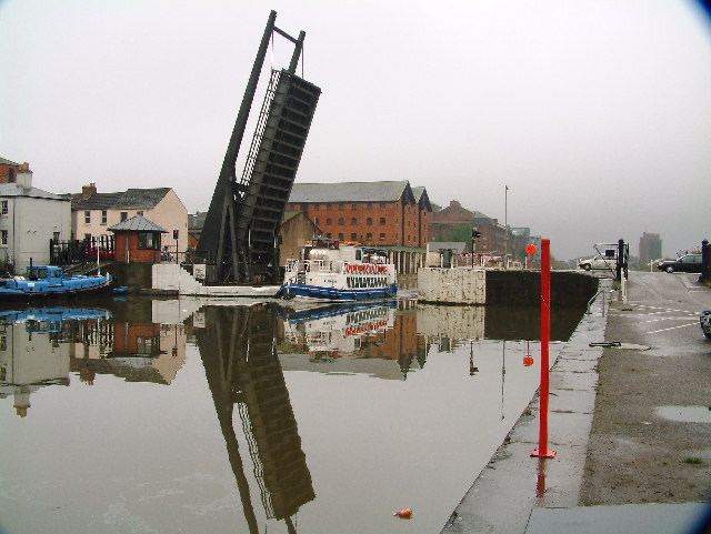
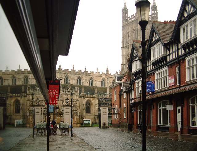
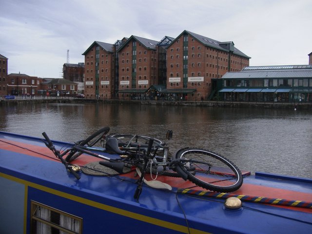
St Paul's Images

Images are sourced within 2km of 51.856247/-2.2491974 or Grid Reference SO8217. Thanks to Geograph Open Source API. All images are credited.

Arches near Gloucester Cathedral
The entrance to Gloucester Docks The River Severn is in flood and is in danger of getting higher than the water level in the lock into Gloucester Docks <span class="nowrap"><a title="http://www.gloucesterdocks.me.uk/gloucester/docks.htm" rel="nofollow ugc noopener" href="http://www.gloucesterdocks.me.uk/gloucester/docks.htm">Link</a><img style="margin-left:2px;" alt="External link" title="External link - shift click to open in new window" src="https://s1.geograph.org.uk/img/external.png" width="10" height="10"/></span> so defences have been erected! The Quay, normally visible on the right is submerged. On the other side of the road is Gloucester Gaol.
The entrance to Gloucester Docks
The River Severn is in flood and is in danger of getting higher than the water level in the lock into Gloucester Docks LinkExternal link so defences have been erected! The Quay, normally visible on the right is submerged. On the other side of the road is Gloucester Gaol.
Gloucester New Yard The machines looking like something out of "The War of the Worlds" are involved a major railway track renewal scheme
Gloucester New Yard
The machines looking like something out of "The War of the Worlds" are involved a major railway track renewal scheme
Gloucester Tramway Junction Looking across Tramway Junction and the site of the GWR loco sheds, with Gloucester station just on the left.
Gloucester Tramway Junction
Looking across Tramway Junction and the site of the GWR loco sheds, with Gloucester station just on the left.
Gloucester Docks National Waterways Museum. Steam dredger getting up a head of steam in the National waterways Museum
Gloucester Docks
National Waterways Museum. Steam dredger getting up a head of steam in the National waterways Museum
Gloucester Docks Gloucester Docks. Boat trip returning into the basin through a lifting road bridge.
Gloucester Docks
Gloucester Docks. Boat trip returning into the basin through a lifting road bridge.
Gloucester A view of the Cathedral from a narrow street
Gloucester
A view of the Cathedral from a narrow street
Gloucester Cathedral  Precinct This was Christmas Day 1969. The cathedral was closed for the day so the dancers were the only attraction for the kids in the party
Gloucester Cathedral Precinct
This was Christmas Day 1969. The cathedral was closed for the day so the dancers were the only attraction for the kids in the party
Docks at Gloucester Recently refurbished and turned into a tourist attraction with new waterfront flats.
Docks at Gloucester
Recently refurbished and turned into a tourist attraction with new waterfront flats.
Gloucester Cathedral Taken from the Cloisters
Gloucester Cathedral
Taken from the Cloisters
High Orchard Derelict buildings in Gloucester's dockland, looking north
High Orchard
Derelict buildings in Gloucester's dockland, looking north
The Crypt School, Gloucester. The school was founded in 1539 at the Church of St Mary de Crypt in the centre of Gloucester (see <a href="https://www.geograph.org.uk/photo/61705">SO8318 : The Old Crypt School Room</a>).  The school moved to these premises in 1944 as the Crypt Grammar School, and today has a special status in Science.  See:- <span class="nowrap"><a title="http://www.cryptschool.org/" rel="nofollow ugc noopener" href="http://www.cryptschool.org/">Link</a><img style="margin-left:2px;" alt="External link" title="External link - shift click to open in new window" src="https://s1.geograph.org.uk/img/external.png" width="10" height="10"/></span> On the day the photograph was taken a bring and buy sale was in full swing on the playing fields.  In the distance the clump of trees on the top of May Hill can be seen.
The Crypt School, Gloucester.
The school was founded in 1539 at the Church of St Mary de Crypt in the centre of Gloucester (see SO8318 : The Old Crypt School Room). The school moved to these premises in 1944 as the Crypt Grammar School, and today has a special status in Science. See:- LinkExternal link On the day the photograph was taken a bring and buy sale was in full swing on the playing fields. In the distance the clump of trees on the top of May Hill can be seen.
St Barnabas's Church, Gloucester By the roundabout at the junction of Stroud Road and Cole Avenue.
St Barnabas's Church, Gloucester
By the roundabout at the junction of Stroud Road and Cole Avenue.
Ukrainian Catholic Church In Derby Road, Gloucester.
Ukrainian Catholic Church
In Derby Road, Gloucester.
Tredworth Cemetery, Gloucester The chapel in this large cemetery near the old Gloucester bypass.
Tredworth Cemetery, Gloucester
The chapel in this large cemetery near the old Gloucester bypass.
Tuffley Avenue, Gloucester The house on the left is typical of many in this part of this mainly residential square.  The building on the right replaced a house demolished when a 'plane crashed into it on the 27th March 1963.  A twin engined Vickers Varsity aircraft crashed onto the house. The three elderly occupants survived unhurt apart from shock and scratches, however the house and the neighbouring property that the Drury family also owned were flooded with aviation fuel.  The plane was on a training run from Staverton Airport and tragically the crew of two were killed. See:- <span class="nowrap"><a title="http://aviation-safety.net/database/record.php?id=19630327-0" rel="nofollow ugc noopener" href="http://aviation-safety.net/database/record.php?id=19630327-0">Link</a><img style="margin-left:2px;" alt="External link" title="External link - shift click to open in new window" src="https://s1.geograph.org.uk/img/external.png" width="10" height="10"/></span> and <span class="nowrap"><a title="http://www.visit-gloucestershire.co.uk/boards/topic/72-g-apaz-the-tuffley-varsity/" rel="nofollow ugc noopener" href="http://www.visit-gloucestershire.co.uk/boards/topic/72-g-apaz-the-tuffley-varsity/">Link</a><img style="margin-left:2px;" alt="External link" title="External link - shift click to open in new window" src="https://s1.geograph.org.uk/img/external.png" width="10" height="10"/></span> .
From a personal perspective I remember cycling home from school nearby and seeing the area cordonned off and the remains of the fuselage embedded in the top half of the house.
Tuffley Avenue, Gloucester
The house on the left is typical of many in this part of this mainly residential square. The building on the right replaced a house demolished when a 'plane crashed into it on the 27th March 1963. A twin engined Vickers Varsity aircraft crashed onto the house. The three elderly occupants survived unhurt apart from shock and scratches, however the house and the neighbouring property that the Drury family also owned were flooded with aviation fuel. The plane was on a training run from Staverton Airport and tragically the crew of two were killed. See:- LinkExternal link and LinkExternal link . From a personal perspective I remember cycling home from school nearby and seeing the area cordonned off and the remains of the fuselage embedded in the top half of the house.
St Michael's Gate, Gloucester This was the entrance to the lay cemetery of St Peter's Abbey, with which Gloucester Cathedral was associated, and was also used by Pilgrims to the shrine of Edward II. Beatrix Potter's 'Tailor of Gloucester' "lived" in the shop visible on the left just before the gateway.
St Michael's Gate, Gloucester
This was the entrance to the lay cemetery of St Peter's Abbey, with which Gloucester Cathedral was associated, and was also used by Pilgrims to the shrine of Edward II. Beatrix Potter's 'Tailor of Gloucester' "lived" in the shop visible on the left just before the gateway.
Gloucester Cathedral from King Edward's Gate The modern iron gates here are on the site of the ancient gateway which gave access from the medieval main street of Gloucester to the precinct of St Peter's Abbey.  The gateway derived its name from the fact that it was here that the abbot received the body of King Edward II for burial after the King's murder at Berkeley  Castle in 1327.
Gloucester Cathedral from King Edward's Gate
The modern iron gates here are on the site of the ancient gateway which gave access from the medieval main street of Gloucester to the precinct of St Peter's Abbey. The gateway derived its name from the fact that it was here that the abbot received the body of King Edward II for burial after the King's murder at Berkeley Castle in 1327.
Show me another place!

St Paul's is located at Grid Ref: SO8217 (Lat: 51.856247, Lng: -2.2491974)

Administrative County: Gloucestershire

District: Gloucester

Police Authority: Gloucestershire

What 3 Words

///rainy.wanted.care. Near Gloucester, Gloucestershire

Nearby Locations

St Paul's High Orchard

Related Wikis

Spa Ground

Spa Ground is a cricket ground in Gloucester, Gloucestershire. The first recorded match on the ground was in 1867, when Gloucester played an All-England...

Norfolk Buildings

Norfolk Buildings is a terrace of grade II listed houses at 73-91 Bristol Road, Gloucester, on the east side between Theresa Street and Alma Place. The...

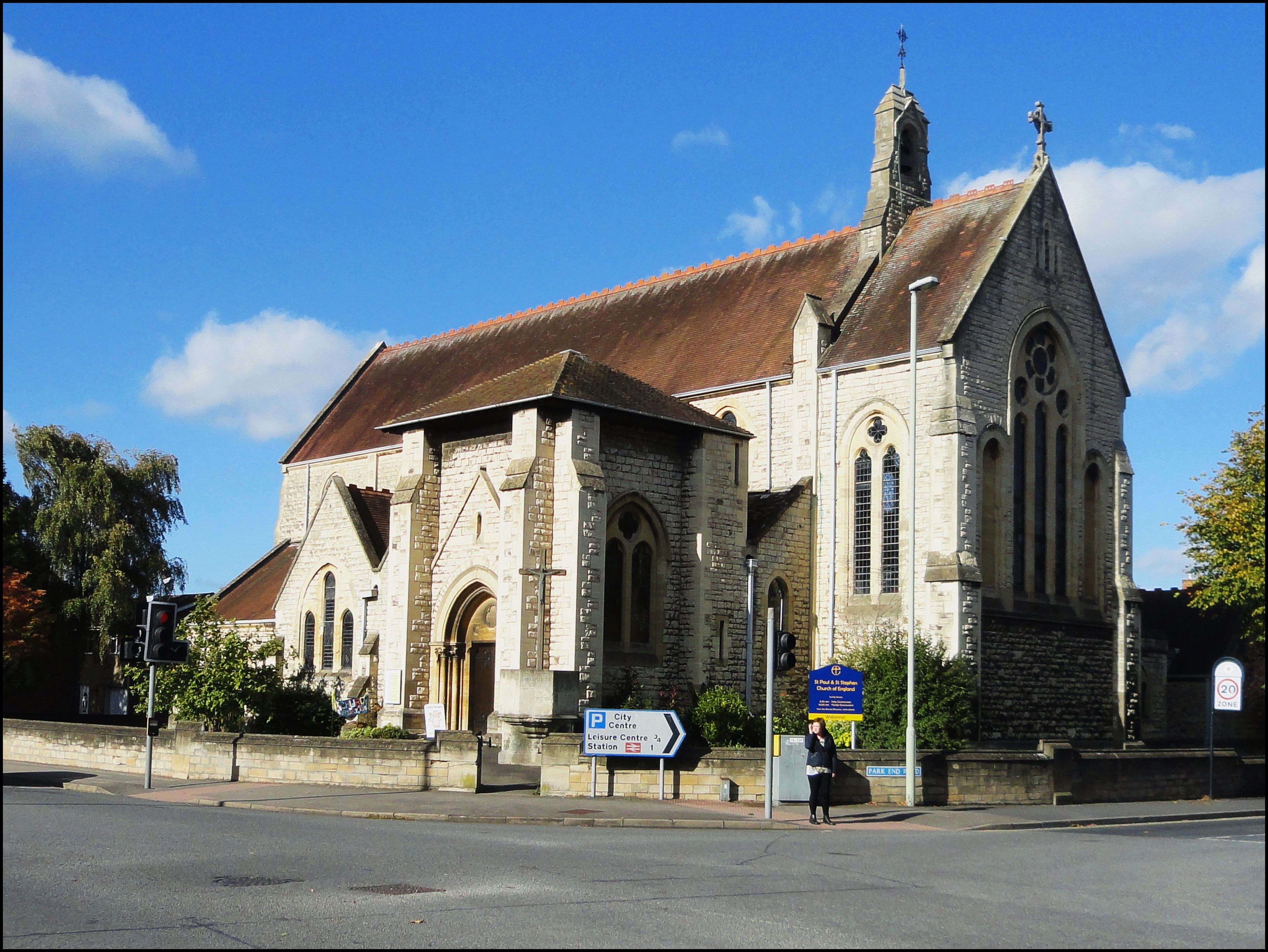
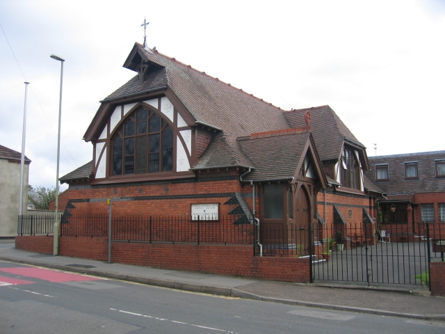
St Paul and St Stephen's Church, Gloucester

St Paul and St Stephen's Church is a Church of England church located in Stroud Road, Gloucester, Gloucestershire. St Paul's church was built between 1882...

Gloucester Park, Gloucester

Gloucester Park is an urban park in Gloucester, Gloucestershire, England. == History == The park began life as part of the "Spa Pleasure Grounds" created...

Nearby Amenities

Located within 500m of 51.856247,-2.2491974
Traffic Signals
Lat/Long: 51.8584752/-2.250592
Traffic Signals
Lat/Long: 51.8581695/-2.2485366
Crossing
Bicycle: designated
Button Operated: yes
Crossing: traffic_signals
Crossing Island: yes
Crossing Ref: toucan
Foot: designated
Tactile Paving: yes
Traffic Signals Sound: yes
Traffic Signals Vibration: yes
Lat/Long: 51.8575498/-2.2458746
Traffic Signals
Lat/Long: 51.8568349/-2.251403
Traffic Signals
Lat/Long: 51.854327/-2.2447745
Traffic Calming: cushion
Lat/Long: 51.857362/-2.2432212
Barrier: bollard
Lat/Long: 51.854022/-2.2528586
Fast Food
Hing's Chinese Takeaway
Addr City: Gloucester
Addr Housenumber: 39
Addr Postcode: GL1 5SA
Addr Street: Bristol Road
Contact Phone: +44 1452 419167
Contact Website: https://hingstakeaway.com/
Cuisine: chinese
Delivery: yes
Fhrs Id: 35395
Opening Hours: Mo off; Tu-Fr 12:00-14:00,17:30-22:00; Sa,Su 17:30-22:00
Outdoor Seating: no
Takeaway: yes
Lat/Long: 51.8556935/-2.252175
Pub
Linden Tree
Opening Hours: Mo-Th 16:00-23:00; Fr-Su 12:00-23:00
Postal Code: GL1 5SN
Lat/Long: 51.8547691/-2.2528448
Turning Circle
Lat/Long: 51.855975/-2.2428467
Traffic Signals
Lat/Long: 51.8584786/-2.2507911
Linden
Is In: Gloucester, Gloucestershire, England, UK
Note: Moved to a more appropriate position - Linden is the name for this entire suburb not only the Linden road are.
Place: suburb
Lat/Long: 51.8530211/-2.2497904
Moreland
Is In: Gloucester, Gloucestershire, England, UK
Note: Moreland is more of a locality than a suburb.
Place: locality
Lat/Long: 51.857203/-2.2496024
Crossing
Bicycle: dismount
Foot: designated
Lat/Long: 51.8581571/-2.2528944
Crossing
Crossing: marked
Crossing Markings: yes
Crossing Ref: zebra
Lat/Long: 51.8578216/-2.2525576
Created By: Potlatch 0.10f
Note: There's a small park here ... would be good to get it on OSM
Lat/Long: 51.8541474/-2.2524509
Pub
The Baker Street
Lat/Long: 51.8590582/-2.2508572
Traffic Signals
Lat/Long: 51.8584795/-2.252867
Traffic Signals
Lat/Long: 51.8585987/-2.2507642
Community Centre
Star 66
Community Centre: youth_centre
Lat/Long: 51.8522968/-2.2508996
Fast Food
Saeed Balti House
Addr City: Gloucester
Addr Housenumber: 36
Addr Postcode: GL1 5PT
Addr Street: Seymour Road
Addr Suburb: Quedgeley
Cuisine: indian
Opening Hours: Mo-Su 17:30-23:30
Url Menu: https://www.chefonline.co.uk/saeed-balti-quedgeley-gloucester-gl1/menu
Website: https://www.saeedbaltihouse.co.uk/
Lat/Long: 51.8527209/-2.2506163
Bus Stop
Rosebank Surgery
Bench: yes
Bus: yes
Naptan AtcoCode: 1600GL4562
Naptan Bearing: NW
Naptan CommonName: Tredworth Rd
Naptan NaptanCode: glodadjd
Naptan PlusbusZoneRef: GLOSTER
Naptan Street: Stroud Rd
Naptan Verified: no
Operator: Stagecoach
Public Transport: platform
Shelter: yes
Source: naptan_import
Lat/Long: 51.8537801/-2.2434154
Bus Stop
Peel Centre & Quays
Bus: yes
Naptan AtcoCode: 1600GL687
Naptan Bearing: SW
Naptan CommonName: Stroud Rd
Naptan NaptanCode: gloawpgp
Naptan PlusbusZoneRef: GLOSTER
Naptan Street: Bristol Rd
Naptan Verified: no
Public Transport: platform
Source: naptan_import
Lat/Long: 51.8572964/-2.2510104
Bus Stop
Peel Centre & Quays
Bench: yes
Bin: yes
Bus: yes
Lit: yes
Naptan AtcoCode: 1600GL688
Naptan Bearing: NE
Naptan CommonName: Stroud Rd
Naptan Indicator: Opp
Naptan NaptanCode: gloawpdt
Naptan PlusbusZoneRef: GLOSTER
Naptan Street: Bristol Rd
Naptan Verified: no
Public Transport: platform
Shelter: yes
Source: naptan_import
Tactile Paving: yes
Lat/Long: 51.8573621/-2.25127
Bus Stop
Gloucester Quays
Bus: yes
Naptan AtcoCode: 1600GLA06422
Naptan Bearing: S
Naptan CommonName: Gloucester Quays
Naptan Indicator: Opp
Naptan NaptanCode: glogptdw
Naptan Street: St Ann Way
Naptan Verified: no
Public Transport: platform
Source: naptan_import
Lat/Long: 51.8583284/-2.2525735
Bus Stop
Gloucester Quays
Bus: yes
Naptan AtcoCode: 1600GLA06423
Naptan Bearing: E
Naptan CommonName: Gloucester Quays
Naptan NaptanCode: glogptga
Naptan Street: St Ann Way
Naptan Verified: no
Public Transport: platform
Source: naptan_import
Lat/Long: 51.8586937/-2.2515155
Bus Stop
Spa Road
Bench: no
Bin: no
Bus: yes
Naptan AtcoCode: 1600GLB047
Naptan Bearing: S
Naptan CommonName: Spa Rd
Naptan NaptanCode: gloawpma
Naptan PlusbusZoneRef: GLOSTER
Naptan Street: Southgate St
Naptan Verified: no
Public Transport: platform
Shelter: no
Source: naptan_import
Tactile Paving: no
Lat/Long: 51.8603547/-2.2508472
Bus Stop
Spa Road
Bench: yes
Bin: no
Bus: yes
Check Date Shelter: 2022-06-24
Lit: yes
Naptan AtcoCode: 1600GLB048
Naptan Bearing: N
Naptan CommonName: Spa Rd
Naptan NaptanCode: gloawpjm
Naptan PlusbusZoneRef: GLOSTER
Naptan Street: Southgate St
Naptan Verified: no
Public Transport: platform
Shelter: yes
Source: naptan_import
Tactile Paving: no
Lat/Long: 51.8599065/-2.2509353
Bus Stop
Kwik Fit
Bench: no
Bin: no
Bus: yes
Lit: yes
Naptan AtcoCode: 1600GLB049
Naptan Bearing: SE
Naptan CommonName: Bristol Rd
Naptan NaptanCode: gloawptp
Naptan PlusbusZoneRef: GLOSTER
Naptan Street: Stroud Rd
Naptan Verified: no
Public Transport: platform
Shelter: no
Source: naptan_import
Tactile Paving: no
Lat/Long: 51.8579558/-2.2504203
Bus Stop
Stroud Road
Bus: yes
Naptan AtcoCode: 1600GLB053
Naptan Bearing: S
Naptan CommonName: Stroud Rd
Naptan NaptanCode: gloawtam
Naptan PlusbusZoneRef: GLOSTER
Naptan Street: Seymour Rd
Naptan Verified: no
Public Transport: platform
Source: naptan_import
Lat/Long: 51.8553794/-2.2488496
Bus Stop
Stroud Road
Naptan AtcoCode: 1600GLB054
Naptan Bearing: N
Naptan CommonName: Stroud Rd
Naptan NaptanCode: gloawtad
Naptan PlusbusZoneRef: GLOSTER
Naptan Street: Seymour Rd
Naptan Verified: no
Source: naptan_import
Lat/Long: 51.8554961/-2.2489354
Bus Stop
Alma Place
Naptan AtcoCode: 1600GLB055
Naptan Bearing: S
Naptan CommonName: Alma Place
Naptan NaptanCode: gloawptj
Naptan PlusbusZoneRef: GLOSTER
Naptan Street: Seymour Rd
Naptan Verified: no
Source: naptan_import
Lat/Long: 51.8531548/-2.2500618
Bus Stop
Alma Place
Naptan AtcoCode: 1600GLB056
Naptan Bearing: N
Naptan CommonName: Alma Place
Naptan NaptanCode: gloawptm
Naptan PlusbusZoneRef: GLOSTER
Naptan Street: Seymour Rd
Naptan Verified: no
Source: naptan_import
Lat/Long: 51.8535055/-2.2500347
Bus Stop
Theresa Street
Bus: yes
Naptan AtcoCode: 1600GLB319
Naptan Bearing: SW
Naptan CommonName: Theresa St
Naptan NaptanCode: gloawmwa
Naptan PlusbusZoneRef: GLOSTER
Naptan Street: Bristol Rd
Naptan Verified: no
Public Transport: platform
Shelter: no
Source: naptan_import
Lat/Long: 51.8550099/-2.2529179
Bus Stop
Madleaze Road
Bus: yes
Naptan AtcoCode: 1600GLB320
Naptan Bearing: NE
Naptan CommonName: Madleaze Rd
Naptan Indicator: Opp
Naptan NaptanCode: gloawpad
Naptan PlusbusZoneRef: GLOSTER
Naptan Street: Bristol Rd
Naptan Verified: no
Public Transport: platform
Source: naptan_import
Lat/Long: 51.8558923/-2.252313
Bus Stop
Frampton Road
Bus: yes
Naptan AtcoCode: 1600GLB321
Naptan Bearing: SW
Naptan CommonName: Frampton Rd
Naptan NaptanCode: gloawmjw
Naptan PlusbusZoneRef: GLOSTER
Naptan Street: Bristol Rd
Naptan Verified: no
Public Transport: platform
Source: naptan_import
Lat/Long: 51.8535319/-2.2545067
Bus Stop
Alma Place
Naptan AtcoCode: 1600GLB322
Naptan Bearing: NE
Naptan CommonName: Alma Place
Naptan Indicator: Opp
Naptan NaptanCode: gloawmta
Naptan PlusbusZoneRef: GLOSTER
Naptan Street: Bristol Rd
Naptan Verified: no
Source: naptan_import
Lat/Long: 51.8544057/-2.2537276
Bus Stop
Stroud Rd
Bus: yes
Naptan AtcoCode: 1600GLB385
Naptan Bearing: S
Naptan CommonName: Stroud Rd
Naptan NaptanCode: gloawtwm
Naptan PlusbusZoneRef: GLOSTER
Naptan Street: King Edward's Ave
Naptan Verified: no
Public Transport: platform
Source: naptan_import
Lat/Long: 51.8537139/-2.2450122
Bus Stop
Church
Bus: yes
Naptan AtcoCode: 1600GLB386
Naptan Bearing: N
Naptan CommonName: St Paul's Church
Naptan NaptanCode: glodadam
Naptan PlusbusZoneRef: GLOSTER
Naptan Street: Park End Rd
Naptan Verified: no
Public Transport: platform
Shelter: no
Source: naptan_import
Lat/Long: 51.8547756/-2.2446549
Bus Stop
Weston Road
Bus: yes
Naptan AtcoCode: 1600GLB393
Naptan Bearing: SW
Naptan CommonName: Weston Rd
Naptan Indicator: Opp
Naptan NaptanCode: glodadgt
Naptan PlusbusZoneRef: GLOSTER
Naptan Street: Park End Rd
Naptan Verified: no
Public Transport: platform
Source: naptan_import
Lat/Long: 51.8564138/-2.2437781
Bus Stop
Weston Road
Bus: yes
Naptan AtcoCode: 1600GLB394
Naptan Bearing: NE
Naptan CommonName: Weston Rd
Naptan NaptanCode: glodadgw
Naptan PlusbusZoneRef: GLOSTER
Naptan Street: Park End Rd
Naptan Verified: no
Public Transport: platform
Shelter: no
Source: naptan_import
Lat/Long: 51.8567735/-2.2437655
Bus Stop
Church
Bus: yes
Naptan AtcoCode: 1600GLB395
Naptan Bearing: SE
Naptan CommonName: St Paul's Church
Naptan NaptanCode: glodadat
Naptan PlusbusZoneRef: GLOSTER
Naptan Street: Stroud Rd
Naptan Verified: no
Public Transport: platform
Source: naptan_import
Lat/Long: 51.8542729/-2.2442747
Post Box
Post Box Type: pillar
Ref: GL1 26
Royal Cypher: EVIIR
Royal Cypher Wikidata: Q33102324
Lat/Long: 51.8545331/-2.2533848
Telephone
Booth: KX300
Covered: booth
Lat/Long: 51.8532477/-2.249899
Post Box
Operator: Royal Mail
Post Box Type: pillar
Ref: GL1 54
Royal Cypher: GR
Royal Cypher Wikidata: Q33102273
Lat/Long: 51.8535441/-2.2474797
Cycleway: asl
Lat/Long: 51.8586517/-2.2506172
Crossing
Crossing: traffic_signals
Crossing Island: no
Crossing Ref: toucan
Lat/Long: 51.8560438/-2.2487918
Crossing
Lat/Long: 51.8542312/-2.2448072
Give Way
Lat/Long: 51.856295/-2.2491776
Traffic Calming Backward: cushion
Lat/Long: 51.8557991/-2.2440846
Leisure: playground
Lat/Long: 51.8540898/-2.2521581
Crossing
Crossing: yes
Crossing Ref: pelican
Source Highway: survey
Lat/Long: 51.8555416/-2.2525117
Waste Basket
Source: survey
Lat/Long: 51.8555931/-2.2523289
Telephone
Booth: KX100
Covered: booth
Mapillary: 1720217628182114
Source: survey
Survey Date: 2020-06-19
Lat/Long: 51.8558165/-2.2524349
Crossing
Crossing: marked
Crossing Markings: yes
Crossing Ref: zebra
Lat/Long: 51.8579281/-2.2525511
Traffic Signals
Lat/Long: 51.8584386/-2.2530532
Traffic Signals
Lat/Long: 51.858397/-2.2526089
Traffic Signals
Lat/Long: 51.8586659/-2.2529626
Traffic Signals
Lat/Long: 51.8583872/-2.2533471
Traffic Signals
Lat/Long: 51.8581684/-2.2530456
Crossing
Lat/Long: 51.858543/-2.2526231
Give Way
Lat/Long: 51.8546806/-2.2463876
Give Way
Lat/Long: 51.8551319/-2.2475456
Crossing
Crossing: marked
Crossing Markings: yes
Crossing Ref: zebra
Tactile Paving: yes
Lat/Long: 51.8577814/-2.2539989
Crossing
Crossing: marked
Crossing Markings: yes
Crossing Ref: zebra
Tactile Paving: yes
Lat/Long: 51.8578332/-2.2533716
Crossing
Crossing: yes
Crossing Ref: zebra
Lat/Long: 51.8578755/-2.2547464
Crossing
Crossing: marked
Crossing Markings: yes
Crossing Ref: zebra
Tactile Paving: yes
Lat/Long: 51.8579498/-2.2533647
Cycleway: asl
Lat/Long: 51.8543803/-2.2450455
Travelodge
Addr City: Gloucester
Addr Postcode: GL1 5SF
Addr Street: St Ann Way
Brand: Travelodge
Brand Wikidata: Q9361374
Brand Wikipedia: en:Travelodge UK
Contact Phone: +44 8719 846427
Contact Website: https://www.travelodge.co.uk/
Fhrs Id: 29282
Internet Access: wlan
Internet Access Fee: customers
Internet Access Ssid: Travelodge WiFi
Source Addr: FHRS Open Data
Tourism: hotel
Lat/Long: 51.8587741/-2.2512911
Toilets
Check Date: 2023-07-06
Fee: no
Lat/Long: 51.8588735/-2.251967
Bank
Lloyds Bank
Brand Wikidata: Q1152847
Contact Website: https://branches.lloydsbank.com/gloucester/86-bristol-road
Lat/Long: 51.8548007/-2.2534244
Fast Food
Panda Chef
Cuisine: chinese
Lat/Long: 51.8552611/-2.2529603
Barrier: bollard
Lat/Long: 51.8538738/-2.2522837
Restaurant
Blue Ginger
Lat/Long: 51.8552181/-2.2530059
Post Box
Collection Times: Mo-Fr 09:00; Sa 07:00
Post Box Type: pillar
Ref: GL1 38
Royal Cypher: VR
Royal Cypher Wikidata: Q33102356
Lat/Long: 51.857156/-2.2493973
Tactile Paving: yes
Lat/Long: 51.8544258/-2.2449769
Crossing
Button Operated: yes
Crossing: traffic_signals
Crossing Island: no
Tactile Paving: yes
Lat/Long: 51.8543718/-2.2450021
Tactile Paving: yes
Lat/Long: 51.8543286/-2.2450201
Tactile Paving: yes
Lat/Long: 51.8542176/-2.2447331
Tactile Paving: yes
Lat/Long: 51.8542425/-2.2448833
Source: Bing
Tactile Paving: yes
Lat/Long: 51.8586197/-2.2530081
Crossing
Source: Bing
Lat/Long: 51.8585456/-2.2530772
Source: Bing
Tactile Paving: yes
Lat/Long: 51.8585352/-2.253161
Crossing
Lat/Long: 51.8586296/-2.252944
Source: Bing
Tactile Paving: yes
Lat/Long: 51.85816/-2.2529537
Crossing
Bicycle: dismount
Crossing: unmarked
Crossing Markings: no
Tactile Paving: yes
Lat/Long: 51.8581517/-2.2540127
Source: Bing
Tactile Paving: yes
Lat/Long: 51.8585338/-2.2504588
Source: Bing
Tactile Paving: yes
Lat/Long: 51.8585145/-2.2503707
Crossing
Lat/Long: 51.8583858/-2.2526616
Source: Bing
Tactile Paving: yes
Lat/Long: 51.8581566/-2.252841
Source: Bing
Tactile Paving: yes
Lat/Long: 51.8581881/-2.2528276
Source: Bing
Tactile Paving: yes
Lat/Long: 51.8583234/-2.2526985
Crossing
Lat/Long: 51.8584759/-2.2503703
Source: Bing
Tactile Paving: yes
Lat/Long: 51.8582008/-2.2531142
Source: Bing
Tactile Paving: yes
Lat/Long: 51.8581964/-2.2529752
Source: Bing
Tactile Paving: yes
Lat/Long: 51.8582246/-2.2531576
Source: Bing
Tactile Paving: yes
Lat/Long: 51.8583968/-2.2503681
Crossing
Bicycle: designated
Foot: designated
Lat/Long: 51.8581975/-2.2530423
Generator Method: photovoltaic
Generator Output Electricity: yes
Generator Source: solar
Generator Type: solar_photovoltaic_panel
Location: roof
Power: generator
Lat/Long: 51.8529149/-2.249906
Generator Method: photovoltaic
Generator Output Electricity: yes
Generator Source: solar
Generator Type: solar_photovoltaic_panel
Location: roof
Power: generator
Lat/Long: 51.8529762/-2.2508508
Generator Method: photovoltaic
Generator Output Electricity: yes
Generator Source: solar
Generator Type: solar_photovoltaic_panel
Location: roof
Power: generator
Lat/Long: 51.8533208/-2.2504565
Generator Method: photovoltaic
Generator Output Electricity: yes
Generator Source: solar
Generator Type: solar_photovoltaic_panel
Location: roof
Power: generator
Lat/Long: 51.8550803/-2.2499388
Dock Branch Junction
Railway: junction
Lat/Long: 51.8586715/-2.2516002
High Orchard Wharf
Railway: site
Lat/Long: 51.859248/-2.2542628
Bench
Backrest: no
Material: metal
Lat/Long: 51.8592246/-2.2446862
Bench
Material: metal
Lat/Long: 51.8596919/-2.2446399
Bench
Lat/Long: 51.8595069/-2.2445531
Bench
Lat/Long: 51.8596691/-2.2448371
Bench
Backrest: yes
Lat/Long: 51.8596489/-2.252637
Waste Basket
Lat/Long: 51.8596575/-2.2521676
Waste Basket
Lat/Long: 51.8593104/-2.2524854
Bench
Backrest: yes
Lat/Long: 51.8596847/-2.2521209
Information: office
Tourism: information
Lat/Long: 51.8590635/-2.2521089
Waste Basket
Lat/Long: 51.8596254/-2.2523916
Waste Basket
Lat/Long: 51.8596903/-2.2526491
Bench
Backrest: yes
Lat/Long: 51.8599811/-2.2519058
Waste Basket
Lat/Long: 51.8590704/-2.2522831
Waste Basket
Lat/Long: 51.8598213/-2.2518653
Waste Basket
Lat/Long: 51.8601031/-2.2519695
Bench
Backrest: yes
Lat/Long: 51.8593935/-2.2525148
Information: terminal
Tourism: information
Lat/Long: 51.8602564/-2.252063
Information: terminal
Tourism: information
Lat/Long: 51.8594481/-2.2525303
Information: terminal
Tourism: information
Lat/Long: 51.8600338/-2.2519344
Bench
Backrest: yes
Lat/Long: 51.8593928/-2.2518309
Information: terminal
Tourism: information
Lat/Long: 51.859904/-2.2526396
Atm
Brand: Barclays
Brand Wikidata: Q245343
Cash In: no
Operator: Barclays
Operator Wikidata: Q245343
Lat/Long: 51.860092/-2.2520768
Information: terminal
Tourism: information
Lat/Long: 51.8595132/-2.2518491
Bench
Backrest: yes
Lat/Long: 51.8592668/-2.2524159
Tourism: information
Lat/Long: 51.8600864/-2.2527252
Bench
Backrest: yes
Lat/Long: 51.8598493/-2.252605
Waste Basket
Lat/Long: 51.8594227/-2.2518334
Toilets
Fee: no
Lat/Long: 51.8601216/-2.2517929
Bench
Backrest: yes
Lat/Long: 51.8601281/-2.2519895
Bench
Backrest: yes
Lat/Long: 51.8598834/-2.2518881
Bench
Backrest: yes
Lat/Long: 51.8603244/-2.2521358
Toilets
Fee: no
Lat/Long: 51.8593596/-2.2528556
Bench
Backrest: yes
Lat/Long: 51.8602024/-2.2520108
Bench
Backrest: yes
Lat/Long: 51.8595426/-2.2526169
Bench
Backrest: yes
Lat/Long: 51.8596362/-2.252335
Waste Basket
Lat/Long: 51.8596748/-2.2526458
Bench
Backrest: yes
Lat/Long: 51.8596135/-2.2518562
Bench
Backrest: yes
Lat/Long: 51.8598612/-2.2526104
Entrance: yes
Lat/Long: 51.8587098/-2.2519199
Vending Machine
Vending: electric_charging
Lat/Long: 51.8597343/-2.2519996
Entrance: yes
Lat/Long: 51.8601188/-2.2527771
Crossing
Tactile Paving: yes
Lat/Long: 51.8538852/-2.2542975
Give Way
Direction: forward
Lat/Long: 51.8530887/-2.2488454
Give Way
Direction: backward
Lat/Long: 51.8530257/-2.2488863
Give Way
Direction: backward
Lat/Long: 51.8537595/-2.2484554
Give Way
Direction: forward
Lat/Long: 51.8538241/-2.2484216
Cycleway: asl
Lat/Long: 51.8542039/-2.2448185
Cycleway: asl
Lat/Long: 51.8544946/-2.2447146
Cycleway: asl
Lat/Long: 51.8542777/-2.2445234
Crossing
Crossing Island: yes
Tactile Paving: yes
Lat/Long: 51.855744/-2.2441085
Traffic Calming Forward: cushion
Lat/Long: 51.8556861/-2.2441343
Traffic Calming: hump
Lat/Long: 51.8560312/-2.2442016
Crossing
Lat/Long: 51.8560604/-2.2439816
Traffic Calming: hump
Lat/Long: 51.8551755/-2.2445937
Cafe
Costa
Addr City: Gloucester
Addr Housename: Next
Addr Housenumber: 6D
Addr Parentstreet: St Ann Way
Addr Postcode: GL1 5SF
Addr Street: The Peel Centre
Brand: Costa
Brand Wikidata: Q608845
Cuisine: coffee_shop
Fhrs Id: 1135943
Fixme: Find precise location within store
Source Addr: FHRS Open Data
Takeaway: yes
Lat/Long: 51.8582667/-2.2549766
Traffic Calming Forward: cushion
Lat/Long: 51.8567912/-2.243657
Traffic Calming Backward: cushion
Lat/Long: 51.8568779/-2.2435896
Crossing
Crossing Island: yes
Tactile Paving: yes
Lat/Long: 51.8568356/-2.2436222
A P R Corner Shop
Shop: convenience
Lat/Long: 51.8553006/-2.2525218
Street Lamp
Lat/Long: 51.8558209/-2.2523247
Restaurant
Spago
Addr City: Gloucester
Addr Housename: 1A Provender
Addr Postcode: GL1 5BQ
Addr Street: Bakers Quay
Contact Facebook: https://www.facebook.com/people/Spago-Gloucester/100063586146722/
Cuisine: spanish;tapas;crepes
Currency XBT: yes
Payment Lightning: yes
Payment Lightning Contactless: yes
Payment Onchain: yes
Phone: +447495498750
Survey Date: 2023-03-22
Website: https://www.spagogloucester.co.uk/
Lat/Long: 51.8589551/-2.2547085
TheWorks.co.uk
Brand: The Works
Brand Wikidata: Q7775853
Level: 0
Shop: gift
Website: https://www.theworks.co.uk/Store?storeId=0781
Lat/Long: 51.8600631/-2.2526169
Lindt
Brand: Lindt
Brand Wikidata: Q152822
Level: 0
Shop: chocolate
Lat/Long: 51.8597494/-2.2519078
Cafe
Costa
Brand: Costa
Brand Wikidata: Q608845
Cuisine: coffee_shop
Level: 0
Takeaway: yes
Lat/Long: 51.8591051/-2.2519984
Level: 0
Shop: vacant
Lat/Long: 51.8597205/-2.251722
Hallmark
Brand: Hallmark
Brand Wikidata: Q1521910
Level: 0
Shop: gift
Lat/Long: 51.8593935/-2.252373
ProCook
Level: 0
Shop: kitchen
Lat/Long: 51.8589815/-2.2525126
Le Cruset
Level: 0
Shop: kitchen
Lat/Long: 51.8599847/-2.2520365
Denby
Level: 0
Shop: kitchen
Lat/Long: 51.8595605/-2.2524849
White Stuff
Brand: White Stuff
Brand Wikidata: Q7995442
Level: 0
Shop: clothes
Lat/Long: 51.860156/-2.252124
Pavers Shoes
Brand: Pavers Shoes
Brand Wikidata: Q7155843
Level: 0
Shop: shoes
Lat/Long: 51.8596702/-2.2526769
Baggage world
Level: 0
Shop: bag
Lat/Long: 51.8596231/-2.2526449
Restaurant
Cornish Bakery
Level: 0
Lat/Long: 51.8591047/-2.2523072
Next Outlet
Brand: Next
Brand Wikidata: Q246655
Level: 0
Shop: clothes
Lat/Long: 51.8590163/-2.2518462
Osprey London
Level: 0
Shop: clothes
Lat/Long: 51.8602635/-2.2520144
JDR Karting
Sport: karting
Website: https://jdrkarting.co.uk/
Lat/Long: 51.8567129/-2.2517976
Hypermoto
Shop: motorcycle
Lat/Long: 51.8602267/-2.2515101
MB Auto Electrical
Shop: car_repair
Lat/Long: 51.8604106/-2.2515435
H.Samuel
Brand: H.Samuel
Brand Wikidata: Q5628558
Shop: jewelry
Website: https://www.hsamuel.co.uk/store/HS4462-Gloucester
Lat/Long: 51.8592184/-2.2523238
Gift Company
Shop: gift
Lat/Long: 51.8600081/-2.2525949
Bedeck Outlet
Shop: household_linen
Lat/Long: 51.8594849/-2.2524066
Beauty Outlet
Shop: beauty
Lat/Long: 51.8590886/-2.2524747
Suit Direct Clearance Outlet
Clothes: suits
Shop: clothes
Lat/Long: 51.8599605/-2.2525773
Gloucester Rugby
Shop: sports
Lat/Long: 51.8591734/-2.2524983
Shop: vacant
Lat/Long: 51.8600872/-2.2529758
Raging Bull
Shop: clothes
Lat/Long: 51.8598886/-2.2527142
Vending Machine
Candy & Toy
Lat/Long: 51.8596889/-2.2525785
Clarks
Brand: Clarks
Brand Wikidata: Q1095857
Shop: shoes
Lat/Long: 51.8592903/-2.2525365
Holland & Barrett
Brand: Holland & Barrett
Brand Wikidata: Q5880870
Shop: health_food
Lat/Long: 51.8598305/-2.252686
Waste Basket
Lat/Long: 51.8600848/-2.2528279
The Fragrance Shop
Brand: The Fragrance Shop
Brand Wikidata: Q105337125
Shop: perfumery
Lat/Long: 51.8594748/-2.2518747
Shop: vacant
Lat/Long: 51.8599631/-2.2527335
Roman
Brand: Roman Originals
Brand Wikidata: Q94579553
Clothes: women
Shop: clothes
Lat/Long: 51.8597776/-2.2526769
Chapelle
Shop: jewelry
Lat/Long: 51.859776/-2.2525518
Skechers
Brand: Skechers
Brand Wikidata: Q2945643
Shop: shoes
Lat/Long: 51.8591779/-2.2517705
Shop: mobile_phone
Lat/Long: 51.8594663/-2.2524557
Trespass
Brand: Trespass
Brand Wikidata: Q17035733
Shop: outdoor
Lat/Long: 51.8594098/-2.2517198
Hotel Chocolat
Brand: Hotel Chocolat
Brand Wikidata: Q5911369
Shop: confectionery
Lat/Long: 51.8592904/-2.2523248
Mountain Warehouse
Brand: Mountain Warehouse
Brand Wikidata: Q6925414
Shop: outdoor
Lat/Long: 51.8592275/-2.2517434
Den
Shop: clothes
Lat/Long: 51.8591037/-2.2517977
Levi's
Brand: Levi's
Brand Wikidata: Q127962
Clothes: denim;men;women
Shop: clothes
Lat/Long: 51.8594965/-2.2517318
Weird Fish
Brand: Weird Fish
Brand Wikidata: Q19903788
Clothes: children;men;women
Shop: clothes
Lat/Long: 51.8598895/-2.2519781
Marks & Spencer
Brand: Marks & Spencer
Brand Wikidata: Q714491
Shop: department_store
Lat/Long: 51.8589548/-2.2521822
Shop: vacant
Lat/Long: 51.8598121/-2.251934
Shop: vacant
Lat/Long: 51.8603392/-2.2520668
Phase Eight
Brand: Phase Eight
Brand Wikidata: Q17020730
Shop: clothes
Lat/Long: 51.8601581/-2.251964
Fat Face
Brand: Fat Face
Brand Wikidata: Q5437186
Shop: clothes
Lat/Long: 51.8598739/-2.2517802
Saltrock
Brand: Saltrock
Brand Wikidata: Q7406195
Shop: clothes
Lat/Long: 51.8593326/-2.2518687
The North Face
Brand: The North Face
Brand Wikidata: Q152784
Clothes: outdoor
Shop: clothes
Lat/Long: 51.8595378/-2.2519106
Puma
Brand: Puma
Brand Wikidata: Q157064
Shop: clothes
Lat/Long: 51.8599238/-2.2518244
Timberland
Brand: Timberland
Brand Wikidata: Q1539185
Shop: clothes
Lat/Long: 51.8592872/-2.2517457
Shop: vacant
Lat/Long: 51.85967/-2.2517263
Shop: vacant
Lat/Long: 51.85962/-2.2517263
Quba & Co. Ltd.
Shop: clothes
Lat/Long: 51.8602571/-2.2521856
Joules
Brand: Joules
Brand Wikidata: Q25351738
Shop: clothes
Lat/Long: 51.8598026/-2.2517405
Oasics
Shop: sports
Lat/Long: 51.859667/-2.251912
Hobbs
Brand: Hobbs
Brand Wikidata: Q25108740
Shop: clothes
Lat/Long: 51.8600462/-2.2519028
Quba & Co. Ltd.
Shop: clothes
Lat/Long: 51.8602571/-2.2521856
Strikeforce Airsoft
Description: Airsoft venue
Website: https://strikeforceairsoft.co.uk
Lat/Long: 51.8559902/-2.2500161
The Laundry Lounge
Addr City: Gloucester
Addr Housenumber: 52
Addr Postcode: GL1 5SD
Addr Street: Bristol Road
Shop: laundry
Website: http://www.thelaundrylounge.co.uk/
Lat/Long: 51.8556205/-2.252702
The data included in this document is from www.openstreetmap.org. The data is made available under ODbL.

Have you been to St Paul's?

Leave your review of St Paul's below (or comments, questions and feedback).