St Ann's

Settlement in Dumfriesshire

Scotland

St Ann's

Hazelbank Trig Point Flush Bracket S7702
Hazelbank Trig Point Flush Bracket S7702 Credit: thejackrustles

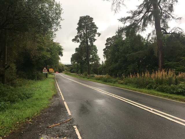
St Ann's is a small village located in the county of Dumfriesshire in southwest Scotland. Nestled amidst the picturesque rolling hills and lush green countryside, this charming village offers a tranquil and idyllic setting for residents and visitors alike.

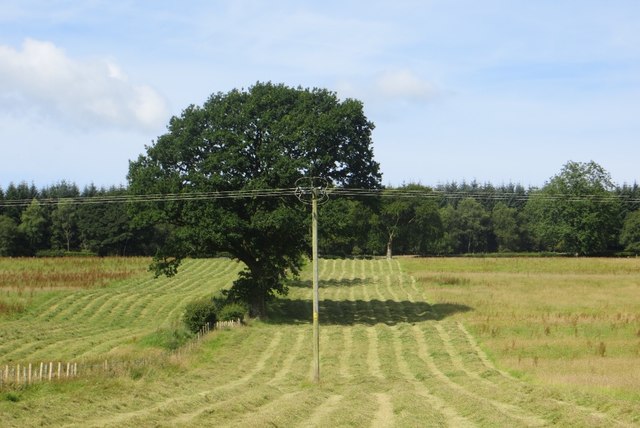
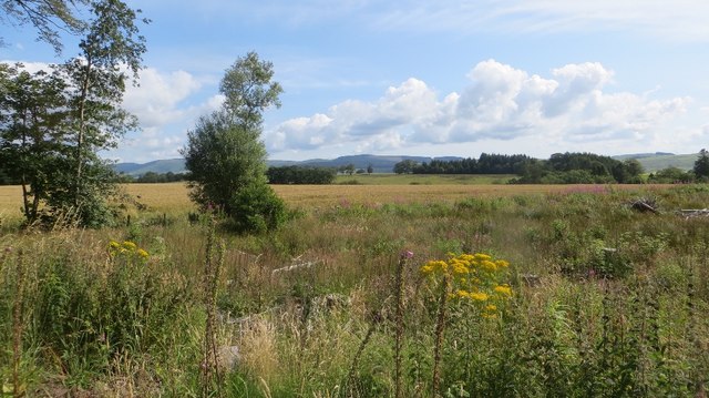
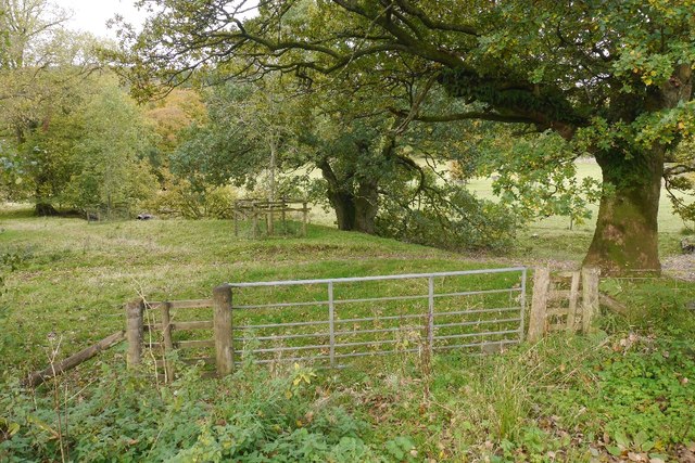
With a population of around 300 people, St Ann's is known for its tight-knit community and warm hospitality. The village consists mainly of traditional stone cottages, giving it a quaint and timeless appeal. The surrounding landscape provides ample opportunities for outdoor activities, such as hiking, cycling, and fishing, making it a haven for nature lovers.

Despite its small size, St Ann's is well-served by essential amenities. The village boasts a local convenience store where residents can purchase groceries and daily necessities. Additionally, there is a primary school catering to the educational needs of the local children.

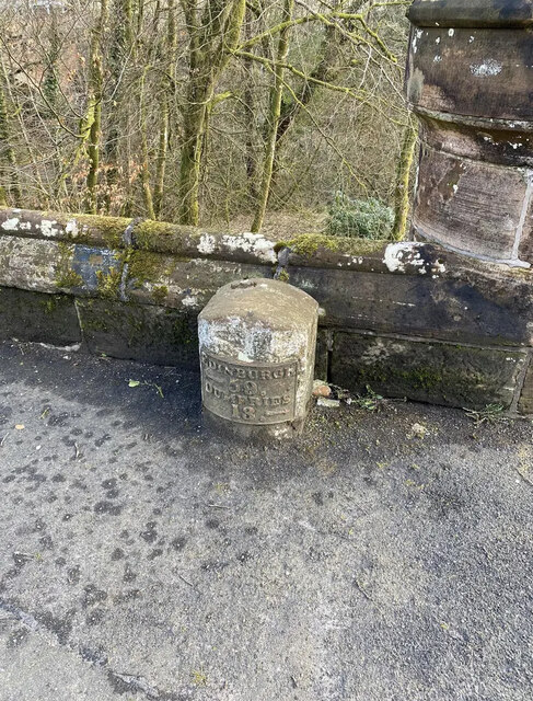
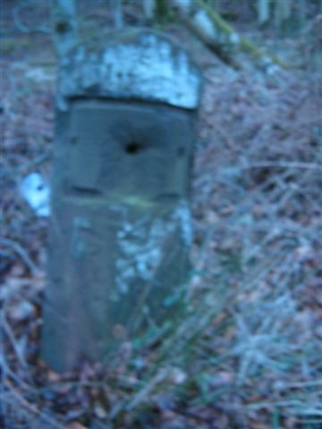
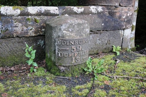
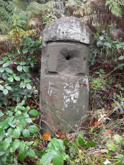
St Ann's is also rich in historical significance. The nearby ruins of a medieval castle serve as a reminder of the area's past, offering visitors a glimpse into its fascinating history. Moreover, the village is known for its annual summer fair, a lively event that brings the community together and attracts visitors from neighboring towns.

For those seeking a peaceful retreat away from the hustle and bustle of urban life, St Ann's in Dumfriesshire is an ideal destination. Whether it's exploring the scenic countryside, immersing oneself in local history, or simply enjoying the warmth and friendliness of the community, St Ann's offers a delightful experience for all who visit.

If you have any feedback on the listing, please let us know in the comments section below.
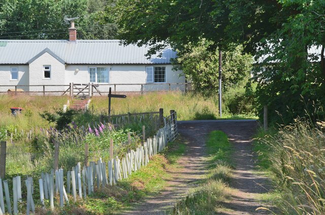
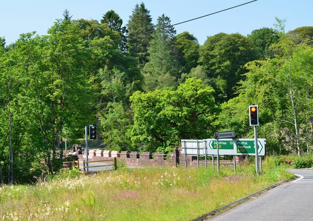
St Ann's Images

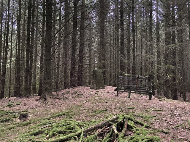
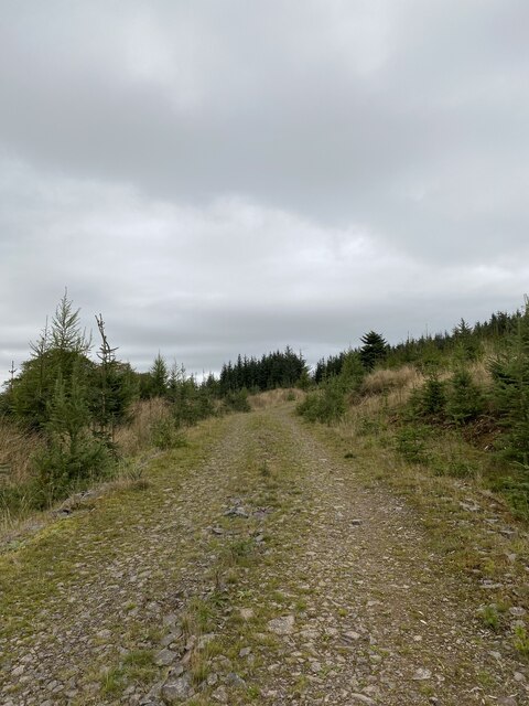
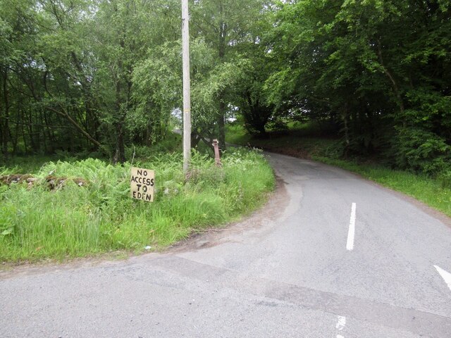
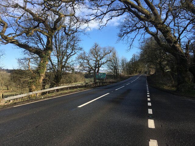
Images are sourced within 2km of 55.225431/-3.4653645 or Grid Reference NY0693. Thanks to Geograph Open Source API. All images are credited.

Hazelbank Trig Point Flush Bracket S7702
Annandale Way
Annandale Way
Woodland track giving access to fields near Beastocking Looking northward.
Woodland track giving access to fields near Beastocking
Looking northward.
Road junction, St Ann's Due to the high wholesale costs of gas, the flaming sword has been replaced by a sign.   (Refers to a festival up the road)
Road junction, St Ann's
Due to the high wholesale costs of gas, the flaming sword has been replaced by a sign. (Refers to a festival up the road)
A701 towards Beattock
A701 towards Dumfries
Old Milestone by the A701, St Ann's Bridge, Johnstone parish Dumfries red sandstone with plate by the A701, in parish of Johnstone (Annandale District), St Ann's, just West of bridge over Kinnel Water. South side of road.

Inscription reads:-
EDINBURGH
{<-arrow} 59.
DUMFRIES
13 {arrow->}

Milestone Society National ID: DG_DFMF13
Old Milestone by the A701, St Ann's Bridge, Johnstone parish
Dumfries red sandstone with plate by the A701, in parish of Johnstone (Annandale District), St Ann's, just West of bridge over Kinnel Water. South side of road. Inscription reads:- EDINBURGH {<-arrow} 59. DUMFRIES 13 {arrow->} Milestone Society National ID: DG_DFMF13
A701 towards Dumfries
Gated farm track near Blackacre
Mown grass Silage or hay making under Hazelbank Plantation, Annandale.
Mown grass
Silage or hay making under Hazelbank Plantation, Annandale.
Felled woodland Felled plantation beside the B7020.
Felled woodland
Felled plantation beside the B7020.
B7020, Kilnpot Wood
B7020, Kilnpot Wood
Parkland, Raehills There are a lot of mature oaks here. View from the A701.
Parkland, Raehills
There are a lot of mature oaks here. View from the A701.
Old Milestone by the A701, near Hennie's Hill, Johnstone parish Dumfries red sandstone by the A701, in parish of Johnstone (Annandale District), Hennie&amp;#039;s Hill, on verge in woods, East side of track.

Surveyed

Milestone Society National ID: DG_DFMF14
Old Milestone by the A701, near Hennie's Hill, Johnstone parish
Dumfries red sandstone by the A701, in parish of Johnstone (Annandale District), Hennie's Hill, on verge in woods, East side of track. Surveyed Milestone Society National ID: DG_DFMF14
Old Milestone by the A701, St Ann's Bridge, Johnstone parish Dumfries red sandstone with plate by the A701, in parish of Johnstone (Annandale District), St Ann&amp;#039;s, just West of bridge over Kinnel Water. South side of road.

Inscription reads:-
EDINBURGH
{&amp;lt;-arrow} 59.
DUMFRIES
13 {arrow-&amp;gt;}

Surveyed

Milestone Society National ID: DG_DFMF13
Old Milestone by the A701, St Ann's Bridge, Johnstone parish
Dumfries red sandstone with plate by the A701, in parish of Johnstone (Annandale District), St Ann's, just West of bridge over Kinnel Water. South side of road. Inscription reads:- EDINBURGH {<-arrow} 59. DUMFRIES 13 {arrow->} Surveyed Milestone Society National ID: DG_DFMF13
Old milestone On the A701 at Hennies Hill, another stone that has had its plate either removed in 1940 or stolen.  The legend was Edinburgh 58, Dumfries 14.

Moderator.  Please substitute this pic for the blue one already noted in this grid square.  it is the same stone.
Old milestone
On the A701 at Hennies Hill, another stone that has had its plate either removed in 1940 or stolen. The legend was Edinburgh 58, Dumfries 14. Moderator. Please substitute this pic for the blue one already noted in this grid square. it is the same stone.
Joining the road at Blackburn Cottage The Annandale Way turns right for about 100m before leaving the road to continue north.
Joining the road at Blackburn Cottage
The Annandale Way turns right for about 100m before leaving the road to continue north.
St Ann's Bridge, A701 Approaching the bridge on the minor road from Blackburn. Traffic lights control the flow across this narrow bridge over the Kinnel Water, a tributary of the River Annan.
St Ann's Bridge, A701
Approaching the bridge on the minor road from Blackburn. Traffic lights control the flow across this narrow bridge over the Kinnel Water, a tributary of the River Annan.
Show me another place!

St Ann's is located at Grid Ref: NY0693 (Lat: 55.225431, Lng: -3.4653645)

Unitary Authority: Dumfries and Galloway

Police Authority: Dumfries and Galloway

What 3 Words

///gravel.swordfish.inflation. Near Johnstonebridge, Dumfries & Galloway

Related Wikis

Johnstonebridge

Johnstonebridge is a village in Dumfries and Galloway, Scotland.It is roughly halfway between Moffat and Lockerbie, and lies on the A74(M) motorway. The...

Dumfriesshire, Clydesdale and Tweeddale (UK Parliament constituency)

Dumfriesshire, Clydesdale and Tweeddale is a constituency of the House of Commons, located in the South of Scotland, within the Dumfries and Galloway,...

Annandale Water services

Annandale Water services is a motorway service station in the village of Johnstonebridge, Scotland. The service station is located next to the A74(M) motorway...

Annandale Water

Annandale Water is a loch in Annandale, Dumfries and Galloway, in the south west of Scotland. It is part of Annandale Water service station at Junction...

Lochwood Tower

Lochwood Tower, also known as Lochwood Castle, is a ruined 16th-century L-plan tower house situated in Annandale (Valley of the River Annan) about 6 miles...

Wallace's House

Wallace's House is an earthen rampart, located near Lochmaben, Scotland, that is associated with William Wallace. The promontory fort is a scheduled item...

Newton Wamphray

Newton Wamphray is a village in Dumfries and Galloway. Wamphray is the name of the surrounding parish and of the Wamphray Water, which flows south-west...

Wamphray railway station

Wamphray railway station served Newton Wamphray, near Beattock, in the Scottish county of Dumfries and Galloway. It was served by local trains on what...

Nearby Amenities

Located within 500m of 55.225431,-3.4653645
Traffic Signals
Lat/Long: 55.2256308/-3.4647857
Traffic Signals
Lat/Long: 55.2255696/-3.4663967
Bus Stop
Village
Naptan AtcoCode: 680000201111
Naptan Bearing: NE
Naptan CommonName: Village
Naptan Indicator: opp Sawmill
Naptan Landmark: Bridge
Naptan NaptanCode: 34232323
Naptan Notes: none
Naptan Street: A701
Naptan Verified: no
Source: naptan_import
Lat/Long: 55.2266136/-3.4636233
Bus Stop
Village
Naptan AtcoCode: 680000201222
Naptan Bearing: SW
Naptan CommonName: Village
Naptan Indicator: Sawmill
Naptan Landmark: St Annes
Naptan NaptanCode: 34238532
Naptan Notes: none
Naptan Street: A701
Naptan Verified: no
Source: naptan_import
Lat/Long: 55.2267252/-3.4633129
St Ann`s Cottage
Is In: Dumfries & Galloway, Scotland, UK
Place: hamlet
Lat/Long: 55.2223856/-3.4617772
Power: pole
Lat/Long: 55.2259333/-3.4582285
Power: pole
Lat/Long: 55.2261082/-3.4595551
Power: pole
Lat/Long: 55.2262756/-3.4608096
Power: pole
Lat/Long: 55.2265798/-3.4617138
Power: pole
Lat/Long: 55.2268707/-3.4625381
Power: pole
Lat/Long: 55.2269/-3.4626437
Power: pole
Lat/Long: 55.2273305/-3.4632362
Power: pole
Lat/Long: 55.2280445/-3.4643412
Power: pole
Lat/Long: 55.22866/-3.4652634
Power: pole
Lat/Long: 55.2292682/-3.4661418
Power: pole
Lat/Long: 55.2297574/-3.4668966
Power: pole
Lat/Long: 55.2268883/-3.461348
Post Box
Mapillary: 186298584152429
Operator: Royal Mail
Operator Wikidata: Q638098
Post Box Type: lamp
Lat/Long: 55.2263097/-3.4636755
The data included in this document is from www.openstreetmap.org. The data is made available under ODbL.

Have you been to St Ann's?

Leave your review of St Ann's below (or comments, questions and feedback).