Springhead

Settlement in Yorkshire

England

Springhead

The Rising Sun public house On Stockport Road, Mossley.
The Rising Sun public house Credit: Ian S

Springhead is a quaint village located in the county of Yorkshire, England. Situated in the Ryedale district, it is nestled amidst the picturesque countryside, surrounded by rolling hills and green landscapes. The village is bordered by the beautiful River Derwent, adding to its scenic charm.

With a population of approximately 500 residents, Springhead exudes a peaceful and tranquil atmosphere. The village is known for its strong sense of community, with locals actively participating in various social and cultural events throughout the year. Traditional English cottages line the streets, adding to the village's timeless appeal.

The village is home to a few amenities, including a local pub, a small convenience store, and a primary school, catering to the needs of the local population. Despite its small size, Springhead enjoys good transport links, with regular bus services connecting it to nearby towns and cities.

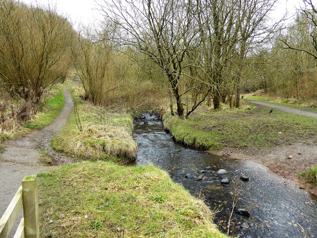
Surrounded by nature, Springhead offers ample opportunities for outdoor activities. The village is located near the beautiful Yorkshire Wolds, providing scenic walking and cycling routes for enthusiasts. Additionally, the nearby River Derwent is a popular spot for fishing and boating.

For those seeking cultural experiences, Springhead is conveniently situated near several historic sites and attractions. The nearby Castle Howard, a magnificent stately home, is a popular destination for tourists and locals alike. The village also hosts an annual summer festival, showcasing local talent and attracting visitors from near and far.

Overall, Springhead is a charming and idyllic village, offering a peaceful retreat and a close-knit community amidst the stunning Yorkshire countryside.

If you have any feedback on the listing, please let us know in the comments section below.
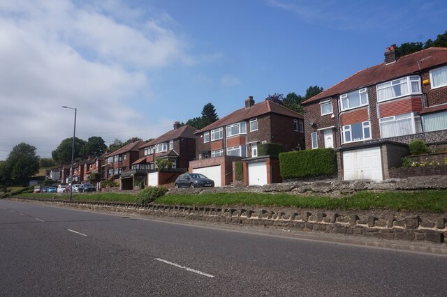
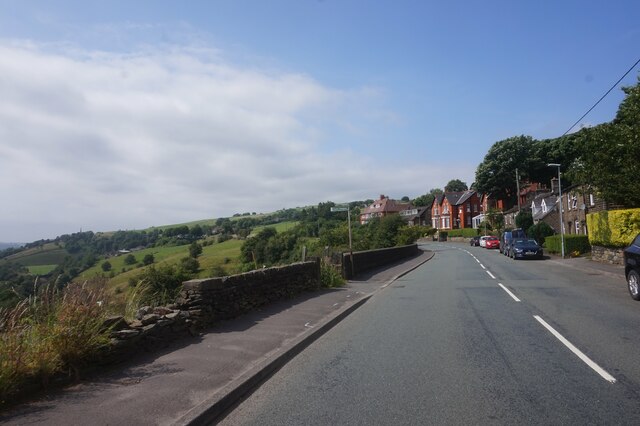
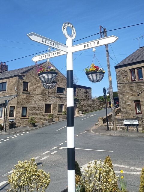
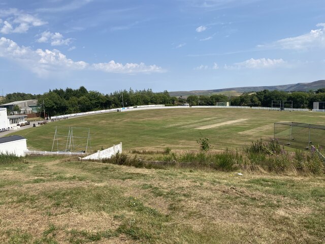
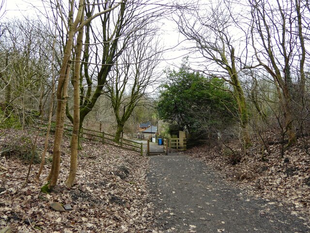
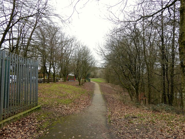
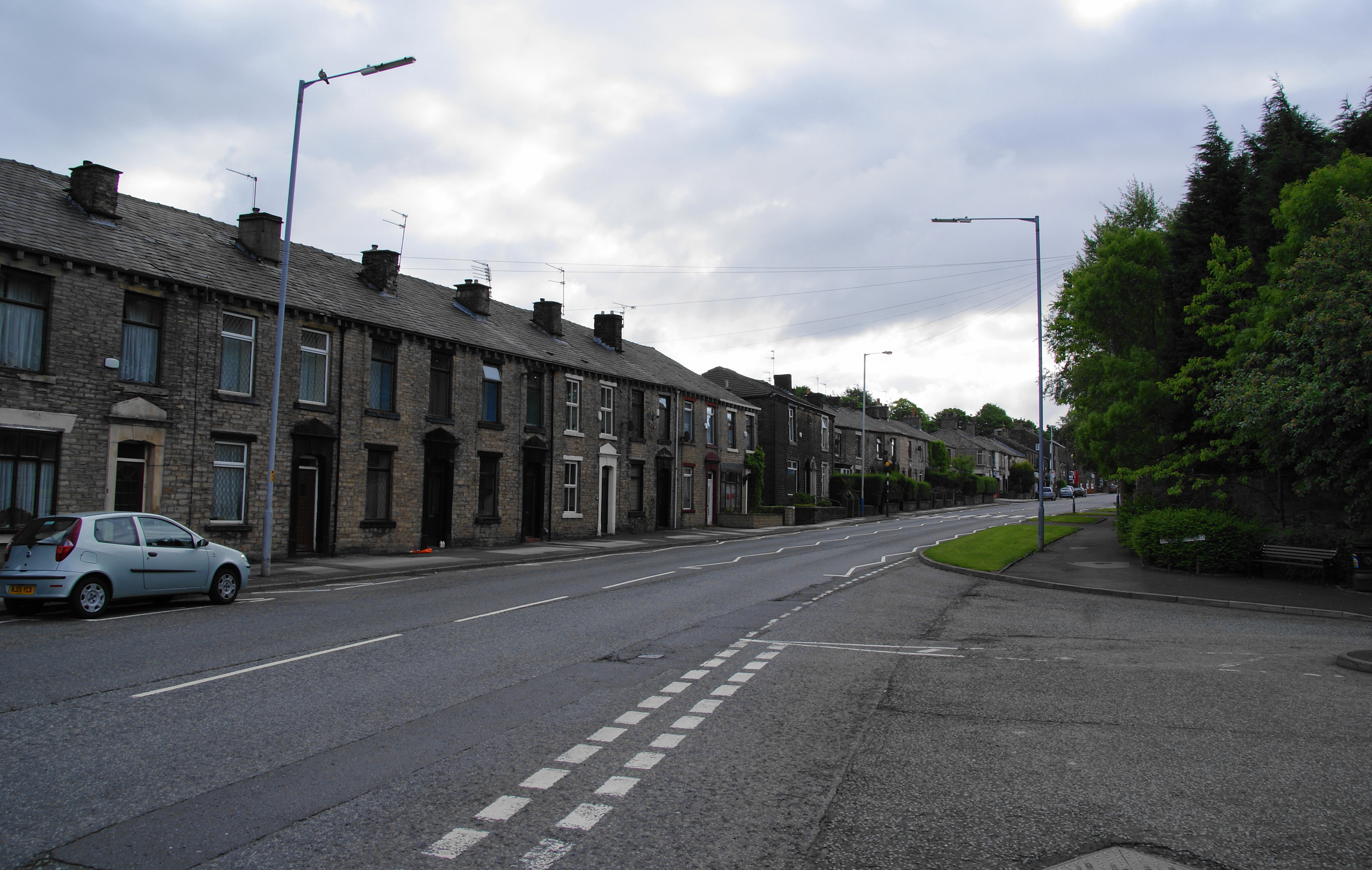
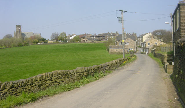
Springhead Images

Images are sourced within 2km of 53.538567/-2.056551 or Grid Reference SD9604. Thanks to Geograph Open Source API. All images are credited.

The Rising Sun public house On Stockport Road, Mossley.
The Rising Sun public house
On Stockport Road, Mossley.
Houses on the A670 Mossley Road
A670 Mossley Road towards Mossley
Mossley Road A670 at Grasscroft
Clough Lane off Mossley Road, Grasscroft
Direction Sign – Signpost at Scouthead in Saddleworth parish Located in Scouthead, on the southeast side of the crossroads of Back Lane, Thurston Clough Road, Thorpe Lane and Doctor Lane in Saddleworth parish. 3 arms and annulus finial. A metal replacement for <a title="https://www.geograph.org.uk/photo/5918932" href="https://www.geograph.org.uk/photo/5918932">Link</a> and <a title="https://www.geograph.org.uk/photo/2007544" href="https://www.geograph.org.uk/photo/2007544">Link</a>.

Milestone Society National ID: YW_SD9706R
Direction Sign – Signpost at Scouthead in Saddleworth parish
Located in Scouthead, on the southeast side of the crossroads of Back Lane, Thurston Clough Road, Thorpe Lane and Doctor Lane in Saddleworth parish. 3 arms and annulus finial. A metal replacement for Link and Link. Milestone Society National ID: YW_SD9706R
Old milestone Another of the late 19C West Riding CC milestones in Saddleworth.   Until the 1970s this area was in the West Riding of Yorkshire but now is Greater Manchester.   Although painted in 2010 the years of passing traffic have taken its toll, so now very rusty as well as ivy covered.

Milestone Society National ID: YW_SRAS04a
Old milestone
Another of the late 19C West Riding CC milestones in Saddleworth. Until the 1970s this area was in the West Riding of Yorkshire but now is Greater Manchester. Although painted in 2010 the years of passing traffic have taken its toll, so now very rusty as well as ivy covered. Milestone Society National ID: YW_SRAS04a
Old milestone Some of the ivy removed from the West Riding CC late 19C milestone on A670 Mossley Road in Saddleworth.   The white paint from 2010 has not survived but the black-painted legends are still clearly read.   The right face has mileages to Manchester (11 miles), Ashton (4¾) and Mossley (1¼).  The attachment was cast at the Brayshaw & Booth foundry in Liversedge and the milestone set up by the family firm of Gill Stead and Son of Mirfield.

Milestone Society National ID: YW_SRAS04a
Old milestone
Some of the ivy removed from the West Riding CC late 19C milestone on A670 Mossley Road in Saddleworth. The white paint from 2010 has not survived but the black-painted legends are still clearly read. The right face has mileages to Manchester (11 miles), Ashton (4¾) and Mossley (1¼). The attachment was cast at the Brayshaw & Booth foundry in Liversedge and the milestone set up by the family firm of Gill Stead and Son of Mirfield. Milestone Society National ID: YW_SRAS04a
Cricket Pitch
Cricket Pitch
Slack Hall Trig Point Flush Bracket S2785
Cricket Pitch
Cricket Pitch
Brown Edge Trig Point Flush Bracket S2784
Views towards Hartshead Pike Tower
Entrance to Highmoor Landfill Site A purpose built road for waste lorries has been built to the main A62 road at Scouthead to avoid the country lane routes to this former quarry
Entrance to Highmoor Landfill Site
A purpose built road for waste lorries has been built to the main A62 road at Scouthead to avoid the country lane routes to this former quarry
Cycle path following route of former railway The path is approaching the former railway bridge at St. John Street which is one of the few not infilled on the route. The path runs from Oldham to Grotton along the former line to Greenfield.
Cycle path following route of former railway
The path is approaching the former railway bridge at St. John Street which is one of the few not infilled on the route. The path runs from Oldham to Grotton along the former line to Greenfield.
River Medlock at Lees View on the Medlock Valley Way from a footbridge
River Medlock at Lees
View on the Medlock Valley Way from a footbridge
The end of the cycle path View towards Old Mill Lane at Grotton. The cycle path has followed the route of the former Oldham to Greenfield railway but deviates here to join Old Mill Lane.
The end of the cycle path
View towards Old Mill Lane at Grotton. The cycle path has followed the route of the former Oldham to Greenfield railway but deviates here to join Old Mill Lane.
Route of former railway at Grotton View from the former Grotton Station towards Lees on the Greenfield to Oldham railway route. A cycle path exists on the Grotton to Oldham portion of the route.
Route of former railway at Grotton
View from the former Grotton Station towards Lees on the Greenfield to Oldham railway route. A cycle path exists on the Grotton to Oldham portion of the route.
Show me another place!

Springhead is located at Grid Ref: SD9604 (Lat: 53.538567, Lng: -2.056551)

Division: West Riding

Unitary Authority: Oldham

Police Authority: Greater Manchester

What 3 Words

///picked.lunch.forget. Near Mossley, Manchester

Related Wikis

Springhead, Greater Manchester

Springhead is a suburban area in the civil parish of Saddleworth in the Metropolitan Borough of Oldham, in Greater Manchester, England. == Description... ==

Lees Urban District

Lees (or Lees Urban District) was from 1894 to 1974, a local government district in the administrative county of Lancashire, England. It was created an...

Grotton and Springhead railway station

Grotton and Springhead railway station served the villages of Grotton and Springhead from 1856 until 1955. == History == The London and North Western Railway...

Grotton

Grotton is an residential area in Saddleworth, a civil parish of the Metropolitan Borough of Oldham, in Greater Manchester, England. Located along the...

Lees, Greater Manchester

Lees is a village in the Metropolitan Borough of Oldham, Greater Manchester, England, amongst the Pennines east of the River Medlock, 1.8 miles (2.9 km...

Lees railway station

Lees railway station opened on 5 July 1856 at Lees, Lancashire, when the London and North Western Railway (L&NWR) opened the branch from Greenfield to...

Austerlands

Austerlands is a suburban area of Saddleworth, a civil parish within the Metropolitan Borough of Oldham, in Greater Manchester, England. It occupies a...

Lydgate, Greater Manchester

Lydgate is a village in the civil parish of Saddleworth in the Metropolitan Borough of Oldham, in Greater Manchester, England. The village has a church...

Nearby Amenities

Located within 500m of 53.538567,-2.056551
Springhead
Is In: Oldham, Greater Manchester, England, UK
Place: suburb
Source: npe
Lat/Long: 53.5385383/-2.0631017
Grotton
Is In: Oldham, Greater Manchester, England, UK
Name Ur: گراٹن
Place: suburb
Source: npe
Lat/Long: 53.5362153/-2.0512003
Bus Stop
Grotton, Oldham Road / opposite Coverhill Road
Bus: yes
Naptan AtcoCode: 1800ED06491
Naptan Bearing: E
Naptan CommonName: Oldham Road/Coverhill Road
Naptan Indicator: Near Path
Naptan Landmark: HOUSE 327
Naptan NaptanCode: manamdgj
Naptan Notes: LOCATION AMENDED
Naptan PlusbusZoneRef: MNCRPIC
Naptan ShortCommonName: Coverhill Road
Naptan Street: OLDHAM ROAD
Naptan Verified: no
Network: TfGM
Operator: TfGM
Public Transport: platform
Source: naptan_import
Lat/Long: 53.5373071/-2.050403
Traffic Signals
Source: survey
Lat/Long: 53.5376501/-2.0541621
Turning Circle
Lat/Long: 53.5354424/-2.0516727
Noexit: yes
Lat/Long: 53.5396847/-2.0519375
Noexit: yes
Lat/Long: 53.539313/-2.0529355
Lydgate Railway Tunnel
Access: private
Entrance: yes
Lat/Long: 53.5361681/-2.0506661
Grotton and Springhead
Historic Railway: station
Railway: site
Wikidata: Q5610813
Wikipedia: en:Grotton and Springhead railway station
Lat/Long: 53.5357143/-2.0546566
Noexit: yes
Lat/Long: 53.5380857/-2.055832
Noexit: yes
Lat/Long: 53.5398683/-2.0631135
Noexit: yes
Lat/Long: 53.5386673/-2.0599154
Noexit: yes
Lat/Long: 53.5369836/-2.0596377
Noexit: yes
Lat/Long: 53.5377268/-2.0579012
Noexit: yes
Lat/Long: 53.5378782/-2.0594646
Turning Circle
Lat/Long: 53.5384693/-2.0635264
Noexit: yes
Lat/Long: 53.5381563/-2.0622947
Noexit: yes
Lat/Long: 53.5399069/-2.0608534
Noexit: yes
Lat/Long: 53.5394664/-2.0609669
Crossing
Crossing: uncontrolled
Crossing Ref: zebra
Source: Bing
Lat/Long: 53.5378622/-2.0624208
Parking
Operator: none
Parking: surface
Surface: concrete
Lat/Long: 53.5359987/-2.0568557
Speed Camera
Direction: 300
Maxspeed: 30 mph
Lat/Long: 53.5374982/-2.0528201
Generator Method: photovoltaic
Generator Output Electricity: yes
Generator Source: solar
Generator Type: solar_photovoltaic_panel
Location: roof
Power: generator
Lat/Long: 53.5421379/-2.059849
Generator Method: photovoltaic
Generator Output Electricity: yes
Generator Source: solar
Generator Type: solar_photovoltaic_panel
Location: roof
Power: generator
Lat/Long: 53.5359453/-2.0617051
Generator Method: photovoltaic
Generator Output Electricity: yes
Generator Source: solar
Generator Type: solar_photovoltaic_panel
Location: roof
Power: generator
Lat/Long: 53.538415/-2.0514469
Generator Method: photovoltaic
Generator Output Electricity: yes
Generator Source: solar
Generator Type: solar_photovoltaic_panel
Location: roof
Power: generator
Lat/Long: 53.5389362/-2.0503874
Generator Method: photovoltaic
Generator Output Electricity: yes
Generator Source: solar
Generator Type: solar_photovoltaic_panel
Location: roof
Power: generator
Lat/Long: 53.5391753/-2.0542766
Generator Method: photovoltaic
Generator Output Electricity: yes
Generator Source: solar
Generator Type: solar_photovoltaic_panel
Location: roof
Power: generator
Lat/Long: 53.5373343/-2.0566718
Generator Method: photovoltaic
Generator Output Electricity: yes
Generator Source: solar
Generator Type: solar_photovoltaic_panel
Location: roof
Power: generator
Lat/Long: 53.5406869/-2.0594428
Generator Method: photovoltaic
Generator Output Electricity: yes
Generator Source: solar
Generator Type: solar_photovoltaic_panel
Location: roof
Power: generator
Lat/Long: 53.5370847/-2.0566803
Generator Method: photovoltaic
Generator Output Electricity: yes
Generator Source: solar
Generator Type: solar_photovoltaic_panel
Location: roof
Power: generator
Lat/Long: 53.5369603/-2.0570035
Generator Method: photovoltaic
Generator Output Electricity: yes
Generator Source: solar
Generator Type: solar_photovoltaic_panel
Location: roof
Power: generator
Lat/Long: 53.5366535/-2.0569588
Post Box
Lat/Long: 53.5378606/-2.0636495
Saddleworth Parish Council Information
Board Type: notice
Direction: 90
Information: board
Operator: Saddleworth Parish Council
Tourism: information
Lat/Long: 53.5378491/-2.0636513
Bus Stop
Grotton, Oldham Road / opposite Brooklands Parade
Bus: yes
Naptan AtcoCode: 1800ED30761
Naptan NaptanCode: MANATMWM
Network: TfGM
Operator: TfGM
Public Transport: platform
Shelter: yes
Lat/Long: 53.5375681/-2.054901
Bench
Material: wood
Lat/Long: 53.5374819/-2.0554798
Bench
Material: wood
Lat/Long: 53.5375163/-2.0554903
Bench
Material: wood
Lat/Long: 53.5374757/-2.0555866
Waste Basket
Lat/Long: 53.5375071/-2.0557495
Material: wood
Power: pole
Lat/Long: 53.5375609/-2.0495437
Material: wood
Power: pole
Lat/Long: 53.5382978/-2.0494441
Material: wood
Power: pole
Lat/Long: 53.5391035/-2.0493445
Material: wood
Power: pole
Lat/Long: 53.5397039/-2.0492469
Material: wood
Power: pole
Lat/Long: 53.5350643/-2.060434
Communication Mobile Phone: yes
Man Made: mast
Tower Type: communication
Lat/Long: 53.5399117/-2.0496125
Board Type: history
Direction: 270
Information: board
Tourism: information
Lat/Long: 53.5357411/-2.0552678
Power: pole
Lat/Long: 53.5405501/-2.051867
Power: pole
Lat/Long: 53.5404519/-2.053236
Power: pole
Lat/Long: 53.540667/-2.0505031
Defibrillator
Access: yes
Defibrillator Location: on wall at right hand side of main entrance
Description: AED
Emergency: defibrillator
Indoor: no
Lat/Long: 53.5378284/-2.0549501
Barrier: stile
Foot: yes
Lat/Long: 53.5355035/-2.060477
Turning Circle
Lat/Long: 53.5393125/-2.0622954
Turning Circle
Lat/Long: 53.5387537/-2.0627449
Bus Stop
Springhead, Oldham Road / opposite Ashbrook Road
Bus: yes
Naptan AtcoCode: 1800ED06461
Naptan NaptanCode: MANAMDGD
Network: TfGM
Operator: TfGM
Public Transport: platform
Lat/Long: 53.5380254/-2.0636949
Bus Stop
Springhead, Oldham Road / near Walkers Lane
Bus: yes
Network: TfGM
Operator: TfGM
Public Transport: platform
Lat/Long: 53.5377408/-2.0613931
Bus Stop
Springhead, Oldham Road / near Cooper Street
Bus: yes
Network: TfGM
Operator: TfGM
Public Transport: platform
Lat/Long: 53.537435/-2.05803
Bus Stop
Grotton, Oldham Road / near Brooklands Parade
Bus: yes
Network: TfGM
Operator: TfGM
Public Transport: platform
Lat/Long: 53.5377129/-2.0537986
Bus Stop
Springhead, Oldham Road / near Old Mill Lane
Bus: yes
Naptan AtcoCode: 1800ED30771
Naptan NaptanCode: MANATMWP
Network: TfGM
Operator: TfGM
Public Transport: platform
Lat/Long: 53.5373401/-2.0576326
Bus Stop
Springhead, Oldham Road / near Ashbrook Road
Bus: yes
Naptan AtcoCode: 1800ED30801
Naptan NaptanCode: MANATPAG
Network: TfGM
Operator: TfGM
Public Transport: platform
Lat/Long: 53.5378892/-2.0636831
Bus Stop
Springhead, southbound Cooper Street
Bus: yes
Network: TfGM
Operator: TfGM
Public Transport: platform
Lat/Long: 53.5422119/-2.0595224
Bus Stop
Springhead, SW-bound Walkers Lane
Bus: yes
Network: TfGM
Operator: TfGM
Public Transport: platform
Lat/Long: 53.538545/-2.0609624
Noexit: yes
Lat/Long: 53.5381778/-2.0638353
Addr City: Oldham
Addr Housenumber: 103
Addr Postcode: OL4 4PY
Addr Street: Oldham Road
Addr Suburb: Springhead
Lat/Long: 53.5380361/-2.0640183
Addr City: Oldham
Addr Housenumber: 105
Addr Postcode: OL4 4PY
Addr Street: Oldham Road
Addr Suburb: Springhead
Lat/Long: 53.5380434/-2.0639554
Addr City: Oldham
Addr Housenumber: 107
Addr Postcode: OL4 4PY
Addr Street: Oldham Road
Addr Suburb: Springhead
Lat/Long: 53.5380529/-2.0638953
Addr City: Oldham
Addr Housenumber: 109
Addr Postcode: OL4 4PY
Addr Street: Oldham Road
Addr Suburb: Springhead
Lat/Long: 53.5380603/-2.0638245
Addr City: Oldham
Addr Housenumber: 111
Addr Postcode: OL4 4PY
Addr Street: Oldham Road
Addr Suburb: Springhead
Lat/Long: 53.5380671/-2.0637511
Noexit: yes
Lat/Long: 53.5380812/-2.063286
Addr City: Oldham
Addr Housenumber: 113
Addr Postcode: OL4 4PY
Addr Street: Oldham Road
Addr Suburb: Springhead
Lat/Long: 53.53806/-2.0636345
Addr City: Oldham
Addr Housenumber: 115
Addr Postcode: OL4 4PY
Addr Street: Oldham Road
Addr Suburb: Springhead
Lat/Long: 53.5380603/-2.0635664
Addr City: Oldham
Addr Housenumber: 117
Addr Postcode: OL4 4PY
Addr Street: Oldham Road
Addr Suburb: Springhead
Lat/Long: 53.5380597/-2.063501
Addr City: Oldham
Addr Housenumber: 119-121
Addr Postcode: OL4 4PY
Addr Street: Oldham Road
Addr Suburb: Springhead
Lat/Long: 53.5380557/-2.0633923
Noexit: yes
Lat/Long: 53.5381601/-2.0631334
Noexit: yes
Lat/Long: 53.5381363/-2.0625279
Addr City: Oldham
Addr Housenumber: 123
Addr Postcode: OL4 4PY
Addr Street: Oldham Road
Addr Suburb: Springhead
Lat/Long: 53.5380431/-2.0632044
Addr City: Oldham
Addr Housenumber: 125
Addr Postcode: OL4 4PY
Addr Street: Oldham Road
Addr Suburb: Springhead
Lat/Long: 53.538034/-2.0631093
Addr City: Oldham
Addr Housenumber: 127
Addr Postcode: OL4 4PY
Addr Street: Oldham Road
Addr Suburb: Springhead
Lat/Long: 53.5380242/-2.0630296
Addr City: Oldham
Addr Housenumber: 129
Addr Postcode: OL4 4PY
Addr Street: Oldham Road
Addr Suburb: Springhead
Lat/Long: 53.5380174/-2.0629594
Addr City: Oldham
Addr Housenumber: 131
Addr Postcode: OL4 4PY
Addr Street: Oldham Road
Addr Suburb: Springhead
Lat/Long: 53.5380083/-2.0628835
Addr City: Oldham
Addr Housenumber: 133
Addr Postcode: OL4 4PY
Addr Street: Oldham Road
Addr Suburb: Springhead
Lat/Long: 53.537998/-2.0628146
Addr City: Oldham
Addr Housenumber: 135
Addr Postcode: OL4 4PY
Addr Street: Oldham Road
Addr Suburb: Springhead
Lat/Long: 53.5379904/-2.0627432
Addr City: Oldham
Addr Housenumber: 137
Addr Postcode: OL4 4PY
Addr Street: Oldham Road
Addr Suburb: Springhead
Lat/Long: 53.537981/-2.062673
Bus Stop
Grotton, Coverhill Road / adjacent Oldham Road
Bus: yes
Network: TfGM
Operator: TfGM
Public Transport: platform
Lat/Long: 53.5371483/-2.0496841
Bus Stop
Springhead, NW-bound Cooper Street
Bus: yes
Network: TfGM
Operator: TfGM
Public Transport: platform
Lat/Long: 53.5382653/-2.0590243
Bus Stop
Springhead, northbound Cooper Street
Bus: yes
Network: TfGM
Operator: TfGM
Public Transport: platform
Lat/Long: 53.5422021/-2.0596557
Noexit: yes
Lat/Long: 53.5385121/-2.0635422
Noexit: yes
Lat/Long: 53.5394887/-2.0636996
Addr City: Oldham
Addr Housenumber: 33
Addr Postcode: OL4 4PF
Addr Street: Ashes Lane
Addr Suburb: Springhead
Lat/Long: 53.5394135/-2.0639809
Addr City: Oldham
Addr Housenumber: 35
Addr Postcode: OL4 4PF
Addr Street: Ashes Lane
Addr Suburb: Springhead
Lat/Long: 53.5393887/-2.0638854
Noexit: yes
Lat/Long: 53.5387668/-2.0639853
Noexit: yes
Lat/Long: 53.5389419/-2.0640395
Noexit: yes
Lat/Long: 53.5387941/-2.0639657
Addr City: Oldham
Addr Housenumber: 23
Addr Postcode: OL4 4PE
Addr Street: Bridge Street
Addr Suburb: Springhead
Lat/Long: 53.538716/-2.0640878
Addr City: Oldham
Addr Housenumber: 25
Addr Postcode: OL4 4PE
Addr Street: Bridge Street
Addr Suburb: Springhead
Lat/Long: 53.5387638/-2.0640471
Addr City: Oldham
Addr Housenumber: 27
Addr Postcode: OL4 4PE
Addr Street: Bridge Street
Addr Suburb: Springhead
Lat/Long: 53.5388269/-2.0639887
Addr City: Oldham
Addr Housenumber: 29
Addr Postcode: OL4 4PE
Addr Street: Bridge Street
Addr Suburb: Springhead
Lat/Long: 53.5388711/-2.0639489
Noexit: yes
Lat/Long: 53.5389277/-2.0638152
Noexit: yes
Lat/Long: 53.5390845/-2.0638095
Addr City: Oldham
Addr Housenumber: 31
Addr Postcode: OL4 4PE
Addr Street: Bridge Street
Addr Suburb: Springhead
Lat/Long: 53.5389755/-2.0638701
Addr City: Oldham
Addr Housenumber: 33
Addr Postcode: OL4 4PE
Addr Street: Bridge Street
Addr Suburb: Springhead
Lat/Long: 53.5390359/-2.063867
Noexit: yes
Lat/Long: 53.5391653/-2.0638952
Addr City: Oldham
Addr Housenumber: 35
Addr Postcode: OL4 4PE
Addr Street: Bridge Street
Addr Suburb: Springhead
Lat/Long: 53.5391492/-2.063962
Noexit: yes
Lat/Long: 53.5382833/-2.0638446
Noexit: yes
Lat/Long: 53.5384667/-2.0636027
Noexit: yes
Lat/Long: 53.5383133/-2.0637917
Noexit: yes
Lat/Long: 53.5382919/-2.0635195
Noexit: yes
Lat/Long: 53.5383063/-2.0634555
Addr City: Oldham
Addr Housenumber: 2
Addr Postcode: OL4 4PD
Addr Street: Bridgefield Crescent
Addr Suburb: Springhead
Lat/Long: 53.5383592/-2.0639876
Addr City: Oldham
Addr Housenumber: 4
Addr Postcode: OL4 4PD
Addr Street: Bridgefield Crescent
Addr Suburb: Springhead
Lat/Long: 53.5383528/-2.0638921
Addr City: Oldham
Addr Housenumber: 6
Addr Postcode: OL4 4PD
Addr Street: Bridgefield Crescent
Addr Suburb: Springhead
Lat/Long: 53.5383734/-2.0637019
Addr City: Oldham
Addr Housenumber: 8
Addr Postcode: OL4 4PD
Addr Street: Bridgefield Crescent
Addr Suburb: Springhead
Lat/Long: 53.5383647/-2.0636048
Noexit: yes
Lat/Long: 53.5384558/-2.0632941
Noexit: yes
Lat/Long: 53.538513/-2.0631768
Addr City: Oldham
Addr Housenumber: 10
Addr Postcode: OL4 4PD
Addr Street: Bridgefield Crescent
Addr Suburb: Springhead
Lat/Long: 53.5383792/-2.0634219
Addr City: Oldham
Addr Housenumber: 12
Addr Postcode: OL4 4PD
Addr Street: Bridgefield Crescent
Addr Suburb: Springhead
Lat/Long: 53.5384294/-2.0633636
Noexit: yes
Lat/Long: 53.5386139/-2.0634883
Noexit: yes
Lat/Long: 53.5386406/-2.063511
Noexit: yes
Lat/Long: 53.5387654/-2.063646
Addr City: Oldham
Addr Housenumber: 14
Addr Postcode: OL4 4PD
Addr Street: Bridgefield Crescent
Addr Suburb: Springhead
Lat/Long: 53.5385354/-2.0633547
Addr City: Oldham
Addr Housenumber: 16
Addr Postcode: OL4 4PD
Addr Street: Bridgefield Crescent
Addr Suburb: Springhead
Lat/Long: 53.5385733/-2.06346
Addr City: Oldham
Addr Housenumber: 18
Addr Postcode: OL4 4PD
Addr Street: Bridgefield Crescent
Addr Suburb: Springhead
Lat/Long: 53.538598/-2.0636075
Addr City: Oldham
Addr Housenumber: 20
Addr Postcode: OL4 4PD
Addr Street: Bridgefield Crescent
Addr Suburb: Springhead
Lat/Long: 53.5386362/-2.0637342
Addr City: Oldham
Addr Housenumber: 139
Addr Postcode: OL4 4PY
Addr Street: Oldham Road
Addr Suburb: Springhead
Lat/Long: 53.5379652/-2.0625219
Addr City: Oldham
Addr Housenumber: 141
Addr Postcode: OL4 4PY
Addr Street: Oldham Road
Addr Suburb: Springhead
Lat/Long: 53.5379488/-2.0624352
Addr City: Oldham
Addr Housenumber: 143
Addr Postcode: OL4 4PY
Addr Street: Oldham Road
Addr Suburb: Springhead
Lat/Long: 53.5379667/-2.0623431
Addr City: Oldham
Addr Housenumber: 145
Addr Postcode: OL4 4PY
Addr Street: Oldham Road
Addr Suburb: Springhead
Lat/Long: 53.5379552/-2.0622635
Addr City: Oldham
Addr Housenumber: 147
Addr Postcode: OL4 4PY
Addr Street: Oldham Road
Addr Suburb: Springhead
Lat/Long: 53.5379441/-2.0621892
Addr City: Oldham
Addr Housenumber: 149
Addr Postcode: OL4 4PY
Addr Street: Oldham Road
Addr Suburb: Springhead
Lat/Long: 53.5379325/-2.0621237
Addr City: Oldham
Addr Housenumber: 151
Addr Postcode: OL4 4PY
Addr Street: Oldham Road
Addr Suburb: Springhead
Lat/Long: 53.5379247/-2.0620547
Addr City: Oldham
Addr Housenumber: 153
Addr Postcode: OL4 4PY
Addr Street: Oldham Road
Addr Suburb: Springhead
Lat/Long: 53.5379126/-2.0619857
Addr City: Oldham
Addr Housenumber: 155
Addr Postcode: OL4 4PY
Addr Street: Oldham Road
Addr Suburb: Springhead
Lat/Long: 53.5379047/-2.0619291
Addr City: Oldham
Addr Housenumber: 157
Addr Postcode: OL4 4PY
Addr Street: Oldham Road
Addr Suburb: Springhead
Lat/Long: 53.5378847/-2.0618211
Noexit: yes
Lat/Long: 53.538133/-2.0618933
Noexit: yes
Lat/Long: 53.5382013/-2.0618945
Addr City: Oldham
Addr Housenumber: 3
Addr Postcode: OL4 4PZ
Addr Street: Hollins Street
Addr Suburb: Springhead
Lat/Long: 53.5381481/-2.0618599
Addr City: Oldham
Addr Housenumber: 2
Addr Postcode: OL4 4PZ
Addr Street: Hollins Street
Addr Suburb: Springhead
Lat/Long: 53.5381385/-2.0617983
Addr City: Oldham
Addr Housenumber: 1
Addr Postcode: OL4 4PZ
Addr Street: Hollins Street
Addr Suburb: Springhead
Lat/Long: 53.5381284/-2.0617352
Addr City: Oldham
Addr Housenumber: 1
Addr Postcode: OL4 4QA
Addr Street: Walkers Lane
Addr Suburb: Springhead
Lat/Long: 53.5381444/-2.0616443
Addr City: Oldham
Addr Housenumber: 3
Addr Postcode: OL4 4QA
Addr Street: Walkers Lane
Addr Suburb: Springhead
Lat/Long: 53.5382067/-2.0616189
Addr City: Oldham
Addr Housenumber: 5
Addr Postcode: OL4 4QA
Addr Street: Walkers Lane
Addr Suburb: Springhead
Lat/Long: 53.5382488/-2.0616004
Addr City: Oldham
Addr Housenumber: 7
Addr Postcode: OL4 4QA
Addr Street: Walkers Lane
Addr Suburb: Springhead
Lat/Long: 53.5382923/-2.0615773
Addr City: Oldham
Addr Housenumber: 9
Addr Postcode: OL4 4QA
Addr Street: Walkers Lane
Addr Suburb: Springhead
Lat/Long: 53.5383486/-2.0615572
Entrance: main
Lat/Long: 53.5378271/-2.0550143
The data included in this document is from www.openstreetmap.org. The data is made available under ODbL.

Have you been to Springhead?

Leave your review of Springhead below (or comments, questions and feedback).