Southerndown

Settlement in Glamorgan

Wales

Southerndown

View from Trwyn y Witch This is the view from the Trwyn y Witch Headland looking south towards Nash Point.
View from Trwyn y Witch Credit: Alan John

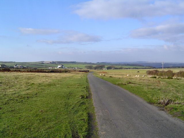
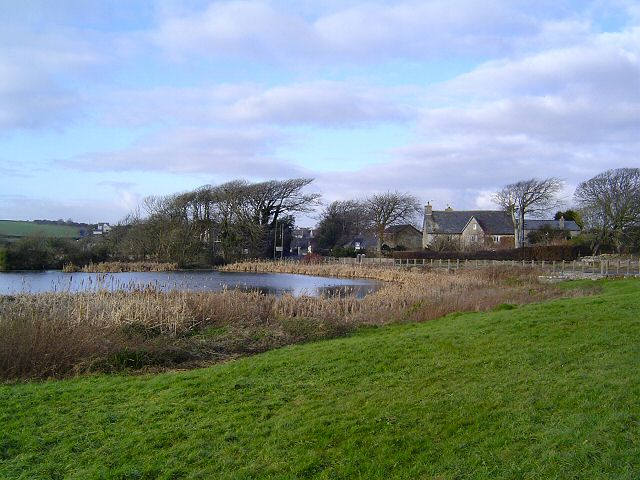
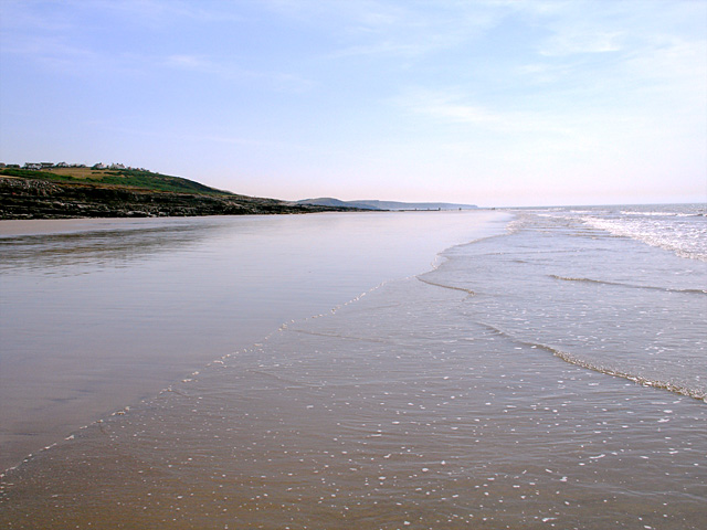
Southerndown is a small coastal village located in the county of Glamorgan, Wales. Situated on the Bristol Channel, it is known for its stunning natural beauty, rugged cliffs, and expansive sandy beach. The village is nestled within the Vale of Glamorgan, an area renowned for its picturesque landscapes and charming rural villages.

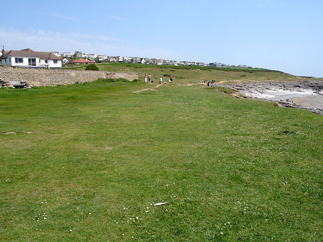
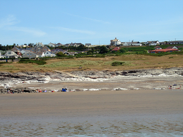
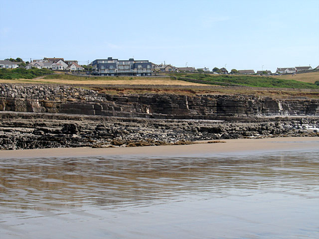
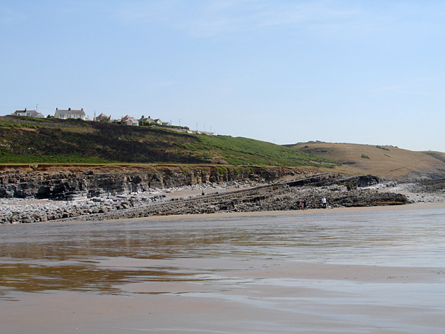
The village of Southerndown is surrounded by rolling hills and farmland, offering visitors a peaceful and idyllic setting. The beach is a major attraction, with its vast stretch of golden sand and dramatic cliffs providing a backdrop of outstanding natural beauty. The waves crashing against the shore attract surfers and water sports enthusiasts, while the beach itself is popular for family activities, picnics, and long walks.

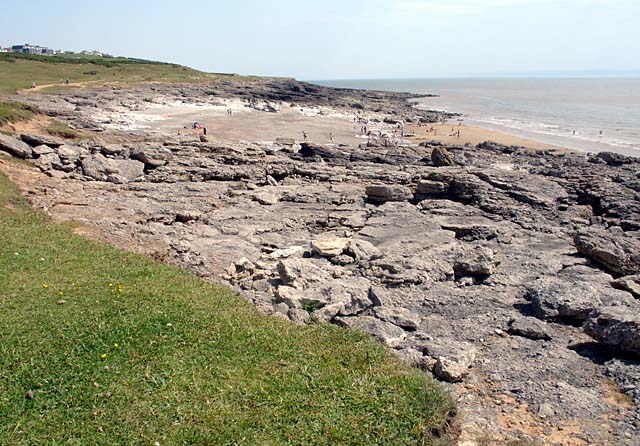
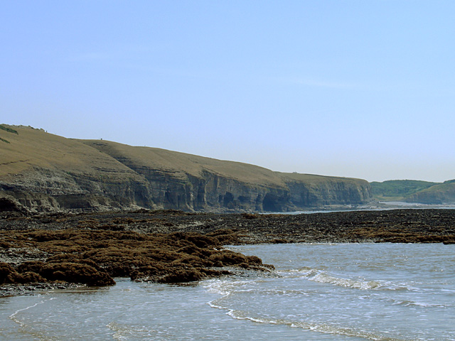
Southerndown is also home to the famous Dunraven Bay, a protected heritage site. This area boasts a captivating coastal landscape with towering limestone cliffs, caves, and rock pools. The bay is a haven for wildlife, with several rare bird species making it their home.

In addition to its natural wonders, Southerndown offers a range of facilities to cater to visitors. The village has a few small shops and cafes, providing essential amenities and a chance to sample local produce and cuisine. There are also public toilets and car parking facilities available for visitors' convenience.

Overall, Southerndown is a hidden gem in Glamorgan, offering a peaceful retreat for nature lovers and those seeking a break from the hustle and bustle of city life. Its breathtaking scenery and tranquil atmosphere make it a must-visit destination for anyone exploring the beauty of Wales.

If you have any feedback on the listing, please let us know in the comments section below.

Southerndown Images

Images are sourced within 2km of 51.454623/-3.6126505 or Grid Reference SS8874. Thanks to Geograph Open Source API. All images are credited.

View from Trwyn y Witch This is the view from the Trwyn y Witch Headland looking south towards Nash Point.
View from Trwyn y Witch
This is the view from the Trwyn y Witch Headland looking south towards Nash Point.
Dunraven Bay, Southerndown,  nr Bridgend, Wales
Dunraven Bay, Southerndown, nr Bridgend, Wales
Trwyn y Witch, Dunraven Bay, Southerndown, Wales
Heol y Mynydd A limestone plateau that supports a great variety of farming.
Heol y Mynydd
A limestone plateau that supports a great variety of farming.
Village pond at St Brides This well known pond is the home of lots of ducks and other water birds. Located beside the Wick road and is opposite the popular Farmer's Arms pub (just out of picture)
Village pond at St Brides
This well known pond is the home of lots of ducks and other water birds. Located beside the Wick road and is opposite the popular Farmer's Arms pub (just out of picture)
Coast near Southerndown looking SE in the direction of Nash Point and Trwyn y Witch
Coast near Southerndown
looking SE in the direction of Nash Point and Trwyn y Witch
Coast near Southerndown looking in the direction of Porthcawl
Coast near Southerndown
looking in the direction of Porthcawl
Descending towards Dunraven Bay The beach was very popular on this Bank Holiday Weekend
Descending towards Dunraven Bay
The beach was very popular on this Bank Holiday Weekend
Trwyn y Witch
Trwyn y Witch
Towards Trwyn y Witch
Bwlch Gwyn This beach is just around the corner from the main beach at Ogmore-by-Sea. But by high tide the beach will have completely disappeared.
Bwlch Gwyn
This beach is just around the corner from the main beach at Ogmore-by-Sea. But by high tide the beach will have completely disappeared.
Ogmore-by-Sea Looking along the coast path with the village of Ogmore-by-Sea in the background.
Ogmore-by-Sea
Looking along the coast path with the village of Ogmore-by-Sea in the background.
Black Rocks Black Rocks at the end of Ogmore Beach at low tide, looking beyond towards the cliffs and caves below Glanmor <a href="https://www.geograph.org.uk/gridref/SS8773">SS8773</a>.
Black Rocks
Black Rocks at the end of Ogmore Beach at low tide, looking beyond towards the cliffs and caves below Glanmor SS8773.
Bwlch Gwyn looking inland Standing on the beach near low tide looking inland. For an alternative view of the same area <a href="https://www.geograph.org.uk/photo/184281">SS8674 : Bwlch Gwyn</a> when the tide was as low.
Bwlch Gwyn looking inland
Standing on the beach near low tide looking inland. For an alternative view of the same area SS8674 : Bwlch Gwyn when the tide was as low.
Rock Strata on Ogmore Beach The rock strata is dipping towards the east here and then just beyond dips the other way.
Rock Strata on Ogmore Beach
The rock strata is dipping towards the east here and then just beyond dips the other way.
Rock Strata on Ogmore Beach 2 The rock strata dips towards the west here just next to <a href="https://www.geograph.org.uk/photo/209395">SS8674 : Rock Strata on Ogmore Beach</a>.
Rock Strata on Ogmore Beach 2
The rock strata dips towards the west here just next to SS8674 : Rock Strata on Ogmore Beach.
Looking along Ogmore Beach towards  SE This beach which can be accessed from the main Ogmore beach via the sand at low tide.
Looking along Ogmore Beach towards SE
This beach which can be accessed from the main Ogmore beach via the sand at low tide.
Show me another place!

Southerndown is located at Grid Ref: SS8874 (Lat: 51.454623, Lng: -3.6126505)

Unitary Authority: The Vale of Glamorgan

Police Authority: South Wales

What 3 Words

///lilac.camp.fixtures. Near Merthyr Mawr, Bridgend

Nearby Locations

Southerndown

Related Wikis

Southerndown

Southerndown is a village in the Vale of Glamorgan, in south Wales. It is southwest of Bridgend, and within the St Brides Major community, close to Llantwit...
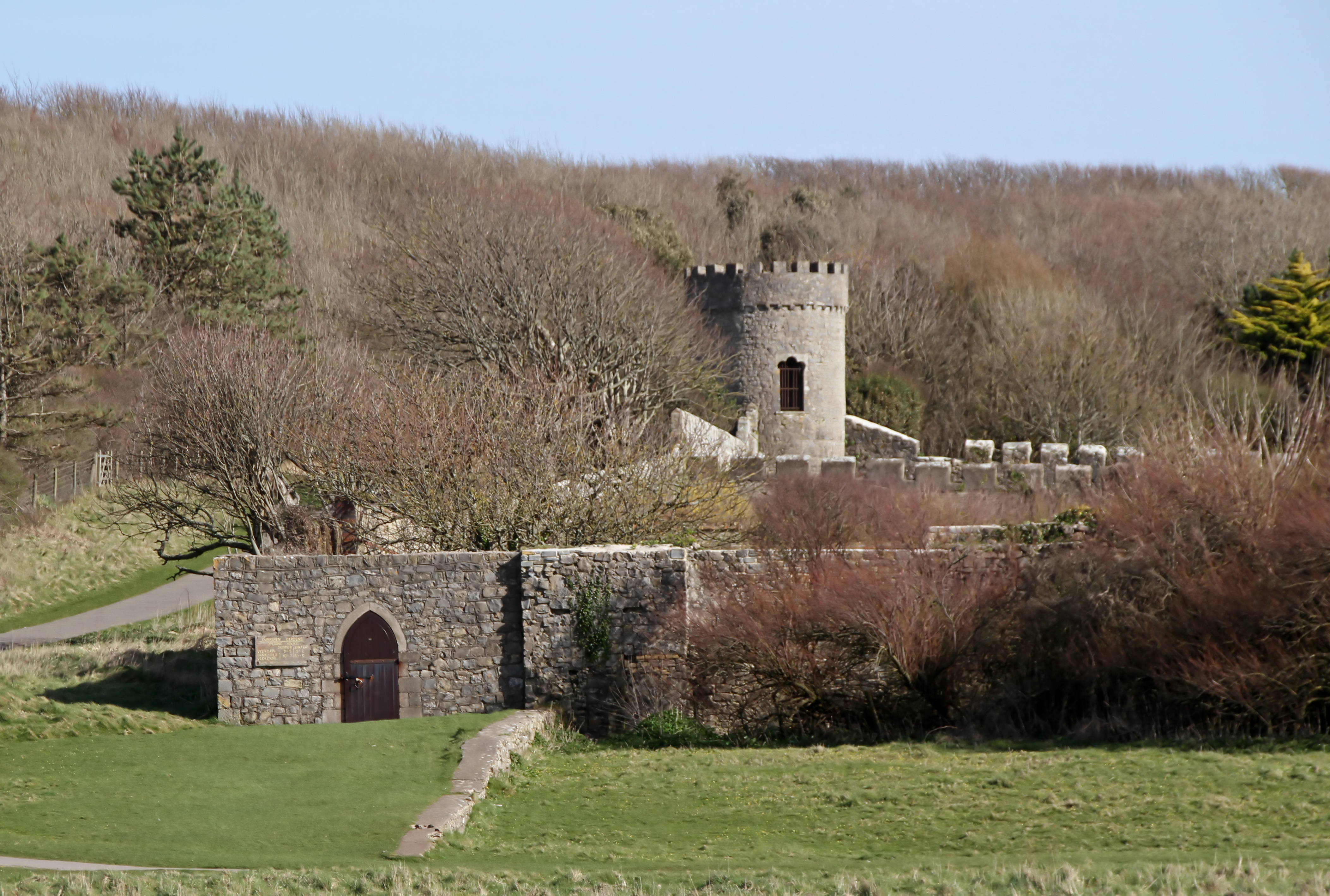
Dunraven Castle

Dunraven Castle (or in Welsh, Castell Dwnrhefn) was a mansion on the South Wales coast near Southerndown. The existing manor house was rebuilt as a castellated...

Southerndown Coast

Southerndown Coast is a Site of Special Scientific Interest (SSSI) in St Brides Major community, in the Vale of Glamorgan, South Wales. It forms part of...

St Brides Major (community)

St Brides Major (Welsh: Sant-y-Brid) is a community on the western edge of the Vale of Glamorgan, South Wales. Its largest settlement is the village of...

Nearby Amenities

Located within 500m of 51.454623,-3.6126505
Source: PGS
Lat/Long: 51.4509549/-3.6164179
Source: PGS
Lat/Long: 51.4508639/-3.6158942
Source: PGS
Lat/Long: 51.4505509/-3.6148376
Southerndown
Name Cy: Southerndown
Name En: Southerndown
Place: village
Lat/Long: 51.4534413/-3.6107531
Access: yes
Barrier: cattle_grid
Lat/Long: 51.4570055/-3.6138175
WP04
Wpt Symbol: Waypoint
Lat/Long: 51.4536139/-3.6163277
Davy Jones' Locker
Leisure: Traditional Climbing
Sport: climbing
Lat/Long: 51.4514745/-3.6177795
Biscuit Bay Area
Leisure: Traditional Climbing
Sport: climbing
Lat/Long: 51.4523136/-3.6186752
Barrier: cattle_grid
Lat/Long: 51.4534971/-3.6164573
Post Box
Operator: Royal Mail
Post Box Mounting: pier
Post Box Type: lamp
Ref: CF32 117
Royal Cypher: EIIR
Royal Cypher Wikidata: Q33102113
Lat/Long: 51.4519786/-3.6098349
Direction: SE
Generator Method: photovoltaic
Generator Output Electricity: yes
Generator Solar Modules: 10
Generator Source: solar
Generator Type: solar_photovoltaic_panel
Location: roof
Power: generator
Lat/Long: 51.4551882/-3.6125044
Direction: 235
Generator Method: photovoltaic
Generator Output Electricity: yes
Generator Solar Modules: 5
Generator Source: solar
Generator Type: solar_photovoltaic_panel
Location: roof
Power: generator
Lat/Long: 51.4551422/-3.6122968
Direction: 255
Generator Method: photovoltaic
Generator Output Electricity: yes
Generator Solar Modules: 8
Generator Source: solar
Generator Type: solar_photovoltaic_panel
Location: roof
Power: generator
Lat/Long: 51.4539359/-3.6168569
Direction: 75
Generator Method: photovoltaic
Generator Output Electricity: yes
Generator Solar Modules: 9
Generator Source: solar
Generator Type: solar_photovoltaic_panel
Location: roof
Power: generator
Lat/Long: 51.4539509/-3.6167751
Direction: 165
Generator Method: photovoltaic
Generator Output Electricity: yes
Generator Solar Modules: 14
Generator Source: solar
Generator Type: solar_photovoltaic_panel
Location: roof
Power: generator
Lat/Long: 51.4520405/-3.6099918
Direction: 235
Generator Method: photovoltaic
Generator Output Electricity: yes
Generator Solar Modules: 12
Generator Source: solar
Generator Type: solar_photovoltaic_panel
Location: roof
Power: generator
Lat/Long: 51.4530711/-3.6108964
Direction: 145
Generator Method: photovoltaic
Generator Output Electricity: yes
Generator Solar Modules: 5
Generator Source: solar
Generator Type: solar_photovoltaic_panel
Location: roof
Power: generator
Lat/Long: 51.455077/-3.6122295
Direction: 145
Generator Method: photovoltaic
Generator Output Electricity: yes
Generator Solar Modules: 3
Generator Source: solar
Generator Type: solar_photovoltaic_panel
Location: roof
Power: generator
Lat/Long: 51.4551144/-3.6122103
Direction: 145
Generator Method: photovoltaic
Generator Output Electricity: yes
Generator Solar Modules: 3
Generator Source: solar
Generator Type: solar_photovoltaic_panel
Location: roof
Power: generator
Lat/Long: 51.4550916/-3.6122771
Direction: SSE
Generator Method: photovoltaic
Generator Output Electricity: yes
Generator Solar Modules: 12
Generator Source: solar
Generator Type: solar_photovoltaic_panel
Location: roof
Power: generator
Lat/Long: 51.4522289/-3.6100552
Direction: 175
Generator Method: photovoltaic
Generator Output Electricity: yes
Generator Solar Modules: 14
Generator Source: solar
Generator Type: solar_photovoltaic_panel
Location: roof
Power: generator
Lat/Long: 51.4511985/-3.6100904
Parking
Lat/Long: 51.4532029/-3.6183231
Three Golden Cups Campsite
Tourism: camp_site
Website: https://www.thethreegoldencups.co.uk/
Lat/Long: 51.4527126/-3.6092163
The data included in this document is from www.openstreetmap.org. The data is made available under ODbL.

Have you been to Southerndown?

Leave your review of Southerndown below (or comments, questions and feedback).