Street, South

Settlement in Kent Canterbury

England

Street, South

Beacon on Tankerton Slopes Grassy seafront area above a low cliff.
Beacon on Tankerton Slopes Credit: David Martin

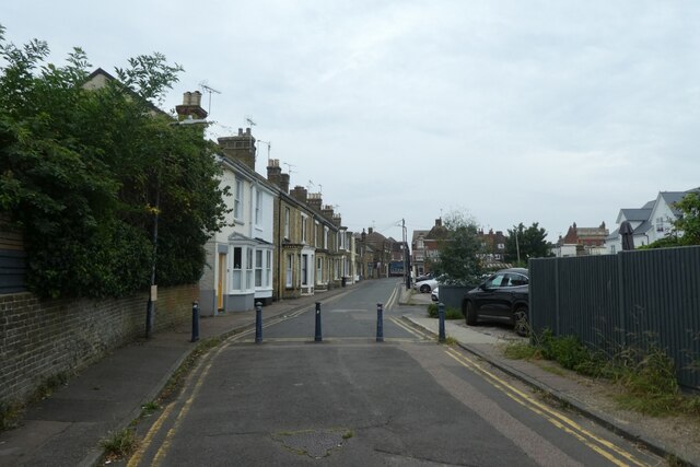
Street, South, Kent is a quaint and charming town located in the county of Kent, England. Situated in the southeastern part of the country, this town is known for its historical significance, picturesque landscapes, and vibrant community.

The town's name, Street, South, Kent, derives from its location south of the main road, known as Street Road, which runs through the heart of the town. Nestled amidst rolling hills and green pastures, Street, South offers a beautiful countryside setting that attracts both locals and tourists alike.

The town is home to a population of approximately 5,000 people, creating a close-knit and friendly atmosphere. The community takes great pride in preserving the town's rich history, evident in its well-preserved architecture and landmarks. The charming town center features a mix of quaint cottages, traditional pubs, and local shops, creating a warm and inviting ambiance.

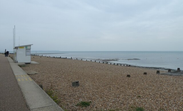
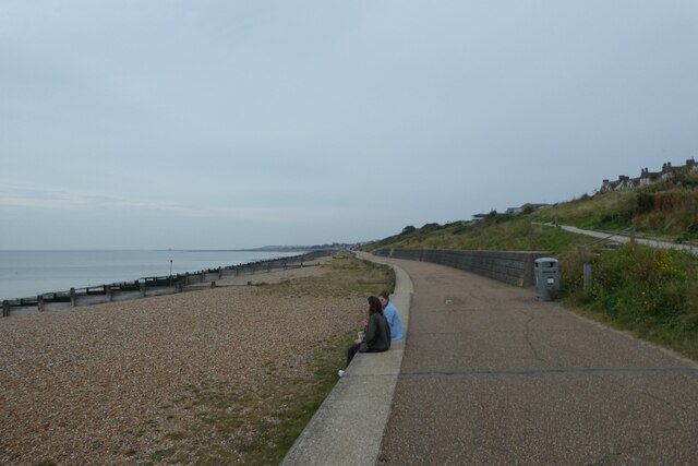
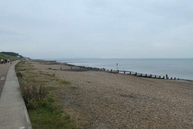
Street, South, Kent is also renowned for its proximity to several notable attractions. The picturesque countryside offers ample opportunities for hiking, cycling, and exploring the great outdoors. Additionally, the town is a short drive away from historic sites such as Canterbury Cathedral and Leeds Castle, making it an ideal base for those seeking to delve into England's past.

In terms of amenities, Street, South has a range of facilities including schools, healthcare services, and recreational spaces. The town also hosts various events and festivals throughout the year, which further enhances the community spirit and brings residents together.

Overall, Street, South, Kent is a peaceful and idyllic town that offers a perfect blend of history, natural beauty, and community spirit. Whether you are seeking a tranquil getaway or a place to call home, this charming town has something to offer everyone.

If you have any feedback on the listing, please let us know in the comments section below.

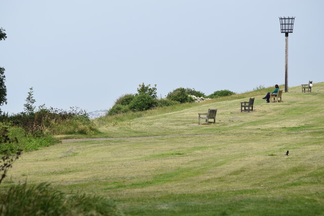
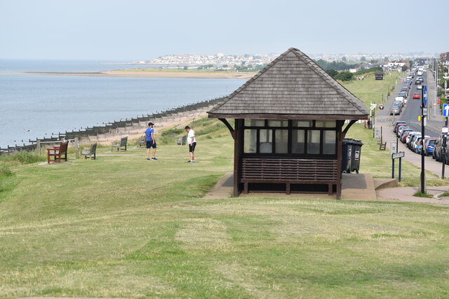
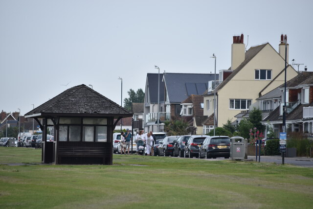
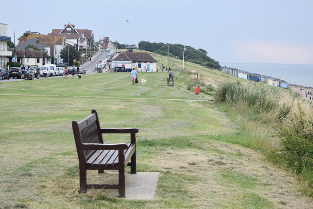
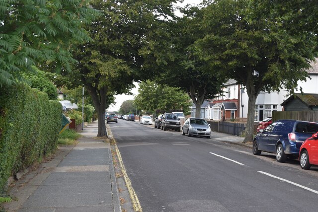
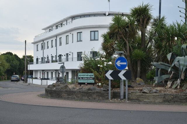
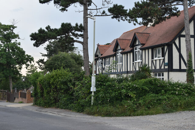
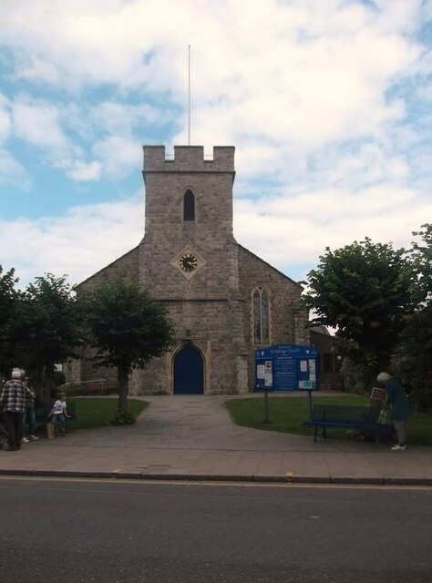
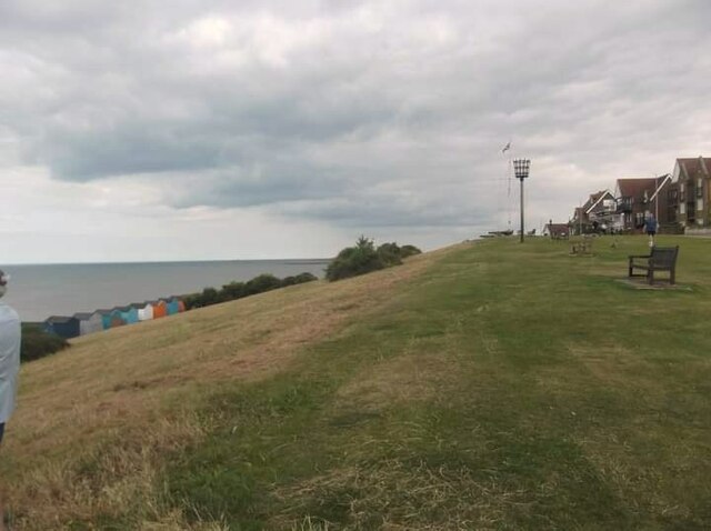
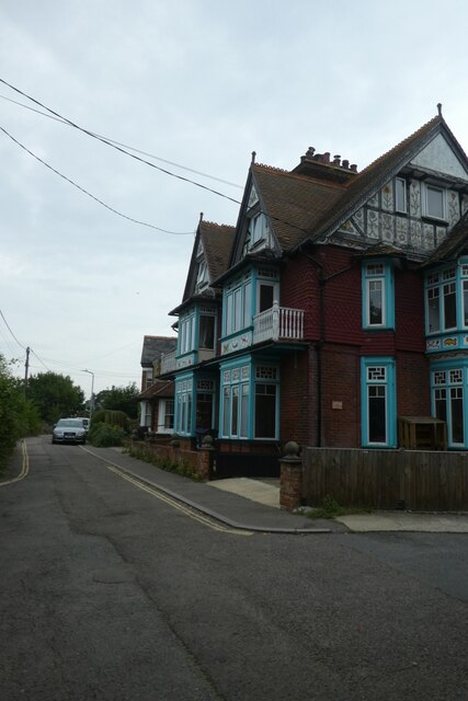
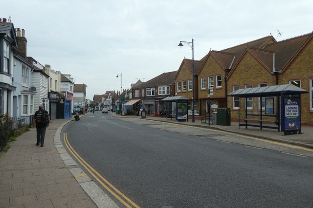
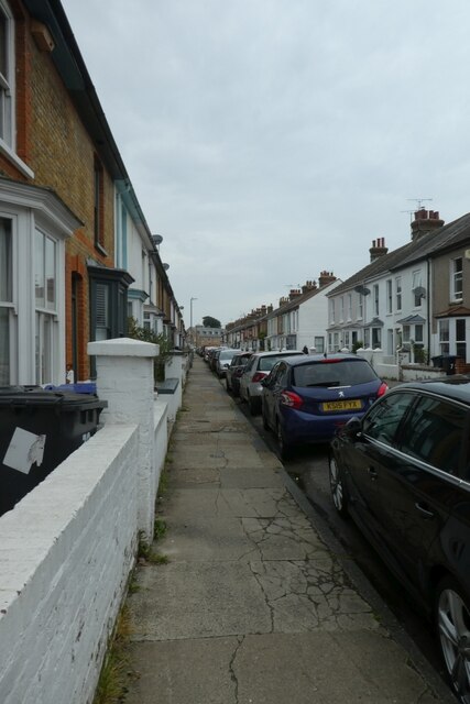
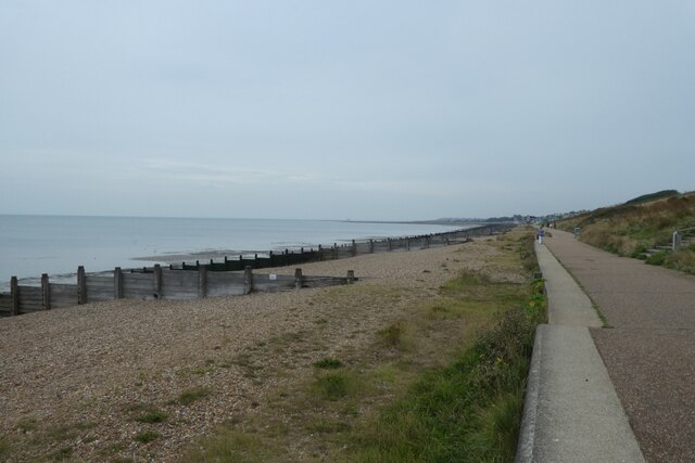
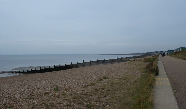
Street, South Images

Images are sourced within 2km of 51.347949/1.047268 or Grid Reference TR1265. Thanks to Geograph Open Source API. All images are credited.

Beacon on Tankerton Slopes Grassy seafront area above a low cliff.
Beacon on Tankerton Slopes
Grassy seafront area above a low cliff.
Shelter on Tankerton Slopes
Seafront shelter, Tankerton
Seafront bench, Tankerton
Graystone Road, Tankerton Typical north Kent seaside suburban street, leading to the seafront.
Graystone Road, Tankerton
Typical north Kent seaside suburban street, leading to the seafront.
Liner-style revival, Tankerton This new residential/retail building by the roundabout very much has the 1930s liner style.
Liner-style revival, Tankerton
This new residential/retail building by the roundabout very much has the 1930s liner style.
Mock tudor style in Kingsdown Park
St Alphege Church
St Alphege Church
Tankerton slopes
Tankerton slopes
West Cliff Looking at houses on West Cliff.
West Cliff
Looking at houses on West Cliff.
Bus shelters on Oxford Street Looking along Oxford Street in Whitstable.
Bus shelters on Oxford Street
Looking along Oxford Street in Whitstable.
Regent Street Looking along Regent Street near the junction with Acton Road.
Regent Street
Looking along Regent Street near the junction with Acton Road.
Gladstone Road Looking along Gladstone Road near the junction with Regent Street.
Gladstone Road
Looking along Gladstone Road near the junction with Regent Street.
Lifeguard lookout Looking across part of Tankerton Beach.
Lifeguard lookout
Looking across part of Tankerton Beach.
Cycle path beside Tankerton Beach Looking along the cycle path on the sea front.
Cycle path beside Tankerton Beach
Looking along the cycle path on the sea front.
Tankerton Beach Looking across part of the shingle beach.
Tankerton Beach
Looking across part of the shingle beach.
Path along the sea wall Looking across part of Tankerton Beach.
Path along the sea wall
Looking across part of Tankerton Beach.
Shingle on Tankerton Beach Looking east along the beach.
Shingle on Tankerton Beach
Looking east along the beach.
Show me another place!

Street, South is located at Grid Ref: TR1265 (Lat: 51.347949, Lng: 1.047268)

Administrative County: Kent

District: Canterbury

Police Authority: Kent

What 3 Words

///leads.artist.tried. Near Tankerton, Kent

Related Wikis

South Street Halt railway station

South Street Halt was a minor station on the Canterbury and Whitstable Railway at Tankerton, Kent. It opened in 1911 and closed in 1931. == History... ==

The Whitstable School

The Whitstable School is a coeducational secondary school and sixth form located in Whitstable, Kent, England. It was established in 1952 as the Sir William...

All Saints Church, Whitstable

All Saints Church is a Church of England church in Whitstable, Kent. It is one of five Church of England churches in the Whitstable Team Ministry. There...

Heart Kent

Heart Kent (previously Invicta FM) was an Independent Local Radio station owned and operated by Global Radio as part of the Heart network. It broadcast...

Tankerton Halt railway station

Tankerton Halt was a minor station on the Canterbury and Whitstable Railway at Tankerton, Kent. It opened in 1914 and closed in 1931. == History == Tankerton...

Chestfield

Chestfield is a village (and civil parish and with Swalecliffe a district council ward) in the Canterbury District of Kent, England. The parish is centred...

Whitstable railway station

Whitstable railway station is on the Ramsgate branch of the Chatham Main Line in England, serving the town of Whitstable, Kent. It is 59 miles 6 chains...

Radfall

Radfall is a hamlet between Whitstable and Canterbury, in southeast England. It lies between the Thanet Way and Thornden Wood, in the Canterbury district...

Nearby Amenities

Located within 500m of 51.347949,1.047268
Turning Circle
Lat/Long: 51.3496015/1.0437567
Post Box
Postal Code: CT5
Ref: CT5 223
Source: survey
Lat/Long: 51.350612/1.0467826
Telephone
Booth: KX100
Covered: booth
Payment Coins: yes
Payment Credit Cards: yes
Payment Debit Cards: yes
Phone: +44 1227 277165
Lat/Long: 51.3480506/1.0421355
Bus Stop
Naptan AtcoCode: 2400A040850A
Naptan NaptanCode: kntdtagm
Lat/Long: 51.3480678/1.042034
Post Box
Collection Times: Mo-Fr 16:00; Sa 09:00
Operator: Royal Mail
Post Box Type: pillar
Ref: CT5 257
Royal Cypher: EIIR
Royal Cypher Wikidata: Q33102113
Source: survey
Lat/Long: 51.3481125/1.0418931
South Street
Is In: Kent, England, UK
Place: hamlet
Source: NPE maps
Lat/Long: 51.3472642/1.0446968
Millennium Milepost South Street
Description: 1) Whitstable 1.75, London 85 2) Canterbury 5.75, Dover 37
Image: https://www.cyclestreets.net/location/185571/cyclestreets185571.jpg
Information: guidepost
Ncn Milepost: mills
Sustrans Ref: MP 318
Tourism: information
Lat/Long: 51.344714/1.0476302
Mini Roundabout
Direction: clockwise
Lat/Long: 51.3472715/1.043551
Post Box
Collection Times: Mo-Fr 16:00; Sa 12:30
Note: Inside front of store.
Postal Code: CT5
Ref: CT5 388
Source: survey
Lat/Long: 51.3468825/1.0422674
Bicycle Parking
Bicycle Parking: front_wheel_only
Capacity: 9
Covered: no
Cyclestreets Id: 16446
Source: survey
Lat/Long: 51.3468571/1.0418786
Recycling
Recycling Clothes: yes
Recycling Glass Bottles: yes
Recycling Paper: yes
Lat/Long: 51.3477198/1.043367
Bus Stop
Virginia Road
Naptan AtcoCode: 2400A040820A
Naptan Bearing: W
Naptan CommonName: Virginia Road
Naptan Indicator: W-bound
Naptan Landmark: South Street
Naptan NaptanCode: kntdtaga
Naptan PlusbusZoneRef: HRNEBAY
Naptan Street: Virginia Road
Naptan Verified: no
Source: naptan_import
Lat/Long: 51.3504302/1.0457571
Bus Stop
Virginia Road
Naptan AtcoCode: 2400A040830A
Naptan Bearing: E
Naptan CommonName: Virginia Road
Naptan Indicator: E-bound
Naptan Landmark: South Street
Naptan NaptanCode: kntdtagd
Naptan PlusbusZoneRef: HRNEBAY
Naptan Street: Virginia Road
Naptan Verified: no
Source: naptan_import
Lat/Long: 51.3505949/1.0463426
Bus Stop
Tesco
Flag: yes
Naptan AtcoCode: 2400A040840A
Naptan Bearing: E
Naptan CommonName: Tesco
Naptan Indicator: opp
Naptan Landmark: Home Choice Carpets
Naptan NaptanCode: kntdtagj
Naptan PlusbusZoneRef: HRNEBAY
Naptan Street: Millstrood Road
Naptan Verified: no
Shelter: no
Source: naptan_import
Tactile Paving: no
Lat/Long: 51.3479223/1.0439676
Bus Stop
Tesco
Naptan AtcoCode: 2400A040850A
Naptan Bearing: W
Naptan CommonName: Tesco
Naptan Indicator: o/s
Naptan Landmark: Tesco
Naptan NaptanCode: kntdtagm
Naptan PlusbusZoneRef: HRNEBAY
Naptan Street: Millstrood Road
Naptan Verified: no
Source: naptan_import
Lat/Long: 51.3480703/1.0420815
South Street
Place: suburb
Source: OS_OpenData_StreetView
Lat/Long: 51.3483244/1.0438482
Traffic Calming: table
Lat/Long: 51.3488059/1.0420565
Barrier: cycle_barrier
Cycle Barrier: tilted
Lat/Long: 51.3447135/1.0476746
Communication Mobile Phone: yes
Man Made: mast
Tower Type: communication
Lat/Long: 51.346941/1.0440262
Snappy's "Indoor PlayArea"
Addr City: Whitstable
Addr Country: GB
Addr Housenumber: 45B
Addr Place: Joseph Wilson Industrial Estate
Addr Postcode: CT5 3PS
Landuse: retail
Lat/Long: 51.3456236/1.0431083
Toilets
Tesco
Check Date: 2024-02-10
Fee: no
Lat/Long: 51.3469497/1.0430426
Bench
Backrest: no
Lat/Long: 51.3496707/1.041816
South Street Station
Board Type: history
Information: board
Tourism: information
Lat/Long: 51.3480437/1.0445249
Crab & Winkle Way Penny Farthing
Artwork Type: sculpture
Note: A sculpture of a metal stick figure riding a penny farthing bike. This is here to represent the Crab and Winkle Way.
Tourism: artwork
Lat/Long: 51.3480031/1.0445437
Cafe
Tesco Cafe
Addr City: Whitstable
Addr Country: GB
Addr Postcode: CT5 3EE
Addr Street: Millstrood Road
Fhrs Id: 1103209
Opening Hours: Mo-Sa 08:00-17:00; Su 10:00-16:00
Source Addr: FHRS Open Data
Lat/Long: 51.3469779/1.0428069
Generator Method: photovoltaic
Generator Orientation: 270
Generator Output Electricity: yes
Generator Solar Modules: 5
Generator Source: solar
Generator Type: solar_photovoltaic_panel
Location: roof
Power: generator
Lat/Long: 51.3500196/1.0438339
Generator Method: photovoltaic
Generator Orientation: 90
Generator Output Electricity: yes
Generator Solar Modules: 5
Generator Source: solar
Generator Type: solar_photovoltaic_panel
Location: roof
Power: generator
Lat/Long: 51.350023/1.0438876
Generator Method: photovoltaic
Generator Orientation: 270
Generator Output Electricity: yes
Generator Solar Modules: 8
Generator Source: solar
Generator Type: solar_photovoltaic_panel
Location: roof
Power: generator
Lat/Long: 51.3496607/1.0434363
Generator Method: photovoltaic
Generator Orientation: 90
Generator Output Electricity: yes
Generator Solar Modules: 8
Generator Source: solar
Generator Type: solar_photovoltaic_panel
Location: roof
Power: generator
Lat/Long: 51.3496603/1.0434792
Generator Method: photovoltaic
Generator Orientation: 109
Generator Output Electricity: yes
Generator Solar Modules: 4
Generator Source: solar
Generator Type: solar_photovoltaic_panel
Location: roof
Power: generator
Lat/Long: 51.3491687/1.0447619
Generator Method: photovoltaic
Generator Orientation: 170
Generator Output Electricity: yes
Generator Solar Modules: 10
Generator Source: solar
Generator Type: solar_photovoltaic_panel
Location: roof
Power: generator
Lat/Long: 51.3486812/1.0417424
Fixme: Double-check module count
Generator Method: photovoltaic
Generator Orientation: 180
Generator Output Electricity: yes
Generator Solar Modules: 17
Generator Source: solar
Generator Type: solar_photovoltaic_panel
Location: roof
Power: generator
Lat/Long: 51.351152/1.0433498
Generator Method: photovoltaic
Generator Orientation: 170
Generator Output Electricity: yes
Generator Solar Modules: 13
Generator Source: solar
Generator Type: solar_photovoltaic_panel
Location: roof
Power: generator
Lat/Long: 51.349339/1.0419417
Generator Method: photovoltaic
Generator Orientation: 115
Generator Output Electricity: yes
Generator Solar Modules: 12
Generator Source: solar
Generator Type: solar_photovoltaic_panel
Location: roof
Power: generator
Lat/Long: 51.3486581/1.0435007
Generator Method: photovoltaic
Generator Orientation: 173
Generator Output Electricity: yes
Generator Solar Modules: 2
Generator Source: solar
Generator Type: solar_photovoltaic_panel
Location: roof
Power: generator
Lat/Long: 51.3509628/1.0419229
Generator Method: photovoltaic
Generator Orientation: 160
Generator Output Electricity: yes
Generator Solar Modules: 12
Generator Source: solar
Generator Type: solar_photovoltaic_panel
Location: roof
Power: generator
Lat/Long: 51.3522459/1.0454285
Generator Method: photovoltaic
Generator Orientation: 180
Generator Output Electricity: yes
Generator Solar Modules: 16
Generator Source: solar
Generator Type: solar_photovoltaic_panel
Location: roof
Power: generator
Lat/Long: 51.3503262/1.0450128
Generator Method: photovoltaic
Generator Orientation: 109
Generator Output Electricity: yes
Generator Solar Modules: 10
Generator Source: solar
Generator Type: solar_photovoltaic_panel
Location: roof
Power: generator
Lat/Long: 51.3493018/1.0448727
Generator Method: photovoltaic
Generator Orientation: 153
Generator Output Electricity: yes
Generator Solar Modules: 14
Generator Source: solar
Generator Type: solar_photovoltaic_panel
Location: roof
Power: generator
Lat/Long: 51.3500716/1.0427584
Generator Method: photovoltaic
Generator Orientation: 270
Generator Output Electricity: yes
Generator Solar Modules: 6
Generator Source: solar
Generator Type: solar_photovoltaic_panel
Location: roof
Power: generator
Lat/Long: 51.3513681/1.0432063
Generator Method: photovoltaic
Generator Output Electricity: yes
Generator Solar Modules: 16
Generator Source: solar
Generator Type: solar_photovoltaic_panel
Location: roof
Power: generator
Lat/Long: 51.3508782/1.0519691
Generator Method: photovoltaic
Generator Output Electricity: yes
Generator Solar Modules: 14
Generator Source: solar
Generator Type: solar_photovoltaic_panel
Location: roof
Power: generator
Lat/Long: 51.3509274/1.0479531
Generator Method: photovoltaic
Generator Output Electricity: yes
Generator Solar Modules: 8
Generator Source: solar
Generator Type: solar_photovoltaic_panel
Location: roof
Power: generator
Lat/Long: 51.3511885/1.0488731
Generator Method: photovoltaic
Generator Output Electricity: yes
Generator Solar Modules: 8
Generator Source: solar
Generator Type: solar_photovoltaic_panel
Location: roof
Power: generator
Lat/Long: 51.3511885/1.0489066
Generator Method: photovoltaic
Generator Orientation: 289
Generator Output Electricity: yes
Generator Solar Modules: 14
Generator Source: solar
Generator Type: solar_photovoltaic_panel
Location: roof
Power: generator
Lat/Long: 51.3491372/1.0446949
Generator Method: photovoltaic
Generator Orientation: 199
Generator Output Electricity: yes
Generator Solar Modules: 2
Generator Source: solar
Generator Type: solar_photovoltaic_panel
Location: roof
Power: generator
Lat/Long: 51.3492683/1.0448163
Generator Method: photovoltaic
Generator Output Electricity: yes
Generator Source: solar
Generator Type: solar_photovoltaic_panel
Location: roof
Power: generator
Lat/Long: 51.3508011/1.0501117
Generator Method: photovoltaic
Generator Output Electricity: yes
Generator Source: solar
Generator Type: solar_photovoltaic_panel
Location: roof
Power: generator
Lat/Long: 51.3509351/1.0501344
Turning Circle
Lat/Long: 51.3514569/1.0479109
South Street
Historic Railway: halt
Railway: site
Wikidata: Q96406083
Wikipedia: en:South Street Halt railway station
Lat/Long: 51.3481816/1.0445015
Southstreet Crossing
Historic Railway: level_crossing
Lat/Long: 51.3476757/1.044779
Rayham Crossing
Historic Railway: level_crossing
Lat/Long: 51.3480945/1.0445629
Traffic Calming: island
Lat/Long: 51.3499306/1.0408706
Charging Station
Otis-Demi
Bicycle: no
Capacity: 2
Motorcar: yes
Motorcycle: no
Operator: Pod Point
Operator Wikidata: Q42888154
Payment App: yes
Payment Coins: no
Payment Contactless: no
Payment Notes: no
Scooter: no
Socket Type2: 2
Socket Type2 Output: 22 kW
Truck: no
Lat/Long: 51.3472377/1.0418139
Charging Station
Myla-Jude
Bicycle: no
Capacity: 2
Motorcar: yes
Motorcycle: no
Operator: Pod Point
Operator Wikidata: Q42888154
Payment App: yes
Payment Contactless: no
Scooter: no
Socket Type2: 2
Socket Type2 Output: 7 kW
Truck: no
Lat/Long: 51.347231/1.0418126
Charging Station
Krew-Edil
Authentication Short Message: yes
Bicycle: no
Capacity: 2
Motorcar: yes
Motorcycle: no
Operator: Pod Point
Operator Wikidata: Q42888154
Payment App: yes
Payment Coins: no
Payment Contactless: yes
Payment Notes: no
Scooter: no
Socket Chademo: 1
Socket Type1 Combo: 1
Truck: no
Lat/Long: 51.3472287/1.041884
Generator Method: photovoltaic
Generator Output Electricity: yes
Generator Source: solar
Generator Type: solar_photovoltaic_panel
Location: roof
Power: generator
Lat/Long: 51.3459529/1.0469533
Generator Method: photovoltaic
Generator Output Electricity: yes
Generator Source: solar
Generator Type: solar_photovoltaic_panel
Location: roof
Power: generator
Lat/Long: 51.3452819/1.0479042
The data included in this document is from www.openstreetmap.org. The data is made available under ODbL.

Have you been to Street, South?

Leave your review of Street, South below (or comments, questions and feedback).