South Tawton

Settlement in Devon West Devon

England

South Tawton

Old Boundary Marker in South Zeal village Parish Boundary Marker lying as an edging stone beside the public footpath from South Zeal village through Mill Field towards Hillfield and Croft. South Tawton parish. 

Inscribed D C / 4 (Duchy of Cornwall) and S Z / 4 (South Zeal citizens) on opposite faces. The stone is one of four stones (SZ1-SZ4) erected in 1895 on South Tawton Common by the Duchy of Cornwall to mark the boundary of their land and prevent encroachment on the Common by villagers, farmers and residents of the parish. The stone was originally located at SX654922, as evidenced by a conveyance held in the Devon Record Office by which the Duchy of Cornwall and 44 ‘purchasers’ legalised 108 enclosures of land which had been subject to dispute.

Milestone Society National ID: DV_SZ04pb
Old Boundary Marker in South Zeal village Credit: T Jenkinson

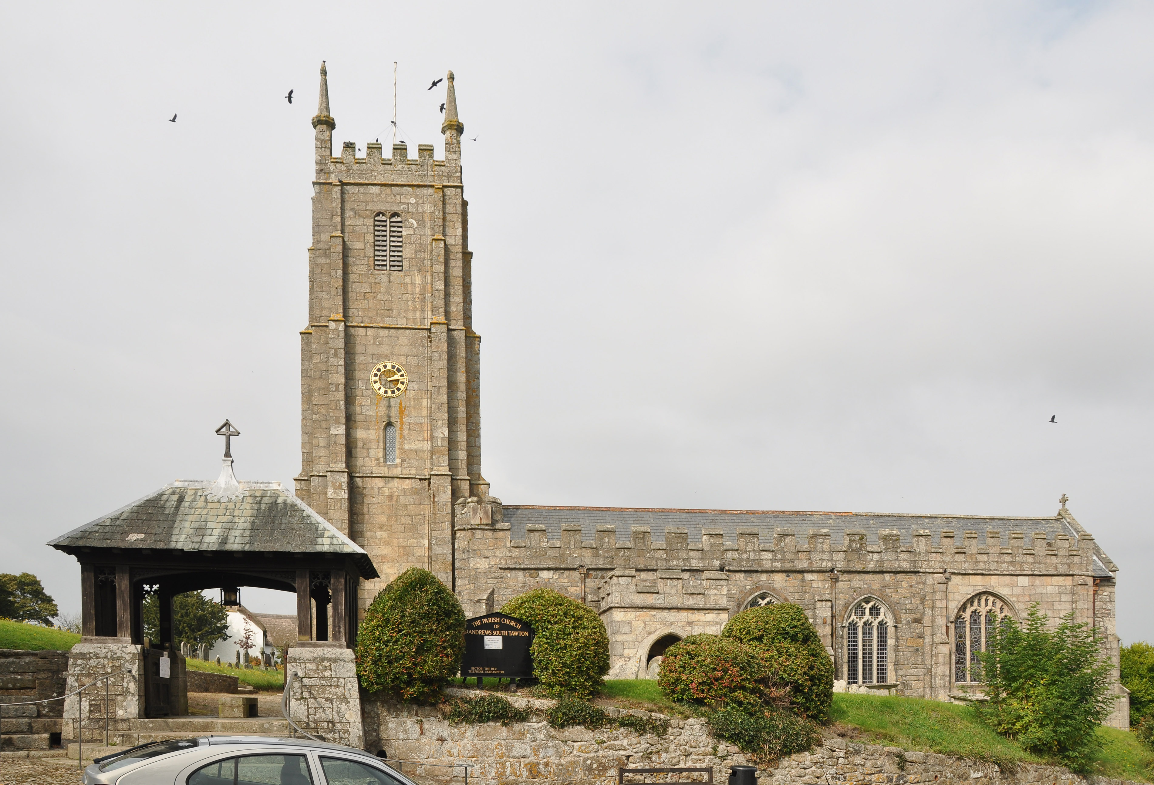
South Tawton is a small village located in the county of Devon, England. Situated in the Dartmoor National Park, South Tawton is surrounded by beautiful countryside and offers stunning views of the nearby moors. The village is known for its picturesque thatched cottages, historic church, and traditional village green.

South Tawton has a close-knit community and a range of amenities including a village shop, post office, and a pub. The village is also home to a primary school and a village hall where various community events and activities take place.

The area around South Tawton is popular with hikers, cyclists, and nature lovers, with a network of walking trails and bridleways to explore. The nearby River Taw offers opportunities for fishing and kayaking, while the surrounding moors provide habitat for a variety of wildlife.

Overall, South Tawton is a charming and peaceful village, perfect for those looking to escape the hustle and bustle of city life and enjoy the natural beauty of the Devon countryside.

If you have any feedback on the listing, please let us know in the comments section below.

South Tawton Images

Images are sourced within 2km of 50.733946/-3.908663 or Grid Reference SX6594. Thanks to Geograph Open Source API. All images are credited.

Old Boundary Marker in South Zeal village Parish Boundary Marker lying as an edging stone beside the public footpath from South Zeal village through Mill Field towards Hillfield and Croft. South Tawton parish. 

Inscribed D C / 4 (Duchy of Cornwall) and S Z / 4 (South Zeal citizens) on opposite faces. The stone is one of four stones (SZ1-SZ4) erected in 1895 on South Tawton Common by the Duchy of Cornwall to mark the boundary of their land and prevent encroachment on the Common by villagers, farmers and residents of the parish. The stone was originally located at SX654922, as evidenced by a conveyance held in the Devon Record Office by which the Duchy of Cornwall and 44 ‘purchasers’ legalised 108 enclosures of land which had been subject to dispute.

Milestone Society National ID: DV_SZ04pb
Old Boundary Marker in South Zeal village
Parish Boundary Marker lying as an edging stone beside the public footpath from South Zeal village through Mill Field towards Hillfield and Croft. South Tawton parish. Inscribed D C / 4 (Duchy of Cornwall) and S Z / 4 (South Zeal citizens) on opposite faces. The stone is one of four stones (SZ1-SZ4) erected in 1895 on South Tawton Common by the Duchy of Cornwall to mark the boundary of their land and prevent encroachment on the Common by villagers, farmers and residents of the parish. The stone was originally located at SX654922, as evidenced by a conveyance held in the Devon Record Office by which the Duchy of Cornwall and 44 ‘purchasers’ legalised 108 enclosures of land which had been subject to dispute. Milestone Society National ID: DV_SZ04pb
South Tawton : Grassy Field A grassy field in the countryside.
South Tawton : Grassy Field
A grassy field in the countryside.
South Tawton : Grassy Field A grassy field in the countryside.
South Tawton : Grassy Field
A grassy field in the countryside.
Flags on the Wall A flag mural and wall plaque commemorating Sticklepath's place on the Trafalgar Way along which the news of the naval victory at the battle of Trafalgar was carried on horseback from Falmouth to London in 1805.
A close up of the wall plaque with the full story is on <a href="https://www.geograph.org.uk/photo/2935608">SX6494 : Trafalgar Way plaque at Sticklepath</a>
While sitting outside the Devonshire Inn opposite, we had a go at looking up the code flag alphabet but only some of the flags on the wall appear on the charts so we couldn't make any sense of it.
Flags on the Wall
A flag mural and wall plaque commemorating Sticklepath's place on the Trafalgar Way along which the news of the naval victory at the battle of Trafalgar was carried on horseback from Falmouth to London in 1805. A close up of the wall plaque with the full story is on SX6494 : Trafalgar Way plaque at Sticklepath While sitting outside the Devonshire Inn opposite, we had a go at looking up the code flag alphabet but only some of the flags on the wall appear on the charts so we couldn't make any sense of it.
Thatched Houses, Sticklepath Along the main road through the village.
Thatched Houses, Sticklepath
Along the main road through the village.
Oaktree Park, Sticklepath Newer housing off the main road.
Oaktree Park, Sticklepath
Newer housing off the main road.
Houses on the Main Road, Sticklepath The main road through Sticklepath was once the A30 before the new road was built north of the village.
Houses on the Main Road, Sticklepath
The main road through Sticklepath was once the A30 before the new road was built north of the village.
Cleave Mill Cottages, Sticklepath The narrowness of the lane makes it difficult to get more than this very angled view.
Cleave Mill Cottages, Sticklepath
The narrowness of the lane makes it difficult to get more than this very angled view.
The Old A30, Sticklepath It's hard to imagine now, but this village street was once one of the busiest main roads in Devon.
It's a lot quieter these days since the bypass was built. In front of the nearest house is a sign promoting the 20mph speed limit.
The Old A30, Sticklepath
It's hard to imagine now, but this village street was once one of the busiest main roads in Devon. It's a lot quieter these days since the bypass was built. In front of the nearest house is a sign promoting the 20mph speed limit.
Church House and Lych Gate, South Tawton The late 15th century church house in the centre of the village next to St Andrew's Church.
Church House and Lych Gate, South Tawton
The late 15th century church house in the centre of the village next to St Andrew's Church.
Church Ways, South Tawton One of the short side streets in the centre of the village.
Church Ways, South Tawton
One of the short side streets in the centre of the village.
Tombs, Ferns and Thatch, South Tawton A view in St Andrew's Churchyard.
Tombs, Ferns and Thatch, South Tawton
A view in St Andrew's Churchyard.
South Tawton Church House The ancient Church House with its impressive flight of steps dates from the late 15th century. The tall tower of  St Andrew's Church is beyond.
South Tawton Church House
The ancient Church House with its impressive flight of steps dates from the late 15th century. The tall tower of St Andrew's Church is beyond.
Old Gates to St Andrew's Churchyard Behind the Church House, this side entrance to the churchyard doesn't look like it's used a lot.
Old Gates to St Andrew's Churchyard
Behind the Church House, this side entrance to the churchyard doesn't look like it's used a lot.
Presented by H. A. Hoare Esq On a wall opposite the Seven Stars pub is an elaborate metal slab inscribed "Presented by H. A. Hoare Esq of Oxenham. July 24th 1863"
It looks like it might have been part of some sort of public water supply. 
Oxenham Manor is about 1km east of here.
Presented by H. A. Hoare Esq
On a wall opposite the Seven Stars pub is an elaborate metal slab inscribed "Presented by H. A. Hoare Esq of Oxenham. July 24th 1863" It looks like it might have been part of some sort of public water supply. Oxenham Manor is about 1km east of here.
River Taw Flowing through Skaigh Wood, just west of Sticklepath village
River Taw
Flowing through Skaigh Wood, just west of Sticklepath village
Gate, view and sky Looking south over a gate from a green lane west of Sticklepath village.
Gate, view and sky
Looking south over a gate from a green lane west of Sticklepath village.
Junction of Back Lane with the main road through Sticklepath
Show me another place!

South Tawton is located at Grid Ref: SX6594 (Lat: 50.733946, Lng: -3.908663)

Administrative County: Devon

District: West Devon

Police Authority: Devon and Cornwall

What 3 Words

///worldwide.hint.caked. Near Okehampton, Devon

Nearby Locations

South Tawton Tawton, South

Related Wikis

South Tawton

South Tawton is a village, parish and former manor on the north edge of Dartmoor, Devon, England. An electoral ward bearing the same name exists. At the...

South Zeal

South Zeal is a village on Dartmoor, in Devon, United Kingdom. It has a Church of England chapel and a Methodist chapel. The church is situated in the...
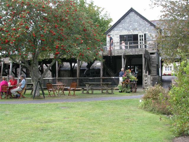
Finch Foundry

Finch Foundry is a 19th-century water-powered forge situated in the village of Sticklepath near Okehampton, Devon, England. It was originally used to produce...

Sticklepath

Sticklepath is a village and civil parish on Dartmoor, in the county of Devon, England. It gives its name to one of the most important geological faults...

Nearby Amenities

Located within 500m of 50.733946,-3.908663
Give Way
Lat/Long: 50.7332431/-3.9101144
South Tawton
Created By: Potlatch 0.10d
Place: village
Lat/Long: 50.7339333/-3.9090765
Give Way
Lat/Long: 50.7336132/-3.9091971
Pub
The Seven Stars
Wikidata: Q80476275
Lat/Long: 50.733724/-3.9097348
Townhall
Church House
Lat/Long: 50.7339906/-3.9100014
Telephone
Defibrillator
Booth: K6
Covered: booth
Defibrillator Location: inside old red phone box in South Tawton
Emergency: defibrillator
Man Made: telephone_box
Lat/Long: 50.7332422/-3.9102737
Post Box
Brand: Royal Mail
Brand Wikidata: Q638098
Brand Wikipedia: en:Royal Mail
Collection Times: Mo-Fr 16:00; Sa 10:30; Su off
Drive Through: no
Operator: Royal Mail
Operator Wikidata: Q638098
Post Box Mounting: wooden_post
Post Box Type: lamp
Ref: EX20 3
Royal Cypher: EIIR
Royal Cypher Wikidata: Q33102113
Source: survey;streetlevel imagery;aerial imagery
Lat/Long: 50.7337413/-3.9101476
Give Way
Lat/Long: 50.7351598/-3.9096036
Blackhall Farm
Place: locality
Lat/Long: 50.7351532/-3.9115331
South Tawton Mill
Place: locality
Lat/Long: 50.7338427/-3.9027891
Moons Cross
Alt Name: Moon’s Cross
Description: Remains of
Historic: milestone
Milestone Type: signpost
Tourism: attraction
Website: http://www.dartmoor-crosses.org.uk/moons.htm
Wikidata: Q26611606
Lat/Long: 50.7310636/-3.9106233
Natural: peak
Source: OS 1:25k
Lat/Long: 50.7347238/-3.915052
Give Way
Lat/Long: 50.7311895/-3.9106684
Give Way
Lat/Long: 50.733282/-3.9101985
Give Way
Lat/Long: 50.7340197/-3.9086564
Give Way
Lat/Long: 50.7343661/-3.9095661
Generator Method: photovoltaic
Generator Output Electricity: yes
Generator Source: solar
Generator Type: solar_photovoltaic_panel
Location: roof
Power: generator
Lat/Long: 50.737595/-3.9060541
Generator Method: photovoltaic
Generator Output Electricity: yes
Generator Source: solar
Generator Type: solar_photovoltaic_panel
Location: roof
Power: generator
Lat/Long: 50.733823/-3.9028703
Advertising: board
Lat/Long: 50.7337306/-3.910115
Bench
Lat/Long: 50.733757/-3.9101552
The data included in this document is from www.openstreetmap.org. The data is made available under ODbL.

Have you been to South Tawton?

Leave your review of South Tawton below (or comments, questions and feedback).