Bloreheath

Settlement in Staffordshire Newcastle-under-Lyme

England

Bloreheath

The Rowans on the A53
The Rowans on the A53 Credit: John Firth

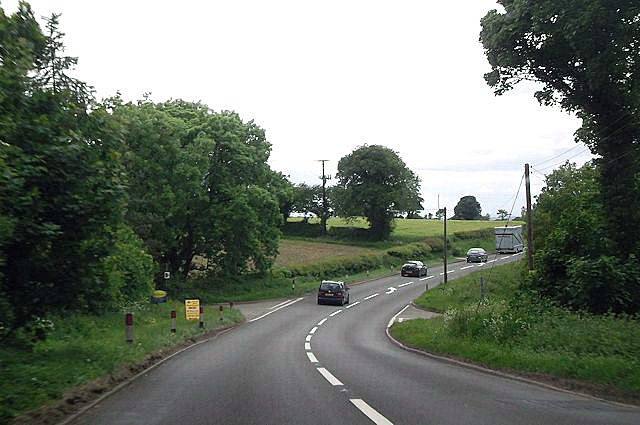
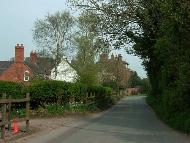
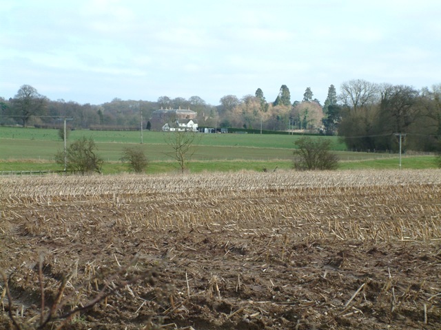
Bloreheath is a small village located in the county of Staffordshire, England. It is situated about 6 miles northeast of Market Drayton and approximately 7 miles southwest of Newcastle-under-Lyme. With a population of around 300 residents, the village maintains a peaceful and rural atmosphere.

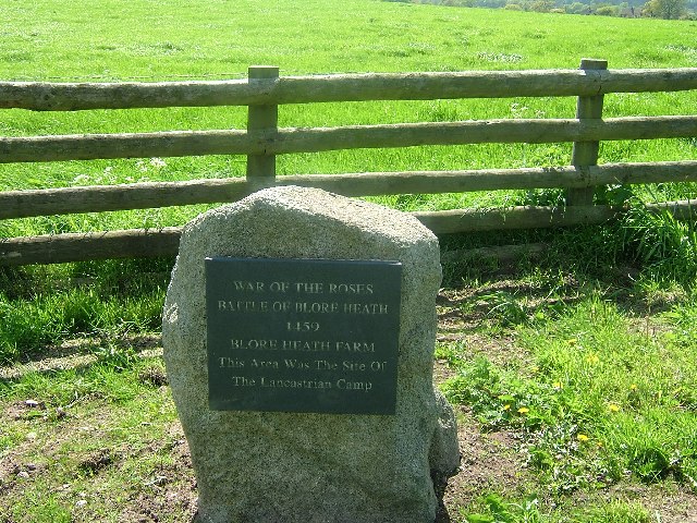
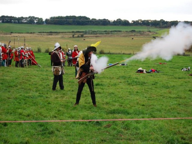
Historically, Bloreheath is known for its significance in the Wars of the Roses, a series of civil wars that took place in England during the 15th century. The Battle of Blore Heath occurred on September 23, 1459, between the forces of the House of Lancaster and the House of York. It was one of the first major battles of the conflict and resulted in a victory for the Yorkists.

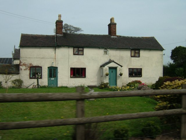
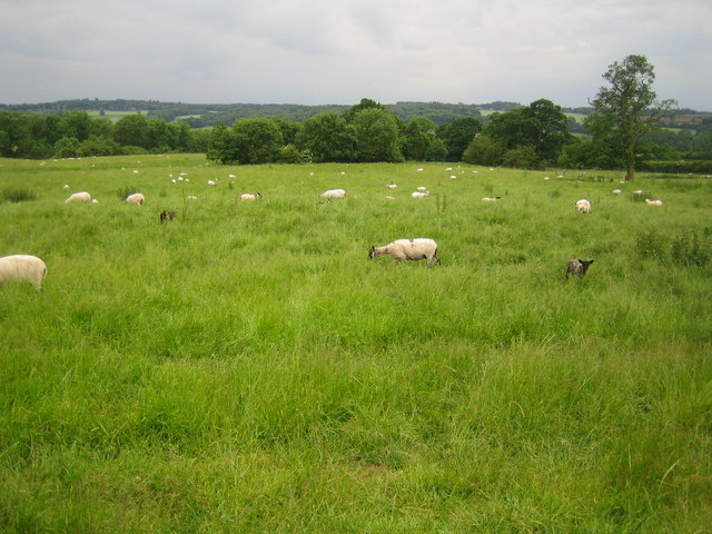
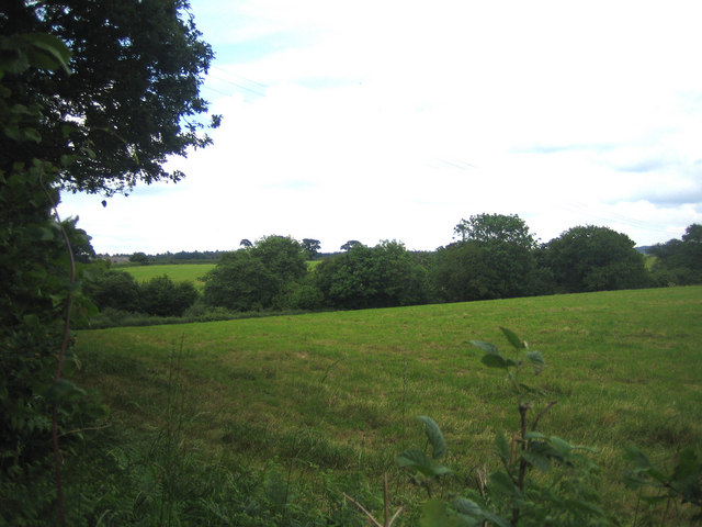
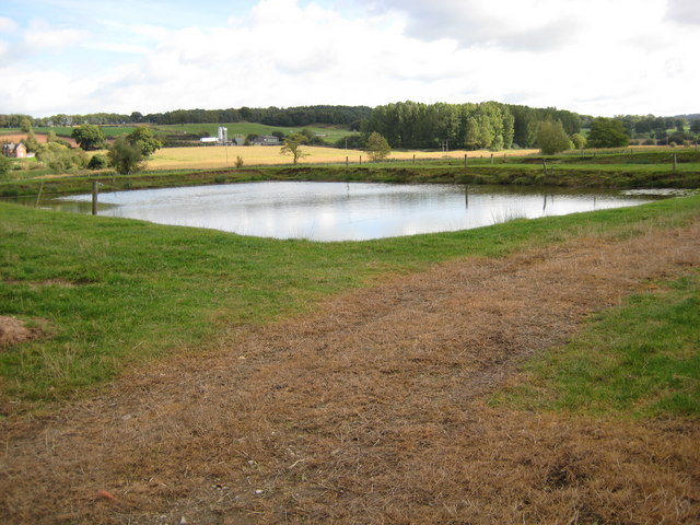
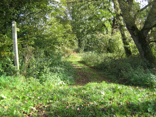
Today, Bloreheath remains a picturesque village with charming cottages and well-maintained gardens. The surrounding countryside offers beautiful views, making it a desirable location for nature enthusiasts and walkers. The village has a close-knit community, and there is a sense of pride among the residents in preserving its rich history.

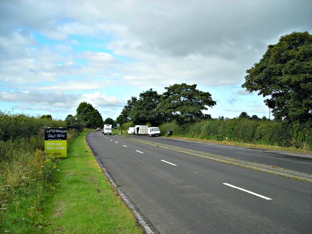
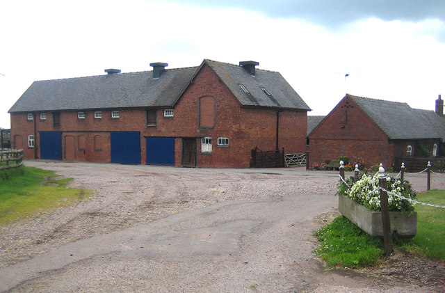
While Bloreheath is primarily a residential area, there are some amenities available to locals and visitors. These include a village hall, a post office, and a small convenience store. Nearby towns provide additional services such as schools, healthcare facilities, and a wider range of shops and restaurants.

Overall, Bloreheath is a tranquil village with a fascinating historical background, making it an appealing destination for those seeking a peaceful countryside retreat or an opportunity to explore England's past.

If you have any feedback on the listing, please let us know in the comments section below.

Bloreheath Images

Images are sourced within 2km of 52.911637/-2.4326778 or Grid Reference SJ7135. Thanks to Geograph Open Source API. All images are credited.

The Rowans on the A53
Crossroads at Bloreheath from A53
Let's take a break Nice layby with handy snack van by the A53.
Let's take a break
Nice layby with handy snack van by the A53.
Oakley Folly Snug cottage on road to Knighton just outside of Market Drayton.
Oakley Folly
Snug cottage on road to Knighton just outside of Market Drayton.
Sleepy Lane Quiet residential area at Almington, Staffordshire
Sleepy Lane
Quiet residential area at Almington, Staffordshire
Old Farm  Cottages Viewed from the A53 near to Loggerheads
Old Farm Cottages
Viewed from the A53 near to Loggerheads
Blore Heath Battleground See additional photo at this grid for battle details.
Blore Heath Battleground
See additional photo at this grid for battle details.
Blore Heath Plaque Commemorating the Battle of Blore Heath, part of the Wars of the Roses.
Blore Heath Plaque
Commemorating the Battle of Blore Heath, part of the Wars of the Roses.
Hales: St Mary's Church The church was founded in the mid-19th century by the Reverend Alexander Buchanan, 'squarson' of neighbouring Hales Hall. It was built to the designs of George Gilbert Scott and completed in 1856. The church is constructed of pink sandstone ashlar. The tower, with its prominent stepped angle buttresses, has a hexagonal stair turret attached to its south-east corner, on the right in the photograph. It is a Grade II Listed Building.
Hales: St Mary's Church
The church was founded in the mid-19th century by the Reverend Alexander Buchanan, 'squarson' of neighbouring Hales Hall. It was built to the designs of George Gilbert Scott and completed in 1856. The church is constructed of pink sandstone ashlar. The tower, with its prominent stepped angle buttresses, has a hexagonal stair turret attached to its south-east corner, on the right in the photograph. It is a Grade II Listed Building.
Hales: Roman Villa This is the site of the Roman Villa at Hales. Nothing is visible on the surface, but the site was excavated in 1928 to reveal a corridor villa thought to date from the late first century. Later excavations in 1967 revealed a separate bath house. This view was taken looking south towards Coal Brook.
Hales: Roman Villa
This is the site of the Roman Villa at Hales. Nothing is visible on the surface, but the site was excavated in 1928 to reveal a corridor villa thought to date from the late first century. Later excavations in 1967 revealed a separate bath house. This view was taken looking south towards Coal Brook.
Blore Blore Farm at the northern end of Flash Lane.
Blore
Blore Farm at the northern end of Flash Lane.
Bloreheath This is the site of the War of the Roses battle on 23 September 1459.
Bloreheath
This is the site of the War of the Roses battle on 23 September 1459.
Bloreheath To the left for Blore, to the right for Hales.
Bloreheath
To the left for Blore, to the right for Hales.
Hales: Flash Lane Minor road leading to Blore.
Hales: Flash Lane
Minor road leading to Blore.
Blore Heath Battle re-enactment This photograph was taken at the Battle of Blore Heath re-enactment. The battle was fought on September 23rd 1459, between the Yorkists and Lancastrians.
Blore Heath Battle re-enactment
This photograph was taken at the Battle of Blore Heath re-enactment. The battle was fought on September 23rd 1459, between the Yorkists and Lancastrians.
Battle of Blore Heath Re-enactment of the Battle of Blore Heath 2007.
Battle of Blore Heath
Re-enactment of the Battle of Blore Heath 2007.
Pool near The Brodder Man made pool beside the lane.
Pool near The Brodder
Man made pool beside the lane.
Footpath towards Old Springs Farm Leafy path leaves the lane heading east
Footpath towards Old Springs Farm
Leafy path leaves the lane heading east
Show me another place!

Bloreheath is located at Grid Ref: SJ7135 (Lat: 52.911637, Lng: -2.4326778)

Administrative County: Staffordshire

District: Newcastle-under-Lyme

Police Authority: Staffordshire

What 3 Words

///waiters.prevented.plunger. Near Market Drayton, Shropshire

Related Wikis

Audley's Cross

Audley's Cross is a cross sited in Blore Heath, Staffordshire to mark the spot on which James Touchet, Lord Audley was killed at the battle of Blore Heath...

Battle of Blore Heath

The Battle of Blore Heath was a battle in the English Wars of the Roses that was fought on 23 September 1459, at Blore Heath, Staffordshire. Blore Heath...

Blore Heath Rural District

Blore Heath was a rural district in Staffordshire, England from 1894 to 1932. It was created under the Local Government Act 1894 from that part of the...

Oakley, Staffordshire

Oakley is a hamlet in Staffordshire, England. It is within Mucklestone ward of Loggerheads Parish. Oakley Hall, a former seat of the Chetwode family, is...

Hales, Staffordshire

Hales is a village in Staffordshire approximately 2 miles east of Market Drayton. Population details as taken at the 2011 census can be found under Loggerheads...

Almington

Almington is a small village in Staffordshire, England. It is about 2 miles (3.2 km) east-northeast of Market Drayton by road, to the northwest of the...

Oakley Hall, Staffordshire

Oakley Hall is an early 18th century 14,929 sf mansion house at Mucklestone, Staffordshire near to the Shropshire town of Market Drayton. It is a Grade...

Betton, Shropshire

Betton is a hamlet in the civil parish of Norton in Hales, in the Shropshire district, in the county of Shropshire, England.

Nearby Amenities

Located within 500m of 52.911637,-2.4326778
Bus Stop
Hempmill
Bus: yes
Naptan AtcoCode: 3800C529401
Naptan Bearing: E
Naptan CommonName: Hempmill
Naptan Indicator: Adj
Naptan Landmark: Hempmill
Naptan Street: Newcastle Road
Naptan Verified: no
Public Transport: platform
Source: naptan_import
Lat/Long: 52.9146453/-2.4303971
Bus Stop
Hempmill
Bus: yes
Naptan AtcoCode: 3800C529402
Naptan Bearing: W
Naptan CommonName: Hempmill
Naptan Indicator: Adj
Naptan Landmark: Hempmill
Naptan Street: Newcastle Road (W)
Naptan Verified: no
Public Transport: platform
Source: naptan_import
Lat/Long: 52.9145549/-2.43053
Power: pole
Lat/Long: 52.9106975/-2.4311918
Power: pole
Lat/Long: 52.911123/-2.4335924
Power: pole
Lat/Long: 52.9114157/-2.4350783
Power: pole
Lat/Long: 52.9116357/-2.4364731
Power: pole
Lat/Long: 52.9106943/-2.43812
Power: pole
Lat/Long: 52.9098969/-2.4394745
Power: pole
Lat/Long: 52.9098791/-2.432718
Power: pole
Lat/Long: 52.9101508/-2.4309558
Power: pole
Lat/Long: 52.9101638/-2.4292526
Power: pole
Lat/Long: 52.910146/-2.4274153
Power: pole
Lat/Long: 52.9111181/-2.4290439
Power: pole
Lat/Long: 52.9155966/-2.4359847
Power: pole
Lat/Long: 52.9154237/-2.4346838
Power: pole
Lat/Long: 52.9152681/-2.4334113
Power: pole
Lat/Long: 52.9151406/-2.4324437
Power: pole
Lat/Long: 52.915018/-2.4314924
Power: pole
Lat/Long: 52.914828/-2.4300796
Power: pole
Lat/Long: 52.9150045/-2.4293743
Power: pole
Lat/Long: 52.9147207/-2.4311639
The data included in this document is from www.openstreetmap.org. The data is made available under ODbL.

Have you been to Bloreheath?

Leave your review of Bloreheath below (or comments, questions and feedback).